Lake District parking map: who charges, and plan B if it's full
What this map holds. Our parking dataset held 974 records on 24 October 2026. 968 of them are shown here as places to leave a car for a walk, including the car parks of Kendal, Cockermouth and the coast; 2 are listed at the end but not counted, because their own record says a car cannot be left there for a walk; and 4 far outside the district, in the North Pennines, are not shown. It is what our data knows, not every place a walker might use. Each entry says where its position and details came from, or that they were not recorded: 336 have a charge we have not verified, and 234 have no details beyond a position. A car park can close, start charging or fill in ways no dataset sees. Wrong or out of date? Report it and we will fix it.

Popular:
These are the places to leave a car for a walk in the Lake District that our data holds — 968 of them, from National Trust car parks with a machine at the gate to a gap in a wall on a single-track road. It is the same data behind the parking panel on every fell and route page, gathered in one place so you can see what your options actually are before you set off.
Vehicles are left entirely at their owner’s risk. We list places people park; we cannot vouch for any of them. Judge it on the day: take valuables with you, leave nothing on show, and if a spot feels wrong when you get there, park somewhere else.
The map
Positions are approximate — good enough to find the spot, not a substitute for looking. Zoom in before you rely on one.
The interactive map needs JavaScript. Every place is listed below with directions, grouped by who runs it.
- 449 free
- 174 charges
- 9 honesty box
- 336 charge not verified
- 479 car parks
- 489 lay-bys and verges
On charges
We record whether a place charges and who runs it, and never the tariff. Prices change, and a stale price is worse than no price — it is the same rule we apply to steamer fares. A photo of a sign shows its price on the day it was taken; check the sign when you arrive. 632 of the 968 entries have a charging status we can stand behind; 336 do not, and those say so rather than guessing. Check the sign when you arrive. What a day’s parking costs, in bands and beside the bus fare, is on what each part of a fell day costs.
When it’s full
29 entries carry a fallback chain — the nearest alternatives and how far away they are — measured on the walking network rather than as the crow flies. They appear under “If it’s full” in the list below. It is the field we are proudest of and the one nothing else on the site surfaces.
For a walk you are planning, RoutePark reads its GPX and keeps the places to park beside it on your phone, for a morning with no signal. How it chooses them.
To arrive before it fills, how early you need to be reads the National Park’s car park tickets hour by hour, and the two kinds of Lake District car park shows which car parks barely notice the season and which all but shut outside it.
Every place in the dataset, by who runs it
136 entries name an operator; the rest are lay-bys, verges and small car parks with no published owner. 343 carry a space count, 42 list nearby toilets, cafes or pubs, and 193 are served by a bus route.
No places match these filters. Clear them to see all 968.
National Trust 36
Aira Force (NT, paid)
PaidCar parkNational TrustBus route
Start of: Aira Force & Gowbarrow Fell, Birketts by Gowbarrow, Gowbarrow Fell and Little Mell Fell, Swineside Knott & Gowbarrow
The main National Trust car park at Aira Force, beside the toilets. Fees: pay and display (LDNP directory, checked Aug 2026). Toilets open 10am-3pm; accessible toilet 24hrs (LDNP directory, checked Aug 2026).
If it’s full: Park Brow (NT, paid) (0.77 km), Round How (layby) (0.9 km), A592, Gowbarrow Park shore (verge, middle) (1.0 km), A592, Gowbarrow Park shore (verge, east) (1.45 km)
Where it is: mapped in OpenStreetMap. Details: from external sources. Checked 2 August 2026. · Directions (opens in new tab)
Ash Landing (NT, paid)
PaidCar parkabout 13 spacesNational Trust
Nearest published walking: 4.2 km from the 'Orrest Head' route start; 2.0 km from Claife Heights. Fees: pay and display (LDNPA directory, checked Aug 2026). Compacted surface (OSM-tagged). Free for NT members (checked Aug 2026).
Where it is: mapped in OpenStreetMap. Details: from external sources. Checked 10 August 2026. · Directions (opens in new tab)
Ashness Bridge (NT, paid)
PaidCar parkabout 15 spacesNational Trust
The National Trust's Ashness Bridge car park, on the road up to Watendlath, 80 m from Ashness Bridge (OSM way/490849444). The 'Walla Crag, Bleaberry Fell, High Seat, High Tove and Armboth Fell' route passes about 20 m away; it starts at Ashness Gate on the B5289, 0.8 km on foot, the nearest route start. Added from the 5 Aug 2026 OSM candidate review. Free for NT members (checked Aug 2026). Charges apply at all times. Cash at machine; JustPark app at some car parks; card/phone payment not available in all car parks (NT, checked Aug 2026). JustPark location 80518 (National Trust, checked Aug 2026).
Where it is: placed by Lee. Details: from external sources. Checked 5 August 2026. · Directions (opens in new tab)
Blea Tarn (NT, paid)
PaidCar parkNational Trust
Start of: Blea Tarn (Little Langdale)
Between the Langdales — Lingmoor, Pike o' Blisco, Blake Rigg side. On Side Gates Road, the Blea Tarn road, about 170 m from the tarn's shore (OSM way/164759245); the 'Blea Tarn (Little Langdale)' route starts here. Fees: pay and display; coins only (Lake District National Park car-parks directory, read Sep 2026). Free for NT members (checked Aug 2026).
Where it is: mapped in OpenStreetMap. Details: from external sources. Checked 2 August 2026. · Directions (opens in new tab)
Buttermere village (NT, paid)
PaidCar parkNational TrustBus route
Start of: Rannerdale Knotts from Buttermere, Scale Fell and Mellbreak, The Buttermere Ridge
For Red Pike, High Stile, Robinson, Rannerdale Knotts. Fees: pay and display (LDNP directory, checked Aug 2026). Free for NT members (checked Aug 2026). Charges apply at all times. Cash at machine; JustPark app at some car parks; card/phone payment not available in all car parks (NT, checked Aug 2026).
If it’s full: High Snockrigg (verge) (0.55 km), Car park for Rannerdale Knotts (1.71 km)
Where it is: placed by Lee. Details: from external sources. Checked 7 August 2026. · Directions (opens in new tab)
Elterwater (NT, paid)
PaidCar parkNational TrustBus route
Start of: Elterwater & Skelwith Force, Elterwater riverside loop, Lingmoor Fell from Elterwater, Loughrigg Tarn & Loughrigg Fell
For Lingmoor Fell, Silver How and lower Langdale. Fees: pay and display (Lake District National Park car-parks directory, checked Aug 2026). Free for NT members (checked Aug 2026).
If it’s full: Elterwater, Mill Row (verge) (0.33 km), Elterwater, east (free) (0.44 km), Elterwater Common (free) (0.45 km), Silverthwaite (Lowther Estates, paid) (1.83 km)
Where it is: mapped in OpenStreetMap. Details: from external sources. Checked 2 August 2026. · Directions (opens in new tab)
Glen Mary Bridge (NT, paid)
PaidCar parkabout 28 spacesNational Trust
On the A593 at Glen Mary Bridge, about 2 miles north of Coniston (OSM relation/16801340, 'Glen Mary Car Park'). The Tarn Hows route starts, in the National Trust car park above, are 0.8 km on foot and about 110 m up. Fees: pay and display (LDNPA directory, checked Aug 2026). Gravel surface (OSM-tagged). Free for NT members (checked Aug 2026).
Where it is: mapped in OpenStreetMap. Details: from external sources. Checked 10 August 2026. · Directions (opens in new tab)
Glencoyne (NT, paid)
PaidCar parkNational TrustBus route
At Glencoyne Bay on the A592, 1.9 km north of Glenridding (OSM way/166055321). The nearest route starts are at Aira Force, among them 'Aira Force & Gowbarrow Fell', 1.9 km on foot. Fees: pay and display - the machine takes coins only, (LDNPA, checked Aug 2026).
Where it is: mapped in OpenStreetMap. Details: from external sources. Checked 10 August 2026. · Directions (opens in new tab)
Great Wood, Keswick (NT, paid)
PaidCar parkNational TrustBus route
Under Walla Crag on the Borrowdale road. Fees: pay and display (LDNP directory, checked Aug 2026). Free for NT members (checked Aug 2026). Charges apply at all times. Cash at machine; JustPark app at some car parks; card/phone payment not available in all car parks (NT, checked Aug 2026).
Where it is: placed by Lee. Details: from external sources. Checked 9 August 2026. · Directions (opens in new tab)
Harrowslack (NT, paid)
PaidCar parkNational Trust
Start of: Along Windermere's Western Shore
Nearest fells: Claife Heights (1.5 km). Fees: pay and display (LDNPA directory, checked Aug 2026). Free for NT members (checked Aug 2026).
Where it is: mapped in OpenStreetMap. Details: from external sources. Checked 10 August 2026. · Directions (opens in new tab)
Heaves car park (paid)
PaidCar parkNational Trust
Nearest published walking: 4.4 km from Scout Scar (Wainwright summit). Paid parking (OSM-tagged).
Where it is: mapped in OpenStreetMap. Details: from external sources. Checked 10 August 2026. · Directions (opens in new tab)
High Cascades (NT, paid)
PaidCar parkNational Trust
Start of: Birketts above Ullswater
Walking base for Low How, High Brow, Randerside and Great Dodd — the 'Birketts above Ullswater' route starts 21 m away. Compacted surface (OSM-tagged). Free for NT members (checked Aug 2026).
Where it is: mapped in OpenStreetMap. Details: from external sources. Checked 10 August 2026. · Directions (opens in new tab)
Honister (NT, paid)
PaidCar parkNational TrustBus route
Start of: Dale Head Hindscarth and Robinson, Great Gable from Honister Slate Mine
Walking base for Great Gable, Green Gable, Brandreth and Grey Knotts — the 'Great Gable from Honister Slate Mine' route starts 61 m away. Also serves 'Haystacks'. Paid National Trust car park - the prices we used to show here came from an aggregator rather than the Trust, so we no longer publish a figure; check the machine on arrival, and members should bring their card (National Trust car-park list, checked Aug 2026). The machine takes cards, and National Trust members park free on production of their membership card (Lee McCoy, local observation, recorded 12 Aug 2026).
Where it is: mapped in OpenStreetMap. Details: from Lee. Checked 12 August 2026. · Directions (opens in new tab)
Kettlewell, Derwentwater (NT, paid)
PaidCar parkNational Trust
On the Borrowdale road by the lake, near Ashness Bridge. Fees: pay and display (LDNP directory, checked Aug 2026). Free for NT members (checked Aug 2026). Charges apply at all times. Cash at machine; JustPark app at some car parks; card/phone payment not available in all car parks (NT, checked Aug 2026). JustPark location 80520 (National Trust, checked Aug 2026).
Where it is: mapped in OpenStreetMap. Details: from external sources. Checked 2 August 2026. · Directions (opens in new tab)
Lake Head, Wasdale (NT, paid)
PaidCar parkNational TrustBus route
Start of: Great Gable & Kirk Fell, Scafell Pike from Wasdale, by Lingmell Col
Walking base for Great Gable, Kirk Fell and Scafell Pike — the 'Great Gable & Kirk Fell' route starts 10 m away. Also serves 'Scafell Pike from Wasdale, by Lingmell Col'. National Trust's access statement records a pay-and-display machine here (National Trust, January 2024) but does not say which payment methods it takes; the same document notes mobile reception is poor across Wasdale, so carry coins as well as a card. Compacted surface (OSM-tagged). Toilets on site. National Trust, pay & display (free for members). The classic base for Scafell Pike, Great Gable, Kirk Fell, Yewbarrow. Fills very early. Charges apply at all times (NT, checked Aug 2026). Free for NT members (checked Aug 2026).
If it’s full: Overbeck Bridge, Wastwater (NT, paid) (1.78 km), Greendale, Nether Wasdale (roadside, free) (4.85 km)
Where it is: mapped in OpenStreetMap. Details: from external sources. Checked 10 August 2026. · Directions (opens in new tab)
Lanthwaite Green
PaidCar parkNational TrustBus route
Start of: Dodd & Whiteside, The Grasmoor Round, The Grasmoor round: Whiteside, Hopegill Head and Whiteless Pike
At the foot of Grasmoor and Whiteside, Crummock Water. Free for National Trust members (National Trust, read 28 Sep 2026).
Where it is: placed by Lee. Details: from external sources. Checked 28 September 2026. · Directions (opens in new tab)
Lanthwaite Wood, Crummock Water (NT, paid)
PaidCar parkNational Trust
By Crummock Water, distinct from Lanthwaite Green further up the valley. Fees: pay and display (Lake District National Park car-parks directory, checked Aug 2026).
Where it is: mapped in OpenStreetMap. Details: from external sources. Checked 2 August 2026. · Directions (opens in new tab)
Maggie's Bridge, Loweswater (NT, paid)
PaidCar parkabout 10 spacesNational Trust
Start of: Around Loweswater, Around Loweswater to Fellbarrow and Low Fell, Birketts by Loweswater, Blake Fell, Gavel Fell, Hen Comb, Loweswater circuit, Mellbreak and Crummock Water
Small paid car park for Mellbreak, Hen Comb and the Loweswater fells. Free for NT members (checked Aug 2026).
If it’s full: Car park for Loweswater Fell (free) (0.96 km), Lanthwaite Wood, Crummock Water (NT, paid) (1.67 km), Darling Fell (layby) (2.85 km)
Where it is: mapped in OpenStreetMap. Details: from external sources. Checked 2 August 2026. · Directions (opens in new tab)
N.T. Disabled Parking (NT, paid)
PaidCar parkNational Trust
OSM names this the National Trust's disabled parking; if you do not need it, use the main Tarn Hows car park, where both our routes start. Walking base for Holme Fell and Black Fell — the 'Holme Fell and Black Fell' route starts 357 m away. Also serves 'Tarn Hows circuit'. Paid parking (OSM-tagged). Unpaved surface (OSM-tagged).
Where it is: mapped in OpenStreetMap. Details: from external sources. Checked 10 August 2026. · Directions (opens in new tab)
NT Hill Top (paid)
PaidCar parkabout 27 spacesNational Trust
Nearest published walking: 2.1 km from the 'Along Windermere's Western Shore' route start, at Ferry House, Far Sawrey; 2.9 km from the 'Hawkshead into the woods' route start. Paid parking (OSM-tagged).
Where it is: mapped in OpenStreetMap. Details: from external sources. Checked 10 August 2026. · Directions (opens in new tab)
Nether Wasdale car park (free)
FreeCar parkabout 8 spacesNational TrustBus route
Walking base for Whin Rigg (Wasdale) and Illgill Head — the 'Whin Rigg, Illgill Head & the Wastwater Screes' route starts 101 m away. Free (OSM-tagged).
Where it is: mapped in OpenStreetMap. Details: from external sources. Checked 10 August 2026. · Directions (opens in new tab)
Old Dungeon Ghyll (NT, paid)
PaidCar parkNational TrustBus route
Start of: Esk Pike and Great End, Rossett Pike, Allen Crags, Great End and more, The Old Dungeon Ghyll Pub Walk (Great Langdale)
Head of Great Langdale — Bowfell, Crinkle Crags, Pike o' Blisco, the Langdale Pikes. Free for NT members (checked Aug 2026).
If it’s full: Stickle Ghyll (NT, paid) (1.04 km), Great Langdale, valley road verge (free) (0.76 km), Side Pike (verge) (0.82 km)
Where it is: placed by Lee. Details: from external sources. Checked 12 August 2026. · Directions (opens in new tab)
Overbeck Bridge, Wastwater (NT, paid)
PaidCar parkabout 20 spacesNational TrustBus route
Start of: Very Long Day Out, Wastwater Shore (the Screes view)
Approx 20 spaces. By Overbeck Bridge on the lakeshore road (OSM way/162782858). 'Very Long Day Out' and 'Wastwater Shore (the Screes view)' start here. Added from the 5 Aug 2026 OSM candidate review. Small NT pay-and-display car park at the foot of Yewbarrow on the lakeshore road. Charges apply at all times (NT, checked Aug 2026). Free for NT members (checked Aug 2026). No overnight parking (National Trust, checked Aug 2026).
Where it is: placed by Lee. Details: from external sources. Checked 9 October 2026. · Directions (opens in new tab)
Park Brow (NT, paid)
PaidCar parkNational TrustBus route
Walking base for Low How, High Brow, Randerside and Great Dodd — the 'Birketts above Ullswater' route starts 0.6 km away. Also serves 'Gowbarrow Fell and Little Mell Fell'. Free for National Trust members. 508/509 bus stop nearby. Free for NT members (checked Aug 2026).
Where it is: placed by Lee. Details: from external sources. Checked 10 August 2026. · Directions (opens in new tab)
Quay Foot Quarry, Borrowdale (NT, paid)
PaidCar parkabout 60 spacesNational TrustBus route
Start of: The Bowder Stone
Old quarry car park below the Bowder Stone and Castle Crag; the National Trust and the LDNPA directory call it the Bowder Stone car park (read 5 Oct 2026). Free for NT members (checked Aug 2026). Charges apply at all times. Cash at machine; JustPark app at some car parks; card/phone payment not available in all car parks (NT, checked Aug 2026).
Where it is: mapped in OpenStreetMap. Details: from external sources. Checked 2 August 2026. · Directions (opens in new tab)
Red Nab (NT)
PaidCar parkNational Trust
Nearest fells: Latterbarrow (1.9 km). Paid parking. Free for National Trust members. Unpaved surface (OSM-tagged). Free for NT members (checked Aug 2026).
Where it is: mapped in OpenStreetMap. Details: from external sources. Checked 10 August 2026. · Directions (opens in new tab)
Rosthwaite (NT, paid)
PaidCar parkabout 20 spacesNational TrustBus route
Start of: Castle Crag from Rosthwaite, Castle Crag, Brund Fell & Great Crag, The Borrowdale Fells (Rosthwaite Fell round)
Village car park in the heart of Rosthwaite, for the central Borrowdale fells and Watendlath ridge. The 'Castle Crag, Brund Fell & Great Crag' route starts 10 m away; 'The Borrowdale Fells (Rosthwaite Fell round)' 23 m. Toilets beside it, often closed in winter (National Trust, read 5 Oct 2026). Fees: pay and display (Lake District National Park car-parks directory, checked Aug 2026). The National Trust does not allow overnight parking here (NT, checked Aug 2026).
If it’s full: Stonethwaite village (roadside, free) (1.52 km), Seatoller (NT, paid) (2.21 km), Quay Foot Quarry, Borrowdale (NT, paid) (2.35 km)
Where it is: mapped in OpenStreetMap. Details: from external sources. Checked 5 October 2026. · Directions (opens in new tab)
Seatoller (NT, paid)
PaidCar parkNational TrustBus route
Pay & display at the foot of Honister. Bus terminus for Borrowdale. Fees: pay and display (LDNP directory, checked Aug 2026). Free for NT members (checked Aug 2026). Charges apply at all times. Cash at machine; JustPark app at some car parks; card/phone payment not available in all car parks (NT, checked Aug 2026). Toilets on site, often closed in winter; coach parking is no longer allowed (National Trust, read 5 Oct 2026).
Where it is: placed by Lee. Details: from external sources. Checked 10 August 2026. · Directions (opens in new tab)
Staveley Fell, west car park (paid)
PaidCar parkNational TrustBus route
Nearest fells: Staveley Fell (1.0 km). Paid parking (OSM-tagged). Grass surface (OSM-tagged).
Where it is: mapped in OpenStreetMap. Details: from external sources. Checked 10 August 2026. · Directions (opens in new tab)
Stickle Ghyll (NT, paid)
PaidCar parkNational TrustBus route
Start of: Langdale Horseshoe, Stickle Tarn from New Dungeon Ghyll
Walking base for Pavey Ark, Harrison Stickle, Thorn Crag and Loft Crag — the 'Langdale Horseshoe' route starts 67 m away. Also serves 'Langdale Pikes Round'. Paid National Trust car park - the prices we used to show here came from an aggregator rather than the Trust, so we no longer publish a figure; check the machine on arrival, and members should bring their card (National Trust car-park list, checked Aug 2026). Unpaved surface (OSM-tagged). Height barrier (community-reported). Direct start up Stickle Ghyll for the Langdale Pikes.
If it’s full: Old Dungeon Ghyll (NT, paid) (1.04 km), Blea Tarn (NT, paid) (3.2 km)
Where it is: placed by Lee. Details: from external sources. Checked 12 August 2026. · Directions (opens in new tab)
Surprise View (NT)
PaidCar parkabout 15 spacesNational Trust
Start of: Watendlath & the packhorse bridge
The National Trust's car park at Surprise View, on the road up to Watendlath (OSM way/490849451). The 'Watendlath & the packhorse bridge' route and the 'Walla Crag, Bleaberry Fell, High Seat, High Tove and Armboth Fell' route pass within 10 m; the nearest start on foot is Ashness Gate on the B5289, 1.5 km (the Walla Crag round), and the Watendlath walk starts on the B5289 by the Lodore Falls Hotel, 1.9 km. Fees: pay and display (Lake District National Park car-parks directory, checked Aug 2026). Free for NT members (checked Aug 2026). Charges apply at all times. Cash at machine; JustPark app at some car parks; card/phone payment not available in all car parks (NT, checked Aug 2026). JustPark location 80521 (National Trust, checked Aug 2026).
Where it is: placed by Lee. Details: from Lee. Checked 10 August 2026. · Directions (opens in new tab)
Tarn Hows (NT, paid)
PaidCar parkNational Trust
Start of: Holme Fell and Black Fell, Tarn Hows circuit
National Trust car park at Tarn Hows. Fees: pay and display (LDNP directory, checked Aug 2026). Free for NT members (checked Aug 2026).
Where it is: mapped in OpenStreetMap. Details: from external sources. Checked 2 August 2026. · Directions (opens in new tab)
Tilberthwaite (NT, free)
FreeCar parkabout 14 spacesNational Trust
The National Trust's car park at Low Tilberthwaite, by the farm track, across the gill from the National Park's paid car park; for Wetherlam and the Tilberthwaite fells. Free (National Trust).
Where it is: mapped in OpenStreetMap. Details: from Lee. Checked 19 October 2026. · Directions (opens in new tab)
Watendlath (NT, paid)
PaidCar parkabout 45 spacesNational Trust
End of the narrow Watendlath road — Grange Fell, Great Crag, Armboth fells. Fees: pay and display (LDNP directory, checked Aug 2026). Free for NT members (checked Aug 2026). Charges apply at all times. Cash at machine; JustPark app at some car parks; card/phone payment not available in all car parks (NT, checked Aug 2026).
Where it is: from the operator. Details: from external sources. Checked 2 August 2026. · Directions (opens in new tab)
Wha House, Eskdale (NT, free)
FreeCar parkabout 8 spacesNational Trust
Start of: Slight Side & Sca Fell
Upper Eskdale - Slight Side, Harter Fell and the Scafell approaches.
Where it is: mapped in OpenStreetMap. Details: from external sources. Checked 2 August 2026. · Directions (opens in new tab)
Wray Castle (NT, paid)
PaidCar parkNational Trust
Start of: Wray Castle & the Windermere west shore
2.1 km from Latterbarrow. Fees: pay and display (LDNP directory, checked Aug 2026). Cash at machine (NT, checked Aug 2026). Free for NT members (checked Aug 2026). Cash at machine or JustPark app (code 80715) (NT, checked Aug 2026).
Where it is: placed by Lee. Details: from Lee. Checked 10 August 2026. · Directions (opens in new tab)
Westmorland & Furness Council 24
Ambleside, King Street (paid)
PaidCar parkabout 29 spacesWestmorland & Furness CouncilBus route
Start of: Stock Ghyll Force
Central town car park, for shorter walks: Wansfell and Loughrigg from the door. Short stay: the council lists charges up to 4 hours only, too short for the Fairfield Horseshoe (W&F council, read 5 Oct 2026). Motorcycles free. Blue Badge: +1h free. Cash/card/contactless; PayByPhone 9907. 3/7-day passes and permits accepted (W&F council, checked Aug 2026). Open every day EXCEPT Wednesday (market day) incl. bank holidays; charges apply 08:00-18:00; on Wednesdays designated parking 06:00-16:00 only (W&F council, checked Aug 2026).
Where it is: mapped in OpenStreetMap. Details: from external sources. Checked 2 August 2026. Lee started a recorded walk here on 31 March 2023. · Directions (opens in new tab)
Ambleside, Lake Road (paid)
PaidCar parkabout 48 spacesWestmorland & Furness CouncilBus route
Start of: Long Hike to Fairfield from Ambleside
South end of town towards Waterhead. Fees: pay and display (Lake District National Park car-parks directory, checked Aug 2026). Motorcycles free. Blue Badge: +1h free. Cash/card/contactless; PayByPhone 9908. 3/7-day passes and permits accepted (W&F council, checked Aug 2026). Charges apply 08:00-20:00, 7 days a week incl. bank holidays. The council's own page is contradictory about access outside those hours - it says both open all day and open from 8am to 8pm - so do not count on getting in before 08:00 (W&F council, checked Aug 2026).
Where it is: mapped in OpenStreetMap. Details: from external sources. Checked 30 August 2026. Lee started a recorded walk here on 31 March 2023. · Directions (opens in new tab)
Ambleside, Low Fold (paid)
PaidCar parkabout 41 spacesWestmorland & Furness CouncilBus route
Start of: Ambleside over Miller Bridge, Ambleside to Wray Castle, Ambleside to the Old Post Office Tea Room, Troutbeck (over Wansfell), Sour Howes, Sallows, Yoke, Ill Bell, Froswick and Troutbeck Tongue in the sun!, Wansfell Pike and Baystones
Towards Waterhead, a short walk from the centre. Fees: pay and display (Lake District National Park car-parks directory, checked Aug 2026). Motorcycles free. Blue Badge: +1h free. Cash/card/contactless; PayByPhone 9912. 3/7-day passes and permits accepted (W&F council, checked Aug 2026). Charges apply 08:00-20:00, every day incl. bank holidays. The council's own page is contradictory about access outside those hours - it says both open all day and open from 8am to 8pm - so do not count on getting in before 08:00 (W&F council, checked Aug 2026).
If it’s full: Ambleside, Miller Bridge (paid) (1.11 km), Under Loughrigg Road (verge), Ambleside (1.34 km), Loughrigg Fell (verge, east) (1.58 km)
Where it is: mapped in OpenStreetMap. Details: from external sources. Checked 2 August 2026. Lee started a recorded walk here on 6 April 2023. · Directions (opens in new tab)
Ambleside, Miller Bridge (paid)
PaidCar parkabout 210 spacesWestmorland & Furness CouncilBus route
The large car park by the river - usually the last in town to fill. Walking base for Loughrigg Fell; the 'Stock Ghyll Force' route starts 383 m away, and it also serves Ambleside, Todd Crag and Rydal Cave. Motorcycles free; Blue Badge holders pay normal charges. Charges apply 08:00-21:00. The council's page is inconsistent about access outside those hours - it says both 'Open all day, seven days a week' and 'Open every day including bank holidays from 8am to 9pm' - so we cannot say whether you can get in before 8am (W&F council, checked Aug 2026).
Where it is: mapped in OpenStreetMap. Details: from external sources. Checked 12 August 2026. · Directions (opens in new tab)
Ambleside, Rydal Road (paid)
PaidCar parkabout 171 spacesWestmorland & Furness CouncilBus route
Start of: Loughrigg Terrace & Rydal Water, The Royal Oak Pub Walk (Ambleside)
North end of town, closest for Rydal Road and the Fairfield Horseshoe start. Motorcycles free. Blue Badge: +1h free on top of time purchased. Cash/card/contactless; PayByPhone 9917. 3/7-day passes and permits accepted (W&F council, checked Aug 2026). Long and short stay. Charges apply 08:00-20:00, 7 days a week incl. bank holidays. The council's own page is contradictory about access outside those hours - it says both open all day and open from 8am to 8pm - so do not count on getting in before 08:00 (W&F council, read 5 Oct 2026). Pay and display (LDNPA, checked Aug 2026).
If it’s full: Ambleside, King Street (paid) (0.4 km)
Where it is: mapped in OpenStreetMap. Details: from external sources. Checked 2 August 2026. · Directions (opens in new tab)
Beetham Road Car Park (paid)
PaidCar parkabout 49 spacesWestmorland & Furness Council
No published walk starts within 5 km; the nearest is Whitbarrow - Lord's Seat, 7.9 km away. Paid parking (OSM-tagged).
Where it is: mapped in OpenStreetMap. Details: from external sources. Checked 30 August 2026. · Directions (opens in new tab)
Bowness, Glebe Road (paid)
PaidCar parkabout 124 spacesWestmorland & Furness Council
Start of: Brant Fell from Bowness
The nearest route start is 'Orrest Head', 2.6 km away at Windermere station. Fees: pay and display. Toilets on site. Charges apply 08:00-20:00. The council's own page says both that the car park is open all day and that it is open 8am to 8pm, so do not count on getting in before 08:00 (W&F council, checked Aug 2026). Open 7 days a week incl. bank holidays; charges apply 08:00-20:00 (W&F council, checked Aug 2026). Motorcycles free. Blue Badge: +1h free. Cash/card/contactless; PayByPhone 9576. 3/7-day passes available; Westmorland and Furness permits NOT valid here (W&F council, checked Aug 2026).
Where it is: mapped in OpenStreetMap. Details: from external sources. Checked 10 August 2026. · Directions (opens in new tab)
Bowness, Quarry Mount (paid)
PaidCar parkabout 36 spacesWestmorland & Furness CouncilBus route
The nearest route start is 'Orrest Head', 1.8 km away at Windermere station. Fees: pay and display. Toilets on site. Charges apply 08:00-18:00. The council's own page says both that the car park is open all day and that it is open 8am to 6pm, so do not count on getting in before 08:00 (W&F council, checked Aug 2026). Open 7 days a week incl. bank holidays; charges apply 08:00-18:00 (W&F council, checked Aug 2026). Motorcycles free. Blue Badge: +1h free. Cash/card/contactless; PayByPhone 9905. 3/7-day passes and permits accepted (W&F council, checked Aug 2026).
Where it is: mapped in OpenStreetMap. Details: from external sources. Checked 10 August 2026. · Directions (opens in new tab)
Bowness, Rayrigg Road (W&F, paid)
PaidCar parkabout 178 spacesWestmorland & Furness CouncilBus route
The nearest route start is 'Orrest Head', 1.9 km away at Windermere station. Fees: pay and display. Toilets on site. Motorcycles free. Open 7 days a week incl. bank holidays; charges apply 08:00-20:00 (W&F council, checked Aug 2026). Blue Badge: +1h free. Cash/card/contactless (machine gives no change); PayByPhone 9906. 3/7-day passes and permits accepted (W&F council, checked Aug 2026).
Where it is: mapped in OpenStreetMap. Details: from external sources. Checked 10 August 2026. · Directions (opens in new tab)
Braithwaite Fold (W&F, paid)
PaidCar parkabout 400 spacesWestmorland & Furness CouncilBus route
The nearest route start is 'Orrest Head', 2.9 km away at Windermere station. Fees: pay and display. Open all day, 7 days a week; charges apply 08:00-20:00 (W&F council, checked Aug 2026). Motorcycles free. Blue Badge: +1h free. Cash/card/phone; PayByPhone 9575. 3/7-day passes and permits accepted (W&F council, checked Aug 2026).
Where it is: mapped in OpenStreetMap. Details: from external sources. Checked 10 August 2026. · Directions (opens in new tab)
Busher Walk (paid)
PaidCar parkWestmorland & Furness CouncilBus route
Nearest published walking: 2.6 km from Cunswick Scar. Paid parking (OSM-tagged).
Where it is: mapped in OpenStreetMap. Details: from external sources. Checked 10 August 2026. · Directions (opens in new tab)
Dowkers Lane Pay And Display (paid)
PaidCar parkabout 82 spacesWestmorland & Furness CouncilBus route
Nearest published walking: 2.9 km from Scout Scar (Wainwright summit). Paid parking (OSM-tagged).
Where it is: mapped in OpenStreetMap. Details: from external sources. Checked 30 August 2026. · Directions (opens in new tab)
Ferry Nab (paid)
PaidCar parkabout 120 spacesWestmorland & Furness CouncilBus route
The nearest route start is 'Orrest Head', 3.1 km away at Windermere station. Fees: pay and display. Open 7 days a week incl. bank holidays; charges apply 08:00-20:00 (W&F council, checked Aug 2026). This car park also serves the Ferry Nab boat-launching facility; on busy days it may be closed to allow boat launches (LDNPA, checked Aug 2026). Trailers need two tickets unless buying the 12-hour tariff. Motorcycles free. Blue Badge: +1h free. Coin/card/contactless; PayByPhone 9904. 3/7-day passes and permits accepted (W&F council, checked Aug 2026).
Where it is: mapped in OpenStreetMap. Details: from external sources. Checked 10 August 2026. · Directions (opens in new tab)
Grange-over-Sands, Hampsfell Road car park (paid)
PaidCar parkabout 24 spacesWestmorland & Furness Council
Nearest fells: Hampsfell (Wainwright summit) (1.6 km). Paid parking (OSM-tagged).
Where it is: mapped in OpenStreetMap. Details: from external sources. Checked 16 October 2026. · Directions (opens in new tab)
Grange-over-Sands, Kents Bank Road (paid)
PaidCar parkabout 53 spacesWestmorland & Furness CouncilBus route
Town car park — Hampsfell and its hospice viewpoint straight from the town.
Where it is: mapped in OpenStreetMap. Details: from external sources. Checked 30 August 2026. · Directions (opens in new tab)
Grange-over-Sands, Main Street car park (paid)
PaidCar parkabout 82 spacesWestmorland & Furness Council
Nearest fells: Hampsfell (Wainwright summit) (1.7 km). Paid parking (OSM-tagged).
Where it is: mapped in OpenStreetMap. Details: from external sources. Checked 16 October 2026. · Directions (opens in new tab)
Grange-over-Sands, Windermere Road car park (paid)
PaidCar parkabout 65 spacesWestmorland & Furness Council
Nearest fells: Hampsfell (Wainwright summit) (1.6 km). Paid (Westmorland & Furness Council). The council's page says only 35 of its bays are open while flood alleviation work goes on (read 16 Oct 2026).
Where it is: mapped in OpenStreetMap. Details: from external sources. Checked 16 October 2026. · Directions (opens in new tab)
Peppercorn Lane (paid)
PaidCar parkabout 48 spacesWestmorland & Furness CouncilBus route
Nearest published walking: 2.9 km from Scout Scar (Wainwright summit). Paid parking (OSM-tagged).
Where it is: mapped in OpenStreetMap. Details: from external sources. Checked 30 August 2026. · Directions (opens in new tab)
Red Bank Road, Grasmere (W&F, paid)
PaidCar parkabout 77 spacesWestmorland & Furness CouncilBus route
Start of: West of Grasmere
Walking base for Tarn Crag (Easedale), Codale Head, Sergeant Man and Blea Rigg — the 'West of Grasmere' route starts 6 m away. Also serves 'Helm Crag & Far Easedale'. Fees: pay and display. Charges apply 08:00-20:00, 7 days a week incl. bank holidays. The council's own page is contradictory about access outside those hours - it says both open all day and open from 8am to 8pm - so do not count on getting in before 08:00 (W&F council, checked Aug 2026). Motorcycles free. Blue Badge: +1h free. CASHLESS - card (Visa/MasterCard/contactless) or PayByPhone 9919 only. 3/7-day passes and permits accepted (W&F council, checked Aug 2026).
Where it is: mapped in OpenStreetMap. Details: from Lee. Checked 30 August 2026. · Directions (opens in new tab)
Sandes Avenue (paid)
PaidCar parkabout 20 spacesWestmorland & Furness CouncilBus route
Nearest published walking: 2.8 km from Cunswick Scar. Paid parking (OSM-tagged).
Where it is: mapped in OpenStreetMap. Details: from external sources. Checked 30 August 2026. · Directions (opens in new tab)
South Lakeland House Car Park (paid)
PaidCar parkabout 194 spacesWestmorland & Furness CouncilBus route
Nearest published walking: 2.9 km from Cunswick Scar. Paid parking (OSM-tagged).
Where it is: mapped in OpenStreetMap. Details: from external sources. Checked 30 August 2026. · Directions (opens in new tab)
Unnamed car park at 54.2264,-2.7746 (paid)
PaidCar parkabout 60 spacesWestmorland & Furness Council
No published walk starts within 5 km; the nearest is Whitbarrow - Lord's Seat, 7.8 km away. Paid parking (OSM-tagged).
Where it is: mapped in OpenStreetMap. Details: from external sources. Checked 10 August 2026. · Directions (opens in new tab)
Windermere, Broad Street (W&F, paid)
PaidCar parkabout 94 spacesWestmorland & Furness CouncilBus route
Walking base for Orrest Head — the 'Orrest Head' route starts 404 m away. Fees: pay and display. Toilets on site. Charges apply 08:00-20:00, 7 days a week incl. bank holidays. The council's own page is contradictory about access outside those hours - it says both open all day and open from 8am to 8pm - so do not count on getting in before 08:00 (W&F council, checked Aug 2026). Motorcycles free. Blue Badge: +1h free. Cash/card/contactless; PayByPhone 9865 / 9879. 3/7-day passes; permits accepted except Early Bird bays (W&F council, checked Aug 2026).
Where it is: mapped in OpenStreetMap. Details: from external sources. Checked 10 August 2026. · Directions (opens in new tab)
Windermere, Rayrigg Meadow (paid)
PaidCar parkabout 45 spacesWestmorland & Furness CouncilBus route
The 'Orrest Head' route starts 1.1 km away, at Windermere station; so does 'Windermere Station to Brockhole and Back'. Fees: pay and display. Toilets on site. Motorcycles free. Charges apply 08:00-20:00. The council's own page says both that the car park is open all day and that it is open 8am to 8pm, so do not count on getting in before 08:00 (W&F council, checked Aug 2026). Open 7 days a week incl. bank holidays; charges apply 08:00-20:00 (W&F council, checked Aug 2026). Blue Badge: +1h free. Cash or PayByPhone 9902 (no card machine listed). 3/7-day passes and permits accepted (W&F council, checked Aug 2026).
Where it is: mapped in OpenStreetMap. Details: from external sources. Checked 10 August 2026. · Directions (opens in new tab)
Lake District National Park Authority 23
Beech Hill (LDNPA, paid)
PaidCar parkLake District National Park Authority
Nearest published walking: 3.0 km from Birch Fell. Fees: pay and display; coins and cards (Lake District National Park car-parks directory, checked Aug 2026). Toilets on site (seasonal - not open all year). Pay and display; coins and cards; RingGo ID 37302 (LDNPA, corrected 12 Sep 2026: 37303 is Hammarbank's).
Where it is: mapped in OpenStreetMap. Details: from external sources. Checked 10 August 2026. · Directions (opens in new tab)
Brockhole on Windermere (LDNPA, paid)
PaidCar parkLake District National Park AuthorityBus route
The 'Windermere Station to Brockhole and Back' walk comes through this car park, about 5.2 km along its route; it starts at Windermere station, 3.3 km away in a straight line. The 'Wray Castle & the Windermere west shore' start is 1.6 km away, but across the lake. Toilets on site. Fees: pay and display; coins and cards; RingGo ID 37312 (LDNPA, checked Aug 2026).
Where it is: mapped in OpenStreetMap. Details: from external sources. Checked 10 August 2026. · Directions (opens in new tab)
Brown Howe (LDNPA, paid)
PaidCar parkLake District National Park Authority
On the west shore, beside the A5084, about 70 m from the water (OSM way/125960910 'Brown Howe Car Park'). No route on this site starts on this side of the lake nearby; Low Light Haw's start at Crab Haws, across the water, is 4.8 km on foot. Run by the Lake District National Park Authority (its car-parks roster, checked 12 Sep 2026). Fees: pay and display; coins and cards; RingGo ID 37300 (Lake District National Park car-parks directory, checked Sep 2026). Toilets on site (seasonal - not open all year).
Where it is: mapped in OpenStreetMap. Details: from external sources. Checked 10 August 2026. · Directions (opens in new tab)
Buttermere village (LDNPA, paid)
PaidCar parkLake District National Park AuthorityBus route
Start of: Buttermere lake circuit, Crummock Water shore circuit
The 'Buttermere lake circuit' route starts 49 m away. Also serves 'Crummock Water shore circuit'. Unpaved surface (OSM-tagged). Toilets on site. Fees: pay and display; coins and cards; RingGo ID 37311 (LDNPA, checked Aug 2026).
Where it is: mapped in OpenStreetMap. Details: from external sources. Checked 8 October 2026. · Directions (opens in new tab)
Coniston Boating Centre (LDNPA, paid)
PaidCar parkLake District National Park Authority
The 'West Side of Coniston' route starts 81 m away. Grass paver surface (OSM-tagged). Toilets on site. Fees: pay and display; coins and cards; RingGo ID 37314 (LDNPA, checked Aug 2026).
Where it is: mapped in OpenStreetMap. Details: from external sources. Checked 10 August 2026. · Directions (opens in new tab)
Coniston Station car park (paid)
PaidCar parkLake District National Park AuthorityBus route
Start of: Coniston Old Man Round, North of Coniston Birketts
On the old station site, west of the village. Fees: pay and display; coins and cards; RingGo ID 37306 (LDNPA, checked Aug 2026).
If it’s full: Coniston, Bluebird Car & Coach Park (paid) (0.58 km), Coniston, Ruskin Avenue (paid) (0.6 km), Walna Scar Road, Coniston (paid, rough track) (1.44 km)
Where it is: mapped in OpenStreetMap. Details: from external sources. Checked 2 August 2026. · Directions (opens in new tab)
Coniston, Ruskin Avenue (paid)
PaidCar parkLake District National Park AuthorityBus route
Start of: The Old Man of Coniston, up and down from Coniston, The Sun Pub Walk (Coniston)
Village car park — the full Coniston round, Old Man and Wetherlam. Fees: pay and display; cards only; RingGo ID 37318 (Lake District National Park car-parks directory, checked Sep 2026). Coach parking, EV chargers (Pod Point) and toilets including disabled (LDNPA directory, read 5 Oct 2026).
Where it is: mapped in OpenStreetMap. Details: none checked. Checked 2 August 2026. · Directions (opens in new tab)
Cow Bridge, Hartsop (paid)
PaidCar parkLake District National Park AuthorityBus route
Start of: Finishing of the Far Eastern Fells, Hartsop Fells and Hart Crag, Middle Dodd Little Hart Crag and High Hartsop Dodd
Paid car park by Brothers Water — Hartsop above How, Dovedale, Caudale Moor. Fees: pay and display; coins and cards; RingGo ID 37323 (LDNPA, checked Aug 2026).
Where it is: mapped in OpenStreetMap. Details: from external sources. Checked 2 August 2026. · Directions (opens in new tab)
Dunmallard Hill, Pooley Bridge (LDNPA, paid)
PaidCar parkLake District National Park AuthorityBus route
Walking base for Heughscar Hill and Arthur's Pike — the 'Heughscar Hill & Arthur's Pike' route starts 105 m away. Fees: pay and display; coins and cards; RingGo ID 37309 (LDNPA, checked Aug 2026).
Where it is: mapped in OpenStreetMap. Details: from external sources. Checked 10 August 2026. · Directions (opens in new tab)
Eusemere Car Park (LDNPA, paid)
PaidCar parkLake District National Park AuthorityBus route
Start of: Pooley Bridge to Shap
Walking base for Heughscar Hill and Arthur's Pike — the 'Heughscar Hill & Arthur's Pike' route starts 71 m away. Fees: pay and display; coins and cards; RingGo ID 37310 (Lake District National Park car-parks directory, checked Sep 2026).
Where it is: mapped in OpenStreetMap. Details: from external sources. Checked 10 August 2026. · Directions (opens in new tab)
Fell Dyke (LDNPA, free)
FreeCar parkabout 10 spacesLake District National Park Authority
Nearest fells: High Hows (Lamplugh) (1.2 km), Murton Fell (Knock Murton) (1.2 km), Owsen Fell (1.9 km). Free (OSM-tagged). Compacted surface (OSM-tagged).
Where it is: mapped in OpenStreetMap. Details: from external sources. Checked 10 August 2026. · Directions (opens in new tab)
Hammarbank (LDNPA, paid)
PaidCar parkLake District National Park Authority
The 'Orrest Head' route starts 1.0 km away, at Windermere station; so does 'Windermere Station to Brockhole and Back'. Fees: pay and display; coins and cards (Lake District National Park car-parks directory, checked Aug 2026). Pay and display; coins and cards; RingGo ID 37303 (LDNPA, checked Aug 2026).
Where it is: mapped in OpenStreetMap. Details: from external sources. Checked 10 August 2026. · Directions (opens in new tab)
Hawkshead Car & Coach Park (paid)
PaidCar parkLake District National Park AuthorityBus route
Start of: Hawkshead into the woods
The main Hawkshead car park - Latterbarrow and Claife Heights. The 'Hawkshead into the woods' route starts 81 m away. Fees: pay and display; coins and cards; RingGo ID 37317 (Lake District National Park car-parks directory, checked Sep 2026). Coach parking, EV chargers and toilets, including disabled (the same directory, read 12 Sep 2026).
Where it is: placed by Lee. Details: none checked. Checked 10 August 2026. · Directions (opens in new tab)
High Dam, Finsthwaite (paid)
PaidCar parkLake District National Park Authority
Car park for High Dam and Finsthwaite Heights, above Lakeside. Fees: pay and display; coins and cards; RingGo ID 37301 (Lake District National Park car-parks directory, checked Sep 2026). Access: farm and emergency vehicles need the lane at all times, so do not obstruct it (Lake District National Park car-parks directory, checked 28 Sep 2026).
Where it is: mapped in OpenStreetMap. Details: none checked. Checked 2 August 2026. · Directions (opens in new tab)
Monk Coniston (LDNPA, paid)
PaidCar parkLake District National Park Authority
The nearest route start is 'West Side of Coniston', 1.2 km away on Lake Road. Toilets on site (seasonal - not open all year). Fees: pay and display; coins and cards; RingGo ID 37307 (LDNPA, checked Aug 2026). Run by the Lake District National Park Authority (its car-parks roster, checked 12 Sep 2026).
Where it is: mapped in OpenStreetMap. Details: from external sources. Checked 10 August 2026. · Directions (opens in new tab)
New Dungeon Ghyll (LDNPA, paid)
PaidCar parkLake District National Park AuthorityBus route
Start of: Langdale Pikes Round
Walking base for Sergeant Man, High Raise (High White Stones), Thunacar Knott and Pavey Ark — the 'Langdale Pikes Round' route starts 127 m away. Also serves 'Langdale Horseshoe'. Fees: pay and display at the machine; whether it takes cards is not published (the Authority's machine records, FOI/2026.500).
Where it is: mapped in OpenStreetMap. Details: from external sources. Checked 10 August 2026. · Directions (opens in new tab)
Ravenglass (LDNPA, paid)
PaidCar parkLake District National Park Authority
The National Park Authority's pay-and-display car park on Croftlands Drive, beside Ravenglass station (OSM way/6459037). The nearest route start is 'Whin Rigg, Illgill Head & the Wastwater Screes', 8.5 km away in a straight line. Toilets on site. Fees: pay and display; cards only; RingGo ID 37304 (LDNPA, checked Aug 2026 and 22 Oct 2026).
Where it is: mapped in OpenStreetMap. Details: from external sources. Checked 10 August 2026. · Directions (opens in new tab)
Red Pit (LDNPA, free)
FreeCar parkabout 20 spacesLake District National Park Authority
Start of: Red Screes from Kirkstone Pass
The National Park's car park on the A592, 0.7 km north of the Kirkstone Pass summit in a straight line, on the Patterdale side (OSM way/348530728). The 'Caudale Moor & St Raven's Edge' route passes about 15 m away; it starts at Hartsop village, 4.7 km on foot, the nearest route start. Free (OSM-tagged). Compacted surface (OSM-tagged).
Where it is: mapped in OpenStreetMap. Details: from external sources. Checked 10 August 2026. · Directions (opens in new tab)
Station Coppice, Thirlmere (LDNPA, paid)
PaidCar parkabout 18 spacesLake District National Park AuthorityBus route
A small Authority car park on the A591 at Thirlmere, just north of the larger Swirls car park and separate from it. 18 spaces. Fees: pay and display; cards only (Lake District National Park car-parks directory, checked Sep 2026). Charges apply 9am-6pm every day including Sundays and bank holidays (visitlakedistrict.com, checked Aug 2026).
Where it is: placed by Lee. Details: from Lee. Checked 19 August 2026. · Directions (opens in new tab)
Stock Lane Car & Coach Park (LDNPA, paid)
PaidCar parkLake District National Park AuthorityBus route
Start of: Castle How & Lang How - Birketts, Grasmere lake circuit, Grasmere to Easdale Tarn, Helm Crag & Far Easedale, Helm Crag, Gibson Knott, Calf Crag, Steel Fell and Tarn Crag, Silver How from Grasmere
Walking base for Lang How, Swinescar Pike, Castle How (Raw Pike) and Stone Arthur — the 'Castle How & Lang How - Birketts' route starts 11 m away. Also serves 'Stone Arthur from Grasmere'. For Helm Crag, Silver How, the Easedale fells and the Far Easedale round. Signed as Stock Lane Car & Coach Park at the entrance. Pay and display (OSM-tagged).
If it’s full: Red Bank Road, Grasmere (W&F, paid) (0.49 km), Grasmere, roadside layby (free) (0.5 km), Broadgate Meadow car park, Grasmere (0.68 km)
Where it is: mapped in OpenStreetMap. Details: from external sources. Checked 12 August 2026. Lee started a recorded walk here on 6 June 2024. · Directions (opens in new tab)
Thirteen Valleys, Grasmere (LDNPA, paid)
PaidCar parkLake District National Park AuthorityBus route
Walking base for Tarn Crag (Easedale), Codale Head, Sergeant Man and Blea Rigg — the 'West of Grasmere' route starts 45 m away. Also serves 'Helm Crag & Far Easedale'. Fees: pay and display; coins and cards; RingGo ID 37338 (LDNPA, checked Aug 2026).
Where it is: mapped in OpenStreetMap. Details: from external sources. Checked 10 August 2026. · Directions (opens in new tab)
Tilberthwaite (paid)
PaidCar parkabout 10 spacesLake District National Park Authority
Start of: The Tilberthwaite Birketts, Wetherlam by Birk Fell
Quarry car park for Wetherlam and the Tilberthwaite fells. It runs a long way along the road with no single entrance: use the marked parking without blocking the road or gateways. The National Trust's own free car park is across the gill, by the farm track. Fees: pay by app only (no cash), RingGo location 37331 (LDNPA, checked Aug 2026).
Where it is: placed by Lee. Details: from Lee. Checked 11 August 2026. · Directions (opens in new tab)
Waterhead (Ambleside) (LDNPA, paid)
PaidCar parkLake District National Park AuthorityBus route
The 'Ambleside to the Old Post Office Tea Room, Troutbeck (over Wansfell)' route starts 545 m away; 'Wansfell Pike and Baystones' 627 m. Toilets on site. Fees: pay and display; coins and cards; RingGo ID 37320 (LDNPA, checked Aug 2026).
Where it is: mapped in OpenStreetMap. Details: from external sources. Checked 10 August 2026. · Directions (opens in new tab)
Forestry England 12
Birks Bridge (FE)
Honesty boxCar parkForestry England
Forestry England's car park at Birks Bridge, beside the River Duddon in the forest above Seathwaite (OSM way/504744126). The nearest route start is the Goat Crag lay-by at the foot of Hardknott Pass ('Alternative Hardknott Round'), about 4.7 km on foot. Unpaved surface (OSM-tagged). Donation (OSM-tagged).
Where it is: mapped in OpenStreetMap. Details: from external sources. Checked 10 August 2026. · Directions (opens in new tab)
Bogle Crag car park, Grizedale (FE, paid)
PaidCar parkForestry England
Nearest fells: Carron Crag (1.6 km). ANPR pay-on-exit (Forestry England, checked Aug 2026). Free for Forestry England members (checked Aug 2026).
Where it is: mapped in OpenStreetMap. Details: from external sources. Checked 10 August 2026. · Directions (opens in new tab)
Bowness Knott, Ennerdale (Forestry, paid)
PaidCar parkForestry England
Start of: Round Ennerdale Water from Bowness Knott
Forestry England car park at the end of the Ennerdale valley road, on the lake's north shore (OS NY 110 154; parking charges apply since 2023) — Great Borne, Starling Dodd, and the long walk-ins to Pillar and Steeple. The last 4 km of road to the car park is narrow and bendy, with few passing places, and there is no vehicle access beyond it.
Where it is: placed by Lee. Details: from external sources. Checked 2 August 2026. · Directions (opens in new tab)
Dodd Wood (paid)
PaidCar parkForestry EnglandBus route
Start of: Dodd from Dodd Wood, Skiddaw via Ullock Pike and Dodd
Forestry car park for Dodd, Carl Side and the Ullock Pike ridge onto Skiddaw. ANPR pay-on-exit, one pay station beside the toilet block; blue badge holders not exempt; card or Park with Ease online within 48h; no charge if arriving car-free (Forestry England, checked Aug 2026). Open 24/7 (Forestry England, checked Aug 2026). Free for Forestry England members (checked Aug 2026).
Where it is: mapped in OpenStreetMap. Details: none checked. Checked 30 August 2026. · Directions (opens in new tab)
Grizedale Forest Visitor Centre (paid)
PaidCar parkForestry England
Start of: Carron Crag from Grizedale
Forest centre car park in Grizedale, for Carron Crag and the forest trails. ANPR pay-on-exit; card at machine, cash at visitor centre, or Park with Ease online within 48h (Forestry England, checked Aug 2026). Open daily (closed only in severe weather) (Forestry England, checked Aug 2026). Free for Forestry England members (checked Aug 2026).
Where it is: mapped in OpenStreetMap. Details: from external sources. Checked 2 August 2026. · Directions (opens in new tab)
Gummer's How car park (free)
FreeCar parkForestry EnglandBus route
Start of: Gummer's How
Short, family-grade climb of Gummer's How above Windermere's foot.
Where it is: mapped in OpenStreetMap. Details: from external sources. Checked 2 August 2026. · Directions (opens in new tab)
High Cross (Forestry England, free)
FreeCar parkForestry EnglandBus route
1.1 km from the 'Holme Fell and Black Fell' route start; 1.1 km from the 'Tarn Hows circuit' route start. Free (OSM-tagged).
Where it is: mapped in OpenStreetMap. Details: from external sources. Checked 10 August 2026. · Directions (opens in new tab)
Machell's Coppice car park, Grizedale (FE, paid)
PaidCar parkForestry England
On the east-shore road, about 30 m from the water (OSM way/128929006 'Machell Coppice'). The 'Top o' Selside' route starts at Dodgson Wood car park, 2.8 km on foot. ANPR pay-on-exit (Forestry England, checked Aug 2026). Free for Forestry England members (checked Aug 2026).
Where it is: mapped in OpenStreetMap. Details: from external sources. Checked 10 August 2026. · Directions (opens in new tab)
Moor Top Car Park
PaidCar parkForestry England
Nearest published walking: 1.8 km from the 'Hawkshead into the woods' route start, at the Hawkshead car park; 2.5 km from the 'Carron Crag from Grizedale' route start, at Grizedale Forest Visitor Centre. ANPR pay-on-exit (Forestry England, checked Aug 2026). Free for Forestry England members (checked Aug 2026).
Where it is: placed by Lee. Details: from Lee. Checked 10 August 2026. · Directions (opens in new tab)
Noble Knott, Whinlatter (Forestry England, free)
FreeCar parkabout 20 spacesForestry EnglandBus route
Forest car park on the Whinlatter pass road, east of the visitor centre. Approx 20 spaces. The 'Coledale Round' start, the car park lower down the same road above Braithwaite, is 1.0 km on foot. Added from the 5 Aug 2026 OSM candidate review. Community walk pages start here for 'Words In The Woods' and 'Whinlatter Forest - Heavy Sides Walk' (community walk listings). Free (OSM-tagged).
Where it is: mapped in OpenStreetMap. Details: from external sources. Checked 12 August 2026. · Directions (opens in new tab)
Revelin Moss, Whinlatter (Forestry England, paid)
PaidCar parkForestry EnglandBus route
The second Whinlatter car park, 300 m along the pass from the visitor centre - ANPR controlled, open 08:30-20:30. ANPR pay-on-exit (Forestry England, checked Aug 2026). Free for Forestry England members (checked Aug 2026).
Where it is: mapped in OpenStreetMap. Details: from external sources. Checked 2 August 2026. · Directions (opens in new tab)
Whinlatter Visitor Centre (paid)
PaidCar parkForestry EnglandBus route
Start of: Birketts around Grisedale Pike, Whinlatter Forest: Tarbarrel Moss, Ullister Hill & Seat How
Forest centre — Lord's Seat, Barf, Whinlatter fells, Grisedale Pike's back route. ANPR pay-on-exit; blue badge holders not exempt; card at machine, cash at visitor centre, or Park with Ease online within 48h (Forestry England, checked Aug 2026). Open 08:30-20:30 (Forestry England, checked Aug 2026). Free for Forestry England members (checked Aug 2026).
Where it is: from the operator. Details: from external sources. Checked 2 August 2026. · Directions (opens in new tab)
Cumberland Council 7
Bitterbeck long stay car park, Cockermouth (paid)
PaidCar parkabout 69 spacesCumberland Council
Nearest published walking: 2.9 km from Watch Hill. MiPermit location 712228 (Cumberland council, checked Aug 2026). Open Monday to Sunday (Cumberland council, checked Aug 2026).
Where it is: mapped in OpenStreetMap. Details: from external sources. Checked 10 August 2026. · Directions (opens in new tab)
Keswick, Bell Close (paid)
PaidCar parkabout 121 spacesCumberland CouncilBus route
Start of: Castlerigg Stone Circle (from Keswick)
Central, next to the bus interchange for the Ramblers. Short stay: 3 hours at most (Cumberland council, read 5 Oct 2026). MiPermit location 712221 (Cumberland council, checked Aug 2026). Open Monday to Sunday (Cumberland council, checked Aug 2026). Pay and display (LDNPA, checked Aug 2026).
If it’s full: Keswick, Otley Road (paid) (0.14 km), Keswick, Central Car Park (paid) (0.26 km), Keswick, Pencil Museum (paid) (0.55 km)
Where it is: mapped in OpenStreetMap. Details: from external sources. Checked 2 August 2026. · Directions (opens in new tab)
Keswick, Central Car Park (paid)
PaidCar parkabout 334 spacesCumberland CouncilBus route
Start of: Walla Crag and Bleaberry Fell from Keswick
The main town car park — hub for the Northern and North Western fells. MiPermit location 712222. Open Monday to Sunday (page states no hour restrictions) (Cumberland council, checked Aug 2026).
Where it is: mapped in OpenStreetMap. Details: from external sources. Checked 2 August 2026. · Directions (opens in new tab)
Keswick, Otley Road (paid)
PaidCar parkabout 87 spacesCumberland CouncilBus route
North side of the centre. MiPermit location 712220. Open Monday to Sunday (Cumberland council, checked Aug 2026). Pay and display (LDNPA, checked Aug 2026).
Where it is: mapped in OpenStreetMap. Details: from external sources. Checked 2 August 2026. · Directions (opens in new tab)
Lakeside long stay car park, Keswick (paid)
PaidCar parkabout 253 spacesCumberland Council
Start of: Ashness Bridge & Surprise View, The full circuit of Derwentwater from Keswick
The 'Ashness Bridge & Surprise View' route starts 61 m away. Toilets on site. MiPermit location 712223. Open Monday to Sunday (Cumberland council, checked Aug 2026). Pay and display (Lake District National Park car-parks directory, checked Aug 2026).
Where it is: mapped in OpenStreetMap. Details: from external sources. Checked 10 August 2026. · Directions (opens in new tab)
Memorial Gardens long stay car park, Cockermouth (paid)
PaidCar parkabout 115 spacesCumberland Council
Nearest published walking: 3.3 km from Watch Hill. MiPermit location 712225. Open Monday to Sunday (Cumberland council, checked Aug 2026).
Where it is: mapped in OpenStreetMap. Details: from external sources. Checked 10 August 2026. · Directions (opens in new tab)
Riverside long stay car park, Cockermouth (paid)
PaidCar parkabout 39 spacesCumberland Council
Nearest published walking: 3.0 km from Watch Hill. MiPermit location 712230. Open Monday to Sunday (Cumberland council, checked Aug 2026).
Where it is: mapped in OpenStreetMap. Details: from external sources. Checked 10 August 2026. · Directions (opens in new tab)
United Utilities 6
Armboth, Thirlmere (United Utilities, paid)
PaidCar parkabout 35 spacesUnited Utilities
West shore of Thirlmere - Armboth Fell and High Tove. Fees: pay and display (Lake District National Park car-parks directory, checked Aug 2026). Pay and display (visitlakedistrict.com, which names United Utilities as operator) (United Utilities, checked Aug 2026). Toilets beside the car park, including disabled; seasonal (Lake District National Park car-parks directory, read 12 Sep 2026).
Where it is: mapped in OpenStreetMap. Details: from external sources. Checked 30 August 2026. · Directions (opens in new tab)
Dob Gill, Thirlmere (United Utilities, paid)
PaidCar parkabout 25 spacesUnited Utilities
Start of: Birketts West of Thirlmere, Brown Rigg & Blea Tarn, Standing Crag, High Tove, Armboth
Closed (Lee, 25 Sep 2026); the LDNP directory in Aug 2026 said pedestrian access is allowed. The Authority's directory (read 12 Sep 2026) says walkers may still use the seasonal toilets here. Steel End, about 1.3 km away, is the nearest other car park we list. West shore of Thirlmere - Harrop Tarn and Ullscarf. When open: pay and display; coins and cards (LDNP directory, checked Aug 2026); pay and display (visitlakedistrict.com) (United Utilities, checked Aug 2026).
If it’s full: Steel End, Thirlmere (paid) (1.27 km), Wythburn Church, Thirlmere (paid) (2.41 km)
Where it is: mapped in OpenStreetMap. Details: from external sources. Checked 30 August 2026. · Directions (opens in new tab)
Legburthwaite (United Utilities, small)
PaidCar parkabout 20 spacesUnited UtilitiesBus route
Start of: Birketts North of Thirlmere, Brown Crag and Raise, Three Dodds and Calfhow Pike
St John's in the Vale — Sticks Pass side, High Rigg, Raven Crag. Fees: pay and display; coins and cards (Lake District National Park car-parks directory, checked Aug 2026). Pay and display (visitlakedistrict.com) (United Utilities, checked Aug 2026).
If it’s full: Roadside parking for Great How (free) (0.67 km), Dam Triangle, Thirlmere (paid) (1.39 km), Roadside parking for Raven Crag (free) (1.53 km)
Where it is: mapped in OpenStreetMap. Details: from external sources. Checked 30 August 2026. · Directions (opens in new tab)
Steel End, Thirlmere (paid)
PaidCar parkabout 10 spacesUnited UtilitiesBus route
South end of Thirlmere for the Wythburn valley and Armboth fells. Fees: pay and display (Lake District National Park car-parks directory, checked Aug 2026). Pay and display (visitlakedistrict.com); named as a UU Thirlmere car park on unitedutilities.com, which states no fee details (United Utilities, checked Aug 2026).
Where it is: mapped in OpenStreetMap. Details: from external sources. Checked 30 August 2026. · Directions (opens in new tab)
Swirls, Thirlmere (paid)
PaidCar parkabout 45 spacesUnited UtilitiesBus route
Start of: Helvellyn & Nethermost Pike via Seat Sandal, Helvellyn from Swirls: the walkers’ way up
The standard west-side route up Helvellyn via Browncove Crags. Fees: pay and display; coins and cards (Lake District National Park car-parks directory, checked Aug 2026). Pay and display (visitlakedistrict.com); named as a UU Thirlmere car park on unitedutilities.com, which states no fee details (United Utilities, checked Aug 2026).
If it’s full: Station Coppice, Thirlmere (LDNPA, paid) (0.17 km), Legburthwaite (United Utilities, small) (3.41 km)
Where it is: mapped in OpenStreetMap. Details: from external sources. Checked 30 August 2026. · Directions (opens in new tab)
Wythburn Church, Thirlmere (paid)
PaidCar parkabout 20 spacesUnited UtilitiesBus route
Direct forest path up Helvellyn's south ridge (Comb Crags). Fees: Pay and display, pay by coin only (visitlakedistrict.com) (United Utilities, checked Aug 2026). Lee has parked here and recalls the machine taking coins, which agrees with United Utilities' own listing rather than the National Park directory's “cards only” - carry coins (Lee McCoy, recollection, recorded 12 Aug 2026).
Where it is: mapped in OpenStreetMap. Details: from external sources. Checked 30 August 2026. · Directions (opens in new tab)
Lowther Estates 4
Loughrigg Fell car park (free)
FreeCar parkLowther Estates
South-east of Grasmere lake, about 260 m from its shore (OSM way/1101555728). The Grasmere village route starts, the 'Grasmere lake circuit' among them, are 1.3 km on foot. Free (OSM-tagged). Gravel surface (OSM-tagged).
Where it is: mapped in OpenStreetMap. Details: from external sources. Checked 10 August 2026. · Directions (opens in new tab)
Silverthwaite (Lowther Estates, paid)
PaidCar parkLowther Estates
On the B5343 between Elterwater and Skelwith Bridge (OSM way/424076637). Loughrigg Tarn is 1.3 km on foot and about 75 m up; the Elterwater village route starts, 'Loughrigg Tarn & Loughrigg Fell' among them, are 1.8 km on foot. Fees: pay in car park (Lake District National Park car-parks directory, checked Aug 2026). Pay on exit; OpenStreetMap records the first 20 minutes free (OSM-tagged, checked Aug 2026).
Where it is: mapped in OpenStreetMap. Details: from external sources. Checked 10 August 2026. · Directions (opens in new tab)
White Moss Common, Upper (paid)
PaidCar parkLowther EstatesBus route
North side of the A591 between Rydal and Grasmere — Loughrigg, Silver How, Heron Pike.
Where it is: mapped in OpenStreetMap. Details: from external sources. Checked 2 August 2026. · Directions (opens in new tab)
White Moss, Lower (paid)
PaidCar parkLowther EstatesBus route
South side of the A591 by the river — Loughrigg Terrace and Rydal Water. Fees: pay in car park (Lake District National Park car-parks directory, checked Aug 2026). The Authority's car-parks directory (read 12 Sep 2026) lists toilets here, but the GB Toilet Map recorded them as permanently closed in May 2026, so do not count on them.
Where it is: mapped in OpenStreetMap. Details: from external sources. Checked 2 August 2026. · Directions (opens in new tab)
Ravenglass and Eskdale Railway 2
Dalegarth Station, Eskdale (paid)
PaidCar parkRavenglass and Eskdale RailwayBus route
Start of: Boat How, Illgill Head & Whin Rigg
Pay & display at the La'al Ratty terminus — Eskdale fells, Harter Fell, Green Crag. Fees: pay and display (Lake District National Park car-parks directory, checked Aug 2026).
Where it is: from the operator. Details: from external sources. Checked 2 August 2026. · Directions (opens in new tab)
Ravenglass Station, Ravenglass and Eskdale Railway (paid)
PaidCar parkabout 80 spacesRavenglass and Eskdale Railway
The Ravenglass and Eskdale Railway's own car park at its Ravenglass station (OSM way/5711924). About 80 pay-and-display spaces on tarmac, with designated accessible bays outside the booking office, shop and museum; tickets at the machine by card or with the Flowbird app; one 22 kW Monta charger, and parking is charged while charging (the railway's accessibility and pre-arrival pages, read 22 Oct 2026). The nearest route start is 'Whin Rigg, Illgill Head & the Wastwater Screes', 8.4 km away in a straight line.
Where it is: mapped in OpenStreetMap. Details: from external sources. Checked 22 October 2026. · Directions (opens in new tab)
Keswick Ministries 2
Keswick, Pencil Museum (paid)
PaidCar parkabout 80 spacesKeswick MinistriesBus route
By the Derwent Pencil Museum on Carding Mill Lane, off the Cockermouth end of Main Street. The 'Friar's Crag & the Derwentwater shore' route starts 295 m away. Also serves 'Walla Crag and Bleaberry Fell from Keswick'. Fees: pay and display (Lake District National Park car-parks directory, checked Aug 2026).
Where it is: mapped in OpenStreetMap. Details: from external sources. Checked 5 October 2026. · Directions (opens in new tab)
Rawnsley Centre car park, Keswick (paid)
PaidCar parkKeswick MinistriesBus route
Keswick Ministries' car park at the Rawnsley Centre, off Main Street, on three levels (LDNPA directory and keswick.org, read 5 Oct 2026). The 'Friar's Crag & the Derwentwater shore' route starts 265 m away. Also serves 'Walla Crag and Bleaberry Fell from Keswick'. Paid parking (OSM-tagged).
Where it is: mapped in OpenStreetMap. Details: from external sources. Checked 5 October 2026. · Directions (opens in new tab)
Coppermines Lakes Cottages 1
Coniston, Bluebird Car & Coach Park (paid)
PaidCar parkabout 70 spacesCoppermines Lakes CottagesBus route
North end of the village, the larger of the two.
Where it is: mapped in OpenStreetMap. Details: from external sources. Checked 2 August 2026. · Directions (opens in new tab)
Rydal Hall 1
Rydal Hall (paid, for visitors)
PaidCar parkRydal Hall
Rydal Hall's own car park, for visitors to the hall, its gardens, the waterfalls and The Tea Room; it charges. OSM maps it with operator Rydal Hall and fee=yes, tagged for customers; Lee's word (23 Oct 2026) is that visitors to the falls park here for the charge. The hall's overflow car park is about 80 m south-west (OSM way/723575622). The Lower Falls and The Grot are about 150 m on foot through the grounds.
Where it is: mapped in OpenStreetMap. Details: from Lee. Checked 23 October 2026. · Directions (opens in new tab)
Fitz Park Trust 1
Keswick, Crosthwaite Road (paid)
PaidCar parkFitz Park TrustBus route
North-west of the centre, handy for Skiddaw via Spoony Green. Fees: pay and display (Lake District National Park car-parks directory, checked Aug 2026).
Where it is: mapped in OpenStreetMap. Details: from external sources. Checked 5 October 2026. · Directions (opens in new tab)
Woodland Trust 1
Natland car park (free)
FreeCar parkabout 4 spacesWoodland Trust
Nearest published walking: 2.9 km from Scout Scar (Wainwright summit). Free (OSM-tagged). Unpaved surface (OSM-tagged).
Where it is: mapped in OpenStreetMap. Details: from external sources. Checked 10 August 2026. · Directions (opens in new tab)
Forestry Commission 1
Newton Fell North car park (free)
FreeCar parkForestry Commission
Nearest fells: Newton Fell North (1.6 km), Staveley Fell (1.8 km). Free (OSM-tagged).
Where it is: mapped in OpenStreetMap. Details: from external sources. Checked 10 August 2026. · Directions (opens in new tab)
The Keswick Country House Hotel 1
Keswick Old Station, hotel car park (paid)
PaidCar parkThe Keswick Country House Hotel
One of the two Keswick Old Station car parks at the start of the Keswick to Threlkeld trail; they are run separately, so use the ticket machine for the part you park in (LDNPA directory, read 5 Oct 2026). The 'Keswick to Threlkeld Railway Trail, with a Pub' route starts 66 m away. Paid parking (OSM-tagged).
Where it is: mapped in OpenStreetMap. Details: from external sources. Checked 5 October 2026. · Directions (opens in new tab)
Allerdale Borough Council 1
Cockermouth car park (paid)
PaidCar parkabout 150 spacesAllerdale Borough CouncilBus route
Nearest published walking: 3.3 km from Watch Hill. Paid parking (OSM-tagged).
Where it is: mapped in OpenStreetMap. Details: from external sources. Checked 10 August 2026. · Directions (opens in new tab)
Patterdale Hotel 1
Patterdale Hotel Car Park (Patterdale Hotel, paid)
PaidCar parkPatterdale HotelBus route
Start of: Patterdale to Hartsop and Brothers Water, Patterdale to Silver Point and Back, Place Fell and The Knight, St Sunday Crag
Walking base for Place Fell, The Knight, Arnison Crag and Birks — the 'Place Fell and The Knight' route starts 23 m away. Also serves 'St Sunday Crag'. Fees: pay and display, coins only (LDNPA directory, read 30 Aug 2026). Unpaved surface (OSM-tagged).
Where it is: mapped in OpenStreetMap. Details: from external sources. Checked 4 October 2026. · Directions (opens in new tab)
Seathwaite Parish Hall 1
Seathwaite Parish Hall, Duddon Valley (paid)
PaidCar parkSeathwaite Parish Hall
The Seathwaite parish hall car park, beside the parish room in the hamlet (OSM way/301462822). The 'Birketts by Dunnerdale Fells' route passes it; its start is 1.2 km on foot. Paid parking (OSM-tagged).
Where it is: mapped in OpenStreetMap. Details: from external sources. Checked 10 August 2026. · Directions (opens in new tab)
Ullswater Steamers 1
Ullswater Steamers Glenridding Pier car park (paid)
PaidCar parkUllswater SteamersBus route
Walking base for Glenridding Dodd, Heron Pike (Glenridding), Sheffield Pike and Catstye Cam — the 'Glenridding Dodd, Sheffield Pike, Catstye Cam, Birkhouse Moor' route starts 373 m away. Also serves 'Helvellyn via Striding Edge & Swirral Edge'. Fees: Pay-and-display; contactless card/cash machine in the main car park near the pier house entrance ('just at the bottom of the ramp'). Tariff amounts not published on the operator's site. Car parking charges apply while using the EV charger.
Where it is: mapped in OpenStreetMap. Details: from external sources. Checked 10 August 2026. · Directions (opens in new tab)
Park with Ease, on behalf of Lake District National Park Authority 1
Beckside Car Park (paid)
PaidCar parkPark with Ease, on behalf of Lake District National Park AuthorityBus route
Start of: Glenridding Dodd, Sheffield Pike, Catstye Cam, Birkhouse Moor, Helvellyn via Striding Edge & Swirral Edge, Lanty's Tarn and Glenridding Beck
Main Helvellyn-from-the-east base: the 'Helvellyn via Striding Edge & Swirral Edge' route starts 94 m away, and the 'Glenridding Dodd, Sheffield Pike, Catstye Cam, Birkhouse Moor' round 58 m away. Toilets on site. Fees: pay and display; coins and cards; RingGo ID 37316 (LDNPA, checked Aug 2026). OpenStreetMap maps it as two sections, both named Beckside Car Park.
If it’s full: Ullswater Steamers Glenridding Pier car park (paid) (0.51 km), Glencoyne (NT, paid) (2.07 km)
Where it is: mapped in OpenStreetMap. Details: from external sources. Checked 4 October 2026. · Directions (opens in new tab)
Keswick Rugby Club 1
Keswick Rugby Club car park (paid)
PaidCar parkKeswick Rugby ClubBus route
Start of: Friar's Crag & the Derwentwater shore
The Rugby Club's car park beside the clubhouse on Crow Park Road (LDNPA directory and keswick.org, read 5 Oct 2026). The 'Walk from Keswick' route starts 141 m away. Also serves 'Friar's Crag & the Derwentwater shore'. Paid parking (OSM-tagged).
Where it is: mapped in OpenStreetMap. Details: from external sources. Checked 5 October 2026. · Directions (opens in new tab)
Newlands Valley Institute 1
Rowling End car park (paid)
PaidCar parkNewlands Valley Institute
Nearest fells: Rowling End (1.0 km), Skelgill Bank (1.0 km), Barrow (1.2 km). Paid parking (OSM-tagged). Compacted surface (OSM-tagged).
Where it is: mapped in OpenStreetMap. Details: from external sources. Checked 10 August 2026. · Directions (opens in new tab)
Northern Rail 1
Windermere Station car park (Northern, paid)
PaidCar parkabout 19 spacesNorthern RailBus route
Start of: Orrest Head, Windermere Station to Brockhole and Back
Walking base for Orrest Head — the 'Orrest Head' route starts 26 m away. Paid parking (OSM-tagged).
Where it is: mapped in OpenStreetMap. Details: from external sources. Checked 6 October 2026. · Directions (opens in new tab)
Private 1
Hodge Close (free)
FreeCar parkPrivate
At Hodge Close Quarry, Little Langdale (OSM way/445437475). The 'Holme Fell and Black Fell' route passes about 130 m away; the nearest route start is the Three Shires Inn, Little Langdale ('Slater Bridge & Cathedral Cave'), 2.3 km on foot. Free (OSM-tagged). Compacted surface (OSM-tagged). The National Trust lists it as a private car park (read 18 Oct 2026).
Where it is: mapped in OpenStreetMap. Details: from external sources. Checked 10 August 2026. · Directions (opens in new tab)
Matterdale Church 1
Bracken How car park
Charge not verifiedCar parkabout 3 spacesMatterdale Church
Nearest fells: Bracken How (1.3 km), Gowbarrow Fell (Wainwright summit) (1.5 km), Round How (1.6 km). Compacted surface (OSM-tagged). Fee not verified — check signage on arrival.
Where it is: mapped in OpenStreetMap. Details: from external sources. Checked 10 August 2026. · Directions (opens in new tab)
Mosedale Quakers 1
Mosedale car park (donation)
Honesty boxCar parkabout 10 spacesMosedale Quakers
Start of: Birketts by Carrock Fell
The Quaker Meeting House car park. The sign says you are welcome to park here, but asks you to leave space on Sunday mornings for people coming to the Meeting House. Walking base for Carrock Fell, Round Knott, Miton Hill and Hare Stones — the 'Birketts by Carrock Fell' route starts 52 m away. Also serves 'Coomb Height, Knott and Great Calva'. Gravel surface (OSM-tagged).
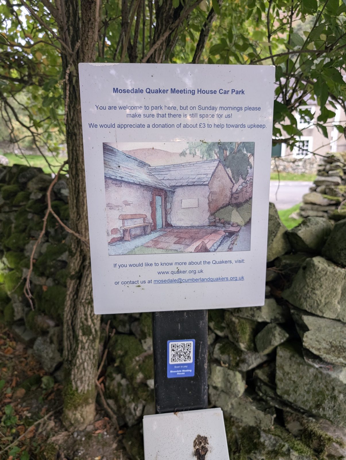
Where it is: mapped in OpenStreetMap. Details: from external sources. Checked 10 August 2026. · Directions (opens in new tab)
Grasmere Hall 1
Grasmere Hall car park (paid)
PaidCar parkGrasmere HallBus route
About 0.5 km (straight line) to the Grasmere Village start (West of Grasmere, Stone Arthur, Helm Crag). Paid parking (OSM-tagged).
Where it is: mapped in OpenStreetMap. Details: from external sources. Checked 10 August 2026. · Directions (opens in new tab)
Lowther Estate 1
Low Sawmill (paid)
PaidCar parkLowther EstateBus route
Nearest published walking: 4.7 km from the 'Heughscar Hill & Arthur's Pike' route start; 3.1 km from Heughscar Hill. Paid parking (OSM-tagged).
Where it is: mapped in OpenStreetMap. Details: from external sources. Checked 10 August 2026. · Directions (opens in new tab)
Cumbria Wildlife Trust 1
Little Eycott Hill car park (free)
FreeCar parkCumbria Wildlife Trust
Nearest fells: Little Eycott Hill (0.8 km), Eycott Hill (0.9 km). Free (OSM-tagged). Compacted surface (OSM-tagged).
Where it is: mapped in OpenStreetMap. Details: from external sources. Checked 10 August 2026. · Directions (opens in new tab)
No operator recorded 832
A5084, 0.5 km N of Lake Bank (layby)
FreeLay-by
Nearest fells: Beacon Fell (1.0 km), Unnamed top (Top o' Selside) (1.2 km), Wool Knott (1.5 km). Free (OSM-tagged). Unpaved surface (OSM-tagged).
Where it is: mapped in OpenStreetMap. Details: from external sources. Checked 10 August 2026. · Directions (opens in new tab)
A5084, 1.6 km N of Lake Bank (layby)
FreeLay-by
Nearest fells: Beacon Fell (1.4 km), High Light Haw (1.5 km), Low Light Haw (1.7 km). Free (OSM-tagged).
Where it is: mapped in OpenStreetMap. Details: from external sources. Checked 10 August 2026. · Directions (opens in new tab)
A590 by Low Newton Northbound (layby)
Charge not verifiedLay-by
Nearest fells: Newton Fell South (Dixon Heights) (1.0 km). Fee not verified — check signage on arrival.
Where it is: mapped in OpenStreetMap. Details: none checked. Checked 10 August 2026. · Directions (opens in new tab)
A590 by Low Newton Southbound (layby)
FreeLay-byBus route
Nearest fells: Newton Fell South (Dixon Heights) (1.2 km). Free (OSM-tagged).
Where it is: mapped in OpenStreetMap. Details: from external sources. Checked 10 August 2026. · Directions (opens in new tab)
A590, 0.8 km NE of Lindale (layby)
Charge not verifiedLay-by
Nearest fells: Newton Fell South (Dixon Heights) (1.1 km). Fee not verified — check signage on arrival.
Where it is: mapped in OpenStreetMap. Details: none checked. Checked 10 August 2026. · Directions (opens in new tab)
A591 north of Swirls (car park)
Charge not verifiedCar park
Walking base for Helvellyn, Helvellyn Lower Man, White Side and Nethermost Pike — the 'Helvellyn from Swirls: the walkers’ way up' route starts 479 m away. Also serves 'Helvellyn & Nethermost Pike via Seat Sandal'. Fee not verified — check signage on arrival.
Where it is: mapped in OpenStreetMap. Details: none checked. Checked 8 October 2026. · Directions (opens in new tab)
A592 Kirkstone Pass, 0.6 km north of the summit (free)
FreeCar parkabout 6 spaces
A small car park on the A592, 0.6 km north of the Kirkstone Pass summit in a straight line and 70 m south of Red Pit, on the Patterdale side (OSM way/522560007). The 'Caudale Moor & St Raven's Edge' route passes about 25 m away; it starts at Hartsop village, 4.2 km away in a straight line (this pin sits too far from the mapped paths to measure a walk). Free (OSM-tagged).
Where it is: mapped in OpenStreetMap. Details: from external sources. Checked 10 August 2026. · Directions (opens in new tab)
A592 Kirkstone Pass, 0.6 km south of the summit (layby)
FreeLay-byabout 1 space
A lay-by on the A592, 0.6 km south of the Kirkstone Pass summit in a straight line, on the Troutbeck side (OSM node/5041498766). No route on this site starts on the pass or passes within 400 m; the nearest start is the Rydal Road car park in Ambleside ('Loughrigg Terrace & Rydal Water'), 3.8 km away in a straight line (this pin sits too far from the mapped paths to measure a walk). Free (OSM-tagged).
Where it is: mapped in OpenStreetMap. Details: from external sources. Checked 10 August 2026. · Directions (opens in new tab)
A592 Kirkstone Pass, 1.0 km south of the summit (free)
FreeCar parkabout 2 spaces
A small car park on the A592, 1.0 km south of the Kirkstone Pass summit in a straight line, on the Troutbeck side (OSM node/5041498753). No route on this site starts on the pass or passes within 400 m; the nearest start is the Rydal Road car park in Ambleside ('Loughrigg Terrace & Rydal Water'), 3.6 km away in a straight line (this pin sits too far from the mapped paths to measure a walk). Free (OSM-tagged).
Where it is: mapped in OpenStreetMap. Details: from external sources. Checked 10 August 2026. · Directions (opens in new tab)
A592 Rayrigg Road, 0.8 km W of Windermere (layby)
FreeLay-by
The 'Orrest Head' route starts 1.0 km away, at Windermere station; so does 'Windermere Station to Brockhole and Back'. Free (OSM-tagged).
Where it is: mapped in OpenStreetMap. Details: from external sources. Checked 9 October 2026. · Directions (opens in new tab)
A592 Rayrigg Road, 0.9 km SW of Windermere (layby)
FreeLay-byabout 4 spacesBus route
The 'Orrest Head' route starts 1.1 km away, at Windermere station; so does 'Windermere Station to Brockhole and Back'. Free (OSM-tagged).
Where it is: mapped in OpenStreetMap. Details: from external sources. Checked 10 August 2026. · Directions (opens in new tab)
A592 Rayrigg Road, by Rayrigg Meadow (layby)
FreeLay-byabout 4 spacesBus route
The 'Orrest Head' route starts 1.1 km away, at Windermere station; so does 'Windermere Station to Brockhole and Back'. Free (OSM-tagged).
Where it is: mapped in OpenStreetMap. Details: from external sources. Checked 6 October 2026. · Directions (opens in new tab)
A592 by Ullswater, below Gowbarrow (layby, east)
FreeLay-byabout 8 spaces
Beside the A592 on the north shore of Ullswater, below Gowbarrow and across the lake from Hallin Fell (OSM way/945711946). The nearest route starts are at Aira Force, among them 'Aira Force & Gowbarrow Fell', about 2.5 km on foot. Free (OSM-tagged). Gravel surface (OSM-tagged).
Where it is: mapped in OpenStreetMap. Details: from external sources. Checked 10 August 2026. · Directions (opens in new tab)
A592 by Ullswater, below Gowbarrow (layby, west)
FreeLay-byabout 10 spacesBus route
Beside the A592 on the north shore of Ullswater, below Gowbarrow and across the lake from Hallin Fell (OSM way/945711945). The nearest route starts are at Aira Force, among them 'Aira Force & Gowbarrow Fell', about 2.5 km on foot. Free (OSM-tagged). Gravel surface (OSM-tagged).
Where it is: mapped in OpenStreetMap. Details: from external sources. Checked 10 August 2026. · Directions (opens in new tab)
A592 by Ullswater, below Gowbarrow (verge, east)
Charge not verifiedVergeabout 2 spaces
Beside the A592 on the north shore of Ullswater, below Gowbarrow and across the lake from Hallin Fell. The nearest route starts are at Aira Force, among them 'Aira Force & Gowbarrow Fell', about 2.5 km on foot.
Where it is: placed by Lee. Details: from Lee. Checked 8 August 2026. · Directions (opens in new tab)
A592 by Ullswater, below Gowbarrow (verge, west)
Charge not verifiedVergeabout 3 spaces
Beside the A592 on the north shore of Ullswater, below Gowbarrow and across the lake from Hallin Fell (OSM way/945711947). The nearest route starts are at Aira Force, among them 'Aira Force & Gowbarrow Fell', about 2.5 km on foot.
Where it is: placed by Lee. Details: from Lee. Checked 8 August 2026. · Directions (opens in new tab)
A592 south of Windy Corner (car park)
FreeCar parkabout 3 spaces
South of Windy Corner on the Kirkstone Pass side, about 480 m south of the Windy Corner bus stops (OSM way/522560013). The nearest route starts are 'Finishing of the Far Eastern Fells', 2.6 km north on foot at Hartsop, and the two at Cow Bridge, 2.9 km north on foot. Free (OSM-tagged).
Where it is: mapped in OpenStreetMap. Details: from external sources. Checked 8 October 2026. · Directions (opens in new tab)
A592, 1.0 km W of Barton (layby)
Charge not verifiedLay-by
Nearest fells: Dunmallet (Dunmallard Hill) (1.8 km). Fee not verified — check signage on arrival.
Where it is: mapped in OpenStreetMap. Details: none checked. Checked 10 August 2026. · Directions (opens in new tab)
A592, 1.3 km NE of Soulby (layby)
Charge not verifiedLay-by
Nearest fells: Dunmallet (Dunmallard Hill) (1.3 km). Fee not verified — check signage on arrival.
Where it is: mapped in OpenStreetMap. Details: none checked. Checked 10 August 2026. · Directions (opens in new tab)
A592, Gowbarrow Park shore (car park)
Charge not verifiedCar park
Beside the A592 on the Ullswater shore, east of Aira Force (OSM node/253264660). The 'Aira Force & Gowbarrow Fell' route starts 1.2 km away, at the Aira Force car park. Fee not verified — check signage on arrival.
Where it is: mapped in OpenStreetMap. Details: none checked. Checked 10 August 2026. · Directions (opens in new tab)
A592, Gowbarrow Park shore (verge, east)
Charge not verifiedVergeabout 2 spaces
Beside the A592 on the Ullswater shore, east of Aira Force. The 'Aira Force & Gowbarrow Fell' route starts 1.5 km away, at the Aira Force car park.
Where it is: placed by Lee. Details: from Lee. Checked 8 August 2026. · Directions (opens in new tab)
A592, Gowbarrow Park shore (verge, middle)
FreeVergeabout 6 spaces
Beside the A592 on the Ullswater shore, east of Aira Force (OSM way/1347781010). The 'Aira Force & Gowbarrow Fell' route starts 1.0 km away on foot, at the Aira Force car park. Free (OSM-tagged). Compacted surface (OSM-tagged).
Where it is: placed by Lee. Details: from Lee. Checked 12 August 2026. · Directions (opens in new tab)
A592, Gowbarrow Park shore (verge, west)
Charge not verifiedVergeabout 6 spaces
Beside the A592 on the Ullswater shore, east of Aira Force. The 'Aira Force & Gowbarrow Fell' route starts 0.7 km away, at the Aira Force car park.
Where it is: placed by Lee. Details: from Lee. Checked 8 August 2026. · Directions (opens in new tab)
A593 at Ellers Brow, Skelwith Bridge (layby)
Charge not verifiedLay-byabout 3 spaces
On the A593 at the foot of Ellers Brow, the lane up to Tarn Foot, north-east of Skelwith Bridge (OSM node/12062049435). Loughrigg Tarn is 1.1 km on foot and about 60 m up; the nearest route starts, in Elterwater village, are 2.9 km on foot.
Where it is: placed by Lee. Details: from Lee. Checked 10 August 2026. · Directions (opens in new tab)
A6 Shap summit (layby)
Charge not verifiedLay-by
High laybys on the old A6 — Wasdale Pike, Crookdale and Borrowdale (Westmorland) fells.
Where it is: placed by Lee. Details: none checked. Checked 9 August 2026. · Directions (opens in new tab)
A66 Keswick Bypass, Crosthwaite (layby)
Charge not verifiedLay-by
Beside the A66 Keswick Bypass at Great Crosthwaite, on the north-west edge of Keswick (OSM node/1270706987). The nearest route start is 'Friar's Crag & the Derwentwater shore' in the town centre, about 1.0 km away in a straight line. Fee not verified — check signage on arrival.
Where it is: mapped in OpenStreetMap. Details: none checked. Checked 9 October 2026. · Directions (opens in new tab)
A66 Keswick Bypass, west (layby)
Charge not verifiedLay-by
Beside the A66 Keswick Bypass, about 0.9 km north-east of Portinscale village in a straight line (OSM node/1640384833). The nearest route starts are in Keswick: 'Keswick to Threlkeld Railway Trail, with a Pub', 2.1 km on foot, and 'Friar's Crag & the Derwentwater shore', 2.3 km. Fee not verified — check signage on arrival.
Where it is: mapped in OpenStreetMap. Details: none checked. Checked 9 October 2026. · Directions (opens in new tab)
A66, 0.5 km SE of Dubwath (layby)
Charge not verifiedLay-by
Nearest fells: Lothwaite (1.3 km), Sale Fell (1.4 km), Rivings (1.5 km). Fee not verified — check signage on arrival.
Where it is: mapped in OpenStreetMap. Details: none checked. Checked 10 August 2026. · Directions (opens in new tab)
A66, 0.7 km W of Lambfoot (layby)
Charge not verifiedLay-by
Nearest fells: Watch Hill (Setmurthy Common) (1.7 km), Watch Hill (1.8 km). Fee not verified — check signage on arrival.
Where it is: mapped in OpenStreetMap. Details: none checked. Checked 10 August 2026. · Directions (opens in new tab)
A66, 1.7 km W of Lambfoot (layby)
Charge not verifiedLay-by
Nearest fells: Watch Hill (1.9 km). Fee not verified — check signage on arrival.
Where it is: mapped in OpenStreetMap. Details: none checked. Checked 10 August 2026. · Directions (opens in new tab)
Abbey Visitor Car Park
PaidCar park
Nearest published walking: 3.8 km from the 'Knipe Scar - Birkett' route start; 2.7 km from Langhowe Pike North Top (Langhowe Pike). The access track is steep and narrow through grazed land and is not suitable for large coaches (English Heritage, checked Aug 2026).
Where it is: mapped in OpenStreetMap. Details: none checked. Checked 10 August 2026. · Directions (opens in new tab)
Ambleside (layby)
Charge not verifiedLay-byBus route
0.7 km from the 'Ambleside to the Old Post Office Tea Room, Troutbeck (over Wansfell)' route start; 0.8 km from the 'Wansfell Pike and Baystones' route start. Fee not verified — check signage on arrival.
Where it is: mapped in OpenStreetMap. Details: none checked. Checked 10 August 2026. · Directions (opens in new tab)
Ambleside Cricket Club car park
Charge not verifiedCar parkabout 15 spaces
By Ambleside Cricket Club's ground, between Ambleside and Rydal (OSM way/423081472). The Pelter Bridge route starts at Rydal, 'Rydal Water & Rydal Caves' among them, are about 0.9 km on foot. A price was reported here and is NOT published: a fee needs a source and a date.
Where it is: placed by Lee. Details: from Lee. Checked 9 August 2026. · Directions (opens in new tab)
Ambleside, Market Place (4 on-street bays)
Charge not verifiedLay-byabout 4 spacesBus route
Start of: Ambleside to Rydal, with Refreshments and Stepping Stones, Ambleside, Todd Crag, Rydal Cave
On-street bays at the Market Place and North Road corner, by the Market Cross. Time limit not checked - read the signs. The 'Ambleside to Rydal, with Refreshments and Stepping Stones' route starts 77 m away. Also serves 'Ambleside, Todd Crag, Rydal Cave'. Fee not verified - check signage on arrival.
Where it is: mapped in OpenStreetMap. Details: from external sources. Checked 5 October 2026. · Directions (opens in new tab)
Ard Crags (layby)
FreeLay-byabout 2 spaces
Nearest fells: Ard Crags (0.8 km), Scar Crags (1.3 km), Causey Pike (1.4 km). Free (OSM-tagged).
Where it is: mapped in OpenStreetMap. Details: from external sources. Checked 10 August 2026. · Directions (opens in new tab)
Arlecdon car park (free)
FreeCar park
Nearest published walking: 4.6 km from Murton Fell (Knock Murton). Free (OSM-tagged).
Where it is: mapped in OpenStreetMap. Details: from external sources. Checked 10 August 2026. · Directions (opens in new tab)
Arnaby (layby)
FreeLay-by
Nearest published walking: 2.9 km from White Hall Knott. Free (OSM-tagged).
Where it is: mapped in OpenStreetMap. Details: from external sources. Checked 10 August 2026. · Directions (opens in new tab)
Arnaby car park (free)
FreeCar park
Nearest published walking: 3.7 km from White Hall Knott. Free (OSM-tagged). Compacted surface (OSM-tagged).
Where it is: mapped in OpenStreetMap. Details: from external sources. Checked 10 August 2026. · Directions (opens in new tab)
Arnside (layby)
FreeLay-by
Nearest published walking: 4.7 km from Hampsfell (Wainwright summit). Free (OSM-tagged).
Where it is: mapped in OpenStreetMap. Details: from external sources. Checked 10 August 2026. · Directions (opens in new tab)
Arnside car park
Charge not verifiedCar park
No published walk starts within 5 km; the nearest is Newton Fell South (Dixon Heights), 5.1 km away. Fee not verified — check signage on arrival.
Where it is: mapped in OpenStreetMap. Details: none checked. Checked 10 August 2026. · Directions (opens in new tab)
Arnside car park 2
Charge not verifiedCar park
No published walk starts within 5 km; the nearest is Newton Fell South (Dixon Heights), 5.3 km away. Fee not verified — check signage on arrival.
Where it is: mapped in OpenStreetMap. Details: none checked. Checked 10 August 2026. · Directions (opens in new tab)
Arnside car park 3
Charge not verifiedCar park
No published walk starts within 5 km; the nearest is Newton Fell South (Dixon Heights), 5.1 km away. Fee not verified — check signage on arrival.
Where it is: mapped in OpenStreetMap. Details: none checked. Checked 10 August 2026. · Directions (opens in new tab)
Arnside car park 4
Charge not verifiedCar park
No published walk starts within 5 km; the nearest is Newton Fell South (Dixon Heights), 5.4 km away. Ground surface (OSM-tagged). Fee not verified — check signage on arrival.
Where it is: mapped in OpenStreetMap. Details: none checked. Checked 10 August 2026. · Directions (opens in new tab)
Arnside, west (layby)
FreeLay-by
No published walk starts within 5 km; the nearest is Newton Fell South (Dixon Heights), 5.0 km away. Free (OSM-tagged).
Where it is: mapped in OpenStreetMap. Details: from external sources. Checked 10 August 2026. · Directions (opens in new tab)
Ashness Bridge, south (verge)
Charge not verifiedVergeabout 1 space
A one-car verge on the road up to Watendlath, 77 m south of the Ashness Bridge car park (Lee's Street View pin). The 'Walla Crag, Bleaberry Fell, High Seat, High Tove and Armboth Fell' route passes about 5 m away; it starts at Ashness Gate on the B5289, 0.8 km on foot, the nearest route start.
Where it is: placed by Lee. Details: from Lee. Checked 10 August 2026. · Directions (opens in new tab)
Ayside, 0.8 km NE (layby)
FreeLay-by
Nearest fells: Newton Fell North (0.6 km). Free (OSM-tagged).
Where it is: mapped in OpenStreetMap. Details: from external sources. Checked 10 August 2026. · Directions (opens in new tab)
B5284 Crook Road, 0.6 km N of Lindeth (layby)
FreeLay-by
Nearest fells: Brant Fell (0.4 km). Free (OSM-tagged).
Where it is: mapped in OpenStreetMap. Details: from external sources. Checked 10 August 2026. · Directions (opens in new tab)
B5320, Pooley Bridge (layby)
FreeLay-byBus route
Walking base for Heughscar Hill and Arthur's Pike — the 'Heughscar Hill & Arthur's Pike' route starts 195 m away. Free (OSM-tagged). OSM records a 2-hour maximum stay here (24 Jul 2026 extract) - that will not cover the Heughscar Hill & Arthur's Pike walk, which is about 3 hours; 'Pooley Bridge, Finkle Street car park (free)' is at the same route start and carries no such limit.
Where it is: mapped in OpenStreetMap. Details: from external sources. Checked 10 August 2026. · Directions (opens in new tab)
B5343, 0.4 km E of Elterwater (layby)
FreeLay-byabout 4 spaces
The 'Elterwater riverside loop' route starts 425 m away. Also serves 'Elterwater & Skelwith Force'. Free (OSM-tagged). Unpaved surface (OSM-tagged).
Where it is: mapped in OpenStreetMap. Details: from external sources. Checked 10 August 2026. · Directions (opens in new tab)
B5343, 0.5 km E of Elterwater (layby)
FreeLay-byabout 4 spaces
The 'Elterwater riverside loop' route starts 482 m away. Also serves 'Elterwater & Skelwith Force'. Free (OSM-tagged). Unpaved surface (OSM-tagged).
Where it is: mapped in OpenStreetMap. Details: from external sources. Checked 10 August 2026. · Directions (opens in new tab)
B5343, east of Elterwater (layby)
Charge not verifiedLay-by
Beside the B5343 east of Elterwater (OSM way/1302362834). The Elterwater village route starts are 0.8 km on foot. Fee not verified — check signage on arrival.
Where it is: mapped in OpenStreetMap. Details: none checked. Checked 10 August 2026. · Directions (opens in new tab)
Bailiff Wood car park, Coniston Water east shore
Charge not verifiedCar park
Beside the east-shore road, about 30 m from the water (OSM node/768273952, unnamed, in Bailiff Wood). The 'Top o' Selside' route starts at Dodgson Wood car park, 0.9 km south-south-west in a straight line. Fee not verified — check signage on arrival.
Where it is: mapped in OpenStreetMap. Details: none checked. Checked 9 October 2026. · Directions (opens in new tab)
Bandrake Head (layby)
Charge not verifiedLay-byabout 4 spaces
Nearest published walking: 4.1 km from the 'Low Light Haw' route start; 3.0 km from Unnamed top (Top o' Selside). Compacted surface (OSM-tagged). Fee not verified — check signage on arrival.
Where it is: mapped in OpenStreetMap. Details: from external sources. Checked 10 August 2026. · Directions (opens in new tab)
Barf (layby)
FreeLay-by
Nearest fells: Barf (1.0 km), Seat How (Thornthwaite) (1.3 km), Ullister Hill (1.5 km). Free (OSM-tagged).
Where it is: mapped in OpenStreetMap. Details: from external sources. Checked 10 August 2026. · Directions (opens in new tab)
Barf, south-east (layby)
FreeLay-by
Community walk pages start here for 'Barf, Lord's Seat, Ullister Hill and Seat How' (community walk listings). Free (OSM-tagged). Unpaved surface (OSM-tagged).
Where it is: mapped in OpenStreetMap. Details: from external sources. Checked 10 August 2026. · Directions (opens in new tab)
Barrow (layby)
FreeLay-byabout 1 space
On the lane from Braithwaite to Stair, by Uzzicar (OSM way/460522300, 'informal parking used by fellwalkers'). The Braithwaite village route starts, 'Scar Crags, Causey Pike' among them, are 2.0 km on foot; the Catbells starts at Hawes End are 2.3 km. Free (OSM-tagged). Compacted surface (OSM-tagged).
Where it is: mapped in OpenStreetMap. Details: from external sources. Checked 10 August 2026. · Directions (opens in new tab)
Barrow, north-east (layby)
FreeLay-byabout 6 spaces
On the lane from Braithwaite to Stair, by Uzzicar (OSM way/460522301, 'informal parking used by fellwalkers'). The Braithwaite village route starts, 'Scar Crags, Causey Pike' among them, are about 1.6 km away in a straight line. Free (OSM-tagged). Compacted surface (OSM-tagged).
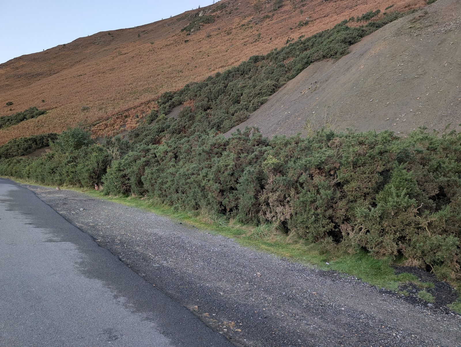
Where it is: mapped in OpenStreetMap. Details: from external sources. Checked 10 August 2026. · Directions (opens in new tab)
Barton (layby) 2
Charge not verifiedLay-by
Nearest published walking: 2.9 km from the 'Heughscar Hill & Arthur's Pike' route start; 3.0 km from Dunmallet (Dunmallard Hill). Unpaved surface (OSM-tagged). Fee not verified — check signage on arrival.
Where it is: mapped in OpenStreetMap. Details: none checked. Checked 10 August 2026. · Directions (opens in new tab)
Barton (layby) 3
Charge not verifiedLay-byBus route
Nearest published walking: 2.6 km from the 'Heughscar Hill & Arthur's Pike' route start; 2.6 km from Dunmallet (Dunmallard Hill). Fee not verified — check signage on arrival.
Where it is: mapped in OpenStreetMap. Details: none checked. Checked 10 August 2026. · Directions (opens in new tab)
Bassenthwaite (layby)
FreeLay-byBus route
Beside the A591 at its junction with the B5291 by the Castle Inn, about 1.1 km north-east of the end of Bassenthwaite Lake and 1.5 km west of Bassenthwaite village (OSM way/292701446). The nearest route start is the 'Binsey Walk', 3.6 km on foot. Free (OSM-tagged). Unpaved surface (OSM-tagged).
Where it is: mapped in OpenStreetMap. Details: from external sources. Checked 10 August 2026. · Directions (opens in new tab)
Baystones (layby)
FreeLay-byabout 4 spaces
Nearest fells: Baystones (Wansfell) (1.4 km), Wansfell (Wansfell North Top) (1.5 km), Sour Howes (1.7 km). Free (OSM-tagged).
Where it is: mapped in OpenStreetMap. Details: from external sources. Checked 10 August 2026. · Directions (opens in new tab)
Baystones car park (free)
FreeCar parkabout 5 spaces
Nearest fells: Baystones (Wansfell) (1.3 km), Wansfell (Wansfell North Top) (1.3 km), Troutbeck Tongue (1.8 km). Free (OSM-tagged).
Where it is: mapped in OpenStreetMap. Details: from external sources. Checked 10 August 2026. · Directions (opens in new tab)
Beacon Fell (layby)
FreeLay-byabout 2 spaces
Nearest fells: Beacon Fell (1.2 km), High Light Haw (1.5 km), Unnamed top (Top o' Selside) (1.5 km). Free (OSM-tagged). Ground surface (OSM-tagged).
Where it is: mapped in OpenStreetMap. Details: from external sources. Checked 10 August 2026. · Directions (opens in new tab)
Beacon Fell, east (layby)
FreeLay-by
Nearest fells: Beacon Fell (0.9 km), Unnamed top (Top o' Selside) (1.3 km), Low Light Haw (1.5 km). Free (OSM-tagged).
Where it is: mapped in OpenStreetMap. Details: from external sources. Checked 10 August 2026. · Directions (opens in new tab)
Beacon Fell, north-east (layby)
FreeLay-by
Nearest fells: Beacon Fell (1.4 km), High Light Haw (1.5 km), Low Light Haw (1.6 km). Free (OSM-tagged).
Where it is: mapped in OpenStreetMap. Details: from external sources. Checked 10 August 2026. · Directions (opens in new tab)
Beacon Fell, south-east (layby)
FreeLay-by
Nearest fells: Unnamed top (Top o' Selside) (1.1 km), Beacon Fell (1.1 km), Low Light Haw (1.4 km). Free (OSM-tagged). Unpaved surface (OSM-tagged).
Where it is: mapped in OpenStreetMap. Details: from external sources. Checked 10 August 2026. · Directions (opens in new tab)
Beanthwaite, 0.5 km SE (free)
FreeCar park
Nearest fells: Burney (1.8 km). Free (OSM-tagged).
Where it is: mapped in OpenStreetMap. Details: from external sources. Checked 10 August 2026. · Directions (opens in new tab)
Beck Head car park
Charge not verifiedCar park
Nearest published walking: 2.5 km from Whitbarrow - Lord's Seat. Fee not verified — check signage on arrival.
Where it is: mapped in OpenStreetMap. Details: none checked. Checked 10 August 2026. · Directions (opens in new tab)
Beck Wythop (free)
FreeCar park
Just off the A66 at Beck Wythop, on the west shore of Bassenthwaite Lake (OSM way/494426533). The nearest route starts are near Wythop Mill, over the hill to the west: 'Rivings and Lothwaite' and 'Ling Fell & Sale Fell', 4.1 km on foot. Free (OSM-tagged).
Where it is: mapped in OpenStreetMap. Details: from external sources. Checked 8 October 2026. · Directions (opens in new tab)
Beckfoot, Eskdale (verge)
Charge not verifiedVergeabout 2 spaces
On the Eskdale valley road between Beckfoot and Dalegarth station, about 0.4 km west of the station (OSM way/217924410). The 'Boat How, Illgill Head & Whin Rigg' route starts at the station, 0.4 km on foot.
Where it is: placed by Lee. Details: from Lee. Checked 9 October 2026. · Directions (opens in new tab)
Beckses (layby)
FreeLay-by
Nearest published walking: 3.0 km from the 'Great Mell Fell' route start; 2.8 km from Great Mell Fell. Free (OSM-tagged).
Where it is: mapped in OpenStreetMap. Details: from external sources. Checked 10 August 2026. · Directions (opens in new tab)
Beckses (layby) 2
FreeLay-byabout 6 spaces
Nearest published walking: 3.3 km from the 'Great Mell Fell' route start; 2.9 km from Great Mell Fell. Free (OSM-tagged).
Where it is: mapped in OpenStreetMap. Details: from external sources. Checked 10 August 2026. · Directions (opens in new tab)
Beckses car park
Charge not verifiedCar parkBus route
Nearest published walking: 3.3 km from the 'Great Mell Fell' route start; 3.3 km from Great Mell Fell. Fee not verified — check signage on arrival.
Where it is: mapped in OpenStreetMap. Details: none checked. Checked 10 August 2026. · Directions (opens in new tab)
Beckses, west (layby)
FreeLay-by
Nearest published walking: 3.2 km from the 'Great Mell Fell' route start; 2.8 km from Great Mell Fell. Free (OSM-tagged).
Where it is: mapped in OpenStreetMap. Details: from external sources. Checked 10 August 2026. · Directions (opens in new tab)
Beda Fell (layby)
FreeLay-by
Nearest fells: Beda Fell (Beda Head) (0.8 km), Gowk Hill (1.1 km), Brownthwaite Crag (1.2 km). Free (OSM-tagged). Grass surface (OSM-tagged).
Where it is: mapped in OpenStreetMap. Details: from external sources. Checked 10 August 2026. · Directions (opens in new tab)
Bewaldeth, 1.9 km NW (layby)
FreeLay-by
Nearest fells: Caermote Hill (0.9 km), St. John's Hill (Caermote Hill N Top) (1.3 km). Free (OSM-tagged). Ground surface (OSM-tagged).
Where it is: mapped in OpenStreetMap. Details: from external sources. Checked 10 August 2026. · Directions (opens in new tab)
Bigland Barrow car park
Charge not verifiedCar park
Nearest fells: Bigland Barrow (1.3 km). Fee not verified — check signage on arrival.
Where it is: mapped in OpenStreetMap. Details: none checked. Checked 10 August 2026. · Directions (opens in new tab)
Bigland Barrow, north (layby)
FreeLay-by
Nearest fells: Bigland Barrow (1.7 km). Free (OSM-tagged).
Where it is: mapped in OpenStreetMap. Details: from external sources. Checked 10 August 2026. · Directions (opens in new tab)
Bigland Barrow, north-west car park
Charge not verifiedCar park
Nearest fells: Bigland Barrow (1.3 km). Fee not verified — check signage on arrival.
Where it is: mapped in OpenStreetMap. Details: none checked. Checked 10 August 2026. · Directions (opens in new tab)
Bigland Barrow, west (layby)
FreeLay-by
Nearest fells: Bigland Barrow (1.0 km). Free (OSM-tagged).
Where it is: mapped in OpenStreetMap. Details: from external sources. Checked 10 August 2026. · Directions (opens in new tab)
Birch Fell car park
Charge not verifiedCar park
Nearest fells: Birch Fell (0.8 km), Gummer's How (0.9 km), Raven's Barrow (Cartmel Fell) (1.5 km). Fee not verified — check signage on arrival.
Where it is: from a walker’s report. Details: none checked. Checked 10 August 2026. · Directions (opens in new tab)
Black Fell (layby)
Charge not verifiedLay-byabout 2 spaces
1.1 km from Black Fell.
Where it is: placed by Lee. Details: from Lee. Checked 10 August 2026. · Directions (opens in new tab)
Black Fell car park, east
Charge not verifiedCar parkabout 10 spaces
1.1 km from Black Fell.
Where it is: placed by Lee. Details: from Lee. Checked 10 August 2026. · Directions (opens in new tab)
Black Fell car park, west
Charge not verifiedCar parkabout 5 spaces
1.1 km from Black Fell.
Where it is: placed by Lee. Details: from Lee. Checked 10 August 2026. · Directions (opens in new tab)
Blackbeck (layby)
Charge not verifiedLay-by
Nearest published walking: 3.8 km from Cold Fell. Fee not verified — check signage on arrival.
Where it is: mapped in OpenStreetMap. Details: none checked. Checked 10 August 2026. · Directions (opens in new tab)
Blake Rigg (verge)
Charge not verifiedVergeabout 1 space
A verge on the Little Langdale valley road towards Wrynose (OSM way/4891332), 600 m west of Fell Foot, under Blake Rigg (Lee's Street View pin). The 'Blea Tarn (Little Langdale)' route starts at the Blea Tarn car park, 1.4 km on foot and about 100 m up; the two routes from the Wrynose Pass car park start 1.8 km away in a straight line.
Where it is: placed by Lee. Details: from Lee. Checked 9 August 2026. · Directions (opens in new tab)
Blake Rigg Little Langdale (verge, east)
Charge not verifiedVergeabout 2 spaces
A verge on the Little Langdale valley road towards Wrynose (OSM way/4891332), 530 m west of Fell Foot, under Blake Rigg (Lee's Street View pin). The 'Blea Tarn (Little Langdale)' route starts at the Blea Tarn car park, 1.4 km on foot and about 100 m up; the two routes from the Wrynose Pass car park start 1.8 km away in a straight line.
Where it is: placed by Lee. Details: from Lee. Checked 8 August 2026. · Directions (opens in new tab)
Blake Rigg Little Langdale (verge, west)
Charge not verifiedVergeabout 3 spaces
A verge on the Wrynose Pass road (OSM way/4891333), 1.6 km west of Fell Foot at the head of Little Langdale (Lee's Street View pin). The 'Stonesty Pike, Great Knott & Wrynose Fell' route passes about 5 m away; it and 'Black Sails & Great How' start at the Wrynose Pass car park, 0.9 km away in a straight line (that car park sits too far from the mapped paths to measure a walk).
Where it is: placed by Lee. Details: from Lee. Checked 8 August 2026. · Directions (opens in new tab)
Blakeley Raise (verge, east)
Charge not verifiedVergeabout 1 space
0.7 km from Blakeley Raise.
Where it is: placed by Lee. Details: from Lee. Checked 10 August 2026. · Directions (opens in new tab)
Blakeley Raise (verge, west)
Charge not verifiedVergeabout 1 space
0.8 km from Blakeley Raise.
Where it is: placed by Lee. Details: from Lee. Checked 10 August 2026. · Directions (opens in new tab)
Bleach Green, Ennerdale (free)
FreeCar parkabout 25 spaces
At the western end of Ennerdale Water, for the lakeshore path. Fees: Free (not National Trust), per NT Ennerdale page (NT, checked Aug 2026). UU Ennerdale page states it has 'no plans to close or introduce car parking charges at any of the United Utilities car parks in the Ennerdale valley' - i.e. no charge currently applies (United Utilities, checked Aug 2026). If it is full, the National Park's car-parks directory (read 12 Sep 2026) says to try Bowness Knott car park.
Where it is: mapped in OpenStreetMap. Details: none checked. Checked 30 August 2026. · Directions (opens in new tab)
Bleach Green, north-west (free)
FreeCar parkabout 25 spaces
At the west end of Ennerdale Water, 130 m north-west of Bleach Green car park, by the road in (OSM way/29381633). The 'Round Ennerdale Water from Bowness Knott' route passes about 490 m away on foot (it joins at about km 8); 'Grike, Crag Fell and Lank Rigg' starts 4.3 km away on foot, on the Cold Fell road. Free (OSM-tagged). Unpaved surface (OSM-tagged).
Where it is: mapped in OpenStreetMap. Details: from external sources. Checked 8 October 2026. · Directions (opens in new tab)
Blind Lane Car Park
Charge not verifiedCar park
Nearest published walking: 2.9 km from the 'Carron Crag from Grizedale' route start; 3.2 km from Arnsbarrow Hill. Ground surface (OSM-tagged). Fee not verified — check signage on arrival.
Where it is: mapped in OpenStreetMap. Details: none checked. Checked 10 August 2026. · Directions (opens in new tab)
Boltongate car park (free)
FreeCar parkabout 8 spaces
Nearest published walking: 4.4 km from Green How - Aughertree Fell. Free (OSM-tagged).
Where it is: mapped in OpenStreetMap. Details: from external sources. Checked 10 August 2026. · Directions (opens in new tab)
Boothwaite Nook car park 2
Charge not verifiedCar park
Nearest published walking: 3.9 km from Burney. Fee not verified — check signage on arrival.
Where it is: mapped in OpenStreetMap. Details: none checked. Checked 10 August 2026. · Directions (opens in new tab)
Boothwaite Nook car park 3
Charge not verifiedCar park
No published walk starts within 5 km; the nearest is Burney, 5.0 km away. Fee not verified — check signage on arrival.
Where it is: mapped in OpenStreetMap. Details: none checked. Checked 10 August 2026. · Directions (opens in new tab)
Boothwaite Nook car park 5
Charge not verifiedCar park
Nearest published walking: 4.9 km from Burney. Fee not verified — check signage on arrival.
Where it is: mapped in OpenStreetMap. Details: none checked. Checked 10 August 2026. · Directions (opens in new tab)
Bootle (layby)
FreeLay-by
Nearest published walking: 3.0 km from Black Combe. Free (OSM-tagged).
Where it is: mapped in OpenStreetMap. Details: from external sources. Checked 10 August 2026. · Directions (opens in new tab)
Bootle car park
Charge not verifiedCar park
Nearest published walking: 4.0 km from Stoneside Hill. Fee not verified — check signage on arrival.
Where it is: mapped in OpenStreetMap. Details: none checked. Checked 10 August 2026. · Directions (opens in new tab)
Bootle, south (layby)
FreeLay-by
Nearest published walking: 2.8 km from Black Combe. Free (OSM-tagged).
Where it is: mapped in OpenStreetMap. Details: from external sources. Checked 10 August 2026. · Directions (opens in new tab)
Border End (verge, east)
Charge not verifiedVergeabout 2 spaces
0.5 km from Border End.
Where it is: placed by Lee. Details: from Lee. Checked 9 August 2026. · Directions (opens in new tab)
Border End (verge, west)
Charge not verifiedVergeabout 2 spaces
0.4 km from Border End.
Where it is: placed by Lee. Details: from Lee. Checked 9 August 2026. · Directions (opens in new tab)
Border End car park
Charge not verifiedCar park
Nearest fells: Border End (0.7 km), Hard Knott (0.9 km), Horsehow Crags (1.1 km). Fee not verified — check signage on arrival.
Where it is: mapped in OpenStreetMap. Details: none checked. Checked 10 August 2026. · Directions (opens in new tab)
Bothel (layby)
Charge not verifiedLay-by
Nearest published walking: 2.3 km from St. John's Hill (Caermote Hill N Top). Fee not verified — check signage on arrival.
Where it is: mapped in OpenStreetMap. Details: none checked. Checked 10 August 2026. · Directions (opens in new tab)
Bouth (layby)
FreeLay-byBus route
Nearest published walking: 4.0 km from Bigland Barrow. Free (OSM-tagged).
Where it is: mapped in OpenStreetMap. Details: from external sources. Checked 10 August 2026. · Directions (opens in new tab)
Bouth (layby) 2
Charge not verifiedLay-byBus route
Nearest published walking: 3.7 km from Bigland Barrow. Fee not verified — check signage on arrival.
Where it is: mapped in OpenStreetMap. Details: none checked. Checked 10 August 2026. · Directions (opens in new tab)
Bowderdale road end (verge)
Charge not verifiedVerge
North-side access — West Fell, Yarlside, the long Bowderdale valley to The Calf.
Where it is: from our first list. Details: none checked. Checked 2 August 2026. · Directions (opens in new tab)
Bowness on Windermere, 1.5 km W (layby)
FreeLay-by
Nearest fells: Claife Heights (0.7 km). Free (OSM-tagged). Dirt surface (OSM-tagged).
Where it is: mapped in OpenStreetMap. Details: from external sources. Checked 10 August 2026. · Directions (opens in new tab)
Bowness, Rayrigg Road (roadside, free)
FreeLay-byabout 5 spaces
The nearest route start is 'Orrest Head', 1.7 km away at Windermere station. Free (OSM-tagged).
Where it is: mapped in OpenStreetMap. Details: from external sources. Checked 6 October 2026. · Directions (opens in new tab)
Bowness, Rayrigg Road by Windermere Jetty (roadside, free)
FreeLay-byabout 10 spacesBus route
The nearest route start is 'Orrest Head', 1.6 km away at Windermere station. Free (OSM-tagged).
Where it is: mapped in OpenStreetMap. Details: from external sources. Checked 6 October 2026. · Directions (opens in new tab)
Bowness, Windermere Quays car park (paid)
PaidCar park
Beside the Windermere Quays marina, 80 m from the Glebe Road car park; operator not identified. The nearest route start is 'Orrest Head', 2.7 km away at Windermere station. Paid parking (OSM-tagged).
Where it is: mapped in OpenStreetMap. Details: from external sources. Checked 6 October 2026. · Directions (opens in new tab)
Bracken How car park (free)
FreeCar parkabout 6 spaces
Nearest fells: Bracken How (1.5 km), Gowbarrow Fell (Wainwright summit) (1.5 km), Round How (1.8 km). Free (OSM-tagged).
Where it is: mapped in OpenStreetMap. Details: from external sources. Checked 10 August 2026. · Directions (opens in new tab)
Bracken How, north car park
Charge not verifiedCar parkabout 5 spacesBus route
In Dockray, beside the A5091 bridge over Aira Beck (OSM way/583318864). The 'Birketts above Ullswater' and 'Swineside Knott & Gowbarrow' routes pass within 15 m. Compacted surface (OSM-tagged). Fee not verified — check signage on arrival.
Where it is: mapped in OpenStreetMap. Details: from external sources. Checked 10 August 2026. · Directions (opens in new tab)
Braithwaite village (roadside/small areas)
Charge not verifiedVergeBus route
Start of: Ard Crags & Knott Rigg, Scar Crags, Causey Pike, Stile End, Outerside, Causey Pike, Rowling End
In the village centre, beside the primary school. The small car park there may be the one the Authority lists as 'Braithwaite School', open to the public at weekends and in school holidays only, with no overnight parking. The 'Scar Crags, Causey Pike', 'Stile End, Outerside, Causey Pike, Rowling End' and 'Ard Crags & Knott Rigg' routes start here; the 'Coledale Round' starts at the Whinlatter Pass road car park above the village, 0.7 km on foot.
If it’s full: Noble Knott, Whinlatter (Forestry England, free) (1.7 km), Revelin Moss, Whinlatter (Forestry England, paid) (3.31 km), Stoneycroft Ghyll, Newlands (free) (2.25 km)
Where it is: placed by Lee. Details: none checked. Checked 9 August 2026. · Directions (opens in new tab)
Branstree (layby)
FreeLay-by
Walking base for Rough Crag (Riggindale), High Street, Mardale Ill Bell and Harter Fell (Mardale) — the 'Mardale circuit' route starts 166 m away. Also serves 'Mardale Ill Bell, High Street, The Knott, Rampsgill Head, High Raise and Kidsty Pike'. Free (OSM-tagged). Unpaved surface (OSM-tagged).
Where it is: mapped in OpenStreetMap. Details: from external sources. Checked 10 August 2026. · Directions (opens in new tab)
Branstree, north (layby)
FreeLay-by
A lay-by on the Haweswater lane, on the south-east shore. The Mardale Head routes start 0.8 km away in a straight line, 0.8 km along the lane. Free (OSM-tagged). Ground surface (OSM-tagged).
Where it is: mapped in OpenStreetMap. Details: from external sources. Checked 10 August 2026. · Directions (opens in new tab)
Brant Fell, south-west (layby)
Charge not verifiedLay-by
Nearest fells: Brant Fell (2.0 km). Fee not verified — check signage on arrival.
Where it is: mapped in OpenStreetMap. Details: none checked. Checked 10 August 2026. · Directions (opens in new tab)
Bridgend (layby)
FreeLay-byabout 5 spaces
On the A592 at Bridgend, between Patterdale and Hartsop, beside a bus stop (OSM way/763325733). The nearest route starts are the two at Cow Bridge, 1.2 km south on foot, and the two in Patterdale, 1.7 km north on foot ('St Sunday Crag', which climbs Arnison Crag, and 'Place Fell and The Knight'). Free (OSM-tagged).
Where it is: mapped in OpenStreetMap. Details: from external sources. Checked 8 October 2026. · Directions (opens in new tab)
Bridgend, south (layby)
FreeLay-byBus route
On the A592 at Bridgend, between Patterdale and Hartsop, beside the Bridgend bus stops (OSM way/348765089). The nearest route starts are the two at Cow Bridge, 1.1 km south on foot, and the two in Patterdale, 1.9 km north on foot ('St Sunday Crag', which climbs Arnison Crag, and 'Place Fell and The Knight'). Free (OSM-tagged).
Where it is: mapped in OpenStreetMap. Details: from external sources. Checked 8 October 2026. · Directions (opens in new tab)
Brigsteer (layby) 2
Charge not verifiedLay-by
Nearest published walking: 3.1 km from Scout Scar (Wainwright summit). Fee not verified — check signage on arrival.
Where it is: mapped in OpenStreetMap. Details: none checked. Checked 10 August 2026. · Directions (opens in new tab)
Brigsteer car park
Charge not verifiedCar park
Nearest published walking: 2.4 km from Scout Scar (Wainwright summit). Fee not verified — check signage on arrival.
Where it is: mapped in OpenStreetMap. Details: none checked. Checked 10 August 2026. · Directions (opens in new tab)
Broad Oak (layby)
FreeLay-byabout 4 spaces
Nearest published walking: 2.3 km from Muncaster Fell - Hooker Crag. Free (OSM-tagged).
Where it is: mapped in OpenStreetMap. Details: from external sources. Checked 10 August 2026. · Directions (opens in new tab)
Broadgate Meadow car park, Grasmere
PaidCar parkBus route
Start of: Alcock Tarn from Grasmere
About 0.5 km (straight line) to the Grasmere Village start (West of Grasmere, Stone Arthur, Helm Crag). Broadgate Meadow Car Park. Fees: pay and display; coins and cards; RingGo ID 37313 (LDNPA, checked Aug 2026).
Where it is: placed by Lee. Details: from Lee. Checked 9 August 2026. · Directions (opens in new tab)
Brothers Water, east shore (free)
FreeCar parkabout 4 spaces
On the A592 by the east shore of Brothers Water (OSM node/5098502627, 26 m from the road). The nearest route starts are 'Finishing of the Far Eastern Fells', 0.8 km north on foot at Hartsop, and the two at Cow Bridge, 1.0 km north on foot. Free (OSM-tagged). Compacted surface (OSM-tagged).
Where it is: mapped in OpenStreetMap. Details: from external sources. Checked 8 October 2026. · Directions (opens in new tab)
Broughton in Furness car park
Charge not verifiedCar park
Nearest published walking: 4.0 km from Great Stickle. Fee not verified — check signage on arrival.
Where it is: mapped in OpenStreetMap. Details: none checked. Checked 10 August 2026. · Directions (opens in new tab)
Brown Hills (layby)
FreeLay-by
Nearest fells: Brown Hills (1.2 km), Glenridding Dodd (1.3 km), Swineside Knott (1.3 km). Free (OSM-tagged).
Where it is: mapped in OpenStreetMap. Details: from external sources. Checked 10 August 2026. · Directions (opens in new tab)
Brown Howe (layby)
FreeLay-by
A lay-by on the Haweswater lane, on the south-east shore. The Mardale Head routes start 1.6 km away in a straight line, 1.7 km along the lane. Free (OSM-tagged). Unpaved surface (OSM-tagged).
Where it is: mapped in OpenStreetMap. Details: from external sources. Checked 10 August 2026. · Directions (opens in new tab)
Brown Howe, north-west (layby)
FreeLay-byabout 2 spaces
A lay-by on the Haweswater lane, on the south-east shore. The Mardale Head routes start 2.2 km away in a straight line, 2.5 km along the lane. Free (OSM-tagged). Ground surface (OSM-tagged).
Where it is: mapped in OpenStreetMap. Details: from external sources. Checked 10 August 2026. · Directions (opens in new tab)
Burnbanks (car park)
Charge not verifiedCar parkabout 10 spaces
In Burnbanks, at the dam end of the Haweswater lane. The routes from the dam end start at the verge by the dam, 0.8 km away in a straight line. Fee not verified — check signage on arrival.
Where it is: mapped in OpenStreetMap. Details: from external sources. Checked 10 August 2026. · Directions (opens in new tab)
Burney (layby)
FreeLay-by
Nearest fells: Burney (0.5 km). Free (OSM-tagged). Unpaved surface (OSM-tagged).
Where it is: mapped in OpenStreetMap. Details: from external sources. Checked 10 August 2026. · Directions (opens in new tab)
Burney (verge)
Charge not verifiedVergeabout 1 space
0.4 km from Burney.
Where it is: placed by Lee. Details: from Lee. Checked 9 August 2026. · Directions (opens in new tab)
Burney, south (layby)
Charge not verifiedLay-by
Nearest fells: Burney (1.0 km). Fee not verified — check signage on arrival.
Where it is: mapped in OpenStreetMap. Details: none checked. Checked 10 August 2026. · Directions (opens in new tab)
Burney, south-east (layby)
Charge not verifiedLay-by
Nearest fells: Burney (1.3 km). Fee not verified — check signage on arrival.
Where it is: mapped in OpenStreetMap. Details: none checked. Checked 10 August 2026. · Directions (opens in new tab)
Burney, south-east car park
Charge not verifiedCar park
Nearest fells: Burney (1.7 km). Fee not verified — check signage on arrival.
Where it is: mapped in OpenStreetMap. Details: none checked. Checked 10 August 2026. · Directions (opens in new tab)
Burney, west car park
Charge not verifiedCar park
Nearest fells: Burney (0.4 km). Fee not verified — check signage on arrival.
Where it is: mapped in OpenStreetMap. Details: none checked. Checked 10 August 2026. · Directions (opens in new tab)
Burthwaite Heights (layby)
FreeLay-by
Nearest fells: Burthwaite Heights (0.5 km), Ling Fell (1.0 km), Sale Fell (1.0 km). Free (OSM-tagged). Ground surface (OSM-tagged).
Where it is: mapped in OpenStreetMap. Details: from external sources. Checked 10 August 2026. · Directions (opens in new tab)
Buttermere village, by the Bridge Hotel (roadside, free)
FreeLay-byBus route
Start of: Great Borne & Starling Dodd, High Snockrigg from Buttermere, High Stile, Seat via Buttermere, Red Pike by Scale Force
Walking base for Red Pike (Buttermere), High Stile, High Stile (Grey Crag - High Stile) and High Crag (Buttermere) — the 'High Stile, Seat via Buttermere' route starts 5 m away. Also serves 'Great Bourne & Starling Dodd'. Unpaved surface (OSM-tagged).
Where it is: mapped in OpenStreetMap. Details: from external sources. Checked 8 October 2026. Lee started a recorded walk here on 17 October 2026. · Directions (opens in new tab)
Caermote Hill (layby)
FreeLay-by
Nearest fells: Caermote Hill (0.9 km), St. John's Hill (Caermote Hill N Top) (1.4 km). Free (OSM-tagged).
Where it is: mapped in OpenStreetMap. Details: from external sources. Checked 10 August 2026. · Directions (opens in new tab)
Caermote Hill, south-east (layby)
FreeLay-by
Nearest fells: Caermote Hill (1.0 km), St. John's Hill (Caermote Hill N Top) (1.4 km). Free (OSM-tagged).
Where it is: mapped in OpenStreetMap. Details: from external sources. Checked 10 August 2026. · Directions (opens in new tab)
Caldbeck Bowling club (free)
FreeCar parkabout 35 spaces
Nearest published walking: 2.3 km from Faulds Brow. Free (OSM-tagged).
Where it is: mapped in OpenStreetMap. Details: from external sources. Checked 10 August 2026. · Directions (opens in new tab)
Caldbeck village (free)
FreeCar park
Northern edge — High Pike and Carrock Fell from the north.
Where it is: placed by Lee. Details: as first entered. Checked 7 August 2026. · Directions (opens in new tab)
Calder Bridge (layby)
Charge not verifiedLay-by
Nearest published walking: 3.7 km from Cold Fell. Fee not verified — check signage on arrival.
Where it is: mapped in OpenStreetMap. Details: none checked. Checked 10 August 2026. · Directions (opens in new tab)
Calder Bridge car park (free)
FreeCar park
Nearest published walking: 3.5 km from Cold Fell. Free (OSM-tagged).
Where it is: mapped in OpenStreetMap. Details: from external sources. Checked 10 August 2026. · Directions (opens in new tab)
Canal Foot car park (free)
FreeCar park
No published walk starts within 5 km; the nearest is Bigland Barrow, 5.9 km away. Free (OSM-tagged). Ground surface (OSM-tagged).
Where it is: mapped in OpenStreetMap. Details: from external sources. Checked 10 August 2026. · Directions (opens in new tab)
Car Park A
Charge not verifiedCar park
Nearest published walking: 4.8 km from Cold Fell. Fee not verified — check signage on arrival.
Where it is: mapped in OpenStreetMap. Details: none checked. Checked 10 August 2026. · Directions (opens in new tab)
Car Park B
Charge not verifiedCar park
Nearest published walking: 4.7 km from Cold Fell. Fee not verified — check signage on arrival.
Where it is: mapped in OpenStreetMap. Details: none checked. Checked 10 August 2026. · Directions (opens in new tab)
Car park for Barf (free)
FreeCar park
0.6 km from Barf. Added from the 5 Aug 2026 OSM candidate review.
Where it is: placed by Lee. Details: from external sources. Checked 5 August 2026. · Directions (opens in new tab)
Car park for Claife Heights (donation)
Honesty boxCar park
1.9 km from Claife Heights. Added from the 5 Aug 2026 OSM candidate review.
Where it is: placed by Lee. Details: from external sources. Checked 5 August 2026. · Directions (opens in new tab)
Car park for Heughscar Hill (free)
FreeCar parkabout 8 spaces
Approx 8 spaces. 1 km from Heughscar Hill. Added from the 5 Aug 2026 OSM candidate review.
Where it is: placed by Lee. Details: from external sources. Checked 5 August 2026. · Directions (opens in new tab)
Car park for Loweswater Fell (free)
FreeCar park
In Loweswater village, beside the road through it (OSM way/550406546). The nearest route starts are at Maggie's Bridge, among them 'Loweswater circuit', 1.0 km on foot. Added from the 5 Aug 2026 OSM candidate review.
Where it is: placed by Lee. Details: from external sources. Checked 5 August 2026. · Directions (opens in new tab)
Car park for Rannerdale Knotts
Charge not verifiedCar park
Beside the B5289 on the shore of Crummock Water, at the foot of Rannerdale Knotts (OSM way/446304181). The nearest route starts are in Buttermere village, among them 'Scale Fell and Mellbreak', 1.7 km on foot. Added from the 5 Aug 2026 OSM candidate review.
Where it is: placed by Lee. Details: from external sources. Checked 8 August 2026. · Directions (opens in new tab)
Car park for Skelgill Bank (free)
FreeCar parkabout 12 spaces
Approx 12 spaces. At Gutherscale, on the lane west of Hawes End (OSM way/385113537). The Hawes End route starts, 'Catbells: the short way up' among them, are 0.3 km on foot. Added from the 5 Aug 2026 OSM candidate review.
Where it is: placed by Lee. Details: from external sources. Checked 5 August 2026. · Directions (opens in new tab)
Carrock Fell (verge, east)
Charge not verifiedVerge
1.6 km from Carrock Fell. Fee not verified — check signage on arrival.
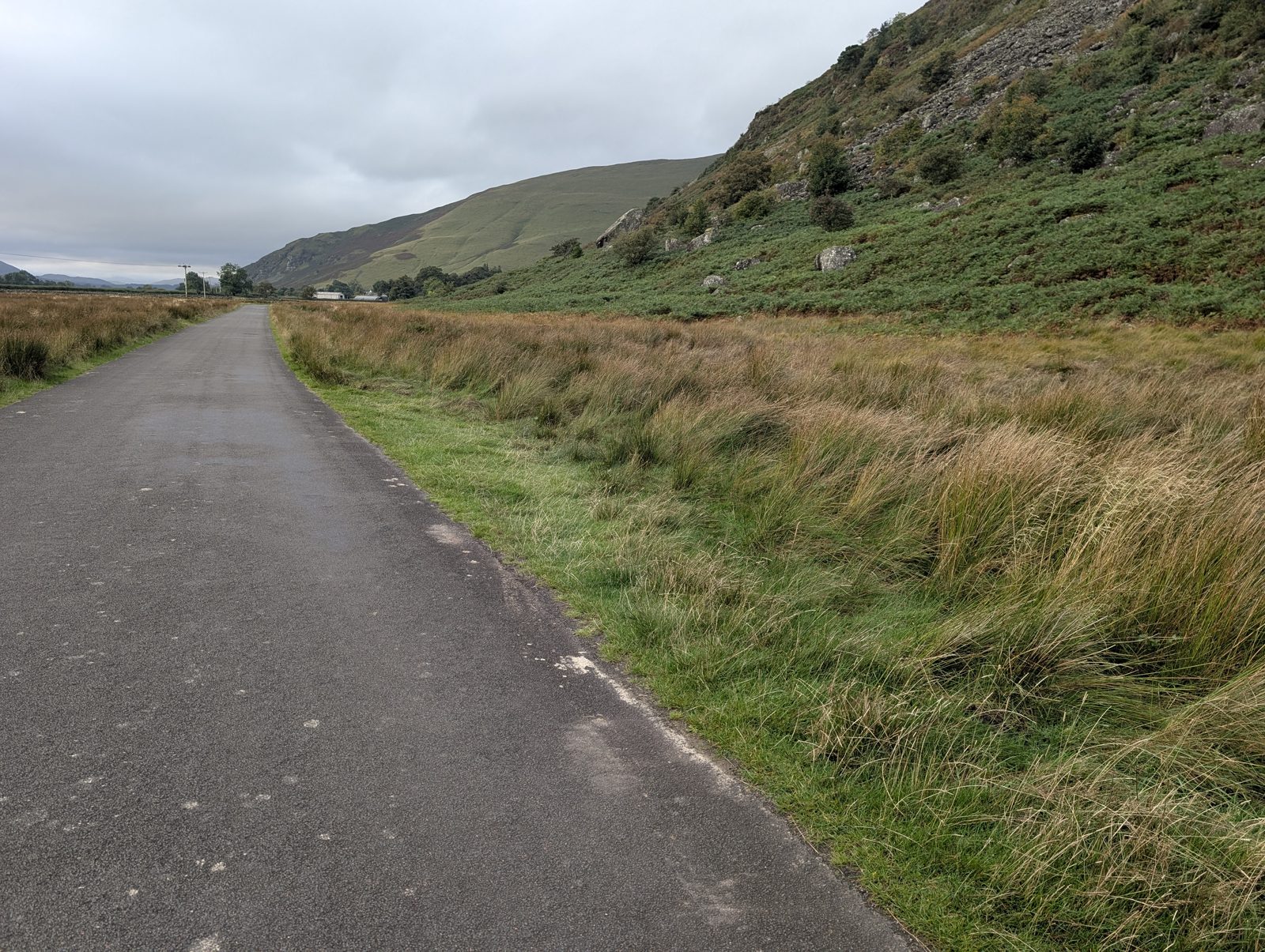
Where it is: placed by Lee. Details: from Lee. Checked 29 September 2026. · Directions (opens in new tab)
Carrock Fell (verge, north)
Charge not verifiedVergeabout 2 spaces
1.6 km from Carrock Fell.
Where it is: placed by Lee. Details: from Lee. Checked 10 August 2026. · Directions (opens in new tab)
Carrock Fell (verge, south)
Charge not verifiedVergeabout 1 space
1.2 km from Carrock Fell.
Where it is: placed by Lee. Details: from Lee. Checked 10 August 2026. · Directions (opens in new tab)
Carrock Fell car park (free)
FreeCar park
Walking base for Carrock Fell, Round Knott, Miton Hill and Hare Stones — the 'Birketts by Carrock Fell' route starts 261 m away. Free (OSM-tagged). Grass surface (OSM-tagged).
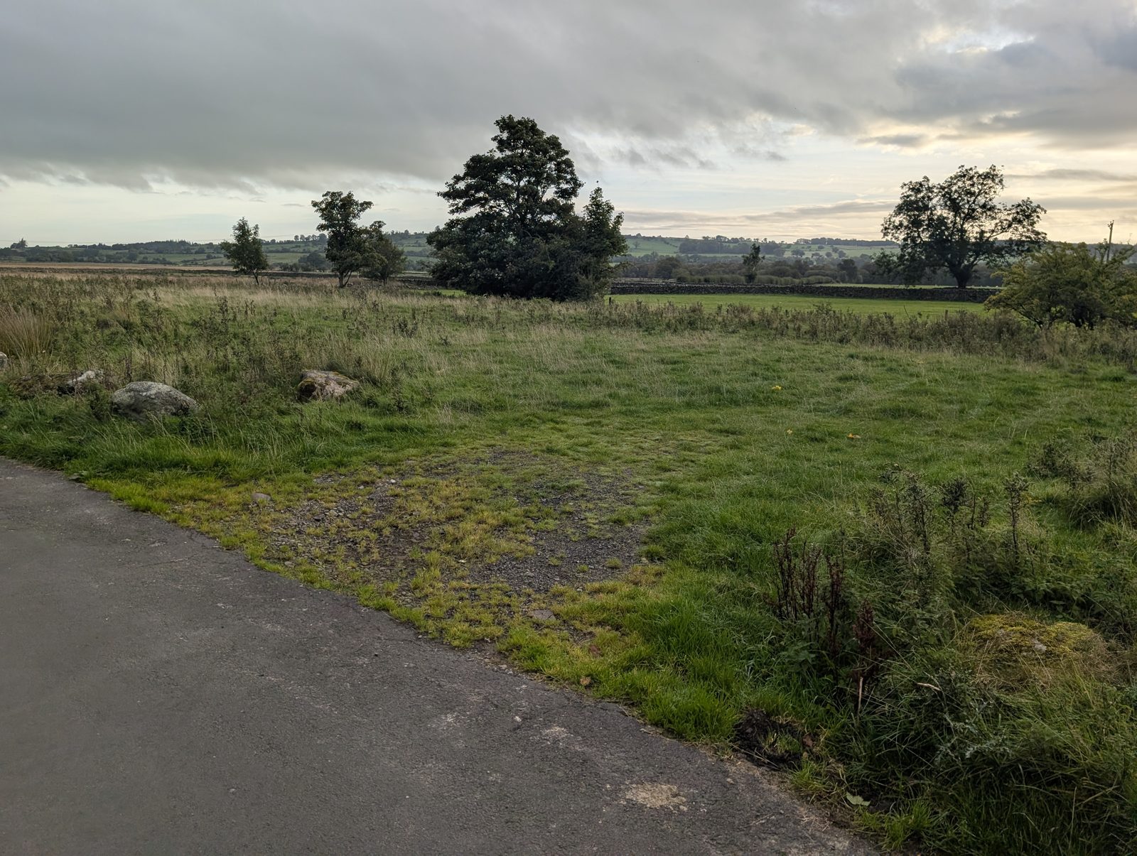
Where it is: mapped in OpenStreetMap. Details: from external sources. Checked 10 August 2026. Lee started a recorded walk here on 29 September 2026. · Directions (opens in new tab)
Carrock Fell, east (layby)
FreeLay-by
Walking base for Carrock Fell, Miton Hill, High Pike (Caldbeck) and Hare Stones — the 'Carrock Fell and Knott' route starts 407 m away. Free (OSM-tagged). Grass surface (OSM-tagged).
Where it is: mapped in OpenStreetMap. Details: from external sources. Checked 10 August 2026. · Directions (opens in new tab)
Carrock Fell, north-east (layby)
FreeLay-by
Nearest fells: Carrock Fell (1.3 km), Round Knott (1.9 km). Free (OSM-tagged). Grass surface (OSM-tagged).
Where it is: mapped in OpenStreetMap. Details: from external sources. Checked 10 August 2026. · Directions (opens in new tab)
Carron Crag car park (paid)
PaidCar park
Nearest fells: Carron Crag (1.1 km). Paid parking (OSM-tagged).
Where it is: mapped in OpenStreetMap. Details: from external sources. Checked 10 August 2026. · Directions (opens in new tab)
Carron Crag, east car park 2
Charge not verifiedCar park
Walking base for Carron Crag — the 'Carron Crag from Grizedale' route starts 82 m away. Grass surface (OSM-tagged). Fee not verified — check signage on arrival.
Where it is: mapped in OpenStreetMap. Details: none checked. Checked 10 August 2026. · Directions (opens in new tab)
Cartmel car park
Charge not verifiedCar park
Nearest published walking: 2.2 km from Hampsfell (Wainwright summit). Fee not verified — check signage on arrival.
Where it is: mapped in OpenStreetMap. Details: none checked. Checked 10 August 2026. · Directions (opens in new tab)
Cartmel car park 2
Charge not verifiedCar park
Nearest published walking: 2.1 km from Hampsfell (Wainwright summit). Fee not verified — check signage on arrival.
Where it is: mapped in OpenStreetMap. Details: none checked. Checked 10 August 2026. · Directions (opens in new tab)
Cartmel car park 3
Charge not verifiedCar park
Nearest published walking: 2.2 km from Hampsfell (Wainwright summit). Fee not verified — check signage on arrival.
Where it is: mapped in OpenStreetMap. Details: none checked. Checked 10 August 2026. · Directions (opens in new tab)
Castle Crag (layby)
FreeLay-by
The 'Castle Crag, Brund Fell & Great Crag' route starts 957 m away, at Rosthwaite. Free (OSM-tagged). Unpaved surface (OSM-tagged).
Where it is: mapped in OpenStreetMap. Details: from external sources. Checked 10 August 2026. · Directions (opens in new tab)
Castle Rock (layby)
FreeLay-byBus route
Walking base for Brown Crag, White Side, Raise and Stybarrow Dodd — the 'Brown Crag and Raise' route starts 213 m away. Also serves 'Three Dodds and Calfhow Pike'. Free (OSM-tagged). Ground surface (OSM-tagged).
Where it is: mapped in OpenStreetMap. Details: from external sources. Checked 10 August 2026. · Directions (opens in new tab)
Cat Bells (layby)
FreeLay-by
Nearest fells: Cat Bells (Catbells) (0.5 km), Skelgill Bank (0.9 km). Free (OSM-tagged). Ground surface (OSM-tagged).
Where it is: mapped in OpenStreetMap. Details: from external sources. Checked 10 August 2026. · Directions (opens in new tab)
Cat Bells Catbells (verge)
Charge not verifiedVergeabout 2 spaces
0.5 km from Cat Bells Catbells.
Where it is: placed by Lee. Details: from Lee. Checked 8 August 2026. · Directions (opens in new tab)
Cat Bells car park
Charge not verifiedCar parkBus route
On the lane south from Hawes End, below Catbells (OSM way/1076976169). The Hawes End route starts, 'Catbells: the short way up' among them, are 1.3 km on foot. Fee not verified — check signage on arrival.
Where it is: mapped in OpenStreetMap. Details: none checked. Checked 10 August 2026. · Directions (opens in new tab)
Cat Bells, south-east (layby)
FreeLay-byabout 10 spaces
Start of: Maiden Moor and High Spy
Nearest fells: Cat Bells (Catbells) (0.8 km), Skelgill Bank (1.4 km), Maiden Moor (1.6 km). Free (OSM-tagged). Ground surface (OSM-tagged).
Where it is: mapped in OpenStreetMap. Details: from external sources. Checked 10 August 2026. · Directions (opens in new tab)
Caudale Bridge (layby)
FreeLay-byabout 5 spacesBus route
On the A592 south of Brothers Water, near Caudale Bridge and about 290 m from the Brotherswater Inn bus stops (OSM way/482996330). The nearest route starts are 'Finishing of the Far Eastern Fells', 1.8 km north on foot at Hartsop, and the two at Cow Bridge, 2.0 km north on foot. Free (OSM-tagged).
Where it is: mapped in OpenStreetMap. Details: from external sources. Checked 8 October 2026. · Directions (opens in new tab)
Causey Pike (layby)
FreeLay-byabout 3 spaces
Nearest fells: Causey Pike (1.3 km), Scope End (1.3 km), Rowling End (1.4 km). Free (OSM-tagged).
Where it is: mapped in OpenStreetMap. Details: from external sources. Checked 10 August 2026. · Directions (opens in new tab)
Church Bridge, Troutbeck (limited)
FreeCar parkabout 10 spacesBus route
Start of: Capple Howe & Sallows
For Wansfell, Troutbeck Tongue and the Ill Bell ridge via Garburn Pass.
Where it is: mapped in OpenStreetMap. Details: from external sources. Checked 2 August 2026. · Directions (opens in new tab)
Claife Heights, south-east (layby)
FreeLay-by
Nearest fells: Claife Heights (1.0 km). Free (OSM-tagged). Dirt surface (OSM-tagged).
Where it is: mapped in OpenStreetMap. Details: from external sources. Checked 10 August 2026. · Directions (opens in new tab)
Cleator Moor car park (free)
FreeCar parkabout 20 spaces
Nearest published walking: 4.5 km from the 'Grike, Crag Fell and Lank Rigg' route start; 3.0 km from Dent. Free (OSM-tagged).
Where it is: mapped in OpenStreetMap. Details: from external sources. Checked 10 August 2026. · Directions (opens in new tab)
Cleator Moor, Cragg Road (car park)
Charge not verifiedCar park
Nearest published walking: 4.2 km from the 'Grike, Crag Fell and Lank Rigg' route start; 2.6 km from Dent. Fee not verified — check signage on arrival.
Where it is: mapped in OpenStreetMap. Details: none checked. Checked 10 August 2026. · Directions (opens in new tab)
Cleator Moor, Market Street (car park)
Charge not verifiedCar park
Nearest published walking: 4.2 km from the 'Grike, Crag Fell and Lank Rigg' route start; 2.7 km from Dent. Fee not verified — check signage on arrival.
Where it is: mapped in OpenStreetMap. Details: none checked. Checked 10 August 2026. · Directions (opens in new tab)
Cleator Moor, Montreal Street (car park)
Charge not verifiedCar park
Nearest published walking: 4.3 km from the 'Grike, Crag Fell and Lank Rigg' route start; 2.7 km from Dent. Fee not verified — check signage on arrival.
Where it is: mapped in OpenStreetMap. Details: none checked. Checked 10 August 2026. · Directions (opens in new tab)
Cleator Moor, by the Council Offices (car park)
Charge not verifiedCar park
Nearest published walking: 4.2 km from the 'Grike, Crag Fell and Lank Rigg' route start; 2.7 km from Dent. Fee not verified — check signage on arrival.
Where it is: mapped in OpenStreetMap. Details: none checked. Checked 10 August 2026. · Directions (opens in new tab)
Cleator car park
Charge not verifiedCar park
Nearest published walking: 4.5 km from the 'Grike, Crag Fell and Lank Rigg' route start; 2.3 km from Dent. Fee not verified — check signage on arrival.
Where it is: mapped in OpenStreetMap. Details: none checked. Checked 10 August 2026. · Directions (opens in new tab)
Clifton (layby)
Charge not verifiedLay-byabout 2 spaces
No published walk starts within 5 km; the nearest is Heughscar Hill, 5.9 km away. Fee not verified — check signage on arrival.
Where it is: mapped in OpenStreetMap. Details: from external sources. Checked 10 August 2026. · Directions (opens in new tab)
Clifton, south-east (layby)
Charge not verifiedLay-byabout 2 spaces
No published walk starts within 5 km; the nearest is Heughscar Hill, 5.9 km away. Fee not verified — check signage on arrival.
Where it is: mapped in OpenStreetMap. Details: from external sources. Checked 10 August 2026. · Directions (opens in new tab)
Clints Crags (layby)
FreeLay-byabout 2 spaces
Nearest fells: Clints Crags (Wainwright summit) (1.4 km). Free (OSM-tagged). Gravel surface (OSM-tagged).
Where it is: mapped in OpenStreetMap. Details: from external sources. Checked 10 August 2026. · Directions (opens in new tab)
Co-op Car Park
Charge not verifiedCar park
Nearest published walking: 4.8 km from the 'Grike, Crag Fell and Lank Rigg' route start; 3.2 km from Dent. Fee not verified — check signage on arrival.
Where it is: mapped in OpenStreetMap. Details: none checked. Checked 10 August 2026. · Directions (opens in new tab)
Cockermouth car park (paid) 2
PaidCar parkBus route
Nearest published walking: 3.2 km from Watch Hill. Paid parking (OSM-tagged).
Where it is: mapped in OpenStreetMap. Details: from external sources. Checked 10 August 2026. · Directions (opens in new tab)
Cockermouth car park 2
Charge not verifiedCar parkabout 60 spacesBus route
Nearest published walking: 3.5 km from Watch Hill. Fee not verified — check signage on arrival.
Where it is: mapped in OpenStreetMap. Details: from external sources. Checked 10 August 2026. · Directions (opens in new tab)
Cockermouth, south-west car park (paid)
PaidCar park
Nearest published walking: 4.4 km from Watch Hill. Paid parking (OSM-tagged).
Where it is: mapped in OpenStreetMap. Details: from external sources. Checked 10 August 2026. · Directions (opens in new tab)
Cold Fell (verge)
Charge not verifiedVergeabout 1 space
3.1 km from Cold Fell.
Where it is: placed by Lee. Details: from Lee. Checked 9 August 2026. · Directions (opens in new tab)
Cold Fell car park (free)
FreeCar parkabout 10 spaces
Nearest fells: Cold Fell (0.9 km). Free (OSM-tagged).
Where it is: mapped in OpenStreetMap. Details: from external sources. Checked 10 August 2026. · Directions (opens in new tab)
Cold Fell road (verge)
Charge not verifiedVerge
Verge parking on the Calder Bridge–Ennerdale road for Lank Rigg and Ponsonby Fell.
Where it is: placed by Lee. Details: none checked. Checked 9 August 2026. · Directions (opens in new tab)
Coleridge Court, Keswick (paid)
PaidCar parkBus route
The 'Friar's Crag & the Derwentwater shore' route starts 164 m away. Also serves 'Walk from Keswick'. Paid parking (OSM-tagged).
Where it is: mapped in OpenStreetMap. Details: from external sources. Checked 10 August 2026. Lee started a recorded walk here on 9 May 2026. · Directions (opens in new tab)
Colwith Bridge (layby)
FreeLay-byabout 3 spaces
Beside the Little Langdale road, 80 m from Colwith Bridge (OSM node/5101288734). The 'Elterwater & Skelwith Force' route passes it; Colwith Force is 0.4 km on foot. Free (OSM-tagged).
Where it is: mapped in OpenStreetMap. Details: from external sources. Checked 10 August 2026. · Directions (opens in new tab)
Competitors
Charge not verifiedCar park
Nearest published walking: 4.4 km from the 'Grike, Crag Fell and Lank Rigg' route start; 2.7 km from Kelton Fell. Fee not verified — check signage on arrival.
Where it is: mapped in OpenStreetMap. Details: none checked. Checked 10 August 2026. · Directions (opens in new tab)
Competitors Pits
Charge not verifiedCar park
Nearest published walking: 4.5 km from the 'Grike, Crag Fell and Lank Rigg' route start; 2.7 km from Kelton Fell. Fee not verified — check signage on arrival.
Where it is: mapped in OpenStreetMap. Details: none checked. Checked 10 August 2026. · Directions (opens in new tab)
Coniston (layby)
Charge not verifiedLay-by
Start of: West Side of Coniston
The 'West Side of Coniston' route starts 27 m away. Fee not verified — check signage on arrival.
Where it is: mapped in OpenStreetMap. Details: none checked. Checked 10 August 2026. · Directions (opens in new tab)
Coniston Sports and Social Centre car park (paid)
PaidCar parkBus route
Beside Coniston Sports and Social Centre; who may park is not published, so check the sign. The 'The Sun Pub Walk (Coniston)' route starts 326 m away. Paid parking (OSM-tagged). Unpaved surface (OSM-tagged).
Where it is: mapped in OpenStreetMap. Details: from external sources. Checked 5 October 2026. · Directions (opens in new tab)
Coniston, by John Ruskin School (paid)
PaidCar parkBus route
Beside John Ruskin School. Access is not confirmed by any operator: no council, LDNPA or operator page lists it (read 5 Oct 2026), so check the signs. The 'The Sun Pub Walk (Coniston)' route starts 265 m away. Also serves 'North of Coniston Birketts'. Paid parking (OSM-tagged).
Where it is: mapped in OpenStreetMap. Details: from external sources. Checked 5 October 2026. · Directions (opens in new tab)
Coppermines and Old Man Car Park (paid)
PaidCar parkabout 50 spaces
Nearest fells: Kitty Crag (1.7 km), Long Crag - Yewdale Fells (1.7 km), High Wythow (1.9 km). Paid parking (OSM-tagged). Gravel surface (OSM-tagged).
Where it is: mapped in OpenStreetMap. Details: from external sources. Checked 10 August 2026. · Directions (opens in new tab)
Corney (layby)
FreeLay-by
Nearest published walking: 2.8 km from Kinmont Buck Barrow. Free (OSM-tagged). Ground surface (OSM-tagged).
Where it is: mapped in OpenStreetMap. Details: from external sources. Checked 10 August 2026. · Directions (opens in new tab)
Corney (layby) 2
Charge not verifiedLay-by
Nearest published walking: 4.7 km from Kinmont Buck Barrow. Fee not verified — check signage on arrival.
Where it is: mapped in OpenStreetMap. Details: none checked. Checked 10 August 2026. · Directions (opens in new tab)
Corney Fell road summit (verge)
Charge not verifiedVerge
Start of: Around Sele Bottom, Awkward Around Swinside Fell
High verge start for Buck Barrow, Whit Fell and the Corney fells.
Where it is: from our first list. Details: none checked. Checked 2 August 2026. · Directions (opens in new tab)
Cotes (layby) 2
FreeLay-by
Nearest published walking: 2.7 km from Whitbarrow - Lord's Seat. Free (OSM-tagged).
Where it is: mapped in OpenStreetMap. Details: from external sources. Checked 10 August 2026. · Directions (opens in new tab)
Cow Bridge (layby)
FreeLay-byabout 10 spacesBus route
Walking base for Middle Dodd, Little Hart Crag (Little Hart Crag - West Top), High Hartsop Dodd and Gale Crag — the 'Middle Dodd Little Hart Crag and High Hartsop Dodd' route starts 56 m away. Also serves 'Hartsop Fells and Hart Crag'. Free (OSM-tagged). Unpaved surface (OSM-tagged).
Where it is: mapped in OpenStreetMap. Details: from external sources. Checked 8 October 2026. · Directions (opens in new tab)
Crab Haws car park, Bethecar Moor (free)
FreeCar park
Start of: Low Light Haw
Small, free car park about 0.8 miles N of High Nibthwaite (OS SD 296 909; what3words ///fault.swordfish.insect). The hidden entrance is immediately after a field on the right. The natural start for the quiet Bethecar Moor / Blawith Birketts (Low & High Light Haw, Arnsbarrow Hill), with a path up through the woods. High Nibthwaite's own roadside laybys are very limited, so use Crab Haws to avoid blocking farm access.
Where it is: from our first list. Details: as first entered. Checked 2 August 2026. · Directions (opens in new tab)
Crook Hall car park
Charge not verifiedCar park
Nearest published walking: 3.7 km from the 'Brunt Knott from Staveley' route start; 2.9 km from Unnamed top (School Knott). Fee not verified — check signage on arrival.
Where it is: mapped in OpenStreetMap. Details: none checked. Checked 10 August 2026. · Directions (opens in new tab)
Cross Keys, Cautley (A683 layby)
Charge not verifiedLay-by
Start of: Cautley Horseshoe
Layby by the temperance inn — Cautley Spout, Yarlside, The Calf's east side.
Where it is: from our first list. Details: none checked. Checked 2 August 2026. · Directions (opens in new tab)
Crosthwaite Green car park (free)
FreeCar parkabout 8 spaces
Nearest published walking: 3.5 km from Raven's Barrow (Cartmel Fell). Free (OSM-tagged).
Where it is: mapped in OpenStreetMap. Details: from external sources. Checked 10 August 2026. · Directions (opens in new tab)
Crosthwaite Green, south car park (free)
FreeCar parkabout 4 spaces
Nearest published walking: 3.6 km from Raven's Barrow (Cartmel Fell). Free (OSM-tagged). Compacted surface (OSM-tagged).
Where it is: mapped in OpenStreetMap. Details: from external sources. Checked 10 August 2026. · Directions (opens in new tab)
Crummock Water, Cinderdale Common (free)
FreeCar parkBus route
Roadside common by Crummock Water - Rannerdale Knotts and Whiteless Pike.
Where it is: mapped in OpenStreetMap. Details: from external sources. Checked 2 August 2026. · Directions (opens in new tab)
Crummock Water, Cinderdale Common, south (free)
FreeVergeabout 5 spacesBus route
Start of: Rannerdale bluebell valley and Rannerdale Knotts
Beside the B5289 at Cinderdale Common, by Crummock Water (OSM way/446128992). The nearest route start is 'Rannerdale bluebell valley and Rannerdale Knotts', which starts here; 'The Grasmoor Round' starts at Lanthwaite Green, 1.6 km on foot. Gravel verge.
Where it is: placed by Lee. Details: from Lee. Checked 9 August 2026. · Directions (opens in new tab)
Cunswick Scar, east car park (free)
FreeCar park
Nearest fells: Cunswick Scar (1.7 km). Free (OSM-tagged).
Where it is: mapped in OpenStreetMap. Details: from external sources. Checked 10 August 2026. · Directions (opens in new tab)
Cunswick Scar, north car park (free)
FreeCar parkabout 20 spaces
Nearest fells: Cunswick Scar (1.2 km). Free (OSM-tagged).
Where it is: mapped in OpenStreetMap. Details: from external sources. Checked 10 August 2026. · Directions (opens in new tab)
Cunswick Scar, north-east car park
Charge not verifiedCar park
Nearest fells: Cunswick Scar (1.9 km). Fee not verified — check signage on arrival.
Where it is: mapped in OpenStreetMap. Details: none checked. Checked 10 August 2026. · Directions (opens in new tab)
Dam Triangle, Thirlmere (paid)
PaidCar park
Start of: Raven Crag from Thirlmere
On Dam Road at the north end of Thirlmere: the 'Raven Crag from Thirlmere' route starts here. Paid car park. The National Park's car-parks directory (read 12 Sep 2026) lists it as 'Dam Triangle', pay and display, and OSM names it 'Dam triangle car park' (way/485343809).
Where it is: placed by Lee. Details: from Lee. Checked 8 October 2026. · Directions (opens in new tab)
Darling Fell (layby)
FreeLay-byabout 9 spaces
Beside the road on the north side of Loweswater (OSM way/1104601979). With a phonebox. The nearest route start is 'Birketts North of Loweswater', 0.4 km on foot.
Where it is: placed by Lee. Details: from Lee. Checked 9 August 2026. · Directions (opens in new tab)
Darling Fell, south-west (layby)
FreeLay-byabout 2 spaces
By the north shore of Loweswater, off the lane along it (OSM node/6723146364). The nearest route start is 'Birketts North of Loweswater', 0.7 km on foot. Free (OSM-tagged). Unpaved surface (OSM-tagged).
Where it is: mapped in OpenStreetMap. Details: from external sources. Checked 10 August 2026. · Directions (opens in new tab)
Darling Fell, west (layby)
FreeLay-byabout 15 spaces
Start of: Birketts North of Loweswater
Beside the road on the north side of Loweswater (OSM node/6720380439). The nearest route start is 'Birketts North of Loweswater', 0.1 km on foot. Free (OSM-tagged). Unpaved surface (OSM-tagged).
Where it is: mapped in OpenStreetMap. Details: from external sources. Checked 10 August 2026. · Directions (opens in new tab)
Deanscales car park (free)
FreeCar park
Nearest published walking: 3.5 km from Hatteringill Head - Whin Fell. Free (OSM-tagged). Unpaved surface (OSM-tagged).
Where it is: mapped in OpenStreetMap. Details: from external sources. Checked 10 August 2026. · Directions (opens in new tab)
Demming Crag (layby)
Charge not verifiedLay-by
Beside the valley road at Birks Bridge, by the River Duddon, 70 m from the Forestry England car park (OSM node/12064443051). The nearest route start is the Goat Crag lay-by at the foot of Hardknott Pass ('Alternative Hardknott Round'), about 4.7 km on foot. Unpaved surface (OSM-tagged). Fee not verified — check signage on arrival.
Where it is: mapped in OpenStreetMap. Details: none checked. Checked 10 August 2026. · Directions (opens in new tab)
Dent (layby)
FreeLay-byabout 8 spaces
Nearest fells: Dent (1.5 km). Free (OSM-tagged).
Where it is: mapped in OpenStreetMap. Details: from external sources. Checked 10 August 2026. · Directions (opens in new tab)
Dent car park
Charge not verifiedCar park
Nearest fells: Dent (1.8 km). Fee not verified — check signage on arrival.
Where it is: mapped in OpenStreetMap. Details: none checked. Checked 10 August 2026. · Directions (opens in new tab)
Dent, north-east car park (free)
FreeCar parkabout 8 spaces
Nearest fells: Dent (1.0 km), Flat Fell (1.1 km). Free (OSM-tagged).
Where it is: mapped in OpenStreetMap. Details: from external sources. Checked 10 August 2026. · Directions (opens in new tab)
Devoke Water turning, Birker Fell road (verge)
FreeVerge
Start of: Birketts Around Devoke Water, Green Crag & Great Whinscale — the wild Birker Fell round
Rough free parking by the bridleway to Devoke Water for the Birker Fell group.
Where it is: mapped in OpenStreetMap. Details: from external sources. Checked 2 August 2026. · Directions (opens in new tab)
Dockray (roadside)
Charge not verifiedVergeBus route
Verge parking for the Dodds and Matterdale Common.
Where it is: placed by Lee. Details: none checked. Checked 7 August 2026. · Directions (opens in new tab)
Dodd (layby)
FreeLay-by
Nearest fells: Dodd (Skiddaw) (0.8 km), Long Side (1.7 km), Ullock Pike (1.7 km). Free (OSM-tagged). Unpaved surface (OSM-tagged).
Where it is: mapped in OpenStreetMap. Details: from external sources. Checked 10 August 2026. · Directions (opens in new tab)
Dodd Lorton (layby)
Charge not verifiedLay-byabout 4 spaces
2.3 km from Dodd Lorton.
Where it is: placed by Lee. Details: from Lee. Checked 9 August 2026. · Directions (opens in new tab)
Dodd car park (free)
FreeCar park
Nearest fells: Dodd (Skiddaw) (1.7 km), Skiddaw Lesser Man (1.9 km), Carl Side (2.0 km). Free (OSM-tagged).
Where it is: mapped in OpenStreetMap. Details: from external sources. Checked 10 August 2026. · Directions (opens in new tab)
Dodgson Wood car park, Coniston Water east shore
Charge not verifiedCar park
Start of: Top o' Selside
Car park on the east side of the lake road south of Brantwood (OS SD 299 927), about 30 m from the water. The 'Top o' Selside' route starts here. A steeper alternative start for the Bethecar Moor fells, climbing through the woodland past Parkamoor.
Where it is: from our first list. Details: none checked. Checked 2 August 2026. · Directions (opens in new tab)
Dubwath, 0.5 km SE (layby)
Charge not verifiedLay-by
Nearest fells: Lothwaite (1.1 km), Sale Fell (1.2 km), Rivings (1.3 km). Fee not verified — check signage on arrival.
Where it is: mapped in OpenStreetMap. Details: none checked. Checked 10 August 2026. · Directions (opens in new tab)
Dubwath, 0.6 km SE (layby)
Charge not verifiedLay-by
Nearest fells: Lothwaite (1.1 km), Sale Fell (1.2 km), Rivings (1.3 km). Fee not verified — check signage on arrival.
Where it is: mapped in OpenStreetMap. Details: none checked. Checked 10 August 2026. · Directions (opens in new tab)
Duddon Bridge (layby)
Charge not verifiedLay-by
Nearest published walking: 4.2 km from Great Stickle. Fee not verified — check signage on arrival.
Where it is: mapped in OpenStreetMap. Details: none checked. Checked 10 August 2026. · Directions (opens in new tab)
Duddon Bridge, north-east (layby)
Charge not verifiedLay-by
Nearest published walking: 3.5 km from Great Stickle. Fee not verified — check signage on arrival.
Where it is: mapped in OpenStreetMap. Details: none checked. Checked 10 August 2026. · Directions (opens in new tab)
Duddon Furnace (paid)
PaidCar parkabout 5 spaces
Nearest published walking: 3.6 km from Great Stickle. Ground surface (OSM-tagged). Fees: pay and display; RingGo ID 27332 (LDNPA, checked Aug 2026).
Where it is: mapped in OpenStreetMap. Details: from external sources. Checked 10 August 2026. · Directions (opens in new tab)
Dunmallet, south car park
Charge not verifiedCar park
Nearest fells: Dunmallet (Dunmallard Hill) (0.7 km). Fee not verified — check signage on arrival.
Where it is: mapped in OpenStreetMap. Details: none checked. Checked 10 August 2026. · Directions (opens in new tab)
Dunmallet, south-west (layby)
FreeLay-byabout 3 spaces
Nearest fells: Dunmallet (Dunmallard Hill) (0.7 km). Free (OSM-tagged).
Where it is: mapped in OpenStreetMap. Details: from external sources. Checked 10 August 2026. · Directions (opens in new tab)
Dunnerdale Fells (layby)
Charge not verifiedLay-byabout 5 spaces
0.9 km from Dunnerdale Fells.
Where it is: placed by Lee. Details: from Lee. Checked 9 August 2026. · Directions (opens in new tab)
Dunnerdale Fells, south-west (layby)
FreeLay-by
Nearest fells: Dunnerdale Fells (1.3 km), Great Stickle (1.4 km), Tarn Hill (1.6 km). Free (OSM-tagged). Ground surface (OSM-tagged).
Where it is: mapped in OpenStreetMap. Details: from external sources. Checked 10 August 2026. · Directions (opens in new tab)
Dunnerdale Fells, west (layby)
FreeLay-by
Nearest fells: Dunnerdale Fells (0.7 km), Tarn Hill (1.0 km), Great Stickle (1.2 km). Free (OSM-tagged).
Where it is: mapped in OpenStreetMap. Details: from external sources. Checked 10 August 2026. · Directions (opens in new tab)
Elterwater (layby)
FreeLay-byBus route
The 'Elterwater & Skelwith Force' route starts 245 m away. Also serves 'Elterwater riverside loop'. Free (OSM-tagged). Unpaved surface (OSM-tagged).
Where it is: mapped in OpenStreetMap. Details: from external sources. Checked 10 August 2026. · Directions (opens in new tab)
Elterwater Common (free)
FreeCar parkabout 8 spaces
On Elterwater Common, north of the village (OSM way/4894297). The Elterwater village route starts are 0.4 km on foot; the 'Loughrigg Tarn & Loughrigg Fell' route passes about 60 m away. Free (OSM-tagged, read 2026-09-20).
Where it is: placed by Lee. Details: from Lee. Checked 9 August 2026. · Directions (opens in new tab)
Elterwater, 1.0 km NE (layby)
FreeLay-byabout 3 spaces
On the road north-east of Elterwater at Low Wood (OSM way/500650827). The 'Loughrigg Tarn & Loughrigg Fell' route passes here; its start in Elterwater village is 1.2 km on foot. Free (OSM-tagged). Unpaved surface (OSM-tagged).
Where it is: mapped in OpenStreetMap. Details: from external sources. Checked 10 August 2026. · Directions (opens in new tab)
Elterwater, Mill Row (verge)
Charge not verifiedVergeabout 6 spaces
Beside Mill Row, north-east of the village and 30 m from the B5343. The 'Loughrigg Tarn & Loughrigg Fell' route passes here; the Elterwater village route starts are 0.3 km on foot.
Where it is: placed by Lee. Details: from Lee. Checked 9 August 2026. · Directions (opens in new tab)
Elterwater, east (Walthwaite)
Charge not verifiedCar parkBus route
Walking base for Lingmoor Fell (Brown How) and Side Pike — the 'Elterwater & Skelwith Force' route starts 216 m away. Also serves 'Lingmoor Fell from Elterwater'. Fee not verified — check signage on arrival.
Where it is: mapped in OpenStreetMap. Details: none checked. Checked 6 October 2026. · Directions (opens in new tab)
Elterwater, east (free)
FreeCar park
The 'Elterwater riverside loop' route starts 338 m away. Also serves 'Elterwater & Skelwith Force'. Free (OSM-tagged). Unpaved surface (OSM-tagged).
Where it is: mapped in OpenStreetMap. Details: from external sources. Checked 6 October 2026. · Directions (opens in new tab)
Elterwater, east 2
Charge not verifiedCar parkBus route
Walking base for Lingmoor Fell (Brown How) and Side Pike — the 'Elterwater & Skelwith Force' route starts 310 m away. Also serves 'Lingmoor Fell from Elterwater'. Fee not verified — check signage on arrival.
Where it is: mapped in OpenStreetMap. Details: none checked. Checked 6 October 2026. · Directions (opens in new tab)
Ennerdale Bridge car park
Charge not verifiedCar park
In Ennerdale Bridge village, beside the Cold Fell road (OSM way/361422335). The nearest route starts are 'Grike, Crag Fell and Lank Rigg', 2.3 km on foot on the Cold Fell road, and 'Birketts by Kirkland', 2.6 km on foot. Fee not verified — check signage on arrival.
Where it is: mapped in OpenStreetMap. Details: none checked. Checked 10 August 2026. · Directions (opens in new tab)
Esthwaite Water (paid)
PaidCar park
Nearest published walking: 2.7 km from the 'Hawkshead into the woods' route start. Ground surface (OSM-tagged). Fees: pay and display; RingGo ID 37339 (LDNPA, checked Aug 2026).
Where it is: mapped in OpenStreetMap. Details: from external sources. Checked 10 August 2026. · Directions (opens in new tab)
Fairmile Gate, Howgill Lane (verge)
Charge not verifiedVerge
West-side access to Fell Head and the Lune-side Howgills.
Where it is: placed by Lee. Details: none checked. Checked 9 August 2026. · Directions (opens in new tab)
Faulds Brow car park (free)
FreeCar park
Nearest fells: Faulds Brow (1.8 km). Free (OSM-tagged). Gravel surface (OSM-tagged).
Where it is: mapped in OpenStreetMap. Details: from external sources. Checked 10 August 2026. · Directions (opens in new tab)
Faulds Brow, east car park (free)
FreeCar park
Nearest fells: Faulds Brow (0.5 km). Free (OSM-tagged). Unpaved surface (OSM-tagged).
Where it is: mapped in OpenStreetMap. Details: from external sources. Checked 10 August 2026. · Directions (opens in new tab)
Faulds Brow, south-east (layby)
FreeLay-by
Nearest fells: Faulds Brow (1.4 km). Free (OSM-tagged). Unpaved surface (OSM-tagged).
Where it is: mapped in OpenStreetMap. Details: from external sources. Checked 10 August 2026. · Directions (opens in new tab)
Fell Side car park (free)
FreeCar parkabout 6 spaces
Nearest published walking: 4.1 km from the 'North of Skiddaw' route start; 2.7 km from Brae Fell. Free (OSM-tagged).
Where it is: mapped in OpenStreetMap. Details: from external sources. Checked 10 August 2026. · Directions (opens in new tab)
Fisher Crag (layby, north)
Charge not verifiedLay-byabout 5 spaces
0.6 km from Fisher Crag.
Where it is: placed by Lee. Details: from Lee. Checked 8 August 2026. · Directions (opens in new tab)
Fisher Crag (layby, south)
Charge not verifiedLay-byabout 5 spaces
0.7 km from Fisher Crag.
Where it is: placed by Lee. Details: from Lee. Checked 8 August 2026. · Directions (opens in new tab)
Fisher Crag (verge)
Charge not verifiedVergeabout 4 spaces
0.4 km from Fisher Crag.
Where it is: placed by Lee. Details: from Lee. Checked 8 August 2026. · Directions (opens in new tab)
Flat Fell (verge)
Charge not verifiedVergeabout 3 spaces
Start of: Grike, Crag Fell and Lank Rigg
0.7 km from Flat Fell.
Where it is: placed by Lee. Details: from Lee. Checked 10 August 2026. · Directions (opens in new tab)
Fleetwith Pike (layby)
FreeLay-by
On the Honister Pass road (B5289), about 610 m east of the Gatesgarth Farm car park (OSM way/463845526). The nearest route start is 'Fleetwith Edge and Haystacks', at the Gatesgarth Farm car park, about 0.6 km west in a straight line. Free (OSM-tagged). Unpaved surface (OSM-tagged).
Where it is: mapped in OpenStreetMap. Details: from external sources. Checked 10 August 2026. · Directions (opens in new tab)
Frizington car park (free)
FreeCar park
Nearest published walking: 4.2 km from the 'Grike, Crag Fell and Lank Rigg' route start; 3.8 km from Flat Fell. Free (OSM-tagged).
Where it is: mapped in OpenStreetMap. Details: from external sources. Checked 10 August 2026. · Directions (opens in new tab)
Garth Row (layby)
Charge not verifiedLay-by
Nearest published walking: 4.8 km from the 'Bannisdale Fell - Long Crag' route start; 3.3 km from Ulgraves. Fee not verified — check signage on arrival.
Where it is: mapped in OpenStreetMap. Details: none checked. Checked 10 August 2026. · Directions (opens in new tab)
Garth Row (layby) 2
Charge not verifiedLay-by
Nearest published walking: 4.2 km from the 'Bannisdale Fell - Long Crag' route start; 2.0 km from Ulgraves. Fee not verified — check signage on arrival.
Where it is: mapped in OpenStreetMap. Details: none checked. Checked 10 August 2026. · Directions (opens in new tab)
Garth Row car park
Charge not verifiedCar park
Nearest published walking: 4.3 km from the 'Bannisdale Fell - Long Crag' route start; 2.5 km from Ulgraves. Fee not verified — check signage on arrival.
Where it is: mapped in OpenStreetMap. Details: none checked. Checked 10 August 2026. · Directions (opens in new tab)
Gatesgarth Farm, Buttermere (paid)
PaidCar parkabout 40 spacesBus route
Start of: Fleetwith Edge and Haystacks
Farm car park at the foot of Haystacks, Fleetwith Pike and the High Stile ridge.
Where it is: mapped in OpenStreetMap. Details: from external sources. Checked 2 August 2026. · Directions (opens in new tab)
Glenridding Dodd (layby)
FreeLay-byBus route
On the A592 by Ullswater, 1.4 km north of Glenridding (OSM way/1080338597). The nearest route starts are in the village by the Beckside car park, among them 'Helvellyn via Striding Edge & Swirral Edge', 1.7 km on foot. Free (OSM-tagged).
Where it is: mapped in OpenStreetMap. Details: from external sources. Checked 10 August 2026. · Directions (opens in new tab)
Glenridding Dodd, north-east (layby)
FreeLay-byBus route
On the A592 by Ullswater, 1.2 km north of Glenridding (OSM way/659549742). The nearest route starts are in the village by the Beckside car park, among them 'Helvellyn via Striding Edge & Swirral Edge', 1.3 km on foot. Free (OSM-tagged).
Where it is: mapped in OpenStreetMap. Details: from external sources. Checked 10 August 2026. · Directions (opens in new tab)
Glenridding, by St Patrick's Boat Landing (car park)
Charge not verifiedCar parkBus route
Walking base for Glenridding Dodd, Heron Pike (Glenridding), Sheffield Pike and Catstye Cam — the 'Glenridding Dodd, Sheffield Pike, Catstye Cam, Birkhouse Moor' route starts 307 m away. Also serves 'Helvellyn via Striding Edge & Swirral Edge'. Fee not verified — check signage on arrival.
Where it is: mapped in OpenStreetMap. Details: none checked. Checked 10 August 2026. · Directions (opens in new tab)
Goat Crag (layby)
FreeLay-by
Start of: Alternative Hardknott Round (Green Crag, Harter Fell & Hard Knott)
Walking base for Green Crag, Harter Fell (Eskdale) and Hard Knott — the 'Alternative Hardknott Round (Green Crag, Harter Fell & Hard Knott)' route starts 25 m away. Free (OSM-tagged). Grass surface (OSM-tagged).
Where it is: mapped in OpenStreetMap. Details: from external sources. Checked 10 August 2026. · Directions (opens in new tab)
Goat Crag, south-east (layby)
FreeLay-by
Walking base for Green Crag, Harter Fell (Eskdale) and Hard Knott — the 'Alternative Hardknott Round (Green Crag, Harter Fell & Hard Knott)' route starts 204 m away. Free (OSM-tagged). Unpaved surface (OSM-tagged).
Where it is: mapped in OpenStreetMap. Details: from external sources. Checked 10 August 2026. · Directions (opens in new tab)
Gosforth (layby)
Charge not verifiedLay-by
Nearest published walking: 4.8 km from Ponsonby Fell. Fee not verified — check signage on arrival.
Where it is: mapped in OpenStreetMap. Details: none checked. Checked 10 August 2026. · Directions (opens in new tab)
Gosforth car park
Charge not verifiedCar park
Nearest published walking: 3.7 km from Ponsonby Fell. Fee not verified — check signage on arrival.
Where it is: mapped in OpenStreetMap. Details: none checked. Checked 10 August 2026. · Directions (opens in new tab)
Gosforth car park 2
Charge not verifiedCar park
Nearest published walking: 3.6 km from Ponsonby Fell. Fee not verified — check signage on arrival.
Where it is: mapped in OpenStreetMap. Details: none checked. Checked 10 August 2026. · Directions (opens in new tab)
Gowk Hill (layby)
Charge not verifiedLay-by
Nearest fells: Gowk Hill (0.8 km), The Nab (1.1 km), Brownthwaite Crag (1.2 km). Unpaved surface (OSM-tagged). Fee not verified — check signage on arrival.
Where it is: mapped in OpenStreetMap. Details: none checked. Checked 10 August 2026. · Directions (opens in new tab)
Grandsire car park (free)
FreeCar parkabout 3 spaces
Nearest fells: Unnamed top (School Knott) (1.6 km), Grandsire (2.0 km). Free (OSM-tagged). Ground surface (OSM-tagged).
Where it is: mapped in OpenStreetMap. Details: from external sources. Checked 10 August 2026. · Directions (opens in new tab)
Grange village car park (by the chapel)
Charge not verifiedCar parkBus route
In Grange, beside the Methodist chapel near Grange Bridge. The 'Bowder Stone' route starts 677 m away. Fee not verified — check signage on arrival.
Where it is: mapped in OpenStreetMap. Details: none checked. Checked 5 October 2026. · Directions (opens in new tab)
Grange-over-Sands car park 2
Charge not verifiedCar park
Nearest published walking: 2.2 km from Hampsfell (Wainwright summit). Fee not verified — check signage on arrival.
Where it is: mapped in OpenStreetMap. Details: none checked. Checked 10 August 2026. · Directions (opens in new tab)
Grange-over-Sands car park 4
Charge not verifiedCar park
Nearest published walking: 2.1 km from Hampsfell (Wainwright summit). Fee not verified — check signage on arrival.
Where it is: mapped in OpenStreetMap. Details: none checked. Checked 10 August 2026. · Directions (opens in new tab)
Grange-over-Sands station (paid)
PaidCar parkabout 33 spacesBus route
Start of: Grange-over-Sands to Hampsfell
At the station on the Furness line — the car-free approach to Hampsfell.
Where it is: mapped in OpenStreetMap. Details: from external sources. Checked 16 October 2026. · Directions (opens in new tab)
Grasmere, roadside layby (free)
FreeLay-byabout 20 spaces
Free roadside layby just outside the village, room for about 20 cars. No facilities beyond bins.
Where it is: placed by Lee. Details: as first entered. Checked 7 August 2026. · Directions (opens in new tab)
Grasmoor (layby)
Charge not verifiedLay-by
Nearest fells: Grasmoor (1.6 km), Lad Hows (1.7 km), Mellbreak North Top (1.8 km). Fee not verified — check signage on arrival.
Where it is: mapped in OpenStreetMap. Details: none checked. Checked 10 August 2026. · Directions (opens in new tab)
Grasmoor (verge)
Charge not verifiedVergeabout 8 spaces
1.6 km from Grasmoor.
Where it is: placed by Lee. Details: from Lee. Checked 9 August 2026. · Directions (opens in new tab)
Graythwaite car park
Charge not verifiedCar park
Nearest published walking: 4.2 km from the 'Carron Crag from Grizedale' route start; 2.4 km from Finsthwaite Heights. Fee not verified — check signage on arrival.
Where it is: mapped in OpenStreetMap. Details: none checked. Checked 10 August 2026. · Directions (opens in new tab)
Great Bank (layby)
Charge not verifiedLay-by
Nearest fells: Great Bank (0.8 km), Irton Fell (1.4 km). Free (community-reported). Grass surface (OSM-tagged).
Where it is: mapped in OpenStreetMap. Details: none checked. Checked 10 August 2026. · Directions (opens in new tab)
Great Bank car park
Charge not verifiedCar park
Nearest fells: Great Bank (1.7 km). Free (community-reported).
Where it is: mapped in OpenStreetMap. Details: none checked. Checked 10 August 2026. · Directions (opens in new tab)
Great Bank car park (free)
FreeCar park
Nearest fells: Great Bank (1.8 km). Free (OSM-tagged).
Where it is: mapped in OpenStreetMap. Details: from external sources. Checked 10 August 2026. · Directions (opens in new tab)
Great How (layby)
FreeLay-byBus route
Community walk pages start here for 'The Dodds and Clough Head, via Sticks Pass and St John's in the Vale' (community walk listings). Free (OSM-tagged). Unpaved surface (OSM-tagged).
Where it is: mapped in OpenStreetMap. Details: from external sources. Checked 10 August 2026. · Directions (opens in new tab)
Great Langdale, valley road verge (free)
Charge not verifiedVergeabout 7 spaces
On the valley road, between the Stickle Ghyll and Old Dungeon Ghyll car parks. The 'Langdale Horseshoe' route starts 370 m away.
Where it is: placed by Lee. Details: from Lee. Checked 6 October 2026. · Directions (opens in new tab)
Great Mell Fell (verge)
Charge not verifiedVergeabout 2 spaces
1.2 km from Great Mell Fell.
Where it is: placed by Lee. Details: from Lee. Checked 8 August 2026. · Directions (opens in new tab)
Great Mell Fell car park
Charge not verifiedCar parkBus route
Nearest fells: Great Mell Fell (2.0 km). Fee not verified — check signage on arrival.
Where it is: from a walker’s report. Details: none checked. Checked 10 August 2026. · Directions (opens in new tab)
Great Mell Fell layby
Charge not verifiedLay-by
Start of: Great Mell Fell
Small layby at the foot of Great Mell Fell.
Where it is: placed by Lee. Details: none checked. Checked 9 August 2026. Lee started a recorded walk here on 20 August 2023. · Directions (opens in new tab)
Great Mell Fell, south-west (layby)
FreeLay-byabout 4 spaces
Nearest fells: Great Mell Fell (1.2 km). Free (OSM-tagged). Ground surface (OSM-tagged).
Where it is: mapped in OpenStreetMap. Details: from external sources. Checked 10 August 2026. · Directions (opens in new tab)
Great Mell Fell, south-west car park
Charge not verifiedCar parkabout 6 spacesBus route
Nearest fells: Great Mell Fell (1.1 km). Fee not verified — check signage on arrival.
Where it is: mapped in OpenStreetMap. Details: from external sources. Checked 10 August 2026. · Directions (opens in new tab)
Green How (layby)
FreeLay-by
Nearest fells: Green How - Aughertree Fell (0.5 km). Free (OSM-tagged). Unpaved surface (OSM-tagged).
Where it is: mapped in OpenStreetMap. Details: from external sources. Checked 10 August 2026. · Directions (opens in new tab)
Greendale (layby)
FreeLay-by
Start of: Middle Fell, Haycock Seatallan and Buckbarrow, The Greendale Horseshoe
Walking base for Middle Fell, Haycock, Little Gowder Crag and Caw Fell — the 'Middle Fell, Haycock Seatallan and Buckbarrow' route starts 22 m away. Free (OSM-tagged). Unpaved surface (OSM-tagged).
Where it is: mapped in OpenStreetMap. Details: from external sources. Checked 10 August 2026. · Directions (opens in new tab)
Greendale, 0.8 km E (layby)
FreeLay-by
Roadside on the valley road along Wast Water's north-west shore, about 50 m from the water (OSM way/498216988). 'Middle Fell, Haycock Seatallan and Buckbarrow' and 'The Greendale Horseshoe' start at Greendale, about 0.7 km west in a straight line. Free (OSM-tagged). Unpaved surface (OSM-tagged).
Where it is: mapped in OpenStreetMap. Details: from external sources. Checked 9 October 2026. · Directions (opens in new tab)
Greendale, 0.8 km ESE (layby)
FreeLay-by
Nearest fells: Buckbarrow (1.7 km), Middle Fell (1.8 km), Illgill Head (1.8 km). Free (OSM-tagged). Unpaved surface (OSM-tagged).
Where it is: mapped in OpenStreetMap. Details: from external sources. Checked 9 October 2026. · Directions (opens in new tab)
Greendale, 0.8 km SE, middle (layby)
FreeLay-by
Nearest fells: Buckbarrow (1.7 km), Whin Rigg (Wasdale) (1.7 km), Illgill Head (1.9 km). Free (OSM-tagged). Unpaved surface (OSM-tagged).
Where it is: mapped in OpenStreetMap. Details: from external sources. Checked 10 August 2026. · Directions (opens in new tab)
Greendale, 0.8 km SE, north (layby)
FreeLay-by
Nearest fells: Buckbarrow (1.7 km), Whin Rigg (Wasdale) (1.8 km), Illgill Head (1.9 km). Free (OSM-tagged). Unpaved surface (OSM-tagged).
Where it is: mapped in OpenStreetMap. Details: from external sources. Checked 10 August 2026. · Directions (opens in new tab)
Greendale, 0.8 km SE, south (layby)
PaidLay-by
Nearest fells: Whin Rigg (Wasdale) (1.6 km), Buckbarrow (1.7 km), Illgill Head (1.9 km). Paid parking (OSM-tagged).
Where it is: mapped in OpenStreetMap. Details: from external sources. Checked 10 August 2026. · Directions (opens in new tab)
Greendale, 0.9 km E (layby)
Charge not verifiedLay-by
Roadside on the valley road along Wast Water's north-west shore, about 40 m from the water (OSM way/498217015). 'Middle Fell, Haycock Seatallan and Buckbarrow' and 'The Greendale Horseshoe' start at Greendale, about 0.9 km west in a straight line. Unpaved surface (OSM-tagged). Fee not verified — check signage on arrival.
Where it is: mapped in OpenStreetMap. Details: none checked. Checked 9 October 2026. · Directions (opens in new tab)
Greendale, 1.0 km E (layby)
FreeLay-by
Roadside on the valley road along Wast Water's north-west shore, about 50 m from the water (OSM way/498217014). 'Middle Fell, Haycock Seatallan and Buckbarrow' and 'The Greendale Horseshoe' start at Greendale, about 0.9 km west in a straight line. Free (OSM-tagged). Unpaved surface (OSM-tagged).
Where it is: mapped in OpenStreetMap. Details: from external sources. Checked 9 October 2026. · Directions (opens in new tab)
Greendale, Nether Wasdale (roadside, free)
FreeVergeBus route
Free verge parking for Middle Fell, Seatallan and Buckbarrow. OSM records the mapped parking area here as access=private - it may not be open to the public; the free verge parking is the roadside, not the yard (OSM element way/859299301, 2026-07-24 extract).
Where it is: placed by Lee. Details: as first entered. Checked 9 August 2026. · Directions (opens in new tab)
Greenholme (layby)
FreeLay-byabout 15 spaces
Nearest published walking: 2.6 km from the 'Ulthwaite Rigg' route start; 3.1 km from Wasdale Pike. Free (OSM-tagged).
Where it is: mapped in OpenStreetMap. Details: from external sources. Checked 10 August 2026. · Directions (opens in new tab)
Greenholme, north-west (layby)
FreeLay-by
Nearest published walking: 2.1 km from the 'Crookdale Birketts' route start; 2.5 km from Wasdale Pike. Free (OSM-tagged).
Where it is: mapped in OpenStreetMap. Details: from external sources. Checked 10 August 2026. · Directions (opens in new tab)
Greenodd car park
Charge not verifiedCar park
No published walk starts within 5 km; the nearest is Bigland Barrow, 5.4 km away. Fee not verified — check signage on arrival.
Where it is: mapped in OpenStreetMap. Details: none checked. Checked 10 August 2026. · Directions (opens in new tab)
Greety Gate car park 4
Charge not verifiedCar park
No published walk starts within 5 km; the nearest is Burney, 5.0 km away. Fee not verified — check signage on arrival.
Where it is: mapped in OpenStreetMap. Details: none checked. Checked 10 August 2026. · Directions (opens in new tab)
Grey Knotts car park
Charge not verifiedCar park
On the Borrowdale side of Honister Pass: the 'Dale Head Hindscarth and Robinson' route starts 529 m away and 'Great Gable from Honister Slate Mine' 571 m, both at the top. Fee not verified — check signage on arrival.
Where it is: mapped in OpenStreetMap. Details: none checked. Checked 10 August 2026. · Directions (opens in new tab)
Greystoke Gill car park
Charge not verifiedCar park
Nearest published walking: 4.9 km from Eycott Hill. Fee not verified — check signage on arrival.
Where it is: mapped in OpenStreetMap. Details: none checked. Checked 10 August 2026. · Directions (opens in new tab)
Grizebeck car park
Charge not verifiedCar park
Nearest published walking: 2.5 km from Burney. Fee not verified — check signage on arrival.
Where it is: mapped in OpenStreetMap. Details: none checked. Checked 10 August 2026. · Directions (opens in new tab)
Grizebeck car park (free)
FreeCar park
Nearest published walking: 2.4 km from Burney. Free (OSM-tagged).
Where it is: mapped in OpenStreetMap. Details: from external sources. Checked 10 August 2026. · Directions (opens in new tab)
HGV Parking
Charge not verifiedCar park
Lorries only - cars are not permitted here (OpenStreetMap, 2026-07-24 extract). No published walk starts within 5 km; the nearest is the 'Crookdale Birketts' route start, 6.3 km away. Fee not verified — check signage on arrival.
Where it is: mapped in OpenStreetMap. Details: from external sources. Checked 10 August 2026. · Directions (opens in new tab)
Haile Church Car Park (free)
FreeCar park
Nearest published walking: 2.8 km from Cold Fell. Free (OSM-tagged).
Where it is: mapped in OpenStreetMap. Details: from external sources. Checked 10 August 2026. · Directions (opens in new tab)
Hallin Fell (layby)
FreeLay-byBus route
Start of: Howtown to Patterdale along Ullswater
Walking base for Swarth Fell (Ullswater), Loadpot Hill, Brownthwaite Crag and Steel Knotts (Pikeawassa - Steel Knotts) — the 'Swarth Fell and Loadpot Hill' route starts 421 m away. Also serves 'Hallin Fell'. Free (OSM-tagged). Unpaved surface (OSM-tagged).
Where it is: mapped in OpenStreetMap. Details: from external sources. Checked 10 August 2026. · Directions (opens in new tab)
Hallin Fell car park (free)
FreeCar park
Start of: Swarth Fell and Loadpot Hill
Walking base for Swarth Fell (Ullswater), Loadpot Hill, Brownthwaite Crag and Steel Knotts (Pikeawassa - Steel Knotts) — the 'Swarth Fell and Loadpot Hill' route starts 6 m away. Also serves 'Hallin Fell'. Free (OSM-tagged). Unpaved surface (OSM-tagged).
Where it is: mapped in OpenStreetMap. Details: from external sources. Checked 10 August 2026. · Directions (opens in new tab)
Hallin Fell, south-east car park (free)
FreeCar park
Start of: Birketts to the South of Ullswater, Fusedale Circuit, Hallin Fell
Walking base for Hallin Fell, Sleet Fell, Low Birk Fell and Birk Fell (Bleaberry Knott - Birk Fell) — the 'Hallin Fell' route starts 8 m away. Also serves 'Birketts to the South of Ullswater'. Free (OSM-tagged). Unpaved surface (OSM-tagged).
Where it is: mapped in OpenStreetMap. Details: from external sources. Checked 10 August 2026. · Directions (opens in new tab)
Hallthwaites (layby)
Charge not verifiedLay-by
Nearest published walking: 2.3 km from White Hall Knott. Fee not verified — check signage on arrival.
Where it is: mapped in OpenStreetMap. Details: none checked. Checked 10 August 2026. · Directions (opens in new tab)
Hampsfell (layby)
FreeLay-byabout 4 spacesBus route
Nearest fells: Hampsfell (Wainwright summit) (1.2 km). Free (OSM-tagged).
Where it is: mapped in OpenStreetMap. Details: from external sources. Checked 10 August 2026. · Directions (opens in new tab)
Hampsfell car park
Charge not verifiedCar park
Nearest fells: Hampsfell (Wainwright summit) (1.8 km). Fee not verified — check signage on arrival.
Where it is: mapped in OpenStreetMap. Details: none checked. Checked 10 August 2026. · Directions (opens in new tab)
Hampsfell, east car park
Charge not verifiedCar park
Nearest fells: Hampsfell (Wainwright summit) (1.9 km). Fee not verified — check signage on arrival.
Where it is: mapped in OpenStreetMap. Details: none checked. Checked 10 August 2026. · Directions (opens in new tab)
Hampsfell, south car park 3
Charge not verifiedCar park
Nearest fells: Hampsfell (Wainwright summit) (1.6 km). Fee not verified — check signage on arrival.
Where it is: mapped in OpenStreetMap. Details: none checked. Checked 10 August 2026. · Directions (opens in new tab)
Hampsfell, south-east (layby)
FreeLay-by
Nearest fells: Hampsfell (Wainwright summit) (1.7 km). Free (OSM-tagged).
Where it is: mapped in OpenStreetMap. Details: from external sources. Checked 10 August 2026. · Directions (opens in new tab)
Hard Knott (verge)
Charge not verifiedVergeabout 1 space
1.7 km from Hard Knott.
Where it is: placed by Lee. Details: from Lee. Checked 9 August 2026. · Directions (opens in new tab)
Hard Knott car park
Charge not verifiedCar park
Nearest fells: Hard Knott (1.2 km), Border End (1.3 km), Yew Bank (1.7 km). Fee not verified — check signage on arrival.
Where it is: mapped in OpenStreetMap. Details: none checked. Checked 10 August 2026. · Directions (opens in new tab)
Hardknott Pass (roadside pull-ins)
Charge not verifiedVerge
Limited pull-ins near the pass summit for Hard Knott and Harter Fell. Don't block passing places.
Where it is: from our first list. Details: none checked. Checked 2 August 2026. · Directions (opens in new tab)
Hardknott Roman Fort (roadside)
Charge not verifiedVerge
Below Hardknott Roman Fort (English Heritage): 0.3 km on foot to the fort.
Where it is: placed by Lee. Details: from external sources. Checked 5 August 2026. · Directions (opens in new tab)
Hartbarrow (layby)
Charge not verifiedLay-by
Nearest published walking: 2.9 km from Birch Fell. Fee not verified — check signage on arrival.
Where it is: mapped in OpenStreetMap. Details: none checked. Checked 10 August 2026. · Directions (opens in new tab)
Hartsop village (donation)
Honesty boxCar parkabout 25 spaces
Start of: Angletarn Pikes and the Martindale round, Brock Crags, Angletarn Pikes, Beda Fell & Place Fell, Caudale Moor & St Raven's Edge, Hartsop Dodd, Stony Cove Pike, Thornthwaite Crag and Gray Crag
For Hartsop Dodd, Gray Crag, High Street via Hayeswater, Brock Crags. It asks an optional donation, not a charge (Lee, who walked past it on 14 Aug 2026). People also use the Cow Bridge car park, 0.9 km away, if they would rather not drive down the lane.
If it’s full: Cow Bridge, Hartsop (paid) (0.87 km)
Where it is: mapped in OpenStreetMap. Details: from Lee. Checked 14 August 2026. · Directions (opens in new tab)
Hassness (free)
FreeCar parkabout 3 spacesBus route
On the B5289 above the north-east shore of Buttermere at Hassness, about 80 m from the Dalegarth bus stops (OSM way/383698937). The nearest route starts are in Buttermere village: 'High Snockrigg, Eel Crag & Lad Hows', 1.7 km north-west on foot, and 'Great Borne & Starling Dodd', 1.8 km. Free (OSM-tagged). Unpaved surface (OSM-tagged).
Where it is: mapped in OpenStreetMap. Details: from external sources. Checked 8 October 2026. · Directions (opens in new tab)
Haverigg car park 4
Charge not verifiedCar park
No published walk starts within 5 km; the nearest is Black Combe South Top, 5.9 km away. Fee not verified — check signage on arrival.
Where it is: mapped in OpenStreetMap. Details: none checked. Checked 10 August 2026. · Directions (opens in new tab)
Haweswater, by the dam (verge)
FreeVerge
Start of: Bampton Fell, Birketts South of Burnbanks, Pinnacle Howe and Four Stones Hill
The routes 'Bampton Fell', 'Birketts South of Burnbanks' and 'Pinnacle Howe and Four Stones Hill' start here. Gravel lane parking at the road side; Lee added the OSM feature himself.
Where it is: placed by Lee. Details: from Lee. Checked 10 August 2026. · Directions (opens in new tab)
Hawkshead Hill (layby)
FreeLay-by
0.7 km from the 'Holme Fell and Black Fell' route start; 0.8 km from the 'Tarn Hows circuit' route start. Free (OSM-tagged). Unpaved surface (OSM-tagged).
Where it is: mapped in OpenStreetMap. Details: from external sources. Checked 10 August 2026. · Directions (opens in new tab)
Healthcare Centre Parking
Charge not verifiedCar park
Nearest published walking: 4.3 km from the 'Grike, Crag Fell and Lank Rigg' route start; 2.8 km from Dent. Fee not verified — check signage on arrival.
Where it is: mapped in OpenStreetMap. Details: none checked. Checked 10 August 2026. · Directions (opens in new tab)
Heaves (layby)
FreeLay-by
No published walk starts within 5 km; the nearest is Whitbarrow - Lord's Seat, 5.7 km away. Free (OSM-tagged).
Where it is: mapped in OpenStreetMap. Details: from external sources. Checked 10 August 2026. · Directions (opens in new tab)
Heaves (layby) 3
FreeLay-by
No published walk starts within 5 km; the nearest is Whitbarrow - Lord's Seat, 5.6 km away. Free (OSM-tagged).
Where it is: mapped in OpenStreetMap. Details: from external sources. Checked 10 August 2026. · Directions (opens in new tab)
Heaves (layby) 4
FreeLay-by
No published walk starts within 5 km; the nearest is Whitbarrow - Lord's Seat, 5.6 km away. Free (OSM-tagged).
Where it is: mapped in OpenStreetMap. Details: from external sources. Checked 10 August 2026. · Directions (opens in new tab)
Heaves car park (free)
FreeCar parkabout 8 spaces
Nearest published walking: 3.7 km from Scout Scar (Wainwright summit). Free (OSM-tagged).
Where it is: mapped in OpenStreetMap. Details: from external sources. Checked 10 August 2026. · Directions (opens in new tab)
Heaves car park (free) 5
FreeCar parkabout 15 spacesBus route
No published walk starts within 5 km; the nearest is Scout Scar (Wainwright summit), 5.2 km away. Free (OSM-tagged).
Where it is: mapped in OpenStreetMap. Details: from external sources. Checked 10 August 2026. · Directions (opens in new tab)
Heaves, north (layby)
FreeLay-byabout 8 spaces
Nearest published walking: 4.1 km from Scout Scar (Wainwright summit). Free (OSM-tagged).
Where it is: mapped in OpenStreetMap. Details: from external sources. Checked 10 August 2026. · Directions (opens in new tab)
Hell Gill Pike (verge)
Charge not verifiedVergeabout 3 spaces
0.9 km from Hell Gill Pike.
Where it is: placed by Lee. Details: from Lee. Checked 9 August 2026. · Directions (opens in new tab)
Hell Gill Pike (verge, south)
Charge not verifiedVergeabout 3 spaces
Start of: Black Sails & Great How, Stonesty Pike, Great Knott & Wrynose Fell
1.3 km from Hell Gill Pike.
Where it is: placed by Lee. Details: from Lee. Checked 9 August 2026. · Directions (opens in new tab)
Helm Crag (layby)
FreeLay-byBus route
Nearest fells: Helm Crag (0.9 km), Stone Arthur (1.3 km), Gibson Knott (1.9 km). Free (OSM-tagged).
Where it is: mapped in OpenStreetMap. Details: from external sources. Checked 10 August 2026. · Directions (opens in new tab)
Helm Crag car park (paid)
PaidCar parkBus route
Nearest fells: Helm Crag (0.8 km), Stone Arthur (1.5 km), Gibson Knott (1.7 km). Paid parking (OSM-tagged). Unpaved surface (OSM-tagged).
Where it is: mapped in OpenStreetMap. Details: from external sources. Checked 10 August 2026. · Directions (opens in new tab)
Hesk Fell (verge)
Charge not verifiedVergeabout 3 spaces
1.4 km from Hesk Fell.
Where it is: placed by Lee. Details: from Lee. Checked 9 August 2026. · Directions (opens in new tab)
Hesket Newmarket car park (free)
FreeCar parkabout 10 spaces
Nearest published walking: 5.0 km from the 'Carrock Fell and Knott' route start; 4.3 km from High Pike (Caldbeck). Free (OSM-tagged).
Where it is: mapped in OpenStreetMap. Details: from external sources. Checked 10 August 2026. · Directions (opens in new tab)
High Beckside (layby)
FreeLay-by
Walking base for The Tongue, Bowscale Fell, Eycott Hill and Little Eycott Hill — the 'The Tongue Birkett' route starts 113 m away. Also serves 'Eycott Hills'. Free (OSM-tagged). Grass surface (OSM-tagged).
Where it is: mapped in OpenStreetMap. Details: from external sources. Checked 10 August 2026. Lee started a recorded walk here on 25 May 2026. · Directions (opens in new tab)
High Bridge End, St John's in the Vale (lane, free)
FreeLay-byBus route
Walking base for Brown Crag, White Side, Raise and Stybarrow Dodd — the 'Brown Crag and Raise' route starts 212 m away. Also serves 'Three Dodds and Calfhow Pike'. Free (OSM-tagged). Ground surface (OSM-tagged).
Where it is: mapped in OpenStreetMap. Details: from external sources. Checked 10 August 2026. · Directions (opens in new tab)
High Dale Park car park
Charge not verifiedCar park
Nearest published walking: 1.9 km from the 'Carron Crag from Grizedale' route start; 3.0 km from Carron Crag. Fee not verified — check signage on arrival.
Where it is: from a walker’s report. Details: none checked. Checked 10 August 2026. · Directions (opens in new tab)
High Dale Park car park (free)
FreeCar park
Nearest published walking: 1.8 km from the 'Carron Crag from Grizedale' route start; 2.9 km from Carron Crag. Free (OSM-tagged). Compacted surface (OSM-tagged).
Where it is: mapped in OpenStreetMap. Details: from external sources. Checked 10 August 2026. · Directions (opens in new tab)
High Dam, Finsthwaite, south-east car park (paid)
PaidCar park
Beside the High Dam car park, about 80 m south-east of it on the lane above Finsthwaite (OSM way/1116804311). High Dam is 0.8 km on foot. Paid parking (OSM-tagged). Gravel surface (OSM-tagged).
Where it is: mapped in OpenStreetMap. Details: from external sources. Checked 9 October 2026. · Directions (opens in new tab)
High House Bank (layby)
FreeLay-by
Nearest fells: High House Bank (1.1 km). Free (OSM-tagged).
Where it is: mapped in OpenStreetMap. Details: from external sources. Checked 10 August 2026. · Directions (opens in new tab)
High Hows car park (free)
FreeCar park
Nearest fells: High Hows (Lamplugh) (0.9 km), Owsen Fell (1.2 km), Murton Fell (Knock Murton) (1.8 km). Free (OSM-tagged).
Where it is: mapped in OpenStreetMap. Details: from external sources. Checked 10 August 2026. · Directions (opens in new tab)
High Oxen Fell Road, by the A593 (layby)
FreeLay-byabout 1 space
Beside High Oxen Fell Road, about 40 m from the A593 (OSM node/5390283912). The nearest route start is the Three Shires Inn, Little Langdale ('Slater Bridge & Cathedral Cave'), 1.9 km on foot; Colwith Force is 1.2 km. Free (OSM-tagged). Unpaved surface (OSM-tagged).
Where it is: mapped in OpenStreetMap. Details: from external sources. Checked 10 August 2026. · Directions (opens in new tab)
High Pike Haw (layby)
FreeLay-by
Nearest fells: High Pike Haw (1.7 km). Free (OSM-tagged). Unpaved surface (OSM-tagged).
Where it is: mapped in OpenStreetMap. Details: from external sources. Checked 10 August 2026. · Directions (opens in new tab)
High Rigg (layby)
FreeLay-by
Walking base for Threlkeld Knotts, Clough Head, Calfhow Pike and High Rigg (Naddle Fell) — the 'Threlkeld Knotts & Clough Head' route starts 347 m away. Also serves 'High Rigg'. Free (OSM-tagged). Unpaved surface (OSM-tagged).
Where it is: mapped in OpenStreetMap. Details: from external sources. Checked 10 August 2026. · Directions (opens in new tab)
High Rigg South Top (verge)
Charge not verifiedVergeabout 2 spaces
1.1 km from High Rigg High Rigg South Top.
Where it is: placed by Lee. Details: from Lee. Checked 8 August 2026. · Directions (opens in new tab)
High Rigg, north-east (layby)
FreeLay-by
Walking base for Threlkeld Knotts, Clough Head, Calfhow Pike and High Rigg (Naddle Fell) — the 'Threlkeld Knotts & Clough Head' route starts 340 m away. Also serves 'High Rigg'. Free (OSM-tagged). Unpaved surface (OSM-tagged).
Where it is: mapped in OpenStreetMap. Details: from external sources. Checked 10 August 2026. · Directions (opens in new tab)
High Rigg, west (layby)
FreeLay-byabout 8 spacesBus route
Nearest fells: High Rigg (High Rigg South Top) (1.5 km), High Rigg (Naddle Fell) (1.5 km), Walla Crag (1.7 km). Free (OSM-tagged).
Where it is: mapped in OpenStreetMap. Details: from external sources. Checked 10 August 2026. · Directions (opens in new tab)
High Snockrigg (layby)
FreeLay-byabout 3 spaces
Walking base for High Snockrigg, Whiteless Pike, Thirdgill Head Man and Crag Hill (Eel Crag) — the 'High Snockrigg, Eel Crag & Lad Hows' route starts 250 m away. Also serves 'Great Bourne & Starling Dodd'. Free (OSM-tagged). Compacted surface (OSM-tagged).
Where it is: mapped in OpenStreetMap. Details: from external sources. Checked 10 August 2026. · Directions (opens in new tab)
High Snockrigg (verge)
Charge not verifiedVergeabout 20 spaces
Start of: High Snockrigg, Eel Crag & Lad Hows, The Buttermere Ridge Anti-Clockwise
On the Newlands Pass road above Buttermere village, about 70 m from the Mountain Road junction bus stop. The 'High Snockrigg, Eel Crag & Lad Hows' route starts 60 m away, and 'Great Borne & Starling Dodd' and 'High Stile, Seat via Buttermere' about 210 m away in the village.
Where it is: placed by Lee. Details: from Lee. Checked 9 August 2026. · Directions (opens in new tab)
High Snockrigg, north-west (layby)
FreeLay-byabout 1 space
Walking base for High Snockrigg, Whiteless Pike, Thirdgill Head Man and Crag Hill (Eel Crag) — the 'High Snockrigg, Eel Crag & Lad Hows' route starts 391 m away. Free (OSM-tagged). Compacted surface (OSM-tagged).
Where it is: mapped in OpenStreetMap. Details: from external sources. Checked 10 August 2026. · Directions (opens in new tab)
Hobcarton (free)
FreeCar parkabout 10 spaces
Nearest fells: Whinlatter (Brown How - Whinlatter) (0.6 km), Whinlatter Top (0.7 km), Hobcarton End (1.1 km). Free (OSM-tagged).
Where it is: mapped in OpenStreetMap. Details: none checked. Checked 10 August 2026. · Directions (opens in new tab)
Hollow Moor (layby)
FreeLay-byabout 4 spaces
Start of: Longsleddale Round (Kentmere Pike, Tarn Crag, Grey Crag & Shipman Knotts)
Walking base for Shipman Knotts, Kentmere Pike, Harter Fell (Mardale) and Little Harter Fell — the 'Longsleddale Round (Kentmere Pike, Tarn Crag, Grey Crag & Shipman Knotts)' route starts 6 m away. Free (OSM-tagged). Ground surface (OSM-tagged).
Where it is: mapped in OpenStreetMap. Details: from external sources. Checked 10 August 2026. · Directions (opens in new tab)
Hollow Moor car park
Charge not verifiedCar park
Walking base for Yoke, Ill Bell, Froswick and Thornthwaite Crag — the 'Kentmere Horseshoe' route starts 248 m away. Fee not verified — check signage on arrival.
Where it is: mapped in OpenStreetMap. Details: none checked. Checked 10 August 2026. · Directions (opens in new tab)
Holme Fell, east (layby)
FreeLay-by
Beside the A593 at Yew Tree Tarn (OSM way/553755254). The Tarn Hows route starts, in the National Trust car park, are about 0.9 km away in a straight line. Free (OSM-tagged).
Where it is: mapped in OpenStreetMap. Details: from external sources. Checked 10 August 2026. · Directions (opens in new tab)
Holme Fell, south (layby)
FreeLay-by
On the lane by Yewdale Beck at Shepherd's Bridge, north of Coniston (OSM way/500441192). The Tarn Hows route starts, in the National Trust car park, are 1.7 km on foot and about 160 m up. Free (OSM-tagged). Unpaved surface (OSM-tagged).
Where it is: mapped in OpenStreetMap. Details: from external sources. Checked 10 August 2026. · Directions (opens in new tab)
Holmrook car park
Charge not verifiedCar park
Nearest published walking: 4.1 km from Muncaster Fell - Hooker Crag. Fee not verified — check signage on arrival.
Where it is: mapped in OpenStreetMap. Details: none checked. Checked 10 August 2026. · Directions (opens in new tab)
Holmrook car park (free)
FreeCar park
Nearest published walking: 3.4 km from Muncaster Fell - Hooker Crag. Free (OSM-tagged).
Where it is: mapped in OpenStreetMap. Details: from external sources. Checked 10 August 2026. · Directions (opens in new tab)
Holmrook, south-west car park
Charge not verifiedCar park
Nearest published walking: 3.8 km from Muncaster Fell - Hooker Crag. Fee not verified — check signage on arrival.
Where it is: mapped in OpenStreetMap. Details: none checked. Checked 10 August 2026. · Directions (opens in new tab)
Honister Crag (layby)
FreeLay-by
Nearest fells: Honister Crag (Black Star) (0.7 km), Fleetwith Pike (0.8 km), Dale Head (1.4 km). Free (OSM-tagged). Unpaved surface (OSM-tagged).
Where it is: mapped in OpenStreetMap. Details: from external sources. Checked 10 August 2026. · Directions (opens in new tab)
Honister Pass (paid, slate mine)
PaidCar parkBus route
Start of: Black Star Brandreth and others, Haystacks, Honister to Keswick: over the Newlands fells
Paid parking at the top of the pass — Dale Head, Fleetwith Pike, Grey Knotts with minimal ascent. This is the slate mine's own car park, the WESTERN one; the National Trust car park 170 m east is a separate one. You pay by card, inside the building, not at a machine in the car park. The posted opening is 9am but it is often later; the mine is content for you to arrive before it and pay on the way out, and the car park is covered by cameras (Lee McCoy, local observation, recorded 12 Aug 2026). Pay and display (LDNPA, checked Aug 2026).
If it’s full: Seatoller (NT, paid) (2.44 km)
Where it is: mapped in OpenStreetMap. Details: from Lee. Checked 12 August 2026. · Directions (opens in new tab)
Horsehow Crags (layby)
FreeLay-by
Nearest fells: Horsehow Crags (0.8 km), Border End (1.2 km), Demming Crag (1.2 km). Free (OSM-tagged). Unpaved surface (OSM-tagged).
Where it is: mapped in OpenStreetMap. Details: from external sources. Checked 10 August 2026. · Directions (opens in new tab)
Howe car park (free)
FreeCar parkabout 5 spaces
Nearest published walking: 2.4 km from Whitbarrow - Lord's Seat. Free (OSM-tagged).
Where it is: mapped in OpenStreetMap. Details: from external sources. Checked 10 August 2026. · Directions (opens in new tab)
Huck's Brow (free)
FreeLay-by
Nearest fells: High House Bank (1.4 km). Free (OSM-tagged).
Where it is: mapped in OpenStreetMap. Details: from external sources. Checked 10 August 2026. · Directions (opens in new tab)
Hutton Roof car park (paid)
PaidCar park
Nearest published walking: 2.7 km from the 'Carrock Fell and Knott' route start; 3.9 km from Carrock Fell. Paid parking (OSM-tagged). Unpaved surface (OSM-tagged).
Where it is: mapped in OpenStreetMap. Details: from external sources. Checked 10 August 2026. · Directions (opens in new tab)
Hutton Roof, 1.9 km NW (layby)
FreeLay-by
Nearest fells: Carrock Fell (1.8 km). Free (OSM-tagged). Unpaved surface (OSM-tagged).
Where it is: mapped in OpenStreetMap. Details: from external sources. Checked 10 August 2026. · Directions (opens in new tab)
Hutton Roof, 2.1 km W (layby)
FreeLay-by
Nearest fells: Carrock Fell (1.4 km), Round Knott (1.9 km). Free (OSM-tagged). Grass surface (OSM-tagged).
Where it is: mapped in OpenStreetMap. Details: from external sources. Checked 10 August 2026. · Directions (opens in new tab)
Hutton Roof, 2.2 km W (layby)
FreeLay-by
Nearest fells: Carrock Fell (1.5 km), Round Knott (2.0 km). Free (OSM-tagged). Grass surface (OSM-tagged).
Where it is: mapped in OpenStreetMap. Details: from external sources. Checked 10 August 2026. · Directions (opens in new tab)
Hutton Roof, 2.4 km NW (layby)
FreeLay-by
Nearest fells: Carrock Fell (1.7 km). Free (OSM-tagged).
Where it is: mapped in OpenStreetMap. Details: from external sources. Checked 10 August 2026. · Directions (opens in new tab)
Hycemoor (layby)
Charge not verifiedLay-by
Nearest published walking: 4.2 km from Stoneside Hill. Fee not verified — check signage on arrival.
Where it is: mapped in OpenStreetMap. Details: none checked. Checked 10 August 2026. · Directions (opens in new tab)
Hycemoor car park
Charge not verifiedCar park
No published walk starts within 5 km; the nearest is Stoneside Hill, 5.3 km away. Fee not verified — check signage on arrival.
Where it is: mapped in OpenStreetMap. Details: none checked. Checked 10 August 2026. · Directions (opens in new tab)
Hycemoor, east (layby)
Charge not verifiedLay-by
Nearest published walking: 4.2 km from Stoneside Hill. Fee not verified — check signage on arrival.
Where it is: mapped in OpenStreetMap. Details: none checked. Checked 10 August 2026. · Directions (opens in new tab)
Informal pull-in on the Birker Fell road (roadside gravel patches only)
Charge not verifiedVerge
Community walk pages start here for 'Green Crag from the Birker Fell road' (community walk listings). Fee not verified — check signage on arrival.
Where it is: placed by Lee. Details: none checked. Checked 10 August 2026. · Directions (opens in new tab)
Irton Fell car park
Honesty boxCar parkabout 40 spaces
Start of: Whin Rigg, Illgill Head & the Wastwater Screes
2.0 km from Irton Fell. 40 vehicles (Lee, 9 Aug 2026). 98 m from the Whin Rigg / Illgill Head route start, whose nearest published pin was 2,361 m away. Fees: No pay-and-display machine; donation box (NT, checked Aug 2026). Free for NT members (checked Aug 2026).
Where it is: placed by Lee. Details: from Lee. Checked 9 August 2026. · Directions (opens in new tab)
Irton Pike car park (free)
FreeCar park
Nearest fells: Irton Pike (0.3 km). Free (OSM-tagged). Unpaved surface (OSM-tagged).
Where it is: mapped in OpenStreetMap. Details: from external sources. Checked 10 August 2026. · Directions (opens in new tab)
Irton Road Station (free)
FreeCar parkabout 5 spaces
Nearest published walking: 3.8 km from the 'Whin Rigg, Illgill Head & the Wastwater Screes' route start; 2.1 km from Great Bank. A station car park by its evidenced name ('Irton Road Station'). Free (OSM-tagged).
Where it is: mapped in OpenStreetMap. Details: from external sources. Checked 10 August 2026. · Directions (opens in new tab)
KGV Playing Field Community Car Park, Patterdale
PaidCar parkBus route
For Place Fell, St Sunday Crag, the Grisedale fells. Walking base for Arnison Crag, Birks, St Sunday Crag and Gavel Pike — the 'St Sunday Crag' route starts 506 m away. Also serves 'Place Fell and The Knight'. On the King George V Playing Field; Patterdale Parish Council lists it as open all year, postcode CA11 0PJ (Parking in Patterdale map, Oct 2025). The National Park's car-parks directory (read 12 Sep 2026) adds that it may be closed to the public on cricket-match, other sports and local community days.
Where it is: placed by Lee. Details: as first entered. Checked 4 October 2026. · Directions (opens in new tab)
Keld (layby)
FreeLay-by
Nearest published walking: 1.6 km from the 'West of Wet Sleddale - Birketts' route start; 3.5 km from Great Ladstones. Free (OSM-tagged).
Where it is: mapped in OpenStreetMap. Details: from external sources. Checked 10 August 2026. · Directions (opens in new tab)
Keld (layby) 2
FreeLay-by
1.2 km from the 'West of Wet Sleddale - Birketts' route start; 1.3 km from the 'Ulthwaite Rigg' route start. Free (OSM-tagged).
Where it is: mapped in OpenStreetMap. Details: from external sources. Checked 10 August 2026. · Directions (opens in new tab)
Kelton Fell (layby)
FreeLay-by
Nearest fells: Kelton Fell (0.7 km), Murton Fell (Knock Murton) (1.2 km), Godworth (1.4 km). Free (OSM-tagged). Ground surface (OSM-tagged).
Where it is: mapped in OpenStreetMap. Details: from external sources. Checked 10 August 2026. · Directions (opens in new tab)
Kelton Fell, west (layby)
FreeLay-byabout 6 spaces
Nearest fells: Kelton Fell (0.8 km), Murton Fell (Knock Murton) (1.1 km), Godworth (1.4 km). Free (OSM-tagged). Unpaved surface (OSM-tagged).
Where it is: mapped in OpenStreetMap. Details: from external sources. Checked 10 August 2026. · Directions (opens in new tab)
Kendal (layby)
Charge not verifiedLay-byabout 6 spaces
Nearest published walking: 3.0 km from Cunswick Scar. Fee not verified — check signage on arrival.
Where it is: mapped in OpenStreetMap. Details: from external sources. Checked 10 August 2026. · Directions (opens in new tab)
Kendal car park
Charge not verifiedCar parkBus route
Nearest published walking: 2.6 km from Cunswick Scar. Fee not verified — check signage on arrival.
Where it is: mapped in OpenStreetMap. Details: none checked. Checked 10 August 2026. · Directions (opens in new tab)
Kendal car park (paid)
PaidCar parkBus route
Nearest published walking: 2.9 km from Cunswick Scar. Paid parking (OSM-tagged).
Where it is: mapped in OpenStreetMap. Details: from external sources. Checked 10 August 2026. · Directions (opens in new tab)
Kendal car park (paid) 2
PaidCar parkBus route
Nearest published walking: 2.7 km from Cunswick Scar. Paid parking (OSM-tagged).
Where it is: mapped in OpenStreetMap. Details: from external sources. Checked 10 August 2026. · Directions (opens in new tab)
Kendal car park (paid) 4
PaidCar parkBus route
Nearest published walking: 2.6 km from Cunswick Scar. Paid parking (OSM-tagged).
Where it is: mapped in OpenStreetMap. Details: from external sources. Checked 10 August 2026. · Directions (opens in new tab)
Kendal, east (layby)
Charge not verifiedLay-byabout 4 spaces
Nearest published walking: 3.7 km from Cunswick Scar. Fee not verified — check signage on arrival.
Where it is: mapped in OpenStreetMap. Details: from external sources. Checked 10 August 2026. · Directions (opens in new tab)
Kendal, south car park (paid)
PaidCar parkBus route
Nearest published walking: 3.0 km from Scout Scar (Wainwright summit). Paid parking (OSM-tagged).
Where it is: mapped in OpenStreetMap. Details: from external sources. Checked 10 August 2026. · Directions (opens in new tab)
Kendal, south car park (paid) 2
PaidCar parkBus route
Nearest published walking: 2.9 km from Scout Scar (Wainwright summit). Paid parking (OSM-tagged).
Where it is: mapped in OpenStreetMap. Details: from external sources. Checked 10 August 2026. · Directions (opens in new tab)
Kentmere Institute (donation, very limited)
Honesty boxCar parkabout 8 spaces
Start of: Kentmere Horseshoe, Kentmere to Hartrigg
Tiny: about eight spaces, so arrive early, and do not assume the verges are allowed. Kentmere Horseshoe: Yoke, Ill Bell, Froswick, Kentmere Pike. The box is a donation box, not a machine (OSM way/776958525, 2026-07-24 extract).
Where it is: placed by Lee. Details: as first entered. Checked 10 August 2026. · Directions (opens in new tab)
Keswick Old Station, leisure centre car park (paid)
PaidCar park
Start of: Keswick to Threlkeld Railway Trail, with a Pub
One of the two Keswick Old Station car parks at the start of the Keswick to Threlkeld trail; they are run separately, so use the ticket machine for the part you park in (LDNPA directory, read 5 Oct 2026). The 'Keswick to Threlkeld Railway Trail, with a Pub' route starts 9 m away. Also serves 'Castlerigg Stone Circle (from Keswick)'. Paid parking (OSM-tagged).
Where it is: mapped in OpenStreetMap. Details: from external sources. Checked 5 October 2026. · Directions (opens in new tab)
King's How (layby)
FreeLay-by
The 'Bowder Stone' route starts 896 m away. Free (OSM-tagged). Ground surface (OSM-tagged).
Where it is: mapped in OpenStreetMap. Details: from external sources. Checked 10 August 2026. · Directions (opens in new tab)
Kinmont Buck Barrow (layby)
FreeLay-by
Nearest fells: Kinmont Buck Barrow (1.4 km), Stoneside Hill (1.6 km), Great Paddy Crag (1.7 km). Free (OSM-tagged). Ground surface (OSM-tagged).
Where it is: mapped in OpenStreetMap. Details: from external sources. Checked 10 August 2026. · Directions (opens in new tab)
Kinn (verge, east)
Charge not verifiedVergeabout 20 spaces
On the lane east of Braithwaite towards Portinscale, about 630 m from Braithwaite village (OSM node/10093317627). The Braithwaite route starts, 'Scar Crags, Causey Pike' among them, are about 0.6 km away in a straight line. A long stretch of roadside with room for about 20 cars; buses park here too, so space can go quickly and the usable length varies (Lee McCoy, local observation, 12 Aug 2026).
Where it is: placed by Lee. Details: from Lee. Checked 12 August 2026. · Directions (opens in new tab)
Kinn (verge, north)
FreeVergeabout 3 spaces
Beside the Whinlatter Pass road (B5292) above Braithwaite. The 'Coledale Round' start, the car park lower down the same road, is 0.6 km on foot. Free (OSM-tagged). It is a verge rather than a formal layby, and the position here is Lee's own (Lee McCoy, 12 Aug 2026).
Where it is: placed by Lee. Details: from Lee. Checked 12 August 2026. · Directions (opens in new tab)
Kinn car park
Charge not verifiedCar parkabout 10 spaces
Start of: Coledale Round
On the Whinlatter Pass road (B5292) above Braithwaite (OSM way/319590628). The 'Coledale Round' starts here. Room for about 10 cars (Lee McCoy, walked through it, 12 Aug 2026).
If it’s full: Braithwaite village (roadside/small areas) (0.69 km), Kinn (verge, east) (1.18 km)
Where it is: placed by Lee. Details: from Lee. Checked 12 August 2026. · Directions (opens in new tab)
Kirgate Centre Car Park
Charge not verifiedCar parkabout 50 spaces
Nearest published walking: 2.8 km from Watch Hill. Fee not verified — check signage on arrival.
Where it is: mapped in OpenStreetMap. Details: from external sources. Checked 10 August 2026. · Directions (opens in new tab)
Kirkby-in-Furness car park
Charge not verifiedCar park
Nearest published walking: 4.7 km from Burney. Fee not verified — check signage on arrival.
Where it is: mapped in OpenStreetMap. Details: none checked. Checked 10 August 2026. · Directions (opens in new tab)
Kirkby-in-Furness car park 2
Charge not verifiedCar park
Nearest published walking: 4.8 km from Burney. Fee not verified — check signage on arrival.
Where it is: mapped in OpenStreetMap. Details: none checked. Checked 10 August 2026. · Directions (opens in new tab)
Kirkland car park
Charge not verifiedCar park
Nearest published walking: 4.5 km from the 'Grike, Crag Fell and Lank Rigg' route start; 2.8 km from Kelton Fell. Fee not verified — check signage on arrival.
Where it is: mapped in OpenStreetMap. Details: none checked. Checked 10 August 2026. · Directions (opens in new tab)
Kirkland road end (verge)
Charge not verifiedVerge
Start of: Birketts by Kirkland
Roadside verge at the road end in Kirkland, west Cumbria: the start of the Birketts by Kirkland walk.
Where it is: from our first list. Details: none checked. Checked 2 August 2026. · Directions (opens in new tab)
Kirkland, north-west car park
Charge not verifiedCar park
Nearest published walking: 4.7 km from the 'Grike, Crag Fell and Lank Rigg' route start; 2.7 km from Kelton Fell. Fee not verified — check signage on arrival.
Where it is: mapped in OpenStreetMap. Details: none checked. Checked 10 August 2026. · Directions (opens in new tab)
Kirksanton (layby)
FreeLay-by
Nearest published walking: 4.5 km from Black Combe South Top. Free (OSM-tagged).
Where it is: mapped in OpenStreetMap. Details: from external sources. Checked 10 August 2026. · Directions (opens in new tab)
Kirksanton car park
Charge not verifiedCar park
Nearest published walking: 4.4 km from Black Combe South Top. Fee not verified — check signage on arrival.
Where it is: mapped in OpenStreetMap. Details: none checked. Checked 10 August 2026. · Directions (opens in new tab)
Kirksanton car park 2
Charge not verifiedCar park
No published walk starts within 5 km; the nearest is Black Combe South Top, 5.9 km away. Fee not verified — check signage on arrival.
Where it is: mapped in OpenStreetMap. Details: none checked. Checked 10 August 2026. · Directions (opens in new tab)
Kirksanton car park 3
Charge not verifiedCar park
No published walk starts within 5 km; the nearest is Black Combe South Top, 5.9 km away. Fee not verified — check signage on arrival.
Where it is: mapped in OpenStreetMap. Details: none checked. Checked 10 August 2026. · Directions (opens in new tab)
Kirksanton, south-east car park
Charge not verifiedCar park
Nearest published walking: 4.4 km from Black Combe South Top. Fee not verified — check signage on arrival.
Where it is: mapped in OpenStreetMap. Details: none checked. Checked 10 August 2026. · Directions (opens in new tab)
Kirkstile Inn, Loweswater (free)
FreeCar parkabout 50 spaces
The Kirkstile Inn's own car park, for its customers: please use the pub if you park here. OSM records access=customers here - check the restriction before relying on it.
Where it is: mapped in OpenStreetMap. Details: from external sources. Checked 2 August 2026. · Directions (opens in new tab)
Kirkstone Pass summit (private, paid)
PaidCar parkBus route
The big car park opposite the Kirkstone Pass Inn, the start for Red Screes (30 min to the top), Caudale Moor and Middle Dodd. Unpaved. It was the National Park Authority's until June 2026, when the Authority handed the lease back; it belongs to the inn site's owner and has been charged since July 2026 - read the sign, and do not assume the pub's custom covers it (BBC and local press, read by Lee 8 Sep 2026).
Where it is: mapped in OpenStreetMap. Details: from Lee. Checked 8 September 2026. · Directions (opens in new tab)
Knipescar Common (verge)
Charge not verifiedVergeabout 2 spaces
Start of: Knipe Scar - Birkett
0.7 km from Knipescar Common.
Where it is: placed by Lee. Details: from Lee. Checked 10 August 2026. · Directions (opens in new tab)
Knipescar Common, south-west (layby)
FreeLay-by
Nearest fells: Knipescar Common (Knipe Scar) (1.5 km). Free (OSM-tagged). Ground surface (OSM-tagged).
Where it is: mapped in OpenStreetMap. Details: from external sources. Checked 10 August 2026. · Directions (opens in new tab)
Knott Rigg (layby)
FreeLay-byabout 3 spaces
Nearest fells: Knott Rigg (0.8 km), Ill Crag (Newlands) (Knott Rigg North Top) (0.8 km), Ard Crags (1.3 km). Free (OSM-tagged).
Where it is: mapped in OpenStreetMap. Details: from external sources. Checked 10 August 2026. · Directions (opens in new tab)
Knowe Crags, south-west (layby)
FreeLay-by
Nearest fells: Knowe Crags (Blease Fell) (1.7 km). Free (OSM-tagged). Unpaved surface (OSM-tagged).
Where it is: mapped in OpenStreetMap. Details: from external sources. Checked 10 August 2026. · Directions (opens in new tab)
Lad Hows (layby)
Charge not verifiedLay-byabout 3 spaces
A lay-by on the B5289 by Crummock Water (OSM way/667242699). The nearest route starts are at Lanthwaite Green, among them 'The Grasmoor Round', 1.1 km on foot.
Where it is: placed by Lee. Details: from Lee. Checked 9 August 2026. · Directions (opens in new tab)
Lad Hows, north-west (layby)
FreeLay-byabout 1 space
A lay-by on the B5289 by Crummock Water (OSM way/666877606). The nearest route starts are at Lanthwaite Green, among them 'The Grasmoor Round', 0.9 km on foot. Free (OSM-tagged). Unpaved surface (OSM-tagged).
Where it is: mapped in OpenStreetMap. Details: from external sources. Checked 10 August 2026. · Directions (opens in new tab)
Lakeside, Windermere Lake Cruises (paid)
PaidCar park
At Lakeside, the south end of Windermere, by the Lakes Aquarium (OSM way/121559800). No route starts within 4 km on foot: Gummer's How, across the lake, is 4.4 km. Paid parking (OSM-tagged).
Where it is: mapped in OpenStreetMap. Details: from external sources. Checked 9 October 2026. · Directions (opens in new tab)
Lakeside, Windermere Lake Cruises, north-west (paid)
PaidCar park
At Lakeside, the south end of Windermere, by the Lakes Aquarium (OSM way/121559802). No route starts within 4 km on foot: Gummer's How, across the lake, is 4.6 km. Paid parking (OSM-tagged).
Where it is: mapped in OpenStreetMap. Details: from external sources. Checked 9 October 2026. · Directions (opens in new tab)
Lamb Pasture (layby)
Charge not verifiedLay-byabout 5 spaces
Start of: Bannisdale Fell - Long Crag
1.7 km from Lamb Pasture.
Where it is: placed by Lee. Details: from Lee. Checked 9 August 2026. · Directions (opens in new tab)
Lamb Pasture, north-east (layby)
Charge not verifiedLay-by
Nearest fells: Lamb Pasture (1.5 km). Fee not verified — check signage on arrival.
Where it is: mapped in OpenStreetMap. Details: none checked. Checked 10 August 2026. · Directions (opens in new tab)
Lamplugh Cross car park
Charge not verifiedCar park
Nearest published walking: 2.2 km from Murton Fell (Knock Murton). Fee not verified — check signage on arrival.
Where it is: mapped in OpenStreetMap. Details: none checked. Checked 10 August 2026. · Directions (opens in new tab)
Langhowe Pike North Top (layby)
Charge not verifiedLay-byabout 5 spaces
1.0 km from Langhowe Pike North Top.
If it’s full: Scalebarrow Knott (layby) (1.62 km)
Where it is: placed by Lee. Details: from Lee. Checked 9 August 2026. · Directions (opens in new tab)
Latrigg (layby)
FreeLay-by
Nearest fells: Latrigg (1.7 km). Free (OSM-tagged).
Where it is: mapped in OpenStreetMap. Details: from external sources. Checked 10 August 2026. · Directions (opens in new tab)
Latrigg (verge)
Charge not verifiedVergeabout 10 spaces
1.1 km from Latrigg. Roadside; Lee has walked past them.
Where it is: placed by Lee. Details: from Lee. Checked 9 August 2026. · Directions (opens in new tab)
Latrigg car park
FreeCar parkabout 10 spaces
Start of: Latrigg, Lonscale Fell, Skiddaw Lesser Man, Skiddaw and Bakestall in the sun!, Up to Skiddaw Round Trip
Free car park at the top of Gale Road behind Latrigg — the shortest way up Skiddaw via Jenkin Hill, and 0.7 km from Latrigg itself. Gale Road runs a long way down and people park in random spots along it; this pin is the very top. Lee has confirmed in person. Three of our routes start within 70 m of the pin: 'Latrigg', 'Lonscale Fell, Skiddaw Lesser Man, Skiddaw and Bakestall in the sun!' and 'Up to Skiddaw Round Trip'.
If it’s full: Latrigg (verge) (2.47 km), Keswick, Crosthwaite Road (paid) (2.75 km), Keswick, Otley Road (paid) (2.99 km)
Where it is: placed by Lee. Details: from Lee. Checked 23 October 2026. · Directions (opens in new tab)
Latrigg, north-west car park
Charge not verifiedCar park
Nearest fells: Latrigg (1.2 km), Jenkin Hill (1.8 km), Skiddaw Lesser Man (1.9 km). Fee not verified — check signage on arrival.
Where it is: mapped in OpenStreetMap. Details: none checked. Checked 10 August 2026. · Directions (opens in new tab)
Levens (layby)
FreeLay-byBus route
Nearest published walking: 3.3 km from Whitbarrow - Lord's Seat. Free (OSM-tagged).
Where it is: mapped in OpenStreetMap. Details: from external sources. Checked 10 August 2026. · Directions (opens in new tab)
Levens Hall layby (free)
FreeLay-byabout 30 spacesBus route
No published walk starts within 5 km; the nearest is Whitbarrow - Lord's Seat, 5.7 km away. Free (OSM-tagged).
Where it is: mapped in OpenStreetMap. Details: from external sources. Checked 10 August 2026. · Directions (opens in new tab)
Levens car park (free)
FreeCar parkabout 6 spaces
Nearest published walking: 4.7 km from Whitbarrow - Lord's Seat. Free (OSM-tagged).
Where it is: mapped in OpenStreetMap. Details: from external sources. Checked 10 August 2026. · Directions (opens in new tab)
Ling Fell (layby)
FreeLay-byabout 6 spaces
Nearest fells: Ling Fell (0.9 km), Burthwaite Heights (1.6 km), Sale Fell (1.8 km). Free (OSM-tagged). Ground surface (OSM-tagged).
Where it is: mapped in OpenStreetMap. Details: from external sources. Checked 10 August 2026. · Directions (opens in new tab)
Ling Fell, north-east (layby)
FreeLay-byabout 8 spaces
Start of: Ling Fell & Sale Fell, Rivings and Lothwaite
Walking base for Ling Fell, Sale Fell, Rivings and Lothwaite — the 'Ling Fell & Sale Fell' route starts 80 m away. Also serves 'Rivings and Lothwaite'. Free (OSM-tagged). Ground surface (OSM-tagged).
Where it is: mapped in OpenStreetMap. Details: from external sources. Checked 10 August 2026. · Directions (opens in new tab)
Ling Fell, north-west (layby)
FreeLay-by
Nearest fells: Ling Fell (1.9 km). Free (OSM-tagged).
Where it is: mapped in OpenStreetMap. Details: from external sources. Checked 10 August 2026. · Directions (opens in new tab)
Lingmoor Fell (layby)
FreeLay-byabout 2 spaces
A lay-by on Side Gates Road, the Blea Tarn road, 0.6 km south-south-east of the Blea Tarn car park in a straight line (OSM way/517951390), on the Little Langdale side. The 'Blea Tarn (Little Langdale)' route starts at that car park, 0.7 km on foot and about 80 m up. Free (OSM-tagged). Unpaved surface (OSM-tagged).
Where it is: mapped in OpenStreetMap. Details: from external sources. Checked 10 August 2026. · Directions (opens in new tab)
Lingmoor Fell Brown How (verge)
Charge not verifiedVergeabout 1 space
A verge on Side Gates Road, the Blea Tarn road, 0.7 km south-south-east of the Blea Tarn car park in a straight line, on the Little Langdale side. The 'Blea Tarn (Little Langdale)' route starts at that car park, 0.7 km on foot and about 80 m up.
Where it is: placed by Lee. Details: from Lee. Checked 9 August 2026. · Directions (opens in new tab)
Lingmoor Fell car park (free)
FreeCar parkabout 3 spaces
A car park on Side Gates Road, the Blea Tarn road, 0.9 km south-south-east of the Blea Tarn car park in a straight line (OSM way/553777830), on the Little Langdale side. The 'Blea Tarn (Little Langdale)' route starts at that car park. Free (OSM-tagged). Compacted surface (OSM-tagged).
Where it is: mapped in OpenStreetMap. Details: from external sources. Checked 10 August 2026. · Directions (opens in new tab)
Little Cockup car park
Charge not verifiedCar parkabout 4 spaces
Start of: A quiet Birkett
1.8 km from Little Cockup.
Where it is: placed by Lee. Details: from Lee. Checked 10 August 2026. · Directions (opens in new tab)
Little Strickland (layby)
FreeLay-by
Nearest published walking: 3.6 km from the 'Knipe Scar - Birkett' route start; 3.0 km from Knipescar Common (Knipe Scar). Free (OSM-tagged).
Where it is: mapped in OpenStreetMap. Details: from external sources. Checked 10 August 2026. · Directions (opens in new tab)
Little Town, Newlands (paid, small)
PaidCar park
Start of: Little Dale Horseshoe, Scope End, Hindscarth & Dale Head from Little Town
Newlands valley — Catbells, Maiden Moor, Hindscarth, Robinson.
Where it is: placed by Lee. Details: as first entered. Checked 7 August 2026. · Directions (opens in new tab)
Littlethwaite (layby)
FreeLay-by
Nearest published walking: 2.2 km from the 'Whinlatter Loop' route start; 2.3 km from Hatteringill Head - Whin Fell. Free (OSM-tagged). Unpaved surface (OSM-tagged).
Where it is: mapped in OpenStreetMap. Details: from external sources. Checked 10 August 2026. · Directions (opens in new tab)
Littletown Glamping, Newlands (paid)
PaidCar park
Newlands valley, at Littletown, for Catbells, Maiden Moor, Hindscarth and Robinson. About 380 m from the Little Town car park.
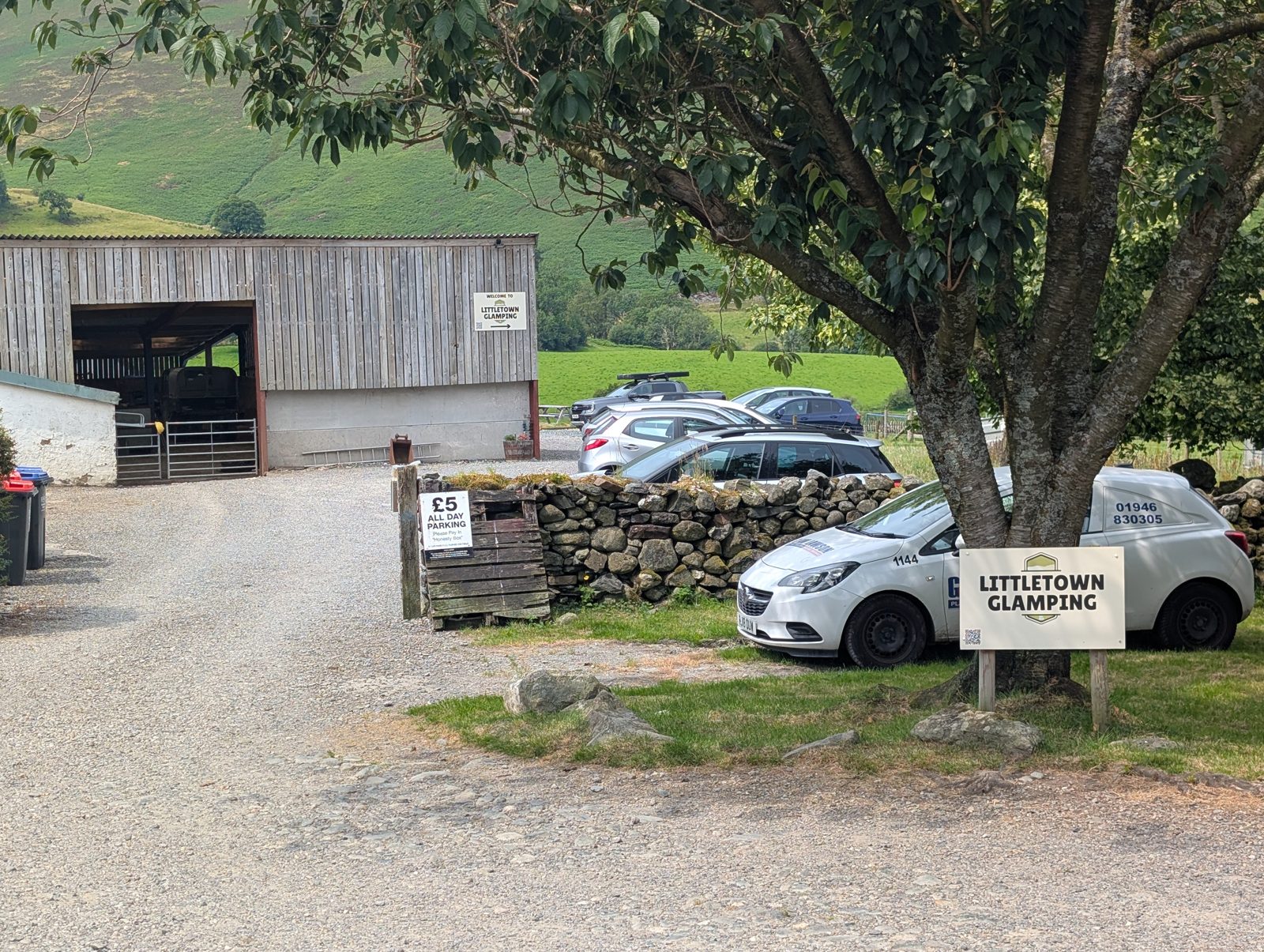
Where it is: placed by Lee. Details: from Lee. Checked 11 July 2026. · Directions (opens in new tab)
Longlands Fell car park
Charge not verifiedCar parkabout 5 spaces
Start of: North of Skiddaw
Walking base for Longlands Fell, Lowthwaite Fell, Brae Fell and Little Sca Fell — the 'North of Skiddaw' route starts 1 m away. Unpaved surface (OSM-tagged). Fee not verified — check signage on arrival.
Where it is: mapped in OpenStreetMap. Details: from external sources. Checked 10 August 2026. · Directions (opens in new tab)
Lothwaite (layby)
FreeLay-by
Beside the A66 on the west shore of Bassenthwaite Lake, about 220 m north of the hamlet of Beck Wythop (OSM node/1640384863). The 'Skiddaw via Ullock Pike and Dodd' route starts across the lake at Dodd Wood; on this side, the nearest route starts are 'Ling Fell & Sale Fell' and 'Rivings and Lothwaite', together near Wythop Mill, about 3.0 km west in a straight line. Free (OSM-tagged).
Where it is: mapped in OpenStreetMap. Details: from external sources. Checked 10 August 2026. · Directions (opens in new tab)
Lothwaite, north (layby)
FreeLay-byabout 3 spaces
Nearest fells: Lothwaite (0.8 km), Sale Fell (1.0 km), Rivings (1.1 km). Free (OSM-tagged). Ground surface (OSM-tagged).
Where it is: mapped in OpenStreetMap. Details: from external sources. Checked 10 August 2026. · Directions (opens in new tab)
Loughrigg Fell (layby)
Charge not verifiedLay-byabout 4 spaces
1.0 km from Loughrigg Fell.
Where it is: placed by Lee. Details: from Lee. Checked 8 August 2026. · Directions (opens in new tab)
Loughrigg Fell (verge, east)
Charge not verifiedVergeabout 7 spaces
2.6 km from Loughrigg Fell.
Where it is: placed by Lee. Details: from Lee. Checked 9 August 2026. · Directions (opens in new tab)
Loughrigg Fell (verge, west 2)
Charge not verifiedVergeabout 4 spaces
On the lane at Tarn Foot, south of Loughrigg Tarn, by the bridge over Mandale Beck (OSM way/500646377). The 'Loughrigg Tarn & Loughrigg Fell' route passes here; its start in Elterwater village is 2.4 km on foot. The path along the tarn's north shore is 0.7 km on foot.
Where it is: placed by Lee. Details: from Lee. Checked 9 August 2026. · Directions (opens in new tab)
Loughrigg Fell (verge, west 3)
Charge not verifiedVergeabout 2 spaces
2.0 km from Loughrigg Fell.
Where it is: placed by Lee. Details: from Lee. Checked 9 August 2026. · Directions (opens in new tab)
Loughrigg Fell (verge, west)
Charge not verifiedVergeabout 3 spaces
On the lane at Tarn Foot, south of Loughrigg Tarn. The 'Loughrigg Tarn & Loughrigg Fell' route passes about 60 m away; its start in Elterwater village is 2.4 km on foot. The path along the tarn's north shore is 0.7 km on foot.
Where it is: placed by Lee. Details: from Lee. Checked 9 August 2026. · Directions (opens in new tab)
Loughrigg Fell, north car park
Charge not verifiedCar park
South-east of Grasmere lake, about 280 m from its shore (OSM way/1101555727). The Grasmere village route starts, the 'Grasmere lake circuit' among them, are 1.4 km on foot. Gravel surface (OSM-tagged). Fee not verified — check signage on arrival.
Where it is: mapped in OpenStreetMap. Details: none checked. Checked 10 August 2026. · Directions (opens in new tab)
Low Bowkerstead car park
Charge not verifiedCar park
Nearest published walking: 2.8 km from the 'Carron Crag from Grizedale' route start; 2.6 km from Arnsbarrow Hill. Fee not verified — check signage on arrival.
Where it is: from a walker’s report. Details: none checked. Checked 10 August 2026. · Directions (opens in new tab)
Low Bowkerstead car park (free)
FreeCar park
Nearest published walking: 2.9 km from the 'Carron Crag from Grizedale' route start; 3.3 km from Finsthwaite Heights. Free (OSM-tagged). Ground surface (OSM-tagged).
Where it is: mapped in OpenStreetMap. Details: from external sources. Checked 10 August 2026. · Directions (opens in new tab)
Low Dale Park (free)
FreeCar park
Nearest published walking: 2.7 km from the 'Carron Crag from Grizedale' route start; 3.5 km from Finsthwaite Heights. Free (OSM-tagged). Ground surface (OSM-tagged).
Where it is: mapped in OpenStreetMap. Details: from external sources. Checked 10 August 2026. · Directions (opens in new tab)
Low How (layby)
Charge not verifiedLay-byabout 7 spaces
Start of: Hart Side, Stybarrow Dodd, Raise, Watson's Dodd and more
0.7 km from Low How. Seen full by about 08:00 on a Saturday - Lee's own visit; a single sighting rather than a pattern.
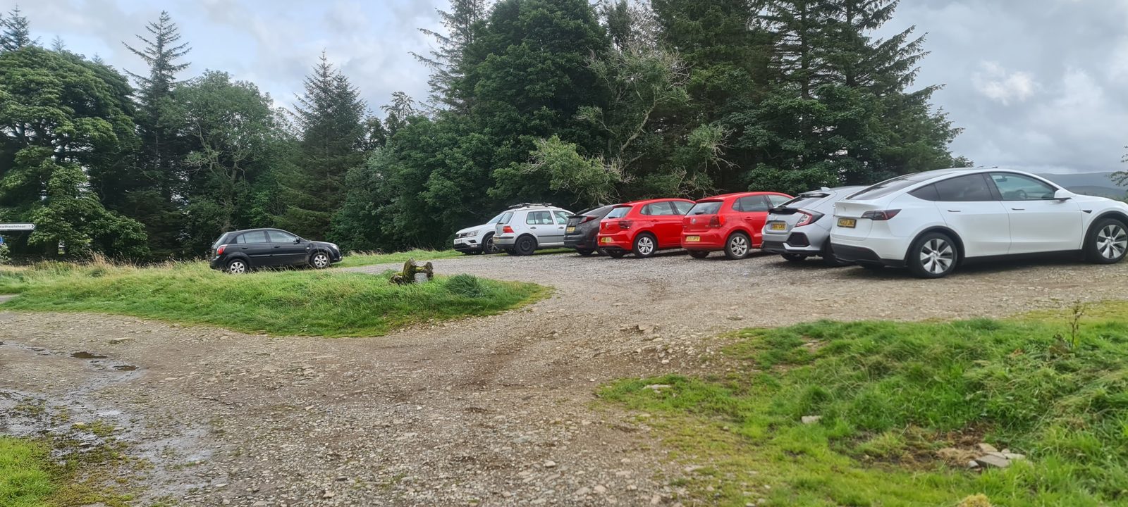
Where it is: placed by Lee. Details: from Lee. Checked 10 August 2026. Lee started a recorded walk here on 20 August 2023. · Directions (opens in new tab)
Low How, north-east (layby)
FreeLay-by
Walking base for Hart Side, Green Side (White Stones - Green Side), Stybarrow Dodd and Raise — the 'Hart Side, Stybarrow Dodd, Raise, Watson's Dodd and more' route starts 32 m away. Free (OSM-tagged). Unpaved surface (OSM-tagged).
Where it is: mapped in OpenStreetMap. Details: from external sources. Checked 10 August 2026. Lee started a recorded walk here on 20 August 2023. · Directions (opens in new tab)
Low Light Haw (layby)
FreeLay-by
Nearest fells: Unnamed top (Top o' Selside) (1.2 km), Low Light Haw (1.6 km), Wool Knott (1.6 km). Free (OSM-tagged). Ground surface (OSM-tagged).
Where it is: mapped in OpenStreetMap. Details: from external sources. Checked 10 August 2026. · Directions (opens in new tab)
Low Light Haw, south-west (layby)
FreeLay-by
Nearest fells: Unnamed top (Top o' Selside) (1.0 km), Low Light Haw (1.4 km), Beacon Fell (1.5 km). Free (OSM-tagged). Ground surface (OSM-tagged).
Where it is: mapped in OpenStreetMap. Details: from external sources. Checked 10 August 2026. · Directions (opens in new tab)
Low Lorton car park (free)
FreeCar parkabout 10 spacesBus route
Nearest published walking: 2.4 km from the 'Whinlatter Loop' route start; 2.1 km from Kirk Fell (Lorton). Free (OSM-tagged).
Where it is: mapped in OpenStreetMap. Details: from external sources. Checked 10 August 2026. · Directions (opens in new tab)
Lowick Community Hall (free)
FreeCar park
Nearest published walking: 5.0 km from the 'Low Light Haw' route start; 2.9 km from Burney. Free (OSM-tagged).
Where it is: mapped in OpenStreetMap. Details: from external sources. Checked 10 August 2026. · Directions (opens in new tab)
Lowick car park
Charge not verifiedCar park
Nearest published walking: 2.9 km from Burney. Fee not verified — check signage on arrival.
Where it is: mapped in OpenStreetMap. Details: none checked. Checked 10 August 2026. · Directions (opens in new tab)
Lowther car park
Charge not verifiedCar park
Nearest published walking: 4.4 km from Knipescar Common (Knipe Scar). Fee not verified — check signage on arrival.
Where it is: mapped in OpenStreetMap. Details: none checked. Checked 10 August 2026. · Directions (opens in new tab)
Machell's Coppice, south car park
Charge not verifiedCar park
On the east-shore road, about 30 m from the water and 0.2 km south-south-west of Machell's Coppice car park (OSM node/768308621, unnamed). The 'Top o' Selside' route starts at Dodgson Wood car park, 2.5 km on foot. Fee not verified — check signage on arrival.
Where it is: mapped in OpenStreetMap. Details: none checked. Checked 9 October 2026. · Directions (opens in new tab)
Mardale Head, Haweswater (free)
FreeCar park
Start of: Birketts West of Haweswater, Mardale Horseshoe, Mardale Ill Bell, High Street, The Knott, Rampsgill Head, High Raise and Kidsty Pike, Mardale circuit, Two Birketts from Mardale Head
Free but small and fills very early — High Street, Harter Fell, Kidsty Pike, Branstree. Five routes on this site start here, among them the 'Mardale Horseshoe' and the 'Mardale circuit'. Staying overnight in a vehicle or tent is banned here without the landowner's written consent (Westmorland and Furness Council, Public Spaces Protection Order 2026 No. 008, in force 18 March 2026). Open 24/7 (United Utilities, checked Aug 2026).
If it’s full: Branstree (layby) (0.2 km), Branstree, north (layby) (0.8 km)
Where it is: mapped in OpenStreetMap. Details: none checked. Checked 30 August 2026. · Directions (opens in new tab)
Martindale, St Peter's church (free, limited)
FreeCar parkabout 10 spaces
Quiet side of Ullswater — Hallin Fell, Steel Knotts, Beda Fell, Pikeawassa.
Where it is: placed by Lee. Details: from Lee. Checked 8 August 2026. · Directions (opens in new tab)
Middle Dodd (layby)
FreeLay-byabout 3 spaces
Nearest fells: Middle Dodd (0.6 km), Red Screes (0.9 km), St Raven's Edge (1.0 km). Free (OSM-tagged).
Where it is: mapped in OpenStreetMap. Details: from external sources. Checked 10 August 2026. · Directions (opens in new tab)
Middle Dodd car park (free)
FreeCar parkabout 2 spaces
Nearest fells: Middle Dodd (0.7 km), Red Screes (0.9 km), St Raven's Edge (0.9 km). Free (OSM-tagged).
Where it is: mapped in OpenStreetMap. Details: from external sources. Checked 10 August 2026. · Directions (opens in new tab)
Middle Dodd, north-east car park (free)
FreeCar parkabout 4 spaces
Nearest fells: Middle Dodd (0.7 km), Caudale Moor - John Bell's Banner (1.0 km), Red Screes (1.3 km). Free (OSM-tagged).
Where it is: mapped in OpenStreetMap. Details: from external sources. Checked 10 August 2026. · Directions (opens in new tab)
Middle Fell car park
Charge not verifiedCar park
By the valley road along Wast Water's north-west shore, about 70 m from the water. 'Middle Fell, Haycock Seatallan and Buckbarrow' and 'The Greendale Horseshoe' start at Greendale, about 1.1 km west in a straight line. Fee not verified — check signage on arrival.
Where it is: from a walker’s report. Details: none checked. Checked 10 August 2026. · Directions (opens in new tab)
Mill Side (layby)
FreeLay-byBus route
Nearest published walking: 3.1 km from Whitbarrow - Lord's Seat. Free (OSM-tagged).
Where it is: mapped in OpenStreetMap. Details: from external sources. Checked 10 August 2026. · Directions (opens in new tab)
Mill Side (layby) 2
FreeLay-byabout 6 spacesBus route
Nearest published walking: 3.1 km from Whitbarrow - Lord's Seat. Free (OSM-tagged).
Where it is: mapped in OpenStreetMap. Details: from external sources. Checked 10 August 2026. · Directions (opens in new tab)
Mill Side (layby) 3
Charge not verifiedLay-byBus route
Nearest published walking: 3.2 km from Whitbarrow - Lord's Seat. Fee not verified — check signage on arrival.
Where it is: mapped in OpenStreetMap. Details: none checked. Checked 10 August 2026. · Directions (opens in new tab)
Mill Side, Whitbarrow (verge)
Charge not verifiedVergeBus route
For Whitbarrow (Lord's Seat) — limestone pavement and easy walking.
Where it is: placed by Lee. Details: none checked. Checked 9 August 2026. · Directions (opens in new tab)
Millgill Bridge (layby)
FreeLay-by
Nearest published walking: 2.0 km from the 'Grike, Crag Fell and Lank Rigg' route start; 2.1 km from Flat Fell. Free (OSM-tagged). Unpaved surface (OSM-tagged).
Where it is: mapped in OpenStreetMap. Details: from external sources. Checked 10 August 2026. · Directions (opens in new tab)
Millhouse (layby)
FreeLay-by
Nearest published walking: 2.2 km from the 'Carrock Fell and Knott' route start; 2.2 km from Carrock Fell. Free (OSM-tagged). Unpaved surface (OSM-tagged).
Where it is: mapped in OpenStreetMap. Details: from external sources. Checked 10 August 2026. · Directions (opens in new tab)
Millom car park
Charge not verifiedCar park
Nearest published walking: 4.5 km from White Hall Knott. Fee not verified — check signage on arrival.
Where it is: mapped in OpenStreetMap. Details: none checked. Checked 10 August 2026. · Directions (opens in new tab)
Mockerkin car park
Charge not verifiedCar park
Nearest published walking: 2.9 km from Owsen Fell. Fee not verified — check signage on arrival.
Where it is: mapped in OpenStreetMap. Details: none checked. Checked 10 August 2026. · Directions (opens in new tab)
Mockerkin car park 2
Charge not verifiedCar park
Nearest published walking: 2.4 km from Owsen Fell. Fee not verified — check signage on arrival.
Where it is: mapped in OpenStreetMap. Details: none checked. Checked 10 August 2026. · Directions (opens in new tab)
Mockerkin, south-west car park
Charge not verifiedCar park
Nearest published walking: 2.4 km from Owsen Fell. Fee not verified — check signage on arrival.
Where it is: mapped in OpenStreetMap. Details: none checked. Checked 10 August 2026. · Directions (opens in new tab)
Moota (layby)
FreeLay-by
Nearest published walking: 2.5 km from Clints Crags (Wainwright summit). Free (OSM-tagged). Ground surface (OSM-tagged).
Where it is: mapped in OpenStreetMap. Details: from external sources. Checked 10 August 2026. · Directions (opens in new tab)
Mosedale / Bowscale (verge)
Charge not verifiedVerge
Verge parking for Carrock Fell and the back o' Skiddaw fells via the Caldew valley.
If it’s full: Mungrisdale village hall (paid) (3.69 km), Mungrisdale (verge, by the village hall) (4.0 km), Roadside parking for The Tongue (free) (2.16 km)
Where it is: placed by Lee. Details: none checked. Checked 12 August 2026. · Directions (opens in new tab)
Mosedale / Bowscale (verge, west)
Charge not verifiedVerge
Not suitable for ordinary cars: the Caldew valley road west of the Mosedale / Bowscale verge has very large potholes (seen 29 Sep 2026). In a 4x4, expect deep potholes and drive slowly. Verge parking on the Caldew valley road, 1.2 km west of the other Mosedale / Bowscale verge - for Carrock Fell, Round Knott and the back o' Skiddaw fells. Fee and capacity are unknown: this is a location Lee supplied, not a survey.
Where it is: placed by Lee. Details: from Lee. Checked 12 August 2026. · Directions (opens in new tab)
Motherby (layby)
Charge not verifiedLay-by
Nearest published walking: 4.8 km from Eycott Hill. Fee not verified — check signage on arrival.
Where it is: mapped in OpenStreetMap. Details: none checked. Checked 10 August 2026. · Directions (opens in new tab)
Muncaster Mill Road, 1.7 km NE of Ravenglass (free)
FreeCar parkabout 10 spaces
On Muncaster Mill Road, 90 m from the A595's Muncaster Mill Bridge and 50 m from the Ravenglass and Eskdale Railway's Muncaster Mill station (OSM way/375502830). The nearest route start is 'Whin Rigg, Illgill Head & the Wastwater Screes', 6.9 km away in a straight line. Free (OSM-tagged). Unpaved surface (OSM-tagged).
Where it is: mapped in OpenStreetMap. Details: from external sources. Checked 10 August 2026. · Directions (opens in new tab)
Muncaster, A595 (layby)
FreeLay-by
A lay-by on the A595 at Muncaster, beside Muncaster Country Guest House and 60 m from Muncaster Castle's main car park (OSM way/1155379811). The nearest route starts are on the Birker Fell road by Devoke Water, 7.3 km away in a straight line. Free (OSM-tagged).
Where it is: mapped in OpenStreetMap. Details: from external sources. Checked 10 August 2026. · Directions (opens in new tab)
Mungrisdale (layby)
PaidLay-by
Walking base for Eycott Hill, Little Eycott Hill, Souther Fell and Scales Fell — the 'Eycott Hills' route starts 185 m away. Also serves 'Blencathra to Mungrisdale Common and over the back'. Paid parking (OSM-tagged). Unpaved surface (OSM-tagged).
Where it is: mapped in OpenStreetMap. Details: from external sources. Checked 10 August 2026. · Directions (opens in new tab)
Mungrisdale (layby, north)
Charge not verifiedLay-by
1.7 km from The Tongue. Fee not verified — check signage on arrival.
Where it is: placed by Lee. Details: from Lee. Checked 29 September 2026. · Directions (opens in new tab)
Mungrisdale (verge, by the village hall)
Charge not verifiedVergeabout 10 spaces
Roadside verge 240 m from the village hall car park — the same fells: Bowscale Fell, Bannerdale Crags, Souther Fell, The Tongue.
If it’s full: Mungrisdale village hall (paid) (0.31 km)
Where it is: placed by Lee. Details: from Lee. Checked 8 August 2026. Lee started a recorded walk here on 25 May 2026. · Directions (opens in new tab)
Mungrisdale (verge, north)
Charge not verifiedVerge
1.6 km from Souther Fell. Fee not verified — check signage on arrival.
Where it is: placed by Lee. Details: from Lee. Checked 29 September 2026. · Directions (opens in new tab)
Mungrisdale village hall (paid)
PaidCar park
Start of: Blencathra to Mungrisdale Common and over the back, Eycott Hills, The Tongue Birkett
For Bowscale Fell, Bannerdale Crags, Souther Fell and The Tongue.
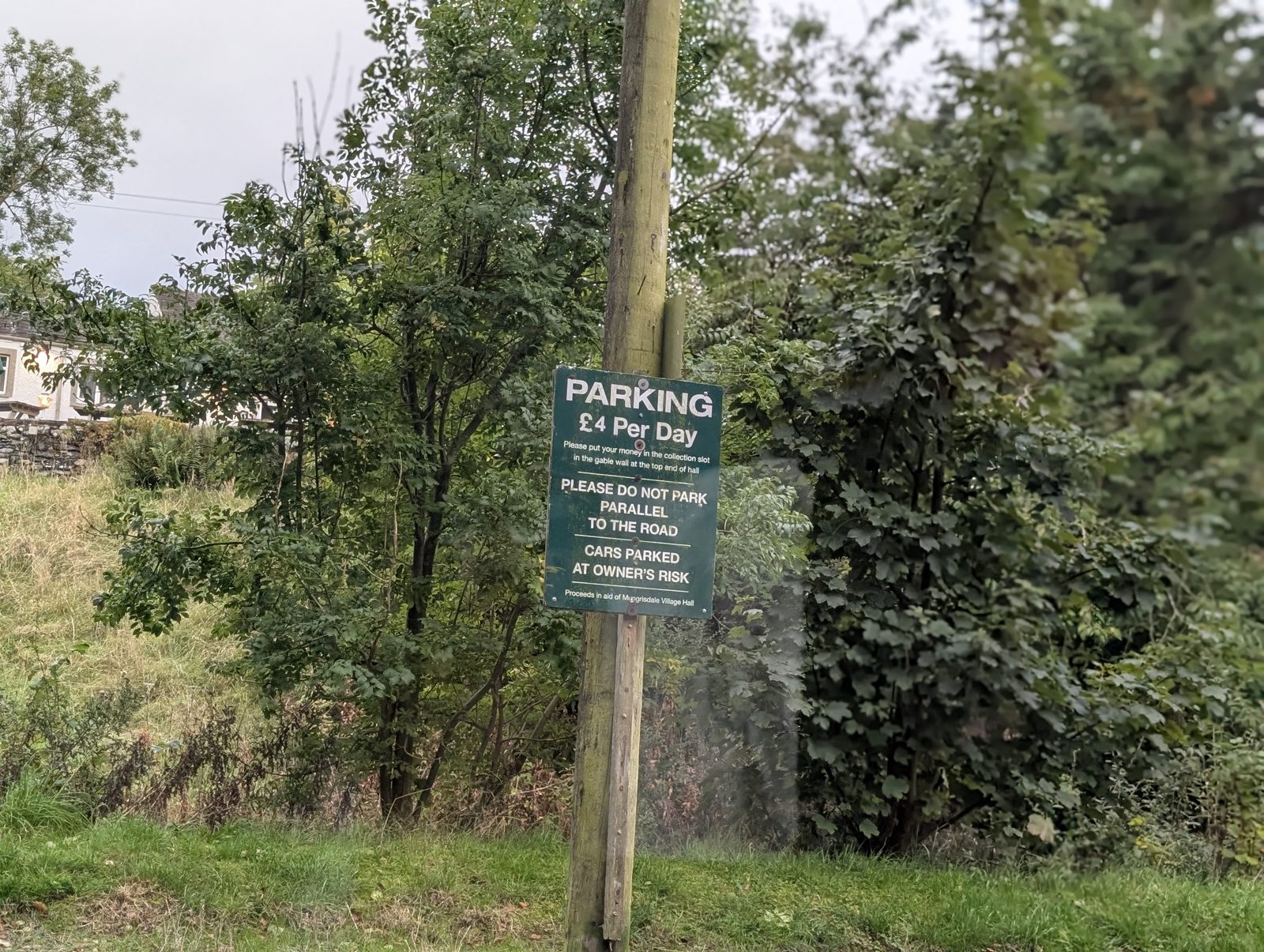
If it’s full: Mosedale / Bowscale (verge) (3.69 km)
Where it is: placed by Lee. Details: from Lee. Checked 29 September 2026. · Directions (opens in new tab)
Nab Scar (layby)
FreeLay-by
Walking base for Helm Crag, Gibson Knott, Calf Crag and Steel Fell (Dead Pike - Steel Fell) — the 'Helm Crag, Gibson Knott, Calf Crag, Steel Fell and Tarn Crag' route starts 374 m away. Also serves 'Stone Arthur from Grasmere'. Free (OSM-tagged).
Where it is: mapped in OpenStreetMap. Details: from external sources. Checked 10 August 2026. · Directions (opens in new tab)
Nab Scar car park (paid)
PaidCar parkBus route
At White Moss, between Rydal and Grasmere: an unnamed paid car park beside the A591, about 90 m from White Moss Common (Upper) (OSM way/1425056898). The Grasmere village route starts, the 'Grasmere lake circuit' among them, are 1.3 km on foot; the Pelter Bridge starts at Rydal are 2.4 km. Paid parking (OSM-tagged).
Where it is: mapped in OpenStreetMap. Details: from external sources. Checked 10 August 2026. · Directions (opens in new tab)
Natland (layby)
FreeLay-byabout 1 space
Nearest published walking: 3.8 km from Scout Scar (Wainwright summit). Free (OSM-tagged).
Where it is: mapped in OpenStreetMap. Details: from external sources. Checked 10 August 2026. · Directions (opens in new tab)
Natland (layby) 2
FreeLay-by
Nearest published walking: 2.5 km from Scout Scar (Wainwright summit). Free (OSM-tagged).
Where it is: mapped in OpenStreetMap. Details: from external sources. Checked 10 August 2026. · Directions (opens in new tab)
Natland car park (free) 2
FreeCar park
Nearest published walking: 3.5 km from Scout Scar (Wainwright summit). Free (OSM-tagged). Compacted surface (OSM-tagged).
Where it is: mapped in OpenStreetMap. Details: from external sources. Checked 10 August 2026. · Directions (opens in new tab)
Natland car park (free) 3
FreeCar park
Nearest published walking: 3.5 km from Scout Scar (Wainwright summit). Free (OSM-tagged).
Where it is: mapped in OpenStreetMap. Details: from external sources. Checked 10 August 2026. · Directions (opens in new tab)
Natland, west (layby)
Charge not verifiedLay-byabout 5 spaces
Nearest published walking: 3.4 km from Scout Scar (Wainwright summit). Fee not verified — check signage on arrival.
Where it is: mapped in OpenStreetMap. Details: from external sources. Checked 10 August 2026. · Directions (opens in new tab)
Near Sawrey (layby)
FreeLay-by
Nearest published walking: 2.0 km from the 'Along Windermere's Western Shore' route start, at Ferry House, Far Sawrey; 3.0 km from the 'Hawkshead into the woods' route start. Free (OSM-tagged).
Where it is: mapped in OpenStreetMap. Details: from external sources. Checked 10 August 2026. · Directions (opens in new tab)
Near Sawrey, north-west (layby)
FreeLay-by
Nearest published walking: 2.2 km from the 'Along Windermere's Western Shore' route start, at Ferry House, Far Sawrey; 2.7 km from the 'Hawkshead into the woods' route start. Free (OSM-tagged).
Where it is: mapped in OpenStreetMap. Details: from external sources. Checked 10 August 2026. · Directions (opens in new tab)
Newbiggin (layby)
Charge not verifiedLay-by
Nearest published walking: 3.8 km from the 'Heughscar Hill & Arthur's Pike' route start; 3.5 km from Dunmallet (Dunmallard Hill). Fee not verified — check signage on arrival.
Where it is: mapped in OpenStreetMap. Details: none checked. Checked 10 August 2026. · Directions (opens in new tab)
Newbiggin (layby) 2
Charge not verifiedLay-by
Nearest published walking: 3.9 km from the 'Heughscar Hill & Arthur's Pike' route start; 3.8 km from Dunmallet (Dunmallard Hill). Fee not verified — check signage on arrival.
Where it is: mapped in OpenStreetMap. Details: none checked. Checked 10 August 2026. · Directions (opens in new tab)
Newbiggin (layby) 3
Charge not verifiedLay-by
Nearest published walking: 3.8 km from the 'Heughscar Hill & Arthur's Pike' route start; 3.6 km from Dunmallet (Dunmallard Hill). Fee not verified — check signage on arrival.
Where it is: mapped in OpenStreetMap. Details: none checked. Checked 10 August 2026. · Directions (opens in new tab)
Newbiggin car park
Charge not verifiedCar park
Nearest published walking: 4.8 km from the 'Heughscar Hill & Arthur's Pike' route start; 4.6 km from Dunmallet (Dunmallard Hill). Fee not verified — check signage on arrival.
Where it is: mapped in OpenStreetMap. Details: none checked. Checked 10 August 2026. · Directions (opens in new tab)
Newby Bridge car park
Charge not verifiedCar parkBus route
Nearest published walking: 2.0 km from Finsthwaite Heights. Fee not verified — check signage on arrival.
Where it is: mapped in OpenStreetMap. Details: none checked. Checked 10 August 2026. · Directions (opens in new tab)
Newlands Hause car park
FreeCar park
Start of: Knott Rigg & Ard Crags Out-and-Back from Newlands Pass, Newlands Hause to the Coledale Tops
At Newlands Hause, the top of the Newlands Pass road above Buttermere. The 'Knott Rigg & Ard Crags Out-and-Back from Newlands Pass' route starts here. Added from the 5 Aug 2026 OSM candidate review.
Where it is: placed by Lee. Details: from external sources. Checked 5 August 2026. · Directions (opens in new tab)
Newton Fell North (layby)
FreeLay-by
Nearest fells: Newton Fell North (0.6 km). Free (OSM-tagged).
Where it is: mapped in OpenStreetMap. Details: from external sources. Checked 10 August 2026. · Directions (opens in new tab)
Newton Fell North car park
Charge not verifiedCar park
Nearest fells: Newton Fell North (1.3 km), Staveley Fell (2.0 km). Fee not verified — check signage on arrival.
Where it is: from a walker’s report. Details: none checked. Checked 10 August 2026. · Directions (opens in new tab)
Newton Fell North, north-west (layby)
FreeLay-byabout 10 spaces
Nearest fells: Newton Fell North (1.6 km), Staveley Fell (1.9 km). Free (OSM-tagged). Dirt surface (OSM-tagged).
Where it is: mapped in OpenStreetMap. Details: from external sources. Checked 10 August 2026. · Directions (opens in new tab)
Newton Fell North, south car park
Charge not verifiedCar parkBus route
Nearest fells: Newton Fell North (1.3 km). Fee not verified — check signage on arrival.
Where it is: from a walker’s report. Details: none checked. Checked 10 August 2026. · Directions (opens in new tab)
Newton Fell North, south-east (layby)
FreeLay-by
Nearest fells: Newton Fell North (0.6 km). Free (OSM-tagged).
Where it is: mapped in OpenStreetMap. Details: from external sources. Checked 10 August 2026. · Directions (opens in new tab)
Newton Fell South (layby)
Charge not verifiedLay-byBus route
Nearest fells: Newton Fell South (Dixon Heights) (1.7 km). Fee not verified — check signage on arrival.
Where it is: mapped in OpenStreetMap. Details: none checked. Checked 10 August 2026. · Directions (opens in new tab)
Newton Fell South, north-west (layby)
FreeLay-byBus route
Nearest fells: Newton Fell South (Dixon Heights) (1.0 km). Free (OSM-tagged).
Where it is: mapped in OpenStreetMap. Details: from external sources. Checked 10 August 2026. · Directions (opens in new tab)
Newton Fell South, south car park
Charge not verifiedCar parkBus route
Nearest fells: Newton Fell South (Dixon Heights) (0.9 km), Hampsfell (Wainwright summit) (1.9 km). Fee not verified — check signage on arrival.
Where it is: mapped in OpenStreetMap. Details: none checked. Checked 10 August 2026. · Directions (opens in new tab)
Newton Fell South, south car park 2
Charge not verifiedCar parkBus route
Nearest fells: Newton Fell South (Dixon Heights) (1.3 km). Fee not verified — check signage on arrival.
Where it is: mapped in OpenStreetMap. Details: none checked. Checked 10 August 2026. · Directions (opens in new tab)
Newtown car park
Charge not verifiedCar parkBus route
Nearest published walking: 3.6 km from Heughscar Hill. Fee not verified — check signage on arrival.
Where it is: mapped in OpenStreetMap. Details: none checked. Checked 10 August 2026. · Directions (opens in new tab)
Oddendale (layby)
FreeLay-by
Nearest published walking: 2.7 km from the 'West of Wet Sleddale - Birketts' route start; 4.6 km from Great Ladstones. Free (OSM-tagged).
Where it is: mapped in OpenStreetMap. Details: from external sources. Checked 10 August 2026. · Directions (opens in new tab)
Oddendale, south-west (layby)
FreeLay-by
1.5 km from the 'West of Wet Sleddale - Birketts' route start; 1.5 km from the 'Ulthwaite Rigg' route start. Free (OSM-tagged).
Where it is: mapped in OpenStreetMap. Details: from external sources. Checked 10 August 2026. · Directions (opens in new tab)
Orrest Head car park (free)
FreeCar parkabout 10 spacesBus route
Walking base for Orrest Head — the 'Orrest Head' route starts 77 m away. Free (OSM-tagged). OSM records a 2-hour maximum stay here between 09:00 and 18:00, every day including public holidays (24 Jul 2026 extract); the same element also carries an unlimited-stay tag, so the two contradict each other - check the signs before leaving the car for longer.
Where it is: mapped in OpenStreetMap. Details: from external sources. Checked 10 August 2026. · Directions (opens in new tab)
Orrest Head, north-east (layby)
FreeLay-byabout 6 spaces
Nearest fells: Orrest Head (1.5 km). Free (OSM-tagged). Compacted surface (OSM-tagged).
Where it is: mapped in OpenStreetMap. Details: from external sources. Checked 10 August 2026. · Directions (opens in new tab)
Orrest Head, north-west (layby)
FreeLay-by
Nearest fells: Orrest Head (1.4 km). Free (OSM-tagged).
Where it is: mapped in OpenStreetMap. Details: from external sources. Checked 10 August 2026. · Directions (opens in new tab)
Orrest Head, south (layby)
FreeLay-byBus route
Walking base for Orrest Head — the 'Orrest Head' route starts 263 m away. Free (OSM-tagged).
Where it is: mapped in OpenStreetMap. Details: from external sources. Checked 10 August 2026. · Directions (opens in new tab)
Orthwaite Bank (layby)
FreeLay-byabout 3 spaces
Nearest fells: Orthwaite Bank (0.7 km), Little Cockup (1.2 km), Cockup (1.8 km). Free (OSM-tagged).
Where it is: mapped in OpenStreetMap. Details: from external sources. Checked 10 August 2026. · Directions (opens in new tab)
Orton village (free)
FreeCar park
For Orton Scar, Great Asby Scar and the Crosby Ravensworth fells.
Where it is: placed by Lee. Details: as first entered. Checked 9 August 2026. · Directions (opens in new tab)
Ouse Bridge (Banks Point)
Charge not verifiedCar park
At the north end of Bassenthwaite Lake, about 40 m from the shore (OSM way/144825158); the Authority's car-parks directory lists it as 'Ouse Bridge (Banks Point) Bassenthwaite Lake northern end'. The nearest route starts are 'Rivings and Lothwaite' and 'Ling Fell & Sale Fell' near Wythop Mill, 3.7 km on foot. Fee not verified — check signage on arrival.
Where it is: mapped in OpenStreetMap. Details: none checked. Checked 10 August 2026. · Directions (opens in new tab)
Outgate, north (layby)
Charge not verifiedLay-byabout 6 spaces
By the road north of Outgate. Nearest published walking: 2.0 km from the 'Wray Castle & the Windermere west shore' route start; 2.3 km from the 'Hawkshead into the woods' route start, which climbs Latterbarrow.
Where it is: placed by Lee. Details: from Lee. Checked 8 October 2026. · Directions (opens in new tab)
Outgate, south (layby)
Charge not verifiedLay-byabout 3 spacesBus route
By the road just south of Outgate, about 280 m south-west of the Outgate Inn bus stops. The 'Hawkshead into the woods' route, which climbs Latterbarrow, starts 1.6 km away, at the Hawkshead car park.
Where it is: placed by Lee. Details: from Lee. Checked 8 October 2026. · Directions (opens in new tab)
Overbeck Bridge, 0.7 km SW (layby)
FreeLay-by
Roadside on the valley road along Wast Water's north-west shore, about 70 m from the water (OSM way/580885832). 'Very Long Day Out' and 'Wastwater Shore (the Screes view)' start at Overbeck Bridge, 0.7 km on foot. Free (OSM-tagged). Unpaved surface (OSM-tagged).
Where it is: mapped in OpenStreetMap. Details: from external sources. Checked 9 October 2026. · Directions (opens in new tab)
Overflow Car Parking
Charge not verifiedCar park
Grass field 105 m from the Coniston Boating Centre car park; the 'West Side of Coniston' route starts 161 m away. Grass surface (OSM-tagged). Fee not verified — check signage on arrival.
Where it is: mapped in OpenStreetMap. Details: none checked. Checked 10 August 2026. · Directions (opens in new tab)
Papcastle car park
Charge not verifiedCar park
Nearest published walking: 4.7 km from Watch Hill. Fee not verified — check signage on arrival.
Where it is: mapped in OpenStreetMap. Details: none checked. Checked 10 August 2026. · Directions (opens in new tab)
Papcastle car park 2
Charge not verifiedCar park
Nearest published walking: 4.4 km from Watch Hill. Fee not verified — check signage on arrival.
Where it is: mapped in OpenStreetMap. Details: none checked. Checked 10 August 2026. · Directions (opens in new tab)
Pardshaw car park (free)
FreeCar park
Nearest published walking: 4.0 km from Owsen Fell. Free (OSM-tagged). Unpaved surface (OSM-tagged).
Where it is: mapped in OpenStreetMap. Details: from external sources. Checked 10 August 2026. · Directions (opens in new tab)
Peel Wyke harbour
Charge not verifiedCar park
Nearest fells: Lothwaite (1.1 km), Sale Fell (1.4 km), Rivings (1.4 km). Fee not verified — check signage on arrival.
Where it is: mapped in OpenStreetMap. Details: none checked. Checked 10 August 2026. · Directions (opens in new tab)
Pelter Bridge, Rydal (paid)
PaidCar parkabout 25 spacesBus route
Start of: Fairfield Horseshoe, Rydal Water & Rydal Caves
For Loughrigg and the Rydal side of the Fairfield Horseshoe. Fees: pay and display; coins and cards; RingGo ID 37305 (LDNPA, checked Aug 2026).
If it’s full: White Moss, Lower (paid) (2.44 km), Ambleside, Rydal Road (paid) (1.7 km), White Moss Common, Upper (paid) (2.34 km)
Where it is: mapped in OpenStreetMap. Details: from external sources. Checked 2 August 2026. · Directions (opens in new tab)
Penruddock (layby)
FreeLay-by
Nearest published walking: 3.7 km from the 'Great Mell Fell' route start; 3.5 km from Little Mell Fell. Free (OSM-tagged).
Where it is: mapped in OpenStreetMap. Details: from external sources. Checked 10 August 2026. · Directions (opens in new tab)
Penruddock, south-west (layby)
FreeLay-by
Nearest published walking: 3.5 km from the 'Great Mell Fell' route start; 3.4 km from Little Mell Fell. Free (OSM-tagged).
Where it is: mapped in OpenStreetMap. Details: from external sources. Checked 10 August 2026. · Directions (opens in new tab)
Peter House Farm, Bassenthwaite (roadside)
FreeVergeabout 5 spaces
Start of: Birketts North of Skiddaw, Cockup at the White Hause and other Birketts
Dash Falls track — Bakestall, Great Calva, Skiddaw the quiet way.
Where it is: mapped in OpenStreetMap. Details: from external sources. Checked 2 August 2026. · Directions (opens in new tab)
Plumgarths layby (free)
FreeCar parkabout 20 spaces
Nearest fells: Cunswick Scar (0.8 km). Free (OSM-tagged).
Where it is: mapped in OpenStreetMap. Details: from external sources. Checked 10 August 2026. · Directions (opens in new tab)
Ponsonby (layby)
FreeLay-by
Nearest published walking: 3.7 km from Ponsonby Fell. Free (OSM-tagged).
Where it is: mapped in OpenStreetMap. Details: from external sources. Checked 10 August 2026. · Directions (opens in new tab)
Ponsonby Fell car park
Charge not verifiedCar park
Nearest fells: Ponsonby Fell (1.8 km). Fee not verified — check signage on arrival.
Where it is: mapped in OpenStreetMap. Details: none checked. Checked 10 August 2026. · Directions (opens in new tab)
Ponsonby car park (free)
FreeCar park
Nearest published walking: 2.4 km from Cold Fell. Free (OSM-tagged). Unpaved surface (OSM-tagged).
Where it is: mapped in OpenStreetMap. Details: from external sources. Checked 10 August 2026. · Directions (opens in new tab)
Ponsonby, south-west (layby)
FreeLay-by
Nearest published walking: 3.7 km from Ponsonby Fell. Free (OSM-tagged).
Where it is: mapped in OpenStreetMap. Details: from external sources. Checked 10 August 2026. · Directions (opens in new tab)
Pooley Bridge, Finkle Street car park (free)
FreeCar parkBus route
Start of: Heughscar Hill & Arthur's Pike
In the village centre at the foot of Finkle Street, by the bridge and the public toilets (OSM way/332015724 and way/332015723). The 'Heughscar Hill & Arthur's Pike' route starts here.
Where it is: from our first list. Details: from Lee. Checked 9 October 2026. · Directions (opens in new tab)
Pooley Bridge, High Street (layby)
FreeLay-byBus route
Walking base for Heughscar Hill and Arthur's Pike — the 'Heughscar Hill & Arthur's Pike' route starts 322 m away. Free (OSM-tagged).
Where it is: mapped in OpenStreetMap. Details: from external sources. Checked 9 October 2026. · Directions (opens in new tab)
Rannerdale Knotts (layby)
FreeLay-byabout 2 spaces
On the B5289 between Buttermere village and Crummock Water, about 1.1 km north-west of the village (OSM way/666875068). The nearest route starts are in the village: 'The Buttermere Ridge', 0.8 km on foot, and 'Scale Fell and Mellbreak', 0.9 km on foot. Free (OSM-tagged). Unpaved surface (OSM-tagged).
Where it is: mapped in OpenStreetMap. Details: from external sources. Checked 10 August 2026. · Directions (opens in new tab)
Rannerdale Knotts, south (layby)
FreeLay-byabout 3 spaces
On the B5289 between Buttermere village and Crummock Water, about 1.1 km north-west of the village (OSM way/666875065). The nearest route starts are in the village: 'The Buttermere Ridge', 0.8 km on foot, and 'Scale Fell and Mellbreak', 0.8 km on foot. Free (OSM-tagged). Unpaved surface (OSM-tagged).
Where it is: mapped in OpenStreetMap. Details: from external sources. Checked 10 August 2026. · Directions (opens in new tab)
Raven Crag (layby)
Charge not verifiedLay-byabout 4 spaces
On the west-shore road below Raven Crag. The 'Raven Crag from Thirlmere' route starts 0.5 km to the north, at the car park on Dam Road.
Where it is: placed by Lee. Details: from Lee. Checked 8 August 2026. · Directions (opens in new tab)
Raven's Barrow, east car park (free)
FreeCar park
Nearest fells: Raven's Barrow (Cartmel Fell) (0.4 km). Free (OSM-tagged). Gravel surface (OSM-tagged).
Where it is: mapped in OpenStreetMap. Details: from external sources. Checked 10 August 2026. · Directions (opens in new tab)
Ravenglass, Murrayfield Terrace (free)
FreeCar park
A small gravel car park off Murrayfield Terrace, by the Pennington Hotel, 24 m from the Authority's car park (OSM way/331355473). The nearest route start is 'Whin Rigg, Illgill Head & the Wastwater Screes', 8.5 km away in a straight line. Free (OSM-tagged). Gravel surface (OSM-tagged).
Where it is: mapped in OpenStreetMap. Details: from external sources. Checked 10 August 2026. · Directions (opens in new tab)
Redhills (layby)
FreeLay-by
No published walk starts within 5 km; the nearest is Dunmallet (Dunmallard Hill), 5.0 km away. Free (OSM-tagged).
Where it is: mapped in OpenStreetMap. Details: from external sources. Checked 10 August 2026. · Directions (opens in new tab)
Redhills, west (layby)
Charge not verifiedLay-by
Nearest published walking: 5.0 km from the 'Heughscar Hill & Arthur's Pike' route start; 5.0 km from Dunmallet (Dunmallard Hill). Fee not verified — check signage on arrival.
Where it is: mapped in OpenStreetMap. Details: none checked. Checked 10 August 2026. · Directions (opens in new tab)
Redmain (layby)
FreeLay-byabout 1 space
Nearest published walking: 2.0 km from Clints Crags (Wainwright summit). Free (OSM-tagged). Compacted surface (OSM-tagged).
Where it is: mapped in OpenStreetMap. Details: from external sources. Checked 10 August 2026. · Directions (opens in new tab)
Reston Scar (layby)
FreeLay-by
Nearest fells: Reston Scar (1.6 km). Free (OSM-tagged).
Where it is: mapped in OpenStreetMap. Details: from external sources. Checked 10 August 2026. · Directions (opens in new tab)
Reston Scar car park (free)
FreeCar park
Nearest fells: Reston Scar (0.9 km), Hugill Fell (Wainwright summit) (1.4 km). Free (OSM-tagged).
Where it is: mapped in OpenStreetMap. Details: from external sources. Checked 10 August 2026. · Directions (opens in new tab)
Reston Scar, west (layby)
FreeLay-byBus route
Nearest fells: Reston Scar (1.5 km), High Knott (1.7 km), Grandsire (1.9 km). Free (OSM-tagged).
Where it is: mapped in OpenStreetMap. Details: from external sources. Checked 10 August 2026. · Directions (opens in new tab)
Rigg Wood Car Park
Charge not verifiedCar park
Walking base for Top o' Selside (Wainwright summit), Arnsbarrow Hill and Stang Hill (Arnsbarrow Hill South Top) — the 'Top o' Selside' route starts 496 m away. Fee not verified — check signage on arrival.
Where it is: mapped in OpenStreetMap. Details: none checked. Checked 10 August 2026. · Directions (opens in new tab)
Roadside Parking, Fangs Brow, Loweswater (free)
Charge not verifiedCar park
Beside the road at Fangs Brow, west of Loweswater, where a bridleway leaves it (OSM way/27231923). The nearest route starts are at Maggie's Bridge, among them 'Loweswater circuit', 3.8 km on foot. Free (community-reported).
Where it is: placed by Lee. Details: none checked. Checked 10 August 2026. · Directions (opens in new tab)
Roadside Parking, Harrow Head Farm, Wasdale (free)
Charge not verifiedCar parkBus route
Nearest fells: Buckbarrow (0.9 km), Glade How (1.0 km). Free (community-reported).
Where it is: from a walker’s report. Details: none checked. Checked 10 August 2026. · Directions (opens in new tab)
Roadside parking for Binsey (free)
FreeVergeabout 3 spaces
Start of: Binsey Walk
Approx 3 spaces. 1.1 km from Binsey. Added from the 5 Aug 2026 OSM candidate review.
Where it is: placed by Lee. Details: from external sources. Checked 5 August 2026. · Directions (opens in new tab)
Roadside parking for Border End
Charge not verifiedVerge
0.5 km from Border End. Added from the 5 Aug 2026 OSM candidate review.
Where it is: placed by Lee. Details: from external sources. Checked 5 August 2026. · Directions (opens in new tab)
Roadside parking for Carrock Fell (free)
FreeVerge
Start of: Carrock Fell High Pike, Knott and Great Calva, Carrock Fell and Knott
1.2 km from Carrock Fell. Added from the 5 Aug 2026 OSM candidate review.
Where it is: placed by Lee. Details: from external sources. Checked 5 August 2026. · Directions (opens in new tab)
Roadside parking for Graystones (free)
FreeVerge
0.8 km from Graystones. Added from the 5 Aug 2026 OSM candidate review.
Where it is: placed by Lee. Details: from external sources. Checked 5 August 2026. · Directions (opens in new tab)
Roadside parking for Great How (free)
FreeVergeBus route
0.5 km from Great How. Added from the 5 Aug 2026 OSM candidate review.
Where it is: placed by Lee. Details: from external sources. Checked 5 August 2026. · Directions (opens in new tab)
Roadside parking for Helm Crag
Charge not verifiedVerge
1 km from Helm Crag. Added from the 5 Aug 2026 OSM candidate review.
Where it is: placed by Lee. Details: from external sources. Checked 5 August 2026. · Directions (opens in new tab)
Roadside parking for Horsehow Crags south (free)
FreeVergeabout 8 spaces
Approx 8 spaces. 1.1 km from Horsehow Crags. Added from the 5 Aug 2026 OSM candidate review.
Where it is: placed by Lee. Details: from external sources. Checked 5 August 2026. · Directions (opens in new tab)
Roadside parking for Latrigg (free)
FreeVerge
1.6 km from Latrigg. Added from the 5 Aug 2026 OSM candidate review.
Where it is: placed by Lee. Details: from external sources. Checked 5 August 2026. · Directions (opens in new tab)
Roadside parking for Ling Fell (free)
FreeVergeabout 5 spaces
Approx 5 spaces. 0.6 km from Ling Fell. Added from the 5 Aug 2026 OSM candidate review.
Where it is: placed by Lee. Details: from external sources. Checked 5 August 2026. Lee started a recorded walk here on 27 July 2024. · Directions (opens in new tab)
Roadside parking for Longlands Fell (free)
FreeVerge
1.1 km from Longlands Fell. Added from the 5 Aug 2026 OSM candidate review.
Where it is: placed by Lee. Details: from external sources. Checked 5 August 2026. · Directions (opens in new tab)
Roadside parking for Raven Crag (free)
FreeVergeabout 4 spaces
Approx 4 spaces. 0.5 km from Raven Crag. Added from the 5 Aug 2026 OSM candidate review.
Where it is: placed by Lee. Details: from external sources. Checked 5 August 2026. · Directions (opens in new tab)
Roadside parking for Reston Scar (free)
FreeVerge
0.9 km from Reston Scar. Added from the 5 Aug 2026 OSM candidate review.
Where it is: placed by Lee. Details: from external sources. Checked 5 August 2026. · Directions (opens in new tab)
Roadside parking for Round Knott (free)
FreeVergeabout 6 spaces
Not suitable for ordinary cars: the Caldew valley road west of the Mosedale / Bowscale verge has very large potholes (seen 29 Sep 2026). In a 4x4, expect deep potholes and drive slowly. Approx 6 spaces. 1.2 km from Round Knott. Added from the 5 Aug 2026 OSM candidate review.
Where it is: placed by Lee. Details: from external sources. Checked 5 August 2026. · Directions (opens in new tab)
Roadside parking for Sale Fell (free)
FreeVerge
0.6 km from Sale Fell. Added from the 5 Aug 2026 OSM candidate review.
Where it is: placed by Lee. Details: from external sources. Checked 5 August 2026. · Directions (opens in new tab)
Roadside parking for Steel Fell (free)
FreeVerge
Start of: Cofa Pike Via Seat Sandal and Dollywaggon
0.9 km from Steel Fell. Added from the 5 Aug 2026 OSM candidate review.
Where it is: placed by Lee. Details: from external sources. Checked 5 August 2026. · Directions (opens in new tab)
Roadside parking for The Tongue (free)
FreeVerge
1.9 km from The Tongue. Added from the 5 Aug 2026 OSM candidate review.
Where it is: placed by Lee. Details: from external sources. Checked 5 August 2026. · Directions (opens in new tab)
Roadside parking for Watermillock Fell (free)
FreeVerge
0.2 km from Watermillock Fell. Added from the 5 Aug 2026 OSM candidate review.
Where it is: placed by Lee. Details: from external sources. Checked 5 August 2026. · Directions (opens in new tab)
Robinson (layby)
FreeLay-byabout 3 spaces
A lay-by on the Newlands Pass road (way/585193027), 0.3 km east of the top of Newlands Hause, on the Newlands side (OSM way/585193026). The 'Knott Rigg & Ard Crags Out-and-Back from Newlands Pass' and 'Newlands Hause to the Coledale Tops' routes start at Newlands Hause, 0.3 km away in a straight line (this pin sits too far from the mapped paths to measure a walk). Free (OSM-tagged).
Where it is: mapped in OpenStreetMap. Details: from external sources. Checked 10 August 2026. · Directions (opens in new tab)
Rosthwaite, south-east field car park (paid)
PaidCar parkBus route
A paid field between the B5289 and Stonethwaite Beck, 0.2 km south-east of the National Trust car park; operator not identified. The 'The Borrowdale Fells (Rosthwaite Fell round)' route starts 174 m away. Also serves 'Castle Crag, Brund Fell & Great Crag'. Paid parking (OSM-tagged). Unpaved surface (OSM-tagged).
Where it is: mapped in OpenStreetMap. Details: from external sources. Checked 5 October 2026. · Directions (opens in new tab)
Rough Crag Birker Moor (verge, south 2)
Charge not verifiedVergeabout 3 spaces
On the Birker Fell road above Eskdale. 'Birketts Around Devoke Water' and 'Green Crag & Great Whinscale — the wild Birker Fell round' start at the Devoke Water turning, about 1.5 km south-east in a straight line.
Where it is: placed by Lee. Details: from Lee. Checked 9 August 2026. · Directions (opens in new tab)
Rough Crag Birker Moor (verge, south 3)
Charge not verifiedVergeabout 2 spaces
On the Birker Fell road above Eskdale. 'Birketts Around Devoke Water' and 'Green Crag & Great Whinscale — the wild Birker Fell round' start at the Devoke Water turning, 2.5 km on foot.
Where it is: placed by Lee. Details: from Lee. Checked 9 August 2026. · Directions (opens in new tab)
Rough Crag Birker Moor (verge, south)
Charge not verifiedVergeabout 2 spaces
On the Birker Fell road above Eskdale, by the Devoke Water turning (OSM way/499854561). 'Birketts Around Devoke Water' and 'Green Crag & Great Whinscale — the wild Birker Fell round' start there, 0.3 km on foot.
Where it is: placed by Lee. Details: from Lee. Checked 9 August 2026. · Directions (opens in new tab)
Round How (layby)
FreeLay-byabout 4 spaces
Walking base for Gowbarrow Fell (Wainwright summit) and Little Mell Fell — the 'Gowbarrow Fell and Little Mell Fell' route starts 394 m away. Free (OSM-tagged).
Where it is: mapped in OpenStreetMap. Details: from external sources. Checked 10 August 2026. · Directions (opens in new tab)
Round Knott (layby)
Charge not verifiedLay-byabout 1 space
Not suitable for ordinary cars: the Caldew valley road west of the Mosedale / Bowscale verge has very large potholes (seen 29 Sep 2026). In a 4x4, expect deep potholes and drive slowly. 1.3 km from Round Knott.
Where it is: placed by Lee. Details: from Lee. Checked 10 August 2026. · Directions (opens in new tab)
Round Knott (verge)
Charge not verifiedVergeabout 3 spaces
Not suitable for ordinary cars: the Caldew valley road west of the Mosedale / Bowscale verge has very large potholes (seen 29 Sep 2026). In a 4x4, expect deep potholes and drive slowly. 1.3 km from Round Knott.
Where it is: placed by Lee. Details: from Lee. Checked 10 August 2026. · Directions (opens in new tab)
Roundthwaite (free)
FreeCar park
No published walk starts within 5 km; the nearest is the 'Bannisdale Fell - Long Crag' route start, 6.3 km away. Free (OSM-tagged). Gravel surface (OSM-tagged).
Where it is: mapped in OpenStreetMap. Details: from external sources. Checked 10 August 2026. · Directions (opens in new tab)
Row car park (free)
FreeCar parkabout 10 spaces
Nearest published walking: 2.8 km from Whitbarrow - Lord's Seat. Free (OSM-tagged).
Where it is: mapped in OpenStreetMap. Details: from external sources. Checked 10 August 2026. · Directions (opens in new tab)
Row car park (free) 2
FreeCar parkabout 3 spaces
Nearest published walking: 3.1 km from Whitbarrow - Lord's Seat. Free (OSM-tagged).
Where it is: mapped in OpenStreetMap. Details: from external sources. Checked 10 August 2026. · Directions (opens in new tab)
Rowling End (layby)
FreeLay-byabout 1 space
Nearest fells: Rowling End (0.6 km), Barrow (0.9 km), Skelgill Bank (1.3 km). Free (OSM-tagged). Compacted surface (OSM-tagged).
Where it is: mapped in OpenStreetMap. Details: from external sources. Checked 10 August 2026. · Directions (opens in new tab)
Rowling End car park (free)
FreeCar parkabout 8 spaces
Nearest fells: Rowling End (0.5 km), Causey Pike (1.3 km), Cat Bells (Catbells) (1.5 km). Free (OSM-tagged). Compacted surface (OSM-tagged).
Where it is: mapped in OpenStreetMap. Details: from external sources. Checked 10 August 2026. · Directions (opens in new tab)
Rowling End, east (layby)
FreeLay-byabout 1 space
Nearest fells: Rowling End (0.5 km), Skelgill Bank (1.1 km), Cat Bells (Catbells) (1.3 km). Free (OSM-tagged). Compacted surface (OSM-tagged).
Where it is: mapped in OpenStreetMap. Details: from external sources. Checked 10 August 2026. · Directions (opens in new tab)
Rowling End, north-east (layby)
FreeLay-byabout 1 space
Nearest fells: Rowling End (0.6 km), Barrow (0.8 km), Skelgill Bank (1.4 km). Free (OSM-tagged). Compacted surface (OSM-tagged).
Where it is: mapped in OpenStreetMap. Details: from external sources. Checked 10 August 2026. · Directions (opens in new tab)
Rowling End, south (layby)
Charge not verifiedLay-by
Walking base for Scope End, Red Knott, High Crags (Newlands) and Hindscarth — the 'Scope End, Hindscarth & Dale Head from Little Town' route starts 108 m away. Unpaved surface (OSM-tagged). Fee not verified — check signage on arrival.
Where it is: mapped in OpenStreetMap. Details: none checked. Checked 10 August 2026. · Directions (opens in new tab)
Rowling End, south-east (layby)
FreeLay-byabout 2 spaces
Nearest fells: Rowling End (0.5 km), Cat Bells (Catbells) (1.3 km), Skelgill Bank (1.3 km). Free (OSM-tagged). Compacted surface (OSM-tagged).
Where it is: mapped in OpenStreetMap. Details: from external sources. Checked 10 August 2026. · Directions (opens in new tab)
Sadgill, Longsleddale (free, limited)
FreeCar park
Start of: Birketts by Kentmere Horseshoe, Harrop Pike & Ancrow Brow - Birketts
Head of Longsleddale — Kentmere Pike, Shipman Knotts, Grey Crag, Tarn Crag.
Where it is: from our first list. Details: as first entered. Checked 2 August 2026. Lee started a recorded walk here on 5 May 2026. · Directions (opens in new tab)
Sale Fell (layby)
Charge not verifiedLay-by
Nearest fells: Sale Fell (1.4 km), Rivings (1.8 km). Fee not verified — check signage on arrival.
Where it is: mapped in OpenStreetMap. Details: none checked. Checked 10 August 2026. · Directions (opens in new tab)
Sale Fell car park (free)
FreeCar park
Nearest fells: Sale Fell (1.3 km), Lothwaite (1.4 km), Rivings (1.5 km). Free (OSM-tagged). Unpaved surface (OSM-tagged).
Where it is: mapped in OpenStreetMap. Details: from external sources. Checked 10 August 2026. · Directions (opens in new tab)
Sale Fell, north-west (layby)
Charge not verifiedLay-by
Nearest fells: Sale Fell (1.7 km). Fee not verified — check signage on arrival.
Where it is: mapped in OpenStreetMap. Details: none checked. Checked 10 August 2026. · Directions (opens in new tab)
Satterthwaite car park (free)
FreeCar parkabout 4 spaces
Nearest published walking: 2.1 km from the 'Carron Crag from Grizedale' route start; 2.6 km from Carron Crag. Free (OSM-tagged). Ground surface (OSM-tagged).
Where it is: mapped in OpenStreetMap. Details: from external sources. Checked 10 August 2026. · Directions (opens in new tab)
Scalebarrow Knott (layby)
Charge not verifiedLay-byabout 10 spaces
0.9 km from Scalebarrow Knott.
Where it is: placed by Lee. Details: from Lee. Checked 9 August 2026. · Directions (opens in new tab)
Scales Fell (layby)
FreeLay-byabout 2 spaces
1.8 km from Scales Fell. Approx 8 spaces. 1.9 km from Scales Fell. Added from the 5 Aug 2026 OSM candidate review.
Where it is: placed by Lee. Details: from Lee. Checked 12 August 2026. · Directions (opens in new tab)
Scales Fell, south-east (layby)
FreeLay-by
Walking base for Atkinson Pike (Foule Crag), Blencathra - Hallsfell Top, Doddick Fell and Scales Fell — the 'Blencathra by Sharp Edge' route starts 482 m away. Free (OSM-tagged).
Where it is: mapped in OpenStreetMap. Details: from external sources. Checked 10 August 2026. · Directions (opens in new tab)
Scales, A66 (layby)
Charge not verifiedLay-byabout 4 spacesBus route
Laybys near the White Horse Inn — Blencathra via Scales Fell or Sharp Edge.
Where it is: placed by Lee. Details: from Lee. Checked 10 August 2026. · Directions (opens in new tab)
School Car Park
Charge not verifiedCar park
Nearest published walking: 4.2 km from The Knott (Stainton Fell). Fee not verified — check signage on arrival.
Where it is: mapped in OpenStreetMap. Details: none checked. Checked 10 August 2026. · Directions (opens in new tab)
School Knott (layby)
FreeLay-by
Nearest fells: Unnamed top (School Knott) (0.8 km), School Knott (1.3 km), Brant Fell (1.3 km). Free (OSM-tagged). Ground surface (OSM-tagged).
Where it is: mapped in OpenStreetMap. Details: from external sources. Checked 10 August 2026. · Directions (opens in new tab)
Scout Scar / Underbarrow Road, Kendal (paid)
PaidCar park
Paid car park on the racecourse road — Scout Scar and Cunswick Scar in an hour or two.
Where it is: mapped in OpenStreetMap. Details: from external sources. Checked 2 August 2026. · Directions (opens in new tab)
Scout Scar, east car park (free)
FreeCar park
Start of: Scout Scar from Kendal
Nearest fells: Scout Scar (Wainwright summit) (1.6 km). Free (OSM-tagged). Compacted surface (OSM-tagged).
Where it is: mapped in OpenStreetMap. Details: from external sources. Checked 10 August 2026. · Directions (opens in new tab)
Scout Scar, north-east car park (free)
FreeCar park
Nearest fells: Scout Scar (Wainwright summit) (0.5 km), Cunswick Scar (1.9 km). Free (OSM-tagged). Unpaved surface (OSM-tagged).
Where it is: mapped in OpenStreetMap. Details: from external sources. Checked 10 August 2026. · Directions (opens in new tab)
Seat How (layby)
Charge not verifiedLay-by
Near the A66 north of Braithwaite, towards Thornthwaite (OSM node/1646768541, a lay-by). The 'Coledale Round' start above Braithwaite is about 1.4 km away in a straight line. Fee not verified — check signage on arrival.
Where it is: mapped in OpenStreetMap. Details: none checked. Checked 10 August 2026. · Directions (opens in new tab)
Seat How car park
Charge not verifiedCar park
Beside the churchyard on Church Lane, Thornthwaite (OSM way/319699724). The 'Coledale Round' start above Braithwaite is 2.2 km on foot. Fee not verified — check signage on arrival.
Where it is: mapped in OpenStreetMap. Details: none checked. Checked 10 August 2026. · Directions (opens in new tab)
Seat How, east (layby)
Charge not verifiedLay-by
Nearest fells: Seat How (Thornthwaite) (1.4 km), Barf (1.7 km), Ullister Hill (1.8 km). Fee not verified — check signage on arrival.
Where it is: mapped in OpenStreetMap. Details: none checked. Checked 10 August 2026. · Directions (opens in new tab)
Seathwaite Farm, Borrowdale (farm field, paid)
PaidCar parkBus route
Start of: Scafell Pike via the Corridor Route
A different place from the free verge on the same lane, and the reason not to race for a verge space. The farm opened it to ease the parking problems in the busy period.
Where it is: mapped in OpenStreetMap. Details: from external sources. Checked 21 September 2026. · Directions (opens in new tab)
Seathwaite Farm, Borrowdale (free verge)
FreeVergeBus route
Start of: Allen Crags & Glaramara
Free verge parking on the Seathwaite lane — the honeypot start for the Scafells, Great Gable and Glaramara. It fills early; the farm’s own field just down the lane takes the pressure off, and the lane needs to stay clear for residents, farm traffic and emergency vehicles.
If it’s full: Honister Pass (paid, slate mine) (1.8 km), Seatoller (NT, paid) (2.0 km), Rosthwaite (NT, paid) (3.8 km)
Where it is: placed by Lee. Details: as first entered. Checked 7 August 2026. · Directions (opens in new tab)
Seathwaite church, Duddon Valley (layby)
FreeLay-byabout 2 spaces
Beside the valley road in Seathwaite, by Holy Trinity church (OSM way/454843576). The 'Birketts by Dunnerdale Fells' route passes it; its start is 1.1 km on foot.
Where it is: placed by Lee. Details: from Lee. Checked 10 August 2026. · Directions (opens in new tab)
Seatoller, south-east field car park (paid)
PaidCar park
Start of: Seathwaite, Green Gable, Base Brown
A paid field by the River Derwent, 0.5 km south-east of Seatoller; operator not identified. The 'Seathwaite, Green Gable, Base Brown' route starts 78 m away. Paid parking (OSM-tagged).
Where it is: mapped in OpenStreetMap. Details: from external sources. Checked 5 October 2026. · Directions (opens in new tab)
Sebergham (layby)
FreeLay-by
No published walk starts within 5 km; the nearest is Faulds Brow, 5.9 km away. Free (OSM-tagged). Unpaved surface (OSM-tagged).
Where it is: mapped in OpenStreetMap. Details: from external sources. Checked 10 August 2026. · Directions (opens in new tab)
Sedbergh (paid)
PaidCar parkBus route
Start of: Sedbergh to The Calf
Main Howgills base — Winder, Arant Haw, The Calf from the town paths.
Where it is: placed by Lee. Details: as first entered. Checked 7 August 2026. · Directions (opens in new tab)
Sedgwick car park (free)
FreeCar parkabout 6 spaces
No published walk starts within 5 km; the nearest is Scout Scar (Wainwright summit), 5.5 km away. Free (OSM-tagged). Compacted surface (OSM-tagged).
Where it is: mapped in OpenStreetMap. Details: from external sources. Checked 10 August 2026. · Directions (opens in new tab)
Sedgwick car park (free) 2
FreeCar parkabout 4 spaces
No published walk starts within 5 km; the nearest is Scout Scar (Wainwright summit), 5.6 km away. Free (OSM-tagged). Compacted surface (OSM-tagged).
Where it is: mapped in OpenStreetMap. Details: from external sources. Checked 10 August 2026. · Directions (opens in new tab)
Sedgwick car park (free) 3
FreeCar park
No published walk starts within 5 km; the nearest is Scout Scar (Wainwright summit), 5.9 km away. Free (OSM-tagged).
Where it is: mapped in OpenStreetMap. Details: from external sources. Checked 10 August 2026. · Directions (opens in new tab)
Sedgwick car park (free) 4
FreeCar parkabout 6 spaces
No published walk starts within 5 km; the nearest is Scout Scar (Wainwright summit), 5.3 km away. Free (OSM-tagged). Compacted surface (OSM-tagged).
Where it is: mapped in OpenStreetMap. Details: from external sources. Checked 10 August 2026. · Directions (opens in new tab)
Selside car park
Charge not verifiedCar parkabout 10 spaces
Nearest published walking: 2.6 km from the 'Bannisdale Fell - Long Crag' route start; 2.4 km from Ulgraves. Compacted surface (OSM-tagged). Fee not verified — check signage on arrival.
Where it is: mapped in OpenStreetMap. Details: from external sources. Checked 10 August 2026. · Directions (opens in new tab)
Setmurthy car park
Charge not verifiedCar parkabout 2 spaces
Nearest published walking: 2.5 km from the 'Rivings and Lothwaite' route start; 2.4 km from Watch Hill (Setmurthy Common). Fee not verified — check signage on arrival.
Where it is: mapped in OpenStreetMap. Details: from external sources. Checked 10 August 2026. · Directions (opens in new tab)
Shap (layby)
FreeLay-by
Nearest published walking: 3.2 km from the 'West of Wet Sleddale - Birketts' route start; 3.8 km from Langhowe Pike North Top (Langhowe Pike). Free (OSM-tagged).
Where it is: mapped in OpenStreetMap. Details: from external sources. Checked 10 August 2026. · Directions (opens in new tab)
Shap (layby) 2
FreeLay-by
Nearest published walking: 3.0 km from the 'West of Wet Sleddale - Birketts' route start; 3.9 km from Langhowe Pike North Top (Langhowe Pike). Free (OSM-tagged).
Where it is: mapped in OpenStreetMap. Details: from external sources. Checked 10 August 2026. · Directions (opens in new tab)
Shap car park (free)
FreeCar park
Nearest published walking: 3.8 km from the 'West of Wet Sleddale - Birketts' route start; 3.9 km from Langhowe Pike North Top (Langhowe Pike). Free (OSM-tagged).
Where it is: mapped in OpenStreetMap. Details: from external sources. Checked 10 August 2026. · Directions (opens in new tab)
Shap village (free)
FreeCar parkBus route
For the Shap fells and Crosby Ravensworth commons.
Where it is: from our first list. Details: as first entered. Checked 2 August 2026. · Directions (opens in new tab)
Shap, north (layby)
Charge not verifiedLay-by
Nearest published walking: 4.2 km from the 'Knipe Scar - Birkett' route start; 4.2 km from Scalebarrow Knott. Fee not verified — check signage on arrival.
Where it is: mapped in OpenStreetMap. Details: none checked. Checked 10 August 2026. · Directions (opens in new tab)
Shipman Knotts (verge)
Charge not verifiedVergeabout 4 spaces
1.2 km from Shipman Knotts.
Where it is: placed by Lee. Details: from Lee. Checked 10 August 2026. · Directions (opens in new tab)
Side Pike (layby)
FreeLay-byabout 2 spaces
A lay-by on Side Gates Road, the Blea Tarn road, below Side Pike, 1.0 km north-west of the Blea Tarn car park in a straight line (OSM way/558834499). The Great Langdale routes start at the Old Dungeon Ghyll, 1.2 km on foot; the 'Blea Tarn (Little Langdale)' route starts at the Blea Tarn car park, 1.3 km on foot. Free (OSM-tagged). Unpaved surface (OSM-tagged).
Where it is: mapped in OpenStreetMap. Details: from external sources. Checked 10 August 2026. · Directions (opens in new tab)
Side Pike (verge)
Charge not verifiedVergeabout 3 spaces
0.9 km from Side Pike.
Where it is: placed by Lee. Details: from Lee. Checked 9 August 2026. · Directions (opens in new tab)
Side Pike, west (layby)
Charge not verifiedLay-byabout 2 spaces
A lay-by on Side Gates Road, the Blea Tarn road, below Side Pike, 1.2 km north-west of the Blea Tarn car park in a straight line (OSM way/995790069). The Great Langdale routes start at the Old Dungeon Ghyll, 1.0 km on foot; the 'Blea Tarn (Little Langdale)' route starts at the Blea Tarn car park, 1.5 km on foot. Ground surface (OSM-tagged). Fee not verified — check signage on arrival.
Where it is: mapped in OpenStreetMap. Details: from external sources. Checked 10 August 2026. · Directions (opens in new tab)
Silecroft (free)
FreeCar park
Nearest published walking: 4.3 km from Black Combe South Top. Free (OSM-tagged). Toilets on site.
Where it is: mapped in OpenStreetMap. Details: none checked. Checked 10 August 2026. · Directions (opens in new tab)
Silver How (layby)
Charge not verifiedLay-byBus route
Walking base for Tarn Crag (Easedale), Codale Head, Sergeant Man and Blea Rigg — the 'West of Grasmere' route starts 290 m away. Also serves 'Stone Arthur from Grasmere'. Fee not verified — check signage on arrival.
Where it is: mapped in OpenStreetMap. Details: none checked. Checked 10 August 2026. · Directions (opens in new tab)
Silver How, north-east car park
Charge not verifiedCar parkBus route
Walking base for Stone Arthur, Helm Crag, Gibson Knott and Calf Crag — the 'Stone Arthur from Grasmere' route starts 77 m away. Also serves 'Helm Crag & Far Easedale'. Fee not verified — check signage on arrival. OpenStreetMap records parking allowed for a fee at weekends and in school holidays (2026-07-24 extract; unconfirmed by an operator - check on arrival).
Where it is: mapped in OpenStreetMap. Details: none checked. Checked 10 August 2026. Lee started a recorded walk here on 8 July 2023. · Directions (opens in new tab)
Skelgill Bank (layby)
FreeLay-byabout 5 spaces
Walking base for Skelgill Bank, Cat Bells (Catbells), Maiden Moor and High Spy — the 'Catbells: the short way up' route starts 376 m away. Also serves 'Catbells, Maiden Moor & High Spy'. Free (OSM-tagged). Ground surface (OSM-tagged).
Where it is: mapped in OpenStreetMap. Details: from external sources. Checked 10 August 2026. · Directions (opens in new tab)
Skelgill Bank car park
Charge not verifiedCar parkBus route
On the lane south from Hawes End, below Catbells (OSM way/1076976181). The Hawes End route starts, 'Catbells: the short way up' among them, are 1.1 km on foot. Fee not verified — check signage on arrival.
Where it is: mapped in OpenStreetMap. Details: none checked. Checked 10 August 2026. · Directions (opens in new tab)
Skelgill Bank, north car park
Charge not verifiedCar parkBus route
Start of: Catbells, Maiden Moor & High Spy, Catbells: the short way up
Walking base for Skelgill Bank, Cat Bells (Catbells), Maiden Moor and High Spy — the 'Catbells: the short way up' route starts 9 m away. Also serves 'Catbells, Maiden Moor & High Spy'. Fee not verified — check signage on arrival.
Where it is: mapped in OpenStreetMap. Details: none checked. Checked 10 August 2026. · Directions (opens in new tab)
Skelgill Bank, north-east car park
Charge not verifiedCar park
Walking base for Skelgill Bank, Cat Bells (Catbells), Maiden Moor and High Spy — the 'Catbells: the short way up' route starts 308 m away. Also serves 'Catbells, Maiden Moor & High Spy'. Fee not verified — check signage on arrival.
Where it is: mapped in OpenStreetMap. Details: none checked. Checked 10 August 2026. · Directions (opens in new tab)
Skelsmergh (layby)
Charge not verifiedLay-by
Nearest published walking: 3.7 km from Cunswick Scar. Fee not verified — check signage on arrival.
Where it is: mapped in OpenStreetMap. Details: none checked. Checked 10 August 2026. · Directions (opens in new tab)
Skelsmergh, north (layby)
Charge not verifiedLay-by
Nearest published walking: 3.8 km from Ulgraves. Fee not verified — check signage on arrival.
Where it is: mapped in OpenStreetMap. Details: none checked. Checked 10 August 2026. · Directions (opens in new tab)
Sockbridge car park
Charge not verifiedCar park
Nearest published walking: 3.9 km from the 'Heughscar Hill & Arthur's Pike' route start; 4.0 km from Dunmallet (Dunmallard Hill). Fee not verified — check signage on arrival.
Where it is: mapped in OpenStreetMap. Details: none checked. Checked 10 August 2026. · Directions (opens in new tab)
Sour Howes (layby)
FreeLay-byabout 5 spaces
Walking base for Sour Howes, Capple Howe and Sallows — the 'Capple Howe & Sallows' route starts 496 m away. Free (OSM-tagged).
Where it is: mapped in OpenStreetMap. Details: from external sources. Checked 10 August 2026. · Directions (opens in new tab)
Sour Howes, north-west (layby)
FreeLay-byabout 4 spacesBus route
Nearest fells: Sour Howes (1.5 km), Baystones (Wansfell) (1.6 km), Wansfell (Wansfell North Top) (1.7 km). Free (OSM-tagged). Compacted surface (OSM-tagged).
Where it is: mapped in OpenStreetMap. Details: from external sources. Checked 10 August 2026. · Directions (opens in new tab)
Sour Howes, west (layby)
FreeLay-byabout 4 spacesBus route
Walking base for Sour Howes, Capple Howe and Sallows — the 'Capple Howe & Sallows' route starts 227 m away. Free (OSM-tagged).
Where it is: mapped in OpenStreetMap. Details: from external sources. Checked 10 August 2026. · Directions (opens in new tab)
Souther Fell (layby)
Charge not verifiedLay-byabout 7 spaces
2.1 km from Souther Fell.
Where it is: placed by Lee. Details: from Lee. Checked 10 August 2026. · Directions (opens in new tab)
Souther Fell, north-east (layby)
FreeLay-byabout 5 spaces
Nearest fells: Souther Fell (1.3 km), Little Eycott Hill (1.9 km), The Tongue (1.9 km). Free (OSM-tagged). Ground surface (OSM-tagged).
Where it is: mapped in OpenStreetMap. Details: from external sources. Checked 10 August 2026. · Directions (opens in new tab)
Southerfell (layby)
FreeLay-by
Nearest published walking: 2.3 km from the 'Blencathra by Sharp Edge' route start; 2.2 km from Souther Fell. Free (OSM-tagged).
Where it is: mapped in OpenStreetMap. Details: from external sources. Checked 10 August 2026. · Directions (opens in new tab)
Southwaite (layby)
Charge not verifiedLay-by
Nearest published walking: 3.5 km from Watch Hill. Fee not verified — check signage on arrival.
Where it is: mapped in OpenStreetMap. Details: none checked. Checked 10 August 2026. · Directions (opens in new tab)
Southwaite (layby) 2
Charge not verifiedLay-by
Nearest published walking: 4.8 km from the 'Rivings and Lothwaite' route start; 2.9 km from Watch Hill. Fee not verified — check signage on arrival.
Where it is: mapped in OpenStreetMap. Details: none checked. Checked 10 August 2026. · Directions (opens in new tab)
Spark Bridge (layby)
Charge not verifiedLay-by
Nearest published walking: 4.9 km from Burney. Fee not verified — check signage on arrival.
Where it is: mapped in OpenStreetMap. Details: none checked. Checked 10 August 2026. · Directions (opens in new tab)
Spark Bridge car park 2
Charge not verifiedCar park
Nearest published walking: 4.3 km from Burney. Fee not verified — check signage on arrival.
Where it is: mapped in OpenStreetMap. Details: none checked. Checked 10 August 2026. · Directions (opens in new tab)
Spout Force Waterfall (free)
FreeCar parkabout 10 spaces
Walking base for Kirk Fell (Lorton), Graystones (Graystones North Top), Graystones and Broom Fell — the 'Kirk Fell and Broom Fell' route starts 473 m away. Also serves 'Whinlatter Loop'. Free (OSM-tagged).
Where it is: mapped in OpenStreetMap. Details: from external sources. Checked 10 August 2026. · Directions (opens in new tab)
Spout Force, Whinlatter (free)
FreeCar parkabout 3 spaces
Start of: Kirk Fell and Broom Fell, Whinlatter Loop
Small car park for Spout Force and the Whinlatter northern fells.
Where it is: mapped in OpenStreetMap. Details: from external sources. Checked 2 August 2026. Lee started a recorded walk here on 24 May 2025. · Directions (opens in new tab)
St Catherine's Church, Eskdale
Charge not verifiedCar parkabout 10 spaces
Beside St Catherine's Church, by the Esk about 0.8 km south of Boot (OSM way/1533518149). The 'Boat How, Illgill Head & Whin Rigg' route starts at Dalegarth station, 0.9 km on foot. St Catherine's Church; payment required. The short way from here to Stanley Ghyll crosses the Esk on the stepping stones beside the church; when the river is up, go round by Trough House Bridge.
Where it is: placed by Lee. Details: from Lee. Checked 9 August 2026. · Directions (opens in new tab)
St John's in the Vale verge, High Rigg (free)
FreeVergeabout 5 spaces
Start of: High Rigg, Threlkeld Knotts & Clough Head
Free verge parking for High Rigg and Naddle Fell, room for about five cars. The nearest parking to either summit.
Where it is: placed by Lee. Details: as first entered. Checked 7 August 2026. · Directions (opens in new tab)
St Kentigern's Church, Crosthwaite (car park)
Charge not verifiedCar park
Beside St Kentigern's Church at Crosthwaite, on the north-west edge of Keswick, next to the Crosthwaite Centre school building (OSM way/309589998, an unnamed car park). The 'Friar's Crag & the Derwentwater shore' route starts 1.1 km away on foot; 'Walla Crag and Bleaberry Fell from Keswick' 1.3 km. Fee not verified — check signage on arrival.
Where it is: mapped in OpenStreetMap. Details: none checked. Checked 9 October 2026. · Directions (opens in new tab)
St Luke's Church Car Park (paid)
PaidCar parkabout 16 spaces
In Torver, by St Luke's Church and the A593 (OSM way/121120196), about 1.3 km from Coniston Water. The nearest route starts are in Coniston village (the Old Man round and the North of Coniston Birketts), 3.8 km on foot, and the Coniston Horseshoe's at the Walna Scar Road car park, 3.8 km. Paid parking (OSM-tagged). Compacted surface (OSM-tagged).
Where it is: mapped in OpenStreetMap. Details: from external sources. Checked 10 August 2026. · Directions (opens in new tab)
St Mary's Church Car Park (honesty box)
Honesty boxCar park
Nearest published walking: 4.1 km from Whitbarrow - Lord's Seat. Honesty-box donation (OSM-tagged).
Where it is: mapped in OpenStreetMap. Details: from external sources. Checked 10 August 2026. · Directions (opens in new tab)
St Peter's Church (honesty box)
Honesty boxCar park
In Finsthwaite village, beside St Peter's Church and the village hall (OSM way/201925268). High Dam is 1.0 km away on foot, about 110 m up. No route starts within 4 km on foot. Honesty-box donation (OSM-tagged).
Where it is: mapped in OpenStreetMap. Details: from external sources. Checked 10 August 2026. · Directions (opens in new tab)
St Raven's Edge (layby)
FreeLay-byabout 1 space
A lay-by on the A592, 550 m south of the Kirkstone Pass summit in a straight line, on the Troutbeck side (OSM node/5041498765). No route on this site starts on the pass or passes within 400 m; the nearest start is the Rydal Road car park in Ambleside ('Loughrigg Terrace & Rydal Water'), 3.9 km away in a straight line (this pin sits too far from the mapped paths to measure a walk). Free (OSM-tagged).
Where it is: mapped in OpenStreetMap. Details: from external sources. Checked 10 August 2026. · Directions (opens in new tab)
St Raven's Edge car park
Charge not verifiedCar park
Nearest fells: St Raven's Edge (1.0 km), Red Screes (1.1 km), Middle Dodd (1.9 km). Gravel surface (OSM-tagged). Fee not verified — check signage on arrival.
Where it is: mapped in OpenStreetMap. Details: none checked. Checked 10 August 2026. · Directions (opens in new tab)
St Raven's Edge car park (free)
FreeCar parkabout 4 spaces
Nearest fells: St Raven's Edge (1.5 km), Wansfell (Wansfell North Top) (1.6 km), Troutbeck Tongue (1.7 km). Free (OSM-tagged).
Where it is: mapped in OpenStreetMap. Details: from external sources. Checked 10 August 2026. · Directions (opens in new tab)
St Raven's Edge, north-west (layby)
FreeLay-byabout 6 spaces
A lay-by on the A592, 390 m north of the Kirkstone Pass summit in a straight line, on the Patterdale side (OSM way/482996325). The 'Caudale Moor & St Raven's Edge' route passes about 45 m away; it starts at Hartsop village, 5.1 km on foot, the nearest route start. Free (OSM-tagged).
Where it is: mapped in OpenStreetMap. Details: from external sources. Checked 10 August 2026. · Directions (opens in new tab)
St Raven's Edge, north-west car park (free)
FreeCar parkabout 2 spaces
A small car park on the A592, 500 m north of the Kirkstone Pass summit in a straight line, on the Patterdale side (OSM way/522560005). The 'Caudale Moor & St Raven's Edge' route passes about 25 m away; it starts at Hartsop village, 4.3 km away in a straight line (this pin sits too far from the mapped paths to measure a walk). Free (OSM-tagged).
Where it is: mapped in OpenStreetMap. Details: from external sources. Checked 10 August 2026. · Directions (opens in new tab)
St Raven's Edge, south (layby)
FreeLay-byabout 2 spaces
Nearest fells: St Raven's Edge (1.4 km), Red Screes (1.8 km), Wansfell (Wansfell North Top) (1.8 km). Free (OSM-tagged).
Where it is: mapped in OpenStreetMap. Details: from external sources. Checked 10 August 2026. · Directions (opens in new tab)
St Raven's Edge, south car park (free)
FreeCar parkabout 2 spaces
Nearest fells: St Raven's Edge (1.4 km), Wansfell (Wansfell North Top) (1.7 km), Baystones (Wansfell) (1.9 km). Free (OSM-tagged).
Where it is: mapped in OpenStreetMap. Details: from external sources. Checked 10 August 2026. · Directions (opens in new tab)
St Raven's Edge, south-west (layby)
FreeLay-byabout 1 space
Nearest fells: St Raven's Edge (1.1 km), Red Screes (1.5 km). Free (OSM-tagged).
Where it is: mapped in OpenStreetMap. Details: from external sources. Checked 10 August 2026. · Directions (opens in new tab)
St Raven's Edge, south-west car park (free)
FreeCar parkabout 3 spaces
Nearest fells: St Raven's Edge (1.0 km), Red Screes (1.3 km). Free (OSM-tagged).
Where it is: mapped in OpenStreetMap. Details: from external sources. Checked 10 August 2026. · Directions (opens in new tab)
St Raven's Edge, west (layby)
FreeLay-byabout 5 spaces
A lay-by on the A592, 230 m north of the Kirkstone Pass summit in a straight line, on the Patterdale side (OSM way/482996324). The 'Caudale Moor & St Raven's Edge' route passes about 40 m away; it starts at Hartsop village, 5.2 km on foot, the nearest route start. Free (OSM-tagged).
Where it is: mapped in OpenStreetMap. Details: from external sources. Checked 10 August 2026. · Directions (opens in new tab)
Stainton car park (free)
FreeCar park
Nearest published walking: 4.1 km from the 'Heughscar Hill & Arthur's Pike' route start; 4.0 km from Dunmallet (Dunmallard Hill). Free (OSM-tagged).
Where it is: mapped in OpenStreetMap. Details: from external sources. Checked 10 August 2026. · Directions (opens in new tab)
Stanger (layby) 2
FreeLay-byBus route
Nearest published walking: 4.6 km from the 'Rivings and Lothwaite' route start; 3.6 km from Watch Hill. Free (OSM-tagged).
Where it is: mapped in OpenStreetMap. Details: from external sources. Checked 10 August 2026. · Directions (opens in new tab)
Station Parking
Charge not verifiedCar park
No published walk starts within 5 km; the nearest is Stoneside Hill, 5.2 km away. A station car park by its evidenced name ('Station Parking'). Fee not verified — check signage on arrival.
Where it is: mapped in OpenStreetMap. Details: none checked. Checked 10 August 2026. · Directions (opens in new tab)
Staveley Fell (layby)
FreeLay-byabout 6 spaces
Nearest fells: Staveley Fell (1.9 km), Bigland Barrow (2.0 km), Newton Fell North (2.0 km). Free (OSM-tagged).
Where it is: mapped in OpenStreetMap. Details: from external sources. Checked 10 August 2026. · Directions (opens in new tab)
Staveley village (paid/free mix)
Charge not verifiedCar parkBus route
Start of: Brunt Knott from Staveley
For Reston Scar, Hugill Fell and Potter Fell.
Where it is: mapped in OpenStreetMap. Details: as first entered. Checked 2 August 2026. · Directions (opens in new tab)
Steel Fell (layby)
FreeLay-byBus route
Nearest fells: Steel Fell (Dead Pike - Steel Fell) (1.0 km), Seat Sandal (1.5 km), Gibson Knott (1.7 km). Free (OSM-tagged).
Where it is: mapped in OpenStreetMap. Details: from external sources. Checked 10 August 2026. · Directions (opens in new tab)
Steel Knotts (layby)
FreeLay-by
Nearest fells: Steel Knotts (Pikeawassa - Steel Knotts) (0.7 km), Sleet Fell (1.2 km), Beda Fell (Beda Head) (1.3 km). Free (OSM-tagged). Unpaved surface (OSM-tagged).
Where it is: mapped in OpenStreetMap. Details: from external sources. Checked 10 August 2026. · Directions (opens in new tab)
Stephenson Ground Farm car park (free)
FreeCar park
Nearest published walking: 4.5 km from the 'Birketts by Dunnerdale Fells' route start; 2.0 km from Yew Bank. Free (OSM-tagged). Unpaved surface (OSM-tagged).
Where it is: mapped in OpenStreetMap. Details: from external sources. Checked 10 August 2026. · Directions (opens in new tab)
Stephenson Ground Farm, south-east car park (free)
FreeCar parkabout 6 spaces
Nearest published walking: 4.6 km from the 'Birketts by Dunnerdale Fells' route start; 2.0 km from Yew Bank. Free (OSM-tagged). Unpaved surface (OSM-tagged).
Where it is: mapped in OpenStreetMap. Details: from external sources. Checked 10 August 2026. · Directions (opens in new tab)
Stickle Pike (layby)
FreeLay-by
Nearest fells: Stickle Pike (0.6 km), Fox Haw (1.1 km), Brock Barrow (1.1 km). Free (OSM-tagged). Ground surface (OSM-tagged).
Where it is: mapped in OpenStreetMap. Details: from external sources. Checked 10 August 2026. · Directions (opens in new tab)
Stickle Pike, north-east (layby)
FreeLay-by
Nearest fells: Stickle Pike (0.6 km), Fox Haw (0.9 km), Raven's Crag (Stickle Pike) (1.0 km). Free (OSM-tagged). Unpaved surface (OSM-tagged).
Where it is: mapped in OpenStreetMap. Details: from external sources. Checked 10 August 2026. · Directions (opens in new tab)
Stone Arthur (layby)
Charge not verifiedLay-byabout 8 spaces
1.2 km from Stone Arthur.
Where it is: placed by Lee. Details: from Lee. Checked 9 August 2026. · Directions (opens in new tab)
Stone Pike (verge)
Charge not verifiedVergeabout 1 space
1.3 km from Stone Pike.
Where it is: placed by Lee. Details: from Lee. Checked 9 August 2026. · Directions (opens in new tab)
Stonestar, 0.5 km N (layby)
FreeLay-by
Nearest fells: Dunnerdale Fells (0.7 km), Tarn Hill (1.0 km), Great Stickle (1.1 km). Free (OSM-tagged). Unpaved surface (OSM-tagged).
Where it is: mapped in OpenStreetMap. Details: from external sources. Checked 10 August 2026. · Directions (opens in new tab)
Stonethwaite lane (layby)
FreeLay-by
Start of: Ullscarf, Eagle Crag & Sergeant's Crag
Walking base for Lining Crag, Ullscarf, Sergeant's Crag and Eagle Crag — the 'Ullscarf, Eagle Crag & Sergeant's Crag' route starts 17 m away. Free (OSM-tagged). Unpaved surface (OSM-tagged).
Where it is: mapped in OpenStreetMap. Details: from external sources. Checked 5 October 2026. · Directions (opens in new tab)
Stonethwaite lane, south-west (layby)
FreeLay-by
Walking base for Lining Crag, Ullscarf, Sergeant's Crag and Eagle Crag — the 'Ullscarf, Eagle Crag & Sergeant's Crag' route starts 59 m away. Free (OSM-tagged). Unpaved surface (OSM-tagged).
Where it is: mapped in OpenStreetMap. Details: from external sources. Checked 5 October 2026. · Directions (opens in new tab)
Stonethwaite village (roadside, free)
FreeVerge
In Stonethwaite. The 'Ullscarf, Eagle Crag & Sergeant's Crag' route starts 304 m away. Added from the 5 Aug 2026 OSM candidate review.
Where it is: placed by Lee. Details: from external sources. Checked 5 October 2026. · Directions (opens in new tab)
Stoneycroft (layby)
FreeLay-byabout 2 spaces
Nearest fells: Rowling End (0.7 km), Barrow (0.8 km), Stile End (1.3 km). Free (OSM-tagged). Compacted surface (OSM-tagged).
Where it is: mapped in OpenStreetMap. Details: from external sources. Checked 10 August 2026. · Directions (opens in new tab)
Stoneycroft Ghyll, Newlands (free)
FreeCar parkabout 15 spaces
Roadside car park in the Newlands valley - Causey Pike and Barrow.
Where it is: mapped in OpenStreetMap. Details: from external sources. Checked 2 August 2026. · Directions (opens in new tab)
Stricklandgate House Car Park (paid)
PaidCar parkBus route
Nearest published walking: 2.7 km from Cunswick Scar. Paid parking (OSM-tagged).
Where it is: mapped in OpenStreetMap. Details: from external sources. Checked 10 August 2026. · Directions (opens in new tab)
Stybarrow Crag layby (free)
FreeLay-byBus route
On the A592 by Ullswater, 0.9 km north of Glenridding (OSM way/478806269). The nearest route starts are in the village by the Beckside car park, among them 'Helvellyn via Striding Edge & Swirral Edge', 1.1 km on foot. Free (OSM-tagged).
Where it is: mapped in OpenStreetMap. Details: from external sources. Checked 10 August 2026. · Directions (opens in new tab)
Sunnyside Car Park (paid)
PaidCar parkBus route
Walking base for Heughscar Hill and Arthur's Pike — the 'Heughscar Hill & Arthur's Pike' route starts 187 m away. Paid parking (OSM-tagged).
Where it is: mapped in OpenStreetMap. Details: from external sources. Checked 10 August 2026. · Directions (opens in new tab)
Swarth Fell (layby)
FreeLay-by
Nearest fells: Swarth Fell (Kinniside) (0.4 km), Burn Edge (1.0 km), Latter Barrow (1.4 km). Free (OSM-tagged). Unpaved surface (OSM-tagged).
Where it is: mapped in OpenStreetMap. Details: from external sources. Checked 10 August 2026. · Directions (opens in new tab)
Swimming Pool Car Park
Charge not verifiedCar park
No published walk starts within 5 km; the nearest is Eycott Hill, 5.6 km away. Fee not verified — check signage on arrival.
Where it is: mapped in OpenStreetMap. Details: none checked. Checked 10 August 2026. · Directions (opens in new tab)
Swineside Knott (layby)
PaidLay-by
Nearest fells: Swineside Knott (1.1 km), Brown Hills (1.1 km), Common Fell (1.5 km). Paid parking (OSM-tagged).
Where it is: mapped in OpenStreetMap. Details: from external sources. Checked 10 August 2026. · Directions (opens in new tab)
Swinklebank Crag (layby)
FreeLay-by
Nearest fells: Swinklebank Crag (Ancrow Brow) (1.0 km), Cocklaw Fell (1.4 km), Ancrow Brow North Top (1.7 km). Free (OSM-tagged). Unpaved surface (OSM-tagged).
Where it is: mapped in OpenStreetMap. Details: from external sources. Checked 10 August 2026. · Directions (opens in new tab)
Swinside (layby)
FreeLay-by
Nearest fells: Swinside (0.8 km), Dodd (Lorton) (1.1 km). Free (OSM-tagged). Unpaved surface (OSM-tagged).
Where it is: mapped in OpenStreetMap. Details: from external sources. Checked 10 August 2026. · Directions (opens in new tab)
Tarbarrel Moss car park (paid)
PaidCar parkabout 4 spacesBus route
Walking base for Hobcarton End, Grisedale Pike, Hobcarton Crag (Hobcarton Head) and Sand Hill — the 'Birketts around Grisedale Pike' route starts 53 m away. Also serves 'Whinlatter Forest: Tarbarrel Moss, Ullister Hill & Seat How'. Paid parking (OSM-tagged).
Where it is: mapped in OpenStreetMap. Details: from external sources. Checked 10 August 2026. · Directions (opens in new tab)
Tarn Crags Top (layby)
FreeLay-by
Start of: Coomb Height, Knott and Great Calva
Walking base for Coomb Height, Knott, Great Calva and Carrock Fell — the 'Coomb Height, Knott and Great Calva' route starts 100 m away. Also serves 'Birketts by Carrock Fell'. Free (OSM-tagged). Unpaved surface (OSM-tagged).
Where it is: mapped in OpenStreetMap. Details: from external sources. Checked 10 August 2026. · Directions (opens in new tab)
Tarn Crags Top, north-east (layby)
FreeLay-by
Nearest fells: Tarn Crags Top (Bowscale Fell East Top) (1.4 km), Carrock Fell (1.4 km), Round Knott (1.9 km). Free (OSM-tagged). Unpaved surface (OSM-tagged).
Where it is: mapped in OpenStreetMap. Details: from external sources. Checked 10 August 2026. · Directions (opens in new tab)
The Gill, Ulverston (paid)
PaidCar parkabout 43 spaces
Charges apply 08:00-18:00, 7 days a week incl. bank holidays. Closed one week in May and one in September for the Fair. The council's own page is contradictory about access outside those hours - it says both open all day and open from 8am to 6pm - so do not count on getting in before 08:00 (W&F council, checked Aug 2026). Motorcycles free. Blue Badge: +1h free. 3/7-day passes and permits accepted (W&F council, checked Aug 2026). Open 7 days a week incl. bank holidays; charges apply 08:00-18:00. Closed one week in May and one in September for the Fair (W&F council, checked Aug 2026). Blue Badge: +1h free. 3/7-day passes and permits accepted (W&F council, checked Aug 2026).
Where it is: mapped in OpenStreetMap. Details: from external sources. Checked 2 August 2026. · Directions (opens in new tab)
The Hause, Little Mell Fell (verge)
Charge not verifiedVerge
Verge parking at the high point of the Watermillock road.
Where it is: placed by Lee. Details: none checked. Checked 9 August 2026. · Directions (opens in new tab)
The Hawk (free)
FreeCar park
Nearest fells: The Knott (1.5 km), Raven's Crag (Stickle Pike) (1.8 km). Free (OSM-tagged). Unpaved surface (OSM-tagged).
Where it is: mapped in OpenStreetMap. Details: from external sources. Checked 10 August 2026. · Directions (opens in new tab)
The Hill (layby) 2
Charge not verifiedLay-by
Nearest published walking: 3.6 km from White Hall Knott. Fee not verified — check signage on arrival.
Where it is: mapped in OpenStreetMap. Details: none checked. Checked 10 August 2026. · Directions (opens in new tab)
The Knott car park (donation)
Honesty boxCar park
Start of: Dunnerdale Fells
Nearest fells: The Knott (1.4 km), Great Stickle (1.5 km). Honesty-box donation (OSM-tagged).
Where it is: mapped in OpenStreetMap. Details: from external sources. Checked 10 August 2026. · Directions (opens in new tab)
The Knott, east (layby)
FreeLay-by
Nearest fells: The Knott (1.5 km), Raven's Crag (Stickle Pike) (1.6 km), Fox Haw (2.0 km). Free (OSM-tagged). Unpaved surface (OSM-tagged).
Where it is: mapped in OpenStreetMap. Details: from external sources. Checked 10 August 2026. · Directions (opens in new tab)
The Pike (layby)
FreeLay-byabout 5 spaces
Start of: Ulpha Birketts
Nearest fells: The Pike (1.1 km), Dunnerdale Fells (1.5 km), Stickle Pike (1.5 km). Free (OSM-tagged). Ground surface (OSM-tagged).
Where it is: mapped in OpenStreetMap. Details: from external sources. Checked 10 August 2026. · Directions (opens in new tab)
The Pike (verge)
Charge not verifiedVergeabout 3 spaces
1.1 km from The Pike.
Where it is: placed by Lee. Details: from Lee. Checked 9 August 2026. · Directions (opens in new tab)
The Pike, south-east (layby)
FreeLay-byabout 3 spaces
Nearest fells: The Pike (1.2 km), Dunnerdale Fells (1.4 km), Tarn Hill (1.5 km). Free (OSM-tagged). Ground surface (OSM-tagged).
Where it is: mapped in OpenStreetMap. Details: from external sources. Checked 10 August 2026. · Directions (opens in new tab)
The Ruddings (layby) 2
FreeLay-by
Nearest published walking: 3.5 km from the 'Rivings and Lothwaite' route start; 2.5 km from Lothwaite. Free (OSM-tagged).
Where it is: mapped in OpenStreetMap. Details: from external sources. Checked 10 August 2026. · Directions (opens in new tab)
The Ruddings car park
Charge not verifiedCar park
Nearest published walking: 3.1 km from the 'Rivings and Lothwaite' route start; 2.3 km from Lothwaite. Fee not verified — check signage on arrival.
Where it is: mapped in OpenStreetMap. Details: none checked. Checked 10 August 2026. · Directions (opens in new tab)
The Square (free)
FreeCar parkBus route
No published walk starts within 5 km; the nearest is Whitbarrow - Lord's Seat, 7.9 km away. Free (OSM-tagged).
Where it is: mapped in OpenStreetMap. Details: from external sources. Checked 10 August 2026. · Directions (opens in new tab)
The Tram (free)
FreeLay-byabout 9 spaces
Nearest published walking: 2.4 km from Cunswick Scar. Free (OSM-tagged). Ground surface (OSM-tagged).
Where it is: mapped in OpenStreetMap. Details: from external sources. Checked 10 August 2026. · Directions (opens in new tab)
The White Horse (free)
FreeLay-by
Start of: Blencathra by Sharp Edge
Walking base for Atkinson Pike (Foule Crag), Blencathra - Hallsfell Top, Doddick Fell and Scales Fell — the 'Blencathra by Sharp Edge' route starts 33 m away. Free (OSM-tagged).
Where it is: mapped in OpenStreetMap. Details: from external sources. Checked 10 August 2026. · Directions (opens in new tab)
Thornythwaite Fell (layby)
FreeLay-by
Walking base for Allen Crags, High House Tarn Top (High House - Allen Crags), Red Beck Top (Glaramara South Top) (Lincomb Head - Glaramara) and Looking Steads (Glaramara) — the 'Allan Crags & Glaramara' route starts 135 m away. Also serves 'Scafell Pike via the Corridor Route'. Free (OSM-tagged). Unpaved surface (OSM-tagged).
Where it is: mapped in OpenStreetMap. Details: from external sources. Checked 10 August 2026. · Directions (opens in new tab)
Thornythwaite Fell, north-west (layby)
FreeLay-by
Walking base for Allen Crags, High House Tarn Top (High House - Allen Crags), Red Beck Top (Glaramara South Top) (Lincomb Head - Glaramara) and Looking Steads (Glaramara) — the 'Allan Crags & Glaramara' route starts 255 m away. Free (OSM-tagged). Unpaved surface (OSM-tagged).
Where it is: mapped in OpenStreetMap. Details: from external sources. Checked 10 August 2026. · Directions (opens in new tab)
Three Shire Stone, Wrynose Pass (verge)
Charge not verifiedVerge
High-level start for Pike o' Blisco, Cold Pike, Wet Side Edge and the Greenburn fells.
Where it is: placed by Lee. Details: none checked. Checked 7 August 2026. · Directions (opens in new tab)
Threlkeld (layby) 2
FreeLay-byBus route
0.5 km from the 'Blencathra via Blease Fell' route start. Free (OSM-tagged).
Where it is: mapped in OpenStreetMap. Details: from external sources. Checked 10 August 2026. · Directions (opens in new tab)
Threlkeld Car Park
Charge not verifiedCar park
Walking base for Knowe Crags (Blease Fell), Gategill Fell Top, Blencathra - Hallsfell Top and Doddick Fell — the 'Blencathra via Blease Fell' route starts 249 m away.
Where it is: mapped in OpenStreetMap. Details: from external sources. Checked 10 August 2026. · Directions (opens in new tab)
Threlkeld Cricket Club (car park)
Charge not verifiedCar parkabout 18 spaces
At the cricket ground on the east edge of Threlkeld, beside the A66. Privately run rather than National Trust or LDNPA. A price was reported here and is NOT published: a fee needs a source and a date.
Where it is: placed by Lee. Details: from Lee. Checked 8 August 2026. · Directions (opens in new tab)
Threlkeld Knotts (layby)
FreeLay-by
Nearest fells: Threlkeld Knotts (1.7 km). Free (OSM-tagged). Unpaved surface (OSM-tagged).
Where it is: mapped in OpenStreetMap. Details: from external sources. Checked 10 August 2026. · Directions (opens in new tab)
Threlkeld Old Station (paid)
PaidCar park
Nearest fells: Threlkeld Knotts (1.8 km). Fees: pay by app only (no cash) (Lake District National Park car-parks directory, checked Aug 2026). Overnight occupation of vehicles is not permitted (Lake District National Park car-parks directory, checked Aug 2026). Unpaved surface (OSM-tagged). Pay by RingGo only; RingGo ID 37324 (LDNPA, checked Aug 2026).
Where it is: mapped in OpenStreetMap. Details: from external sources. Checked 10 August 2026. · Directions (opens in new tab)
Threlkeld village (no public car park, customers only)
Charge not verifiedCar parkBus route
Start of: Blencathra via Blease Fell
Blencathra via Hall's Fell ridge; Clough Head across the valley. No public car park is mapped here - the nearest parking areas are the Horse and Farrier's and the village hall's own customer land, and one is tagged private. Do not rely on a donation box (checked Aug 2026).
Where it is: placed by Lee. Details: as first entered. Checked 7 August 2026. · Directions (opens in new tab)
Thrimby (layby)
Charge not verifiedLay-by
Nearest published walking: 4.0 km from the 'Knipe Scar - Birkett' route start; 2.9 km from Knipescar Common (Knipe Scar). Fee not verified — check signage on arrival.
Where it is: mapped in OpenStreetMap. Details: none checked. Checked 10 August 2026. · Directions (opens in new tab)
Tongue House (layby)
FreeLay-by
0.7 km from the 'Birketts by Dunnerdale Fells' route start. Free (OSM-tagged). Unpaved surface (OSM-tagged).
Where it is: mapped in OpenStreetMap. Details: from external sources. Checked 10 August 2026. · Directions (opens in new tab)
Torver (layby)
FreeLay-by
At Torver Common, beside the A5084 west of the lake, about 390 m from the water (OSM way/519937843 'Torver Common'). The nearest route starts are in Coniston village (the Old Man round and the North of Coniston Birketts), 5.3 km on foot, and the Coniston Horseshoe's at the Walna Scar Road car park, 5.4 km. Free (OSM-tagged). Unpaved surface (OSM-tagged).
Where it is: mapped in OpenStreetMap. Details: from external sources. Checked 10 August 2026. · Directions (opens in new tab)
Torver Common (free)
FreeCar park
At Torver Common, by the A5084 west of the lake, about 580 m from the water (OSM node/940617946 'Torver Common'). The nearest route starts are in Coniston village (the Old Man round and the North of Coniston Birketts), 4.9 km on foot, and the Coniston Horseshoe's at the Walna Scar Road car park, 5.0 km. Free (OSM-tagged).
Where it is: mapped in OpenStreetMap. Details: from external sources. Checked 10 August 2026. · Directions (opens in new tab)
Torver car park
Charge not verifiedCar park
West of Torver (OSM way/1308567449), about 1.0 km south-west of the village. The nearest route starts are in Coniston village (the Old Man round and the North of Coniston Birketts), 5.0 km on foot, and the Coniston Horseshoe's at the Walna Scar Road car park, 5.1 km. Fee not verified — check signage on arrival.
Where it is: mapped in OpenStreetMap. Details: none checked. Checked 10 August 2026. · Directions (opens in new tab)
Torver, north car park
Charge not verifiedCar park
In Torver, by the A593 and A5084 junction (OSM way/358838673), about 1.3 km from Coniston Water. The nearest route starts are in Coniston village (the Old Man round and the North of Coniston Birketts), 3.9 km on foot, and the Coniston Horseshoe's at the Walna Scar Road car park, 3.9 km. Fee not verified — check signage on arrival.
Where it is: mapped in OpenStreetMap. Details: none checked. Checked 10 August 2026. · Directions (opens in new tab)
Torver, north-east (layby)
FreeLay-by
In Torver, beside the A593 (OSM way/583684231), about 1.2 km from Coniston Water. The nearest route starts are in Coniston village (the Old Man round and the North of Coniston Birketts), 3.3 km on foot, and the Coniston Horseshoe's at the Walna Scar Road car park, 3.3 km. Free (OSM-tagged).
Where it is: mapped in OpenStreetMap. Details: from external sources. Checked 10 August 2026. · Directions (opens in new tab)
Town End car park
Charge not verifiedCar park
Nearest published walking: 2.8 km from Newton Fell South (Dixon Heights). Fee not verified — check signage on arrival.
Where it is: mapped in OpenStreetMap. Details: none checked. Checked 10 August 2026. · Directions (opens in new tab)
Town End, south car park
Charge not verifiedCar park
Nearest published walking: 2.7 km from Newton Fell South (Dixon Heights). Fee not verified — check signage on arrival.
Where it is: mapped in OpenStreetMap. Details: none checked. Checked 10 August 2026. · Directions (opens in new tab)
Town End, south car park 2
Charge not verifiedCar park
Start of: Whitbarrow Scar and Lord's Seat from Witherslack
Nearest published walking: 3.0 km from Newton Fell South (Dixon Heights). Fee not verified — check signage on arrival.
Where it is: mapped in OpenStreetMap. Details: none checked. Checked 10 August 2026. · Directions (opens in new tab)
Trough House Bridge
Charge not verifiedCar park
By Trough House Bridge, about 0.5 km south of Dalegarth station (OSM way/420216221). The 'Boat How, Illgill Head & Whin Rigg' route starts at the station, 0.6 km on foot. Unpaved surface (OSM-tagged). Fee not verified — check signage on arrival.
Where it is: mapped in OpenStreetMap. Details: none checked. Checked 10 August 2026. · Directions (opens in new tab)
Troutbeck (layby)
FreeLay-by
Nearest published walking: 3.1 km from the 'Great Mell Fell' route start; 2.1 km from Great Mell Fell. Free (OSM-tagged).
Where it is: mapped in OpenStreetMap. Details: from external sources. Checked 10 August 2026. · Directions (opens in new tab)
Troutbeck Bridge car park
Charge not verifiedCar park
Nearest published walking: 1.5 km from the 'Wray Castle & the Windermere west shore' route start; 3.0 km from Latterbarrow. Fee not verified — check signage on arrival.
Where it is: mapped in OpenStreetMap. Details: none checked. Checked 10 August 2026. · Directions (opens in new tab)
Troutbeck Tongue (layby)
FreeLay-byabout 3 spaces
Nearest fells: Troutbeck Tongue (1.2 km), Wansfell (Wansfell North Top) (1.5 km), Baystones (Wansfell) (1.6 km). Free (OSM-tagged).
Where it is: mapped in OpenStreetMap. Details: from external sources. Checked 10 August 2026. · Directions (opens in new tab)
Troutbeck Tongue car park (free)
FreeCar parkabout 4 spaces
Nearest fells: Troutbeck Tongue (1.5 km), Wansfell (Wansfell North Top) (1.5 km), St Raven's Edge (1.7 km). Free (OSM-tagged).
Where it is: mapped in OpenStreetMap. Details: from external sources. Checked 10 August 2026. · Directions (opens in new tab)
Troutbeck Tongue, west (layby)
FreeLay-byabout 2 spaces
Nearest fells: Troutbeck Tongue (0.9 km), Wansfell (Wansfell North Top) (1.4 km), Baystones (Wansfell) (1.5 km). Free (OSM-tagged).
Where it is: mapped in OpenStreetMap. Details: from external sources. Checked 10 August 2026. · Directions (opens in new tab)
Troutbeck, south-west (layby)
FreeLay-by
1.1 km from the 'Capple Howe & Sallows' route start. Free (OSM-tagged). Compacted surface (OSM-tagged).
Where it is: mapped in OpenStreetMap. Details: from external sources. Checked 10 August 2026. · Directions (opens in new tab)
Troutbeck, west (layby)
FreeLay-by
Nearest published walking: 3.5 km from the 'Great Mell Fell' route start; 2.2 km from Great Mell Fell. Free (OSM-tagged).
Where it is: mapped in OpenStreetMap. Details: from external sources. Checked 10 August 2026. · Directions (opens in new tab)
Ullock Pike car park (free)
FreeCar park
On the A591 below Ullock Pike, about 40 m from the Long Side Plantation bus stop and about 1.1 km east of the lake (OSM way/328728203). The 'Skiddaw via Ullock Pike and Dodd' route starts at Dodd Wood, 1.2 km south on foot. Free (OSM-tagged). Unpaved surface (OSM-tagged).
Where it is: mapped in OpenStreetMap. Details: from external sources. Checked 10 August 2026. · Directions (opens in new tab)
Under Loughrigg Road (verge), Ambleside
Charge not verifiedVergeabout 3 spaces
On Under Loughrigg Road, west of the Rothay by Miller Bridge. The 'Ambleside, Todd Crag, Rydal Cave' route starts 489 m away.
Where it is: placed by Lee. Details: from Lee. Checked 9 August 2026. · Directions (opens in new tab)
Underscar (paid)
Charge not verifiedCar park
Nearest fells: Latrigg (1.3 km), Jenkin Hill (1.8 km), Skiddaw Lesser Man (1.9 km).
Where it is: mapped in OpenStreetMap. Details: none checked. Checked 10 August 2026. · Directions (opens in new tab)
Unnamed car park at 54.1887,-2.8313
Charge not verifiedCar park
No published walk starts within 5 km; the nearest is Newton Fell South (Dixon Heights), 6.2 km away. Fee not verified — check signage on arrival.
Where it is: mapped in OpenStreetMap. Details: none checked. Checked 10 August 2026. · Directions (opens in new tab)
Unnamed car park at 54.1892,-2.8445
Charge not verifiedCar park
No published walk starts within 5 km; the nearest is Hampsfell (Wainwright summit), 5.4 km away. Fee not verified — check signage on arrival.
Where it is: mapped in OpenStreetMap. Details: none checked. Checked 10 August 2026. · Directions (opens in new tab)
Unnamed car park at 54.2001,-3.3083
Charge not verifiedCar park
No published walk starts within 5 km; the nearest is Black Combe South Top, 6.2 km away. Fee not verified — check signage on arrival.
Where it is: mapped in OpenStreetMap. Details: none checked. Checked 10 August 2026. · Directions (opens in new tab)
Unnamed car park at 54.2058,-2.8153
Charge not verifiedCar parkabout 6 spaces
No published walk starts within 5 km; the nearest is Newton Fell South (Dixon Heights), 6.0 km away. Fee not verified — check signage on arrival.
Where it is: mapped in OpenStreetMap. Details: from external sources. Checked 10 August 2026. · Directions (opens in new tab)
Unnamed car park at 54.2274,-2.7762
Charge not verifiedCar park
No published walk starts within 5 km; the nearest is Whitbarrow - Lord's Seat, 7.6 km away. Fee not verified — check signage on arrival.
Where it is: mapped in OpenStreetMap. Details: none checked. Checked 10 August 2026. · Directions (opens in new tab)
Unnamed car park at 54.2691,-2.7591 (free)
FreeCar park
No published walk starts within 5 km; the nearest is Scout Scar (Wainwright summit), 6.1 km away. Free (OSM-tagged). Compacted surface (OSM-tagged).
Where it is: mapped in OpenStreetMap. Details: from external sources. Checked 10 August 2026. · Directions (opens in new tab)
Unnamed car park at 54.3037,-3.4151
Charge not verifiedCar park
No published walk starts within 5 km; the nearest is Kinmont Buck Barrow, 6.6 km away. Fee not verified — check signage on arrival.
Where it is: from a walker’s report. Details: none checked. Checked 10 August 2026. · Directions (opens in new tab)
Unnamed car park at 54.4006,-2.6052 (free)
FreeCar park
No published walk starts within 5 km; the nearest is the 'Bannisdale Fell - Long Crag' route start, 5.9 km away. Free (OSM-tagged).
Where it is: mapped in OpenStreetMap. Details: from external sources. Checked 10 August 2026. · Directions (opens in new tab)
Unnamed car park at 54.4074,-2.6085 (free)
FreeCar parkabout 10 spaces
No published walk starts within 5 km; the nearest is the 'Bannisdale Fell - Long Crag' route start, 5.6 km away. Free (OSM-tagged).
Where it is: mapped in OpenStreetMap. Details: from external sources. Checked 10 August 2026. · Directions (opens in new tab)
Unnamed car park at 54.4523,-2.6068 (free)
FreeCar parkabout 10 spaces
No published walk starts within 5 km; the nearest is the 'Crookdale Birketts' route start, 5.4 km away. Free (OSM-tagged).
Where it is: mapped in OpenStreetMap. Details: from external sources. Checked 10 August 2026. · Directions (opens in new tab)
Unnamed car park at 54.4529,-2.6061 (free)
FreeCar park
No published walk starts within 5 km; the nearest is the 'Crookdale Birketts' route start, 5.4 km away. Free (OSM-tagged).
Where it is: mapped in OpenStreetMap. Details: from external sources. Checked 10 August 2026. · Directions (opens in new tab)
Unnamed car park at 54.4531,-2.6064 (free)
FreeCar park
No published walk starts within 5 km; the nearest is the 'Crookdale Birketts' route start, 5.4 km away. Free (OSM-tagged).
Where it is: mapped in OpenStreetMap. Details: from external sources. Checked 10 August 2026. · Directions (opens in new tab)
Unnamed car park at 54.6405,-2.7256
Charge not verifiedCar park
No published walk starts within 5 km; the nearest is Heughscar Hill, 6.2 km away. Fee not verified — check signage on arrival.
Where it is: mapped in OpenStreetMap. Details: none checked. Checked 10 August 2026. · Directions (opens in new tab)
Unnamed car park at 54.6548,-2.7558
Charge not verifiedCar park
No published walk starts within 5 km; the nearest is the 'Heughscar Hill & Arthur's Pike' route start, 6.3 km away. Fee not verified — check signage on arrival.
Where it is: mapped in OpenStreetMap. Details: none checked. Checked 10 August 2026. · Directions (opens in new tab)
Unnamed layby at 54.2135,-3.0652 (free) (layby)
FreeLay-by
No published walk starts within 5 km; the nearest is Bigland Barrow, 6.8 km away. Free (OSM-tagged).
Where it is: mapped in OpenStreetMap. Details: from external sources. Checked 10 August 2026. · Directions (opens in new tab)
Unnamed layby at 54.2214,-2.7732 (free) (layby)
FreeLay-by
No published walk starts within 5 km; the nearest is Whitbarrow - Lord's Seat, 8.2 km away. Free (OSM-tagged).
Where it is: mapped in OpenStreetMap. Details: from external sources. Checked 10 August 2026. · Directions (opens in new tab)
Unnamed layby at 54.2255,-2.7845 (free) (layby)
FreeLay-byabout 8 spaces
No published walk starts within 5 km; the nearest is Whitbarrow - Lord's Seat, 7.4 km away. Free (OSM-tagged).
Where it is: mapped in OpenStreetMap. Details: from external sources. Checked 10 August 2026. · Directions (opens in new tab)
Unnamed layby at 54.2336,-2.7730 (free) (layby)
FreeLay-byBus route
No published walk starts within 5 km; the nearest is Whitbarrow - Lord's Seat, 7.3 km away. Free (OSM-tagged).
Where it is: mapped in OpenStreetMap. Details: from external sources. Checked 10 August 2026. · Directions (opens in new tab)
Unnamed layby at 54.2469,-2.7762 (free) (layby)
FreeLay-byabout 5 spacesBus route
No published walk starts within 5 km; the nearest is Whitbarrow - Lord's Seat, 6.3 km away. Free (OSM-tagged).
Where it is: mapped in OpenStreetMap. Details: from external sources. Checked 10 August 2026. · Directions (opens in new tab)
Unnamed layby at 54.2476,-2.7763 (free) (layby)
FreeLay-byabout 5 spacesBus route
No published walk starts within 5 km; the nearest is Whitbarrow - Lord's Seat, 6.2 km away. Free (OSM-tagged).
Where it is: mapped in OpenStreetMap. Details: from external sources. Checked 10 August 2026. · Directions (opens in new tab)
Unnamed layby at 54.2602,-2.7485 (free) (layby)
FreeLay-by
No published walk starts within 5 km; the nearest is Scout Scar (Wainwright summit), 7.3 km away. Free (OSM-tagged).
Where it is: mapped in OpenStreetMap. Details: from external sources. Checked 10 August 2026. · Directions (opens in new tab)
Unnamed layby at 54.3629,-2.5922 (layby)
Charge not verifiedLay-by
No published walk starts within 5 km; the nearest is the 'Bannisdale Fell - Long Crag' route start, 8.2 km away. Unpaved surface (OSM-tagged). Fee not verified — check signage on arrival.
Where it is: mapped in OpenStreetMap. Details: none checked. Checked 10 August 2026. · Directions (opens in new tab)
Unnamed layby at 54.3704,-2.6351 (layby)
Charge not verifiedLay-by
No published walk starts within 5 km; the nearest is the 'Bannisdale Fell - Long Crag' route start, 5.5 km away. Fee not verified — check signage on arrival.
Where it is: mapped in OpenStreetMap. Details: none checked. Checked 10 August 2026. · Directions (opens in new tab)
Unnamed layby at 54.3836,-2.5975 (layby)
Charge not verifiedLay-by
No published walk starts within 5 km; the nearest is the 'Bannisdale Fell - Long Crag' route start, 6.8 km away. Fee not verified — check signage on arrival.
Where it is: mapped in OpenStreetMap. Details: none checked. Checked 10 August 2026. · Directions (opens in new tab)
Unnamed layby at 54.6430,-2.7320 (free) (layby)
FreeLay-by
No published walk starts within 5 km; the nearest is Heughscar Hill, 6.1 km away. Free (OSM-tagged).
Where it is: mapped in OpenStreetMap. Details: from external sources. Checked 10 August 2026. · Directions (opens in new tab)
Unnamed layby at 54.6481,-2.7393 (layby)
Charge not verifiedLay-byBus route
No published walk starts within 5 km; the nearest is Heughscar Hill, 6.3 km away. Fee not verified — check signage on arrival.
Where it is: mapped in OpenStreetMap. Details: none checked. Checked 10 August 2026. · Directions (opens in new tab)
Unnamed layby at 54.6534,-2.7543 (free) (layby)
FreeLay-by
No published walk starts within 5 km; the nearest is the 'Heughscar Hill & Arthur's Pike' route start, 6.3 km away. Free (OSM-tagged).
Where it is: mapped in OpenStreetMap. Details: from external sources. Checked 10 August 2026. · Directions (opens in new tab)
Unnamed layby at 54.6535,-2.7471 (free) (layby)
FreeLay-by
No published walk starts within 5 km; the nearest is Heughscar Hill, 6.6 km away. Free (OSM-tagged).
Where it is: mapped in OpenStreetMap. Details: from external sources. Checked 10 August 2026. · Directions (opens in new tab)
Unnamed roadside parking at 54.3731,-3.4655 (free) (layby)
FreeLay-by
No published walk starts within 5 km; the nearest is Muncaster Fell - Hooker Crag, 6.3 km away. Free (OSM-tagged).
Where it is: mapped in OpenStreetMap. Details: from external sources. Checked 10 August 2026. · Directions (opens in new tab)
Unnamed roadside parking at 54.3762,-2.5720 (layby)
Charge not verifiedLay-byabout 6 spaces
Start of: Western Howgills from Fairmile Road
No published walk starts within 5 km; the nearest is the 'Bannisdale Fell - Long Crag' route start, 8.6 km away. Ground surface (OSM-tagged). Fee not verified — check signage on arrival. OSM records access=unknown here - check the restriction before relying on it.
Where it is: mapped in OpenStreetMap. Details: from external sources. Checked 10 August 2026. · Directions (opens in new tab)
Unnamed roadside parking at 54.3901,-2.5803 (free) (layby)
FreeLay-byabout 2 spaces
No published walk starts within 5 km; the nearest is the 'Bannisdale Fell - Long Crag' route start, 7.7 km away. Free (OSM-tagged). Ground surface (OSM-tagged). OSM records access=unknown here - check the restriction before relying on it.
Where it is: mapped in OpenStreetMap. Details: from external sources. Checked 10 August 2026. · Directions (opens in new tab)
Unnamed roadside parking at 54.4345,-2.5887 (free) (layby)
FreeLay-byabout 6 spaces
No published walk starts within 5 km; the nearest is the 'Crookdale Birketts' route start, 6.8 km away. Free (OSM-tagged). Compacted surface (OSM-tagged).
Where it is: mapped in OpenStreetMap. Details: from external sources. Checked 10 August 2026. · Directions (opens in new tab)
Unnamed roadside parking at 54.4406,-2.5921 (free) (layby)
FreeLay-byabout 10 spaces
No published walk starts within 5 km; the nearest is the 'Crookdale Birketts' route start, 6.4 km away. Free (OSM-tagged).
Where it is: mapped in OpenStreetMap. Details: from external sources. Checked 10 August 2026. · Directions (opens in new tab)
Unnamed roadside parking at 54.6472,-2.7452 (free) (layby)
FreeLay-byBus route
No published walk starts within 5 km; the nearest is Heughscar Hill, 6.0 km away. Free (OSM-tagged). Gravel surface (OSM-tagged).
Where it is: mapped in OpenStreetMap. Details: from external sources. Checked 10 August 2026. · Directions (opens in new tab)
Uzzicar, 0.6 km N (layby)
FreeLay-byabout 3 spaces
On the lane from Braithwaite to Stair, which OSM names Newlands Hause, north of Uzzicar (OSM way/460522302, 'informal parking used by fellwalkers'). The Braithwaite village route starts, 'Scar Crags, Causey Pike' among them, are 1.5 km on foot. Free (OSM-tagged). Compacted surface (OSM-tagged).
Where it is: mapped in OpenStreetMap. Details: from external sources. Checked 10 August 2026. · Directions (opens in new tab)
Waberthwaite (layby)
FreeLay-by
Nearest published walking: 4.4 km from The Knott (Stainton Fell). Free (OSM-tagged).
Where it is: mapped in OpenStreetMap. Details: from external sources. Checked 10 August 2026. · Directions (opens in new tab)
Walla Crag car park (free)
FreeCar parkBus route
Start of: Walla Crag, Bleaberry Fell, High Seat, High Tove and Armboth Fell
Walking base for Walla Crag, Bleaberry Fell, High Seat and Armboth Fell (Birkett) — the 'Walla Crag, Bleaberry Fell, High Seat, High Tove and Armboth Fell' route starts 4 m away. Free (OSM-tagged). Unpaved surface (OSM-tagged).
Where it is: mapped in OpenStreetMap. Details: from external sources. Checked 10 August 2026. Lee started a recorded walk here on 24 August 2025. · Directions (opens in new tab)
Walla Crag car park (paid)
PaidCar park
Nearest fells: Walla Crag (1.4 km). Paid parking (OSM-tagged).
Where it is: mapped in OpenStreetMap. Details: from external sources. Checked 10 August 2026. · Directions (opens in new tab)
Wallthwaite (layby)
PaidLay-by
1.1 km from the 'Blencathra by Sharp Edge' route start. Paid parking (OSM-tagged).
Where it is: mapped in OpenStreetMap. Details: from external sources. Checked 10 August 2026. · Directions (opens in new tab)
Walna Scar Road, Coniston (paid, rough track)
PaidCar parkabout 60 spaces
Start of: Dow Crag without the Old Man, The Coniston Horseshoe
High paid car park above Coniston — Old Man, Dow Crag, Brown Pike with a head start. Fees: pay and display; cards only; RingGo ID 37321 (LDNPA, checked Aug 2026).
Where it is: mapped in OpenStreetMap. Details: from external sources. Checked 2 August 2026. · Directions (opens in new tab)
Walna Scar Road, above Seathwaite (layby)
FreeLay-by
Start of: Birketts by Dunnerdale Fells
Walking base for Walna Scar, White Maiden, White Pike (Seathwaite) and Pikes — the 'Birketts by Dunnerdale Fells' route starts 466 m away. Free (OSM-tagged). Unpaved surface (OSM-tagged).
Where it is: mapped in OpenStreetMap. Details: from external sources. Checked 10 August 2026. · Directions (opens in new tab)
Wansfell (layby)
FreeLay-by
Nearest published walking: 1.6 km from the 'Loughrigg Terrace & Rydal Water' route start, at the Rydal Road car park in Ambleside; 2.0 km from the 'Wansfell Pike and Baystones' route start, in Ambleside. Free (OSM-tagged). Unpaved surface (OSM-tagged).
Where it is: mapped in OpenStreetMap. Details: from external sources. Checked 10 August 2026. · Directions (opens in new tab)
Wansfell Pike car park (free)
FreeCar parkabout 6 spaces
Nearest fells: Wansfell Pike (2.0 km). Free (OSM-tagged).
Where it is: mapped in OpenStreetMap. Details: from external sources. Checked 10 August 2026. · Directions (opens in new tab)
Wasdale Head village green car park (free)
FreeCar park
Start of: Extended Mosedale Horseshoe, Round Kirk Fell from Wasdale Head
At Wasdale Head, about 0.3 km south of the Wasdale Head Inn (OSM way/60793551); the National Trust's Pillar trail starts here and calls it the Wasdale Head Village Green car park (grid ref NY 1868 0852, read 17 Oct 2026). The 'Round Kirk Fell from Wasdale Head' and 'Extended Mosedale Horseshoe' routes start here; the Great Gable and Scafell Pike routes start at Lake Head, 1.3 km on foot. Added from the 5 Aug 2026 OSM candidate review.
Where it is: placed by Lee. Details: from external sources. Checked 5 August 2026. · Directions (opens in new tab)
Wasdale road, north-west shore (layby)
FreeLay-byabout 2 spaces
Nearest fells: Whin Rigg (Wasdale) (1.3 km), Buckbarrow (1.8 km). Free (OSM-tagged). Unpaved surface (OSM-tagged).
Where it is: mapped in OpenStreetMap. Details: from external sources. Checked 10 August 2026. · Directions (opens in new tab)
Watch Hill (layby)
Charge not verifiedLay-byabout 15 spaces
2.7 km from Watch Hill. Supplied to 4 dp (~11 m) where the rest of the batch is 6 dp (~0.1 m).
Where it is: placed by Lee. Details: from Lee. Checked 9 August 2026. · Directions (opens in new tab)
Watch Hill car park (free)
FreeCar parkabout 6 spaces
Nearest fells: Watch Hill (Setmurthy Common) (1.5 km), Watch Hill (1.9 km), Clints Crags (Wainwright summit) (1.9 km). Free (OSM-tagged).
Where it is: mapped in OpenStreetMap. Details: from external sources. Checked 10 August 2026. · Directions (opens in new tab)
Watch Hill, north (layby)
FreeLay-by
Nearest fells: Watch Hill (Setmurthy Common) (1.4 km), Watch Hill (1.9 km). Free (OSM-tagged). Unpaved surface (OSM-tagged).
Where it is: mapped in OpenStreetMap. Details: from external sources. Checked 10 August 2026. · Directions (opens in new tab)
Watch Hill, south (layby)
FreeLay-by
Nearest fells: Watch Hill (1.3 km), Watch Hill (Setmurthy Common) (1.7 km). Free (OSM-tagged).
Where it is: mapped in OpenStreetMap. Details: from external sources. Checked 10 August 2026. · Directions (opens in new tab)
Watch Hill, south-east (layby)
FreeLay-by
Nearest fells: Watch Hill (Setmurthy Common) (1.7 km). Free (OSM-tagged).
Where it is: mapped in OpenStreetMap. Details: from external sources. Checked 10 August 2026. · Directions (opens in new tab)
Watch Hill, south-east car park
Charge not verifiedCar park
Nearest fells: Watch Hill (Setmurthy Common) (1.2 km). Fee not verified — check signage on arrival.
Where it is: from a walker’s report. Details: none checked. Checked 10 August 2026. · Directions (opens in new tab)
Watch Hill, south-west car park
Charge not verifiedCar park
Nearest fells: Watch Hill (1.5 km). Fee not verified — check signage on arrival.
Where it is: from a walker’s report. Details: none checked. Checked 10 August 2026. · Directions (opens in new tab)
Watches (layby)
FreeLay-byabout 7 spaces
Nearest fells: Watches (0.7 km). Free (OSM-tagged). Unpaved surface (OSM-tagged).
Where it is: mapped in OpenStreetMap. Details: from external sources. Checked 10 August 2026. · Directions (opens in new tab)
Watches, south-west (layby)
FreeLay-byabout 5 spaces
Beside the A591 about 290 m north of the Ullock Pike car park (OSM way/548353131). The 'Skiddaw via Ullock Pike and Dodd' route starts at Dodd Wood, 1.5 km south on foot. Free (OSM-tagged).
Where it is: mapped in OpenStreetMap. Details: from external sources. Checked 10 August 2026. · Directions (opens in new tab)
Water Crag (layby)
Charge not verifiedLay-byabout 10 spaces
2.1 km from Water Crag.
Where it is: placed by Lee. Details: from Lee. Checked 9 August 2026. · Directions (opens in new tab)
Waterfoot Car Park (paid)
PaidCar parkBus route
Beside the A592 at Waterfoot, west of Pooley Bridge (OSM way/760024921). The steamer pier is 0.5 km on foot; the 'Heughscar Hill & Arthur's Pike' route starts in the village, 0.8 km on foot. Paid parking (OSM-tagged). Gravel surface (OSM-tagged).
Where it is: mapped in OpenStreetMap. Details: from external sources. Checked 10 August 2026. · Directions (opens in new tab)
Wath Brow, Cleator Moor (roadside)
Charge not verifiedVerge
Start of the Nannycatch/Dent paths for the far-western outliers.
Where it is: placed by Lee. Details: none checked. Checked 9 August 2026. · Directions (opens in new tab)
Welton (layby)
FreeLay-by
Nearest published walking: 4.8 km from Faulds Brow. Free (OSM-tagged). Unpaved surface (OSM-tagged).
Where it is: mapped in OpenStreetMap. Details: from external sources. Checked 10 August 2026. · Directions (opens in new tab)
Wescoe (layby)
FreeLay-by
1.4 km from the 'Blencathra via Blease Fell' route start; 1.5 km from the 'High Rigg' route start. Free (OSM-tagged).
Where it is: mapped in OpenStreetMap. Details: from external sources. Checked 10 August 2026. · Directions (opens in new tab)
Wescoe (layby) 2
Charge not verifiedLay-by
Nearest published walking: 1.7 km from the 'High Rigg' route start; 2.2 km from Latrigg. Fee not verified — check signage on arrival.
Where it is: mapped in OpenStreetMap. Details: none checked. Checked 10 August 2026. · Directions (opens in new tab)
Wescoe, east (layby)
FreeLay-by
1.1 km from the 'Blencathra via Blease Fell' route start. Free (OSM-tagged).
Where it is: mapped in OpenStreetMap. Details: from external sources. Checked 10 August 2026. · Directions (opens in new tab)
Wescoe, south-west (layby)
FreeLay-by
Nearest published walking: 1.7 km from the 'High Rigg' route start; 2.1 km from Latrigg. Free (OSM-tagged).
Where it is: mapped in OpenStreetMap. Details: from external sources. Checked 10 August 2026. · Directions (opens in new tab)
Westmorland Shopping Centre (paid)
PaidCar parkabout 629 spacesBus route
Nearest published walking: 2.8 km from Cunswick Scar. Paid parking (OSM-tagged). Multi-storey, pay on exit; OpenStreetMap records opening hours Mon-Sat 07:00-19:00, Sun and bank holidays 09:30-17:30 (OSM-tagged) - not confirmed with the centre.
Where it is: mapped in OpenStreetMap. Details: from external sources. Checked 30 August 2026. · Directions (opens in new tab)
Wet Sleddale Reservoir Car Park
Charge not verifiedCar parkabout 10 spaces
Start of: Ulthwaite Rigg, West of Wet Sleddale - Birketts
2.4 km from Great Ladstones.
Where it is: placed by Lee. Details: from Lee. Checked 10 August 2026. · Directions (opens in new tab)
Whatshaw Common (layby)
FreeLay-by
Start of: Borrowdale Birketts, Crookdale Birketts
Walking base for Robin Hood, Lord's Seat (Crookdale), Harrop Pike and Great Saddle Crag — the 'Crookdale Birketts' route starts 237 m away. Free (OSM-tagged).
Where it is: mapped in OpenStreetMap. Details: from external sources. Checked 10 August 2026. · Directions (opens in new tab)
Whicham (layby)
FreeLay-by
Start of: Black Combe from Whicham
Nearest published walking: 2.5 km from Black Combe South Top. Free (OSM-tagged).
Where it is: mapped in OpenStreetMap. Details: from external sources. Checked 10 August 2026. · Directions (opens in new tab)
Whicham (layby) 2
Charge not verifiedLay-by
Start of: Black Combe from Silecroft station
Nearest published walking: 2.9 km from Black Combe South Top. Fee not verified — check signage on arrival.
Where it is: mapped in OpenStreetMap. Details: none checked. Checked 10 August 2026. · Directions (opens in new tab)
Whicham church, Silecroft road (verge)
Charge not verifiedVerge
Silecroft station (Cumbrian Coast line) is about 0.85 km away in a straight line.
Where it is: from our first list. Details: none checked. Checked 2 August 2026. · Directions (opens in new tab)
Whin Rigg (layby)
FreeLay-by
Nearest fells: Whin Rigg (Wasdale) (1.7 km), Buckbarrow (1.7 km), Illgill Head (1.9 km). Free (OSM-tagged). Unpaved surface (OSM-tagged).
Where it is: mapped in OpenStreetMap. Details: from external sources. Checked 10 August 2026. · Directions (opens in new tab)
Whinlatter - Forestry England (paid)
PaidCar parkBus route
Walking base for Hobcarton End, Grisedale Pike, Hobcarton Crag (Hobcarton Head) and Sand Hill — the 'Birketts around Grisedale Pike' route starts 59 m away. Also serves 'Whinlatter Forest: Tarbarrel Moss, Ullister Hill & Seat How'. Paid parking (OSM-tagged).
Where it is: mapped in OpenStreetMap. Details: from external sources. Checked 10 August 2026. · Directions (opens in new tab)
Whinlatter Top (verge)
Charge not verifiedVergeabout 3 spaces
0.4 km from Whinlatter Top. Gravel verge.
Where it is: placed by Lee. Details: from Lee. Checked 9 August 2026. · Directions (opens in new tab)
Whitbarrow, south-west (layby)
Charge not verifiedLay-byabout 4 spaces
Nearest fells: Whitbarrow - Lord's Seat (1.2 km). Fee not verified — check signage on arrival.
Where it is: mapped in OpenStreetMap. Details: from external sources. Checked 10 August 2026. · Directions (opens in new tab)
Whitbeck (layby)
FreeLay-by
Nearest published walking: 2.2 km from Black Combe South Top. Free (OSM-tagged).
Where it is: mapped in OpenStreetMap. Details: from external sources. Checked 10 August 2026. · Directions (opens in new tab)
Whitbeck (layby) 2
FreeLay-by
Nearest published walking: 2.1 km from Black Combe South Top. Free (OSM-tagged).
Where it is: mapped in OpenStreetMap. Details: from external sources. Checked 10 August 2026. · Directions (opens in new tab)
Whitbeck (layby) 3
FreeLay-by
Nearest published walking: 2.0 km from Black Combe South Top. Free (OSM-tagged).
Where it is: mapped in OpenStreetMap. Details: from external sources. Checked 10 August 2026. · Directions (opens in new tab)
Whitbeck (layby) 4
Charge not verifiedLay-by
Nearest published walking: 2.1 km from Black Combe South Top. Fee not verified — check signage on arrival.
Where it is: mapped in OpenStreetMap. Details: none checked. Checked 10 August 2026. · Directions (opens in new tab)
White Hall Knott (layby)
FreeLay-by
Nearest fells: White Hall Knott (1.2 km), Black Combe South Top (1.6 km), Black Combe (1.8 km). Free (OSM-tagged).
Where it is: mapped in OpenStreetMap. Details: from external sources. Checked 10 August 2026. · Directions (opens in new tab)
Windy Corner (layby)
FreeLay-byBus route
On the A592 at Windy Corner, beside the Windy Corner bus stops (OSM node/3659153583). The nearest route starts are 'Finishing of the Far Eastern Fells', 2.1 km north on foot at Hartsop, and the two at Cow Bridge, 2.3 km north on foot. Free (OSM-tagged).
Where it is: mapped in OpenStreetMap. Details: from external sources. Checked 8 October 2026. · Directions (opens in new tab)
Winster (layby)
FreeLay-by
Nearest published walking: 3.1 km from Brant Fell. Free (OSM-tagged). Ground surface (OSM-tagged).
Where it is: mapped in OpenStreetMap. Details: from external sources. Checked 10 August 2026. · Directions (opens in new tab)
Winster (layby) 2
FreeLay-byabout 6 spaces
Nearest published walking: 3.5 km from Brant Fell. Free (OSM-tagged).
Where it is: mapped in OpenStreetMap. Details: from external sources. Checked 10 August 2026. · Directions (opens in new tab)
Winster (layby) 3
FreeLay-byabout 6 spaces
Nearest published walking: 3.8 km from Brant Fell. Free (OSM-tagged).
Where it is: mapped in OpenStreetMap. Details: from external sources. Checked 10 August 2026. · Directions (opens in new tab)
Winster car park (free)
FreeCar parkabout 3 spaces
Nearest published walking: 3.1 km from Brant Fell. Free (OSM-tagged).
Where it is: mapped in OpenStreetMap. Details: from external sources. Checked 10 August 2026. · Directions (opens in new tab)
Winster, north-west car park (free)
FreeCar parkabout 10 spaces
Nearest published walking: 4.5 km from the 'Orrest Head' route start; 2.0 km from Brant Fell. Free (OSM-tagged). Compacted surface (OSM-tagged).
Where it is: mapped in OpenStreetMap. Details: from external sources. Checked 10 August 2026. · Directions (opens in new tab)
Woodend Brow (Wood End) (free)
FreeCar park
Beside the A66 on the west shore of Bassenthwaite Lake, by the Woodend Car Park bus stops (OSM way/324443400, 'Woodend Brow Car Park'); the Authority's car-parks directory lists it as 'Wood End, Bassenthwaite western lakeshore'. No route on this site starts within 4 km of it on foot: the nearest, the 'Coledale Round' above Braithwaite and the Whinlatter Forest walk, are about 4.5 km. Free (OSM-tagged). Unpaved surface (OSM-tagged).
Where it is: mapped in OpenStreetMap. Details: none checked. Checked 10 August 2026. · Directions (opens in new tab)
Wool Knott (layby)
FreeLay-byabout 5 spaces
Nearest fells: Unnamed top (Top o' Selside) (1.2 km), Wool Knott (1.5 km), Low Light Haw (1.7 km). Free (OSM-tagged).
Where it is: mapped in OpenStreetMap. Details: from external sources. Checked 10 August 2026. · Directions (opens in new tab)
Wrynose Fell (layby)
FreeLay-byabout 2 spaces
Walking base for Hell Gill Pike, Little Carrs, Great Carrs and Swirl How — the 'Black Sails & Great How' route starts 131 m away. Also serves 'Stonesty Pike, Great Knott & Wrynose Fell'. Free (OSM-tagged). Unpaved surface (OSM-tagged).
Where it is: mapped in OpenStreetMap. Details: from external sources. Checked 10 August 2026. · Directions (opens in new tab)
Wrynose Fell - Long Crag (verge, east)
Charge not verifiedVergeabout 3 spaces
1.1 km from Wrynose Fell - Long Crag.
Where it is: placed by Lee. Details: from Lee. Checked 9 August 2026. · Directions (opens in new tab)
Wrynose Fell - Long Crag (verge, west)
Charge not verifiedVergeabout 2 spaces
1.2 km from Wrynose Fell - Long Crag.
Where it is: placed by Lee. Details: from Lee. Checked 9 August 2026. · Directions (opens in new tab)
Not for walk parking 2
Ambleside, The Slack (20-minute bays)
FreeCar parkabout 9 spacesBus routeNot for walk parking
Not a place to leave a car for a walk: OpenStreetMap records a 20-minute maximum stay here (way/561321012). It is not counted in the totals on this page and is not on the map.
Short-stay bays on The Slack in the centre of Ambleside. The 'Stock Ghyll Force' route starts 64 m away. Also serves 'Ambleside, Todd Crag, Rydal Cave'. Free (OSM-tagged). OpenStreetMap also records a 20-minute maximum stay here (9 spaces; fee last surveyed 1 Apr 2026), so treat it as a short-stay bay rather than a base for a walk. Twenty-minute maximum stay - OSM records maxstay=20 minutes here, so this is not a car park to leave a car in for a walk; check the signs on arrival (OSM element way/561321012, 2026-07-24 extract). OSM records a 20-minute maximum stay here (24 Jul 2026 extract) - check the restriction before relying on it.
Where it is: mapped in OpenStreetMap. Details: from external sources. Checked 5 October 2026. · Directions (opens in new tab)
Layby for Brant Fell
Charge not verifiedLay-byBus routeNot for walk parking
Not a place to leave a car for a walk: OpenStreetMap records a loading bay with a load/unload-only maximum stay (node/5433763624). It is not counted in the totals on this page and is not on the map.
A loading bay, not parking - OpenStreetMap records access=delivery with a load/unload-only maximum stay (OSM node/5433763624, checked Aug 2026). 1 km from Brant Fell. Added from the 5 Aug 2026 OSM candidate review.
Where it is: placed by Lee. Details: from external sources. Checked 5 August 2026. · Directions (opens in new tab)
When people arrive
Twenty of the National Park Authority’s own car parks have a page of their own: when the day’s tickets are bought, hour by hour and month by month, from the Authority’s transaction data released under FOI; the price where it is published; EV charging; the bus that stops there.
- Beech Hill
- Broadgate Meadow
- Brockhole
- Brown Howe
- Buttermere
- Coniston Boating Centre
- Coniston Old Station
- Cow Bridge
- Glenridding
- Hammarbank
- Hawkshead
- High Dam
- Monk Coniston
- New Dungeon Ghyll
- Pooley Bridge (Eusemere)
- Ravenglass
- Ruskin Avenue
- Station Coppice
- Threlkeld Old Station
- Waterhead
Where this comes from
Every one of the 968 entries carries a checked date inside the last twelve months (100%), because the whole dataset was re-verified in August 2026. That clears the freshness bar this page was meant to be gated on, which is why the more useful number is where the DETAIL comes from: 525 entries have facts from OpenStreetMap, 76 from the operator’s own page, 112 are Lee’s own, 15 from the original site entry — and 234 have no details recorded at all beyond a position. Those 234 are the weak spot in this dataset.
Position tiers: lee means Lee has stood there or placed the
pin himself; osm means it came from OpenStreetMap’s geometry;
operator from the operator’s own page; community from a
community source with the precision recorded. Every entry links a way to tell us it has changed.
Why there are no risk ratings here
We are asked for this, and we have looked at the data. Police.uk publishes vehicle crime with every incident snapped to the nearest point on a list of anonymous map points — and “Parking Area” is one of those point categories. In a rural valley with few points, one car park becomes the sink for a whole catchment. A count rendered against that car park would look precise, carry police provenance, and overstate that specific place’s risk. That is a damaging claim about a named place, often somebody’s business, so we do not make it — in either direction. No place here is marked risky, and no place is marked safe.