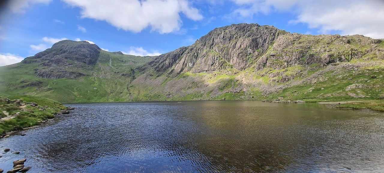
Langdale Horseshoe
Key facts
Difficulty profile
Five independent axes, not one score — all field-checked on the ground here, with nothing left as a desk estimate.
Conditions on this route
We score every Lakeland Wainwright each morning on cloud, wind, rain and underfoot, and this route crosses 9 of them. The worst summit governs the verdict — a route is only as kind as its roughest top.
Modelled guidance — not a substitute for the mountain forecast or your own judgement. See how every fell ranks today →
Daylight & turnaround
Daylight is short from October to February — check today’s sunrise and sunset before you set off, and carry a head-torch and spare batteries. On short days, decide your turn-back time before you start.
Why this matters: 78% of Mountain Rescue call-outs come after midday — the day runs out on the way home, not on the way up. See also walking in bad weather and today’s conditions.
1 Pavey Ark2 Harrison Stickle3 Thorn Crag4 Loft Crag5 Pike of Stickle6 Black Crags (Mickleden)7 Rossett Pike8 Bowfell9 Shelter Crags10 Crinkle Crags - Gunson Knott (Fifth Crinkle)11 Crinkle Crags - Fourth Crinkle12 Crinkle Crags - Long Top (Second Crinkle)13 Crinkle Crags South Top (First Crinkle)14 Cold Pike15 Pike of Blisco
Easy 59%Moderate 21%Hard 11%Severe 9%
Free mapping: OpenTopoMap / OpenStreetMap (switch layers top-right).
This walk covers about 20.2 km with around 1497 m of ascent, taking in 15 summits. The map above shows the line; the elevation profile and stage notes are below.
Access & barriers
Can a dog, a buggy or dodgy knees manage this route? A quick read from the gates and stiles mapped along the way.
- Dog: A stile of unmapped type — a dog may need lifting over.
- Buggy: Stiles or rough going on the route.
- Knees: A long, steep ~41% drop around the 17.0 km mark — hard on the knees.
On the line: 8 gates · 1 kissing gate · 2 stiles (type unmapped)
These are mapped barriers, from OpenStreetMap — coverage in the Lakes is good but not guaranteed complete. Spotted a stile or gate we’ve missed? Tell us (opens in new tab) and we’ll fix it. Barrier data as of 2026-07-14. Access data © OpenStreetMap contributors (via Overpass).
Pacing
| Summit | Cumulative | Ascent | Time (fast–steady) |
|---|---|---|---|
| 1Pavey Ark | 2.8 km | 610 m | 1:35–2:07 |
| 2Harrison Stickle | 3.7 km | 632 m | 1:47–2:22 |
| 3Thorn Crag | 4.3 km | 634 m | 1:55–2:33 |
| 4Loft Crag | 4.5 km | 653 m | 1:59–2:38 |
| 5Pike of Stickle | 4.9 km | 684 m | 2:07–2:50 |
| 6Black Crags (Mickleden) | 7.4 km | 814 m | 2:50–3:46 |
| 7Rossett Pike | 8.2 km | 867 m | 3:05–4:06 |
| 8Bowfell | 9.7 km | 1169 m | 3:54–5:11 |
| 9Shelter Crags | 11.3 km | 1263 m | 4:22–5:48 |
| 10Crinkle Crags - Gunson Knott (Fifth Crinkle) | 11.5 km | 1270 m | 4:25–5:53 |
| 11Crinkle Crags - Fourth Crinkle | 11.7 km | 1286 m | 4:28–5:57 |
| 12Crinkle Crags - Long Top (Second Crinkle) | 11.9 km | 1309 m | 4:34–6:04 |
| 13Crinkle Crags South Top (First Crinkle) | 12.4 km | 1310 m | 4:40–6:12 |
| 14Cold Pike | 14.1 km | 1317 m | 5:01–6:41 |
| 15Pike of Blisco | 15.7 km | 1491 m | 5:38–7:29 |
| Finish | 20.2 km | 1497 m | 6:32–8:41 |
Naismith-based estimate — a fast/steady range. Your pace will vary. These use Naismith’s textbook constants (5 km/h, 600 m of ascent an hour). Measured against a pace fitted to 41 recorded Lakeland walks they run about 8% slow, and we have left them that way deliberately: a slow estimate strands nobody.
The walk, stage by stage
- 1
Start → Pavey Ark (2.8 km, 610 m)
Depart the valley floor (New/Old Dungeon Ghyll) and ascend the heavily pitched stone path alongside Stickle Ghyll. Reach the dam at Stickle Tarn. Avoid the face-climb of Jack’s Rake; instead, skirt the east (right) side of the tarn and take the North Rake path up the rear to the summit
WaypointsStickle Ghyll, Stickle Tarn, North Rake path, Pavey Ark summit
Decision pointStickle Ghyll and Stickle Tarn provide foolproof visual handrails
Easy to get wrongA relentless, immediate 22% gradient
If you need to get offTurn around and safely descend the Stickle Ghyll path back to the start
- 2
Pavey Ark → Harrison Stickle (0.8 km, 21 m)
Head South-West across the rugged, sometimes boggy plateau connecting the two peaks, rising slightly to the prominent rocky crown of Harrison Stickle
WaypointsHarrison Stickle summit
Decision pointHarrison Stickle is the highest point of the Langdale Pikes and dominates the immediate skyline
Easy to get wrongMinor rocky undulations; can be disorienting in low visibility
If you need to get offRetreat to Pavey Ark and descend the North Rake back to Stickle Tarn
- 3
Harrison Stickle → Thorn Crag (0.6 km, 3 m)
Drop off the western flank of Harrison Stickle into the grassy depression, passing over the minor rocky bump of Thorn Crag
WaypointsThorn Crag summit area
Decision pointKeep the sheer drop into Langdale on your left (South) at a safe distance
Easy to get wrongSteep initial descent off Harrison Stickle requiring careful footing
If you need to get offA steep descent path drops directly south down Dungeon Ghyll ravine back to the valley floor
- 4
Thorn Crag → Loft Crag (0.2 km, 19 m)
A very short, straightforward grassy and rocky pull heading West from Thorn Crag up to the airy summit of Loft Crag
WaypointsLoft Crag summit
Decision pointDirect line of sight to the summit
Easy to get wrongExtremely exposed drop-offs to the south
If you need to get offRetreat 200m east and take the Dungeon Ghyll descent path
- 5
Loft Crag → Pike of Stickle (0.5 km, 31 m)
Descend briefly North-West into the saddle, then approach the unmistakable thimble-shaped dome of Pike of Stickle. Scramble up the rock to the peak
WaypointsPike of Stickle summit
Decision pointThe thimble profile of Pike of Stickle is completely unmistakable
Easy to get wrongThe final 50 feet requires hands-on scrambling on exposed rock
If you need to get offLeave the scramble entirely and begin the descent into Martcrag Moor
- 6
Pike of Stickle → Black Crags (Mickleden) (2.5 km, 130 m)
Drop off the back (North-West) of Pike of Stickle into the wide, flat expanse of Martcrag Moor. Follow the faint path across the moor toward the Stake Pass junction, then continue slightly uphill towards the crags
WaypointsMartcrag Moor, Stake Pass crossroad
Decision pointThe Stake Pass junction is a clear perpendicular path cut
Easy to get wrongThis area is a notorious bog. Pathfinding is difficult after heavy rain as the track disappears into mud
If you need to get offTurn left (South-East) at Stake Pass for a safe, zig-zag descent into Mickleden valley
- 7
Black Crags (Mickleden) → Rossett Pike (0.8 km, 53 m)
Continue South-West from Black Crags, following the ridge line over a gentle ascent to the summit of Rossett Pike
WaypointsRossett Pike summit
Decision pointFollow the natural ridge line directly toward the looming mass of Bowfell
Easy to get wrongRelatively straightforward, grassy walking
If you need to get offRetreat 800m to Stake Pass and descend into Mickleden
- 8
Rossett Pike → Bowfell (1.5 km, 302 m)
Descend slightly to Rossett Pass, then begin the grueling, steep ascent up Bowfell’s northern shoulder. The path threads through a massive, unrelenting boulder field to the summit
WaypointsRossett Pass, Angle Tarn (visible below), Bowfell summit
Decision pointLook for small guide cairns through the boulders
Easy to get wrongThe steepest sustained climb since Pavey Ark. The boulder fields are exhausting and treacherous when wet
If you need to get offBefore ascending Bowfell, turn left at Rossett Pass down the old pony track (Rossett Gill) into Mickleden
- 9
Bowfell → Shelter Crags (1.5 km, 95 m)
Descend South off Bowfell’s rocky summit down to the wide saddle of Three Tarns. From the tarns, begin the ascent up the first rocky prominence of the ridge: Shelter Crags
WaypointsThree Tarns saddle, Shelter Crags summit
Decision pointThe pools of water at Three Tarns serve as an unmistakable target
Easy to get wrongNavigating the descent off Bowfell in poor visibility; it is easy to drift too far East
If you need to get offAt Three Tarns, turn left (East) to descend "The Band"—a long, safe grassy ridge leading straight back to Langdale
- 10
Shelter Crags → Crinkle Crags - Gunson Knott (Fifth Crinkle) (0.3 km, 7 m)
Continue South along the rocky, convoluted ridge. This marks the start of the "Crinkles," moving South over the Fifth Crinkle
WaypointsGunson Knott (Fifth Crinkle)
Decision pointKeep the sheer drops into Upper Eskdale firmly on your right (West)
Easy to get wrongTerrain is rocky, broken, and requires continuous minor route-finding
If you need to get offRetreat north to Three Tarns and descend The Band. Do not bail off the sides of the Crinkles
- 11
Crinkle Crags - Gunson Knott (Fifth Crinkle) → Crinkle Crags - Fourth Crinkle (0.1 km, 16 m)
A very brief dip and rise to the next prominence on the ridge
WaypointsFourth Crinkle
Decision pointStick to the most worn rock path along the crest
Easy to get wrongMaintaining orientation; the peaks look similar in mist
If you need to get offRetreat north to Three Tarns
- 12
Crinkle Crags - Fourth Crinkle → Crinkle Crags - Long Top (Second Crinkle) (0.2 km, 24 m)
Continue South. This GPX skips the Third Crinkle summit, pushing directly to the highest point of the ridge, Long Top
WaypointsLong Top (Second Crinkle)
Decision pointLong Top is visibly the highest point of this ridge section
Easy to get wrongSteep, rocky steps up to the summit of Long Top
If you need to get offRetreat north to Three Tarns
- 13
Crinkle Crags - Long Top (Second Crinkle) → Crinkle Crags South Top (First Crinkle) (0.5 km, 0 m)
Descend South from Long Top. You will immediately encounter the Bad Step. Either down-climb this 10-foot rock chute, or take the bypass path wrapping around to the West (right), before continuing to the final crag, South Top
WaypointsThe Bad Step, South Top (First Crinkle)
Decision pointThe bypass path is faint but marked by wear on the grass/rock on the western flank
Easy to get wrongThe Bad Step is the most technical obstacle on the route
If you need to get offNone immediately. Must press on to Red Tarn or retreat all the way to Three Tarns
- 14
Crinkle Crags South Top (First Crinkle) → Cold Pike (1.7 km, 7 m)
Descend South-East off the Crinkles, dropping steadily over grass and rock into the wide saddle containing Red Tarn. From the tarn, take a short, grassy detour South to the summit of Cold Pike
WaypointsRed Tarn col, Cold Pike summit
Decision pointRed Tarn is highly visible from above
Easy to get wrongThe descent off the Crinkles is long but relatively straightforward compared to the ridge itself
If you need to get offFrom Red Tarn, take the clear path heading East down into the Oxendale valley
- 15
Cold Pike → Pike of Blisco (1.6 km, 174 m)
Return slightly toward Red Tarn, then head East up the heavily pitched, stepped stone path leading to the rocky summit of Pike of Blisco
WaypointsPike of Blisco summit
Decision pointThe pitched path is impossible to miss
Easy to get wrongHigh rocky steps on exhausted legs
If you need to get offRetreat to Red Tarn and descend into Oxendale
Pike of Blisco → Finish (4.5 km, 7 m)
Descend the steep, eastern flank of Pike of Blisco via a rugged path of stone-pitched steps. Reach the Wrynose Pass road area, and follow the valley floor tracks back to the Dungeon Ghyll car parks
WaypointsEastern descent steps, Wrynose Pass road
Decision pointThe Langdale valley and road serve as a clear visual destination throughout the descent
Easy to get wrongThe pitched descent is notorious for causing knee pain at the end of a long hike. The steps are uneven and require focus
If you need to get offN/A - Direct descent to the finish
Summits bagged (15)
- 1Pavey Ark702 m
- 2Harrison Stickle735 m
- 3Thorn Crag644 m
- 4Loft Crag682 m
- 5Pike of Stickle708 m
- 6Black Crags (Mickleden)588 m
- 7Rossett Pike651 m
- 8Bowfell903 m
- 9Shelter Crags815 m
- 10Crinkle Crags - Gunson Knott (Fifth Crinkle)822 m
- 11Crinkle Crags - Fourth Crinkle832 m
- 12Crinkle Crags - Long Top (Second Crinkle)859 m
- 13Crinkle Crags South Top (First Crinkle)834 m
- 14Cold Pike700 m
- 15Pike of Blisco703 m
In the order you walk them — the same numbers the elevation profile, the stage notes and the pacing table use.
Getting there & parking
⛽ Nearest fuel to this start: Hills Garage, Ambleside, 11.6 km by road (Mon 07:00-21:00; Tue 07:00-21:00; Wed 07:00-21:00; Thu 07:00-21:00; Fri 07:00-21:00; Sat 07:00-21:00; Sun 08:00-21:00). Nearest shop: Langdale Co-operative Society, 4.4 km. Both measured along the road from the parking we publish at Old Dungeon Ghyll, checked 8 August 2026. Coming in from a particular direction you may pass a closer one — the last petrol before each valley →
Positions are approximate.
Vehicles are left entirely at their owner’s risk. We list places people park; we cannot vouch for any of them. Judge it on the day: take valuables with you, leave nothing on show, and if a spot feels wrong when you get there, park somewhere else.
Every option near this start, on the parking map →
Water, shelter & getting away
💧 Treat water from the fell before you drink it. A mapped point is usually a tap or public supply, but never drink untreated from a beck, stream or tarn — even clear-looking hill water can carry giardia or cryptosporidium from livestock or a carcass upstream and leave you seriously ill. Run it through a filter or purifier (a LifeStraw, Sawyer Squeeze or HydraPak) or bring it to a rolling boil first.
On-route facilities © OpenStreetMap contributors — an absent marker does not mean the facility isn’t there.
Buses
The 516 stops at New Dungeon Ghyll Hotel (opp), 290 m from this start. Last bus: Monday to Friday 20:03 towards Dungeon Ghyll (516); Saturday 22:23 towards Dungeon Ghyll (516); Sunday 20:03 towards Dungeon Ghyll (516). Checked against the operator’s timetable, 7 September 2026. Times here are a guide, not a promise — leave yourself more than the minute.
The 516 passes this route at 19.5 km (Dungeon Ghyll, at Great Langdale Camp Site, 10 m off the line).
Rural routes change seasonally — confirm on stagecoachbus.com (opens in new tab) or Traveline before travelling.
If the parking is full
If the first one is full, these do not all fill together. The 3 below sit in different places or are different kinds of parking, so a busy morning at one does not mean a busy morning at all of them.
- Old Dungeon Ghyll (NT, paid)
- Side Pike (layby)
- Side Pike (verge, south)
Worked out from the parking we hold within walking reach of this route and the other walks each place serves — two places that serve the same walks fill for the same reasons. We are not saying whether anywhere has spaces today, and we never will: this is what exists, not what is free.
Toilets and refreshments
At Stickle Ghyll (NT, paid), the closest parking we hold to where this route starts:
Distances are straight lines from the car park, not walking routes. Opening hours change; none of this is checked daily.
When the sun reaches the tops
Not sunrise — the moment the sun clears the skyline from that summit, which on a fell with high ground to its east can be a good deal later. The two equinoxes are shown because they fall in the walking season, and late December too wherever a top keeps you waiting then; the clock gap between the equinoxes is British Summer Time, not the hill. Rounded to the nearest quarter hour and meant as a general idea, not a schedule.
- Pavey Ark — in late March the sun reaches it around 06:15, with the sunrise. In late September, about 07:00.
- Harrison Stickle — in late March the sun reaches it around 06:15, with the sunrise. In late September, about 07:00.
- Loft Crag — in late March the sun reaches it around 06:15, with the sunrise. In late September, about 07:00. It waits longest in midsummer — about an hour after sunrise.
- Pike of Stickle — in late March the sun reaches it around 06:15, with the sunrise. In late September, about 07:00.
- Rossett Pike — in late March the sun reaches it around 06:30, with the sunrise. In late September, about 07:00. It waits longest in midsummer — about a quarter of an hour after sunrise.
- Bowfell — in late March the sun reaches it around 06:15, with the sunrise. In late September, about 07:00.
- Crinkle Crags - Long Top (Second Crinkle) — in late March the sun reaches it around 06:15, with the sunrise. In late September, about 07:00.
- Cold Pike — in late March the sun reaches it around 06:15, with the sunrise. In late September, about 07:00.
- Pike of Blisco — in late March the sun reaches it around 06:15, with the sunrise. In late September, about 07:00.
Modelled from a 30 m elevation model against each summit’s own skyline — the same figures the fell pages carry, never observed. Cloud is not in it.
Safety & conditions
- The Bad Step (Crinkle Crags, Long Top). A short, awkward rock step that turns a walk into a scramble and regularly stops people dead. There is a bypass path to the left — use it if you are unsure.
- Do not attempt Jack’s Rake on Pavey Ark unless you know what you are taking on. It is a graded scramble with real exposure, not a path. The walkers’ line goes round.
- 20 km, 1,497 m and fifteen tops. This is a full, committing day. Start early, and decide your turn-back time before you leave the car.
- The Crinkles are the classic place to descend the wrong side in cloud. Know which valley you want before you are in it.
Check live conditions in the “From the fells” panel, on MWIS (opens in new tab) and the Met Office mountain forecast (opens in new tab) before you set off.
Make it easier or harder
Short version: turn back at about 10.5 km (drop to Start) — roughly half the distance.
Places to stay near this start
From Great Langdale: 3 places in Grasmere