One walker, one honest guide to the Lakeland fells.
For every Wainwright (and Outlying Fell), see which Birketts you can bag on the same walk — with maps, parking, buses and weather. A personal project by Lee McCoy.
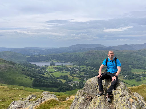 Stone Arthur · 8 July 2023
Where the data comes from
Every number and map layer on the site is traceable to a named source. Forecasts come from a mountain-weather model, mapping from Ordnance Survey and OpenStreetMap, and safety figures from the Met Office, ONS and Mountain Rescue. The full list — and how each is used — lives on the data sources page.
See all data sources →Now go and use it — today’s conditions · all 214 Wainwrights · hand-mapped routes.
About this site — and me
I’m Lee McCoy. I walk the Lake District fells and write everything on this site myself — the routes, the conditions, the parking, the bits that go wrong. No team, no trail crew, no sponsors. If a walked route says a path is boggy, it’s because I stood in it. Planned routes say so at the top, and their ground notes come from the map and the guidebooks until I’ve been.
I grew up in South Africa, where my father and brother used to take me camping out in the bush. Sleeping under a vast sky with nothing but the sounds of the night around you leaves a mark — even if it took me a few decades to fully appreciate it.
Back in England, life got in the way. A long stretch of inactivity and the inevitable weight gain that comes with it. I made a start in my late thirties — hiking, running, losing the weight — then life got in the way again. The usual story.
What pulled me back properly was the Yorkshire Three Peaks. I've done it more than a dozen times now, enough to know every boggy section by heart. I always assumed the Lake District fells were a step too far — proper mountains, properly serious.
Then in 2023, on holiday in Ambleside, I walked the Fairfield Horseshoe. Nine miles, 900 metres of ascent, and views that stopped me in my tracks. Something shifted that day. I came home and ordered a copy of Wainwright's Eastern Fells.
The Wainwrights — work in progress
Completed: 77% of the 214 Wainwright fells
How that figure is counted. It is my own count, kept by hand and last set on 1 September 2026. It is not a machine total, so treat it as a walker's tally rather than a measurement. The one part of it I can show you is Strava: of the 214, 154 — 72% — have a summit visit matched to a recorded activity. The gap between 77% and 72% is fells I walked before I recorded anything, or on days the watch stayed in the rucksack. I would rather show you both numbers than round them into one.
The Wainwrights became the goal — all 214 of them, from the modest humps above Penrith to the serious ridges of the Western Fells. I'm 77% of the way through, and a member of The Wainwright Society (opens in new tab). Along the way I started noticing all the other summits nearby that weren't on the list: close enough to bag on the same walk, but invisible unless you knew where to look.
Why the Fells? Why this site?
The Birketts — the 541 fells in the Lake District National Park that top 1,000 feet in height — felt like the natural next chapter. I'll be passing half of them anyway on the way to Wainwright summits. I might as well be deliberate about it. When I retire, the plan is to go after the full 541.
The problem was the tooling. Juggling a fell-bagging app, a mapping site and a weather forecast across three browser tabs on a wet Saturday morning isn't fun. I wanted one page that told me: here's the Wainwright, here are the nearby Birketts, here's how to get there and park, here's the forecast, and here's a map. It didn't exist, so I built it.
Down the road I'll add the Synges, Fellrangers, Nuttalls and the rest. One list at a time.
Recent walks
A few of my latest walks that I took photos on — proof I'm actually out on these fells, not just writing about them. Each one links to the full activity on Strava.
What I hope this does
- Help others think beyond the Wainwrights. The 214 are wonderful — but there are hundreds of other summits up there with just as much character. This site tries to make them a little more visible.
- Give me something to look back on. Part of this is honestly a gift to my future self — something to sit with when the knees give out and the hills are too far away. A record of the good times.
- Get my kids up there. When they're old enough to head into the fells on their own, I want something useful waiting for them. Maybe they'll roll their eyes at dad's website. Maybe they won't.
Get in touch
If you find an error, a missing parking spot, or just want to say you've been up there too — I'd genuinely love to hear from you. This is a personal project and very much a work in progress. The quickest way is the contact page; I’m also on LinkedIn (opens in new tab) if you’d rather.
The site itself is on X (opens in new tab) and Instagram (opens in new tab) — new fell pages, conditions worth knowing about, and photographs from the tops.
Spotted a mistake? This is a personal guide, kept current by one walker — so if a fell detail, a hazard note, a route line or a forecast looks wrong, please tell me. Every report is read; where a correction checks out, the page is updated and the change is logged in the Changelog with a revised date. Honest corrections keep the site trustworthy for the next person on the hill, and they're always welcome.
Not sponsored. No brand pays to appear here. There's no sponsored content, no paid placement and no gifted-product reviews anywhere on hikes.guide. There are no affiliate links either: the Amazon “Maps & guidebooks” section came off every page in September 2026. Nothing on hikes.guide earns a commission, and no recommendation is paid for.