Walking in Bad Weather in the Lake District
Most bad-weather trouble on the fells isn’t bad luck — it’s a decision made too late. This guide puts the decision first: a simple, conservative scale for turning a forecast into a go, a go-lower or a no-go, then the conditions one at a time, the evidence, the kit and the emergencies. It won’t make you bomb-proof, and it never replaces the live mountain forecast or your own judgement.
Chapter 0Who this is for, and the honest limits
This is a guide to day walks on the Lake District fells in poor weather — wind, rain, cold, fog, thunder and, increasingly, heat. It is written for walkers who want to keep going out when the forecast turns, and to do it well.
It is not a winter-mountaineering manual. Where the ground is frozen, an ice axe, crampons and the trained skill to use them become mandatory, and that is a course and a mentor, not a web page — we signpost proper winter-skills training rather than pretend to teach it. And nothing here replaces the live mountain forecast for the day, read for the summit, not the valley: this guide helps you interpret it, not skip it.
Read this first
The advice below is deliberately conservative. It sits below the point where the wind will blow you over, not at it. If in doubt, go lower — the fells will still be there next week.
Chapter 1 · the crown jewelThe Go / Go-Lower / No-Go Scale
The mountains will always be there. The trick is to make sure you are too.
AdventureSmart UK (opens in new tab) boils the whole thing down to three questions to answer ‘yes’ to before you go: have I the knowledge and skills; do I know what the weather will do; have I the right gear? This Scale is the deep version of the middle one, made specific to the Lakeland fells.
It is re-anchored to the MWIS “effect of wind on you” (opens in new tab) scale and keyed on the gust speed for the summit — it’s the gust that knocks you over, not the average, and the valley forecast understates the ridge. Grade the day by the worst of: gust wind, freezing level, precipitation, visibility and thunder. The wind bands are cited to MWIS; the terrain calls and named fells are our judgement from walking them, and we say so.
Drop a band regardless of the wind when the freezing level is near or below the summits (ice on steep ground), the cloud base is below the tops (navigation degrades — the Helvellyn plateau, the Scafell Pike boulder field), or the rain is intense (becks rise fast). And be one band more cautious if you’re less experienced, solo, in a group with weaker members, carrying a big pack, or in winter.
Hard NO-GO, any band, no hedging: a lightning forecast on the tops or ridges; ice on steep ground without an axe, crampons and the skills to use them; a flooded or spate beck crossing; storm-force gusts on any edge.
The signature move is not “stay home” — it’s “choose differently.” Most bad days are a go-lower day, not a no-go day. That’s what the tool below, and the Alternative Finder later, are for.
Work out your band
Enter what the mountain forecast says for the summit you have in mind, and this returns the band on the Scale — with the terrain call and named Lakeland examples. It reads the gust, not the average.
Decision support, not decision-making. This tool is deliberately conservative and cannot see the day you are standing in. Always defer to the live mountain forecast (opens in new tab) and your own judgement, and be ready to turn back.
Chapter 2The conditions, one at a time
Each condition here follows the same shape: what it does to you, what it does to your decisions, how it behaves in the Lakes, and what to do about it.
Heavy rain
A cold rain is among the most dangerous conditions a walker meets, because it drives hypothermia even in well-above-freezing temperatures — wet clothing cools you far faster than dry. The risk isn’t the wet, it’s the compounding: wet and wind and cold is the killer combination. Rain also hides the other hazards — it slicks the rock and raises the becks. Lakeland catchments respond fast: a beck that’s a dry-shod step in the morning can be an impassable spate by afternoon.
Tactics. Waterproof and windproof shell and trousers; no cotton; keep a dry insulating layer sealed in a dry-bag; eat and drink more often than in the sun. Never cross a flooded or spate beck — change the route or wait (Mountaineering Scotland (opens in new tab)).
Lee — Raise Beck, in the rain
“Descending Dollywaggon Pike down the scree, the rain had become exceptionally bad. My route was meant to take me up over Seat Sandal and down to Dunmail Raise — but as I skirted Grisedale Tarn and got caught in the bog, the going was so strenuous I decided I hadn’t the energy for the climb, and followed the track down beside Raise Beck instead. That was inexperience. The beck was exceptionally high and fast, the rocks slippery, and with my fatigue it was dangerous. I should have taken the 155 m climb over Seat Sandal for an easier descent to the road.”
The lesson: plan your escape before you need it, and in spate the high line beats the beck.
Wind
It’s the gust that knocks you over, not the average — and wind-chill pulls the felt temperature on the tops well below what the valley suggests, even in high summer: we’ve measured it, below. Read the gust for the summit and drop a band if you’re less experienced, solo or in winter. On the MWIS calibration: ~20–25 mph affects balance; ~30–35 mph is strenuous with gusts that can knock you off your feet; ~40–50 mph blows you over; ~50–60 mph and above, mobility is near-impossible (MWIS (opens in new tab)). The exposed edges are the first to become unsafe — Striding Edge, Sharp Edge and the Crinkle Crags step go long before the rounded tops do.
What 600 m does to a July afternoon — measured, not asserted
Paired hourly observations — the same date and the same hour at two Met Office stations 584 m apart, across ten Julys (2014–2023, daytime 09:00–17:00, n = 2,524 paired hours): Shap (263 m) and Great Dun Fell (847 m) (Met Office MIDAS Open via CEDA (opens in new tab)).
| July daytime | Upland base (263 m) | Summit (847 m) | Summit feels like (computed) |
|---|---|---|---|
| Median, any July afternoon | 16.3 °C | 10.4 °C | 6.9 °C |
| When the base sits at 18 °C or warmer | 20.3 °C | 14.0 °C | 12.1 °C |
| When the base sits at 20 °C or warmer | 21.7 °C | 15.4 °C | 14.3 °C |
| When the base sits at 24 °C or warmer | 25.2 °C | 19.3 °C | 18.9 °C |
The median gap is 6.0 °C — about 1 °C per 100 m — and the median summit wind is 21 mph, which is what takes 10.4 °C down to a felt 6.9 °C. So the honest version: the summit isn’t arctic on a warm day — it’s about six degrees colder, and it’s windy. Six degrees plus twenty miles an hour plus rain plus a cotton t-shirt is a different day from the one you set off in — and that, not extreme cold, is the mechanism behind summer hypothermia callouts. It’s also why you read the mountain forecast, not the valley one: they are measurably different weather. The rest of the summer picture — heat, cold water, lightning, wildlife and fire, ranked by evidence — is in Summer on the Fells.
Honesty notes: Great Dun Fell is a North Pennine summit, so this is a regional, altitude-based reading — what ~850 m does to a July afternoon — never a per-fell figure. Shap is itself upland at 263 m, not a valley floor: a true Lakeland valley would read warmer, so the real gap is larger than shown — our figure is deliberately conservative. “Feels like” is computed (the JAG/TI wind-chill formula), not observed; the formula is strictly valid at ≤10 °C and the all-July median sits on that boundary, so treat 6.9 °C as indicative. ⇩ Download the paired data (CSV) — Open Government Licence v3.0.
Tactics. Poles for balance; a wide stance; move between gusts; and the honest one — turn back or go lower before the crux, not on it.
Getting to the top is optional. Getting down is mandatory.
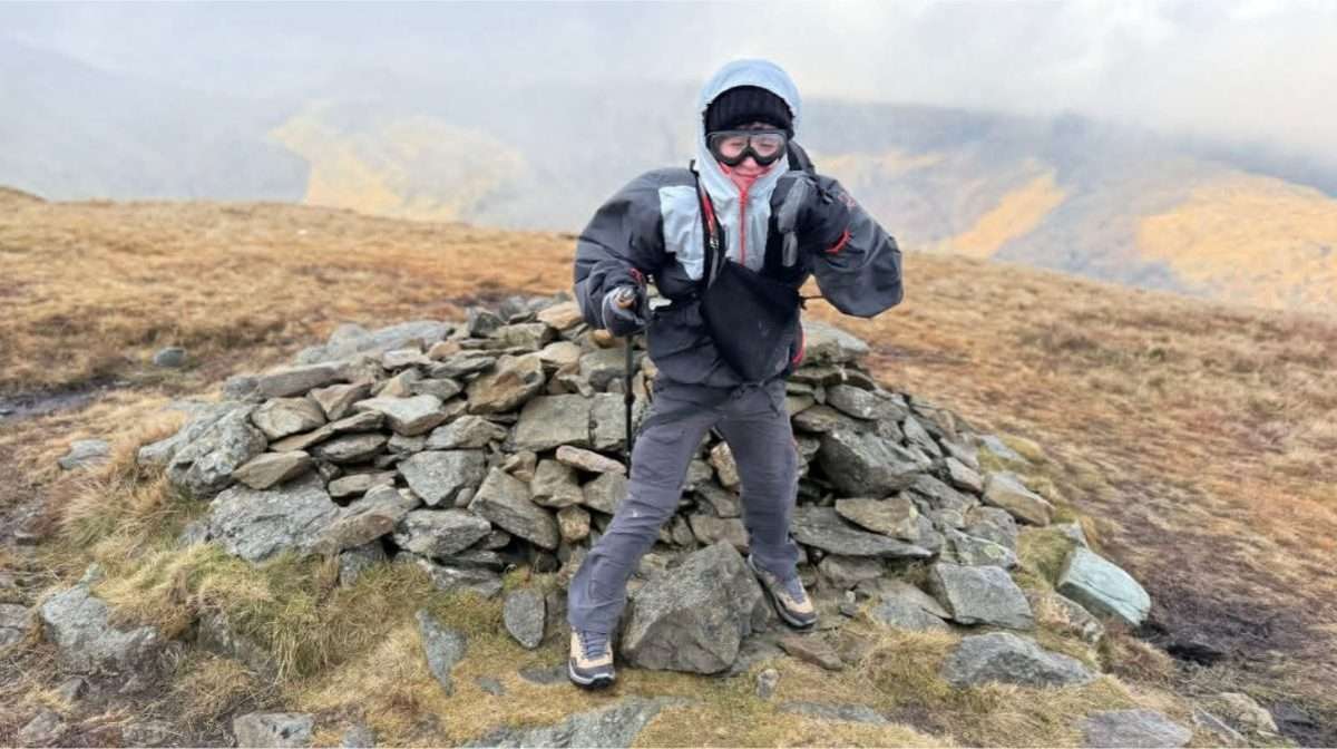
Lee — Helvellyn, over 50 mph
“The morning started damp but I’d committed to Helvellyn. It worsened steadily, and near Lower Man a group of young men coming down told me not to go higher. I didn’t think the next 50 m of climb could get much worse. It absolutely did. At the summit a man was cowering behind the trig point trying to get layers on; I could hardly stand upright with poles — it must have been over 50 mph. I’d misjudged my exits, and my jacket wasn’t up to it.”
The lesson: know your exits before you start, and heed the people coming down — they’ve just been where you’re going. Over 50 mph is the Scale’s go-lower/valleys day.
What the Scale is built for: an exposed top in strong wind and driving rain. © Lee McCoy
Cold & ice
Hypothermia progresses through the “umbles” — grumbles (shivering), fumbles (numb hands), mumbles (slurred speech), stumbles (can’t walk straight, confused). Ice adds a fall-on-steep-ground risk. The freezing level is the most under-read line on the forecast: near or below summit height means ice or verglas on steep ground, and that’s where microspikes stop being optional and an axe, crampons and the skills to use them become mandatory. This guide is for day walks, not winter mountaineering — get proper winter-skills training before you rely on that kit.
Tactics. Carry more insulation than you think and keep it dry; if someone shows the umbles, act early (see on the hill); watch the weakest member of the group.
Lee — footwear, and St Sunday Crag
“I’ve been well prepared for cold in terms of layers, but caught out twice by the small things. My drinks froze — the bladder hose and spare bottles. And footwear: I’ve twice chosen lighter shoes over heavy boots and paid for it — a snail’s-pace descent off Gibson Knott with no confidence in the grip, and worse on St Sunday Crag, where I went off the trail in snow, kept going when I should have turned back, and ended up pushing through deep snow.”
The lesson: in winter conditions the boots — and the discipline to turn back to a known line — matter more than the layers.
Fog & whiteout
Cloud base below the summit degrades navigation to near-zero, fast — and navigation error, self-reported lost and benightment are exactly what the rescue data records (see the evidence). The genuine problem grounds are the Helvellyn plateau (cornices in winter) and the Scafell Pike boulder field — featureless, cliff-edged, easy to misread.
Tactics. Map and compass and the skill to use them; don’t rely on a phone (the battery dies in the cold). Navigate by bearings and handrails. If genuinely lost, see the lost-in-fog steps.
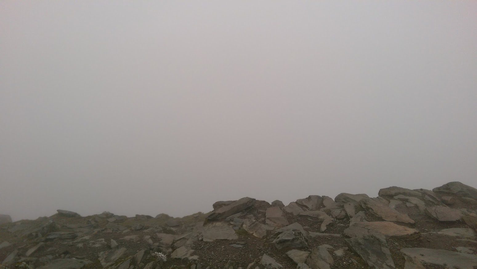
Lee — the clag on Dollywaggon
“I’ve done plenty of hikes in the clag and always avoided the ridges in it. The one time it bit was on Dollywaggon Pike — I nearly walked off the side, no bearings, and a watch GPS slow to update. By then, retracing my steps would have been more dangerous than finding an exit — so I took the way off.”
The lesson: a compass bearing doesn’t lag like a GPS watch — and avoiding the ridges in the clag is a rule worth keeping.
Thunder & lightning
If thunderstorms are forecast, go another day, pick a low-level route, or start early to be off the high ground before they arrive; watch for towering cumulonimbus building (Met Office (opens in new tab), BMC (opens in new tab)). If you’re caught out, get off summits and ridges to lower ground immediately, crouch on the balls of your feet, don’t lie down, and separate from metal (poles, axe) and isolated trees.
Any lightning forecast on the tops or ridges is a hard no-go on the Scale.
Lee — the call I’m glad I made
“I’ve no experience of being caught in it — because I’ve always cancelled when lightning was forecast, two or three times now.”
The lesson: that is the lesson: on the fells the correct move is to not be there.
Heat — the new Lakeland hazard
Our Climate Report (opens in new tab) shows the fells about +1.38 °C warmer than Wainwright’s decade, with 2023 and 2025 the warmest years on record. Heat is now a genuine, rising Lakeland risk — and the one condition every rival “bad weather” guide ignores. Heat exhaustion tips into heatstroke; dehydration accelerates poor decisions. Start early, carry more water than feels necessary, and know the shaded and valley alternatives — the go-lower principle works in a heatwave too.
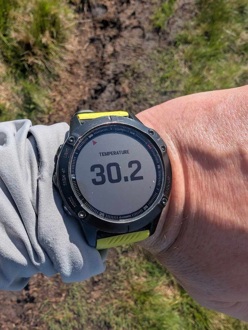
Lee — Helm Crag, 35 °C
“I normally treat about 35 °C as my limit. On Helm Crag the morning was warm but by the summit it was 35 °C and my stomach reacted to the hydration salts — first burping, then throwing up. By then I was round near Calf Crag and it felt more dangerous to turn back, so I kept going, met a very experienced walker, and with plenty of liquid and a sun hoodie I felt I could carry on safely.”
The lesson: vomiting is a recognised warning sign of heat illness. The safer call was to stop, cool down in shade and rehydrate slowly — meeting another walker or having a drink at the car doesn’t remove the risk. Keep the story, keep the correct lesson.
Chapter 3The evidence
What actually gets people rescued isn’t drama — it’s decisions and navigation in poor conditions. In the 2025 England & Wales mountain-rescue figures, poor decision-making or human error was a recorded contributory factor in 939 incidents and inexperience in 644 — against 518 for the weather itself. The weather sets the stage; the decision is what the data keeps pointing to.
The rest of the picture is on-thesis too: about 78% of call-outs come after midday, as people are caught out on the descent; slips and trips are the single commonest cause; and the busiest months are now the warm ones. The full breakdown, per team and per year, is in our Mountain Rescue Data Report (opens in new tab), and the long-run weather behind it — wetter, warmer, less reliably frozen — is in the Climate Report (opens in new tab).
The compiled figures behind this chapter are a public download: weather-decisions-evidence.csv (each row carries its basis, geography, year, confidence and source). Figures are England & Wales at the year and basis stated — no invented per-fell granularity.
Chapter 4Kit, mechanism-first
Kit earns its place by what it does, not by its brand. We carry no affiliate links and make nothing from a recommendation — that’s a deliberate trust signal, not an oversight. The mechanism matters more than the label:
- A waterproof, windproof shell — because wet-plus-wind is what drives hypothermia. This is the one to spend on; a shell that wets through in an hour is the failure point in most cold-and-wet epics.
- A dry insulating layer, sealed in a dry-bag — insulation only works dry, so keep the spare warm layer sealed until you stop and need it.
- Map and compass, and the skill to use them — because a phone battery dies in the cold and a GPS watch lags. A bearing doesn’t.
- Head torch, whistle, first aid, food and more water than you think — 78% of rescues start after midday, and benightment is a decision-cascade, not bad luck.
- Boots for the season — in winter conditions, grip and ankle support matter more than saved weight.
Lee — my layering system
“Managing layers has been one of the hardest skills to learn — and buying the right gear in the first place. I was always told ‘be bold, start cold’, but it took me years to find the balance. Now I run a top-quality base layer, a mid-layer, and my rain jacket saved for the worst conditions. I often carry a wind jacket that keeps the breeze off but lets the heat out, and I try not to start in waterproof trousers and gaiters — I save them for when I really need them.”
The lesson: pace to avoid sweating out your insulation; strip a layer before the climb, not at the top.
Chapter 5On the hill & emergencies
Climb if you will, but remember that courage and strength are nought without prudence, and that a momentary negligence may destroy the happiness of a lifetime.
Managing the day. Pace to avoid sweating out your insulation; nobody walks alone off the back of the group; work to the weakest member; read the sky and commit to escape decisions early.
Hypothermia — recognise and respond
Recognise the umbles (grumbles → fumbles → mumbles → stumbles) and act on the grumbles, not once you’re certain. Get out of the wind and wet: remove wet clothing, insulate, and use a group shelter; if they can swallow, give warm sweet drinks and high-energy food; get off the hill and handle a very cold person gently. Do not rub the limbs, give alcohol, or rewarm with direct heat — and call 999 if they’re deteriorating (NHS (opens in new tab)).
Lost in poor visibility
Stop — don’t wander. Work out where you are deliberately (last known point, time, pace, bearing); relocate to a catching feature or handrail; shelter and wait if you can’t move safely. Panic-descending into the wrong valley, or over a crag, is the classic serious error.
Calling for help
Dial 999 or 112, ask for Police, then Mountain Rescue — and then stay where you are until the team reaches you. Call early: mountain rescue is unpaid volunteers who must muster and then reach you. Give your location (a grid reference or what3words), the number in your party, the nature of the injury or problem, and your phone number and battery level; they may text you a link that pins your phone’s location, so follow it. In poor signal, text 999 — but that only works if you have registered in advance by texting the word ‘register’ to 999 (Mountain Rescue England & Wales (opens in new tab)).
Leave word before you go: tell a named person your route and expected return, and what to do if you’re overdue — call 999 and ask for Police, then Mountain Rescue.
Lee — my leave-word routine
“I always carry a satellite messenger. I send my wife and eldest son the route beforehand with my expected return time, message them when I set off, and they can follow my track over the satellite connection.”
The lesson: a plan shared, a check-in, and live tracking that works with no phone signal.
Printable trailhead checklist
hikes.guide — Walking in Bad Weather · decision support, not a substitute for the live forecast & your judgement
Before you leave the car
- Checked the mountain forecast (summit gust, freezing level, cloud base) — not just the valley?
- 3 of 3 on the AdventureSmart questions (opens in new tab): knowledge & skills / weather / gear?
- Run your fell through the Go / Go-Lower / No-Go Scale — and have a lower plan B?
- Map & compass, and you can use them? Phone charged, in a warm pocket?
- Waterproofs, warm spare layer in a dry-bag, hat & gloves, food & water, head torch, whistle, first aid?
- Known your escape points off the ridge before you start?
Leave word
Tell a named person your plan:
- Route / fell:
- Set off: Expected back:
- Car & where parked:
- If I'm overdue by [__] hrs: dial 999, ask for Police, then Mountain Rescue.
The “umbles” — catch hypothermia early
Grumbles (shivering, complaining of cold) → fumbles (clumsy, numb hands) → mumbles (slurred speech) → stumbles (can't walk straight, confused). Act on the grumbles.
Do: shelter from wind & wet, remove wet clothing, insulate, group shelter; warm sweet drink & food if fully awake; get off the hill; work to the weakest person. Don't: rub the limbs, give alcohol, or rewarm with direct heat (NHS (opens in new tab)).
Calling for help
Dial 999 or 112 → ask for Police → then Mountain Rescue. Then stay where you are until the team reaches you.
Give: location (grid ref / what3words), number in the party, the injury or problem, your phone number & battery. No signal? Text 999 — but you must register first (text ‘register’ to 999 today) (Mountain Rescue E&W (opens in new tab)).
Bad-Weather Alternative Finder
The go-lower principle as a tool. Pick the fell you had planned and how the day is looking, and this finds lower, more sheltered fells nearby to swap to. Distances are as the crow flies from your intended summit.
Decision support, not decision-making. Shelter and exposure are a first-pass classification from height and terrain and are still being reviewed — always defer to the live forecast and your own judgement. A lower fell in a storm can still be serious.
On a true valleys-only day, the easy & family walks (low-level lakeshores, tarns and waterfalls) and the lakeshore routes are the safe bets.
Chapter 6 · the experience layerThe Turn-Back Log
Real decisions on the hill, and what they taught me — mostly the ones I got wrong or had to correct, which is more honest and more useful than a row of clean retreats. Each maps to a band on the Scale, and this log grows each season.
- Raise Beck, from Dollywaggon Pike — heavy rain. Chose the beck over the Seat Sandal climb when tired; the beck was in spate and dangerous. Plan the escape early; in spate the high line beats the beck. → go-lower.
- Helvellyn — wind over 50 mph. Pushed to the summit past a group warning me down, exits unknown, jacket not up to it. Know your exits; heed the people coming down. → valleys only.
- St Sunday Crag — winter snow. Off-track in the wrong boots, pushed on instead of returning to the known line. Boots for the season, and the discipline to turn back. → go-lower / no-go.
- Dollywaggon Pike — the clag. Nearly walked off the edge with a lagging GPS watch; took the exit rather than retrace. A bearing doesn’t lag; avoid the ridges in cloud. → go-lower.
- Helm Crag — heat, 35 °C. Sick from the heat and salts, pushed on to Calf Crag. Stop, cool, rehydrate — don’t push on while being sick. → go-lower.
- Two or three clean cancellations when lightning was forecast — the correct call, logged as the model. → no-go.
This log is append-only and grows each season — new entries honestly bump the “updated” date at the top.
AnswersFrequently asked questions
Is it safe to hike in high wind?
It depends on the gust speed at the summit, not the average, and on the terrain. As a guide calibrated to MWIS: under about 25 mph you have the full range; 25–35 mph and the exposed edges come off the menu; 35–45 mph gusts can knock you off your feet, so go lower; 45–55 mph blows you over, so valleys only; above about 55 mph, stay off. Read the gust, take the summit figure, and be one band more cautious if you are less experienced, solo or in winter.
When should I cancel a hike?
Cancel or go much lower when the mountain forecast shows summit gusts above about 45 mph, a lightning risk on the tops, a freezing level near or below the summits without the ice-axe skills to match, or intense rain that will put becks in spate. A lightning forecast on the tops or ridges is a hard no. There is no shame in it — most bad days are a case of choosing a lower fell, not staying home.
What are the signs of hypothermia, and what do I do?
Watch for the “umbles”: grumbles (shivering, complaining of cold), fumbles (clumsy, numb hands), mumbles (slurred speech) and stumbles (unsteady, confused). Act early: shelter from wind and wet, remove wet clothing and insulate, use a group shelter, and give warm sweet drinks and food if the person is fully awake. Do not rub the limbs, give alcohol or apply direct heat. Get off the hill and call for help if they are deteriorating (NHS guidance).
How do I call mountain rescue in the Lake District?
Dial 999 or 112, ask for the Police, then ask for Mountain Rescue, and then stay where you are until the team reaches you. Give your location with a grid reference or what3words, the number in your party, the injury or problem, and your phone number and battery level. If you have no signal you can text 999 — but only if you have registered your phone in advance by texting the word register to 999.
Is it worth hiking in the Lake District when the weather is bad?
Often yes — if you choose the right ground. A wet or windy day on a low fell, a lakeshore or a waterfall walk can be superb, and far safer than forcing a high exposed round. The trick is to match the walk to the day rather than the day to the walk. That is what the Go / Go-Lower / No-Go Scale and the Alternative Finder on this page are for.
This guide is reviewed before each winter and before Easter, and whenever a new turn-back entry is added. Every threshold is sourced or flagged as judgement; emergency details were re-verified against the official sources on 4 July 2026. Spotted something that looks wrong? Please use the Report a Problem link in the footer — safety corrections come first.