Home › Routes › Easy walks
Easy & family walks
The Lake District's gentlest walks — lakeshores, waterfalls, tarns and easy viewpoints, all under 500 m of climb — with honest suitability flags so families know what they're taking on. Several already have a full guide with a map, GPX and live conditions; the rest are on the way. After a bigger day instead? See all fell routes →
These are the walks I'd pick with children in tow. I walked most of Ambleside to Rydal pushing a pushchair in April 2026, and its page names the stretch I haven't.
🍼 Pushchair
👶 Young kids
👀 Big view
👣 Good going
🐕 Dog-friendly
✅ Guides ready
Feature
Any Lake & shore Waterfall Tarn Viewpoint Forest Small fell
Distance
Any Under 2 mi 2–4 mi Over 4 mi
Effort is the size of the day, from the distance and the climb; each route’s own page grades the steepness, navigation, exposure and ground underfoot, and names the hardest.
👶 Young kids 👀 View 👣 Good going Easy effort Moderate: navigation
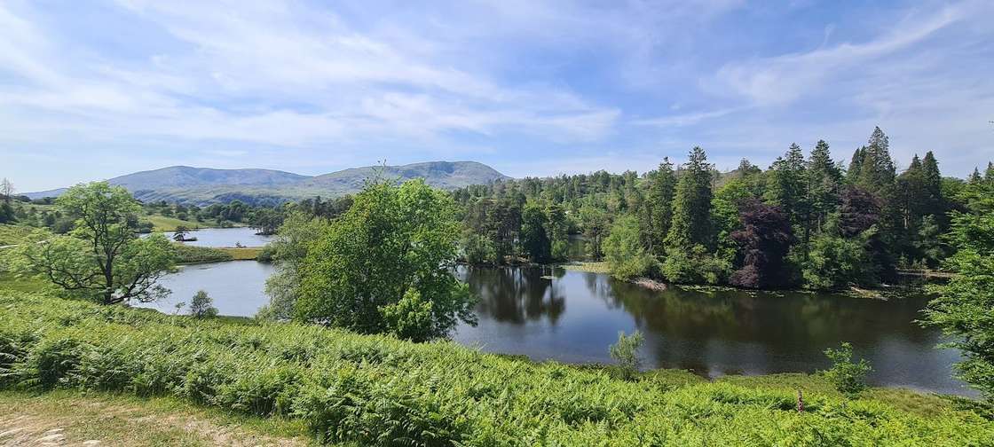
2.92 km · ~61 m ascent · ~½–1 h · loop
Starts at Tarn Hows NT car park · near
Coniston Park: Tarn Hows (NT, paid) · Bus: 505, 1.4 km walk from Holling Brow (near)
🏔️ 🍼 Part-buggy 👶 Young kids 👀 Big view 👣 Good going Easy effort Moderate: navigation
7.41 km · ~66 m ascent · ~1½–2¼ h · loop
Starts at Buttermere village
Park: Buttermere village (LDNPA, paid) · Bus: 77 at the start
🏔️ 👶 Young kids 👀 Big view 👣 Good going Easy effort Moderate: navigation
4.16 km · ~173 m ascent · ~1–1½ h · loop · 1 summit
Park: Windermere Station car park (Northern, paid) · Bus: 505 at the start
👶 Young kids 👀 View 👣 Good going Easy effort Moderate: navigation
1.92 km · ~89 m ascent · ~½–¾ h · loop
Park: Ambleside, King Street (paid) · Bus: 555, 810 m walk from Ambleside, at Hayes Garden Centre
👶 Young kids 👀 Big view 👣 Good going Easy effort Easy: distance, steepness and navigation
2.48 km · ~106 m ascent · ~½–1 h · loop · 1 summit
Starts at Gale Road, Keswick · near
Keswick Park: Latrigg car park (free) · Bus: 554, 2.6 km walk from Keswick, opposite The Pheasant
👶 Young kids 👀 View 👣 Good going Easy effort Moderate: navigation
4.22 km · ~43 m ascent · ~¾–1¼ h · loop
Starts at Keswick town centre · near
Keswick Park: Keswick Rugby Club car park (paid) · Bus: 554 at the start
👶 Young kids 👀 Big view 👣 Good going Easy effort Moderate: steepness
1.98 km · ~165 m ascent · ~½–1 h · out and back · 1 summit
Out and back · Park: unnamed car park south-east of Hallin Fell (free) · Bus: UB1, 530 m walk from Martindale Cattle Grid (near)
👶 Kids (care) 👀 Big view ⚠️ easy-moderate Moderate effort Moderate: distance and navigation
10.71 km · ~288 m ascent · ~2½–3½ h · loop
Starts at Grasmere / Rydal · near
Grasmere Park: Ambleside, Rydal Road (paid) · Bus: 555, 1.6 km walk from Ambleside, at Scandale Bridge
🏔️ 🍼 Part-buggy 👶 Young kids 👀 View 👣 Good going Easy effort Moderate: navigation
7.6 km · ~164 m ascent · ~1¾–2½ h · loop
Starts at Elterwater village · near
Ambleside Park: Elterwater (NT, paid) · Bus: 516 at the start
👶 Young kids 👀 Big view Easy effort Moderate: navigation
5.67 km · ~95 m ascent · ~1¼–1¾ h · loop
Starts at Grasmere village · near
Grasmere Park: Stock Lane Car & Coach Park (LDNPA, paid) · Bus: 555 at the start
🏔️ 👶 Young kids 👀 View 👣 Good going ⚠️ longer (4 mi) but gentle Easy effort Moderate: steepness and navigation
6.46 km · ~216 m ascent · ~1½–2¼ h · loop
Starts at Rydal / Pelter Bridge · near
Grasmere Park: Pelter Bridge, Rydal (paid) · Bus: 555, 2.3 km walk from Rydal, at White Moss Common
👶 Young kids 👀 Big view 👣 Good going Easy effort Easy: distance, steepness, terrain, navigation and exposure
2.66 km · ~34 m ascent · ~½–1 h · loop
Starts at Blea Tarn NT car park
Park: Blea Tarn (NT, paid) · Bus: 516, 2.4 km walk from Old Dungeon Ghyll Hotel
🏔️ 👶 Young kids 👀 View ⚠️ torch for the tunnel; unprotected drops and deep water at the quarry; dogs on leads Easy effort Moderate: navigation
2.2 km · ~92 m ascent · ~½–1 h · loop
Starts at Little Langdale
Bus: 516, 2.2 km walk from Elterwater, opposite The Britannia Inn
🏔️ Watendlath & the packhorse bridge Guide coming
🍼 Part-buggy 👶 Young kids 👀 View 👣 Good going
~1.0 mi · tarn
Starts at Watendlath, Borrowdale
🏔️ 🍼 Part-buggy 👶 Young kids 👀 View 👣 Good going Easy effort Moderate: navigation
1.16 km · ~16 m ascent · ~¼–½ h · out and back
Starts at Borrowdale
Out and back · Park: Quay Foot Quarry, Borrowdale (NT, paid) · Bus: 78 at the start
🏔️ 🍼 Part-buggy 👶 Young kids 👀 View 👣 Good going Easy effort Moderate: navigation
5.87 km · ~56 m ascent · ~1¼–1¾ h · loop
Starts at Loweswater
Park: Maggie's Bridge, Loweswater (NT, paid) · Bus: 77, 3.2 km walk from Lanthwaite Green Farm (opposite)
🏔️ 👶 Young kids 👀 View 👣 Good going ⚠️ flat underfoot but long (8 mi) Moderate effort Moderate: distance
13.17 km · ~191 m ascent · ~2¾–4 h · loop
Starts at Buttermere
Park: Buttermere village (LDNPA, paid) · Bus: 77 at the start
🏔️ 👶 Young kids 👀 View 👣 Good going ⚠️ flat lakeshore but 6 mi round Moderate effort Moderate: distance
9.58 km · ~114 m ascent · ~2–3 h · loop
Starts at Claife / Wray Castle · near
Hawkshead Park: Wray Castle (NT, paid) · Bus: 505, 1.6 km walk from Low Wray, at Wray Castle Road End
🏔️ Fell Foot Park Guide coming
🍼 Pushchair 👶 Young kids 👀 View 👣 Good going
~1.0 mi · lakeshore-park
Starts at Newby Bridge
🏔️ Brockhole grounds & shore Guide coming
🍼 Pushchair 👶 Young kids 👀 View 👣 Good going
~1.0 mi · gardens/lake
🏔️ Wastwater shore (the Screes view) Guide coming
🍼 Part-buggy 👶 Young kids 👀 Big view 👣 Good going
~3.0 mi · lake
Starts at Wasdale
🏔️ Lanty's Tarn & Keldas Guide coming
👶 Young kids 👀 View 👣 Good going
~2.0 mi · tarn/viewpoint
🏔️ Dodd summit (Dodd Wood) Guide coming
👶 Young kids 👀 Big view 👣 Good going
~3.0 mi · forest/view
Starts at Dodd Wood, Bassenthwaite
🏔️ Whinlatter Forest trails Guide coming
🍼 Part-buggy 👶 Young kids 👀 View 👣 Good going
~2.5 mi · forest-trail
🏔️ Grizedale Forest sculpture trail Guide coming
🍼 Part-buggy 👶 Young kids 👣 Good going
~2.5 mi · forest/art
🏔️ Holme Fell Guide coming
👶 Young kids 👀 Big view 👣 Good going
~2.5 mi · small-fell
Starts at Coniston / Yew Tree Tarn · near
Coniston 🏔️ Black Crag (Black Fell) Guide coming
👶 Young kids 👀 View 👣 Good going
~3.0 mi · small-fell
🏔️ Walla Crag Guide coming
👶 Young kids 👀 Big view 👣 Good going
~3.5 mi · viewpoint
Starts at Keswick / Great Wood · near
Keswick 🏔️ Castle Crag (Borrowdale) Guide coming
👶 Kids (care) 👀 Big view ⚠️ steep, loose quarry-spoil path to the summit — not for tiny legs
~4.0 mi · small-fell
Starts at Grange, Borrowdale
🏔️ Silver How Guide coming
👶 Kids (care) 👀 Big view 👣 Good going
~3.0 mi · viewpoint
🏔️ Loughrigg Fell (Ambleside side) Guide coming
👶 Young kids 👀 Big view 👣 Good going
~3.0 mi · viewpoint
🏔️ Jenkin Crag & Stagshaw Guide coming
👶 Young kids 👀 View 👣 Good going
~2.0 mi · viewpoint/woods
Starts at Ambleside / Waterhead · near
Ambleside 🏔️ Todd Crag Guide coming
👶 Young kids 👀 View 👣 Good going
~2.0 mi · viewpoint
🏔️ Stickle Ghyll to Stickle Tarn Guide coming
👶 Kids (care) 👀 Big view ⚠️ steep/rocky — not for tiny legs
~2.5 mi · tarn/waterfall
Starts at Langdale (NT)
🏔️ Colwith Force Guide coming
👶 Young kids 👀 View 👣 Good going
~1.5 mi · waterfall
Starts at Little Langdale
🏔️ Claife Heights / The Station Guide coming
👶 Young kids 👀 View 👣 Good going
~3.0 mi · viewpoint/woods
Starts at Windermere west shore (ferry) · near
Hawkshead 🏔️ Coniston shore & Brantwood Guide coming
🍼 Part-buggy 👶 Young kids 👀 View 👣 Good going
~3.0 mi · lakeshore
🏔️ Beatrix Potter's Hill Top & Near Sawrey Guide coming
🍼 Part-buggy 👶 Young kids 👀 View 👣 Good going
~2.0 mi · village/fields
🏔️ Dunmallard Hill & River Eamont Guide coming
🍼 Part-buggy 👶 Young kids 👀 View 👣 Good going
~1.5 mi · hill/riverside
🏔️ Heughscar Hill Guide coming
👶 Young kids 👀 View 👣 Good going
~3.0 mi · viewpoint/Roman-road
🏔️ Ullswater Way: Pooley Bridge to Howtown Guide coming
👶 Kids (care) 👀 Big view 👣 Good going
~6.5 mi · lakeshore
🏔️ White Moss & the Wordsworth walks Guide coming
🍼 Part-buggy 👶 Young kids 👀 View 👣 Good going
~2.0 mi · woods/lake
Starts at White Moss, Rydal/Grasmere · near
Grasmere 🏔️ Buttermere: Sourmilk Gill & Scale Force fringe Guide coming
👶 Young kids 👀 View
~3.0 mi · waterfall
Starts at Buttermere village
🏔️ Tarn Hows from Coniston (Monk Coniston) Guide coming
👶 Young kids 👀 View 👣 Good going
~5.0 mi · tarn
🏔️ Gowbarrow Fell (Aira Force round) Guide coming
👶 Young kids 👀 Big view 👣 Good going
~3.5 mi · small-fell/falls
👶 Young kids 👀 View Easy effort Moderate: navigation
7.32 km · ~261 m ascent · ~1¾–2¾ h · loop · 3 summits
Starts at Whinlatter - Forestry Commission Car Park
Park: Whinlatter Visitor Centre (paid) · Bus: 77 at the start
🏔️ 👶 Young kids 👀 Big view Easy effort Moderate: terrain
6.42 km · ~202 m ascent · ~1½–2¼ h · loop
Starts at Coniston Village
Park: Coniston, Ruskin Avenue (paid) · Bus: 505 at the start
🏔️ 🍼 Part-buggy Easy effort Moderate: navigation
5.8 km · ~27 m ascent · ~1–1¾ h · out and back
Starts at Coniston, Lake Road
Out and back · Park: Coniston (layby) · Bus: 505, 660 m walk from Coniston, outside John Ruskin School
🏔️ 🍼 Part-buggy Easy effort Easy: distance, steepness, terrain and navigation
6.21 km · ~78 m ascent · ~1¼–2 h · out and back
Starts at Ambleside
Out and back · Park: Ambleside, Market Place (4 on-street bays) · Bus: 555 at the start
🏔️ 👶 Young kids 👀 View Easy effort Easy: distance, steepness, terrain, navigation and exposure
5.94 km · ~68 m ascent · ~1¼–1¾ h · loop
Starts at Ambleside
Park: Ambleside, Rydal Road (paid) · Bus: 555 at the start
🏔️ 🍼 Part-buggy Moderate effort Moderate: distance
9.12 km · ~153 m ascent · ~2–3 h · out and back
Starts at Windermere station
Out and back · Park: Windermere Station car park (Northern, paid) · Bus: 505 at the start
🏔️ Easy effort Moderate: navigation
4.47 km · ~62 m ascent · ~1–1½ h · out and back
Starts at Kentmere
Out and back · Park: Kentmere Institute (donation, very limited)
👶 Young kids 👀 Big view Moderate effort Moderate: distance, steepness, terrain and navigation
9.52 km · ~237 m ascent · ~2¼–3¼ h · out and back
Starts at Grasmere Village
Out and back · Park: Stock Lane Car & Coach Park (LDNPA, paid) · Bus: 555 at the start
🏔️ 👶 Young kids 👀 Big view Easy effort Moderate: steepness, terrain and navigation
7.54 km · ~283 m ascent · ~1¾–2¾ h · loop · 1 summit
Starts at Hawkshead Car Park
Park: Hawkshead Car & Coach Park (paid) · Bus: 505 at the start
🏔️ Easy effort Easy: distance, steepness and navigation
6.54 km · ~189 m ascent · ~1½–2¼ h · one-way
Starts at Ambleside
One-way: finishes at Wray Castle · Start: Ambleside, Low Fold (paid) · Bus: 555, 360 m walk from Ambleside, at Hayes Garden Centre
🏔️ 🍼 Pushchair Easy effort Easy: distance, steepness and navigation
3.16 km · ~162 m ascent · ~¾–1¼ h · one-way
Starts at Ambleside
One-way: finishes at Pine Rigg · Start: Ambleside, Low Fold (paid) · Bus: 555, 350 m walk from Ambleside, at Hayes Garden Centre
🏔️ Easy effort Moderate: navigation
7.57 km · ~94 m ascent · ~1½–2¼ h · out and back
Starts at Ferry House, Far Sawrey
Out and back · Park: Harrowslack (NT, paid)
🏔️ 👶 Young kids 👀 Big view Easy effort Moderate: navigation
6.61 km · ~106 m ascent · ~1½–2 h · loop
Starts at Old Dungeon Ghyll
Park: Old Dungeon Ghyll (NT, paid) · Bus: 516 at the start
🏔️ 👶 Young kids 👀 View 👣 Good going Easy effort Moderate: terrain
4.25 km · ~91 m ascent · ~1–1½ h · loop
Starts at Elterwater Village
Park: Elterwater (NT, paid) · Bus: 516 at the start
No walks match those filters — try removing one.
Common questions
What are the best easy walks in the Lake District? Family favourites include Tarn Hows, the Buttermere lake circuit, Orrest Head, Latrigg and Friar's Crag — low-level lakeshores, waterfalls, tarns and easy viewpoints, all under 500 m of climb. Filter this page by pushchair, young kids, view or feature to find the right one.
Which Lake District walks are pushchair-friendly? Tarn Hows, Friar's Crag and the Derwentwater shore read as pushchair-friendly from OpenStreetMap's mapped surfaces and barriers. We have not walked them with a pushchair, so treat the ‘Pushchair’ filter as what the map says rather than a promise.
What are good Lake District walks with young children? Short, rewarding walks with a feature to aim for work best — a waterfall (Aira Force, Stock Ghyll Force), a tarn (Tarn Hows, Blea Tarn), a stone circle (Castlerigg) or a quick big-view summit (Latrigg). Filter by ‘Young kids’.
Are there flat walks with no big hills? Yes — the lakeshore and valley walks are the flattest: Buttermere, Derwentwater (Friar's Crag), Grasmere, Rydal Water, Elterwater and the Ullswater Way are all gentle, low-level routes.
What are the best short walks for bad weather? Waterfalls are at their best in the rain (Aira Force, Stock Ghyll Force, Skelwith Force), and forest trails (Whinlatter, Grizedale) and short lakeshore strolls give a worthwhile outing without the exposed tops.
Are there easy walks near Keswick, Windermere or Ullswater? Plenty. Near Keswick: Friar's Crag, Latrigg, Castlerigg, Walla Crag. Near Windermere/Ambleside: Orrest Head, Stock Ghyll Force, Brockhole, Jenkin Crag. Near Ullswater: Aira Force, Lanty's Tarn, the Pooley Bridge walks.