Pooley Bridge
Ready for your day: the walks from Pooley Bridge, the tops above it, and the bus to the start.
Daylight on 27 October: sunrise 07:03, sunset 16:46
The tops Decent on Hallin Fell and Little Mell Fell, the best of the 4 fells nearest Pooley Bridge verdicts for 27 October
Choose from all 3 walksExplore the map
A walk can have more than one way to its start. Verdicts: the site’s scorer reading the weather on each top, not whether a walk suits you. Daylight: worked out for the centre of Pooley Bridge; a latest start assumes a steady pace and an hour in hand before dusk, a computed time, not a guarantee. How we check →
First light
The sun reaches the Pooley Bridge start about 08:30 in October · sunrise 07:40
From the terrain around the start (Copernicus GLO-30), mid-month · how we work it outThe last bus
From Pooley Bridge Inn:
Towards Windermere Bus Rail Interchange (508): 19:20, every day.
Towards Basecamp Nth Lakes (UB1): 18:36, every day.
Towards Aira Force (UB2): 16:32, every day.
Signed off per direction against the operator’s timetable, 7 September · the bus mapA day from Pooley Bridge
On the fells
Verdicts for 27 October, lowest fell first:
- Hallin Fell 388 m Decent
- Little Mell Fell 505 m Decent
- Bonscale Pike 524 m Save it
- Arthur's Pike 533 m Save it
On the water
Ullswater 'Steamers' on Ullswater: Sails nearly every day of the year, on a timetable that changes through the year; wind at Pooley Bridge cuts the service to Glenridding to Howtown. The Aira Force pier is closed until the operator reopens it (still closed when we last checked, 24 September 2026).
Landings: Glenridding, Howtown, Pooley Bridge
Landing seasons as of 27 October; the operator’s page read 17 September · Ullswater 'Steamers'’s own timetable and status (opens in new tab)Mountain forecast
Met Office mountain forecast for the Lake District (opens in new tab)
The forecasters’ own words for the tops.Explore Pooley Bridge
The walks from Pooley Bridge on one map, with the fells above them, the buses that reach their starts, and where to park. Choose a walk to see how you reach its start; everything on the map is in the lists below it.
An overview, not a navigation map: carry a map and compass on the fell. Lines are simplified from our GPX; distances to a stop or landing are on foot, the others in a straight line. Map data © OpenStreetMap contributors, SRTM; map style © OpenTopoMap (CC-BY-SA).
The walks on the map
3 walks that start within 5 km of Pooley Bridge, as Walks from Pooley Bridge lists them, the ones you reach on foot first, then by bus, then by car; shortest first within each:
All 3 walks
Each filter reads the walk’s own card: how you reach the start is its lines below; effort is its band, the size of the day from the distance and the climb; length is its distance in the route pages’ length grades. One answer to each question; the map shows the same walks.
Heughscar Hill & Arthur's Pike
11.68 km · ~437 m up · ~3–4¼ h
Moderate effort Moderate: distance, steepness and navigation
Measured from the GPX track: the distance; the steepest sustained climb, about 19%. Navigation: estimated from the map, not checked on the ground.
Starts at Pooley Bridge
- On foot from the village starts by the bus stop at Pooley Bridge Inn
- By bus 508 at the start
- By car park at Pooley Bridge, Finkle Street car park (free)
Pooley Bridge to Shap
15.4 km · ~382 m up · ~3½–5 h
Moderate effort Hard: distance and navigation
Measured from the GPX track: the distance. Navigation: estimated from the map, not checked on the ground.
Starts at Pooley Bridge · One-way: finishes 12.8 km from the start in a straight line
- On foot from the village starts by the bus stop at Pooley Bridge Inn
- By bus 508 at the start
- By car start at Eusemere Car Park (LDNPA, paid)
The Mell Fells & Gowbarrow Fell
15.78 km · ~776 m up · ~4¼–6 h
Hard effort Hard: distance and steepness
Measured from the GPX track: the distance; the steepest sustained climb, about 26%.
Starts at The Hause
- By bus UB1, 1.0 km walk from Horrockwood, opposite The Quiet Site
- By car park at Roadside parking for Watermillock Fell (free)
The fells on the map
Verdicts for 27 October, lowest fell first:
- Dunmallet (Dunmallard Hill) 240 m Not scored
- Heughscar Hill 375 m Not scored
- Little Mell Fell 505 m Decent
- Bonscale Pike 524 m Save it
- Arthur's Pike 533 m Save it
Buses, stops and the boats
The buses that call in Pooley Bridge:
- The 508
- The UB1: seasonal, Saturdays and Sundays from 5 September 2026 to 1 November 2026; and on 15 listed dates, 7 September 2026 to 25 September 2026
Their stops on this map:
- Aira Force, Matterdale: the 508 and UB1 · stop pages: one side of the road, the other side
- Another Place, Watermillock: the UB1 · stop pages: one side of the road, the other side
- Brackenrigg Inn, Watermillock: the 508 and UB1 · stop pages: one side of the road, the other side
- Brook House Farm, Matterdale End: the UB1 · stop pages: one side of the road, the other side
- Bus Shelter, Glenridding: the 508 · stop page
- Caravan Park, Waterfoot: the UB1 · stop page
- Cattle Grid, Martindale: the UB1 · stop pages: one side of the road, the other side
- Church, Barton: the 508 · stop pages: one side of the road, the other side
- Dobbin Wood Lodge, Matterdale: the 508 and UB1 · stop pages: one side of the road, the other side
- Glencoyne car park, Ullswater: the 508 · stop pages: one side of the road, the other side
- Gowbarrow Cottages, Knotts: the 508 and UB1 · stop pages: one side of the road, the other side
- Hall, Patterdale: the 508 · stop pages: one side of the road, the other side
- Leeming House Hotel, Knotts: the 508 and UB1 · stop pages: one side of the road, the other side
- Longthwaite road end, Watermillock: the 508 · stop pages: one side of the road, the other side
- Mains Farm, Pooley Bridge: the 508 · stop pages: one side of the road, the other side
- Park Foot Holiday Park, Barton: the UB1 · stop pages: one side of the road, the other side
- Patterdale Hotel: the 508 · stop pages: one side of the road, the other side
- Pier, Howtown: the UB1 · stop pages: one side of the road, the other side
- Pooley Bridge Inn: the 508 and UB1 · stop page
- Rookin House, Troutbeck: the UB1 · stop pages: one side of the road, the other side
- Seldom Seen Track End, Ullswater: the 508 · stop page
- Seldom Seen Track End, Ullswater: the 508 · stop page
- Stybarrow Crag, Ullswater: the 508 · stop pages: one side of the road, the other side
- The Quiet Site, Horrockwood: the UB1 · stop page
- The Royal Hotel, Dockray: the UB1 · stop pages: one side of the road, the other side
- Turn for Hilcroft Park, Sharrow Bay: the UB1 · stop page
- Turn for Hillcroft Park, Sharrow Bay: the UB1 · stop page
- Turn for Wreay Mansions, Horrockwood: the UB1 · stop pages: one side of the road, the other side
- Ullswater Guest House, Pooley Bridge: the 508 and UB1 · stop page
- Ullswater Holiday Park, Horrockwood: the UB1 · stop pages: one side of the road, the other side
- Ullswater Steamer Pier, Pooley Bridge: the 508 and UB1 · stop pages: one side of the road, the other side
- Ullswater Yacht Club, Howtown: the UB1 · stop pages: one side of the road, the other side
- Waterside Farm Camp Site, Howtown: the UB1 · stop page
- Waterside Farm Holiday Park, Howtown: the UB1 · stop page
- Youth Hostel, Patterdale: the 508 · stop pages: one side of the road, the other side
Landings (Ullswater 'Steamers' (opens in new tab) on Ullswater), as of 27 October:
- Glenridding, on Ullswater
- Howtown, on Ullswater
- Pooley Bridge, on Ullswater
Where the buses stop and where the boats land, not when: the stop and route pages have the timetables, and the operator’s own page says whether a boat is running today.
Car parks and toilets
- Pooley Bridge, Finkle Street car park (free) · in Parking near Pooley Bridge
- Eusemere Car Park (LDNPA, paid) (pay and display, Lake District National Park Authority) · in Parking near Pooley Bridge
- Dunmallard Hill, Pooley Bridge (LDNPA, paid) (pay and display, Lake District National Park Authority) · in Parking near Pooley Bridge
- Sunnyside Car Park (paid) · in Parking near Pooley Bridge
- B5320, Pooley Bridge (layby) (free) · in Parking near Pooley Bridge
- Pooley Bridge, High Street (layby) (free) · in Parking near Pooley Bridge
Toilets near those car parks:
- Pooley Bridge (accessible, RADAR key), about 64 m from Pooley Bridge, Finkle Street car park (free) in a straight line
- Public toilets (free), about 1561 m from Pooley Bridge, Finkle Street car park (free) in a straight line
Pooley Bridge at a glance
Pooley Bridge is the lively little village at the northern foot of Ullswater, where the lake empties into the River Eamont on its way to Penrith. It is the busier, more open end of the lake — a cluster of pubs, cafés and shops around the green, the northern steamer pier, the start (or finish) of the Ullswater Way, some of the Lake District's biggest camping and caravan parks, and the famous bridge that was washed away in the 2015 floods and rebuilt in 2020. Just up the road sits Dalemain, the historic house and gardens.
It makes an excellent, easy-access base: barely five miles from Penrith and the M6 (Junction 40), well set up for families and campers, and the gateway to two very different walking worlds — the gentle low fells right above the village, and the quiet, beautiful Howtown and Martindale fells down the eastern shore.
Quick facts
| Where | Eastern Lake District, Cumbria — at the northern foot of Ullswater, ~5 miles from Penrith |
|---|---|
| Lake & river | At the foot of Ullswater; the River Eamont flows out here towards Penrith |
| Train station | None — nearest is Penrith (~5 miles, M6 J40), then the 508 bus along Ullswater |
| Getting there | By car on the A592 off the A66/M6 at Penrith; quick to reach compared with the head of the lake |
| Famous for | The rebuilt bridge, the Ullswater steamers, big camping sites, and Dalemain nearby |
| Dogs | Very dog-friendly — the lake shore, the fells, the steamers (on a lead) and most pubs |
| Weather | Mild but wet; a touch lower and gentler than the head of the lake — pack waterproofs |
Why is Pooley Bridge famous? Is it worth visiting?
Yes — Pooley Bridge is well worth a visit, especially if you want easy access, the lake and a family-friendly base rather than a remote mountain village. It is famous on several counts.
First, Ullswater itself begins here, and the steamers run from the village pier down to Howtown and Glenridding. Second, the bridge: the loss of the old 18th-century bridge in the 2015 floods, and its striking steel replacement, made national news and is the thing many people now associate with the name (see below). Third, camping — this is a big camping and caravanning corner of the Lakes, with several large, lakeside-ish holiday parks. And fourth, it is the gateway to the quiet eastern fells — the Howtown and Martindale country that sees a fraction of the crowds of the central Lakes.
Add Dalemain (the historic house, gardens and famous Marmalade Festival) a mile up the road, good dog-friendly pubs, and the easy run to Penrith and the M6, and Pooley Bridge punches well above its size. Check the live "Best fells today" conditions before heading for the tops.
What happened to Pooley Bridge? The bridge
The question many people ask — and the village's big recent story. The original three-arch stone bridge of 1764 carried the road over the River Eamont for two and a half centuries until, on 6 December 2015, Storm Desmond brought record rainfall to the Ullswater fells; the swollen Eamont scoured away the riverbed around the bridge's piers and the historic bridge collapsed and was washed away.
For several years the village made do with a temporary footbridge and a long road diversion. Its replacement, opened to traffic in October 2020 (and lifted into place earlier that year), is a single graceful span — the first stainless-steel road bridge in the UK — designed to clear the river in one arch so scour can't undermine it again, while echoing the curve of the old stone bridge it replaced. It has quickly become a landmark in its own right.
Ullswater, the steamers & the Ullswater Way
Pooley Bridge sits at the foot of Ullswater, and the lake is the centre of everything here.
- The Ullswater 'Steamers' — the historic launches call at the Pooley Bridge pier, running down the lake to Howtown and on to Glenridding at the head. The classic, much-loved outing is to sail one way and walk back along the shore.
- The Ullswater Way — Pooley Bridge is the northern end of the 20-mile waymarked circuit of the whole lake (Pooley Bridge, Howtown, Glenridding, Aira Force and back). Most visitors walk a scenic section and use the steamer or bus to complete the loop rather than doing all 20 miles.
- "Can you walk from Pooley Bridge to Howtown?" — yes: the eastern-shore path is a beautiful stretch of the Ullswater Way. The popular way to do it is to take the steamer to Howtown and walk the shore back to Pooley Bridge (about 6–7 miles) — and see the first-hand note in Getting there & around on why the steamer beats driving that way.
- There is swimming, paddleboarding and boat hire on the lake, and a pleasant green and playground by the water for families.
Walks & fells from Pooley Bridge
The walking here splits neatly into the easy fells right above the village and the quieter, higher Howtown/Martindale fells down the eastern shore. Always check the live conditions first.
Right above the village (easy):
- Heughscar Hill — the obvious low fell behind Pooley Bridge, crossed by the High Street Roman road (cobbles still visible) and the limestone of Heugh Scar; a short walk for a big, gentle view over the foot of Ullswater.
- Dunmallard Hill — the little wooded, conical hill right by the bridge (an Iron Age hillfort site); a quick, shady stroll from the village.
The Howtown & Martindale fells (down the eastern shore):
- Hallin Fell — the celebrated short, steep little fell above Howtown that gives one of the best views-for-effort in the whole Lake District — a family favourite from the steamer pier.
- Steel Knotts, Beda Fell and Place Fell — the shapely fells ringing the quiet valleys of Martindale and Boredale.
- The Martindale / Fusedale round — a fine, lonely horseshoe on the High Street side over Arthur's Pike, Bonscale Pike, Loadpot Hill and Wether Hill, with the old Roman High Street running the ridge.
A first-hand tip: for the Howtown and Martindale fells, take the Ullswater Steamer to Howtown rather than driving — the narrow eastern-shore road gets badly congested, and the steamer-and-walk is genuinely faster and far nicer. More on this in Getting there & around.
Use the fells on the map in Explore Pooley Bridge, above, and the live "Best fells today" conditions to pick the right hill.
Cloud on the tops? Good walks in poor weather & low cloud lists the lower-risk routes we would try first: easy to navigate, low in exposure, never 'safe'.
The walks from Pooley Bridge are in Explore Pooley Bridge above, on one map and in a list you can filter by how you reach the start.
Places nearby: Ullswater · Aira Force
Camping & where to stay
Pooley Bridge is a major camping and caravanning base, with several large holiday parks around the foot of the lake, as well as inns, guest houses and B&Bs.
- Park Foot Holiday Park — the big, well-known park on the Howtown road, with camping, touring pitches, lodges and pods, and its own bar and amenities. On the much-searched "discount code for Park Foot" question: book through the official site for current prices and any genuine offers — and be wary of third-party sites advertising "codes" (we won't invent one).
- Waterside House and Hillcroft Park — two more large, popular camping/caravan/pod sites near the village and the lake shore.
- The Pooley Bridge Inn — the landmark inn in the centre of the village, recently given a £1m refurbishment by Robinsons Brewery: a traditional, dog- and child-friendly bar with open fires and 12 refurbished en-suite rooms (see Food & drink).
- The Crown Inn and The Sun Inn — village pubs with rooms, plus a range of guest houses, B&Bs and self-catering in and around Pooley Bridge.
→ Always book the holiday parks via their official sites for the live price; never use a third-party "discount code."
Things to do, a day, a rainy day & with kids
- Ride the Ullswater Steamers from the pier — the signature Pooley Bridge outing, in any weather.
- Visit Dalemain — the historic house and gardens a mile towards Penrith, home of the famous Marmalade Festival; a great rainy-day or with-kids option.
- Climb Hallin Fell from Howtown (off the steamer) for a huge view with little effort — superb with children.
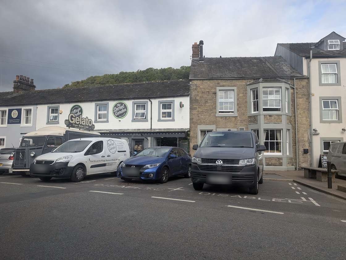
- The Secret Garden tearoom and the village cafés for coffee and cake; the green and playground by the lake for little ones.
- Swim or paddle in Ullswater from the shore on a warm day.
- A rainy day: the steamers run whatever the weather, Dalemain's house is indoors, and Penrith (shops, castle, museum) is ten minutes away.
Food & drink
For a small village, Pooley Bridge is well served — and for a big supermarket shop, Penrith is only five miles off.
- The Pooley Bridge Inn — the central village inn, given a recent £1m Robinsons Brewery refurbishment: a traditional bar with open fires welcoming dogs and children, and a menu of pub classics, pies and local steaks. The answer to "what makes the Pooley Bridge Inn special?" is essentially that — a smartly restored landmark inn at the heart of the village, moments from the lake.
- Dog-friendly pubs — to the much-asked "best dog-friendly pub": the Crown Inn and the Sun Inn, like the Pooley Bridge Inn, welcome dogs and walkers.
- The Secret Garden café/tearoom for coffee, lunch and cake.
- Shops — to "does Pooley Bridge have shops?": yes, for a small village — a village shop/store and a handful of independents around the green for essentials, gifts and outdoor bits, though a full shop means Penrith.
Weather & when to visit
Pooley Bridge has the classic, honest Lakeland climate — mild, green and frequently wet — though, at the lower, northern foot of the lake, it is a touch gentler than the head of Ullswater. Late spring and early autumn give a good balance of long days and settled spells; high summer is the busy camping season and the car parks and holiday parks fill early; the Howtown and Martindale fells are at their best in clear conditions, while the lakeside and the easy fells above the village are rewarding year-round. Whatever the season, check the live "Best fells today" conditions and the mountain forecast before heading up.
Getting there, parking & getting around
Without a car: The nearest stations as the crow flies are Penrith (North Lakes) (7 km away) and Langwathby (14 km away); the 508, 509, UB1 and UB2 stop at Pooley Bridge Inn, 0.0 km from here in a straight line. The UB1 and UB2 run until 1 November 2026, the last day of their season. The bus map has every stop we hold.
There is no railway station in Pooley Bridge. The nearest is Penrith (~5 miles, on the West Coast Main Line and the M6 at Junction 40), which makes Pooley Bridge one of the quickest Ullswater villages to reach. By car it is a short run on the A592 off the A66.
Parking, toilets and buses: Parking near Pooley Bridge
Arrive early on fine summer days, when the campsites and the lake bring the crowds.
By bus, the 508 (Penrith–Ullswater–Windermere) serves the village.
First-hand local notes — two things worth knowing:
- Don't drive to Howtown and Martindale if you can help it. The narrow eastern-shore road from Pooley Bridge to Howtown gets very congested, especially in season — for those fells (Hallin Fell, the Martindale round), take the Ullswater Steamer to Howtown instead. It is genuinely faster and far nicer than crawling along the lane, and you arrive at the foot of the fells by the pier.
- Check which way the bus is actually going. The Ullswater bus loops into Pooley Bridge and back out the same way, and the service runs through in both directions — towards Penrith one way, and towards Keswick/Glenridding the other. A bus sitting at the Pooley Bridge stop can be on either leg, so check the destination on the front before you board rather than assuming — it is an easy way to end up heading the wrong way.
Parking near Pooley Bridge
Toilets, food and shops near these car parks
Toilets: Public toilets (opens in new tab) (about 1561 m from Pooley Bridge, Finkle Street car park (free), straight line, free)
Cafes: Secret Garden (opens in new tab), Pooley Bridge Pier House (opens in new tab), Granny Dowbekins Tea Rooms (opens in new tab)
Pubs: The Sun Inn (opens in new tab), Pooley Bridge Inn (opens in new tab), Crown Inn (opens in new tab)
Shops: The Barn (opens in new tab)
All the car parks around Pooley Bridge on the parking map →
Straight-line distances from the centre of Pooley Bridge. We publish whether a car park charges, and who runs it, but never the price — tariffs change and a stale one is worse than none, so check the sign or the operator’s own site on the day.
Vehicles are left entirely at their owner’s risk. We list places people park; we cannot vouch for any of them. Judge it on the day: take valuables with you, leave nothing on show, and if a spot feels wrong when you get there, park somewhere else.
Can you stay overnight?
- Eusemere Car Park (LDNPA, paid) — run by Lake District National Park Authority, which does not permit overnight parking. “The only legal places to park are on formal camp sites.” (checked 2026-08-05)
These are the land managers’ and the council’s own published rules, quoted. Where a car park is not listed here we have found no published rule for it, which is not the same as permission.
Getting there across the Lake District: Buses · Parking map · By train · By boat
Practical info
- Dogs: very welcome — the lake shore, the fells, the steamers (on a lead) and the village pubs.
- Toilets: public toilets in the village centre, by the bridge.
- Cash & cards: card is accepted widely; cash machines are limited in such a small village, so draw cash in Penrith if you need it.
- EV charging: limited in the village — check your charging app before relying on it; Penrith has more.
- Mountain Rescue & safety: the area is covered by Patterdale Mountain Rescue Team; mobile signal is patchy on the eastern fells, so carry a map and compass. In an emergency, call 999 and ask for Police, then Mountain Rescue.
Day trips & nearby
- Dalemain — the historic house, gardens and Marmalade Festival, a mile towards Penrith.
- Penrith — the nearest market town (~5 miles): shops, the castle, services and the railway.
- Askham & Lowther — the pretty estate village of Askham and the Lowther Castle ruins, gardens and adventure playground, a short drive east.
- Aira Force — the National Trust's dramatic waterfall down the western shore of Ullswater.
- Glenridding & Patterdale — the villages at the head of Ullswater, the base for Helvellyn and St Sunday Crag; reachable by steamer, the 508 or the Ullswater Way.
- Howtown — the quiet hamlet down the eastern shore, the steamer halfway-stop and the start for Hallin Fell and Martindale.
- Haweswater — the wild, quiet reservoir-valley over the fells to the south-east, for a real away-from-it-all day.
Frequently asked questions about Pooley Bridge
What makes the Pooley Bridge Inn special?
Sources: Robinsons Brewery — Pooley Bridge Inn reopens after £1m investment (opens in new tab)
What happened to Pooley Bridge — and the bridge itself?
Sources: New Civil Engineer — Pooley Bridge steel structure (opens in new tab)
Is Pooley Bridge worth visiting?
Can you walk from Pooley Bridge to Howtown?
Where is Pooley Bridge, what lake is it on, and what river runs through?
Where is the best place to park at Pooley Bridge?
Is there a discount code for Park Foot Holiday Park?
What's the best dog-friendly pub in Pooley Bridge?
Should I drive to Howtown and Martindale, or take the steamer?
How do I catch the right bus at Pooley Bridge — it seems to go both ways?
Sources: Ullswater bus 509 — Keswick, Pooley Bridge, Penrith (opens in new tab)
Events across the Lake District
Planning a trip around a show or festival? See our Lake District events & festivals guide for what's on near Pooley Bridge — traditional Lakeland sports, agricultural shows and seasonal events, month by month.