Patterdale
Ready for your day: the walks from Patterdale, the tops above it, and the bus to the start.
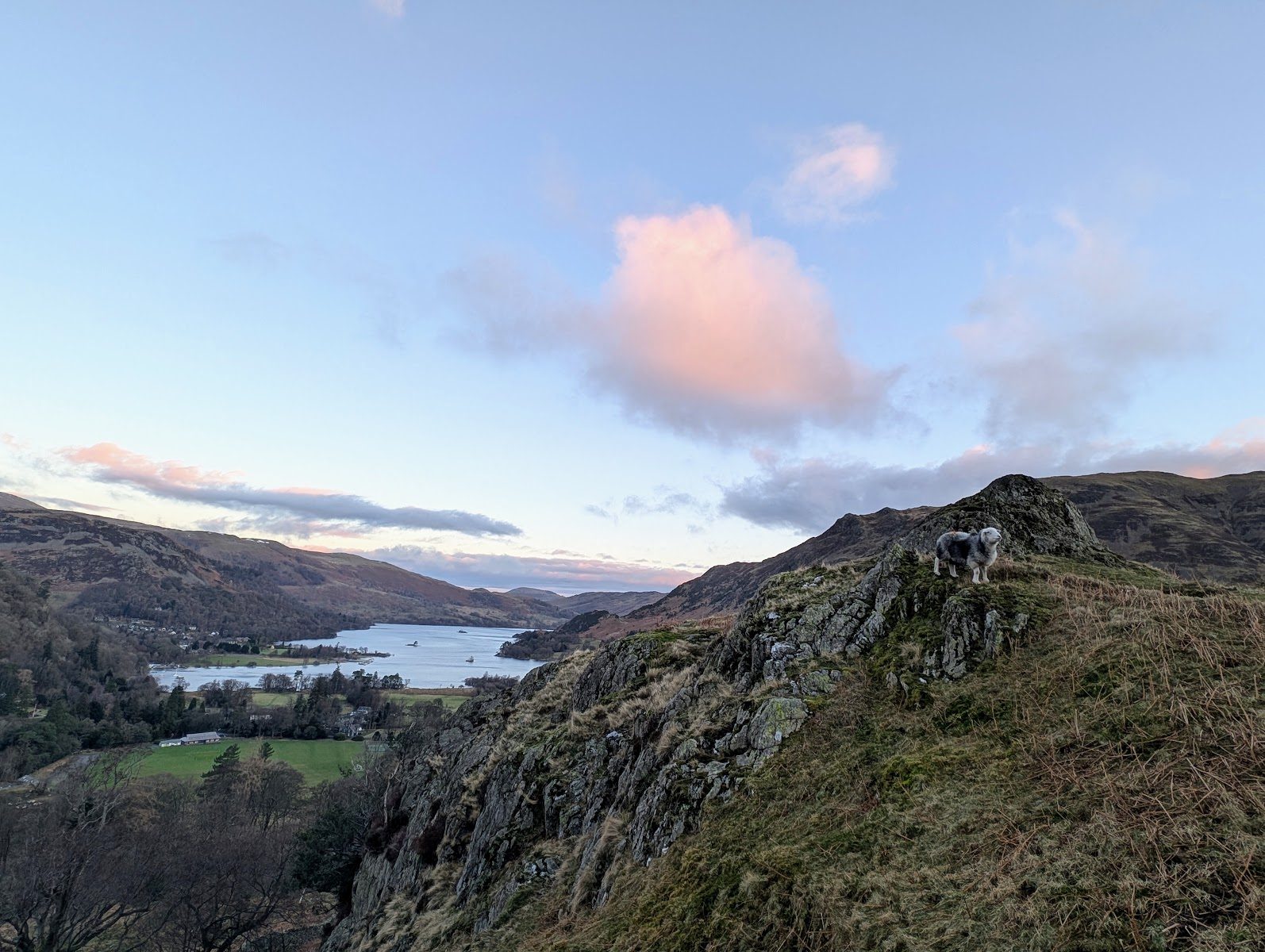
Daylight on 27 October: sunrise 07:03, sunset 16:47
The tops Decent on Arnison Crag, the best of the 6 fells nearest Patterdale: dry verdicts for 27 October
Choose from all 19 walksExplore the map
A walk can have more than one way to its start. Verdicts: the site’s scorer reading the weather on each top, not whether a walk suits you. Daylight: worked out for the centre of Patterdale; a latest start assumes a steady pace and an hour in hand before dusk, a computed time, not a guarantee. How we check →
First light
The sun reaches the Patterdale start about 09:11 in October · sunrise 07:41
From the terrain around the start (Copernicus GLO-30), mid-month · how we work it outThe last bus
From Patterdale Hotel (opposite):
Towards Windermere Bus Rail Interchange (508): 19:46, every day.
Towards Hartsop road end (509): 15:09, every day.
Signed off per direction against the operator’s timetable, 7 September · the bus mapA day from Patterdale
On the fells
Verdicts for 27 October, lowest fell first:
- Arnison Crag 433 m Decent
- Glenridding Dodd 442 m Save it
- Angletarn Pikes (Angletarn Pikes North Top) 566 m Save it
- Birks 624 m Save it
- Place Fell 657 m Save it
- Birkhouse Moor 718 m Save it
On the water
Ullswater 'Steamers' on Ullswater: Sails nearly every day of the year, on a timetable that changes through the year; wind at Pooley Bridge cuts the service to Glenridding to Howtown. The Aira Force pier is closed until the operator reopens it (still closed when we last checked, 24 September 2026).
Landings: Glenridding, Howtown, Pooley Bridge
Landing seasons as of 27 October; the operator’s page read 17 September · Ullswater 'Steamers'’s own timetable and status (opens in new tab)Mountain forecast
Met Office mountain forecast for the Lake District (opens in new tab)
The forecasters’ own words for the tops.Explore Patterdale
The walks from Patterdale on one map, with the fells above them, the buses that reach their starts, and where to park. Choose a walk to see how you reach its start; everything on the map is in the lists below it.
An overview, not a navigation map: carry a map and compass on the fell. Lines are simplified from our GPX; distances to a stop or landing are on foot, the others in a straight line. Map data © OpenStreetMap contributors, SRTM; map style © OpenTopoMap (CC-BY-SA).
The walks on the map
19 walks that start within 5 km of Patterdale, as Walks from Patterdale lists them, the ones you reach on foot first, then by bus, then by car; shortest first within each:
All 19 walks
Each filter reads the walk’s own card: how you reach the start is its lines below; effort is its band, the size of the day from the distance and the climb; length is its distance in the route pages’ length grades. One answer to each question; the map shows the same walks.
Patterdale to Silver Point and Back
6.5 km · ~118 m up · ~1½–2 h
Easy effort Moderate: navigation
Navigation: estimated from the map, not checked on the ground.
Out and back
- On foot from the village a loop that starts and ends in Patterdale
- By car park at Patterdale Hotel Car Park (Patterdale Hotel, paid)
Place Fell and The Knight
7.28 km · ~547 m up · ~2¼–3¼ h
Moderate effort Hard: steepness
Measured from the GPX track: the steepest sustained descent, about 35%.
- On foot from the village a loop that starts and ends in Patterdale
- By car park at Patterdale Hotel Car Park (Patterdale Hotel, paid)
St Sunday Crag
10.22 km · ~838 m up · ~3¼–4¾ h
Moderate effort Severe: steepness
Measured from the GPX track: the steepest sustained descent, about 43%.
- On foot from the village a loop that starts and ends in Patterdale
- By car park at Patterdale Hotel Car Park (Patterdale Hotel, paid)
Patterdale to Hartsop and Brothers Water
11.48 km · ~169 m up · ~2½–3½ h
Moderate effort Hard: navigation
Navigation: estimated from the map, not checked on the ground.
- On foot from the village a loop that starts and ends in Patterdale
- By car park at Patterdale Hotel Car Park (Patterdale Hotel, paid)
Grisedale Tarn, Fairfield, St Sunday Crag from Patterdale
15.92 km · ~983 m up · ~4¾–6½ h
Hard effort Severe: steepness
Measured from the GPX track: the steepest sustained climb, about 41%.
- On foot from the village a loop that starts and ends in Patterdale
- By car park at Patterdale Hotel Car Park (Patterdale Hotel, paid)
Lanty's Tarn and Glenridding Beck
3.11 km · ~126 m up · ~¾–1¼ h
Easy effort Moderate: steepness and navigation
Measured from the GPX track: the steepest sustained climb, about 18%. Navigation: estimated from the map, not checked on the ground.
Starts at Glenridding
- By bus 508 at the start
- By car park at Beckside Car Park (paid)
Aira Force & Gowbarrow Fell
6.88 km · ~341 m up · ~1¾–2¾ h
Easy effort Hard: steepness
Measured from the GPX track: the steepest sustained climb, about 27%.
Starts at Aira Force (NT, paid)
- By bus 508 at the start
- By car park at Aira Force (NT, paid)
Hartsop Dodd, Stony Cove Pike, Thornthwaite Crag and Gray Crag
10 km · ~858 m up · ~3¼–4¾ h
Moderate effort Severe: steepness
Measured from the GPX track: the steepest sustained climb, about 51%.
Starts at Hartsop village
- By bus 508, 590 m walk from Hartsop, adjacent to road end
- By car park at Hartsop village (donation)
Middle Dodd Little Hart Crag and High Hartsop Dodd
10.42 km · ~743 m up · ~3¼–4½ h
Moderate effort Severe: steepness
Measured from the GPX track: the steepest sustained climb, about 53%.
Starts at Cow Bridge
- By bus 508 at the start
- By car park at Cow Bridge, Hartsop (paid)
Hartsop Fells and Hart Crag
11.87 km · ~837 m up · ~3¾–5¼ h
Moderate effort Severe: steepness
Measured from the GPX track: the steepest sustained descent, about 41%.
Starts at Cow Bridge
- By bus 508 at the start
- By car park at Cow Bridge, Hartsop (paid)
Birketts by Gowbarrow
12.03 km · ~591 m up · ~3¼–4¾ h
Moderate effort Hard: steepness and navigation
Measured from the GPX track: the steepest sustained descent, about 27%. Navigation: estimated from the map, not checked on the ground.
Starts at Aira Force (NT, paid)
- By bus 508 at the start
- By car park at Aira Force (NT, paid)
Helvellyn via Striding Edge & Swirral Edge
12.71 km · ~948 m up · ~4–5½ h
Hard effort Severe: terrain, navigation and exposure
Exposure, terrain and navigation: our judgement from the map and the route’s record; that stretch not walked.
Starts at Glenridding
- By bus 508 at the start
- By car park at Beckside Car Park (paid)
Caudale Moor & St Raven's Edge
12.96 km · ~732 m up · ~3¾–5¼ h
Moderate effort Severe: steepness
Measured from the GPX track: the steepest sustained climb, about 50%.
Starts at Hartsop village
- By bus 508, 570 m walk from Hartsop, adjacent to road end
- By car park at Hartsop village (donation)
Swineside Knott & Gowbarrow
13.27 km · ~657 m up · ~3¾–5 h
Moderate effort Hard: steepness
Measured from the GPX track: the steepest sustained climb, about 29%.
Starts at Aira Force (NT, paid)
- By bus 508 at the start
- By car park at Aira Force (NT, paid)
Gowbarrow Fell and Little Mell Fell
15.11 km · ~713 m up · ~4–5¾ h
Hard effort Hard: distance
Measured from the GPX track: the distance.
- By bus 508, 470 m walk from Matterdale, opposite Aira Force
- By car park at Aira Force (NT, paid)
Glenridding Dodd, Sheffield Pike, Catstye Cam, Birkhouse Moor
15.58 km · ~1269 m up · ~5–7 h
Severe effort Hard: distance, steepness, terrain, navigation and exposure
Measured from the GPX track: the distance; the steepest sustained climb, about 34%. Exposure, terrain and navigation: graded by Lee on the ground.
Starts at Glenridding
- By bus 508 at the start
- By car park at Beckside Car Park (paid)
Brock Crags, Angletarn Pikes, Beda Fell & Place Fell
19.71 km · ~1072 m up · ~5½–7¾ h
Hard effort Hard: distance and steepness
Measured from the GPX track: the distance; the steepest sustained descent, about 27%.
- By bus 508, 580 m walk from Hartsop, adjacent to road end
- By car park at Hartsop village (donation)
Angletarn Pikes and the Martindale round
22.23 km · ~1402 m up · ~6¾–9¼ h
Severe effort Severe: distance
Measured from the GPX track: the distance.
- By bus 508, 560 m walk from Hartsop, adjacent to road end
- By car park at Hartsop village (donation)
Finishing of the Far Eastern Fells
22.5 km · ~1294 m up · ~6½–9 h
Severe effort Severe: distance
Measured from the GPX track: the distance.
One-way: finishes 2.9 km from the start in a straight line
- By bus 508 at the start
- By car start at Cow Bridge, Hartsop (paid)
The fells on the map
Verdicts for 27 October, lowest fell first:
- Arnison Crag 433 m Decent
- Glenridding Dodd 442 m Save it
- Beda Fell (Beda Head) 509 m Decent
- Brock Crags (Wainwright) 561 m Save it
- Angletarn Pikes (Angletarn Pikes North Top) 566 m Save it
- The Nab 576 m Save it
- Hartsop Above How (Gill Crag) 586 m Save it
- Hartsop Dodd 619 m Save it
- Birks 624 m Save it
- Place Fell 657 m Save it
- Sheffield Pike 676 m Save it
- Rest Dodd 696 m Save it
- Birkhouse Moor 718 m Save it
- St Sunday Crag 841 m Save it
- Catstye Cam 890 m Save it
Buses, stops and the boats
The buses that call in Patterdale:
Their stops on this map:
- Aira Force, Matterdale: the 508 and 509 · stop pages: stop 1, stop 2, stop 3, stop 4
- Bridge End phone box, Patterdale: the 508 and 509 · stop page
- Bridgend, Patterdale: the 508 and 509 · stop page
- Brook House Farm, Matterdale End: the 509 · stop pages: one side of the road, the other side
- Brotherswater Inn, Hartsop: the 508 · stop pages: one side of the road, the other side
- Bus Shelter, Glenridding: the 508 and 509 · stop page
- Cow Bridge car park, Hartsop: the 508 and 509 · stop page
- Cow Bridge, Hartsop: the 508 and 509 · stop page
- Dobbin Wood Lodge, Matterdale: the 508 · stop pages: one side of the road, the other side
- Glencoyne car park, Ullswater: the 508 and 509 · stop pages: one side of the road, the other side
- Gowbarrow Cottages, Knotts: the 508 · stop pages: one side of the road, the other side
- Hall, Patterdale: the 508 and 509 · stop pages: one side of the road, the other side
- Hartsop Hall camp site: the 508 · stop page
- Hartsop Hall Campsite: the 508 · stop page
- Leeming House Hotel, Knotts: the 508 · stop pages: one side of the road, the other side
- Longthwaite road end, Watermillock: the 508 · stop pages: one side of the road, the other side
- Pass Inn, Kirkstone: the 508 · stop pages: one side of the road, the other side
- Patterdale Hotel: the 508 and 509 · stop pages: one side of the road, the other side
- road end, Hartsop: the 508 and 509 · stop pages: one side of the road, the other side
- Seldom Seen Track End, Ullswater: the 508 and 509 · stop page
- Seldom Seen Track End, Ullswater: the 508 and 509 · stop page
- Stybarrow Crag, Ullswater: the 508 and 509 · stop pages: one side of the road, the other side
- The Royal Hotel, Dockray: the 509 · stop pages: one side of the road, the other side
- Windy Corner, Hartsop: the 508 · stop pages: one side of the road, the other side
- Youth Hostel, Patterdale: the 508 and 509 · stop pages: one side of the road, the other side
Landings (Ullswater 'Steamers' (opens in new tab) on Ullswater), as of 27 October:
- Glenridding, on Ullswater
- Howtown, on Ullswater
- Pooley Bridge, on Ullswater
Where the buses stop and where the boats land, not when: the stop and route pages have the timetables, and the operator’s own page says whether a boat is running today.
Car parks and toilets
- Patterdale Hotel Car Park (Patterdale Hotel, paid) (pay and display, Patterdale Hotel) · in Parking near Patterdale
- KGV Playing Field Community Car Park, Patterdale (pay and display) · in Parking near Patterdale
- Ullswater Steamers Glenridding Pier car park (paid) (Ullswater Steamers) · in Parking near Patterdale
- Bridgend (layby) (free) · in Parking near Patterdale
- Bridgend, south (layby) (free) · in Parking near Patterdale
Toilets near those car parks:
- Public toilets (free), about 705 m from KGV Playing Field Community Car Park, Patterdale in a straight line
- Public toilets, about 926 m from KGV Playing Field Community Car Park, Patterdale in a straight line
Patterdale at a glance
Patterdale is a tiny village at the very head of Ullswater, a mile or so up the valley from its better-known neighbour Glenridding. It is a proper walkers' village — a church, a hotel, a pub, a village store and a scatter of farms and guest houses, ringed by big fells: Helvellyn and Striding Edge to the west, the soaring wedge of St Sunday Crag straight above, and the High Street range across the valley. The name itself comes from "Patrick's dale," and St Patrick's church still sits at its heart.
For visitors Patterdale is three things at once: the southern base (with Glenridding) for Helvellyn and the high Eastern Fells, a classic overnight stop on Wainwright's Coast to Coast, and a quiet, unspoilt valley head where Ullswater begins. There is no railway and one main road in, so it feels gloriously out-of-the-way — part of the appeal, but worth planning for.
Quick facts
| Where | Eastern Lake District, Cumbria — at the head (southern tip) of Ullswater, below Helvellyn and St Sunday Crag |
|---|---|
| Lake | At the head of Ullswater (with little Brothers Water just up the valley) |
| Train station | None — nearest is Penrith (~15 miles), then the 508 bus along Ullswater |
| Getting there | By car on the A592 (via Penrith, or over Kirkstone Pass from Windermere/Ambleside) |
| Famous for | The base for Helvellyn/Striding Edge and St Sunday Crag, and a key Coast to Coast stop |
| Neighbour | Glenridding is ~1 mile up the road — the two villages work as a pair |
| Dogs | Very dog-friendly — the fells, the lake shore and most pubs |
| Weather | Mild but wet; the valley funnels weather off Helvellyn — pack waterproofs |
Why is Patterdale famous? Is it worth visiting?
Yes — if you have come for the walking and the lake, Patterdale is well worth it; if you want shops and nightlife, it is tiny and you should set expectations accordingly. What it does, it does superbly.
It is famous, first, as a mountain base: this is — with Glenridding — the launch point for Helvellyn and the knife-edge of Striding Edge, and it sits directly beneath St Sunday Crag, a fine middle-height fell. Second, for Ullswater — many people's favourite lake — which begins right here at the valley head. And third, as a Coast to Coast village: Wainwright's celebrated coast-to-coast walk comes over the fells into Patterdale, making it a natural overnight that gives the place a steady through-flow of long-distance walkers.
Add the unspoilt setting at the head of the dale, little Brothers Water, the old hamlet of Hartsop, and the Ullswater steamers a mile away at Glenridding pier, and there is far more here than the size of the village suggests. Check the live "Best fells today" conditions before you commit to the high tops.
The YHA / Patterdale youth hostel — what's happening?
This is the single most-searched question about Patterdale, so here is the short answer. YHA Patterdale, the large hostel by the road south of the village, was put up for sale by the YHA in 2023. In April 2024 it was bought by Delta Academies Trust, a group of schools, which uses the building as an outdoor-education centre for school groups. It is no longer a youth hostel you can book.
Source: Delta Outdoors — the history of Patterdale, read 4 October 2026.
For a hostel bed, the nearest YHA is YHA Helvellyn at Greenside, up the fellside above Glenridding; it was open and taking bookings when we checked on 4 October 2026. Otherwise there are Patterdale's B&Bs, the campsite at Side Farm and rooms at the village inns (see Where to stay).
Walks & fells from Patterdale
This is Patterdale's real depth, and where our fell and route guides earn their keep. Always check the live conditions and the mountain forecast first — Helvellyn and the edges are serious ground in poor weather.
Helvellyn — Patterdale and Glenridding together are the base for England's third-highest mountain. The classic line is the Striding Edge & Swirral Edge route Walked in part — an exposed grade-1 scramble and a classic British ridge walk — which starts from Glenridding a mile up the road. To the common question "how long does Helvellyn take from Patterdale?": the Striding Edge round takes about 4–5½ hours of walking from Glenridding, the time on our route page; add your stops and the mile each way between Patterdale and Glenridding, and allow longer in winter conditions.
St Sunday Crag — the magnificent fell that rises straight above the village, and arguably Patterdale's own mountain. Our walked St Sunday Crag route Walked January 2025 climbs it as a round over Birks and Arnison Crag, with superb views down Ullswater and across to Helvellyn's eastern crags.
Place Fell — the shapely lower fell across the valley, with what many rate the best view of Ullswater of any summit. It pairs beautifully with the Ullswater shore path back towards Glenridding for a classic, lower-level day when the high tops are out. Better still, use the boat: take the Ullswater Steamer from Glenridding to Howtown and walk back over the top, which turns an out-and-back into a proper traverse with the lake below you the whole way. Sail first and walk back, so a slow walk can't miss the last boat.
The High Street & Hartsop side — across the valley to the east, a big horseshoe of fells rises above Hartsop and Brothers Water: Hartsop Dodd, Gray Crag, Rest Dodd, The Knott, High Street itself and Kidsty Pike. To the south, Deepdale bites back into the Fairfield group, and the Fairfield Horseshoe route Walked April 2023 is within reach from the valley.
Use the fells on the map in Explore Patterdale, above, and the live "Best fells today" conditions to pick the right hill for the day.
The walks from Patterdale are in Explore Patterdale above, on one map and in a list you can filter by how you reach the start.
Places nearby: Glenridding · Angle Tarn (Patterdale) · Brothers Water · Aira Force
The Coast to Coast
Patterdale is a well-loved overnight stop on Wainwright's Coast to Coast Walk — the unofficial 190-mile route from St Bees on the Irish Sea to Robin Hood's Bay on the North Sea. Walkers drop into Patterdale off the high fells (the celebrated stage over Grisedale Tarn or via Boredale/Boardale Hause from Grasmere), spend the night, and climb out the next day towards Haweswater over the Kidsty Pike side. That steady flow of long-distance walkers gives this small village a friendly, boots-and-rucksacks character, and its inns and B&Bs are well used to one-night, early-breakfast, drying-room guests. If you are walking the C2C, Patterdale is a natural and welcome halt; if you are not, it is a good place to feel the romance of the route.
Ullswater, Brothers Water & Hartsop
Patterdale sits where Ullswater ends and the high valley begins, so water and mountains are tightly packed here.
- Ullswater — the lake begins at the head of the valley by Patterdale and Glenridding. The historic Ullswater 'Steamers' run from Glenridding pier (a mile away) down to Howtown and Pooley Bridge — the classic outing being to sail one way and walk back along the shore.
- The Ullswater Way — the 20-mile waymarked circuit of the lake passes through; most visitors walk a scenic section (the Patterdale–Side Farm–Silver Bay shore towards Howtown is a lovely stretch) and use the steamer or the 508 bus to complete the loop.
- Brothers Water — the small, atmospheric tarn-like lake just up the valley towards Kirkstone, ringed by fells and reed beds; a gentle, beautiful low-level walk from the village.
- Hartsop — the old hamlet of spinning-gallery farmhouses tucked under the High Street fells, an unspoilt corner of the eastern Lakes, with Hayeswater (the tarn above it) and the Hartsop horseshoe rising behind.
Things to do, how to spend a day & rainy days
- A day: a fell day on St Sunday Crag or Helvellyn, finishing with a pub meal — or, easier, the shore walk to Side Farm and back with the steamer from Glenridding.
- A weekend: one big fell day (Helvellyn or St Sunday Crag), one lake/low day (the steamer + Ullswater shore, or Brothers Water and Hartsop), and an evening in the pub.
- A rainy day / with kids: the Ullswater Steamers from Glenridding run whatever the weather; Aira Force (the NT waterfall up the lake) is spectacular in spate; the gentle stroll around Brothers Water or along the shore suits little legs; and Penrith (shops, castle, museum) is half an hour away for a proper wet-weather bolthole.
Where to stay
Patterdale is tiny, so book ahead in season. The mainstays:
- The Patterdale Hotel — the large, traditional hotel in the centre of the village, a long-standing walkers' and Coast-to-Coast base with bars and a restaurant. On the much-asked "who owns the Patterdale Hotel?": it was bought in 2026 by Lake District Hotels, the family-run Cumbrian group that also runs the Inn on the Lake on Ullswater, the Lodore Falls and several other local hotels.
- The White Lion — the village inn, a proper walkers' pub with rooms (see Food & drink).
- Old Water View — a well-regarded small guest house, long popular with Coast to Coast walkers and fell-goers.
- Patterdale Hall — a large house and estate at the edge of the village, used as an outdoor-education and activity centre (group and school stays) rather than a conventional hotel.
- YHA Helvellyn — the nearest youth hostel, at Greenside above Glenridding. The old YHA Patterdale is now a school outdoor centre and takes no bookings (see the YHA section above).
- Camping — Side Farm campsite, on the Ullswater shore just out of the village, is the classic walkers' and C2C site; book ahead in summer.
Food & drink
For its size Patterdale is well served, but it is a very small village — for a proper supermarket shop you'll want Glenridding's village shop, Pooley Bridge or Penrith.
- The White Lion — the village pub, doing walkers' food and a pint by the fire; the natural evening spot in Patterdale itself.
- The Patterdale Hotel bar and restaurant — meals and drinks in the centre of the village.
- The village store & café — for essentials, coffee, cake and stocking up before the fells.
Weather & when to visit
Patterdale has a classic, honest Lakeland climate — mild, green and frequently wet, with the valley funnelling weather straight off Helvellyn and St Sunday Crag. Late spring and early autumn (May–June, September) give a good balance of long days and settled spells; high summer is busiest and parking fills earliest; winter on the high fells means full winter conditions on Helvellyn and the edges — for experienced, equipped walkers only, while the valley walks (Brothers Water, the Ullswater shore) stay rewarding year-round. Whatever the season, check the live "Best fells today" conditions and the mountain forecast before heading up.
Getting there & parking
Without a car: The nearest stations as the crow flies are Windermere (18 km away) and Penrith (North Lakes) (18 km away); the 508 and 509 stop at Patterdale Hotel (opposite), 0.1 km from here in a straight line. The bus map has every stop we hold.
There is no railway station in Patterdale. The nearest is Penrith (~15 miles, on the West Coast Main Line), from where the 508 bus runs the length of Ullswater through Pooley Bridge, Aira Force and Glenridding to Patterdale — and on over Kirkstone Pass to Windermere when the pass is open (the seasonal open-top service is a fine ride in itself). By car, Patterdale is on the A592: about 35 minutes from the M6 at Penrith down the side of Ullswater, or over the dramatic Kirkstone Pass from Ambleside and Windermere.
Parking is limited — on fine days the spaces near the popular fell starts go early. Many walkers use the larger Beckside car park in neighbouring Glenridding (a mile away) and walk or bus in. Arrive early, especially for a Helvellyn or St Sunday Crag day.
Parking, toilets and buses: Parking near Patterdale
Parking near Patterdale
Toilets, food and shops near these car parks
Toilets: Public toilets (opens in new tab) (about 705 m from KGV Playing Field Community Car Park, Patterdale, straight line, free); Public toilets (opens in new tab) (about 926 m from KGV Playing Field Community Car Park, Patterdale, straight line)
Pubs: White Lion Inn (opens in new tab), Patterdale Hotel (opens in new tab)
All the car parks around Patterdale on the parking map →
Straight-line distances from the centre of Patterdale. We publish whether a car park charges, and who runs it, but never the price — tariffs change and a stale one is worse than none, so check the sign or the operator’s own site on the day.
Vehicles are left entirely at their owner’s risk. We list places people park; we cannot vouch for any of them. Judge it on the day: take valuables with you, leave nothing on show, and if a spot feels wrong when you get there, park somewhere else.
Can you stay overnight?
- Ullswater Steamers Glenridding Pier car park (paid) — not permitted. Westmorland and Furness Council’s own wording: “No person shall position any vehicle, campervan, motorhome, caravan, tent or any other temporary structure designed or intended to provide shelter or accommodation for the purpose of an overnight stay or stays, within the areas listed in Schedule 2A and Schedule 2B, unless prior written consent has been obtained from the Council or National Trust.”
These are the land managers’ and the council’s own published rules, quoted. Where a car park is not listed here we have found no published rule for it, which is not the same as permission.
Getting there across the Lake District: Buses · Parking map · By train · By boat
Practical info
- Dogs: very welcome — the fells, the lake shore and most pubs.
- Toilets: public toilets are limited in the village; the main staffed facilities are at Glenridding's Beckside car park a mile away.
- Cash & cards: card is accepted widely, but cash machines are scarce in such a small village — draw cash in Glenridding, Pooley Bridge or Penrith.
- EV charging: very limited in the village — check your charging app before relying on it; Glenridding and Penrith have more.
- Mountain Rescue & safety: the valley is covered by Patterdale Mountain Rescue Team; mobile signal is patchy in the valley and largely absent on the high fells, so carry a map and compass and don't rely on your phone for navigation on Helvellyn. In an emergency, call 999 and ask for Police, then Mountain Rescue.
Day trips & nearby
- Glenridding — Patterdale's neighbour a mile up the road, the Ullswater steamer pier and the main car park; the two villages are best thought of as a pair.
- Aira Force & Gowbarrow — the National Trust waterfall and the little fell above it, a short, rewarding outing up the lake.
- Pooley Bridge — the village at the far, northern end of Ullswater; reachable by steamer, the 508 bus or the Ullswater Way.
- Ullswater by steamer — from Glenridding pier, a fine "day trip".
- Penrith — the nearest market town (~15 miles): shops, the castle, services and the railway.
- Over Kirkstone to Ambleside — when the pass is open, the spectacular road south drops you into the central Lakes.
Frequently asked questions about Patterdale
What happened to YHA Patterdale — is it for sale or closing?
Sources: Delta Outdoors — history of Patterdale (read 4 Oct 2026) (opens in new tab) · YHA Helvellyn (checked 4 Oct 2026) (opens in new tab)
Is Patterdale worth visiting?
What is Patterdale famous for?
Where is Patterdale, and is it on Ullswater?
How long does it take to walk Helvellyn from Patterdale?
What are the best walks from Patterdale?
How do I get to Patterdale without a car?
Sources: Stagecoach 508 — Penrith, Ullswater, Windermere (opens in new tab)
Who owns the Patterdale Hotel?
Sources: Cumbria Crack — Patterdale Hotel sold (opens in new tab)
Patterdale or Glenridding — what's the difference, and which should I stay in?
Is Patterdale a dog breed or a sofa? This page is about the village, right?
Events across the Lake District
Planning a trip around a show or festival? See our Lake District events & festivals guide for what's on near Patterdale — traditional Lakeland sports, agricultural shows and seasonal events, month by month.