Glenridding
Ready for your day: the walks from Glenridding, the tops above it, and the bus to the start.
Daylight on 27 October: sunrise 07:03, sunset 16:47
The tops Decent on Arnison Crag, the best of the 6 fells nearest Glenridding: dry verdicts for 27 October
Choose from all 21 walksExplore the map
A walk can have more than one way to its start. Verdicts: the site’s scorer reading the weather on each top, not whether a walk suits you. Daylight: worked out for the centre of Glenridding; a latest start assumes a steady pace and an hour in hand before dusk, a computed time, not a guarantee. How we check →
First light
The sun reaches the Glenridding start about 08:33 in October · sunrise 07:41
From the terrain around the start (Copernicus GLO-30), mid-month · how we work it outThe last bus
From Glenridding, at Bus Shelter:
Towards Windermere Bus Rail Interchange (508): 19:41, every day.
Towards Penrith Rail Station (508): 17:55, every day.
Towards Grasmere Heaton Cooper Studio (559): 17:45, every day.
Towards Patterdale Patterdale Hotel (509): 17:29, every day.
Towards Keswick Bus Station (K) (509): 16:00, every day.
Towards Hartsop road end (509): 15:04, every day.
Signed off per direction against the operator’s timetable, 7 September · the bus mapA day from Glenridding
On the fells
Verdicts for 27 October, lowest fell first:
- Arnison Crag 433 m Decent
- Glenridding Dodd 442 m Save it
- Birks 624 m Save it
- Place Fell 657 m Save it
- Sheffield Pike 676 m Save it
- Birkhouse Moor 718 m Save it
On the water
Ullswater 'Steamers' on Ullswater: Sails nearly every day of the year, on a timetable that changes through the year; wind at Pooley Bridge cuts the service to Glenridding to Howtown. The Aira Force pier is closed until the operator reopens it (still closed when we last checked, 24 September 2026).
Landings: Glenridding, Howtown, Pooley Bridge
Landing seasons as of 27 October; the operator’s page read 17 September · Ullswater 'Steamers'’s own timetable and status (opens in new tab)Mountain forecast
Met Office mountain forecast for the Lake District (opens in new tab)
The forecasters’ own words for the tops.Explore Glenridding
The walks from Glenridding on one map, with the fells above them, the buses that reach their starts, and where to park. Choose a walk to see how you reach its start; everything on the map is in the lists below it.
An overview, not a navigation map: carry a map and compass on the fell. Lines are simplified from our GPX; distances to a stop or landing are on foot, the others in a straight line. Map data © OpenStreetMap contributors, SRTM; map style © OpenTopoMap (CC-BY-SA).
The walks on the map
21 walks that start within 5 km of Glenridding, as Walks from Glenridding lists them, the ones you reach on foot first, then by bus, then by car; shortest first within each:
All 21 walks
Each filter reads the walk’s own card: how you reach the start is its lines below; effort is its band, the size of the day from the distance and the climb; length is its distance in the route pages’ length grades. One answer to each question; the map shows the same walks.
Lanty's Tarn and Glenridding Beck
3.11 km · ~126 m up · ~¾–1¼ h
Easy effort Moderate: steepness and navigation
Measured from the GPX track: the steepest sustained climb, about 18%. Navigation: estimated from the map, not checked on the ground.
Starts at Glenridding
- On foot from the village starts by the bus stop at Bus Shelter
- By bus 508 at the start
- By car park at Beckside Car Park (paid)
Helvellyn via Striding Edge & Swirral Edge
12.71 km · ~948 m up · ~4–5½ h
Hard effort Severe: terrain, navigation and exposure
Exposure, terrain and navigation: our judgement from the map and the route’s record; that stretch not walked.
Starts at Glenridding
- On foot from the village starts by the bus stop at Bus Shelter
- By bus 508 at the start
- By car park at Beckside Car Park (paid)
Glenridding Dodd, Sheffield Pike, Catstye Cam, Birkhouse Moor
15.58 km · ~1269 m up · ~5–7 h
Severe effort Hard: distance, steepness, terrain, navigation and exposure
Measured from the GPX track: the distance; the steepest sustained climb, about 34%. Exposure, terrain and navigation: graded by Lee on the ground.
Starts at Glenridding
- On foot from the village starts by the bus stop at Bus Shelter
- By bus 508 at the start
- By car park at Beckside Car Park (paid)
Patterdale to Silver Point and Back
6.5 km · ~118 m up · ~1½–2 h
Easy effort Moderate: navigation
Navigation: estimated from the map, not checked on the ground.
Starts at Patterdale · Out and back
- By bus 508 at the start
- By car park at Patterdale Hotel Car Park (Patterdale Hotel, paid)
Aira Force & Gowbarrow Fell
6.88 km · ~341 m up · ~1¾–2¾ h
Easy effort Hard: steepness
Measured from the GPX track: the steepest sustained climb, about 27%.
Starts at Aira Force (NT, paid)
- By bus 508 at the start
- By car park at Aira Force (NT, paid)
Place Fell and The Knight
7.28 km · ~547 m up · ~2¼–3¼ h
Moderate effort Hard: steepness
Measured from the GPX track: the steepest sustained descent, about 35%.
Starts at Patterdale
- By bus 508 at the start
- By car park at Patterdale Hotel Car Park (Patterdale Hotel, paid)
Hartsop Dodd, Stony Cove Pike, Thornthwaite Crag and Gray Crag
10 km · ~858 m up · ~3¼–4¾ h
Moderate effort Severe: steepness
Measured from the GPX track: the steepest sustained climb, about 51%.
Starts at Hartsop village
- By bus 508, 590 m walk from Hartsop, adjacent to road end
- By car park at Hartsop village (donation)
St Sunday Crag
10.22 km · ~838 m up · ~3¼–4¾ h
Moderate effort Severe: steepness
Measured from the GPX track: the steepest sustained descent, about 43%.
Starts at Patterdale
- By bus 508 at the start
- By car park at Patterdale Hotel Car Park (Patterdale Hotel, paid)
Middle Dodd Little Hart Crag and High Hartsop Dodd
10.42 km · ~743 m up · ~3¼–4½ h
Moderate effort Severe: steepness
Measured from the GPX track: the steepest sustained climb, about 53%.
Starts at Cow Bridge
- By bus 508 at the start
- By car park at Cow Bridge, Hartsop (paid)
Patterdale to Hartsop and Brothers Water
11.48 km · ~169 m up · ~2½–3½ h
Moderate effort Hard: navigation
Navigation: estimated from the map, not checked on the ground.
Starts at Patterdale
- By bus 508 at the start
- By car park at Patterdale Hotel Car Park (Patterdale Hotel, paid)
Hartsop Fells and Hart Crag
11.87 km · ~837 m up · ~3¾–5¼ h
Moderate effort Severe: steepness
Measured from the GPX track: the steepest sustained descent, about 41%.
Starts at Cow Bridge
- By bus 508 at the start
- By car park at Cow Bridge, Hartsop (paid)
Birketts by Gowbarrow
12.03 km · ~591 m up · ~3¼–4¾ h
Moderate effort Hard: steepness and navigation
Measured from the GPX track: the steepest sustained descent, about 27%. Navigation: estimated from the map, not checked on the ground.
Starts at Aira Force (NT, paid)
- By bus 508 at the start
- By car park at Aira Force (NT, paid)
Caudale Moor & St Raven's Edge
12.96 km · ~732 m up · ~3¾–5¼ h
Moderate effort Severe: steepness
Measured from the GPX track: the steepest sustained climb, about 50%.
Starts at Hartsop village
- By bus 508, 570 m walk from Hartsop, adjacent to road end
- By car park at Hartsop village (donation)
Swineside Knott & Gowbarrow
13.27 km · ~657 m up · ~3¾–5 h
Moderate effort Hard: steepness
Measured from the GPX track: the steepest sustained climb, about 29%.
Starts at Aira Force (NT, paid)
- By bus 508 at the start
- By car park at Aira Force (NT, paid)
Gowbarrow Fell and Little Mell Fell
15.11 km · ~713 m up · ~4–5¾ h
Hard effort Hard: distance
Measured from the GPX track: the distance.
- By bus 508, 470 m walk from Matterdale, opposite Aira Force
- By car park at Aira Force (NT, paid)
Grisedale Tarn, Fairfield, St Sunday Crag from Patterdale
15.92 km · ~983 m up · ~4¾–6½ h
Hard effort Severe: steepness
Measured from the GPX track: the steepest sustained climb, about 41%.
Starts at Patterdale
- By bus 508 at the start
- By car park at Patterdale Hotel Car Park (Patterdale Hotel, paid)
Birketts above Ullswater
16.45 km · ~766 m up · ~4½–6¼ h
Hard effort Hard: distance and navigation
Measured from the GPX track: the distance. Navigation: estimated from the map, not checked on the ground.
- By bus 509, 750 m walk from Dockray, outside The Royal Hotel
- By car park at High Cascades (NT, paid)
Brock Crags, Angletarn Pikes, Beda Fell & Place Fell
19.71 km · ~1072 m up · ~5½–7¾ h
Hard effort Hard: distance and steepness
Measured from the GPX track: the distance; the steepest sustained descent, about 27%.
- By bus 508, 580 m walk from Hartsop, adjacent to road end
- By car park at Hartsop village (donation)
Hart Side, Stybarrow Dodd, Raise, Watson's Dodd and more
21.89 km · ~1281 m up · ~6½–8¾ h
Severe effort Severe: distance
Measured from the GPX track: the distance.
Starts at High Row
- By bus 509, 1.6 km walk from Dockray, outside The Royal Hotel
- By car park at Low How (layby)
Angletarn Pikes and the Martindale round
22.23 km · ~1402 m up · ~6¾–9¼ h
Severe effort Severe: distance
Measured from the GPX track: the distance.
- By bus 508, 560 m walk from Hartsop, adjacent to road end
- By car park at Hartsop village (donation)
Finishing of the Far Eastern Fells
22.5 km · ~1294 m up · ~6½–9 h
Severe effort Severe: distance
Measured from the GPX track: the distance.
One-way: finishes 2.9 km from the start in a straight line
- By bus 508 at the start
- By car start at Cow Bridge, Hartsop (paid)
The fells on the map
Verdicts for 27 October, lowest fell first:
- Arnison Crag 433 m Decent
- Glenridding Dodd 442 m Save it
- Beda Fell (Beda Head) 509 m Decent
- Brock Crags (Wainwright) 561 m Save it
- Angletarn Pikes (Angletarn Pikes North Top) 566 m Save it
- Birks 624 m Save it
- Place Fell 657 m Save it
- Sheffield Pike 676 m Save it
- Birkhouse Moor 718 m Save it
- Hart Side 756 m Save it
- St Sunday Crag 841 m Save it
- Stybarrow Dodd 844 m Save it
- White Side 863 m Save it
- Raise 883 m Save it
- Catstye Cam 890 m Save it
- Helvellyn 950 m Save it
Buses, stops and the boats
The buses that call in Glenridding:
Their stops on this map:
- Aira Force, Matterdale: the 508 and 509 · stop pages: stop 1, stop 2, stop 3, stop 4
- Bridge End phone box, Patterdale: the 508 and 509 · stop page
- Bridgend, Patterdale: the 508 and 509 · stop page
- Brook House Farm, Matterdale End: the 509 · stop pages: one side of the road, the other side
- Brotherswater Inn, Hartsop: the 508 · stop pages: one side of the road, the other side
- Bus Shelter, Glenridding: the 508 and 509 · stop page
- Cow Bridge car park, Hartsop: the 508 and 509 · stop page
- Cow Bridge, Hartsop: the 508 and 509 · stop page
- Dobbin Wood Lodge, Matterdale: the 508 · stop pages: one side of the road, the other side
- Glencoyne car park, Ullswater: the 508 and 509 · stop pages: one side of the road, the other side
- Gowbarrow Cottages, Knotts: the 508 · stop pages: one side of the road, the other side
- Hall, Patterdale: the 508 and 509 · stop pages: one side of the road, the other side
- Hartsop Hall camp site: the 508 · stop page
- Hartsop Hall Campsite: the 508 · stop page
- Leeming House Hotel, Knotts: the 508 · stop pages: one side of the road, the other side
- Longthwaite road end, Watermillock: the 508 · stop pages: one side of the road, the other side
- Pass Inn, Kirkstone: the 508 · stop pages: one side of the road, the other side
- Patterdale Hotel: the 508 and 509 · stop pages: one side of the road, the other side
- road end, Hartsop: the 508 and 509 · stop pages: one side of the road, the other side
- Seldom Seen Track End, Ullswater: the 508 and 509 · stop page
- Seldom Seen Track End, Ullswater: the 508 and 509 · stop page
- Stybarrow Crag, Ullswater: the 508 and 509 · stop pages: one side of the road, the other side
- The Royal Hotel, Dockray: the 509 · stop pages: one side of the road, the other side
- Windy Corner, Hartsop: the 508 · stop pages: one side of the road, the other side
- Youth Hostel, Patterdale: the 508 and 509 · stop pages: one side of the road, the other side
Landings (Ullswater 'Steamers' (opens in new tab) on Ullswater), as of 27 October:
- Glenridding, on Ullswater
- Howtown, on Ullswater
- Pooley Bridge, on Ullswater
Where the buses stop and where the boats land, not when: the stop and route pages have the timetables, and the operator’s own page says whether a boat is running today.
Car parks and toilets
- Beckside Car Park (paid) (Park with Ease, on behalf of Lake District National Park Authority) · in Parking near Glenridding
- Ullswater Steamers Glenridding Pier car park (paid) (Ullswater Steamers) · in Parking near Glenridding
- Glenridding, by St Patrick's Boat Landing (car park) · in Parking near Glenridding
- Stybarrow Crag layby (free) · in Parking near Glenridding
- KGV Playing Field Community Car Park, Patterdale (pay and display) · in Parking near Glenridding
- Glenridding Dodd, north-east (layby) (free) · in Parking near Glenridding
Toilets near those car parks:
- Glenridding Village Car Park, about 69 m from Beckside Car Park (paid) in a straight line
- Public toilets, about 187 m from Beckside Car Park (paid) in a straight line
- Public toilets (free), about 705 m from KGV Playing Field Community Car Park, Patterdale in a straight line
Glenridding at a glance
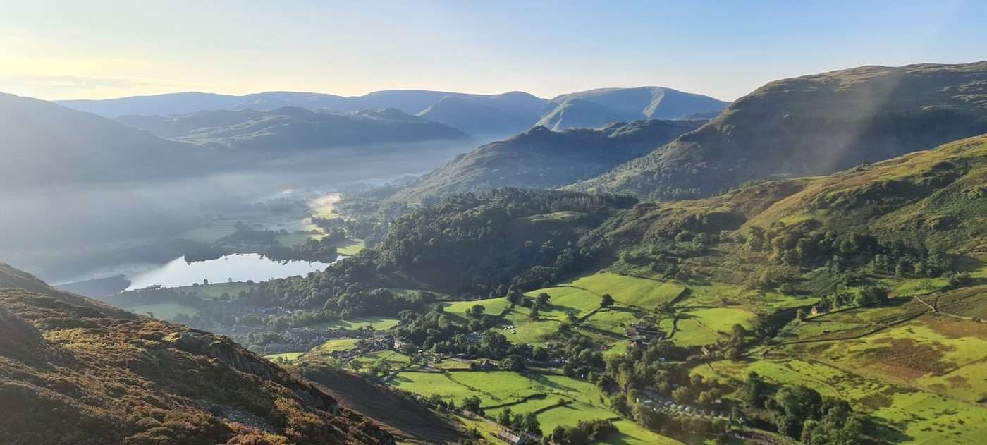
Glenridding is a small village at the southern end of Ullswater, tucked into the valley head below Helvellyn — England's third-highest mountain, which rises straight from the back of the village. For most visitors it is two things at once: the classic launch pad for Helvellyn and the high Eastern Fells, and a lakeside spot where the Ullswater steamers set off from the pier. It is compact and walkable, more outdoors-base than resort, and on a fine weekend it fills early — chiefly because of the walkers heading for the tops.
The village sits in the Patterdale valley, with neighbouring Patterdale a mile or so up the road. There is no railway and only one main road in, so Glenridding feels a little more out-of-the-way than the honeypots around Windermere — part of its appeal.
Quick facts
| Where | Eastern Lake District, Cumbria — at the southern tip of Ullswater, below Helvellyn |
|---|---|
| Lake | On Ullswater (not Windermere — a common mix-up; they are different lakes in different valleys) |
| Train station | None — nearest is Penrith (~14 miles), then the 508 bus along Ullswater |
| Getting there | By car on the A592 (via Penrith, or over Kirkstone Pass from Windermere/Ambleside) |
| Famous for | Helvellyn by Striding Edge, the Ullswater steamers and the old Greenside lead mine |
| Dogs | Very dog-friendly — the fells, the lake shore, the steamers (on a lead) and most pubs |
| Weather | Mild but wet; the valley funnels weather off Helvellyn — pack waterproofs |
Editor's note: _[Glenridding really is a jewel of the eastern half of the Lake District - and that shows in the footfall and the difficulty in parking. When I've used Glenridding as a base for a day's hike I get their super-early and grab a spot at the Beckside Lake District National Park Authority carpark - the public toilets are a short walk away at the Glenridding Village car park, and I seem to need them before and definitely after a hike. If you wanted a relatively short hike you can try Glenridding Dodd which is the closest one to the north west which is only 442m, but if you wanted to extend it ab it futher you could add in Heron Pike and then Sheffield Pike - but not in wet conditions as coming off back round Nick Head and Lucy's Tongue can be damp ]_
Why is Glenridding famous? Is it worth visiting?
Yes — Glenridding is well worth visiting, and it earns its reputation on two counts. First, the walking: this is the base for Helvellyn, with everything from a steady plod to the summit to the knife-edge of Striding Edge starting from the village. Second, Ullswater, with the steamers, the waterfall at Aira Force and the long curving shoreline of the Ullswater Way all on the doorstep.
Beyond those headline draws there is the Greenside lead mine, once the largest in the Lake District (it worked until 1962 and its old tracks now make some of the easiest walking lines onto the high fells), and a genuinely dramatic setting at the head of the valley. It is not a place for shopping or nightlife — it is small, and the evenings are quiet — but as a base for the Eastern Fells and Ullswater it works very well. Check the live "Best fells today" conditions before you commit to the tops.
Parking in Glenridding
Parking is the single most-asked question about Glenridding, because the main car park is the launch point for Helvellyn: of the pay-and-display machine tickets sold at Glenridding from 17 August 2024 to 31 March 2026, 34% were bought before 10am (our count of FOI/2026.500 ticket data; contains public sector information licensed under the Open Government Licence v3.0). Here is the honest version.
Parking, toilets and buses: Parking near Glenridding
How to pay: the machines take coins and cards, and you can also pay by phone with the RingGo app (location 37316), handy when there is a queue at the machine. Bring a card and have RingGo set up as a backup.
→ Official tariff & details: Lake District National Park — car parks.
Where to park for Helvellyn: the Beckside car park is the one — almost every Glenridding route up Helvellyn starts from here, including the Striding Edge & Swirral Edge route Walked in part. Arrive early (well before 9am on a sunny weekend) or you may not get in.
Where to park for Glenridding Dodd: the same Beckside car park — the fell rises directly above the village, so it is a short walk to the start.
Alternatives if it's full: the National Trust car park at Glencoyne Bay (a mile or so up the lake towards Aira Force) and the NT car park at Aira Force are the main fallbacks — both also pay-and-display, free to NT members. On the busiest days, arriving early is far more reliable than hunting for a space mid-morning.
Routes that start near Glenridding
| Route | Distance | Ascent | Estimate |
|---|---|---|---|
| Patterdale to Silver Point and BackStart 1.4 km away (straight line) · not yet walked | 6.5 km | 118 m | ~1½–2 h |
| Patterdale to Hartsop and Brothers WaterStart 1.4 km away (straight line) · not yet walked | 11.48 km | 169 m | ~2½–3½ h |
| Place Fell and The KnightStart 1.4 km away (straight line) · not yet walked | 7.28 km | 547 m | ~2¼–3¼ h |
| St Sunday CragStart 1.4 km away (straight line) | 10.22 km | 838 m | ~3¼–4¾ h |
| Grisedale Tarn, Fairfield, St Sunday Crag from PatterdaleStart 1.4 km away (straight line) · not yet walked | 15.92 km | 983 m | ~4¾–6½ h |
| Glenridding Dodd, Sheffield Pike, Catstye Cam, Birkhouse MoorStart 0.1 km away (straight line) | 15.58 km | 1269 m | ~5–7 h |
More routes that start near Glenridding: Lanty's Tarn and Glenridding Beck (not yet walked) · Helvellyn via Striding Edge & Swirral Edge
Routes starting within about 2 km of Glenridding, or on its doorstep at one of the car parks above. Each time is the whole route’s, from a fast to a steady pace, and takes no account of stops, conditions or daylight — a guide, not a schedule.
Places nearby: Patterdale · Aira Force · Angle Tarn (Patterdale) · Brothers Water
Helvellyn & the high fells from Glenridding
This is Glenridding's depth advantage, and where our fell and route pages come into their own. Always check the live conditions and the mountain forecast first — Helvellyn is a serious mountain and the edges are no place to be in poor weather.
Helvellyn — the main event. There are two very different ways up from Glenridding:
- The easiest way (no scrambling): follow the old Greenside mine road out of the village and take the gentler line onto the mountain via Mires Beck and the broad back of the fell, keeping clear of the edges. It is a long, steady climb rather than a technical one — the sensible choice for most walkers, in winter, or when cloud is down.
- The classic (serious) way: the Striding Edge & Swirral Edge route — a classic British ridge walk — starts right here in Glenridding, climbing over Birkhouse Moor to Striding Edge and returning over Catstye Cam via Swirral Edge. This is an exposed grade-1 scramble in places and demands a head for heights and settled weather.
Glenridding Dodd — the short, easy fell right above the village, and the answer to "is it a hard walk?" — no: it is an accessible little summit, with a fine view down Ullswater for modest effort. It pairs neatly with Sheffield Pike and Heron Pike for a longer round.
The Helvellyn range — for a bigger day on the high tops, the old Greenside mine gives a back-door approach to Raise, White Side, Stybarrow Dodd and Helvellyn Lower Man — a quieter, less scrambly way onto the ridge than the edges.
A note on a common question: Glenridding itself is not a Wainwright — it is the village. The Wainwright fells around it are Glenridding Dodd, Sheffield Pike, Helvellyn, Catstye Cam, Birkhouse Moor and the rest above.
Ullswater — the lake, the steamers & Aira Force
Is Glenridding on Ullswater? Yes — the village sits at the southern tip of Ullswater, and the pier is a few minutes' walk from the centre. (And to settle another frequent mix-up: Glenridding is not in or on Windermere — that is a different, larger lake in a different valley to the south. Easy to confuse by name, but a good half-hour apart by road.)
The Ullswater 'Steamers' are the classic thing to do here: historic launches running the length of the lake between Glenridding, Howtown and Pooley Bridge. The much-loved combination is to take the steamer one way and walk back along the shore — and you don't have to do the whole thing.
It works just as well for the fells, and hardly anyone uses it that way. Sail from Glenridding to Howtown and you can walk back over Place Fell — a high traverse with Ullswater below you the whole way, and a far better day than the same ground out-and-back. The same boat is the sensible way to reach the quiet fells above Howtown (Hallin Fell, Steel Knotts, Bonscale Pike), where the lane is narrow and there is almost nowhere to park. Sail out, walk back — not the other way round, so a slow walk never becomes a missed boat.
The Ullswater Way is the 20-mile waymarked circuit of the whole lake (Glenridding, Aira Force, Pooley Bridge, Howtown and back). Most visitors walk a section and use the steamer or the 508 bus to complete the loop rather than doing all 20 miles in a day — the Glenridding-to-Aira-Force stretch is a popular, scenic half-day.
Aira Force is the National Trust's dramatic 65-foot waterfall a couple of miles up the lake — a good short walk, and an easy outing with children. There is sailing and boat hire on Ullswater, and (for the hardy) open-water swimming.
Things to do & attractions
- Ride the Ullswater Steamers from Glenridding pier — the signature Glenridding day out, in any weather.
- Walk to Aira Force — the NT waterfall up the lake; short, spectacular, kid-friendly.
- Climb Glenridding Dodd for a big Ullswater view with little effort.
- Explore the Greenside mine heritage — the tracks and remains of what was once the Lakes' largest lead mine, behind the village.
- Take on Helvellyn — the reason many people come (see the fells section above).
- Stroll up to Patterdale — a gentle valley walk to Glenridding's quiet neighbour.
How to spend a day, a weekend or a rainy day
- A day: the steamer to Howtown and the shoreline walk back, or a fell day on Helvellyn or Glenridding Dodd, finishing with a pub meal in the village.
- A weekend: one big fell day (Helvellyn), one lake day (steamer + Aira Force), and an easy evening stroll along the shore.
- A rainy day / with kids: the steamer runs whatever the weather, Aira Force is at its best in spate after rain, and Glenridding Dodd is a short, low option when the tops are clagged in. For a bigger wet-weather plan, Penrith (shops, the castle, the museum) is half an hour away.
Where to stay
Glenridding is small, so book ahead in season. The standouts:
- Inn on the Lake — the big, well-known 4-star hotel in its own grounds on the lake shore, with Ullswater and Helvellyn views, a couple of bars and a restaurant; it is also a popular wedding venue. To answer the common question: the Inn on the Lake is owned and run by Lake District Hotels, a family-run Cumbrian group with several properties in the area.
- The Glenridding Hotel — the large hotel in the village centre. It was hit hard by the December 2015 Storm Desmond floods (see below) and flooded repeatedly; its owners rebuilt and reopened it in December 2016, and it has been refurbished since — so it is open and trading, not lost to the floods as some still assume.
- Glenridding House and a range of guest houses, B&Bs and self-catering cottages in and around the village.
- YHA Helvellyn (up the fellside above Greenside) for budget and group stays, plus camping at the valley campsites. The old YHA Patterdale is now a school outdoor centre, not a hostel.
Food & drink
For its size Glenridding is well served, though it is a small village — for a big supermarket shop you'll want Penrith or Pooley Bridge.
- Pubs: the village pubs and hotel bars do walkers' food; for the much-asked "best pub with a view," the lakeside spots and the Inn on the Lake's terrace are the ones for an Ullswater outlook. The Travellers Rest, up on the Greenside road, is the traditional walkers' pub on the way to/from the fells.
- Cafes: there are cafes in the village centre for coffee, cake and a post-walk plate of chips — handy by the car park and pier.
- Shops: a village shop for essentials, and Catstycam, the long-standing outdoor shop, for any kit you've forgotten before heading up Helvellyn.
The 2015 floods
In December 2015, Storm Desmond brought record rainfall to the fells above Glenridding. Glenridding Beck burst its banks and tore through the village on 6 December, then flooded again in the days that followed — silt, gravel and boulders washed down from the slopes of Helvellyn, with the Glenridding Hotel among the worst-hit buildings. The community and businesses rebuilt, flood defences along the beck were improved, and the village recovered; today the floods are part of Glenridding's recent story rather than its present. It is the honest answer to "when was Glenridding flooded?" — December 2015.
Weather & when to visit
Glenridding has a classic, honest Lakeland climate: mild, green and frequently wet, with the valley funnelling weather straight off Helvellyn. Late spring and early autumn give a good balance of long days and (relatively) settled conditions; high summer is busiest and the car park fills earliest; winter on the high fells means full winter conditions on Helvellyn — for experienced, equipped walkers only. Whatever the season, check the live "Best fells today" conditions and the mountain forecast before heading up.
Getting there & parking
Without a car: The nearest stations as the crow flies are Penrith (North Lakes) (18 km away) and Windermere (19 km away); the 508, 509 and 559 stop at Bus Shelter, 0.1 km from here in a straight line. The bus map has every stop we hold.
There is no railway station in Glenridding. The nearest is Penrith (~14 miles, on the West Coast Main Line), from where the 508 bus runs along Ullswater through Pooley Bridge and Aira Force to Glenridding and Patterdale (and on over Kirkstone Pass to Windermere when the pass is open). By car, the village is on the A592 — about half an hour from the M6 at Penrith, or over the dramatic Kirkstone Pass from Ambleside and Windermere.
On "how far is Glenridding from Windermere?" — it is roughly 30 minutes by car over Kirkstone (or longer round by road), which is also why the two are sometimes confused: they are near-ish neighbours but on different lakes, Glenridding on Ullswater and Windermere on its own lake to the south. For parking once you arrive, see the Parking in Glenridding section above.
Parking near Glenridding
Toilets, food and shops near these car parks
Toilets: Public toilets (opens in new tab) (about 187 m from Beckside Car Park (paid), straight line); Public toilets (opens in new tab) (about 705 m from KGV Playing Field Community Car Park, Patterdale, straight line, free)
Cafes: Let It Brew (opens in new tab), Fairlight Cafe & Restaurant (opens in new tab), Fellbites (opens in new tab)
Pubs: Travellers Rest (opens in new tab), White Lion Inn (opens in new tab), Patterdale Hotel (opens in new tab)
All the car parks around Glenridding on the parking map →
Straight-line distances from the centre of Glenridding. We publish whether a car park charges, and who runs it, but never the price — tariffs change and a stale one is worse than none, so check the sign or the operator’s own site on the day.
Vehicles are left entirely at their owner’s risk. We list places people park; we cannot vouch for any of them. Judge it on the day: take valuables with you, leave nothing on show, and if a spot feels wrong when you get there, park somewhere else.
Can you stay overnight?
- Beckside Car Park (paid) — run by Lake District National Park Authority, which does not permit overnight parking. “The only legal places to park are on formal camp sites.” (checked 2026-08-05)
- Ullswater Steamers Glenridding Pier car park (paid) — not permitted. Westmorland and Furness Council’s own wording: “No person shall position any vehicle, campervan, motorhome, caravan, tent or any other temporary structure designed or intended to provide shelter or accommodation for the purpose of an overnight stay or stays, within the areas listed in Schedule 2A and Schedule 2B, unless prior written consent has been obtained from the Council or National Trust.”
- Glencoyne (NT, paid) — not permitted. Westmorland and Furness Council’s own wording: “No person shall position any vehicle, campervan, motorhome, caravan, tent or any other temporary structure designed or intended to provide shelter or accommodation for the purpose of an overnight stay or stays, within the areas listed in Schedule 2A and Schedule 2B, unless prior written consent has been obtained from the Council or National Trust.”
These are the land managers’ and the council’s own published rules, quoted. Where a car park is not listed here we have found no published rule for it, which is not the same as permission.
Getting there across the Lake District: Buses · Parking map · By train · By boat
Practical info
- Dogs: very welcome — the fells, the lake shore, the steamers (on a lead) and most pubs.
- Toilets: public toilets at the main Beckside car park in the village centre.
- Cash & cards: card is accepted widely; cash machines are limited in such a small village, so draw cash in Penrith or Pooley Bridge if you need it.
- EV charging: limited in the village — check your charging app before relying on it; Penrith has more.
- Medical & signal: the nearest pharmacy and main services are in Penrith; mobile signal is patchy in the valley and largely absent on the high fells — don't rely on your phone for navigation on Helvellyn.
Day trips & nearby
- Patterdale — Glenridding's quiet neighbour a mile up the valley, and another Helvellyn base.
- Aira Force & Gowbarrow — the NT waterfall and the little fell above it, an easy and rewarding outing.
- Pooley Bridge — the village at the far (northern) end of Ullswater; reachable by steamer, the 508 or the Ullswater Way.
- Penrith — the nearest market town (~14 miles): shops, the castle, services and the railway.
- Ullswater by steamer — the lake itself makes a fine "day trip".
- Over Kirkstone to Ambleside — when the pass is open, the spectacular road south drops you into the central Lakes.
Frequently asked questions about Glenridding
How do I pay at Glenridding car park?
Sources: Lake District National Park — car parks (opens in new tab)
How much is parking in Glenridding?
Sources: Lake District National Park — car parks (opens in new tab)
Where do I park for Helvellyn from Glenridding?
Sources: Lake District National Park — car parks (opens in new tab)
Is there free parking in Glenridding?
Sources: Lake District National Park — car parks (opens in new tab)
Is Glenridding on Ullswater?
Sources: Lake District National Park — Ullswater (opens in new tab)
Is Glenridding in Windermere?
Sources: Lake District National Park — Ullswater (opens in new tab)
What is the easiest route up Helvellyn from Glenridding?
Is Glenridding a Wainwright?
Is Glenridding Dodd a hard walk?
What happened to the Glenridding Hotel?
Sources: ITV News — Glenridding Hotel reopens after Storm Desmond (opens in new tab)
Who owns the Inn on the Lake at Ullswater?
Sources: Lake District Hotels — Inn on the Lake (opens in new tab)
When was Glenridding flooded?
How do I get to Glenridding without a car?
Events across the Lake District
Planning a trip around a show or festival? See our Lake District events & festivals guide for what's on near Glenridding — traditional Lakeland sports, agricultural shows and seasonal events, month by month.