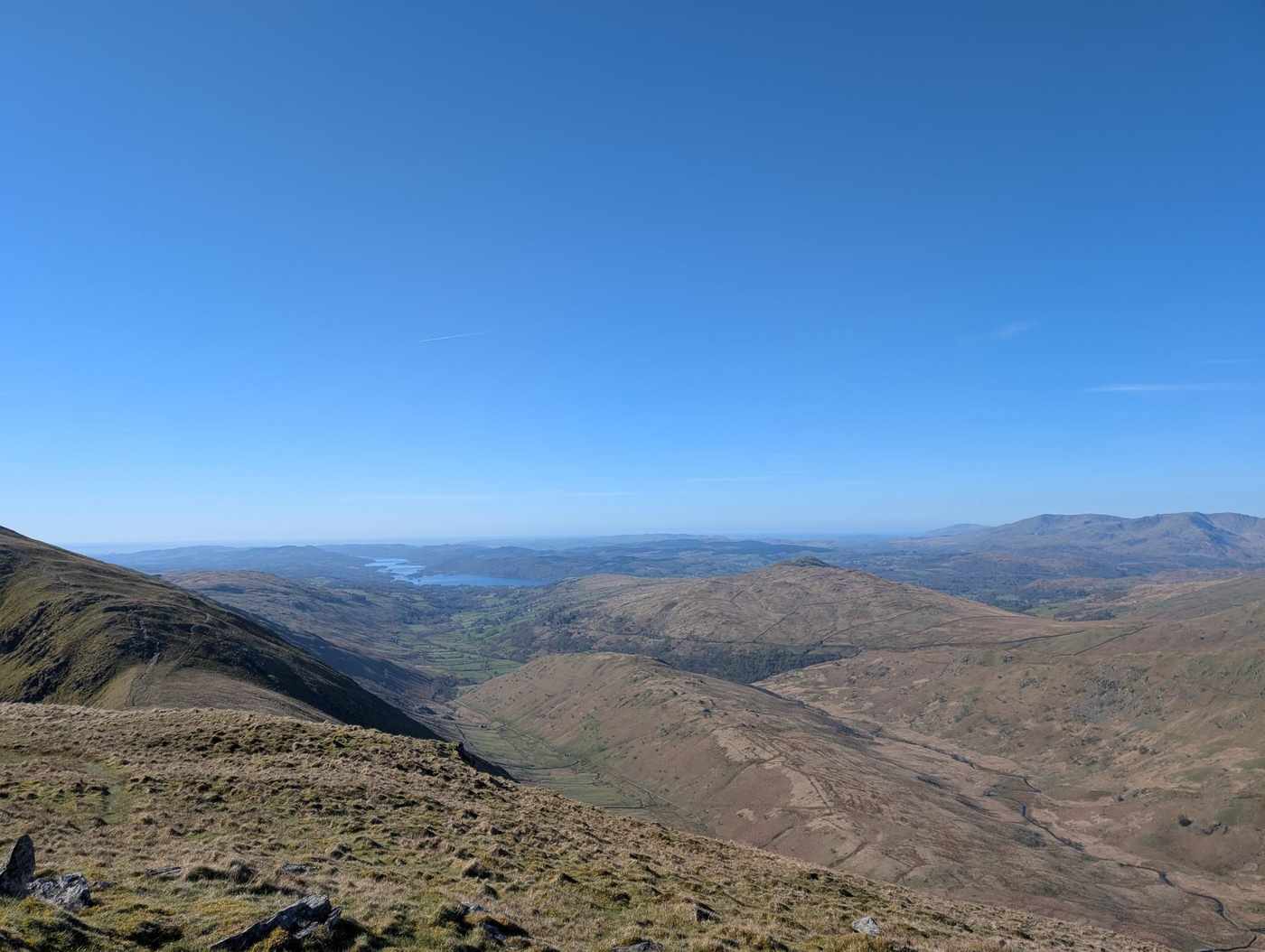
Hartsop Dodd, Stony Cove Pike, Thornthwaite Crag and Gray Crag
Key facts
Difficulty profile
Five independent axes, not one score. “Desk” ratings come from maps and guidebooks, not yet walked — treat them as a guide, not a survey.
Conditions on this route
We score every Lakeland Wainwright each morning on cloud, wind, rain and underfoot, and this route crosses 4 of them. The worst summit governs the verdict — a route is only as kind as its roughest top.
Modelled guidance — not a substitute for the mountain forecast or your own judgement. See how every fell ranks today →
☀️ Daylight & turnaround
Daylight is short from October to February — check today’s sunrise and sunset before you set off, and carry a head-torch and spare batteries. On short days, decide your turn-back time before you start.
Why this matters: 78% of Mountain Rescue call-outs come after midday — the day runs out on the way home, not on the way up. See also walking in bad weather and today’s conditions.
1 Hartsop Dodd2 Stony Cove Pike (Caudale Moor)3 Thornthwaite Crag4 Gray Crag
Free mapping: OpenTopoMap / OpenStreetMap (switch layers top-right).
This walk covers about 10.0 km with around 832 m of ascent, taking in 4 summits. The map above shows the line; the elevation profile and stage notes are below.
Access & barriers
Can a dog, a buggy or dodgy knees manage this route? A quick read from the gates and stiles mapped along the way.
- Dog: A stile of unmapped type — a dog may need lifting over.
- Buggy: Stiles or rough going on the route.
- Knees: A long, steep ~38% drop around the 8.5 km mark — hard on the knees.
On the line: 9 gates · 2 kissing gates · 1 stile (type unmapped)
These are mapped barriers, from OpenStreetMap — coverage in the Lakes is good but not guaranteed complete. Spotted a stile or gate we’ve missed? Tell us (opens in new tab) and we’ll fix it. Barrier data as of 2026-07-19. Access data © OpenStreetMap contributors (via Overpass).
Pacing
| Summit | Cumulative | Ascent | Time (fast–steady) |
|---|---|---|---|
| Hartsop Dodd | 1.3 km | 455 m | 1:01–1:21 |
| Stony Cove Pike (Caudale Moor) | 3.4 km | 642 m | 1:45–2:19 |
| Thornthwaite Crag | 5.3 km | 796 m | 2:24–3:11 |
| Gray Crag | 7.1 km | 819 m | 2:47–3:43 |
| Finish | 10.0 km | 832 m | 3:23–4:30 |
Naismith-based estimate — a fast/steady range. Your pace will vary.
The walk, stage by stage
Start → Hartsop Dodd (1.3 km, 455 m)
Climb of about 455 m over 1.3 km (around 35% average).
Hartsop Dodd → Stony Cove Pike (Caudale Moor) (2.1 km, 187 m)
Climb of about 187 m over 2.1 km (around 9% average).
Stony Cove Pike (Caudale Moor) → Thornthwaite Crag (2.0 km, 154 m)
Climb of about 154 m over 2.0 km (around 8% average).
Thornthwaite Crag → Gray Crag (1.8 km, 23 m)
Descent of about 75 m over 1.8 km.
Gray Crag → Finish (2.9 km, 13 m)
Descent of about 507 m over 2.9 km.
Stage-by-stage field notes coming soon.
Summits bagged (4)
- Hartsop Dodd 619 m · Far Eastern · Wainwright, Birkett, Fellranger, Synge, Nuttall
- Stony Cove Pike (Caudale Moor) 764 m · Far Eastern · Wainwright, Birkett, Fellranger, Synge, Nuttall, Marilyn
- Thornthwaite Crag 784 m · Far Eastern · Wainwright, Birkett, Fellranger, Synge, Nuttall
- Gray Crag 698 m · Far Eastern · Wainwright, Birkett, Fellranger, Synge
🅿️ Getting there & parking
Positions are approximate. Lakeland car parks fill before 9am on fine weekends.
💧 Water, shelter & getting away
On-route facilities © OpenStreetMap contributors — an absent marker does not mean the facility isn’t there.
🚌 Buses
Rural routes change seasonally — confirm on stagecoachbus.com (opens in new tab) or Traveline before travelling.
⚠️ Safety & conditions
Check live conditions in the “From the fells” panel, on MWIS (opens in new tab) and the Met Office mountain forecast (opens in new tab) before you set off.
Make it easier or harder
Short version: turn back at about 4.6 km (drop to Start) — roughly half the distance.
📚 Maps & guidebooks for Hartsop Dodd, Stony Cove Pike, Thornthwaite Crag and Gray Crag
- Buy on Amazon (opens in new tab)
- Buy on Amazon (opens in new tab)
- Buy on Amazon (opens in new tab)
- Buy on Amazon (opens in new tab)
- Buy on Amazon (opens in new tab)
- Buy on Amazon (opens in new tab)
As an Amazon Associate we earn from qualifying purchases — at no extra cost to you. How affiliate links work →