Good walks in poor weather & low cloud
When the cloud is down and the high tops are wild, these are the lower-risk routes to consider — our walked routes that are both easy to navigate (clear lines, no featureless plateaus where you'd lose your way) and low in exposure (no edges or big drops). That makes them more forgiving in poor visibility. But lower-risk is not ‘safe’: hill weather is serious whatever you climb, so carry a map and compass and know how to use them, check the mountain forecast, and turn back if it doesn't feel right. The conditions shown are our daily prediction — and a route is only as good as its worst summit, so that's what we score.
0 of these are rated good to climb on 27 July — see live conditions →
A prediction from our daily fell score (clear summits, wind, rain, visibility), not a guarantee — always check the mountain forecast before you go.
Map
● routes
An interactive map of the route start points and the fells within about 5 km. Each marker links to its page; the same routes and fells are listed below.
- Heughscar Hill & Arthur's Pike11.7 km~436 m~3–4 hModerateMarginal · 45Not enough daylight — start early
- Long Hike to Fairfield from Ambleside22.4 km~1350 m~6.5–9 hSevereMarginal · 40Summit likely clagged in
- Raven Crag Easy Walk5.8 km~312 m~1.5–2.5 hEasyMarginal · 40Summit likely clagged in
- Rivings and Lothwaite4.4 km~0.5–1 hEasyMarginal · 40Summit likely clagged in
- West of Wet Sleddale - Birketts23.8 km~856 m~6–8 hHardMarginal · 40Summit likely clagged in
- High Rigg3.6 km~215 m~1–1.5 hEasyMarginal · 40Summit likely clagged in
- Lingmoor Fell from Elterwater11.5 km~487 m~3–4 hModerateMarginal · 40Summit likely clagged inThe best low fell in Langdale, and the one that shows you the valley properly. Lingmoor sits between Great and Little Langdale, so the Pikes rear up across the dale in front of you the whole way along the ridge. Side Pike at the far end throws in a famous rock squeeze. Half the effort of the big Langdale rounds and arguably a better view of them.
- Sour Howes, Sallows, Yorke, Illl Bell, Frostwick and Troutbeck Tongue in the sun!27.6 km~1395 m~7.5–10.5 hSevereMarginal · 40Summit likely clagged in
- The Tongue Birkett10.6 km~2–3 hModerateMarginal · 40Summit likely clagged in
- Walla Crag and Bleaberry Fell from Keswick12.5 km~655 m~3.5–5 hModerateMarginal · 40Summit likely clagged inA proper fell day that starts and finishes on foot from Keswick — no car needed. Walla Crag gives one of the great Derwentwater views for very little effort; Bleaberry Fell behind it is a rougher, boggier, quieter proposition that most people skip. Together they make a satisfying half-day horseshoe straight out of the town.
- West of Grasmere15.4 km~806 m~4–6 hHardMarginal · 40Summit likely clagged in
- St Sunday Crag10 km~782 m~3–4.5 hModerateMarginal · 40Summit likely clagged in
- Stone Arthur from Grasmere6.8 km~516 m~2–3 hModerateMarginal · 40Summit likely clagged in
- Swineside Knott & Gowbarrow13.3 km~649 m~3.5–5 hModerateMarginal · 40Summit likely clagged inA satisfying loop over the heather tops of Gowbarrow above Ullswater, starting from the busy Aira Force car park — but climbing quickly away from the waterfall crowds onto quiet, rolling moorland that most of them never reach. The round takes in Brown Hills, Swineside Knott and Common Fell before the open summit of Gowbarrow Fell, a Wainwright with one of the finest views over Ullswater, which stays with you for much of the way. Moderate, with one steep early pull — save it for a clear day and let the lake do the rest.
- Catbells, Maiden Moor & High Spy13.8 km~824 m~4–5.5 hHardMarginal · 40Summit likely clagged inA lovely, accessible ridge walk above the western shore of Derwentwater, and a great introduction to the fells. From Hawes End it climbs the shapely little peak of Catbells, then follows the airy but easy ridge south over Maiden Moor to High Spy, with Derwentwater and the Newlands valley spread out below. There are a few easy scrambly steps on Catbells that some guides don't mention, but nothing most people can't manage. A modest, rewarding day with some of the best views in the northern Lakes for the effort.
- Cockup at the White Hause and other Birketts23.9 km~1160 m~6.5–9 hHardMarginal · 40Summit likely clagged in
- A quiet Birkett13 km~2.5–3.5 hModerateMarginal · 40Summit likely clagged in
- Ambleside, Todd Crag, Rydal Cave10.4 km~392 m~2.5–3.5 hModerateMarginal · 40Summit likely clagged inThe classic Ambleside circuit of Loughrigg Fell — up through Rothay Park and over Todd Crag past Lily Tarn, across the undulating top to the summit trig point, then down to Loughrigg Terrace above Grasmere and back along the fell's flank via Rydal Cave. Low in height, big in views, and the best-value 10 km in the central Lakes.
- Ard Crags & Knott Rigg19.7 km~687 m~5–7 hHardMarginal · 40Summit likely clagged in<AI-GENERATED for planned routes; replaced with Lee's own account once Revised>
- Binsey Walk2.4 km~175 m~0.5–1 hEasyMarginal · 40Summit likely clagged inThe northern outlier, and the biggest view-per-minute in the Lake District. Binsey stands alone above the Solway plain with nothing between it and Scotland — forty minutes up a grassy path and you can see the whole Skiddaw massif on one side and the Galloway hills on the other. A first fell, an evening fell, a fell for a bad forecast everywhere else.
- Gowbarrow Fell and️ Little Mell Fell15.1 km~705 m~4–5.5 hHardMarginal · 40Summit likely clagged in
- Grike, Crag Fell and Lank Rigg13.1 km~618 m~3.5–5 hModerateMarginal · 40Summit likely clagged in
- Great Mell Fell3.5 km~269 m~1–1.5 hEasyMarginal · 40Summit likely clagged in
- Green Crag & Great Whinscale — the wild Birker Fell round11.9 km~478 m~3–4.5 hModerateMarginal · 40Summit likely clagged inA wild, trackless round over the knobbly tops of Birker Fell, in the empty south-western corner of the Lakes that most walkers never reach. From the Birker Fell road it crosses open, boggy moor past Devoke Water — the Lake District's largest tarn — to a cluster of five rocky little summits: Great Whinscale, Crook Crag, then Green Crag, the Wainwright and high point of the day, before Broad Crag and Great Crag on Birker Fell. Under 12 km but genuinely rough underfoot, with proper solitude and a big view over the Duddon, Eskdale and out to the sea.
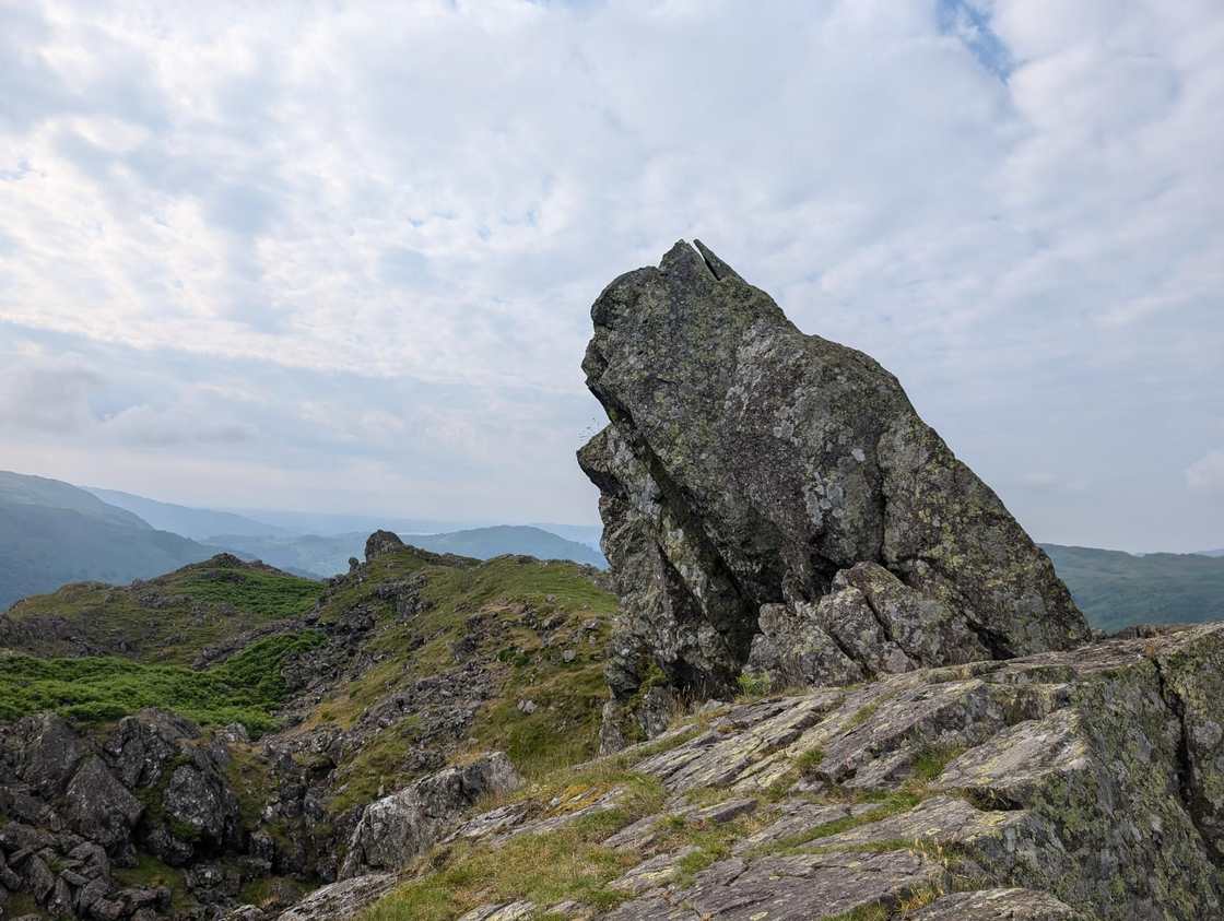 Helm Crag & Far Easedale15.9 km~850 m~4.5–6 hHardMarginal · 40Summit likely clagged in
- Lonscale Fell, Skiddaw Lesser Man, Skiddaw and Bakestall in the sun!19.3 km~1116 m~5.5–7.5 hHardMarginal · 39Summit likely clagged in
- Birketts North of Skiddaw23 km~1434 m~7–9.5 hSevereMarginal · 39Summit likely clagged in
- Esk Pike and Great End17.7 km~1099 m~5–7 hHardSave it · 20Too windy for the tops
- Low Light Haw5.6 km~247 m~1.5–2 hEasyA short, quiet loop onto Low Light Haw, one of the overlooked Bethecar Moor Birketts on the wild eastern side of Coniston Water. While the crowds file up the Old Man across the lake, this little top sees almost no one — a steep pull up through the woods onto open, heathery moor, a wide view over Coniston Water and the southern fells, and an easy return. Under 6 km, but with one genuinely steep climb: a fine short outing for a clear day and a bit of solitude.
- Eycott Hills11 km~2–3 hModerate
- Wastwater Shore (the Screes view)8.8 km~77 m~1.5–2.5 hEasy
- Watendlath & the packhorse bridge10.3 km~298 m~2.5–3.5 hModerateA roughly 6.4-mile Borrowdale loop up to the hidden hamlet of Watendlath, its tarn and the much-photographed packhorse bridge, returning down the valley. A satisfying low-level half-day.
Nothing matches those filters — .