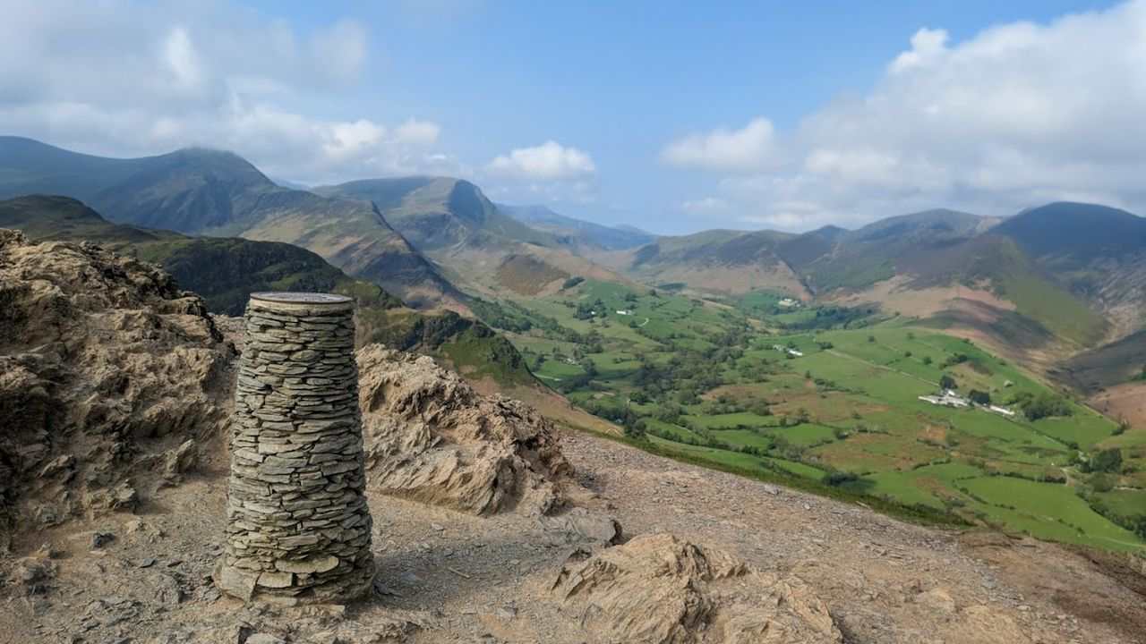
Catbells, Maiden Moor & High Spy
Photo: © Lee McCoy
Key facts
Difficulty profile
Five independent axes, not one score. “Desk” ratings come from maps and guidebooks, not yet walked — treat them as a guide, not a survey.
Conditions on this route
We score every Lakeland Wainwright each morning on cloud, wind, rain and underfoot, and this route crosses 3 of them. The worst summit governs the verdict — a route is only as kind as its roughest top.
Modelled guidance — not a substitute for the mountain forecast or your own judgement. See how every fell ranks today →
Daylight & turnaround
By bus: the Honister Rambler (77/77A) (opens in new tab) reaches Catbells at 08:33 and the last one back leaves at 18:58. At a steady pace this walk finishes about 14:03. Be off High Spy by 15:42. Runs daily, including public holidays. From the summer 2026 timetable, read on 21 Aug 2026. Check the timetable before you rely on it.
Daylight is short from October to February — check today’s sunrise and sunset before you set off, and carry a head-torch and spare batteries. On short days, decide your turn-back time before you start.
Why this matters: 78% of Mountain Rescue call-outs come after midday — the day runs out on the way home, not on the way up. See also walking in bad weather and today’s conditions.
1 Skelgill Bank2 Cat Bells (Catbells)3 Maiden Moor4 High Spy
⚑ escape route
Easy 67%Moderate 24%Hard 9%Severe 1%
Free mapping: OpenTopoMap / OpenStreetMap (switch layers top-right).
This walk covers about 13.79 km with around 824 m of ascent, taking in 4 summits. The map above shows the line; the elevation profile and stage notes are below.
Access & barriers
Can a dog, a buggy or dodgy knees manage this route? A quick read from the gates and stiles mapped along the way.
- Dog: Gates and kissing gates only — a dog can do the whole route.
- Buggy: Stiles or rough going on the route.
- Knees: A long, steep ~32% drop around the 10.7 km mark — hard on the knees.
On the line: 1 gate
These are mapped barriers, from OpenStreetMap — coverage in the Lakes is good but not guaranteed complete. Spotted a stile or gate we’ve missed? Tell us (opens in new tab) and we’ll fix it. Barrier data as of 2026-07-09. Access data © OpenStreetMap contributors (via Overpass).
Pacing
| Summit | Cumulative | Ascent | Time (fast–steady) |
|---|---|---|---|
| 1Skelgill Bank | 1.0 km | 212 m | 0:34–0:45 |
| 2Cat Bells (Catbells) | 1.8 km | 330 m | 0:54–1:12 |
| 3Maiden Moor | 3.9 km | 542 m | 1:41–2:15 |
| 4High Spy | 6.0 km | 630 m | 2:15–2:59 |
| Finish | 13.8 km | 824 m | 4:08–5:30 |
Naismith-based estimate — a fast/steady range. Your pace will vary. These use Naismith’s textbook constants (5 km/h, 600 m of ascent an hour). Measured against a pace fitted to 41 recorded Lakeland walks they run about 8% slow, and we have left them that way deliberately: a slow estimate strands nobody.
The walk, stage by stage
- 1
Hawes End → Skelgill Bank (1.0 km, 212 m)
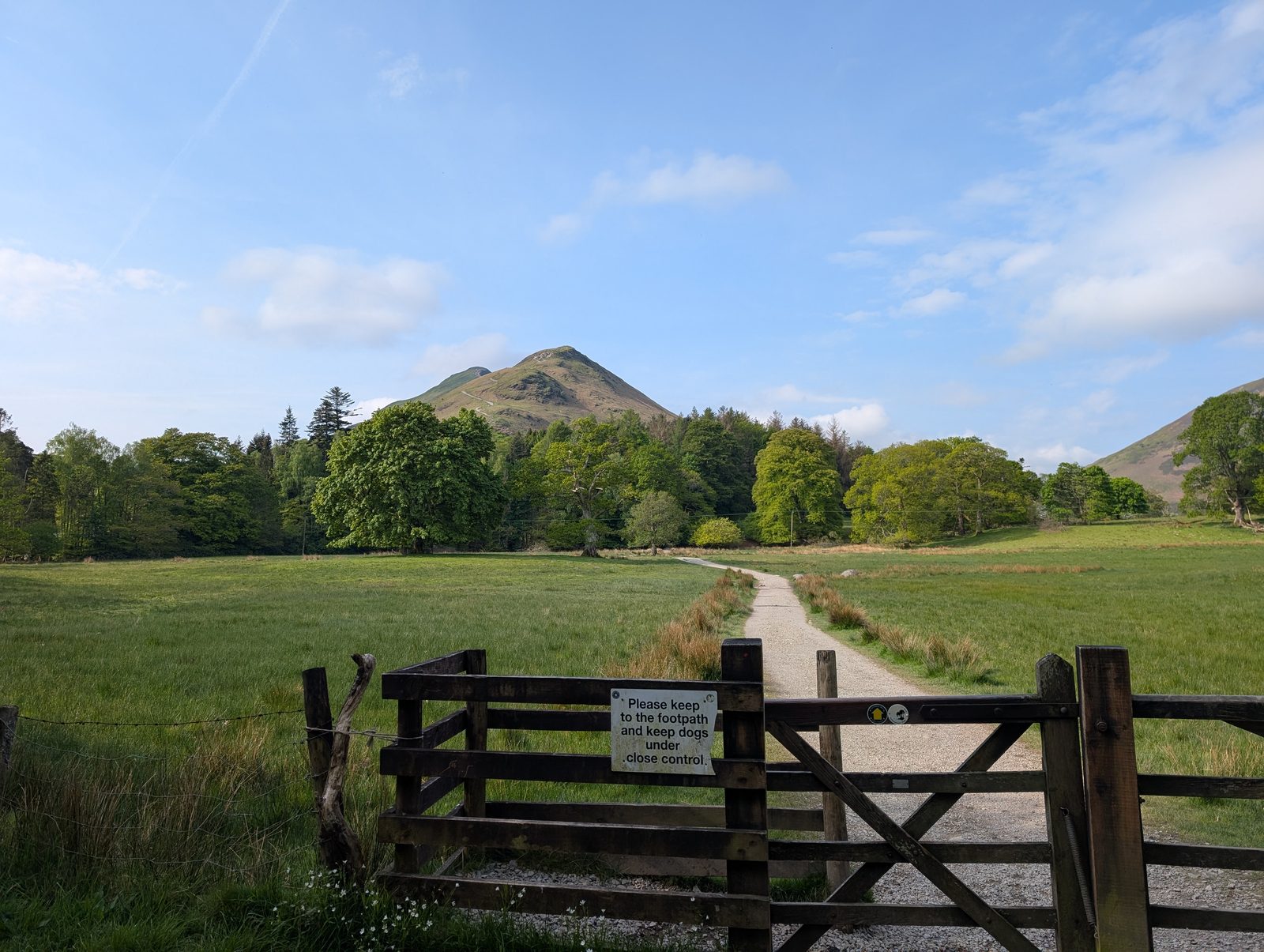
Decision pointStart at Hawes End on the signed path for “Catbells, 1 mile”. It rises immediately from near road level on a good fell path and pulls up steadily to the ridge. Where the path forks low down, either branch works — they rejoin — so don’t fret over the left or right line. You gain the ridge at Skelgill Bank, with Derwentwater on your left and the Newlands valley on your right.
Easy to get wrongSkelgill Bank looks like the top but isn’t Catbells — keep going along the ridge. It’s a continuous pull, so let fitter walkers pass and go at your own pace.
© Lee McCoy - 2
Skelgill Bank → Cat Bells (Catbells) (0.7 km, 117 m)
Decision pointContinue straight along the obvious ridge path — you can’t really go wrong, and the track stays clear even in poor weather. Near the top come the well-known “scrambly” steps, where the path briefly steepens and you’ll want hands.
Easy to get wrongThe short scramble isn’t extreme and there’s an easier line on either side; with children, stay behind them and talk them through. Take care on the steps when wet.
- 3
Cat Bells (Catbells) → Maiden Moor (2.1 km, 213 m)
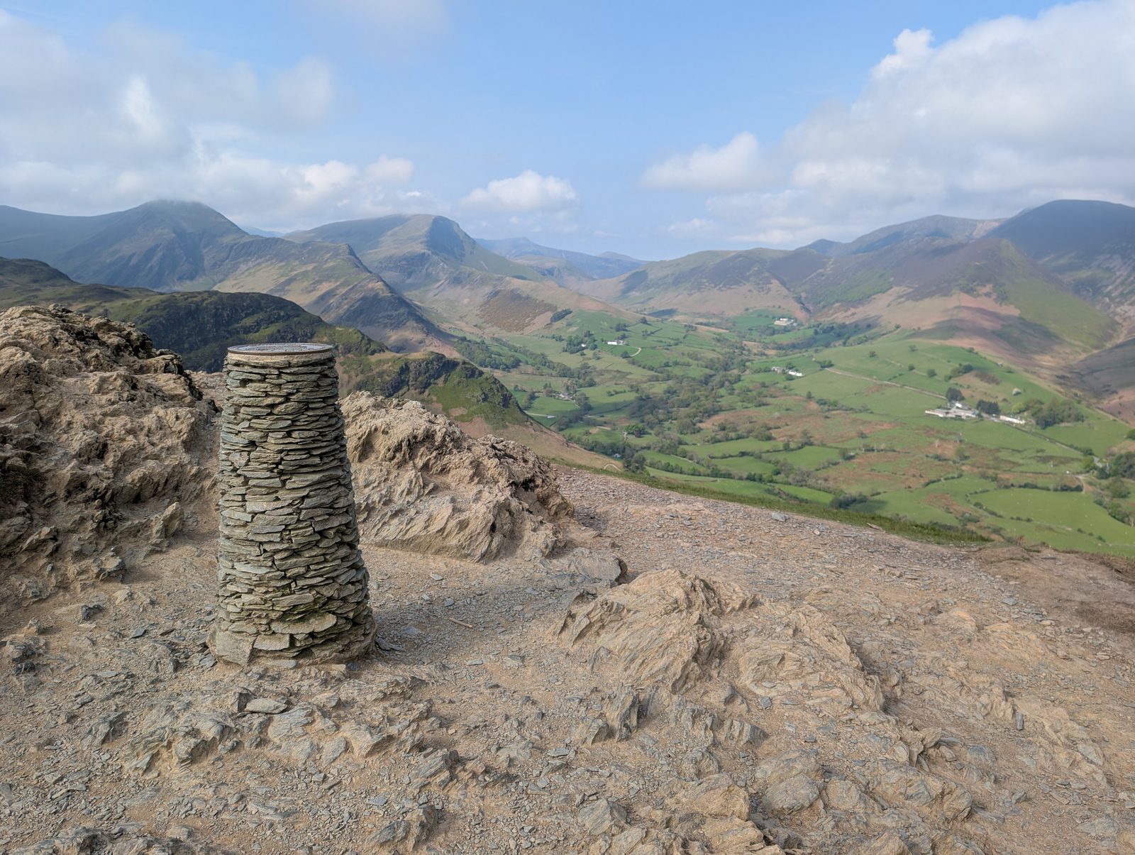
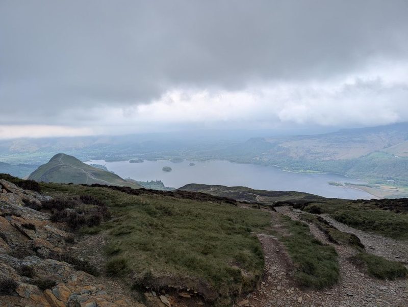
Decision pointFrom the Catbells summit drop to the col at Hause Gate, then climb steadily up to Maiden Moor — a plod rather than a pull, far less steep than the Catbells ascent, with only a couple of very minor scrambly bits. It soon plateaus into open moorland; as you near the top, take a deliberate right turn to the summit.
Easy to get wrongMaiden Moor’s top is easily missed — the instinctive left turn bypasses it, so swing right to tag it. Note the Hause Gate descent on the way up: it’s your bail option (below) and your return line.
© Lee McCoy · 2 photographs - 4
Maiden Moor → High Spy (2.0 km, 88 m)
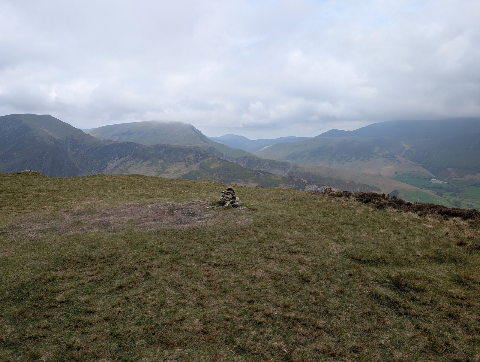
Decision pointSmoother and easier underfoot — gentle undulation rather than a defined climb. Follow the main ridge line; it bends on the ground even when it feels like you’re staying on the central spine. High Spy shows ahead as a more definite rise with a large cairn slightly left of your line.
Easy to get wrongA mix of short stony stretches and grassy trods, never narrow enough to feel exposed but with steep ground dropping away on both sides — stay on the main trod, especially in cloud.
© Lee McCoy High Spy → Finish (7.8 km, 194 m)
Decision pointHead north off High Spy, keeping to the right so you don’t re-climb Maiden Moor (it saves a few minutes). Follow your outward line back down towards Hause Gate; it bends right and can be slightly boggy — or carry on to the clear 90-degree right turn and descend the maintained walkway. Near the bottom, at the first significant junction turn left, then about 100 m later left again onto another clear path, and follow it out to the road and back to Hawes End.
Easy to get wrongKeep right coming off High Spy to avoid revisiting Maiden Moor. The bend towards Hause Gate can be boggy underfoot; if that doesn’t appeal, stay on to the maintained track.


Summits bagged (4)
- 1Skelgill Bank338 m
- 2Cat Bells (Catbells)451 m
- 3Maiden Moor575 m
- 4High Spy653 m
In the order you walk them — the same numbers the elevation profile, the stage notes and the pacing table use.
Getting there & parking
Positions are approximate. Lakeland car parks fill before 9am on fine weekends.
Vehicles are left entirely at their owner’s risk. We list places people park; we cannot vouch for any of them. Judge it on the day: take valuables with you, leave nothing on show, and if a spot feels wrong when you get there, park somewhere else.
Every option near this start, on the parking map →
Water, shelter & getting away
On-route facilities © OpenStreetMap contributors — an absent marker does not mean the facility isn’t there.
Buses
The 77 stops at Hawes End, outside Cattle Grid, 80 m from this start. Seasonal: the 77 does not run all year. 1 November 2026 is its last day, and it is not daily before then — a bus on 31 of the 56 days from 7 September. We don’t know when it returns. Confirmed with the operator, 29 August 2026. The last bus is 19:00 towards Keswick (77), every day. Checked against the operator’s timetable, 7 September 2026. Times here are a guide, not a promise — leave yourself more than the minute.
The 77 passes this route at 0.0 km (Swinside, at Green Road, 630 m off the line). It passes again at 13.7 km.
Rural routes change seasonally — confirm on stagecoachbus.com (opens in new tab) or Traveline before travelling.
If the parking is full
There is no real plan B here. Every place we know beside this route serves the same walks and sits close together, so if one is full the others usually are too. Worth starting early, or having a different walk in mind before you set off.
- Hawse End / Skelgill Bank, Catbells (roadside, limited)
- Cat Bells, south-east (layby)
- Skelgill Bank car park
Worked out from the parking we hold within walking reach of this route and the other walks each place serves — two places that serve the same walks fill for the same reasons. We are not saying whether anywhere has spaces today, and we never will: this is what exists, not what is free.
Toilets and refreshments
Mapped as nearby on OpenStreetMap, as of 13 September 2026, within 250 m of where this route starts (information boards within 150 m; benches and shelter within 50 m):
Also mapped within reach: 3 information boards.
Distances are straight lines from where this route starts, not walking routes. Opening hours are as mapped and change; none of this is checked daily.
Map data © OpenStreetMap contributors (opens in new tab), ODbL.
When the sun reaches the tops
Not sunrise — the moment the sun clears the skyline from that summit, which on a fell with high ground to its east can be a good deal later. The two equinoxes are shown because they fall in the walking season, and late December too wherever a top keeps you waiting then; the clock gap between the equinoxes is British Summer Time, not the hill. Rounded to the nearest quarter hour and meant as a general idea, not a schedule.
- Cat Bells (Catbells) — in late March the sun reaches it around 06:30, about a quarter of an hour later. In late September, about 07:15. It waits longest in late March — about a quarter of an hour after sunrise.
- Maiden Moor — in late March the sun reaches it around 06:30, with the sunrise. In late September, about 07:00.
- High Spy — in late March the sun reaches it around 06:15, with the sunrise. In late September, about 07:00.
Modelled from a 30 m elevation model against each summit’s own skyline — the same figures the fell pages carry, never observed. Cloud is not in it.
Safety & conditions
- A few easy scrambly steps on Catbells — take care, especially when wet.
- The ridge is narrow in places with steep ground either side; fine for most, but keep children close.
Hazard & incident notes: Cat Bells (Catbells) · Maiden Moor · High Spy
Check live conditions in the “From the fells” panel, on MWIS (opens in new tab) and the Met Office mountain forecast (opens in new tab) before you set off.
Escape routes
- At about 2.5 km: descend to Derwentwater (east) or Little Town (west) (cuts ~11.3 km) — From Catbells summit or the Hause Gate col you can cut the walk short. East to Derwentwater is my preference — it’s not a tricky descent, keeps the lake views on a sunny day, and you’re usually out of the prevailing wind. West to Little Town is shorter but a bit more exposed.
Bail-out lines verified on the ground. In poor visibility a marked descent can be safer than retracing a ridge.
Make it easier or harder
Easier: For a short day, turn back at Catbells — the first and most popular Wainwright — and drop from the Hause Gate col (east to Derwentwater is the gentler, more sheltered way down). You bag one Wainwright and skip the longer ridge out to Maiden Moor and High Spy.
Harder: The line here takes a short detour onto High Spy North Top, a Nuttall/Synge top just off the main summit — a little extra ground for top-baggers. It isn’t a Wainwright, so it doesn’t change the three-Wainwright tally.
Why this direction: Walked Catbells-first (Hawes End → Skelgill Bank → Catbells → Hause Gate → Maiden Moor → High Spy, returning to Hawes End): you get the steep pull over early while fresh, then traverse the ridge with Derwentwater on your shoulder, and the return keeps right off High Spy to avoid re-climbing Maiden Moor.
Short version: turn back at about 4.4 km (drop to Hawes End) — roughly half the distance.
Places to stay near this start
From Hawes End: 6 places in Keswick