
Raven Crag Easy Walk
Photo: © Lee McCoy
Key facts
Difficulty profile
Five independent axes, not one score — all field-checked on the ground here, with nothing left as a desk estimate.
Conditions on this route
We score every Lakeland Wainwright each morning on cloud, wind, rain and underfoot, and this route crosses 1 of them. The worst summit governs the verdict — a route is only as kind as its roughest top.
Modelled guidance — not a substitute for the mountain forecast or your own judgement. See how every fell ranks today →
Daylight & turnaround
Daylight is short from October to February — check today’s sunrise and sunset before you set off, and carry a head-torch and spare batteries. On short days, decide your turn-back time before you start.
Why this matters: 78% of Mountain Rescue call-outs come after midday — the day runs out on the way home, not on the way up. See also walking in bad weather and today’s conditions.
1 Raven Crag
Easy 74%Moderate 23%Hard 3%Severe
Free mapping: OpenTopoMap / OpenStreetMap (switch layers top-right).
This walk covers about 5.79 km with around 312 m of ascent, taking in 1 summit. The map above shows the line; the elevation profile and stage notes are below.
Access & barriers
Can a dog, a buggy or dodgy knees manage this route? A quick read from the gates and stiles mapped along the way.
- Dog: Gates and kissing gates only — a dog can do the whole route.
- Buggy: Stiles or rough going on the route.
- Knees: A sustained ~19% descent around the 1.4 km mark — a little jarring on tired knees.
On the line: 12 gates · 1 step-over stile
These are mapped barriers, from OpenStreetMap — coverage in the Lakes is good but not guaranteed complete. Spotted a stile or gate we’ve missed? Tell us (opens in new tab) and we’ll fix it. Barrier data as of 2026-07-26. Access data © OpenStreetMap contributors (via Overpass).
Pacing
| Summit | Cumulative | Ascent | Time (fast–steady) |
|---|---|---|---|
| 1Raven Crag | 1.3 km | 257 m | 0:42–0:55 |
| Finish | 5.8 km | 312 m | 1:41–2:14 |
Naismith-based estimate — a fast/steady range. Your pace will vary. These use Naismith’s textbook constants (5 km/h, 600 m of ascent an hour). Measured against a pace fitted to 41 recorded Lakeland walks they run about 8% slow, and we have left them that way deliberately: a slow estimate strands nobody.
The walk, stage by stage
- 1
Dam Triangle Car Park → Raven Crag (1.3 km, 257 m)
Starting from the parking area near the northern end of the Thirlmere dam, cross the road and immediately enter the dense forestry plantation. Tackle the fiercely steep climb up the eastern flank, utilizing the heavily stepped, zig-zagging path that winds relentlessly up through the pine trees to emerge at the summit's dramatic viewing platform
WaypointsDam Triangle Car Park, Thirlmere lower forestry track, Raven Crag summit (461 m) / viewing platform
Decision pointThe ascent path is unmistakable, heavily maintained, and clearly routed through the commercial forestry. At the summit, a purpose-built wooden boardwalk and viewing platform jutting out over the sheer drop acts as your ultimate destination marker
Easy to get wrongA short but brutally sharp 20% average climb. The route is highly engineered with hundreds of wooden and stone steps. While technically simple and free of bogs, it is a lung-busting stair-master workout that offers virtually no reprieve until you breach the summit. The steps can become treacherous when covered in wet pine needles or winter ice
If you need to get offTurn around and carefully descend the steep steps directly back to the car park
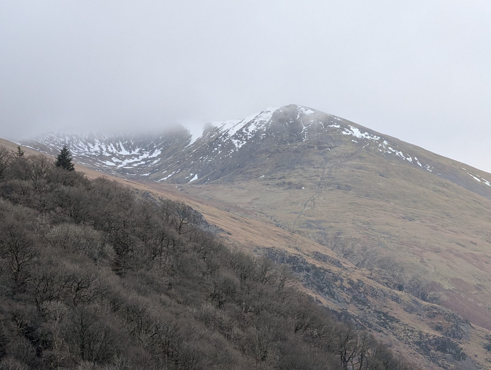
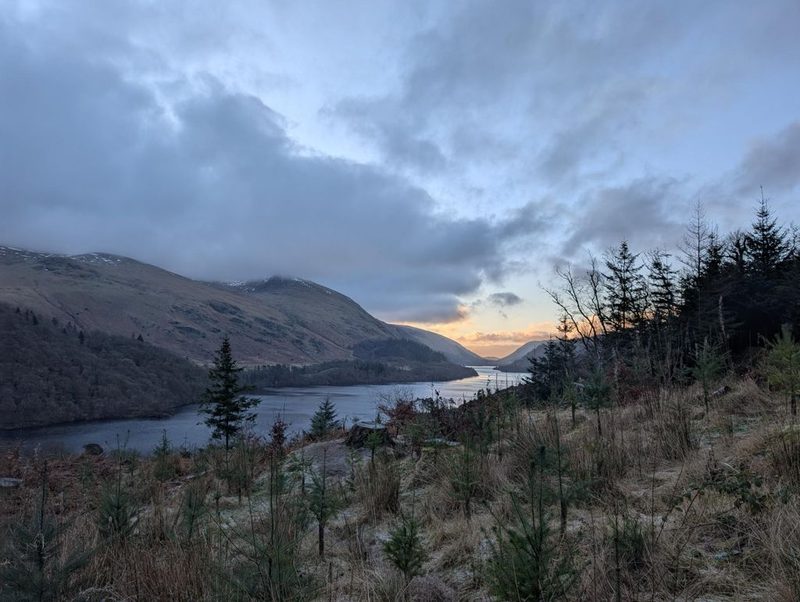
© Lee McCoy · 2 photographs Raven Crag → Finish (4.5 km, 55 m)
Descend from the summit platform, retracing your steps down the steep, stepped path to intersect the lower forestry roads. From here, the route extends into a gentle, undulating circuit through the Smaithwaite woodland, wrapping around the lower contours before crossing the massive structure of the Thirlmere dam to return to the parking area
WaypointsRaven Crag summit, stepped descent, lower forestry tracks, Smaithwaite woodland, Thirlmere Dam, Finish
Decision pointThe descent path funnels you safely off the crag. Once on the valley floor, the colossal concrete expanse of the Thirlmere dam and the reservoir itself provide massive, infallible visual handrails to guide you effortlessly back to the start
Easy to get wrongThe initial drop off the crag is fiercely steep and can be highly jarring on the knees due to the endless hard steps. Once off the fellside, the remaining 4.5 km is a mechanically easy, relaxing stroll on wide, hard-packed forestry commission tracks. The 55 m of minor ascent is barely noticeable on the rolling woodland roads
If you need to get offYou are on the final descent and exit route. Stick strictly to the primary, wide forestry tracks; under no circumstances should you attempt to shortcut directly down the sheer, craggy eastern face of Raven Crag toward the water
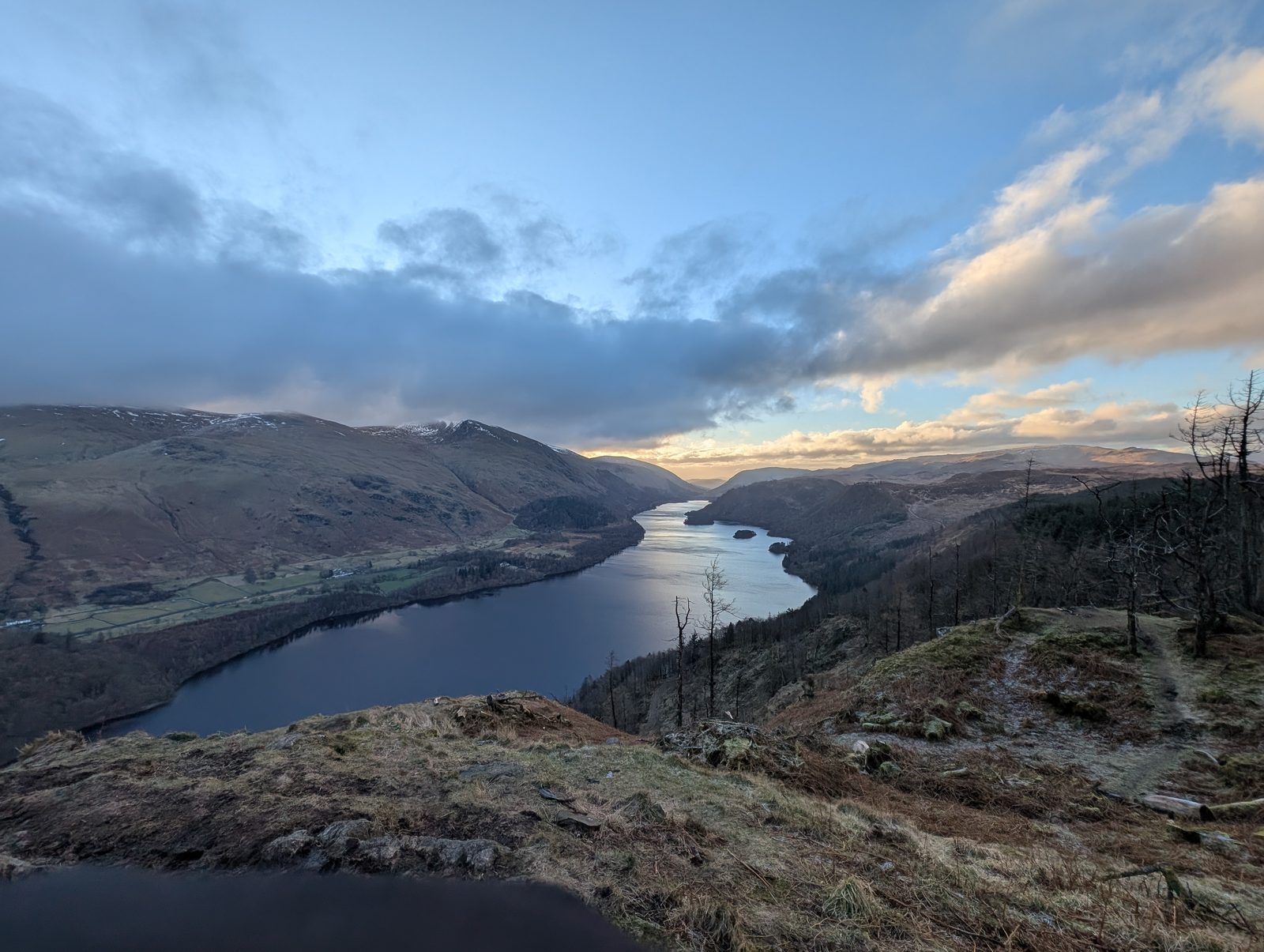
© Lee McCoy


Summits bagged (1)
- 1Raven Crag461 m
Getting there & parking
Positions are approximate. Lakeland car parks fill before 9am on fine weekends.
Vehicles are left entirely at their owner’s risk. We list places people park; we cannot vouch for any of them. Judge it on the day: take valuables with you, leave nothing on show, and if a spot feels wrong when you get there, park somewhere else.
Every option near this start, on the parking map →
💧 No mapped drinking water or shelter on this route — that doesn’t mean there is none, and never drink untreated from a beck. (Facilities data © OpenStreetMap contributors.)
Buses
The 555 stops at Stanah, at Dam road end. From there it is 1.2 km and 93 m of ascent to this start — a walk in before the walk. Last bus: Monday to Friday 21:05 towards Keswick (555); Saturday 21:05 towards Keswick (555); Sunday 18:56 towards Keswick (555). Checked against the operator’s timetable, 7 September 2026. Times here are a guide, not a promise — leave yourself more than the minute.
The 555 passes this route at 3.4 km (Stanah, at Shoulthwaite Farm, 380 m off the line).
Rural routes change seasonally — confirm on stagecoachbus.com (opens in new tab) or Traveline before travelling.
If the parking is full
There is a fallback here, but it is a weak one. Some of the 3 below tend to fill for the same reasons at the same time. Treat the list as one-and-a-bit options rather than 3.
- Raven Crag (layby)
- Castle Rock (layby)
- High Rigg South Top (verge)
Worked out from the parking we hold within walking reach of this route and the other walks each place serves — two places that serve the same walks fill for the same reasons. We are not saying whether anywhere has spaces today, and we never will: this is what exists, not what is free.
When the sun reaches the tops
Not sunrise — the moment the sun clears the skyline from that summit, which on a fell with high ground to its east can be a good deal later. The two equinoxes are shown because they fall in the walking season, and late December too wherever a top keeps you waiting then; the clock gap between the equinoxes is British Summer Time, not the hill. Rounded to the nearest quarter hour and meant as a general idea, not a schedule.
- Raven Crag — in late March the sun reaches it around 06:45, about half an hour later. In late September, about 07:30. It waits longest in late December — about an hour after sunrise.
Modelled from a 30 m elevation model against each summit’s own skyline — the same figures the fell pages carry, never observed. Cloud is not in it.
Safety & conditions
Check live conditions in the “From the fells” panel, on MWIS (opens in new tab) and the Met Office mountain forecast (opens in new tab) before you set off.
Places to stay near this start
From Legburthwaite: 3 places in Keswick