hikes.guideLake District

A Lake District walking collection — generated from live fell & route data.

Hallin Fell
Collection · 510 fells

Quick fells — under 3 hours

Short on time, saving your legs, or staring at half a day of decent weather? These are the Lakeland fells you can climb and be back down from in about three hours or less, by our typical round-trip time — the short, sharp, high-reward summits. They're perfect for a half-day, a late start, an unsettled forecast or a walk with younger legs, and several start close to a bus stop. Each one carries its live conditions, so you can pick a quick fell that's actually clear on top today. The times are a guide for a steady walker on the normal route — add a little for photo stops, big groups, snow or boggy ground.

510
fells
0
dog-friendly
12
regions covered

36 of these are rated good to climb on 11 Septembersee live conditions →
A prediction from our daily fell score (clear summits, wind, rain, visibility), not a guarantee — always check the mountain forecast before you go.

Map

fells within ~5 km

An interactive map of the route start points and the fells within about 5 km. Each marker links to its page; the same routes and fells are listed below.

  • Hallin FellHallin FellFar Eastern388 m~1.5 h🚌 BusDecent · 70DryHallin Fell at 388m (1,273ft) is one of Lakeland's most perfectly formed little summits — a grassy cone projecting into Ullswater above Howtown, its summit giving the finest aerial view of the lake's two bends in all of Lakeland.
  • Rannerdale KnottsRannerdale KnottsNorth Western355 m~1.5 h🚌 BusMarginal · 40Summit likely clagged inRannerdale Knotts at 355m (1,165ft) is a small, delightful ridge of rocky knolls above Crummock Water, giving some of the finest views of the lake from any fell in the North Western Fells.
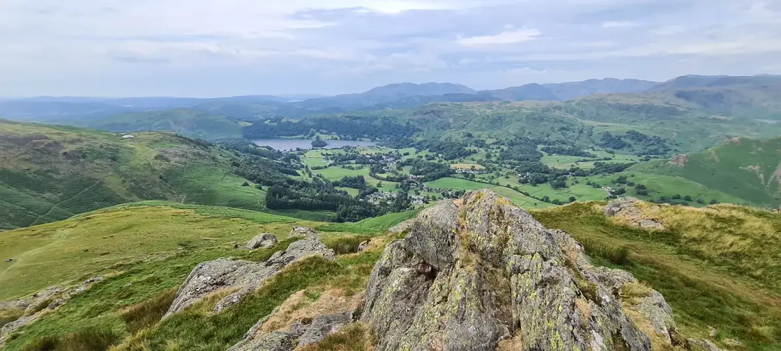
  • Sale FellSale FellNorth Western359 m~1.5 h🚌 BusDecent · 68Dry, firm underfootSale Fell at 359m (1,178ft) is a pleasant little summit above Bassenthwaite Lake, its low summit giving fine views of the lake and across to Skiddaw above.
  • Ling FellLing FellNorth Western374 m~1.5 h🚌 BusMarginal · 40Summit likely clagged inLing Fell at 374m (1,227ft) is a small, heathery summit above Wythop Mill near Bassenthwaite Lake, its modest top giving pleasant views across the lake and north to the Solway.
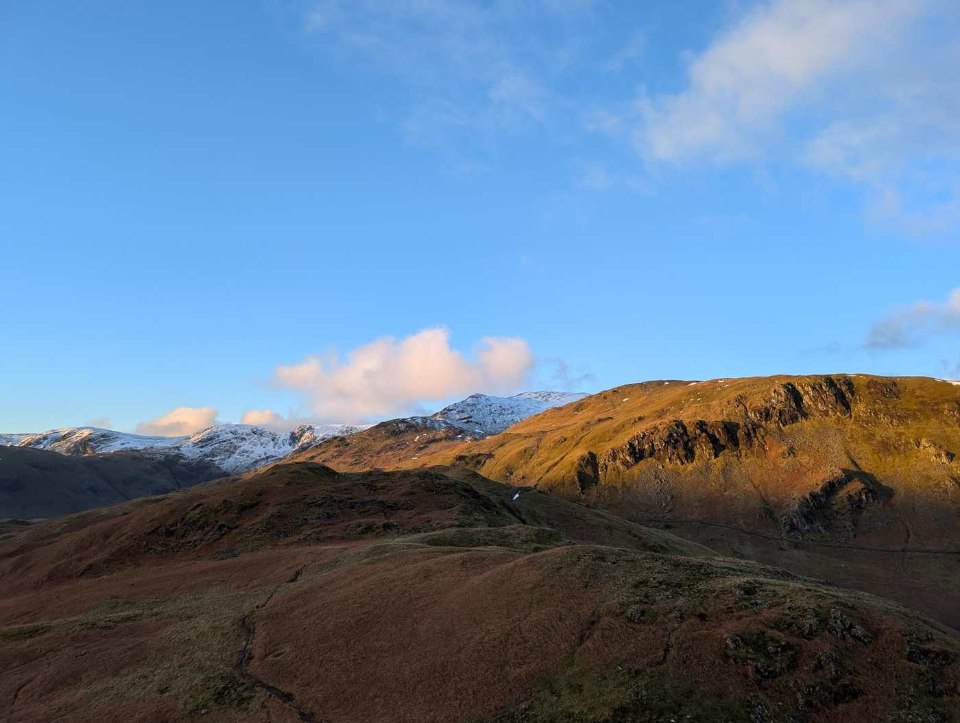
  • High Rigg (Naddle Fell)Central356 m~1.5 h🚌 BusDecent · 64DryHigh Rigg at 357m (1,171ft) is a delightful, craggy ridge above St John's in the Vale — one of the most pleasant low-level walks in the Eastern Fells, its heathery knolls giving fine views of Blencathra, Helvellyn and the Vale of St John from multiple viewpoints.
  • Little Mell FellLittle Mell FellEastern505 m~1.5 h🚌 BusMarginal · 40Summit likely clagged inLittle Mell Fell at 505m (1,657ft) is the smaller companion of Great Mell Fell, standing above the Matterdale valley with views across to Ullswater and the Eastern Fells.
  • LatriggLatriggNorthern369 m~1.5 h🚌 BusMarginal · 40Summit likely clagged inLatrigg at 368m (1,207ft) is the little fell above Keswick, its summit giving one of the finest and most accessible viewpoints of Derwent Water and the surrounding fells in the whole Lake District.
  • BinseyBinseyNorthern447 m~1.5 h🚌 BusMarginal · 40Summit likely clagged inBinsey at 447m (1,467ft) is a solitary, isolated fell above Bassenthwaite village, its rounded summit entirely separate from any other fell group.
  • Gowbarrow Fell (Wainwright summit)Gowbarrow Fell (Wainwright summit)Eastern481 m~2 h🚌 BusMarginal · 40Summit likely clagged inGowbarrow Fell at 481m (1,578ft) rises above the wooded western shores of Ullswater, its open summit giving excellent views of the lake — particularly the middle reach from Howtown to Pooley Bridge.
  • Nab ScarEastern450 m~2 h🚌 BusDecent · 70DryNab Scar at 450m (1,476ft) is the steep, rocky escarpment directly above Rydal Water, its craggy face one of the most recognisable profiles in the southern Lake District.
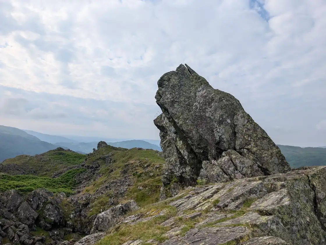
  • Helm CragHelm CragCentral405 m~2 h🚌 BusDecent · 70Dry, firm underfootHelm Crag at 405m (1,329ft) is one of the most famous and distinctive summits in Lakeland — the jagged, rocky outline known as 'The Lion and the Lamb' visible from Grasmere below.
  • Stone ArthurStone ArthurEastern504 m~2 h🚌 BusDecent · 67DryStone Arthur at 500m (1,640ft) is a craggy rock outcrop on the ridge above Grasmere, its small but distinctive summit giving one of the finest low-level views over Grasmere and Rydal Water in the whole district.
  • Low FellWestern422 m~2 h🚌 BusDecent · 65Mixed but walkableLow Fell at 423m (1,388ft) above Loweswater is a delightful, craggy little fell giving outstanding views of Loweswater lake and the Grasmoor group above.
  • Great Mell FellEastern537 m~2 h🚌 BusDecent · 70Dry, firm underfootGreat Mell Fell at 537m (1,762ft) is an isolated, conical summit above the Vale of Matterdale, its distinctive shape standing out from the surrounding farmland.
  • Graystones (Graystones North Top)Graystones (Graystones North Top)North Western450 m~2 h🚌 BusMarginal · 40Summit likely clagged inGraystones at 456m (1,496ft) is a small, heathery fell above Lorton Vale, its summit giving pleasant views of Bassenthwaite Lake and the northern fells.
  • Gibson KnottGibson KnottCentral420 m~2 h🚌 BusMarginal · 40Summit likely clagged inGibson Knott at 420m (1,378ft) is a craggy, pleasant little summit on the ridge above Greenburn above Grasmere, giving good views of the valley and Helm Crag to the south.
  • BarrowNorth Western455 m~2 h🚌 BusMarginal · 40Summit likely clagged inBarrow at 455m (1,493ft) is a small, grassy summit above Braithwaite, giving one of the finest views of the Coledale valley and the Causey Pike ridge for its modest height.
  • Grange Fell (Brund Fell)Grange Fell (Brund Fell)Central417 m~2 h🚌 BusMarginal · 40Summit likely clagged inGrange Fell at 415m (1,362ft) is a rough, rocky summit above the village of Grange in Borrowdale, its craggy knolls and heathery terraces giving a charming, varied walk.
  • Fellbarrow - Mosser FellWestern416 m~2 h🚌 BusDecent · 65Mixed but walkableFellbarrow at 416m (1,365ft) is a heathery summit above Lorton Vale, giving fine views of the vale and Bassenthwaite Lake.
  • Black FellBlack FellSouthern323 m~2 h🚌 BusCracking · 75Dry, firm underfootBlack Fell at 323m (1,060ft) is a small, heathery summit above Tarn Hows, its top giving fine views of this most popular of Lakeland beauty spots.
  • Troutbeck TongueTroutbeck TongueFar Eastern364 m~2 h🚌 BusDecent · 62DryTroutbeck Tongue at 364m (1,194ft) is a long, narrow ridge jutting into the Troutbeck valley, its summit giving fine views of the valley and the Ill Bell ridge above.
  • Steel Knotts (Pikeawassa)Steel Knotts (Pikeawassa)Far Eastern432 m~2 h🚌 BusDecent · 66DrySteel Knotts at 432m (1,417ft) is a small, rocky summit above Martindale with excellent views of Ullswater from its craggy top.
  • BuckbarrowWestern423 m~2 hMarginal · 40Summit likely clagged inBuckbarrow at 423m (1,388ft) is a craggy little summit above Wastwater, its western crags giving a dramatic profile from the road below and excellent views of the lake from the summit.
  • Holme FellHolme FellSouthern316 m~2 h🚌 BusCracking · 76Dry, firm underfootHolme Fell at 317m (1,040ft) is a delightful, craggy little summit above Yewdale near Coniston, its rocky outcrops of Uskdale Gap and Ivy Crag providing surprisingly varied and interesting walking for such a modest height.
  • Castle CragCastle CragNorth Western290 m~2 h🚌 BusCracking · 75Dry, light winds, firm underfootCastle Crag at 290m (951ft) is the lowest of all the Wainwright fells, yet one of the most dramatic — a rocky prow standing sentinel in the narrowest part of the Borrowdale gorge between Grange and Rosthwaite.
  • Arnison CragArnison CragEastern433 m~2 h🚌 BusCracking · 75Dry, light windsArnison Crag at 433m (1,421ft) is the small, craggy summit directly above Patterdale village, its rocky top giving an excellent bird's-eye view of the village and Goldrill Beck below.
  • Dodd (Skiddaw)Dodd (Skiddaw)Northern502 m~2 h🚌 BusMarginal · 40Summit likely clagged inDodd at 502m (1,647ft) is the prominent wooded cone above Bassenthwaite Lake, its open summit — above the Dodd Wood forest — giving one of the finest aerial views of Bassenthwaite Lake in the whole district.
  • Silver HowSilver HowCentral394 m~2 h🚌 BusDecent · 74DrySilver How at 395m (1,296ft) is a delightful, rocky little summit above Grasmere and Chapel Stile, its summit giving one of the finest views of Grasmere and the surrounding fells from any low-level viewpoint in the district.
  • Glenridding DoddGlenridding DoddEastern442 m~2 h🚌 BusMarginal · 40Summit likely clagged inGlenridding Dodd at 442m (1,450ft) is a small grassy summit above the Glenridding valley, its top giving good views of Ullswater and across to Sheffield Pike.
  • Walla CragWalla CragCentral379 m~2 h🚌 BusMarginal · 40Summit likely clagged inWalla Crag at 379m (1,244ft) is the great rocky escarpment above Derwent Water, its summit giving one of the finest aerial views of the lake in the whole district.
  • Loughrigg FellLoughrigg FellCentral335 m~2 h🚌 BusDecent · 68DryLoughrigg Fell at 335m (1,099ft) is one of the most beloved and visited fells in the Lake District, a complex heathery mass rising between Ambleside, Grasmere and Elterwater.
  • Eagle CragEagle CragCentral523 m~2.5 h🚌 BusMarginal · 40Summit likely clagged inEagle Crag at 520m (1,706ft) is a magnificent rocky buttress above Langstrath, its eastern face dropping in great crags to the valley below.
  • High ToveCentral515 m~2.5 h🚌 BusMarginal · 40Summit likely clagged inHigh Tove at 515m (1,690ft) is a modest, boggy summit on the Armboth plateau between Thirlmere and Borrowdale, its open top giving views across to the Helvellyn range and north to Skiddaw.
  • Whinlatter (Brown How)North Western517 m~2.5 h🚌 BusMarginal · 40Summit likely clagged inWhinlatter at 525m (1,722ft) is the fell above Whinlatter Pass — the broad, wooded ridge between Braithwaite and Lorton — its open summit giving views west to the coast and north to Bassenthwaite Lake.
  • Calf CragCalf CragCentral537 m~2.5 h🚌 BusMarginal · 40Summit likely clagged inCalf Crag at 537m (1,762ft) is the northernmost summit of the Central Fells above Greenburn, a rocky top giving fine views down into Wythburn and north to the Helvellyn range.
  • Blea RiggCentral542 m~2.5 h🚌 BusMarginal · 40Summit likely clagged inBlea Rigg at 541m (1,775ft) is a craggy, complex ridge above Easedale and Langdale, giving excellent views down into Great Langdale from its rocky summit.
  • Tarn Crag (Easedale)Tarn Crag (Easedale)Central549 m~2.5 h🚌 BusMarginal · 40Summit likely clagged inTarn Crag at 583m (1,913ft) above Easedale is a craggy little summit above the head of the Sour Milk Gill path from Grasmere.
  • Hard KnottSouthern550 m~2.5 hMarginal · 40Summit likely clagged inHard Knott at 549m (1,801ft) stands above the infamous Hardknott Pass, its rocky summit giving superb views down to the Roman fort of Mediobogdum directly below — one of the most evocative historical viewpoints in the Lake District.
  • Broom FellBroom FellNorth Western510 m~2.5 h🚌 BusMarginal · 40Summit likely clagged inBroom Fell at 509m (1,670ft) is a grassy summit above Lorton Vale in the north-western corner of the Lake District, giving wide views across Bassenthwaite Lake and north towards the Solway.
  • Cat Bells (Catbells)North Western451 m~2.5 h🚌 BusMarginal · 40Summit likely clagged inCatbells is one of Alfred Wainwright's great favourites, and his fondness for it shines through in The North-Western Fells — he saw it as a 'family fell,' approachable enough for grandparents and young children to climb together, yet rewarding with shapely, sun-warmed slopes and a genuinely striking position above Derwent Water.
  • Great Crag (Stonethwaite)Great Crag (Stonethwaite)Central449 m~2.5 h🚌 BusDecent · 70Dry, light windsGreat Crag at 449m (1,473ft) is a small, craggy summit above Watendlath, its rocky top giving fine views of the charming hamlet and tarn below and across to Glaramara and the Borrowdale fells.
  • Hartsop DoddFar Eastern619 m~2.5 h🚌 BusMarginal · 40Summit likely clagged inHartsop Dodd at 618m (2,028ft) is a grassy ridge summit above Hartsop village, its long slope rising to a broad top with fine views of Brothers Water and the Patterdale valley below.
  • Raven CragRaven CragCentral461 m~2.5 h🚌 BusMarginal · 40Summit likely clagged inRaven Crag at 461m (1,512ft) is the dramatic cliff above Thirlmere, its great crag face one of the most impressive roadside crags in Lakeland.
  • Armboth Fell (Armboth Fell South Top)Central475 m~2.5 h🚌 BusMarginal · 40Summit likely clagged inArmboth Fell at 479m (1,572ft) is a broad, peaty summit on the central plateau between Thirlmere and Watendlath, giving adequate views across to the Helvellyn range.
  • Lingmoor Fell (Brown How)Southern470 m~2.5 h🚌 BusDecent · 70Dry, firm underfootLingmoor Fell at 469m (1,539ft) is a heathery ridge between Great Langdale and Little Langdale, its summit giving one of the finest aerial views of Great Langdale available from any low fell.
  • BarfBarfNorth Western469 m~2.5 h🚌 BusMarginal · 40Summit likely clagged inBarf at 469m (1,539ft) is one of the most distinctive fells in the North Western group, rising steeply above Bassenthwaite Lake.
  • Rosthwaite Fell - BessybootSouthern551 m~2.5 h🚌 BusMarginal · 40Summit likely clagged inBessyboot at 551m (1,808ft) is the distinctive rocky summit of Rosthwaite Fell in the Central Fells above Stonethwaite and Borrowdale.
  • Baystones (Wansfell)Baystones (Wansfell)Far Eastern487 m~2.5 h🚌 BusDecent · 63DryBaystones at 487m (1,598ft) is the north top of the Wansfell ridge above Ambleside, giving outstanding views of Windermere and the Central Fells.
  • Sour HowesSour HowesFar Eastern483 m~2.5 h🚌 BusDecent · 69Dry, light windsSour Howes at 483m (1,585ft) is a broad, grassy summit above Troutbeck with good views south to Windermere.
  • Longlands FellNorthern483 m~2.5 hMarginal · 40Summit likely clagged inLonglands Fell at 483m (1,585ft) is the lowest of the Back o' Skiddaw group, a pleasant, easy summit above Caldbeck giving views across the northern moorlands.
  • Beda Fell (Beda Head)Beda Fell (Beda Head)Far Eastern509 m~2.5 h🚌 BusDecent · 68DryBeda Fell at 509m (1,670ft) is a long, smooth ridge above Martindale, its summit giving outstanding views of Ullswater and the northern Eastern Fells.
  • Bonscale PikeFar Eastern524 m~2.5 h🚌 BusDecent · 63Dry, firm underfootBonscale Pike at 524m (1,719ft) stands above Ullswater's western shore, its grassy summit giving fine views of the lake's southern reach and across to the Helvellyn range.
  • High Hartsop DoddHigh Hartsop DoddEastern519 m~2.5 h🚌 BusDecent · 71DryHigh Hartsop Dodd at 519m (1,703ft) is a small, grassy summit above Hartsop village, its top giving good views of Brothers Water and the lower Patterdale valley.
  • SallowsSallowsFar Eastern516 m~2.5 h🚌 BusDecent · 59DrySallows at 516m (1,693ft) is a smooth, grassy summit on the Kentmere ridge above the Troutbeck valley, its open top giving views south to Windermere and east to the Kentmere fells.
  • Brae FellNorthern585 m~2.5 hMarginal · 40Summit likely clagged inBrae Fell at 586m (1,923ft) is a moorland summit in the Back o' Skiddaw country, its broad top giving wide views north towards the Solway and east to the Pennines.
  • Green CragSouthern489 m~2.5 hDecent · 66Dry, firm underfootGreen Crag at 489m (1,604ft) is a delightful rocky summit above the Ulpha Fells in Dunnerdale, its small crags and bilberry-covered knolls quite different in character from the high fells to the north.
  • Low PikeEastern508 m~2.5 h🚌 BusDecent · 66DryLow Pike at 508m (1,667ft) is a Wainwright summit in the Eastern Fells, the first top on the Scandale ridge rising above Ambleside towards High Pike and Dove Crag.
  • Lord's SeatLord's SeatNorth Western552 m~2.5 h🚌 BusMarginal · 40Summit likely clagged inLord's Seat at 552m (1,811ft) is the highest point of the Whinlatter Forest fells, a broad, grassy summit giving outstanding views of Bassenthwaite Lake and the Skiddaw massif.
  • Souther FellNorthern522 m~2.5 h🚌 BusDecent · 67Dry, firm underfootSouther Fell at 522m (1,713ft) is an isolated, flat-topped ridge above Mungrisdale, famous in local tradition for the legendary ghostly army said to have been seen marching along its crest in the 18th century.
  • Great CockupNorthern526 m~2.5 h🚌 BusMarginal · 40Summit likely clagged inGreat Cockup at 526m (1,726ft) is an isolated summit north of Skiddaw, its open top giving wide views across the Solway Plain and north towards Scotland.
  • Meal FellNorthern549 m~2.5 hMarginal · 40Summit likely clagged inMeal Fell at 550m (1,804ft) is a small, grassy summit in the Back o' Skiddaw country above Longlands, giving pleasant views across the northern moorlands.
  • Arthur's PikeArthur's PikeFar Eastern533 m~2.5 h🚌 BusDecent · 63Dry, firm underfootArthur's Pike at 533m (1,749ft) is a grassy summit above Ullswater's western shore, giving fine views of the lake from its open top.
  • Maiden MoorNorth Western575 m~2.5 h🚌 BusMarginal · 40Summit likely clagged inMaiden Moor at 576m (1,890ft) is the broad ridge south of Catbells on the Newlands Horseshoe, giving outstanding views of Derwent Water from its open summit plateau.
  • Ard CragsNorth Western581 m~2.5 h🚌 BusMarginal · 40Summit likely clagged inArd Crags at 581m (1,906ft) is a craggy ridge summit above the head of the Newlands valley, its rocky west face giving the fell its name.
  • Bleaberry FellBleaberry FellCentral590 m~2.5 h🚌 BusMarginal · 40Summit likely clagged inBleaberry Fell at 590m (1,936ft) is a broad, heathery summit above Cat Bells and Derwent Water, giving one of the finest aerial views of the lake in the whole district.
  • Sergeant's CragCentral571 m~2.5 h🚌 BusMarginal · 40Summit likely clagged inSergeant's Crag at 571m (1,873ft) is a craggy, rocky summit above Langstrath in Borrowdale, its small crags giving a surprisingly dramatic profile for a modest summit.
  • Steel Fell (Dead Pike)Steel Fell (Dead Pike)Central553 m~2.5 h🚌 BusMarginal · 40Summit likely clagged inSteel Fell at 553m (1,814ft) is the ridge south of Dunmail Raise above Thirlmere, its long summit crest giving outstanding views of Grasmere below and the full Southern Fells beyond.
  • Knott RiggNorth Western556 m~2.5 h🚌 BusMarginal · 40Summit likely clagged inKnott Rigg at 556m (1,824ft) is a pleasant, grassy ridge summit above the Newlands valley between Ard Crags and the Buttermere road, giving fine views of the Grasmoor and Newlands Horseshoe ranges.
  • OutersideNorth Western568 m~2.5 h🚌 BusMarginal · 40Summit likely clagged inOuterside at 568m (1,864ft) is a small, grassy summit between Causey Pike and the Coledale valley, giving pleasant views of the surrounding North Western Fells.
  • Fleetwith PikeFleetwith PikeWestern649 m~2.5 h🚌 BusMarginal · 40Summit likely clagged inFleetwith Pike at 648m (2,126ft) stands above Honister Pass, its northern face falling in the famous Honister Crags that Wainwright described as giving one of the most dramatic fell profiles in the Western Fells.
  • Hartsop Above How (Gill Crag)Hartsop Above How (Gill Crag)Eastern586 m~2.5 h🚌 BusDecent · 64DryHartsop above How at 586m (1,923ft) is a long, grassy ridge above the Hartsop valley, its summit giving good views down Brothers Water and across to Place Fell.
  • Brock Crags (Wainwright)Brock Crags (Wainwright)Far Eastern561 m~2.5 h🚌 BusMarginal · 40Summit likely clagged inBrock Crags at 561m (1,841ft) is a craggy little summit above Hayeswater, sitting between Angletarn Pikes and Rest Dodd on the ridge above Patterdale.
  • Angletarn Pikes (Angletarn Pikes North Top)Angletarn Pikes (Angletarn Pikes North Top)Far Eastern566 m~2.5 h🚌 BusDecent · 73Dry, light winds, firm underfootAngletarn Pikes at 567m (1,860ft) are twin rocky summits above Angle Tarn — the perfect mountain tarn, cupped in a dramatic hollow above Patterdale.
  • Shipman KnottsFar Eastern587 m~2.5 hDecent · 64DryShipman Knotts at 587m (1,926ft) is a neat, rocky summit above the Kentmere valley, the southernmost point of the Kentmere Horseshoe.
  • Seathwaite Fell (Wainwright summit)Southern601 m~2.5 h🚌 BusMarginal · 40Summit likely clagged inThe AA cairn of Seathwaite Fell at 550m (1,804ft) is the highest point on the western edge of the Seathwaite Fell plateau above Borrowdale, marked by the Automobile Association triangulation pillar.
  • Selside PikeFar Eastern655 m~3 hMarginal · 40Summit likely clagged inSelside Pike is a quiet, grassy Wainwright on the high watershed between Haweswater and Swindale, in the lonely Far Eastern Fells.
  • Place FellPlace FellFar Eastern657 m~3 h🚌 BusDecent · 63Dry, firm underfootPlace Fell at 657m (2,156ft) is the great ridge fell on the eastern shore of Ullswater, its long summit ridge giving one of the finest views of the lake in all Lakeland.
  • High Pike (Scandale)Eastern657 m~3 h🚌 BusMarginal · 40Summit likely clagged inHigh Pike at 656m (2,152ft), above Scandale, is a broad grassy summit at the southern end of the ridge above Ambleside giving wide views south across Windermere and north to the Fairfield group.
  • Wether HillWether HillFar Eastern672 m~3 h🚌 BusDecent · 66DryWether Hill at 671m (2,201ft) is an intermediate summit on the High Street plateau between Loadpot Hill and High Raise, its broad, grassy top passing almost unnoticed on the main ridge path.
  • Tarn Crag (Sleddale)Tarn Crag (Sleddale)Far Eastern664 m~3 hMarginal · 40Summit likely clagged inTarn Crag at 664m (2,178ft) in Sleddale is a broad, grassy summit on the remote moorland east of Shap, giving wide views across the Shap Fells to the Pennines.
  • Loadpot HillLoadpot HillFar Eastern672 m~3 h🚌 BusMarginal · 52DryLoadpot Hill at 671m (2,201ft) is the northern summit of the High Street plateau above Ullswater, the site of a ruined Roman turret on the ancient road that runs along the ridge.
  • Middle DoddMiddle DoddEastern654 m~3 h🚌 BusMarginal · 40Summit likely clagged inMiddle Dodd at 654m (2,146ft) is the grassy ridge between Red Screes and Little Hart Crag above the Kirkstone Pass, its open summit giving fine views of the pass road and the Hartsop valley below.
  • Harter Fell (Eskdale)Southern653 m~3 hDecent · 63Dry, firm underfootHarter Fell at 654m (2,146ft) in Eskdale is a shapely, rocky summit above Boot, quite distinct in character from the Mardale fell of the same name.
  • Long SideLong SideNorthern734 m~3 h🚌 BusMarginal · 40Summit likely clagged inLong Side at 734m (2,408ft) is an intermediate summit on the Ullock Pike to Skiddaw ridge, its long, narrow crest giving outstanding views across Bassenthwaite Lake below and north to the Solway coast.
  • Heron Pike (Rydal)Eastern612 m~3 h🚌 BusMarginal · 40Summit likely clagged inHeron Pike at 612m (2,008ft) is the southern end of the Fairfield Horseshoe ridge above Rydal, its rocky summit giving excellent views across Windermere and south to Morecambe Bay.
  • Grey Crag (Sleddale Fell)Far Eastern638 m~3 hMarginal · 35Poor visibility — nav riskGrey Crag at 638m (2,093ft) is the summit of Sleddale Fell, a Wainwright in the Far Eastern Fells above the remote Longsleddale valley.
  • Little Hart Crag (West Top)Little Hart Crag (West Top)Eastern637 m~3 h🚌 BusMarginal · 40Summit likely clagged inLittle Hart Crag at 637m (2,090ft) is the rocky subsidiary summit above the Dovedale valley, giving excellent views down to Brothers Water and across to Red Screes.
  • BirksBirksEastern624 m~3 h🚌 BusMarginal · 40Summit likely clagged inBirks at 622m (2,040ft) is the lower, southern ridge of St Sunday Crag above Grisedale, its summit giving good views up the valley to Fairfield and across to the Helvellyn range.
  • UllscarfCentral723 m~3 h🚌 BusMarginal · 40Summit likely clagged inUllscarf at 726m (2,382ft) is the quietest and most remote of the Central Fells, a broad, heathery plateau above the headwaters of Wyth Burn that Wainwright described as giving an unfrequented and peaceful summit with outstanding views in all directions.
  • Thunacar KnottCentral723 m~3 h🚌 BusDecent · 63DryThunacar Knott at 723m (2,372ft) is the broad, grassy summit between Harrison Stickle and High Raise, often crossed without recognition on the way between the Langdale Pikes and the High Raise plateau.
  • Sergeant ManSergeant ManCentral736 m~3 h🚌 BusMarginal · 40Summit likely clagged inSergeant Man at 736m (2,415ft) is the subsidiary summit of High Raise above Langdale, a rocky outcrop on the rim of the plateau with outstanding views of the Langdale valley and the Pikes below.
  • HindscarthHindscarthNorth Western727 m~3 h🚌 BusMarginal · 40Summit likely clagged inHindscarth at 727m (2,385ft) is an elegant summit on the Newlands Horseshoe between Dale Head and Robinson, its pointed profile visible from the Newlands valley below.
  • Pike of StickleCentral708 m~3 h🚌 BusMarginal · 40Summit likely clagged inPike of Stickle at 709m (2,326ft) is the most distinctive of the Langdale Pikes — a soaring, pointed summit of volcanic rock that thrusts skyward above the head of Langdale.
  • Cold PikeSouthern700 m~3 h🚌 BusMarginal · 40Summit likely clagged inCold Pike at 701m (2,300ft) is a rocky little summit on the ridge between Pike of Blisco and Crinkle Crags, its three small tops each providing slightly different views.
  • Pavey ArkCentral702 m~3 h🚌 BusMarginal · 40Summit likely clagged inPavey Ark at 700m (2,297ft) is the great crag above Stickle Tarn in Great Langdale — its massive cliff face dropping nearly 100m from rim to tarn and offering some of the finest rock climbing in the Lake District.
  • Whiteside (Whiteside West Top)Whiteside (Whiteside West Top)North Western707 m~3 h🚌 BusMarginal · 40Summit likely clagged inWhiteside at 719m (2,359ft) is a long, narrow ridge above Crummock Water, its steep south face dropping dramatically to the lake below.
  • Pike of BliscoSouthern703 m~3 h🚌 BusMarginal · 40Summit likely clagged inPike of Blisco at 705m (2,313ft) is a shapely, rocky little summit above the head of Great Langdale, beloved by Wainwright for its excellent views and its distinctive, pointed profile when seen from the valley.
  • Harrison StickleHarrison StickleCentral735 m~3 h🚌 BusMarginal · 40Summit likely clagged inHarrison Stickle at 736m (2,415ft) is the highest and most prominent of the Langdale Pikes, a magnificent crag-crowned summit that dominates the head of Great Langdale and is one of the most recognisable profiles in English fell walking.
  • Ullock PikeUllock PikeNorthern690 m~3 h🚌 BusMarginal · 40Summit likely clagged inUllock Pike at 692m (2,270ft) is the sharp, pointed north-western extremity of the Skiddaw ridge, its needle-like profile visible from the Bassenthwaite valley below.
  • Bannerdale CragsNorthern684 m~3 h🚌 BusMarginal · 40Summit likely clagged inBannerdale Crags at 683m (2,240ft) stands above the remote Bannerdale valley between Mungrisdale and the Helvellyn range, its summit crags giving a dramatic and largely unvisited view of the eastern Northern Fells.
  • Lonscale FellLonscale FellNorthern715 m~3 h🚌 BusMarginal · 40Summit likely clagged inLonscale Fell at 715m (2,346ft) is the eastern shoulder of Skiddaw above the River Glenderaterra, giving fine views of the Blencathra massif and east across the Northern Fells.
  • Bowscale FellNorthern702 m~3 h🚌 BusMarginal · 40Summit likely clagged inBowscale Fell at 702m (2,303ft) is a broad summit above Mungrisdale, its eastern face concealing one of Lakeland's most atmospheric tarns — Bowscale Tarn, set in a dark corrie below the fell's north-east face.
  • BakestallBakestallNorthern674 m~3 h🚌 BusMarginal · 40Summit likely clagged inBakestall at 673m (2,208ft) is the north-eastern satellite of Skiddaw, a broad grassy summit with the best views of the Back o' Skiddaw plateau and north towards the Solway.
  • Great Sca FellNorthern651 m~3 h🚌 BusMarginal · 40Summit likely clagged inGreat Sca Fell at 651m (2,136ft) is a rounded, grassy summit in the Back o' Skiddaw country, giving wide views across the northern moorlands to the Solway and the Pennines.
  • RobinsonRobinsonNorth Western738 m~3 h🚌 BusMarginal · 40Summit likely clagged inRobinson at 737m (2,418ft) is the north-western bastion of the Newlands Horseshoe — the great classic ridge walk that circuits the Newlands valley.
  • Carrock FellNorthern662 m~3 hMarginal · 40Summit likely clagged inCarrock Fell at 663m (2,175ft) is the easternmost of the Northern Fells, an isolated summit above the Vale of Eden with a remarkable ancient hillfort on its summit — one of the finest Iron Age fortifications in northern England.
  • High Pike (Caldbeck)Northern658 m~3 hMarginal · 40Summit likely clagged inHigh Pike at 658m (2,159ft) above Caldbeck is the northernmost fell in Wainwright's guide, a broad grassy summit on the edge of the Lake District whose summit gives an extraordinary view north and east — the Solway Firth, the Isle of Man and the Pennines all visible on a clear day.
  • FroswickFroswickFar Eastern720 m~3 h🚌 BusMarginal · 40Summit likely clagged inFroswick at 720m (2,362ft) is the middle summit of the Ill Bell ridge above Troutbeck, a pointed peak with a surprisingly shapely profile when viewed from the Troutbeck valley below.
  • Birkhouse MoorBirkhouse MoorEastern718 m~3 h🚌 BusMarginal · 40Summit likely clagged inBirkhouse Moor at 718m (2,356ft) is the long, grassy shoulder south of Glenridding that forms the approach ridge to Striding Edge and Helvellyn from Patterdale.
  • Kentmere PikeFar Eastern730 m~3 hMarginal · 40Summit likely clagged inKentmere Pike at 730m (2,395ft) is the eastern anchor of the Kentmere Horseshoe, a broad, grassy summit giving outstanding views east across the Shap Fells and south down the Kentmere valley.
  • Clough HeadEastern726 m~3 h🚌 BusMarginal · 40Summit likely clagged inClough Head at 726m (2,382ft) is the northernmost of the main Helvellyn ridge summits, a grassy whale-back that Wainwright noted as the ideal starting or finishing point for the full northern Dodds traverse.
  • BranstreeFar Eastern712 m~3 hMarginal · 40Summit likely clagged inBranstree at 713m (2,339ft) is a broad, featureless summit on the moorland plateau east of Haweswater, giving extensive views east to the Pennines and south across the Shap Fells.
  • Rest DoddRest DoddFar Eastern696 m~3 h🚌 BusMarginal · 40Summit likely clagged inRest Dodd at 696m (2,283ft) is an isolated summit above Patterdale, separated from the main High Street range by the hollow of Boardale Hause.
  • Sheffield PikeEastern676 m~3 h🚌 BusMarginal · 40Summit likely clagged inSheffield Pike at 675m (2,215ft) is a craggy, satisfying summit above Glenridding with outstanding views of Ullswater — Wainwright considered it one of the best Ullswater viewpoints in the Eastern Fells.
  • YokeYokeFar Eastern707 m~3 h🚌 BusMarginal · 40Summit likely clagged inYoke at 706m (2,316ft) is the southernmost summit of the Ill Bell ridge, a grassy shoulder above Troutbeck with fine views south to Windermere.
  • Gray CragFar Eastern698 m~3 h🚌 BusMarginal · 40Summit likely clagged inGray Crag at 638m (2,093ft) stands above Hayeswater and Hartsop, its steep eastern face dropping to the Hayeswater valley in a series of crags.
  • Seat SandalEastern737 m~3 h🚌 BusMarginal · 40Summit likely clagged inSeat Sandal at 736m (2,415ft) is an isolated summit above Dunmail Raise, its pointed profile clearly visible from the A591 and from Grasmere below.
  • Whiteless PikeWhiteless PikeNorth Western660 m~3 h🚌 BusMarginal · 40Summit likely clagged inWhiteless Pike at 660m (2,165ft) is the southern sentinel of the Grasmoor ridge above Buttermere, a sharp, pointed summit giving excellent views of the Buttermere valley and Crummock Water.
  • High SpyNorth Western653 m~3 h🚌 BusMarginal · 40Summit likely clagged inHigh Spy at 653m (2,142ft) is the high point of the Newlands Horseshoe ridge above Maiden Moor, its summit giving excellent views of Derwent Water to the north and the Dale Head group to the south.
  • Loft CragLoft CragCentral682 m~3 h🚌 BusMarginal · 40Summit likely clagged inLoft Crag at 682m (2,237ft) is the smallest and least visited of the Langdale Pikes, sitting between Pike of Stickle and Harrison Stickle on the western side of the Pikes circuit.
  • Scar CragsNorth Western672 m~3 h🚌 BusMarginal · 40Summit likely clagged inScar Crags at 672m (2,205ft) is a craggy ridge summit above Coledale between Causey Pike and Sail, its rocky profile one of the features of the Coledale Horseshoe.
  • Rossett PikeSouthern651 m~3 h🚌 BusMarginal · 40Summit likely clagged inThe south top of Rossett Pike at 612m (2,008ft) is a rocky point on the ridge south of the main Rossett Pike summit, giving additional views down the Mickleden valley in Great Langdale.
  • Middle FellWestern582 m~3 hMarginal · 40Summit likely clagged inMiddle Fell at 582m (1,909ft) is a small, craggy summit above Wasdale overlooking Wastwater, its top giving fine views of the lake and the Wastwater Screes.
  • The Knott (High Street)Far Eastern739 m~3 hMarginal · 40Summit likely clagged inThe Knott at 739m (2,425ft) stands above Hayeswater tarn, the highest and most secluded of the Eastern Fell tarns.
  • Causey PikeNorth Western637 m~3 h🚌 BusMarginal · 40Summit likely clagged inCausey Pike at 637m (2,090ft) is one of the most attractive North Western summits — a pointed, rocky knob visible from across Derwent Water that Wainwright regarded as giving one of the finest low-level views of the lake.
  • High SeatCentral609 m~3 h🚌 BusMarginal · 40Summit likely clagged inHigh Seat at 608m (1,995ft) is the highest summit of the Bleaberry Fell–Armboth plateau above Thirlmere and Derwent Water — a broad, boggy moorland that Wainwright regarded as something of an endurance test, given the extensive wet ground.
  • Floutern CopWestern451 mFloutern Cop is a Birkett (one of the 541 tops in Bill Birkett's Complete Lakeland Fells), a quiet Western top reached by few walkers.
  • Stile EndNorth Western447 mStile End at 447m (1,467ft) is the grassy ridge summit between Outerside and Barrow above the Coledale valley, its open top giving views of the surrounding North Western Fells.
  • The Benn (Sippling Crag)Central446 mThe Benn at 446m (1,463ft) is a Birkett top above the St John's in the Vale valley between Thirlmere and Blencathra, giving views along the valley and towards the Helvellyn range.
  • Banna FellWestern455 mBanna Fell (455 m / 1,493 ft) is a Birkett (one of the 541 tops in Bill Birkett's Complete Lakeland Fells), one of the lesser-known Western tops.
  • Dodd (Lorton)North Western454 mDodd at 454m (1,490ft) is a Birkett top above the Lorton Vale between Loweswater and Cockermouth, its rounded summit giving views across the fertile valley and towards the higher North Western Fells.
  • Red KnottNorth Western452 mRed Knott at 452m (1,483ft) is a Birkett top on the Whiteside ridge in the North Western Fells above the Gasgale Gill, giving views across the Coledale valley and towards Grasmoor.
  • Rowling EndNorth Western433 mRowling End at 433m (1,421ft) is the rocky spur below Causey Pike above the Newlands valley, its craggy top giving excellent views of Derwent Water and the Skiddaw massif.
  • Glade HowWestern440 mGlade How at 440m (1,444ft) is a Birkett top in the Western Fells above the lower Ennerdale valley, its heathery summit giving views across the valley and west to the Lakeland coast.
  • Lad HowsNorth Western426 mLad Hows (426 m / 1,398 ft) is a Birkett (one of the 541 tops in Bill Birkett's Complete Lakeland Fells), one of the lesser-known North Western tops.
  • Scar LathingSouthern439 mScar Lathing at 439m (1,440ft) is a Birkett top on the fell above the upper Dunnerdale valley, giving views across the head of the Duddon towards the Coniston fells.
  • Lingmell (Ennerdale)Western427 mLingmell at 427m (1,401ft) — distinct from the Lingmell above Wasdale — is a Birkett fell above the south side of Ennerdale, its heathery summit giving views across the valley and towards the high Ennerdale fells.
  • Low PenWestern435 mAt 435 m (1,427 ft), Low Pen is a Birkett (one of the 541 tops in Bill Birkett's Complete Lakeland Fells) in the North Western Fells — an overlooked summit away from the crowds.
  • Yew BankSouthern499 mYew Bank at 499m (1,637ft) is a Birkett fell in the West Cumbria group above the Dunnerdale area, its heathery summit giving views across the lower Duddon valley and towards the coast.
  • Shivery KnottCentral491 mAt 491 m (1,611 ft), Shivery Knott is a Birkett (one of the 541 tops in Bill Birkett's Complete Lakeland Fells) in the Central Fells — an overlooked summit away from the crowds.
  • Gavel Fell - High Nook (Gavel Fell North Top)Western488 m
  • SwinsideNorth Western509 mSwinside at 509m (1,670ft) is a Birkett top above the Bassenthwaite valley in the North Western Fells, giving views across Bassenthwaite Lake and towards the Skiddaw massif.
  • Wythburn FellCentral508 mWythburn Fell at 508m (1,667ft) is a Birkett top on the broad moorland above the southern end of Thirlmere in the Central Fells, its grassy summit giving views across the reservoir and towards the Helvellyn range.
  • Castle How (Raw Pike)Central498 mCastle How at 498m (1,634ft) is a Birkett top on the rough fell ground above Grasmere and Easedale, its rocky summit giving views across the Grasmere valley and towards the Central Fells.
  • Armboth Fell (Birkett)Armboth Fell (Birkett)Central479 mArmboth Fell at 479m (1,572ft) rises above Thirlmere reservoir in the Central Fells, its sprawling, marshy summit giving modest but pleasant views over the conifer plantations and across to the Helvellyn range.
  • High PenWestern475 mAt 475 m (1,558 ft), High Pen is a Birkett (one of the 541 tops in Bill Birkett's Complete Lakeland Fells) in the North Western Fells — an overlooked summit away from the crowds.
  • Brown RiggCentral462 mBrown Rigg at 462m (1,516ft) is a Birkett top on the open moorland between Thirlmere and the Wyth Burn, its grassy summit giving views across the central plateau and towards the Helvellyn range.
  • High ScarthSouthern487 mHigh Scarth (487 m / 1,598 ft) is a Birkett (one of the 541 tops in Bill Birkett's Complete Lakeland Fells), one of the lesser-known Southern tops.
  • Middle CragCentral484 mMiddle Crag at 484m (1,588ft) is a Birkett top on the rough fell above the Thirlmere reservoir in the Central Fells, its rocky character giving views across the long lake and towards the Helvellyn range.
  • Sharp KnottWestern482 mSharp Knott at 482m (1,581ft) is a Birkett fell above the south side of Ennerdale in the Western Fells, its pointed summit giving views across Ennerdale and towards the higher fells.
  • Darling FellWestern392 mDarling Fell at 392m (1,286ft) is a Birkett top above the south side of Ennerdale, its heathery summit giving views across the valley to the high fells of the Ennerdale horseshoe and west to the Lakeland coast.
  • Blakeley RaiseWestern389 mBlakeley Raise at 373m (1,224ft) is a broad moorland summit above Ennerdale Water, giving views of the lake and the western fells above.
  • Hatteringill Head - Whin FellWestern385 mHatteringill Head at 385m (1,263ft) is a Birkett top on the fell above the Calder valley in the far western fells, giving views across the coastal plain and inland to the higher Western Fells.
  • Silverybield CragSouthern395 mSilverybield Crag (395 m / 1,296 ft) is a Birkett (one of the 541 tops in Bill Birkett's Complete Lakeland Fells), one of the lesser-known Southern tops.
  • King's How - Grange FellCentral392 mKing's How at 392m (1,286ft) is the summit of Grange Fell above Borrowdale — a named memorial tor on the rocky crest above the Jaws of Borrowdale, given to the nation in memory of King Edward VII.
  • Smithy FellWestern392 mSmithy Fell at 392m (1,286ft) is a Birkett fell above the south side of Ennerdale in the Western Fells, its heathery summit giving views across the valley and towards the coast.
  • Little Dodd (Loweswater)Western362 mLittle Dodd at 362m (1,188ft) is a Birkett top above Loweswater in the North Western Fells, its heathery summit giving views across the small and beautiful lake of Loweswater.
  • Side PikeSouthern362 mSide Pike at 362m (1,188ft) is a small, rocky knoll above the head of Great Langdale beside Blea Tarn, its craggy top giving outstanding views of both Great and Little Langdale and the Langdale Pikes.
  • Latter BarrowWestern354 mAt 354 m (1,161 ft), Latter Barrow is a Birkett (one of the 541 tops in Bill Birkett's Complete Lakeland Fells) in the Western Fells — an overlooked summit away from the crowds.
  • KinnisideWestern375 mKinniside at 375m (1,230ft) is a Birkett fell above the Calder valley in the far western fells, its open summit giving views across the coastal plain and inland to the Western Fells.
  • KinnKinnNorth Western374 mKinn at 374m (1,227ft) is a Birkett top above the Bassenthwaite valley in the North Western Fells, giving views across the lake and towards the Skiddaw massif.
  • GodworthWestern365 mGodworth (365 m / 1,198 ft) is a Birkett (one of the 541 tops in Bill Birkett's Complete Lakeland Fells), one of the lesser-known Western tops.
  • Lang HowCentral414 mLang How is a Birkett (one of the 541 tops in Bill Birkett's Complete Lakeland Fells), a quiet Central top reached by few walkers.
  • Loweswater Fell (Low Fell South Top)Western417 mLoweswater Fell South Top at 417m (1,368ft) is a Birkett top on the Low Fell ridge above Loweswater in the North Western Fells, giving views across the intimate Loweswater lake and the surrounding pastoral valley.
  • Scope EndNorth Western412 mScope End at 538m (1,765ft) is the grassy ridge end above Buttermere village, giving pleasant views of the lake and the Grasmoor massif above.
  • Eskdale Fell - WhinscalesSouthern425 mEskdale Fell - Whinscales is a Birkett (one of the 541 tops in Bill Birkett's Complete Lakeland Fells), a quiet Western top reached by few walkers.
  • Castle Crag (Shoulthwaite)Central404 mCastle Crag at 404m (1,325ft) is a Birkett top above the Shoulthwaite valley on the western side of Thirlmere, its rocky summit giving views across Thirlmere and towards the Helvellyn range.
  • Fisher CragCentral421 mFisher Crag at 421m (1,381ft) is a Birkett top above the head of Thirlmere on the Central Fells, its rocky character giving good views across the reservoir and towards the Helvellyn range.
  • Throstlehow CragSouthern404 mThrostlehow Crag at 404m (1,325ft) is a Birkett top above the upper Dunnerdale valley, giving views across the head of the Duddon and towards the Coniston fells.
  • Dawsonground CragsSouthern397 mDawsonground Crags at 397m (1,302ft) is a rocky Birkett top on the fell above the Dunnerdale valley south of Ulpha, its craggy summit giving views across the Duddon Sands and towards Black Combe.
  • Irton FellSouthern395 mIrton Fell at 395m (1,296ft) is a Birkett fell above the Eskdale and Miterdale valleys in the Western Fells, its heathery moorland summit giving views across lower Eskdale and west towards the coast.
  • Sourfoot FellWestern411 mSourfoot Fell at 441m (1,447ft) is a small fell above the Vale of Eden near Penrith, its open top giving views across the vale to the Pennines and west to the Northern Fells.
  • Swinescar PikeCentral411 mSwinescar Pike (411 m / 1,348 ft) is a Birkett (one of the 541 tops in Bill Birkett's Complete Lakeland Fells), one of the lesser-known Central tops.
  • Owsen FellWestern409 mOwsen Fell is a Birkett (one of the 541 tops in Bill Birkett's Complete Lakeland Fells), a quiet Western top reached by few walkers.
  • LothwaiteNorth Western345 mLothwaite is a Birkett (one of the 541 tops in Bill Birkett's Complete Lakeland Fells), a quiet Northern top reached by few walkers.
  • Little Eycott HillNorthern332 mLittle Eycott Hill is a Birkett (one of the 541 tops in Bill Birkett's Complete Lakeland Fells), a quiet Northern top reached by few walkers.
  • RivingsNorth Western335 mAt 335 m (1,099 ft), Rivings is a Birkett (one of the 541 tops in Bill Birkett's Complete Lakeland Fells) in the Northern Fells — an overlooked summit away from the crowds.
  • Little CockupNorthern399 mLittle Cockup at 399m (1,309ft) is a Birkett top in the Back o' Skiddaw country north of the main Lakeland fells, part of the broad moorland ridge between the Caldbeck Fells and Skiddaw Forest.
  • Orthwaite BankNorthern348 mOrthwaite Bank at 348m (1,142ft) is a Birkett top in the Back o' Skiddaw country north of the main Lakeland fells, its open moorland summit giving views across the Uldale Fells and north towards the Solway.
  • Eycott HillNorthern345 mEycott Hill (345 m / 1,132 ft) is a Birkett (one of the 541 tops in Bill Birkett's Complete Lakeland Fells), one of the lesser-known Northern tops.
  • Crinkle Crags - Fourth CrinkleSouthern832 mCrinkle Crags at 859m (2,818ft) is exactly what its name suggests — a jagged, entertaining ridge of five distinct tops above the head of Great Langdale.
  • Crinkle Crags - Gunson Knott (Fifth Crinkle)Southern822 mGunson Knott at 790m (2,592ft) is the craggy top on the Crinkle Crags ridge between the main crinkles, a rocky prominence that gives excellent views of the central Crinkle Crags complex.
  • Pike de BieldSouthern810 mPike de Bield at 810m (2,657ft) is a high Birkett top on the ridge between Pike o' Stickle and Rossett Pike in the Southern Fells, its rocky summit giving excellent views across the Langdale Pikes and into the wild upper Langdale.
  • WatchesNorthern333 mWatches at 333m (1,093ft) is a Birkett top on the western flanks of the Skiddaw massif above the Bassenthwaite valley, giving views across Bassenthwaite Lake and north towards the Solway.
  • Green How - Aughertree FellNorthern321 mGreen How at 321m (1,053ft) is a Birkett top on the Aughertree Fell north of Bassenthwaite, its open summit giving views north across the Solway plain and south along the northern edge of the Lake District.
  • Burthwaite HeightsNorth Western318 mBurthwaite Heights at 318m (1,043ft) is a Birkett top above the Bassenthwaite valley on the western flanks of the Skiddaw massif, its open summit giving views across Bassenthwaite Lake and towards the Solway Firth.
  • Round KnottNorthern603 mRound Knott at 603m (1,978ft) is a Birkett top in the Back o' Skiddaw country north of the main Lakeland fells, its open moorland summit giving wide views across the Caldbeck Fells and north towards the Solway.
  • Burn TodNorthern595 mBurnt Tod at 521m (1,709ft) is a small, heathery summit in the Back o' Skiddaw country above Orthwaite, its open top giving wide views north.
  • The TongueNorthern553 mThe Tongue at 553m (1,814ft) is a Birkett top in the Back o' Skiddaw country on the broad northern flanks of the Skiddaw massif, its moorland summit giving views across the Caldbeck Fells and north towards the Solway.
  • Coomb HeightNorthern627 mAt 627 m (2,057 ft), Coomb Height is a Birkett (one of the 541 tops in Bill Birkett's Complete Lakeland Fells) in the Northern Fells — an overlooked summit away from the crowds.
  • Frozen FellNorthern625 mFrozen Fell at 625m (2,051ft) is a Birkett top in the Back o' Skiddaw country north of the main Lakeland hills, its open moorland summit giving wide views across the Uldale Fells and north to the Solway.
  • Miton HillNorthern607 mMiton Hill at 607m (1,991ft) is a Birkett top in the Back o' Skiddaw country north of the main Lakeland fells, its open moorland summit giving views across the northern fell country and towards the Solway.
  • Tarbarrel MossNorth Western493 mTarbarrel Moss at 493m (1,617ft) is a Birkett top on the broad moorland between Lord's Seat and the Whinlatter fells in the North Western Fells, its boggy summit giving views across the Lorton Vale and towards the Buttermere fells.
  • GraystonesGraystonesNorth Western455 mGraystones North Top at 455m (1,493ft) is the subsidiary northern summit of the Graystones group above Lorton Vale in the North Western Fells.
  • Kirk Fell (Lorton)North Western437 mKirk Fell at 437m (1,434ft) — distinct from the famous Kirk Fell above Wasdale — is a Birkett fell above the Lorton Vale between Loweswater and Cockermouth, giving views across the fertile valley and towards the Buttermere fells.
  • Hare CragNorthern538 mHare Crag at 538m (1,765ft) is a Birkett top on the broad Skiddaw massif above the Mosedale valley, its open summit giving views across the northern fells and towards the Solway Firth.
  • CockupNorthern505 mCockup is a Birkett (one of the 541 tops in Bill Birkett's Complete Lakeland Fells), a quiet Northern top reached by few walkers.
  • Seat How (Thornthwaite)North Western495 mAt 495 m (1,624 ft), Seat How (Thornthwaite) is a Birkett (one of the 541 tops in Bill Birkett's Complete Lakeland Fells) in the North Western Fells — an overlooked summit away from the crowds.
  • Wrynose Fell - Long CragSouthern547 mWrynose Fell at 547m (1,795ft) is a Birkett top on the fell above the Wrynose Pass in the Southern Fells, its position giving views across the pass and towards the surrounding high ground of the Coniston and Langdale fells.
  • Lining CragCentral542 mLining Crag at 542m (1,778ft) is a Birkett top on the ridge above the Langstrath valley in the Central Fells, its rocky character giving views down into the wild Langstrath and across to the Eagle Crag ridge.
  • Blake Rigg (Little Langdale)Southern535 mBlake Rigg at 535m (1,755ft) is a craggy Birkett top above the Little Langdale valley and the Wrynose Pass road, its rocky outcrops giving fine views across the valley to Lingmoor Fell and south to the Furness Fells.
  • White Stones - The BandSouthern568 mWhite Stones at 568m (1,864ft) is a Birkett top on The Band ridge above Great Langdale in the Southern Fells, its position on the well-used path to Bowfell giving views across the Langdale valley and towards the Langdale Pikes.
  • HerdusWestern562 mHerdus (562 m / 1,844 ft) is a Birkett (one of the 541 tops in Bill Birkett's Complete Lakeland Fells), one of the lesser-known Western tops.
  • Ill Crag (Newlands) (Knott Rigg North Top)North Western546 mThe Causey Pike spur of Eel Crag at 467m (1,532ft) is a rocky subsidiary summit on the approach ridge to Causey Pike from the Newlands valley, giving views of the Coledale fells and Derwent Water.
  • Gale FellWestern518 mGale Fell (518 m / 1,699 ft) is a Birkett (one of the 541 tops in Bill Birkett's Complete Lakeland Fells), one of the lesser-known Western tops.
  • Watendlath Fell (Long Moss)Central515 mWatendlath Fell at 350m (1,148ft) is the broad, heathery fell above the beautiful hamlet of Watendlath above Borrowdale, its open summit giving fine views of the hamlet and tarn below.
  • WhoapWestern511 mWhoap at 511m (1,676ft) is a small, heathery summit above Ennerdale, its open top giving views of the western fells and towards the coast.
  • High Crags (Newlands)North Western529 mHigh Crags at 529m (1,736ft) is a Birkett top on the ridge between Robinson and High Stile above the Newlands valley, its craggy character giving views across the valley to Causey Pike and the Coledale fells.
  • Border EndSouthern522 mBorder End (522 m / 1,713 ft) is a Birkett (one of the 541 tops in Bill Birkett's Complete Lakeland Fells), one of the lesser-known Southern tops.
  • Loweswater End - Carling KnottWestern519 m
  • Low White StonesCentral731 mLow White Stones at 624m (2,047ft) is an intermediate summit on the High Raise plateau between Sergeant Man and Ullscarf, a broad, grassy top with open views across the Central Fells.
  • Gasgale CragsGasgale CragsNorth Western703 mGasgale Crags at 703m (2,306ft) is a dramatic Birkett top on the ridge of Whiteside above the Gasgale Gill ravine in the North Western Fells, its craggy summit giving views into the deep gully below and across to Hopegill Head.
  • Coldbarrow Fell - High SaddleCentral675 mColdbarrow Fell at 467m (1,532ft) is a broad, heathery plateau above Watendlath on the Armboth Fell system, its open top giving views west to Derwent Water and east to the Helvellyn range.
  • Eel Crag (Birkett)North Western807 mEel Crag at 839m (2,752ft) — known locally as Crag Hill — is the eastern summit of the Grasmoor range, its broad top giving outstanding views of the Coledale and Newlands valleys below.
  • Stonesty PikeSouthern765 mStonesty Pike at 765m (2,510ft) is a high Birkett top on the rocky ridge between Pike o' Blisco and Crinkle Crags in the Southern Fells, giving views across the Great Langdale valley and towards the Scafell group.
  • Thirdgill Head ManThirdgill Head ManNorth Western734 mThirdgill Head Man is a Birkett (one of the 541 tops in Bill Birkett's Complete Lakeland Fells), a quiet North Western top reached by few walkers.
  • Little Dodd (Ennerdale)Western590 mLittle Dodd (Ennerdale) (590 m / 1,936 ft) is a Birkett (one of the 541 tops in Bill Birkett's Complete Lakeland Fells), one of the lesser-known Western tops.
  • Thornythwaite FellSouthern574 mThornythwaite Fell at 574m (1,883ft) is a Birkett top on the broad fell above the Borrowdale valley between the Castle Crag gorge and the Allen Crags ridge, giving views down Borrowdale and across to the surrounding fell ridges.
  • High Gait CragsSouthern572 mHigh Gait Crags at 572m (1,877ft) is a Birkett top above the upper Duddon valley near Cockley Beck, its rocky summit giving views across the Dunnerdale fells and towards the Scafell group.
  • Thorn CragThorn CragCentral644 mThorn Crag at 644m (2,113ft) is a Birkett top on the rough fell above the Langstrath valley and Stonethwaite in the Central Fells, giving views into the wild Langstrath valley and across to the Glaramara ridge.
  • Standing CragStanding CragCentral611 mStanding Crag at 425m (1,394ft) is a rocky summit above Borrowdale near Stonethwaite, its small crags giving good views of the Borrowdale valley and Eagle Crag opposite.
  • Buck Pike (Mickleden)Southern606 m
  • Hell Gill PikeSouthern662 mHell Gill Pike at 662m (2,172ft) is a Birkett top on the high fell above the upper Wrynose valley, its rocky summit giving views across the head of Dunnerdale and towards the Crinkle Crags ridge.
  • White Pike (Seathwaite)Southern600 mAt 600 m (1,969 ft), White Pike (Seathwaite) is a Birkett (one of the 541 tops in Bill Birkett's Complete Lakeland Fells) in the Western Fells — an overlooked summit away from the crowds.
  • Black Combe South TopWestern588 mBlack Combe South Top at 588m (1,929ft) is the subsidiary summit of the Black Combe massif in the far south-west of the Lake District, giving views across the Duddon Sands and towards the Isle of Man and the Mull of Galloway on clear days.
  • Great How (Swirl Band)Southern775 m
  • Buck Pike - Seathwaite FellSouthern744 mBuck Pike at 744m (2,441ft) is a fine Birkett summit on the ridge above Seathwaite Tarn in Dunnerdale, its rocky top giving views across the Coniston fells and down into the upper Duddon valley.
  • Little CarrsSouthern692 mLittle Carrs at 692m (2,270ft) is a Birkett top on the ridge between Great Carrs and Grey Friar in the Southern Fells above Wrynose, its position giving views across the Greenburn valley and towards the Coniston fells.
  • Crook CragSouthern469 mCrook Crag at 456m (1,496ft) is a rocky fell top in the Dunnerdale Fells above the Duddon valley, its craggy summit giving fine views across to the Coniston Fells and south to the coast.
  • Plough FellWestern448 mAt 448 m (1,470 ft), Plough Fell is a Birkett (one of the 541 tops in Bill Birkett's Complete Lakeland Fells) in the Western Fells — an overlooked summit away from the crowds.
  • Birker Fell - White HowSouthern444 mBirker Fell at 478m (1,568ft) is a broad moorland plateau above Eskdale, its open summit giving sweeping views south-west to the Duddon estuary and the Cumbrian coast.
  • Great Paddy CragWestern532 mGreat Paddy Crag at 532m (1,745ft) is a Birkett top in the remote fell country above the coast between Sellafield and the Muncaster area, giving views across the Irish Sea and inland towards the Western Fells.
  • Birk Fell Man - Birk FellSouthern528 mBirk Fell Man at 528m (1,732ft) is the highest point of Birk Fell, a rocky ridge above the Tilberthwaite and Little Langdale valleys in the Southern Fells.
  • Demming CragSouthern525 mDemming Crag at 525m (1,722ft) is a Birkett top on the fell above the upper Duddon valley near Wrynose Bottom, its rocky summit giving views across the valley and towards Hard Knott and Harter Fell.
  • Pinnacle HoweFar Eastern383 mAt 383 m (1,257 ft), Pinnacle Howe is a Birkett (one of the 541 tops in Bill Birkett's Complete Lakeland Fells) in the Far Eastern Fells — an overlooked summit away from the crowds.
  • Sleet FellFar Eastern378 mSleet Fell at 378m (1,240ft) is a Birkett top on the moorland above the Bampton valley east of Ullswater, its open summit giving views across the pastoral valley and towards the Far Eastern Fells.
  • Bracken HowEastern373 mBracken How (373 m / 1,224 ft) is a Birkett (one of the 541 tops in Bill Birkett's Complete Lakeland Fells), one of the lesser-known Eastern tops.
  • Little MeldrumEastern404 mLittle Meldrum is a Birkett (one of the 541 tops in Bill Birkett's Complete Lakeland Fells), a quiet Eastern top reached by few walkers.
  • Castle Crag (Mardale)Far Eastern395 m
  • Round HowEastern387 mRound How is a Birkett (one of the 541 tops in Bill Birkett's Complete Lakeland Fells), a quiet Eastern top reached by few walkers.
  • Castle RockEastern339 mCastle Rock at 339m (1,112ft) is a rocky Birkett top above the St John's in the Vale valley between Thirlmere and Blencathra, its dramatic crag face a well-known rock climbing venue.
  • Great How (Thirlmere)Central333 mGreat How at 391m (1,283ft) above Thirlmere is a small wooded summit in the Wythburn valley, its rocky top giving views across Thirlmere reservoir.
  • Wren CragCentral311 mWren Crag is a rocky little top at the northern end of the High Rigg ridge, above Legburthwaite at the foot of St John's in the Vale near Thirlmere.
  • Low Birk FellFar Eastern373 mLow Birk Fell at 373m (1,224ft) is a Birkett top above the Bampton valley east of Ullswater, its open moorland summit giving views across the pastoral valley and towards the Haweswater fells.
  • Cocklaw FellFar Eastern365 mCocklaw Fell at 365m (1,198ft) is a Birkett top on the moorland east of Kentmere in the Far Eastern Fells, its open summit giving views across Kentmere and east towards the Shap Fells.
  • High Rigg (High Rigg South Top)Central343 mHigh Rigg South Top at 343m (1,125ft) is a Birkett top on the High Rigg ridge above the St John's in the Vale valley between Thirlmere and Blencathra.
  • High Pike HawSouthern354 mHigh Pike Haw at 354m (1,161ft) is a Birkett top in the low fells south of Coniston above the Torver area, giving views across Coniston Water and south to the Furness Fells.
  • Brock BarrowSouthern343 mAt 343 m (1,125 ft), Brock Barrow is a Birkett (one of the 541 tops in Bill Birkett's Complete Lakeland Fells) in the Southern Fells — an overlooked summit away from the crowds.
  • Birker Fell - Great CragSouthern333 mBirker Fell - Great Crag is a Birkett (one of the 541 tops in Bill Birkett's Complete Lakeland Fells), a quiet Southern top reached by few walkers.
  • Broad Crag - Birker FellSouthern372 mAt 372 m (1,220 ft), Broad Crag - Birker Fell is a Birkett (one of the 541 tops in Bill Birkett's Complete Lakeland Fells) in the Southern Fells — an overlooked summit away from the crowds.
  • Low WythowSouthern372 mLow Wythow is a Birkett (one of the 541 tops in Bill Birkett's Complete Lakeland Fells), a quiet Southern top reached by few walkers.
  • Brackeny CragSouthern364 mBrackeny Crag is a Birkett (one of the 541 tops in Bill Birkett's Complete Lakeland Fells), a quiet Southern top reached by few walkers.
  • Birch FellSouthern318 mBirch Fell at 318m (1,043ft) is a quiet Birkett summit above the Rusland Valley and Esthwaite Water in the South Lakeland lowlands, its heathery top giving pleasant views across the wooded valley.
  • Stang Hill (Arnsbarrow Hill South Top)Southern316 mAt 316 m (1,037 ft), Stang Hill (Arnsbarrow Hill South Top) is a Birkett (one of the 541 tops in Bill Birkett's Complete Lakeland Fells) in the Southern Fells — an overlooked summit away from the crowds.
  • White Hall KnottWestern311 mWhite Hall Knott at 311m (1,020ft) is a Birkett fell in the West Cumbria group above the Duddon estuary, giving views across the coastal plain and the Duddon Sands.
  • BigertWestern331 mBigert at 331m (1,086ft) is a small Birkett summit on the moorland above the lower Esk valley in the Western Fells, giving views towards the Scafell group and across the coastal plain.
  • Kepple CragSouthern328 mKepple Crag at 426m (1,398ft) is a small rocky summit above the Yewdale valley near Coniston, its craggy top giving views across to the Coniston Fells.
  • Arnsbarrow HillSouthern322 mAt 322 m (1,056 ft), Arnsbarrow Hill is a Birkett (one of the 541 tops in Bill Birkett's Complete Lakeland Fells) in the Southern Fells — an overlooked summit away from the crowds.
  • High Fell (Hawk Rigg)Southern428 mHigh Fell at 428m (1,404ft) is a Birkett top above the Tilberthwaite valley near Coniston, its rocky summit giving views across the quarry landscape and south to the Furness Fells.
  • Great WhinscaleSouthern427 mAt 427 m (1,401 ft), Great Whinscale is a Birkett (one of the 541 tops in Bill Birkett's Complete Lakeland Fells) in the Southern Fells — an overlooked summit away from the crowds.
  • Blake Rigg (Tilberthwaite)Southern423 mBlake Rigg at 423m (1,388ft) is a Birkett top on the rough fell ground above the Tilberthwaite valley, its rocky summit giving views across the slate quarry landscape towards Coniston Old Man.
  • Hawk RiggSouthern441 mHawk Rigg at 441m (1,447ft) is a Birkett top on the rough fell above the Tilberthwaite and Yewdale valleys north of Coniston, its craggy character giving views across the slate quarry landscape.
  • Kitty CragSouthern435 mKitty Crag at 435m (1,427ft) is a Birkett top in the lower fell country above the Yewdale valley north of Coniston, giving views across the valley and south to Coniston Water.
  • Horsehow CragsSouthern433 mAt 433 m (1,421 ft), Horsehow Crags is a Birkett (one of the 541 tops in Bill Birkett's Complete Lakeland Fells) in the Southern Fells — an overlooked summit away from the crowds.
  • High WythowSouthern410 mHigh Wythow (410 m / 1,345 ft) is a Birkett (one of the 541 tops in Bill Birkett's Complete Lakeland Fells), one of the lesser-known Southern tops.
  • Great Intake - Low FellSouthern408 m
  • Fox HawSouthern385 mFox Haw (385 m / 1,263 ft) is a Birkett (one of the 541 tops in Bill Birkett's Complete Lakeland Fells), one of the lesser-known Southern tops.
  • Stoneside HillWestern422 mAt 422 m (1,385 ft), Stoneside Hill is a Birkett (one of the 541 tops in Bill Birkett's Complete Lakeland Fells) in the Western Fells — an overlooked summit away from the crowds.
  • Haystacks (Tilberthwaite)Southern423 mHaystacks at 423m (1,388ft) — not to be confused with the famous Haystacks above Buttermere — is a Birkett top on the rough fell above Tilberthwaite, its rocky summit giving views across the Tilberthwaite valley and the surrounding quarry landscape south of the Langdales.
  • Long Crag - Yewdale FellsSouthern421 mYewdale Fells at 420m (1,378ft) is a broad, heathery summit above the Yewdale valley near Coniston, giving views across the pastoral valley to the higher Coniston Fells beyond.
  • Gavel PikeGavel PikeEastern784 mGavel Pike at 784m (2,572ft) is a Birkett top on the ridge between St Sunday Crag and Deepdale Hause in the Eastern Fells, its summit giving fine views down into Deepdale and across Ullswater.
  • Caudale Moor - John Bell's BannerFar Eastern755 mCaudale Moor at 763m (2,503ft), also known as Stony Cove Pike, stands above the Kirkstone Pass with fine views of the Patterdale and Ambleside valleys.
  • Low RaiseFar Eastern754 mLow Raise at 754m (2,474ft) is a high Birkett top on the broad High Street plateau above Haweswater in the Far Eastern Fells, its position on the ancient Roman road ridge giving wide views across the Haweswater reservoir and east to the Pennines.
  • Kelton FellWestern311 mKelton Fell (311 m / 1,020 ft) is a Birkett (one of the 541 tops in Bill Birkett's Complete Lakeland Fells), one of the lesser-known Western tops.
  • Cofa PikeEastern823 mCofa Pike at 823m (2,700ft) is a Birkett top forming the dramatic rocky summit on the ridge between Deepdale Hause and Fairfield in the Eastern Fells.
  • Little Dodd (St John's Common)Eastern785 m
  • Little Harter FellFar Eastern681 m
  • Heron Pike (Glenridding)Heron Pike (Glenridding)Eastern612 mHeron Pike at 612m (2,008ft) — distinct from the Heron Pike above Grasmere — is a Birkett top on the ridge above Glenridding in the Eastern Fells, giving fine views across Ullswater and towards the main Helvellyn massif.
  • Brown CragEastern610 mBrown Crag at 610m (2,001ft) is a Birkett top on the broad moorland between Ullswater and the Helvellyn range, its open summit giving views east over the Pennines and across the peaceful Eamont valley.
  • RandersideEastern729 mRanderside at 729m (2,392ft) is a Birkett top on the broad moorland above the Matterdale valley between Helvellyn and the eastern fells, giving views across the Ullswater area and towards the Pennines.
  • Birkett FellBirkett FellEastern725 mBirkett Fell at 725m (2,379ft) is a broad, heathery summit on the high moorland east of Ullswater, giving wide views across the Pennines and over the pastoral Eamont valley.
  • Red CragFar Eastern711 m
  • Skelgill BankSkelgill BankNorth Western338 mSkelgill Bank at 338m (1,109ft) is a Birkett top above the Newlands valley in the Central Fells, giving views across the beautiful valley towards Causey Pike and the Coledale fells.
  • Swarth Fell (Kinniside)Western335 mSwarth Fell (Kinniside) (335 m / 1,099 ft) is a Birkett (one of the 541 tops in Bill Birkett's Complete Lakeland Fells), one of the lesser-known Western tops.
  • Bowness KnottWestern333 mBowness Knott at 333m (1,093ft) is a Birkett fell above the south shore of Ennerdale Water, its heathery summit giving views across the lake to the high Ennerdale fells and west towards the coastal plain.
  • Whin Crag (Eskdale)Southern358 mWhin Crag at 358m (1,175ft) is a Birkett top above the Eskdale valley in the Western Fells, its rocky summit giving views across Eskdale and towards the Scafell group.
  • Swainson KnottWestern345 mSwainson Knott at 345m (1,132ft) is a Birkett fell above the lower Calder valley in the far western fells, its open summit giving views across the coastal plain and inland to the Western Fells.
  • Scale KnottWestern338 mScale Knott at 338m (1,109ft) is a Birkett fell above the lower Ennerdale valley, its heathery summit giving views across Ennerdale Water and west to the coast.
  • Burn EdgeWestern320 mBurn Edge at 320m (1,050ft) is a Birkett top on the moorland above the River Calder in the far western fells, its open summit giving views towards the Lakeland coast and inland to the higher fells.
  • High Hows (Lamplugh)Western313 mAt 313 m (1,027 ft), High Hows (Lamplugh) is a Birkett (one of the 541 tops in Bill Birkett's Complete Lakeland Fells) in the Western Fells — an overlooked summit away from the crowds.
  • Goat CragSouthern312 mGoat Crag at 312m (1,024ft) is a Birkett top in the Dunnerdale fells above the Duddon valley, its craggy summit giving views across the valley and south to the Furness peninsula.
  • Great BankSouthern329 mGreat Bank at 329m (1,079ft) is a Birkett top on the fell above the south shore of Ennerdale, its moorland summit giving views across the valley to the high Ennerdale fells.
  • Brown How (Ennerdale)Western330 mBrown How at 330m (1,083ft) is a Birkett fell above the south shore of Ennerdale Water, its heathery summit giving quiet views across the lake and towards the higher fells of the Ennerdale horseshoe.
  • Stone PikeWestern322 mStone Pike at 322m (1,056ft) is a Birkett fell above the lower Calder valley in the far Western Fells, its open summit giving views across the coastal plain and inland.
  • Gowk HillFar Eastern471 mGowk Hill at 413m (1,355ft) is a heathery summit above the Lowther valley, giving views across the lower eastern Lake District fells.
  • Powleys HillFar Eastern465 mPowleys Hill at 465m (1,526ft) is a Birkett top on the moorland east of Haweswater in the Far Eastern Fells, its open summit giving views across the limestone plateau and the Shap Fells.
  • Capple HoweFar Eastern445 mCapple Howe at 445m (1,460ft) is a Birkett top on the moorland above Kentmere in the Far Eastern Fells, its grassy summit giving views across the Kentmere valley and towards the High Street ridge.
  • Bampton Fell (Bampton Common)Far Eastern489 mBampton Fell (Bampton Common) is a Birkett (one of the 541 tops in Bill Birkett's Complete Lakeland Fells), a quiet Far Eastern top reached by few walkers.
  • Wansfell PikeFar Eastern484 mWansfell at 484m (1,588ft) rises sharply above Ambleside, its summit giving one of the best views of Windermere from any fell in the district.
  • Glede HoweFar Eastern476 mGlede Howe at 476m (1,562ft) is a Birkett top on the high moorland east of Haweswater, its open summit giving wide views across the Far Eastern Fells and the limestone plateau towards Shap.
  • Naddle Low ForestFar Eastern426 mNaddle Low Forest at 426m (1,398ft) is a Birkett top forming part of the Naddle valley ridge near Shap, giving views across the limestone country towards Haweswater.
  • Watermillock Fell (Little Mell Fell South Top)Eastern424 mWatermillock Fell (Little Mell Fell South Top) is a Birkett (one of the 541 tops in Bill Birkett's Complete Lakeland Fells), a quiet Eastern top reached by few walkers.
  • Four Stones HillFar Eastern415 mAt 415 m (1,362 ft), Four Stones Hill is a Birkett (one of the 541 tops in Bill Birkett's Complete Lakeland Fells) in the Far Eastern Fells — an overlooked summit away from the crowds.
  • Brownthwaite CragBrownthwaite CragFar Eastern444 mBrownthwaite Crag at 444m (1,457ft) is a rocky Birkett top on the ridge above the Swindale valley east of Shap, giving views across the quiet limestone country towards the Pennines.
  • Green Hill - Gowbarrow ParkEastern439 mGreen Hill at 439m (1,440ft) is a Birkett top in the Gowbarrow Park above the northern shore of Ullswater, its wooded summit giving views across the lake and towards the eastern fells.
  • Great MeldrumEastern437 mGreat Meldrum at 437m (1,434ft) is a Birkett top on the moorland above the Matterdale valley east of Ullswater, its open summit giving views across the eastern fells and towards the Pennines.
  • Common FellEastern552 mCommon Fell (552 m / 1,811 ft) is a Birkett (one of the 541 tops in Bill Birkett's Complete Lakeland Fells), one of the lesser-known Eastern tops.
  • Brown HillsEastern551 mBrown Hills at 551m (1,808ft) is a Birkett top on the high moorland east of Ullswater, giving wide views across the quiet fell country towards Shap and the Pennines.
  • Swarth Fell (Ullswater)Far Eastern545 m
  • High BrowEastern575 mHigh Brow at 442m (1,450ft) is a moorland summit above the Matterdale valley, giving open views across to the Northern and Eastern Fells.
  • Low KopFar Eastern572 mLow Kop at 572m (1,877ft) is a Birkett top on the high moorland east of Haweswater in the Far Eastern Fells, its grassy summit giving wide views across the limestone plateau.
  • Swineside KnottEastern553 mSwineside Knott (553 m / 1,814 ft) is a Birkett (one of the 541 tops in Bill Birkett's Complete Lakeland Fells), one of the lesser-known Eastern tops.
  • Gale CragEastern512 mGale Crag at 512m (1,680ft) is a Birkett top on the broad moorland ridge above the Naddle valley east of Ullswater, giving views across the pastoral valley and towards the eastern fells.
  • Low HowEastern497 mLow How at 497m (1,631ft) is a Birkett top above the Matterdale valley east of Ullswater, giving views across the valley and towards the Helvellyn range.
  • Great Howe (Longsleddale)Far Eastern494 mGreat Howe at 494m (1,621ft) is a Birkett top in the quiet fell country above Longsleddale in the Far Eastern Fells, its grassy summit giving views down the valley and across to the High Street ridge.
  • The KnightFar Eastern552 mThe Knight at 552m (1,811ft) is a Birkett top above the Matterdale valley east of Ullswater, its summit giving views across the valley and towards the Helvellyn range.
  • Brown Howe (Mardale)Far Eastern529 mBrown Howe (Mardale) (529 m / 1,736 ft) is a Birkett (one of the 541 tops in Bill Birkett's Complete Lakeland Fells), one of the lesser-known Far Eastern tops.
  • Threlkeld KnottsEastern514 mThrelkeld Knotts at 514m (1,686ft) is a Birkett top above the Threlkeld valley between Blencathra and the Helvellyn range, giving views along St John's in the Vale and towards Blencathra's dramatic southern ridges.
  • White CombeWest Cumbria417 mWhite Combe is a Birkett (one of the 541 tops in Bill Birkett's Complete Lakeland Fells), a quiet Western top reached by few walkers.
  • Stickle PikeWest Cumbria375 mStickle Pike at 375m (1,230ft) is a small, rocky summit above the Dunnerdale Fells, its distinctive pointed profile visible from the Duddon valley below.
  • The PikeWest Cumbria370 mThe Pike (370 m / 1,214 ft) rises on the Whitfell moors above the Duddon valley, in the empty south-western marches between Ulpha and Corney Fell.
  • White Pike (Birkby Fell)West Cumbria442 mWhite Pike at 442m (1,450ft) is a Birkett fell on the Birkby Fell above the Duddon estuary in the West Cumbria group, giving views across the coastal plain and the Duddon Sands.
  • Great Worm CragWest Cumbria427 mGreat Worm Crag at 427m (1,401ft) is a Birkett top in the West Cumbria fells above the Kinniside area, its rocky summit giving views across the coastal plain and inland to the Western Fells.
  • Green PikesSouth Lakeland420 mGreen Pikes (420 m / 1,378 ft) is one of the heather knolls of Torver Back Common, the rough low-fell country between Torver, Coniston Water and the Crake valley to the south of Coniston.
  • Rough Crag (Birker Moor)West Cumbria319 mRough Crag (319 m / 1,047 ft) is a low, rocky knoll on Birker Moor, taken in on Wainwright's Devoke Water round close to its neighbour Seat How.
  • Carron CragSouth Lakeland314 mCarron Crag at 314m (1,030ft) is a Birkett top in the Grizedale Forest above the Furness Fells, its summit now partially cleared of conifers and giving views across Esthwaite Water and south to Morecambe Bay.
  • Tarn HillWest Cumbria313 mTarn Hill (313 m / 1,027 ft) is a Birkett (one of the 541 tops in Bill Birkett's Complete Lakeland Fells), one of the lesser-known Southern tops.
  • UlgravesSouth Lakeland333 mUlgraves is a listed Lakeland top, a quiet South Lakeland top reached by few walkers.
  • The Knott (Stainton Fell)West Cumbria331 mThe Knott (331 m / 1,086 ft) is the summit of Stainton Fell, a broad moorland shoulder on the Birkby Fell side of Wainwright's Devoke Water circuit, away to the south-west above Waberthwaite and Corney.
  • Gummer's HowSouth Lakeland321 mGummers How at 321m (1,053ft) is a small, rocky summit above the southern end of Windermere, giving one of the finest aerial views of the lake in the whole district.
  • Burn MoorWest Cumbria543 m
  • Kinmont Buck BarrowWest Cumbria535 mKinmont Buck Barrow at 510m (1,673ft) is a subsidiary summit on the Buck Barrow ridge above the Duddon estuary, giving fine coastal views towards the Irish Sea.
  • CawSouth Lakeland529 mCaw at 529m (1,736ft) is an isolated, rocky summit in the Dunnerdale Fells above the Duddon valley, its craggy top giving fine views of the Coniston Fells and the Duddon estuary.
  • Black CombeWest Cumbria600 mBlack Combe at 600m (1,969ft) is the great isolated summit of the Furness peninsula, standing entirely separate from the main Lakeland fells above the Cumbrian coast.
  • WhitfellWest Cumbria573 mWhitfell at 573m (1,880ft) is the highest point of the remote moorland plateau above the Duddon estuary in west Cumbria, giving outstanding views south across Morecambe Bay and west to the Irish Sea.
  • Buck BarrowWest Cumbria549 mBuck Barrow at 549m (1,801ft) is a rocky, craggy summit on the Black Combe to Whitfell ridge above the Duddon estuary, its crags giving it more character than its western moorland neighbours.
  • Hesk FellWest Cumbria478 mHesk Fell at 478m (1,568ft) is a Birkett fell in the West Cumbria group above the Esk estuary and Ravenglass, its open summit giving views across the coastal plain and out to sea.
  • Stoupdale HeadWest Cumbria472 mStoupdale Head is a Birkett (one of the 541 tops in Bill Birkett's Complete Lakeland Fells), a quiet Western top reached by few walkers.
  • PikesSouth Lakeland469 mPikes (469 m / 1,539 ft) is the highest of the heather tops on Torver Back Common, the broad shoulder of low fell south of Coniston between the lake and the Duddon.
  • Stainton PikeWest Cumbria498 mStainton Pike at 498m (1,634ft) is a Birkett fell in the West Cumbria group above the Duddon estuary, its rocky summit giving views across the coastal plain and the Black Combe massif.
  • YoadcastleWest Cumbria494 mYoadcastle (494 m / 1,621 ft) is the rocky high point of Wainwright's Devoke Water round, one of the finest walks in The Outlying Fells of Lakeland.
  • Woodend HeightWest Cumbria489 mWoodend Height at 358m (1,175ft) is a small fell above the Calder valley in west Cumbria, giving views across the coastal plain and south towards the Duddon estuary.
  • Scout Scar (Wainwright summit)South Lakeland233 mScout Scar at 235m (771ft) is the dramatic limestone escarpment above Kendal, its long, airy ridge giving outstanding views of the Lakeland fells, the Pennines and Morecambe Bay.
  • School KnottSouth Lakeland232 mAt 232 m (761 ft), School Knott is a listed Lakeland top in the South Lakeland area — an overlooked summit away from the crowds.
  • Muncaster Fell - Hooker CragWest Cumbria231 mMuncaster Fell at 231m (758ft) is a long, heathery ridge above the Esk estuary near Ravenglass, giving one of the finest views of the lower Esk valley and the Scafell group above.
  • LatterbarrowSouth Lakeland244 mLatterbarrow at 244m (800ft) is a delightful, craggy little summit above Hawkshead, its rocky top — marked by a tall stone obelisk — giving outstanding views of Esthwaite Water and the surrounding wooded country.
  • Orrest HeadSouth Lakeland238 mOrrest Head at 238m (781ft) is the famous viewpoint above Windermere, the first fell the young Alfred Wainwright climbed when he arrived in Lakeland — and the view that changed his life.
  • Newton Fell NorthSouth Lakeland237 mNewton Fell at 225m (738ft) is a heathery ridge above the Winster valley between Windermere and Cartmel, giving views across the Winster valley and south to Morecambe Bay.
  • Wool KnottSouth Lakeland223 mWool Knott at 448m (1,470ft) is a small, grassy summit in the Dunnerdale Fells, its open top giving views across the moorland to the Coniston group.
  • Cunswick ScarSouth Lakeland207 mCunswick Scar at 202m (663ft) is a limestone escarpment above Kendal, its scarp edge giving fine views of the town and the Lakeland fells beyond.
  • Yew BankWest Cumbria207 mYew Bank at 207m (679ft) is a low, pathless rise of heather and bracken west of the foot of Coniston Water, in the quiet Woodland corner of Wainwright's Outlying Fells.
  • Tottlebank HeightSouth Lakeland236 mTottlebank Height (236 m / 775 ft) is Blawith Knott's near neighbour and usual companion, a heather-and-bracken top on the Blawith Fells common between Coniston Water and the Duddon.
  • Hampsfell (Wainwright summit)South Lakeland220 mHampsfell at 225m (738ft) is the fine limestone summit above Grange-over-Sands, its open top giving outstanding views of Morecambe Bay, the Lakeland fells and the Pennines from the famous Hospice — a stone shelter built in 1846 for the use of walkers.
  • Whitbarrow - Lord's SeatSouth Lakeland216 mWhitbarrow at 215m (705ft) is a magnificent limestone escarpment above the Lyth valley, its white scarp edge — visible from miles around — giving outstanding views of Morecambe Bay, the Kent estuary and the Lakeland fells.
  • BurneySouth Lakeland298 mBurney at 298m (978ft) is a small Outlying Fell south of Coniston in the lower fells of the Furness peninsula, giving pleasant views across the Crake valley and south towards Morecambe Bay.
  • The KnottWest Cumbria284 mThe Knott is a modest top of 284m (932ft) among the Dunnerdale Fells, on the rough moorland east of the Duddon valley between Broughton Mills and Ulpha.
  • Dunnerdale FellsWest Cumbria280 mThe Dunnerdale Fells are a cluster of low, rough volcanic tops and hidden tarns between Broughton Mills and Ulpha, on the quiet eastern side of the Duddon valley.
  • Seat How (Birker Moor)West Cumbria311 mSeat How (311 m / 1,020 ft) is a rocky little rise on Birker Moor beside Devoke Water, one of the string of low tops on Wainwright's Devoke Water circuit above Eskdale.
  • Water CragWest Cumbria305 mWater Crag at 305m (1,001ft) is a Birkett fell in the West Cumbria group above the Duddon estuary, its modest summit giving views across the coastal lowlands.
  • Great StickleWest Cumbria305 mGreat Stickle at 369m (1,211ft) is a rocky fell above the Dunnerdale Fells area, its craggy top giving views across the Duddon valley to the Coniston Fells.
  • Beacon FellSouth Lakeland255 mBeacon Fell at 336m (1,102ft) is a small, pleasant summit in the lower fells south of Coniston, its heathery top giving a fine view of Coniston Water and the higher fells of the Old Man group behind the town.
  • Blawith KnottSouth Lakeland248 mBlawith Knott (248 m / 814 ft) has the best view of the whole Blawith round — south over the Cumbrian estuaries to Black Combe, with the Duddon valley merging into the Coniston fells.
  • Low Light HawSouth Lakeland250 mLow Light Haw (250 m / 820 ft) is the lower of the two Light Haw knolls, a quiet rise of heather and scattered birch in the soft country south of Tarn Hows and west of Hawkshead.
  • Claife HeightsSouth Lakeland270 mClaife Heights at 270m (886ft) is the long, forested ridge on the western shore of Windermere, giving fine views of the lake through the trees.
  • Staveley FellSouth Lakeland265 mStaveley Fell at 265m (869ft) is an Outlying Fell above the Kentmere valley near Staveley in the South Lakeland group, giving views across the valley and towards the Kent estuary.
  • High Light HawSouth Lakeland263 mHigh Light Haw (263 m / 863 ft) is the higher of a low twin pair of heather-and-birch knolls in the gentle wooded country between Tarn Hows, Hawkshead and Arnsbarrow Hill.
  • Wasdale PikePennines565 mWasdale Pike at 565m (1,854ft) is an Outlying Fell on the limestone upland east of Shap, giving views across the Shap Fells and towards the Pennines.
  • High Wether HowePennines531 mHigh Wether Howe at 463m (1,519ft) is a small, grassy summit above the Haweswater eastern shore, giving views of the reservoir.
  • White Howe (Bannisdale)South Lakeland530 mWhite Howe at 530m (1,739ft) is an Outlying Fell above the Bannisdale valley on the eastern fringe of the Lake District, giving views across the limestone upland and towards Longsleddale.
  • Great YarlsidePennines591 mGreat Yarlside at 591m (1,939ft) is an Outlying Fell on the limestone upland east of Shap giving views across the Shap Fells and west to the Haweswater area.
  • HowesSouth Lakeland583 m
  • Great Saddle CragPennines560 mGreat Saddle Crag at 560m (1,837ft) is an Outlying Fell on the limestone plateau east of Shap, giving views across the Pennine moorland and west to the Haweswater fells.
  • CapplebarrowSouth Lakeland513 mCapplebarrow at 513m (1,683ft) is an Outlying Fell above the Longsleddale valley on the eastern fringe of the Lake District, giving views across Longsleddale and east towards the Pennines.
  • Fewling StonesPennines509 mFewling Stones at 509m (1,670ft) is an Outlying Fell on the western edge of the Pennines above Shap, giving views across the limestone plateau and west to the Haweswater fells.
  • Sleddale PikePennines506 mSleddale Pike at 506m (1,660ft) is an Outlying Fell on the western Pennines above Shap, giving views across the limestone plateau and west to the Haweswater fells.
  • Lord's Seat (Crookdale) (High House Fell)South Lakeland524 mLord's Seat at 524m (1,719ft) is an Outlying Fell on the broad moorland above the Bannisdale and Crookdale valleys south of Shap, giving views across the limestone upland and east towards the Pennines.
  • Little YarlsidePennines518 m
  • Seat RobertPennines515 mSeat Robert at 591m (1,939ft) is a grassy summit on the ridge between High Street and Riggindale above Haweswater, giving views across the reservoir to the Kidsty Pike ridge.
  • Clints Crags (Wainwright summit)Northern Outliers245 mClints Crags at 245m (804ft) is a small Outlying Fell above the Solway coastal plain near Mawbray in the Northern Outliers group, its modest summit giving views across the Solway Firth to the Scottish hills.
  • Dunmallet (Dunmallard Hill)Around Penrith240 mDunmallet at 240m (787ft) is a small Outlying Fell above the foot of Ullswater at Pooley Bridge, its wooded summit giving charming views across the head of the lake and towards the Far Eastern Fells.
  • Watch HillNorthern Outliers236 mWatch Hill (236 m / 774 ft) is the western, lower of the two grassy tops of the Watch Hill ridge, on the far north-western fringe of the Lake District directly above Cockermouth.
  • Faulds BrowNorthern Outliers344 mFaulds Brow at 344m (1,129ft) is an Outlying Fell north of the Lake District proper on the upland above Caldbeck, giving views north across the Solway Firth to Scotland.
  • St. John's Hill (Caermote Hill N Top)Northern Outliers285 mSt John's Hill at 285m (935ft) is an Outlying Fell north of the Lake District proper near Bothel, forming the northern top of the Caermote Hill group.
  • Watch Hill (Setmurthy Common)Northern Outliers255 mWatch Hill (Setmurthy Common) is the higher, eastern top of the Watch Hill ridge at 255m (837ft), on the north-western edge of the Lake District above Cockermouth.
  • Cold FellWest Cumbria291 mCold Fell at 291m (955ft) is an Outlying Fell in the far west of Cumbria near Cleator Moor, rising above the coastal plain and giving views across the Irish Sea and inland to the Western Fells.
  • Flat FellNorthern Outliers272 mFlat Fell at 272m (892ft) is an Outlying Fell above the coastal plain near Cleator in west Cumbria, its modest summit giving views across the Irish Sea and inland to the Western Fells.
  • Irton PikeIrton PikeWest Cumbria229 mIrton Pike at 229m (751ft) is a Birkett fell in the West Cumbria group above the Esk estuary and Miterdale, its modest summit giving views across the coastal plain and towards Ravenglass.
  • DentNorthern Outliers346 mDent at 346m (1,135ft) is an Outlying Fell above the west Cumbrian coastal plain near Cleator, giving views across the Irish Sea and east to the fells of the Ennerdale and Wasdale area.
  • Boat HowWest Cumbria337 mBoat How at 337m (1,106ft) is a small, rocky summit above Eskdale, its craggy top giving views across lower Eskdale and towards the sea.
  • Ponsonby FellWest Cumbria315 mPonsonby Fell rises to 315m (1,033ft) in the quiet west of the Lake District, above Gosforth and the wooded valley of the River Bleng (Blengdale).
  • Heughscar HillAround Penrith375 mHeughscar Hill at 279m (915ft) is a small, heathery fell above Askham near Ullswater, its open top giving views across the Lowther valley and towards Ullswater.
  • Lamb PastureSouth Lakeland367 mLamb Pasture (367 m / 1,204 ft) is the last and lowest top of the Bannisdale Horseshoe — the longest walk in Wainwright's Outlying Fells, a nine-summit skyline round between the Longsleddale and Bannisdale valleys that he warned was 'only for the superbly fit'.
  • Knipescar Common (Knipe Scar)Around Penrith341 mKnipescar Common at 341m (1,119ft) is an Outlying Fell on the limestone escarpment above the Lowther valley near Shap, giving views across the Haweswater fells and over the pastoral Lowther valley.
  • Todd FellSouth Lakeland401 mTodd Fell at 401m (1,316ft) is an Outlying Fell on the limestone upland east of the Kentmere valley, giving views across the limestone plateau and towards the Kent estuary.
  • Langhowe Pike North Top (Langhowe Pike)Northern Outliers401 mLanghowe Pike North Top at 401m (1,316ft) is an Outlying Fell on the limestone upland east of Shap, giving views across the Shap Fells and towards the Pennines.
  • Whiteside PikeSouth Lakeland397 mWhiteside Pike is a Birkett (one of the 541 tops in Bill Birkett's Complete Lakeland Fells), a quiet Far Eastern top reached by few walkers.
  • Reston ScarSouth Lakeland255 mReston Scar at 255m (837ft) is an Outlying Fell on the limestone escarpment above the Winster valley in the South Lakeland group, its rocky scarp edge giving views across the pastoral valley towards Windermere and the Lake District fells.
  • GrandsireSouth Lakeland251 mGrandsire is a low, grassy fell of 251m (823ft) in the gentle country south-east of Windermere, near Ings.
  • Walna ScarSouth Lakeland621 mWalna Scar at 621m (2,037ft) is an Outlying Fell above the Duddon valley near Seathwaite in the South Lakeland group, its position on the ancient Walna Scar Road giving views across the head of Dunnerdale and towards Coniston Old Man.
  • Scalebarrow KnottAround Penrith338 m
  • High KnottSouth Lakeland275 mHigh Knott at 275m (902ft) rises above Staveley in the South Lakeland fells, and appears on some Ordnance Survey maps under the name of the structure on its summit.
  • Hugill Fell (Wainwright summit)South Lakeland265 mHugill Fell at 318m (1,043ft) is a heathery fell above the Kentmere and Windermere area, its open top giving views of Windermere and the surrounding South Lakeland countryside.
  • Robin HoodSouth Lakeland492 mRobin Hood at 492m (1,614ft) is an Outlying Fell on the limestone upland east of Shap, giving views across the Shap Fells and the Bannisdale valley.
  • Bannisdale Fell - Long CragSouth Lakeland493 mBannisdale Fell - Long Crag at 493m (1,617ft) is the highest point of the long Bannisdale ridge south of Shap, a remote and rarely visited moorland fell giving wide views across the limestone plateau to the Pennines.
  • Nabs MoorPennines493 mNabs Moor at 493m (1,617ft) is an Outlying Fell on the limestone upland above Shap, giving views across the Shap Fells and towards the Pennines.
  • Hare ShawAround Penrith503 mHare Shaw at 503m (1,650ft) is an Outlying Fell above the Lowther valley east of Shap, giving views across the limestone plateau and towards the Haweswater fells.
  • Ulthwaite RiggPennines502 mUlthwaite Rigg at 502m (1,647ft) is an Outlying Fell on the limestone plateau east of Shap, giving views across the Shap Fells and towards the Pennines.
  • High House BankPennines495 mHigh House Bank (495 m / 1,624 ft) is a grassy top on the far-eastern moors between Longsleddale and Bannisdale, on the quiet Shap-fell skyline near Capplebarrow.
  • Hollow Moor (Green Quarter Fell)South Lakeland426 mHollow Moor at 334m (1,096ft) is a broad, heathery moorland above the Crake valley between Coniston Water and Windermere, giving wide views of the surrounding South Lakeland countryside.
  • Harper HillsAround Penrith420 mHarper Hills at 420m (1,378ft) is an Outlying Fell above the Lowther valley east of Shap, giving views across the limestone country towards the Pennines and back west to the Haweswater fells.
  • Hugh's Laithes PikeAround Penrith419 mHugh's Laithes Pike at 419m (1,375ft) is an Outlying Fell above the Lowther valley east of Shap, giving views across the limestone plateau and towards the Haweswater fells.
  • Whatshaw CommonPennines490 mWhatshaw Common at 490m (1,608ft) is an Outlying Fell on the limestone plateau east of Shap, giving views across the Shap Fells and the Bannisdale valley.
  • Great LadstonesPennines440 mAt 440 m (1,444 ft), Great Ladstones is a listed Lakeland top in the Pennines area — an overlooked summit away from the crowds.
  • Brunt KnottSouth Lakeland427 mBrunt Knott at 433m (1,421ft) is a heathery fell summit above Kentmere and the Longsleddale valley, giving pleasant views of the Kent valley and the Far Eastern Fells above.
  • Adam SeatFar Eastern666 mAdam Seat at 666m (2,185ft) is a broad, grassy summit on the high moorland south of Mardale Head, forming part of the ridge between Branstree and Harter Fell.
  • Calfhow PikeEastern660 mCalfhow Pike at 660m (2,165ft) is a Birkett top on the broad moorland ridge above the Matterdale valley east of Ullswater, giving wide views across Ullswater and the eastern fells towards the Pennines.
  • Harrop PikeHarrop PikeFar Eastern637 mHarrop Pike at 637m (2,090ft) is a Birkett top on the high moorland east of Haweswater in the Far Eastern Fells, its grassy summit giving wide views across the limestone plateau and east to the Pennines.
  • High Crag (Grisedale)Eastern884 mHigh Crag at 884m (2,900ft) is a dramatic Birkett top on the ridge between Nethermost Pike and St Sunday Crag above Grisedale in the Eastern Fells, its craggy character giving views into the wild upper Grisedale valley and across Ullswater.
  • Green Side (White Stones)Eastern794 mGreen Side at 794m (2,605ft) is a high Birkett top on the ridge above Glenridding in the Eastern Fells, part of the broad plateau between Sticks Pass and the Helvellyn range.
  • Branstree NE Top (Branstree East Top) (High Howes (Mardale))Far Eastern673 mBranstree NE Top (Branstree East Top) (High Howes (Mardale)) (673 m / 2,208 ft) is a Birkett (one of the 541 tops in Bill Birkett's Complete Lakeland Fells), one of the lesser-known Far Eastern tops.
  • Black SailsSouthern745 mBlack Sails at 745m (2,444ft) is an intermediate top on the ridge between Swirl How and Wetherlam, a rocky summit that sits at the head of Greenburn Beck above Little Langdale.
  • Brown PikeSouthern682 mBrown Pike (682 m / 2,238 ft) is a Birkett (one of the 541 tops in Bill Birkett's Complete Lakeland Fells), one of the lesser-known Western tops.
  • White MaidenSouthern613 mWhite Maiden at 613m (2,011ft) is a Birkett top on the ridge above the Dunnerdale valley, its rocky summit giving views across the Duddon and towards the Coniston fells.
  • Rough Crag (Riggindale)Far Eastern628 mRough Crag at 628m (2,060ft) is a Birkett top on the ridge above the Riggindale valley leading to Haweswater's southern end, giving fine views across the reservoir and towards the High Street ridge.
  • Goat ScarGoat ScarFar Eastern626 mGoat Scar at 626m (2,054ft) is a Birkett top on the eastern edge of the Far Eastern Fells above the Longsleddale valley, its craggy character giving views across Longsleddale and east towards the Pennines.
  • Heron Pike North Top (Rydal Fell)Heron Pike North Top (Rydal Fell)Eastern621 mHeron Pike North Top (Rydal Fell) is a Birkett (one of the 541 tops in Bill Birkett's Complete Lakeland Fells), a quiet Eastern top reached by few walkers.
  • Dodd (Buttermere)Western641 mThe east top of Starling Dodd at 590m (1,936ft) is a subsidiary summit on the eastern ridge of Starling Dodd above Ennerdale, giving views of the Ennerdale valley and the high fells above.
  • Hobcarton EndNorth Western634 mHobcarton End at 634m (2,080ft) is a Birkett top on the ridge above the Hobcarton valley between Grisedale Pike and Hopegill Head in the North Western Fells.
  • Seathwaite Fell (Great Slack)Southern631 mSeathwaite Fell at 601m (1,972ft) sits above the head of Borrowdale, its broad, boggy summit plateau forming the watershed between Styhead Gill and Grains Gill.
  • High House Tarn Top (High House - Allen Crags)Southern683 mHigh House Tarn Top at 683m (2,241ft) is a high Birkett top on the ridge between Allen Crags and Glaramara above Borrowdale, its position above the Langstrath valley giving dramatic views into the wild upper Borrowdale and across to the Scafell group.
  • Low SaddleCentral656 mLow Saddle at 656m (2,152ft) is a Birkett top above the head of Langstrath in the Central Fells, its position on the ridge giving views down into the wild Langstrath valley and across to the Glaramara ridge.
  • Iron Crag (Ennerdale Fell)Western640 mIron Crag at 640m (2,100ft) is a craggy summit above the Calder valley in the far west of the Lake District, its rocky top giving views across to the coast and inland to the high fells.
  • Rosthwaite Fell (Rosthwaite Cam)Southern612 mRosthwaite Fell (Rosthwaite Cam) (612 m / 2,008 ft) is a Birkett (one of the 541 tops in Bill Birkett's Complete Lakeland Fells), one of the lesser-known Southern tops.
  • Murton Fell (Knock Murton)Western446 mMurton Fell (Knock Murton) is a Birkett (one of the 541 tops in Bill Birkett's Complete Lakeland Fells), a quiet North Western top reached by few walkers.
  • Helvellyn Lower ManEastern924 mLower Man at 925m (3,035ft) is the north-western shoulder of Helvellyn, a broad, stony top on the main ridge between Helvellyn and White Side.
  • Dovenest Top (Dovenest Crag) (Stonethwaite Fell)Southern633 mDovenest Top (Dovenest Crag) (Stonethwaite Fell) (633 m / 2,077 ft) is a Birkett (one of the 541 tops in Bill Birkett's Complete Lakeland Fells), one of the lesser-known Southern tops.
  • Looking Stead (Pillar)Western628 mLooking Stead at 627m (2,057ft) is the intermediate summit on the ridge between Black Sail Pass and Pillar, a broad top giving fine views of the Ennerdale valley and the Black Sail Youth Hostel below.
  • Yewbarrow North Top (Stirrup Crag)Western617 mYewbarrow North Top at 617m (2,024ft) is a high Birkett top on the Yewbarrow ridge above Wasdale Head, forming the dramatic rocky crest of Stirrup Crag at the northern end of the fell.
  • Skiddaw Middle TopNorthern929 mThe south top of Skiddaw at 926m (3,038ft) is the subsidiary summit south of Skiddaw's main summit, a broad top on the smooth slate ridges giving excellent views south to the Helvellyn range and across Derwent Water.
  • Skiddaw South TopSkiddaw South TopNorthern926 mSkiddaw South Top at 926m (3,038ft) is the southern subsidiary summit of Skiddaw, one of England's highest mountains, giving panoramic views across the northern Lake District, Derwent Water, and the Solway Firth.
  • Broad EndBroad EndNorthern832 mBroad End at 832m (2,730ft) is the broad north ridge of Skiddaw, a Birkett top giving views across the Solway Firth to Scotland and along the northern fells.
  • High DoddFar Eastern501 mHigh Dodd at 501m (1,644ft) is a Birkett top on the broad ridge above the eastern shore of Ullswater, giving views across the lake and towards the main Helvellyn massif.
  • Birk Fell (Bleaberry Knott)Far Eastern512 m
  • PenSouthern762 mPen at 762m (2,500ft) is a high Birkett top on the ridge above the Dunnerdale valley, its prominent rocky summit giving dramatic views across the head of Dunnerdale and towards the Coniston fells and the Scafell group.
  • Lonscale Pike (Lonscale Fell East Top)Lonscale Pike (Lonscale Fell East Top)Northern703 mLonscale Pike at 703m (2,306ft) is a dramatic Birkett top on the eastern spur of Lonscale Fell above Skiddaw Forest, its sharp rocky summit giving fine views across the Glenderaterra valley towards Blencathra and south to the Central Fells.
  • Scales FellNorthern682 mScales Fell at 675m (2,215ft) is the broad eastern shoulder of Blencathra above Scales village, its open moorland giving fine views east to the Pennines and down to the Vale of Eden.
  • Little Sca FellNorthern633 mLittle Sca Fell at 605m (1,985ft) is the companion summit to Great Sca Fell in the Back o' Skiddaw country, its broad top giving views across the northern moorlands and to the Solway.
  • Skiddaw Lesser ManSkiddaw Lesser ManNorthern824 mSkiddaw Lesser Man at 824m (2,703ft) is a high Birkett top on the Skiddaw massif between the main Skiddaw summit and Skiddaw Little Man, its broad ridge giving views across the northern fell country and the Solway Firth.
  • Doddick FellNorthern742 mDoddick Fell at 742m (2,434ft) is a high Birkett top on the eastern flank of Blencathra, forming one of the dramatic ridges that characterise Blencathra's southern face above Threlkeld.
  • Jenkin HillJenkin HillNorthern735 mJenkin Hill at 573m (1,880ft) is the broad saddle on the main tourist path to Skiddaw from Keswick, a Birkett fell giving the first wide views of the Skiddaw ridge above.
  • Lowthwaite FellNorthern509 mLowthwaite Fell at 509m (1,670ft) is a Birkett top in the remote Back o' Skiddaw country north of the main Lakeland fells, its open moorland summit giving wide views across the Caldbeck Fells and north towards the Solway.
  • Black Crags (Mickleden)Southern588 mBlack Crags at 588m (1,929ft) is a rocky Birkett top on the southern rim of the Great Langdale valley above Mickleden, giving excellent views across the valley floor to the Langdale Pikes and up into the wild upper reaches towards Bow Fell.
  • SeatWestern561 m
  • Honister Crag (Black Star)Western634 mAt 634 m (2,080 ft), Honister Crag (Black Star) is a Birkett (one of the 541 tops in Bill Birkett's Complete Lakeland Fells) in the Western Fells — an overlooked summit away from the crowds.
  • Ullister HillNorth Western525 mUllister Hill (525 m / 1,722 ft) is a Birkett (one of the 541 tops in Bill Birkett's Complete Lakeland Fells), one of the lesser-known North Western tops.
  • Whinlatter TopNorth Western525 mWhinlatter Top at 525m (1,722ft) is a Birkett top on the Whinlatter ridge above the Whinlatter Pass in the North Western Fells, giving views across the Lorton Vale and towards the Buttermere and Coledale fells.
  • Great How - Eskdale FellSouthern522 mAt 522 m (1,713 ft), Great How - Eskdale Fell is a Birkett (one of the 541 tops in Bill Birkett's Complete Lakeland Fells) in the Western Fells — an overlooked summit away from the crowds.
  • Mellbreak North TopWestern509 mMellbreak North Top at 509m (1,670ft) is a Birkett top on the dramatic Mellbreak ridge above Crummock Water in the North Western Fells, its summit giving views across the lake to the Buttermere fells and Grasmoor.
  • St Raven's EdgeFar Eastern593 mSt Raven's Edge (593 m / 1,946 ft) is a Birkett (one of the 541 tops in Bill Birkett's Complete Lakeland Fells), one of the lesser-known Far Eastern tops.
  • Bell Crags (Long Moss) (Blea Tarn Fell)Central559 mBell Crags at 559m (1,834ft) is a rocky Birkett top on the broad moorland between Thirlmere and the Langdales, rising above the boggy expanse of Long Moss.
  • Carling KnottWestern544 mCarling Knott at 544m (1,785ft) is a heathery ridge summit above Loweswater, giving fine views of the lake and the Grasmoor massif beyond.
  • High SnockriggNorth Western526 mHigh Snockrigg at 610m (2,001ft) is a broad grassy summit above Buttermere on the Robinson-Hindscarth ridge, giving good views of Buttermere and Crummock Water.
  • Potter FellSouth Lakeland390 m
  • Unnamed top (School Knott)South Lakeland247 m
  • Raven's Crag (Stickle Pike)West Cumbria361 mRaven's Crag at 347m (1,138ft) is a small rocky summit above the Duddon valley in Dunnerdale, its craggy face adding character to the valley below.
  • Wallow CragAround Penrith433 mWallow Crag at 433m (1,421ft) is an Outlying Fell forming part of the Naddle Horseshoe above the Naddle valley near Shap, giving views across the limestone country and towards the Haweswater fells.
  • Naddle Farm Top (Naddle Horseshoe - 3)Around Penrith395 mNaddle Farm Top at 395m (1,296ft) is an Outlying Fell forming part of the Naddle Horseshoe above the Naddle valley near Shap, giving views across the limestone country and towards the Haweswater fells.
  • Brunt Knott South TopSouth Lakeland395 m
  • Atkinson Pike (Foule Crag)Atkinson Pike (Foule Crag)Northern845 mAtkinson Pike at 845m (2,772ft) is the northernmost and most dramatic summit of Blencathra, the rocky top above Sharp Edge that Wainwright described as the most exciting approach to any Lakeland summit.
  • Knowe Crags (Blease Fell)Northern804 mKnowe Crags (Blease Fell) (804 m / 2,638 ft) is a Birkett (one of the 541 tops in Bill Birkett's Complete Lakeland Fells), one of the lesser-known Northern tops.
  • Sale HowNorthern666 mSale How at 666m (2,185ft) is a Birkett top in the Back o' Skiddaw country on the broad northern flanks of the Skiddaw massif, giving views across the Caldbeck Fells and north towards the Solway.
  • Unnamed top (Top o' Selside)South Lakeland221 m
  • Top o' Selside (Wainwright summit)South Lakeland332 mTop o' Selside at 335m (1,099ft) is a heathery summit between Coniston Water and the Grizedale Forest, giving fine views of Coniston Water and the Coniston Fells.
  • Gategill Fell TopNorthern852 mAt 852 m (2,795 ft), Gategill Fell Top is a Birkett (one of the 541 tops in Bill Birkett's Complete Lakeland Fells) in the Northern Fells — an overlooked summit away from the crowds.
  • Raven's Barrow (Cartmel Fell)South Lakeland152 mRaven's Barrow at 152m (499ft) is a small Outlying Fell above the Cartmel valley south of Windermere in the South Lakeland group, its wooded summit giving views across the estuary country towards Morecambe Bay.
  • Humphrey HeadSouth Lakeland53 mHumphrey Head at 53m (174ft) is a small Outlying Fell on the limestone headland projecting into Morecambe Bay near Flookburgh, its rocky limestone cliffs dropping to the sea.
  • Caermote HillNorthern Outliers289 mCaermote Hill at 289m (948ft) is an Outlying Fell north of the Lake District proper, rising above the coastal plain near Bothel in the Northern Outliers group.
  • Brant FellSouth Lakeland191 mBrant Fell at 191m (627ft) is the rocky little top rising directly behind Bowness-on-Windermere, and among the most accessible of all Wainwright's Outlying Fells.
  • Bigland BarrowSouth Lakeland193 mBigland Barrow at 193m (633ft) is the highest point of the low forested ridge above Bigland Tarn near Haverthwaite in the South Lakeland fells.
  • Finsthwaite HeightsSouth Lakeland180 mFinsthwaite Heights is a listed Lakeland top, a quiet South Lakeland top reached by few walkers.
  • The Forest (Borrowdale Head)South Lakeland528 mThe Forest at 528m (1,732ft) is an Outlying Fell forming part of the Bannisdale Horseshoe above the remote Bannisdale valley, giving views across the limestone upland east of the main Lake District.
  • Hollow Moor East TopSouth Lakeland413 m
  • Naddle High ForestAround Penrith435 mNaddle High Forest at 435m (1,427ft) is an Outlying Fell forming the first top of the Naddle Horseshoe above the Naddle valley near Shap, giving views across the limestone upland and towards the Haweswater fells.
  • Newton Fell South (Dixon Heights)South Lakeland177 mNewton Fell South at 177m (581ft) is an Outlying Fell on the low hills south of Grange-over-Sands in the South Lakeland group, giving views across the Kent estuary and Morecambe Bay.
  • Ancrow Brow North TopSouth Lakeland540 m
  • Swinklebank Crag (Ancrow Brow)South Lakeland554 mSwinklebank Crag at 554m (1,818ft) is an Outlying Fell forming part of the Bannisdale Horseshoe above the remote Bannisdale valley east of Shap, giving views across the limestone upland and the Bannisdale valley.
  • Little StandSouthern740 mLittle Stand at 740m (2,428ft) is a high Birkett top on the ridge above the Wrynose Pass in the Southern Fells, forming part of the dramatic high ground between Crinkle Crags and Swirl How.
  • Hobcarton Crag (Hobcarton Head)North Western738 mHobcarton Crag at 596m (1,955ft) is the rocky spur above the Hobcarton valley between Grisedale Pike and Hopegill Head, its crags giving the Coledale Horseshoe much of its character.
  • Combe HeadSouthern735 mCombe Head (735 m / 2,411 ft) is a Birkett (one of the 541 tops in Bill Birkett's Complete Lakeland Fells), one of the lesser-known Southern tops.
  • Pillar RockWestern780 mPillar Rock at 780m (2,559ft) is a dramatic Birkett top on the face of Pillar in the Western Fells, distinct from the main Pillar summit — it is the famous freestanding rock tower that is one of the great rock climbing venues in England.
  • Looking Steads (Glaramara)Southern774 mLooking Steads (Glaramara) (774 m / 2,539 ft) is a Birkett (one of the 541 tops in Bill Birkett's Complete Lakeland Fells), one of the lesser-known Southern tops.
  • Sand HillSand HillNorth Western756 mSand Hill at 756m (2,480ft) is an intermediate summit on the Coledale Horseshoe ridge between Grisedale Pike and Hopegill Head, its grassy top giving fine views of the Coledale valley and the surrounding ridges.
  • Whiteside East Top (Whiteside) (Gasgale Crags)Whiteside East Top (Whiteside) (Gasgale Crags)North Western719 mWhiteside East Top (Whiteside) (Gasgale Crags) (719 m / 2,359 ft) is a Birkett (one of the 541 tops in Bill Birkett's Complete Lakeland Fells), one of the lesser-known North Western tops.
  • Ladyside PikeNorth Western704 mLadyside Pike (704 m / 2,310 ft) is a Birkett (one of the 541 tops in Bill Birkett's Complete Lakeland Fells), one of the lesser-known North Western tops.
  • Great KnottSouthern695 mGreat Knott at 695m (2,280ft) is a Birkett top on the Crinkle Crags ridge above Great Langdale, forming part of the southern end of that celebrated ridge.
  • Little Gowder CragWestern734 mLittle Gowder Crag at 580m (1,903ft) is a rocky summit above the Ennerdale valley, its crags giving a dramatic face above the forest below.
  • Codale HeadCodale HeadCentral732 mCodale Head at 730m (2,395ft) is the high moorland ridge between High Raise and Ullscarf, its broad top giving views across the Central Fells plateau.
  • Red Beck Top (Glaramara South Top) (Lincomb Head - Glaramara)Southern720 mAt 720 m (2,362 ft), Red Beck Top (Glaramara South Top) (Lincomb Head - Glaramara) is a Birkett (one of the 541 tops in Bill Birkett's Complete Lakeland Fells) in the Southern Fells — an overlooked summit away from the crowds.
  • Great Lingy HillNorthern616 mGreat Lingy Hill is a Birkett (one of the 541 tops in Bill Birkett's Complete Lakeland Fells), a quiet Northern top reached by few walkers.
  • Miller Moss (Little Lingy Hill)Northern610 mMiller Moss at 610m (2,001ft) is a Birkett top in the remote Back o' Skiddaw country north of the main Lakeland fells, its open moorland summit giving wide views across the Caldbeck Fells.
  • Ill CragSouthern931 mIll Crag at 935m (3,068ft) is one of the three satellite summits crowning the broad ridge that connects Great End to Scafell Pike.
  • Tarn Crags Top (Bowscale Fell East Top)Northern665 mTarn Crags Top at 665m (2,182ft) is a Birkett top on the eastern ridge of Bowscale Fell in the Northern Fells, giving views east across the Uldale Fells and north towards the Solway.
  • Little CalvaNorthern642 mLittle Calva (642 m / 2,106 ft) is a Birkett (one of the 541 tops in Bill Birkett's Complete Lakeland Fells), one of the lesser-known Northern tops.
  • Hare StonesNorthern627 mAt 627 m (2,057 ft), Hare Stones is a Birkett (one of the 541 tops in Bill Birkett's Complete Lakeland Fells) in the Northern Fells — an overlooked summit away from the crowds.
  • Shelter CragsSouthern815 mShelter Crags at 815m (2,674ft) is a high Birkett top on the Crinkle Crags ridge above Great Langdale, forming part of the dramatic series of summits on this celebrated ridge.
  • High Stile (Grey Crag)Western806 mHigh Stile's Grey Crag subsidiary at 806m (2,644ft) is a Birkett top on the High Stile ridge above Buttermere, sitting between High Stile and High Crag on the famous ridge above Buttermere.
  • Kirk Fell East Top (Kirk Fell North Top)Western787 mKirk Fell East Top (Kirk Fell North Top) is a Birkett (one of the 541 tops in Bill Birkett's Complete Lakeland Fells), a quiet Western top reached by few walkers.
  • Broad CragSouthern935 mBroad Crag at 934m (3,064ft) sits on the final ridge between Ill Crag and Scafell Pike, forming one of the three high satellite summits of England's highest mountain.
  • Crinkle Crags South Top (First Crinkle)Southern834 mCrinkle Crags South Top at 834m (2,736ft) is the first and southernmost of the Crinkle Crags summits, also known as First Crinkle, forming the rocky starting point of the famous Crinkle ridge above the Great Langdale valley.
  • Black CragBlack CragWestern828 mBlack Crag at 828m (2,717ft) is a high Birkett top on the ridge south of Pillar in the Western Fells, its rocky summit giving dramatic views into the Mosedale and Ennerdale valleys.

Common questions

What are the best short fell walks in the Lake District?
Some of the most popular Lakeland summits are also among the quickest: Catbells, Latrigg and Walla Crag near Keswick; Loughrigg Fell and Silver How from Ambleside and Grasmere; Hallin Fell above Ullswater; and Rannerdale Knotts in Buttermere. This page lists every fell on the site with a typical round of about three hours or less, ranked by today's conditions.
How long does it take to climb a Lake District fell?
It depends on the fell: the little valley-edge tops here take roughly 1–3 hours round trip, while the big mountains and ridge rounds are more like 4–7 hours or a full day. The times shown are our typical round-trip estimate for a steady walker — allow more for short daylight, hard conditions, navigation or a larger group.
Are these good for a half-day or for walking with children?
Yes — a sub-3-hour fell is the ideal half-day, and many of these make a good first summit for children (though a few still have steep or rocky sections, so check the individual fell page). For the gentlest, low-level options — lakeshores, waterfalls and easy viewpoints — see our easy & family walks.
Are the times live conditions?
The round-trip time is a fixed estimate; the ‘good to climb today’ rating is our daily fell-conditions score (clear summits, wind, rain and visibility) and is a prediction, not a guarantee. It refreshes each morning — tap through to the live conditions page and always check the Met Office mountain forecast and MWIS before you set off.

More collections

All collections →