hikes.guideLake District

537 m · Wainwright — Eastern Fells · Birketts to bag nearby, parking, buses, my hikes and live summit weather.

Great Mell Fell, a Lake District fell
Wainwright — Eastern FellsAlso a Birkett

Great Mell Fell

Great Mell Fell at 537m (1,762ft) is an isolated, conical summit above the Vale of Matterdale, its distinctive shape standing out from the surrounding farmland.

537 m
Height
~2–2.5 h
Typical time
+0
Bonus Birketts
See routes & download GPX →
537 mWainwright — Eastern Fells✓ summit is also a Birkett+0 bonus Birketts within 3 km Straightforward in cloud

Is it worth going? — Today’s conditions & 7-day summit forecast

Modelled guidance for the 537 m summit. Always check the Met Office mountain forecast and MWIS before you set off.

On the summit today (Tue 28 Jul): 16° to 14°C, gusts to 31 mph, 1.1 mm of rain forecast.

Tue 28 Jul
🌦️
16° / 14°
💨 31 mph
🌧 1.1 mm (100%)
Wed 29 Jul
🌧️
17° / 12°
💨 23 mph
🌧 2.3 mm (100%)
Thu 30 Jul
🌦️
14° / 7°
💨 30 mph
🌧 0.7 mm (78%)
Fri 31 Jul
🌤️
15° / 4°
💨 24 mph
🌧 0.0 mm (78%)
Sat 1 Aug
🌦️
15° / 6°
💨 13 mph
🌧 3.0 mm (54%)
Sun 2 Aug
🌤️
16° / 4°
💨 18 mph
🌧 0.0 mm (24%)
Mon 3 Aug
🌦️
16° / 7°
💨 15 mph
🌧 0.4 mm (23%)

Forecast snapshot from 28 Jul 2026, 04:58 UTC — refreshed nightly and updated live in your browser. Temperatures and gusts adjusted to the 537 m summit altitude via Open-Meteo. Summit conditions are always harsher than the valley — check the professional mountain forecasts before you go.

About the walk

Key information

Great Mell Fell

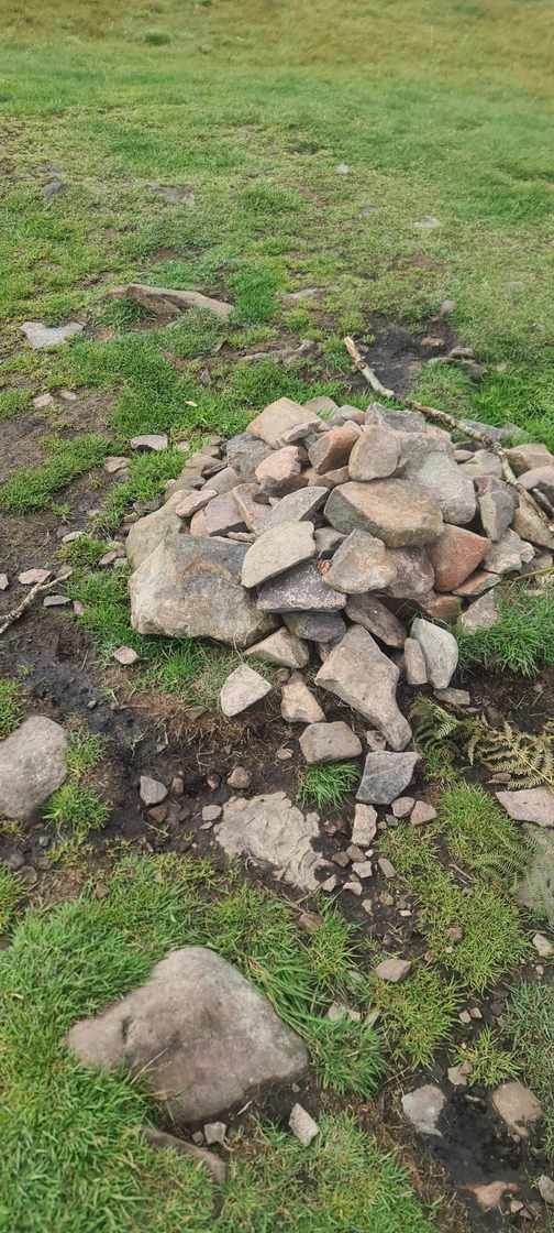
Great Mell Fell, a Lake District fell
© Lee McCoy

Great Mell Fell at 537m (1,762ft) is an isolated, conical summit above the Vale of Matterdale, its distinctive shape standing out from the surrounding farmland. Wainwright described it as a pleasant, easy climb with surprisingly wide views — north to Blencathra and Skiddaw, and east across the Eden Valley to the Pennines. The ascent from Brownrigg Farm is short and straightforward through bracken and heather. Often combined with Little Mell Fell as a gentle half-day outing from Penrith or Ullswater. A good introduction to Lakeland fell walking for beginners.

Routes up Great Mell Fell

Hand-mapped, with GPX to download — full maps further down.

Classifications & hill data
Wainwright
Eastern
Birkett
Fellranger
Synge
Marilyn
537 m
Height
1,762 ft
In feet
NY 3968 2537
Grid ref

Map & nearby Birketts

Free mapping: OpenTopoMap / OpenStreetMap (switch layers top-right). Parking positions are approximate.

Nearest parking: Great Mell Fell layby, about 0.9 km from the summit (straight line). Full parking, toilets and bus details are below.

Birketts near Great Mell Fell (within 3 km)

No bonus Birketts within 3 km — every Birkett near here is already a Wainwright summit, so just enjoy the walk.

Routes over Great Mell Fell

3.47 km · ~269 m ascent · loop · ~1–1.5 h
Summits: Great Mell Fell

⬇️ Download GPX

Full route guide ↗

A planned line is a suggestion, not a guarantee — conditions change. Navigate independently and carry a map & compass.

The View from Great Mell Fell

A computed 360° skyline — every visible named top labelled by distance and bearing, from the terrain model in perfect clarity, not photographed. Drag to pan; reveal the far four-nations horizon.

drag to pan · arrow keys
Computed 360-degree skyline from Great Mell Fell36 labelled tops shown (9 distant behind the far-horizon toggle). Theoretical visibility in perfect clarity; computed from terrain, not photographed.eye levelNNEESESSWWNWHelvellyn · 12 kmPillar · 26 kmRaise · 10 kmFairfield · 14 kmBlencathra · 8 kmDollywaggon Pike · 13 kmGreat Dodd · 7 kmGrasmoor · 23 kmStybarrow Dodd · 8 kmHigh Street · 15 kmHigh Raise · 13 kmKnowe Crags · 9 kmDove Crag · 15 kmRed Screes · 17 kmStony Cove Pike · 16 kmClough Head · 7 kmBowscale Fell · 8 kmBannerdale Crags · 7 kmLoadpot Hill · 9 kmTarn Crags Top · 8 kmCarrock Fell · 10 kmHigh Pike · 12 kmCross Fell · 30 km · clear daysHobcarton End · 20 kmGreat Borne · 29 kmLord's Seat · 19 kmArthur's Pike · 8 kmSwarth Fell · 8 kmLittle Mell Fell · 3 kmGowk Hill · 10 kmSighty Crag · 59 km · clear daysRoan Fell · 68 km · clear daysHeughscar Hill · 9 kmEycott Hill · 4 kmMickle Fell · 41 km · clear daysCold Fell · 37 km · clear daysHelvellyn Lower Man · 12 kmAtkinson Pike · 8 kmSt Sunday Crag · 12 kmRampsgill Head · 13 kmGrisedale Pike · 20 kmThornthwaite Crag · 16 kmBirkhouse Moor · 10 kmWether Hill · 10 kmLittle Hart Crag · 15 kmSt Raven's Edge · 17 kmGategill Fell Top · 8 kmWhinlatter Top · 20 kmSouther Fell · 6 kmRowling End · 17 kmCalkin Rig · 63 km · clear daysRogan's Seat · 57 km · clear daysHoove · 63 km · clear daysDunmallet · 7 kmLarriston Fells · 69 km · clear daysDufton Pike · 30 km · clear daysBroad Law · 101 km · a rare clear dayThe Cheviot · 108 km · a rare clear dayTinto · 118 km · a rare clear dayGreen Lowther · 100 km · a rare clear dayWisp Hill · 74 km · a rare clear dayCauldcleuch Head · 76 km · a rare clear dayDun Rig · 107 km · a rare clear dayPeel Fell · 78 km · a rare clear dayBlackwood Hill · 72 km · a rare clear day
What you can see from Great Mell Fell, by direction
  • South-east: Red Crag (12 km), High Raise (13 km), Low Raise (13 km)
  • South: Birkhouse Moor (10 km), Gavel Pike (12 km), St Sunday Crag (12 km), Dollywaggon Pike (13 km), Rampsgill Head (13 km), Kidsty Pike (14 km), Fairfield (14 km), High Street (15 km), Dove Crag (15 km), Caudale Moor (15 km), Stony Cove Pike (16 km), Thornthwaite Crag (16 km), Red Screes (17 km)
  • South-west: Hart Side (7 km), Clough Head (7 km), Great Dodd (7 km), Green Side (8 km), Stybarrow Dodd (8 km), Raise (10 km), Catstye Cam (11 km), Helvellyn Lower Man (12 km), Helvellyn (12 km), Nethermost Pike (12 km), High Crag (13 km), Pillar (26 km)
  • West: Blencathra (8 km), Atkinson Pike (8 km), Knowe Crags (9 km), Grisedale Pike (20 km), Sail (20 km), Hobcarton Crag (21 km), Crag Hill (21 km), Eel Crag (21 km), Sand Hill (21 km), Hopegill Head (21 km), Wandope (22 km), Grasmoor (23 km)

On the clearest days the far horizon adds: Broad Law (101 km, Scotland), The Cheviot (108 km, England), Tinto (118 km, Scotland), Green Lowther (100 km, Scotland), White Coomb (93 km, Scotland), Queensberry (85 km, Scotland), Ettrick Pen (85 km, Scotland), Wisp Hill (74 km, Scotland).

Computed from terrain in perfect clarity, not photographed · distances are straight-line.

Computed from Copernicus GLO-30 terrain; distant tops from the Database of British and Irish Hills (opens in new tab) (CC BY 4.0). See how we compute the view · and the summit intervisibility report below.

What you can see from Great Mell Fell

On a clear day — computed sightlines, curvature- and refraction-corrected.
68Wainwrights in view+2 marginal
32 kmFurthest sightlineGreat Dun Fell
Sea in viewnone from here
Far horizons
  • Great Dun Fell North PenninesENE · 32 km clear
  • Cross Fell North PenninesENE · 30 km clear
All 68 Wainwrights in clear view (nearest first)

How Great Mell Fell’s view compares with all 214 — the View Report: every Wainwright ranked by what you can see from the top.

Sightlines from a bare-earth terrain model (forests and buildings not included), corrected for the Earth’s curvature and average atmospheric refraction. “Distant” sightlines and any over 100 km depend on exceptionally clear air. Modelled from Copernicus GLO-30 open elevation data — a guide to the view, not a guarantee of any single one.

Best parking to hike Great Mell Fell

Where we have the data, each parking spot also shows the nearest public toilets and facilities (cafés, pubs, shops).

Great Mell Fell layby — 0.9 km from summit (straight line)
Small layby at the foot of Great Mell Fell.
Directions (opens in new tab)
The Hause, Little Mell Fell (verge) — 2.5 km from summit (straight line)
Verge parking at the high point of the Watermillock road.
Directions (opens in new tab)

Positions are approximate — zoom the map to confirm. Lakeland car parks fill before 9am on fine weekends.

Tip: pan and zoom the interactive map at the top of this page to spot other potential parking near your route.

Buses to Great Mell Fell from Penrith / Ambleside / Windermere

No regular bus serves the start points for this fell — this is one for the car (or a long approach from the nearest served valley). The nearest hubs are Penrith (X4/X5 & 508), Ambleside and Windermere (555, 505, 516).

Rural routes change seasonally — confirm on stagecoachbus.com (opens in new tab) or Traveline before relying on a last bus.

My hikes over Great Mell Fell (Strava)

1 logged hike pass over this summit:

Interactive route maps and photos load here for visitors with JavaScript. Data from Strava.

Navigating Great Mell Fell in cloud

Straightforward

A broad, gently-sloping top with little to steer by — easy to lose your bearings and hard to relocate in mist. Navigation here is relatively straightforward even in cloud — but carry map and compass and know how to use them; a low score never means “safe”.

In winter — snow, whiteout, cornices, buried features — every top demands full winter navigation skills whatever its band, and a broad, gentle summit can be the worst place of all. See walking in bad weather and the navigation guide.

How Great Mell Fell compares with all 214 — the Clag Index: navigating in cloud. A relative, deliberately cautious guide; the site can’t navigate for you.

Frequently asked questions about Great Mell Fell

How do you climb Great Mell Fell?

From the lay-by on the lane along its western foot: a clear path circles into the National Trust woodland, then climbs steadily to the open 537 m (1,762 ft) dome. Our walked loop is about 3.5 km — roughly an hour up and down — with the famous wind-bent pines near the top marking the way.

How long does Great Mell Fell take?

About an hour up and down at a steady pace; add a little to wander the summit. Most baggers pair it with Little Mell Fell across the lanes — both in a relaxed half day.

What makes Great Mell Fell distinctive?

Its shape and its solitude: a perfectly rounded, isolated cone standing apart from every other fell, so the summit feels like a viewing platform for the whole north-eastern district — Blencathra one way, the Dodds and Ullswater the other. The wind-sculpted trees on its flanks are a favourite of photographers, and the fell is National Trust land.

Is Great Mell Fell dog friendly?

Mostly — our route survey found gates with the odd stile, so a dog may need one lift. It's grazed, so leads on; the woodland fringe has roe deer too.

Questions drawn from real Google “People also ask” searches; answers written and fact-checked by us. · Reviewed 2026-07-20 · Suggest a question or correction (opens in new tab)

Maps & guidebooks for Great Mell Fell

As an Amazon Associate we earn from qualifying purchases — at no extra cost to you. How affiliate links work →