Hartsop Above How (Gill Crag - Hartsop Above How)
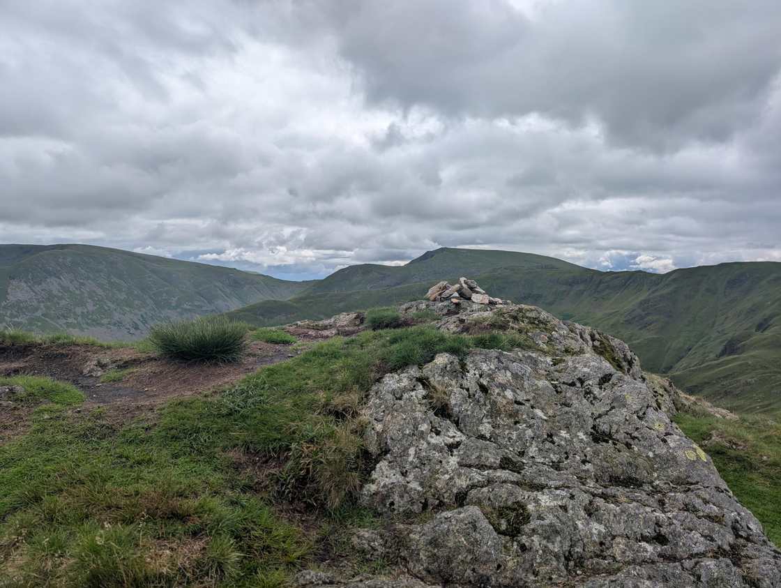
Hartsop above How at 586m (1,923ft) is a long, grassy ridge above the Hartsop valley, its summit giving good views down Brothers Water and across to Place Fell.
Is it worth going? — Today’s conditions & 7-day summit forecast
Modelled guidance for the 586 m summit. Always check the Met Office mountain forecast and MWIS before you set off.
On the summit today (Tue 28 Jul): 15° to 14°C, gusts to 43 mph, 10.4 mm of rain forecast.
Forecast snapshot from 28 Jul 2026, 04:58 UTC — refreshed nightly and updated live in your browser. Temperatures and gusts adjusted to the 586 m summit altitude via Open-Meteo. Summit conditions are always harsher than the valley — check the professional mountain forecasts before you go.
About the walk
Hartsop Above How (Gill Crag - Hartsop Above How)
Routes up Hartsop Above How (Gill Crag - Hartsop Above How)
Hand-mapped, with GPX to download — full maps further down.
Map & nearby Birketts
Skip mapFree mapping: OpenTopoMap / OpenStreetMap (switch layers top-right). Parking positions are approximate.
Nearest parking: Cow Bridge, Hartsop (free), about 2.6 km from the summit (straight line). Full parking, toilets and bus details are below.
Birketts near Hartsop Above How (Gill Crag - Hartsop Above How) (within 3 km)
These Birkett tops are not Wainwright summits — detour to them on this walk and they are pure profit. Distances are straight-line; allow extra for terrain.
Routes over Hartsop Above How (Gill Crag - Hartsop Above How)
A planned line is a suggestion, not a guarantee — conditions change. Navigate independently and carry a map & compass.
The View from Hartsop Above How (Gill Crag - Hartsop Above How)
A computed 360° skyline — every visible named top labelled by distance and bearing, from the terrain model in perfect clarity, not photographed. Drag to pan; reveal the far four-nations horizon.
What you can see from Hartsop Above How (Gill Crag - Hartsop Above How), by direction
- North: Birks (2 km), Sheffield Pike (6 km), Birk Fell (7 km), Birkett Fell (8 km), Little Mell Fell (13 km), Great Mell Fell (13 km)
- North-east: Brock Crags (4 km), Angletarn Pikes (4 km), Angletarn Pikes South Top (4 km), Place Fell (5 km), The Nab (6 km), Red Crag (7 km), Wether Hill (9 km), Loadpot Hill (10 km), Swarth Fell (10 km), Bonscale Pike (11 km), Arthur's Pike (12 km), Cross Fell (38 km)
- East: Hartsop Dodd (3 km), Gray Crag (4 km), Thornthwaite Crag (5 km), Rest Dodd (5 km), The Knott (5 km), High Street (6 km), Rampsgill Head (6 km), High Raise (7 km)
- South-east: High Hartsop Dodd (2 km), Middle Dodd (3 km), Caudale Moor (4 km), Stony Cove Pike (4 km)
- South: Little Hart Crag (2 km), Red Screes (4 km)
- South-west: Hart Crag (2 km), Dove Crag (2 km)
- West: Fairfield (2 km), Cofa Pike (2 km), Dollywaggon Pike (4 km)
- North-west: Gavel Pike (2 km), St Sunday Crag (2 km), High Crag (4 km)
On the clearest days the far horizon adds: Boulsworth Hill (94 km, England), Sighty Crag (72 km, England), Cauldcleuch Head (89 km, Scotland), Roan Fell (81 km, Scotland), Peel Fell (91 km, England), Blackwood Hill (86 km, Scotland), Greatmoor Hill (89 km, Scotland), Larriston Fells (82 km, Scotland).
Computed from terrain in perfect clarity, not photographed · distances are straight-line.
Computed from Copernicus GLO-30 terrain; distant tops from the Database of British and Irish Hills (opens in new tab) (CC BY 4.0). See how we compute the view · and the summit intervisibility report below.
What you can see from Hartsop Above How (Gill Crag - Hartsop Above How)
On a clear day — computed sightlines, curvature- and refraction-corrected.- Cross Fell North Pennines
All 30 Wainwrights in clear view (nearest first)
High Hartsop Dodd, Hart Crag, Dove Crag, St Sunday Crag, Little Hart Crag (Little Hart Crag - West Top), Birks, Fairfield, Middle Dodd, Hartsop Dodd, Arnison Crag, Red Screes, Brock Crags (Wainwright), Dollywaggon Pike, Stony Cove Pike (Caudale Moor), Angletarn Pikes (Angletarn Pikes North Top), Gray Crag, Thornthwaite Crag, Rest Dodd, The Knott (High Street), Place Fell, High Street, The Nab, Rampsgill Head, High Raise (High Street), Wether Hill, Hallin Fell, Loadpot Hill, Gowbarrow Fell (Wainwright summit), Little Mell Fell, Great Mell Fell
How Hartsop Above How (Gill Crag - Hartsop Above How)’s view compares with all 214 — the View Report: every Wainwright ranked by what you can see from the top.
Sightlines from a bare-earth terrain model (forests and buildings not included), corrected for the Earth’s curvature and average atmospheric refraction. “Distant” sightlines and any over 100 km depend on exceptionally clear air. Modelled from Copernicus GLO-30 open elevation data — a guide to the view, not a guarantee of any single one.
Best parking to hike Hartsop Above How (Gill Crag - Hartsop Above How)
Where we have the data, each parking spot also shows the nearest public toilets and facilities (cafés, pubs, shops).
Positions are approximate — zoom the map to confirm. Lakeland car parks fill before 9am on fine weekends.
Tip: pan and zoom the interactive map at the top of this page to spot other potential parking near your route.
Water & shelter on the way up
On the Hartsop Fells and Hart Crag route:
On-route facilities © OpenStreetMap contributors, per route — an absent marker doesn’t mean none.
Buses to Hartsop Above How (Gill Crag - Hartsop Above How) from Penrith / Ambleside / Windermere
Rural routes change seasonally — confirm on stagecoachbus.com (opens in new tab) or Traveline before relying on a last bus.
My hikes over Hartsop Above How (Gill Crag - Hartsop Above How) (Strava)
1 logged hike pass over this summit:
- Completing the Eastern Wainwrights. But seriously hampered by intermittent GPS (opens in new tab) — 15.9 km · 1061 m ascent · 4h 34m moving · 6 Jul 2025
Interactive route maps and photos load here for visitors with JavaScript. Data from Strava.
Hazard & Incident Information for Hartsop Above How (Gill Crag - Hartsop Above How)
A long, narrowing ridge running out between Deepdale and Dovedale toward Hart Crag, grassy but with considerable rock and steep flanks for most of its three-mile length. Near the summit (Gill Crag) it becomes an airy promenade, and rocky faces — Gill Crag, Black Crag, Gale Crag — fall to Dovedale and Deepdale. Wet rock and the narrow section are the things to watch. Patterdale Mountain Rescue Team covers this ground.
- The narrow, airy summit ridge: Near the top the ridge narrows to an airy crest with steep drops, especially rough above Dovedale. Take it steadily, keep to the crest, and treat it with care in strong wind or when the rock is wet.
- Steep flanks & rocky faces: Both flanks are steep for most of the ridge, with rocky faces (Gill Crag, Black Crag, Erne Nest Crag) above Deepdale and Dovedale. Don't drop off the ridge onto these — keep to the crest line.
- Wet rock & navigation: The rock sections are unpleasant and slippery in the wet, and the long ridge needs a bearing in cloud to stay on line toward Hart Crag or back to the valley. Mind your footing and navigate carefully.
Most common causes: Slips on the narrow airy crest or the wet rock sections · Walkers straying onto the steep rocky flanks above Dovedale/Deepdale · Navigation errors on the long ridge in cloud · Winter ice on the rocky crest and steep flanks
Local Mountain Rescue: Patterdale Mountain Rescue Team (opens in new tab) · Reviewed 14 Jun 2026
Safety: Hazard guidance compiled from published Mountain Rescue reports and well-documented accident history - editorial background, not a live feed of callouts. Always check current conditions, carry proper navigation equipment, and seek qualified instruction before heading onto the fells. In an emergency, call 999, ask for Police, then Mountain Rescue.
Navigating Hartsop Above How (Gill Crag - Hartsop Above How) in cloud
StraightforwardA rough, rocky summit ringed by crags, with no single obvious way off in poor visibility. Navigation here is relatively straightforward even in cloud — but carry map and compass and know how to use them; a low score never means “safe”.
In winter — snow, whiteout, cornices, buried features — every top demands full winter navigation skills whatever its band, and a broad, gentle summit can be the worst place of all. See walking in bad weather and the navigation guide.
How Hartsop Above How (Gill Crag - Hartsop Above How) compares with all 214 — the Clag Index: navigating in cloud. A relative, deliberately cautious guide; the site can’t navigate for you.
Other fells near Hartsop Above How (Gill Crag - Hartsop Above How)
- Arnison Crag
- Birkhouse Moor
- Birks
- Catstye Cam
- Clough Head
- Dollywaggon Pike
- Dove Crag
- Fairfield
- Glenridding Dodd
- Gowbarrow Fell (Wainwright summit)
- Great Dodd
- Great Mell Fell
- Great Rigg
- Hart Crag
- Hart Side
- Helvellyn
- Heron Pike (Rydal)
- High Hartsop Dodd
- High Pike (Scandale)
- Little Hart Crag (Little Hart Crag - West Top)
- Little Mell Fell
- Low Pike
- Middle Dodd
- Nab Scar
- Nethermost Pike
- Raise
- Red Screes
- Seat Sandal
- Sheffield Pike
- St Sunday Crag
- Stone Arthur
- Stybarrow Dodd
- Watson's Dodd
- White Side
Maps & guidebooks for Hartsop Above How (Gill Crag - Hartsop Above How)
- Buy on Amazon (opens in new tab)
- Buy on Amazon (opens in new tab)
- Buy on Amazon (opens in new tab)
- Buy on Amazon (opens in new tab)
- Buy on Amazon (opens in new tab)
As an Amazon Associate we earn from qualifying purchases — at no extra cost to you. How affiliate links work →