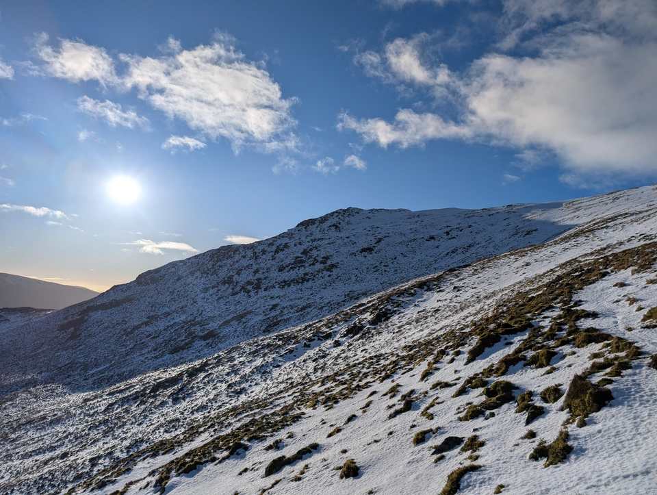
Gavel Pike
Gavel Pike at 784m (2,572ft) is a Birkett top on the ridge between St Sunday Crag and Deepdale Hause in the Eastern Fells, its summit giving fine views down into Deepdale and across Ullswater.
Is it worth going? — Today’s conditions & 7-day summit forecast
Modelled guidance for the 784 m summit. Always check the Met Office mountain forecast and MWIS before you set off.
On the summit today (Tue 28 Jul): 14° to 12°C, gusts to 43 mph, 10.4 mm of rain forecast.
Forecast snapshot from 28 Jul 2026, 04:58 UTC — refreshed nightly and updated live in your browser. Temperatures and gusts adjusted to the 784 m summit altitude via Open-Meteo. Summit conditions are always harsher than the valley — check the professional mountain forecasts before you go.
About the walk
Gavel Pike
Routes up Gavel Pike
Hand-mapped, with GPX to download — full maps further down.
Map & nearby Birketts
Skip mapFree mapping: OpenTopoMap / OpenStreetMap (switch layers top-right). Parking positions are approximate.
Nearest parking: Cow Bridge, Hartsop (free), about 3.1 km from the summit (straight line). Full parking, toilets and bus details are below.
Birketts near Gavel Pike (within 3 km)
These Birkett tops are not Wainwright summits — detour to them on this walk and they are pure profit. Distances are straight-line; allow extra for terrain.
Routes over Gavel Pike
A planned line is a suggestion, not a guarantee — conditions change. Navigate independently and carry a map & compass.
Best parking to hike Gavel Pike
Where we have the data, each parking spot also shows the nearest public toilets and facilities (cafés, pubs, shops).
Positions are approximate — zoom the map to confirm. Lakeland car parks fill before 9am on fine weekends.
Tip: pan and zoom the interactive map at the top of this page to spot other potential parking near your route.
Water & shelter on the way up
On the St Sunday Crag route:
On-route facilities © OpenStreetMap contributors, per route — an absent marker doesn’t mean none.
Buses to Gavel Pike from Penrith / Ambleside / Windermere
Rural routes change seasonally — confirm on stagecoachbus.com (opens in new tab) or Traveline before relying on a last bus.
Other fells near Gavel Pike
- Arnison Crag
- Birkhouse Moor
- Birks
- Catstye Cam
- Clough Head
- Dollywaggon Pike
- Dove Crag
- Fairfield
- Glenridding Dodd
- Gowbarrow Fell (Wainwright summit)
- Great Dodd
- Great Mell Fell
- Great Rigg
- Hart Crag
- Hart Side
- Hartsop Above How (Gill Crag - Hartsop Above How)
- Helvellyn
- Heron Pike (Rydal)
- High Hartsop Dodd
- High Pike (Scandale)
- Little Hart Crag (Little Hart Crag - West Top)
- Little Mell Fell
- Low Pike
- Middle Dodd
- Nab Scar
- Nethermost Pike
- Raise
- Red Screes
- Seat Sandal
- Sheffield Pike
- St Sunday Crag
- Stone Arthur
- Stybarrow Dodd
- Watson's Dodd
- White Side
Maps & guidebooks for Gavel Pike
- Buy on Amazon (opens in new tab)
- Buy on Amazon (opens in new tab)
- Buy on Amazon (opens in new tab)
- Buy on Amazon (opens in new tab)
As an Amazon Associate we earn from qualifying purchases — at no extra cost to you. How affiliate links work →