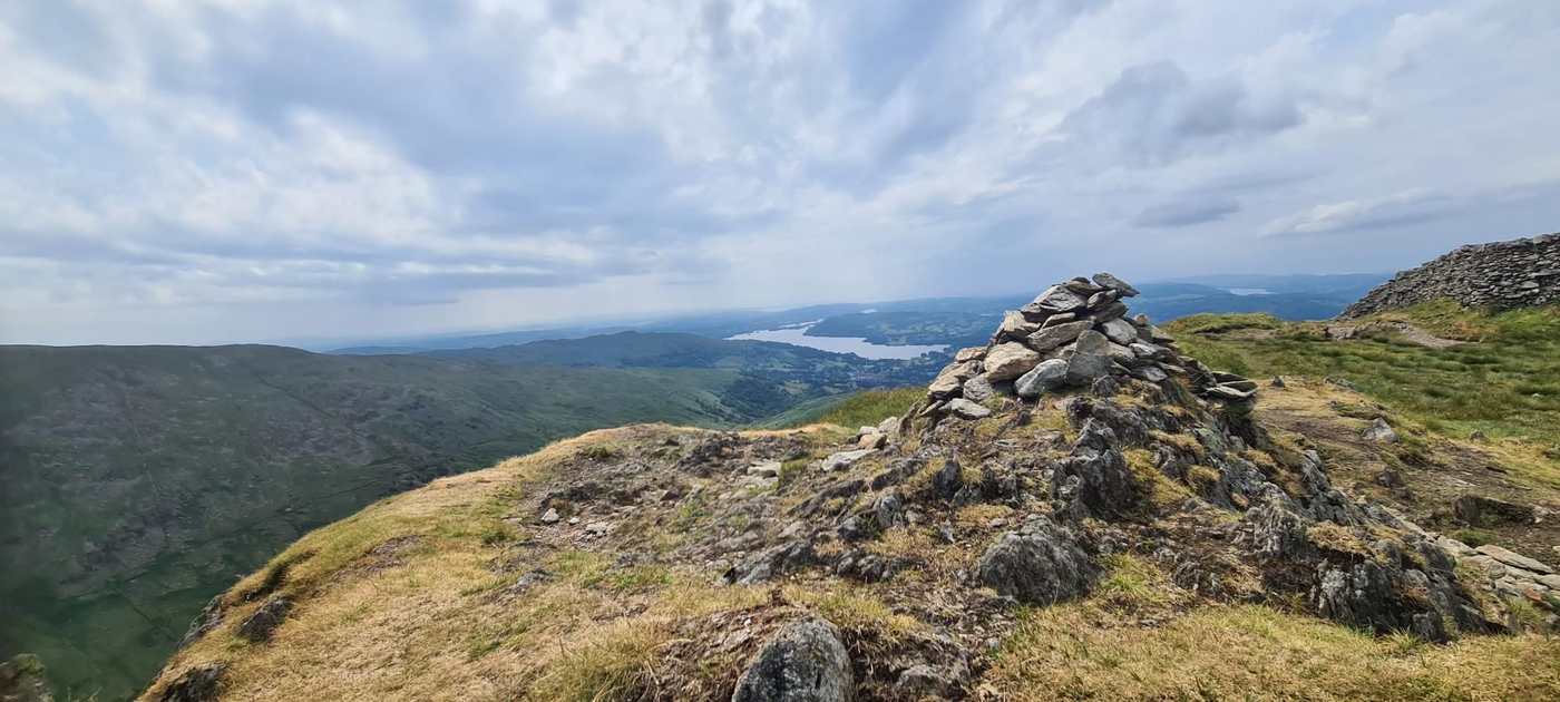
Low Pike
Low Pike at 508m (1,667ft) is a Wainwright summit in the Eastern Fells, the first top on the Scandale ridge rising above Ambleside towards High Pike and Dove Crag.
Is it worth going? — Today’s conditions & 7-day summit forecast
Modelled guidance for the 508 m summit. Always check the Met Office mountain forecast and MWIS before you set off.
On the summit today (Tue 28 Jul): 16° to 14°C, gusts to 35 mph, 14.5 mm of rain forecast.
Forecast snapshot from 28 Jul 2026, 04:58 UTC — refreshed nightly and updated live in your browser. Temperatures and gusts adjusted to the 508 m summit altitude via Open-Meteo. Summit conditions are always harsher than the valley — check the professional mountain forecasts before you go.
About the walk
Low Pike
Routes up Low Pike
Hand-mapped, with GPX to download — full maps further down.
Map & nearby Birketts
Skip mapFree mapping: OpenTopoMap / OpenStreetMap (switch layers top-right). Parking positions are approximate.
Nearest parking: Pelter Bridge, Rydal (paid), about 2.2 km from the summit (straight line). Full parking, toilets and bus details are below.
Birketts near Low Pike (within 3 km)
These Birkett tops are not Wainwright summits — detour to them on this walk and they are pure profit. Distances are straight-line; allow extra for terrain.
Routes over Low Pike
A planned line is a suggestion, not a guarantee — conditions change. Navigate independently and carry a map & compass.
The View from Low Pike
A computed 360° skyline — every visible named top labelled by distance and bearing, from the terrain model in perfect clarity, not photographed. Drag to pan; reveal the far four-nations horizon.
What you can see from Low Pike, by direction
- North: High Pike (1 km)
- North-east: Little Hart Crag (3 km), Hartsop Dodd (6 km), Loadpot Hill (13 km)
- South-east: Wansfell Pike (4 km), Ingleborough (50 km)
- South-west: Wetherlam (11 km), High Wythow (12 km), Long Crag (12 km), Kitty Crag (12 km), Little Carrs (12 km), Swirl How (12 km), Great Carrs (12 km), Brim Fell (14 km), The Old Man of Coniston (14 km), Harter Fell (18 km)
- West: Pavey Ark (9 km), Harrison Stickle (9 km), Thunacar Knott (9 km), Thorn Crag (9 km), Loft Crag (10 km), Pike of Blisco (11 km), Cold Pike (12 km), Great Knott (12 km), Crinkle Crags (13 km), Shelter Crags (13 km), Crinkle Crags (13 km), Crinkle Crags (13 km), Crinkle Crags (13 km), Crinkle Crags South Top (13 km), Bowfell (13 km), Little Stand (13 km), Esk Pike (14 km), Great End (15 km), Ill Crag (15 km), Broad Crag (16 km), Scafell Pike (16 km), Scafell (17 km)
- North-west: Heron Pike North Top (2 km), Great Rigg (3 km)
On the clearest days the far horizon adds: Snowdon (171 km, Wales), Carnedd Llewelyn (159 km, Wales), Arenig Fawr (179 km, Wales), Craig Cwm Silyn (179 km, Wales), Pendle Hill (79 km, England), Moel y Gamelin (162 km, Wales), Cadair Berwyn (178 km, Wales), Carnedd y Filiast (171 km, Wales).
Computed from terrain in perfect clarity, not photographed · distances are straight-line.
Computed from Copernicus GLO-30 terrain; distant tops from the Database of British and Irish Hills (opens in new tab) (CC BY 4.0). See how we compute the view · and the summit intervisibility report below.
What you can see from Low Pike
On a clear day — computed sightlines, curvature- and refraction-corrected.On the clearest days the view reaches across to Wales.
- Snowdon (Yr Wyddfa) Wales
- Carnedd Llewelyn Wales
- Ingleborough Yorkshire Dales
- Whernside Yorkshire Dales
- Morecambe Bay bay/estuary
All 32 Wainwrights in clear view (nearest first)
High Pike (Scandale), Heron Pike (Rydal), Nab Scar, Little Hart Crag (Little Hart Crag - West Top), Great Rigg, Loughrigg Fell, Baystones (Wansfell), Silver How, Hartsop Dodd, Sour Howes, Black Fell, Lingmoor Fell (Brown How), Pavey Ark, Harrison Stickle, Holme Fell, Thunacar Knott, Loft Crag, Wetherlam, Pike of Blisco, Cold Pike, Swirl How, Great Carrs, Crinkle Crags - Long Top (Second Crinkle), Bowfell, Loadpot Hill, Esk Pike, Brim Fell, The Old Man of Coniston (Coniston Old Man), Great End, Scafell Pike, Scafell, Harter Fell (Eskdale)
How Low Pike’s view compares with all 214 — the View Report: every Wainwright ranked by what you can see from the top.
Sightlines from a bare-earth terrain model (forests and buildings not included), corrected for the Earth’s curvature and average atmospheric refraction. “Distant” sightlines and any over 100 km depend on exceptionally clear air. Modelled from Copernicus GLO-30 open elevation data — a guide to the view, not a guarantee of any single one.
Best parking to hike Low Pike
Where we have the data, each parking spot also shows the nearest public toilets and facilities (cafés, pubs, shops).
Positions are approximate — zoom the map to confirm. Lakeland car parks fill before 9am on fine weekends.
Tip: pan and zoom the interactive map at the top of this page to spot other potential parking near your route.
Water & shelter on the way up
On the Fairfield Horseshoe route:
On-route facilities © OpenStreetMap contributors, per route — an absent marker doesn’t mean none.
Buses to Low Pike from Penrith / Ambleside / Windermere
Rural routes change seasonally — confirm on stagecoachbus.com (opens in new tab) or Traveline before relying on a last bus.
My hikes over Low Pike (Strava)
1 logged hike pass over this summit:
- 4 Wainwrights, 3 Kids and a while load of "how far is the car?" (opens in new tab) — 16.0 km · 873 m ascent · 4h 41m moving · 25 Jun 2023
Interactive route maps and photos load here for visitors with JavaScript. Data from Strava.
Navigating Low Pike in cloud
StraightforwardWalkable ground sits close to a lethal drop — in cloud it’s easy to walk straight onto steep ground. Navigation here is relatively straightforward even in cloud — but carry map and compass and know how to use them; a low score never means “safe”.
In winter — snow, whiteout, cornices, buried features — every top demands full winter navigation skills whatever its band, and a broad, gentle summit can be the worst place of all. See walking in bad weather and the navigation guide.
How Low Pike compares with all 214 — the Clag Index: navigating in cloud. A relative, deliberately cautious guide; the site can’t navigate for you.
Other fells near Low Pike
- Arnison Crag
- Birkhouse Moor
- Birks
- Catstye Cam
- Clough Head
- Dollywaggon Pike
- Dove Crag
- Fairfield
- Glenridding Dodd
- Gowbarrow Fell (Wainwright summit)
- Great Dodd
- Great Mell Fell
- Great Rigg
- Hart Crag
- Hart Side
- Hartsop Above How (Gill Crag - Hartsop Above How)
- Helvellyn
- Heron Pike (Rydal)
- High Hartsop Dodd
- High Pike (Scandale)
- Little Hart Crag (Little Hart Crag - West Top)
- Little Mell Fell
- Middle Dodd
- Nab Scar
- Nethermost Pike
- Raise
- Red Screes
- Seat Sandal
- Sheffield Pike
- St Sunday Crag
- Stone Arthur
- Stybarrow Dodd
- Watson's Dodd
- White Side
Maps & guidebooks for Low Pike
- Buy on Amazon (opens in new tab)
- Buy on Amazon (opens in new tab)
- Buy on Amazon (opens in new tab)
- Buy on Amazon (opens in new tab)
- Buy on Amazon (opens in new tab)
As an Amazon Associate we earn from qualifying purchases — at no extra cost to you. How affiliate links work →