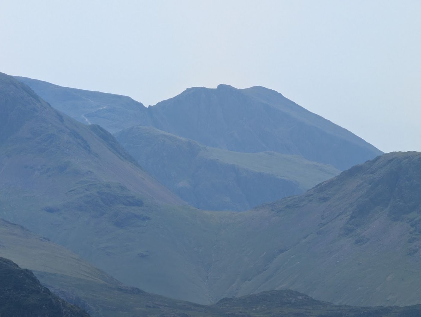
Scafell Pike
England's highest mountain, Scafell Pike stands at 978m (3,209ft) and is the supreme objective for every Lakeland walker.
Is it worth going? — Today’s conditions & 7-day summit forecast
Modelled guidance for the 978 m summit. Always check the Met Office mountain forecast and MWIS before you set off.
On the summit today (Tue 28 Jul): 12° to 11°C, gusts to 39 mph, 11.9 mm of rain forecast.
Forecast snapshot from 28 Jul 2026, 04:58 UTC — refreshed nightly and updated live in your browser. Temperatures and gusts adjusted to the 978 m summit altitude via Open-Meteo. Summit conditions are always harsher than the valley — check the professional mountain forecasts before you go.
About the walk
Scafell Pike
- Height
- 978 m (3,209 ft)
- How long
- ~5.5–7 h
- How hard
- Scafell Pike is a hard day for most walkers, but a non-technical one
- Weather today
- 🌧️ 12°/11°C, gusts 39 mph
- Is it dangerous?
- Scafell Pike deserves real respect — but the danger is specific, and it is not the summit push.
- Parking
- Wasdale Head (NT car park)
Short version: Scafell Pike is a hard day for most walkers, but a non-technical one — no scrambling or exposure on the normal routes, just a lot of sustained, rough ascent and a summit that is genuinely hard to navigate. It is not a beginner’s first fell, and there is no easy way up it.
Harder than Helvellyn or Skiddaw?
By our five-axis reading of the walkers’ routes, all three sit in the same overall band — but Scafell Pike is the more serious of the group: harder underfoot (rough boulder ground rather than a made path) and materially harder to navigate — we grade its summit Severe for navigation, against Hard for Helvellyn and Skiddaw. Same league; Scafell Pike is the one that punishes a mistake in cloud.
Can a beginner do it? On the right terms, yes — but only on the right terms, and not as a first hill. Pick a settled, clear day; take the most-walked line from Wasdale; start early and set a turn-back time before you go; carry, and know how to use, a map and compass; and build up on a few smaller fells first. On a wet or clagged day, or against the clock, it is a genuinely serious undertaking — this is the mountain with the most rescue call-outs in England.
Harder than Snowdon? We can’t give you a straight answer, and we won’t fake one: we measure Lakeland fells route-by-route, not Welsh or Scottish ones, so we hold no comparable data for Snowdon or Ben Nevis. What we can say is how Scafell Pike sits against the English fells we do assess — above.
How we know: these are our own difficulty gradings from the routes we’ve mapped — length and steepness from the terrain model, and terrain, navigation and exposure assessed editorially. We flag on each route that they are drawn but not yet personally walked, so treat this as a careful, honest steer rather than the last word.
Routes up Scafell Pike
Hand-mapped, with GPX to download — full maps further down.
Map & nearby Birketts
Skip mapFree mapping: OpenTopoMap / OpenStreetMap (switch layers top-right). Parking positions are approximate.
Nearest parking: Wasdale Head (NT car park), about 3.3 km from the summit (straight line). Full parking, toilets and bus details are below.
Birketts near Scafell Pike (within 3 km)
These Birkett tops are not Wainwright summits — detour to them on this walk and they are pure profit. Distances are straight-line; allow extra for terrain.
Routes over Scafell Pike
✎️ Planned route — drawn but not personally walked or checked yet.
A planned line is a suggestion, not a guarantee — conditions change. Navigate independently and carry a map & compass.
✎️ Wasdale is the classic base for the Pike and this is the classic line from it. It is not the prettiest route — the Corridor Route is finer — but it is the direct one, and on a clear day the view from the top reaches the Isle of Man and the hills of Galloway.
✎️ Planned route — drawn but not personally walked or checked yet.
A planned line is a suggestion, not a guarantee — conditions change. Navigate independently and carry a map & compass.
The View from Scafell Pike
A computed 360° skyline — every visible named top labelled by distance and bearing, from the terrain model in perfect clarity, not photographed. Drag to pan; reveal the far four-nations horizon.
What you can see from Scafell Pike, by direction
- North: Crag Hill (13 km), Grasmoor (14 km), Grisedale Pike (15 km), Skiddaw Lesser Man (21 km), Skiddaw Little Man (21 km), Carl Side (21 km), Skiddaw South Top (22 km), Skiddaw Middle Top (22 km), Skiddaw (22 km)
- North-east: High Crag (14 km), Dollywaggon Pike (14 km), Nethermost Pike (15 km), Helvellyn Lower Man (15 km), Helvellyn (15 km), White Side (16 km), Raise (16 km), Stybarrow Dodd (17 km), Green Side (18 km), Little Dodd (18 km), Great Dodd (18 km), Knowe Crags (22 km), Gategill Fell Top (23 km), Blencathra (23 km), Doddick Fell (23 km)
- East: Fairfield (15 km), Cofa Pike (15 km), Dove Crag (16 km), St Sunday Crag (17 km), Red Screes (18 km), Caudale Moor (20 km), Stony Cove Pike (20 km), Thornthwaite Crag (22 km), Ill Bell (22 km), High Street (23 km), Mardale Ill Bell (23 km), Rampsgill Head (24 km), Kidsty Pike (24 km), High Raise (24 km), Harter Fell (24 km)
- South-west: Scafell (1 km)
On the clearest days the far horizon adds: Snowdon (164 km, Wales), Slieve Donard (179 km, Ireland), Carnedd Llewelyn (152 km, Wales), Merrick (111 km, Scotland), Aran Fawddwy (188 km, Wales), Broad Law (116 km, Scotland), Snaefell (84 km, Isle of Man), Moel Siabod (161 km, Wales).
Computed from terrain in perfect clarity, not photographed · distances are straight-line.
Computed from Copernicus GLO-30 terrain; distant tops from the Database of British and Irish Hills (opens in new tab) (CC BY 4.0). See how we compute the view · and the summit intervisibility report below.
What you can see from Scafell Pike
On a clear day — computed sightlines, curvature- and refraction-corrected.On the clearest days the view reaches across to Wales, Scotland and the Isle of Man.
- Snowdon (Yr Wyddfa) Wales
- Carnedd Llewelyn Wales
- Merrick Scotland
- Snaefell Isle of Man
- Ingleborough Yorkshire Dales
- Criffel Scotland
- Whernside Yorkshire Dales
- Great Dun Fell North Pennines
- Cross Fell North Pennines
- Solway Firth bay/estuary
- Irish Sea open water
- Morecambe Bay bay/estuary
All 121 Wainwrights in clear view (nearest first)
Scafell, Lingmell, Great End, Esk Pike, Slight Side, Bowfell, Great Gable, Seathwaite Fell (Wainwright summit), Green Gable, Kirk Fell, Crinkle Crags - Long Top (Second Crinkle), Base Brown, Yewbarrow, Glaramara, Hard Knott, Grey Knotts, Pike of Stickle, Red Pike (Wasdale), Loft Crag, Thunacar Knott, Middle Fell, Pillar, Harrison Stickle, High Raise (High White Stones), Pavey Ark, Scoat Fell (Little Scoat Fell), Sergeant's Crag, Steeple, Sergeant Man, Harter Fell (Eskdale), High Crag (Buttermere), Seatallan, Eagle Crag, Haycock, Buckbarrow, Dale Head, Grey Friar, Great Carrs, Swirl How, High Stile, Ullscarf, Green Crag, High Spy, Hindscarth, Castle Crag, Wetherlam, Robinson, Red Pike (Buttermere), Grange Fell (Brund Fell), Dow Crag, The Old Man of Coniston (Coniston Old Man), Maiden Moor, High Tove, Whiteless Pike, Ard Crags, Wandope, High Seat, Sail, Crag Hill (Eel Crag), Stone Arthur, Scar Crags, Seat Sandal, Causey Pike, Grasmoor, Hen Comb, Black Fell, Nab Scar, Heron Pike (Rydal), Bleaberry Fell, Dollywaggon Pike, Great Rigg, Raven Crag, Helvellyn, Fairfield, Hopegill Head, Grisedale Pike, Walla Crag, White Side, Hart Crag, Low Pike, High Pike (Scandale), Dove Crag, Raise, St Sunday Crag, Watson's Dodd, Red Screes, Middle Dodd, Great Dodd, Latrigg, Baystones (Wansfell), Fellbarrow - Mosser Fell, Clough Head, Lord's Seat, Barf, Dodd (Skiddaw), Stony Cove Pike (Caudale Moor), Troutbeck Tongue, Lonscale Fell, Skiddaw Little Man, Carl Side, Long Side, Sour Howes, Ullock Pike, Thornthwaite Crag, Froswick, Ill Bell, Yoke, Skiddaw, Sallows, The Knott (High Street), Blencathra - Hallsfell Top, The Nab, Rampsgill Head, Kidsty Pike, High Raise (High Street), Great Calva, Souther Fell, Branstree, Knott, Binsey, High Pike (Caldbeck)
How Scafell Pike’s view compares with all 214 — the View Report: every Wainwright ranked by what you can see from the top.
Sightlines from a bare-earth terrain model (forests and buildings not included), corrected for the Earth’s curvature and average atmospheric refraction. “Distant” sightlines and any over 100 km depend on exceptionally clear air. Modelled from Copernicus GLO-30 open elevation data — a guide to the view, not a guarantee of any single one.
The path beneath your boots
The Brown Tongue path onto Scafell Pike is one of the busiest in Lakeland — Fix the Fells counts more than 100,000 walkers a year on a single line here — and it takes major, repeated repair to carry that many boots.
Fix the Fells built and maintains this path. How a fell path is made → · Give back (opens in new tab)
Path-repair data © Fix the Fells (National Trust / Lake District National Park). Source (opens in new tab).
Best parking to hike Scafell Pike
Where we have the data, each parking spot also shows the nearest public toilets and facilities (cafés, pubs, shops).
Positions are approximate — zoom the map to confirm. Lakeland car parks fill before 9am on fine weekends.
Tip: pan and zoom the interactive map at the top of this page to spot other potential parking near your route.
Water & shelter on the way up
On the Scafell Pike via the Corridor Route route:
On the Scafell Pike from Wasdale, by Lingmell Col route:
💧 Treat water from the fell before you drink it. A mapped point is usually a tap or public supply, but never drink untreated from a beck, stream or tarn — even clear-looking hill water can carry giardia or cryptosporidium from livestock or a carcass upstream and leave you seriously ill. Run it through a filter or purifier (a LifeStraw, Sawyer Squeeze or HydraPak) or bring it to a rolling boil first.
On-route facilities © OpenStreetMap contributors, per route — an absent marker doesn’t mean none.
Buses to Scafell Pike from Penrith / Ambleside / Windermere
No regular bus serves the start points for this fell — this is one for the car (or a long approach from the nearest served valley). The nearest hubs are Penrith (X4/X5 & 508), Ambleside and Windermere (555, 505, 516).
Rural routes change seasonally — confirm on stagecoachbus.com (opens in new tab) or Traveline before relying on a last bus.
Is Scafell Pike dangerous?
Scafell Pike deserves real respect — but the danger is specific, and it is not the summit push. England’s highest mountain is a strenuous walk, not a climb, on its normal routes; what puts people on a stretcher is the ground on either side of the walkers’ line, and the descent in cloud.
Two named places account for the gravest accidents. Piers Gill, the ravine on the Wasdale flank, is a trap: its top looks benign, but it is a staircase of waterfall pitches that get harder the further down you go and cannot be climbed back up, so walkers who stray in from the Corridor Route become committed. Broad Stand, the direct link to Scafell, looks like a shortcut and is a graded rock climb that has killed unroped walkers. The other killer is the summit itself — a vast boulder plateau, ringed by crags, that is genuinely disorienting in cloud, so most trouble starts on the walk off the top, not up it.
You may have arrived here after searching how many people have died on Scafell Pike. We don’t publish a per-fell death count — no verified one exists, and a number wouldn’t keep you safe. What will: knowing the two places that actually catch people, carrying and being able to follow a compass bearing off the plateau, and choosing the right day. How hard the mountain really is, and whether it is within your reach, is the next section.
Go deeper: the Mountain Rescue Report (what actually goes wrong, in numbers) · Summer on the Fells — the season’s hazards, ranked by evidence.
Hazard & Incident Information for Scafell Pike
England's highest and most rescue-prone summit. Its vast boulder fields are genuinely disorienting in cloud, with no handrails and cliffs on several sides, and walkers get exhausted, injured, benighted or lost. Two named spots account for the gravest accidents: Piers Gill and Broad Stand.
- Piers Gill: A deep ravine that has caused repeated fatalities, mostly to walkers descending the Corridor Route who stray toward it in cloud. Do not try to descend the gill or walk down the bed of the stream: it is a canyon of waterfall pitches. Where the Corridor Route reaches the gill, go right round the corner and slightly uphill, well away from Piers Gill, to the path down to Sty Head. The bank paths are dangerous: the west bank has no path and Wasdale Mountain Rescue Team report fatalities there in recent years; if you get onto the steep path on the other bank and into difficulty, turn around and retrace to the Corridor Route. There is no mobile phone signal at the gill, so do not rely on calling for help from it - get back up to where you have coverage or attract attention.
- Broad Stand: The rock step toward Scafell looks like a shortcut but is a serious climb that has killed unroped walkers. Do not attempt it.
- Summit boulder plateau in poor visibility: A confusing sea of rock with cliffs on several sides; a compass and the ability to follow a precise bearing are essential when cloud is down.
Most common causes: Ankle and knee injuries on the boulder descent · Navigation errors in cloud · Exhaustion, exposure and benightment · Underestimating the time and distance
Local Mountain Rescue: Wasdale Mountain Rescue Team (opens in new tab) · Wasdale Mountain Rescue Team - Piers Gill, Scafell Pike (opens in new tab) · Reviewed 13 Jun 2026
Safety: Hazard guidance compiled from published Mountain Rescue reports and well-documented accident history - editorial background, not a live feed of callouts. Always check current conditions, carry proper navigation equipment, and seek qualified instruction before heading onto the fells. In an emergency, call 999, ask for Police, then Mountain Rescue.
Navigating Scafell Pike in cloud
Serious in cloudA rough, rocky summit ringed by crags, with no single obvious way off in poor visibility. A serious place to be caught in cloud: carry map and compass (or GPS) and know how to use them, or save it for a clear day.
In winter — snow, whiteout, cornices, buried features — every top demands full winter navigation skills whatever its band, and a broad, gentle summit can be the worst place of all. See walking in bad weather and the navigation guide.
How Scafell Pike compares with all 214 — the Clag Index: navigating in cloud. A relative, deliberately cautious guide; the site can’t navigate for you.
Frequently asked questions about Scafell Pike
How high is Scafell Pike?
Scafell Pike is 978 m (3,209 ft) — the highest mountain in England, and one of only a handful of English summits over 3,000 feet. Its neighbour Scafell (964 m) is slightly lower; the two are separate mountains, linked by the notorious Broad Stand.
Where is Scafell Pike?
Scafell Pike is in the western Lake District, in Cumbria, north-west England. The nearest and shortest start is Wasdale Head; the other main approaches begin at Seathwaite in Borrowdale (the Corridor Route) and, more quietly, from Eskdale. There is no road to the foot of the mountain and no useful train station nearby.
Is Scafell Pike a difficult climb?
Scafell Pike is a strenuous but non-technical climb — no ropes or scrambling are needed on the normal routes, but at 978 m (3,209 ft) it is England's highest mountain and every path involves long, sustained ascent over rough, rocky ground. A reasonably fit walker will find it challenging rather than dangerous, provided the weather is kind.
What makes it hard is rarely the gradient alone:
- Sustained ascent. The shortest route (from Wasdale) climbs roughly 900 m in about 4 km — one of the steepest sustained pulls of any popular UK peak.
- Rough terrain. The upper mountain is a boulder field, hard on the ankles and tiring underfoot.
- Navigation. The stony summit plateau is notoriously difficult to navigate in cloud, which is when most walkers get into trouble.
Sources: National Trust — Scafell Pike via Hollow Stones (opens in new tab) · Ramblers — best routes up Scafell Pike (opens in new tab)
Can a beginner or unfit person climb Scafell Pike?
It can be, but only on your terms. Scafell Pike is regularly climbed by first-time hill walkers, yet it should not be underestimated. It is a full mountain day, not a stroll, and someone who is very unfit or has done no hill walking should build up to it rather than make it their first ever climb.
If you are a beginner, set yourself up to succeed:
- Choose a settled, clear-weather day and start early.
- Take the well-trodden Wasdale route, or go with a guided group.
- Allow plenty of time — there is no shame in turning back.
- Build some fitness first with a few smaller fells (for example a local Wainwright) so you know how your body copes with sustained ascent.
The mountain punishes the unprepared far more than the unfit: poor kit, bad weather and weak navigation cause more rescues than tired legs.
Sources: National Trust — climbing Scafell Pike, Wasdale (opens in new tab)
What is the easiest route up Scafell Pike?
The shortest and most popular route is from Wasdale Head via Lingmell Gill and Hollow Stones — about 6 miles (9.7 km) round trip with roughly 900 m of ascent. It is the quickest way up but also the steepest, and it is the route used on the National Three Peaks Challenge.
The main alternatives trade distance for a gentler grade or better scenery:
- Wasdale Head — shortest and steepest; best for a quick ascent in good weather.
- Seathwaite (Borrowdale), the Corridor Route — longer and more scenic, with more interesting walking and better-graded climbing.
- Eskdale — the longest and quietest approach, for a big, remote mountain day.
"Easiest" really means "shortest" here — there is no genuinely easy way up England's highest peak.
Sources: Scafell Pike Guidebook — Wasdale Head route (opens in new tab) · Three Peaks Challenge — Scafell Pike (opens in new tab)
How long does it take to climb Scafell Pike?
Most walkers take 4 to 6 hours for the round trip from Wasdale Head, including breaks. Fast, fit walkers complete it in around 3.5 hours; a steady or first-time walker, or a wet and misty day, can push it past 6.
Your time depends on:
- Route — Wasdale is quickest; the Corridor Route and Eskdale add 1–3 hours.
- Fitness and group size — a group moves at the pace of its slowest member.
- Weather and visibility — navigation slows everyone in cloud.
Always plan to be off the summit with daylight to spare, and carry a head torch in case you are slower than expected.
Sources: Three Peaks Challenge — Scafell Pike (opens in new tab) · Ramblers — best routes up Scafell Pike (opens in new tab)
Can you climb Scafell Pike in trainers?
It is strongly discouraged. The upper mountain is loose rock and boulder, often wet, and trainers offer little grip or ankle support — twisted ankles and slips on wet rock are among the most common reasons walkers need help. Proper walking boots or sturdy approach shoes with a good sole are the sensible minimum.
Whatever the forecast at the valley, pack for a mountain:
- Walking boots with ankle support and a grippy sole.
- Waterproof jacket and trousers, plus a warm layer — the summit is far colder and windier than the car park.
- Map and compass (and the skill to use them), not just a phone.
- Food, water, a head torch and a charged phone.
Sources: National Trust — climbing Scafell Pike, Wasdale (opens in new tab) · Wasdale Mountain Rescue Team (opens in new tab)
When should you not climb Scafell Pike?
Avoid the mountain when the weather is against you. The summit is highly exposed, and conditions there can be dramatically worse than in the valley — strong wind, driving rain, low cloud and, in winter, snow and ice. The stony plateau is extremely hard to navigate in poor visibility, which is exactly when most accidents happen.
Think twice, or turn back, if:
- The mountain forecast shows gale-force wind, heavy rain or cloud on the tops.
- Visibility is poor and you are not confident navigating with map and compass.
- It is winter and there is snow or ice but you lack the kit (ice axe, crampons) and experience.
- You are starting too late to finish in daylight.
Always check a dedicated mountain forecast — not the town forecast — before you set off.
Sources: Met Office — Lake District mountain forecast (opens in new tab) · Mountain Weather Information Service (MWIS) (opens in new tab)
Is Scafell Pike harder than Snowdon or Ben Nevis?
It depends on the route and the day, not just the height. Of the three national peaks, Ben Nevis (1,345 m) is the highest and Snowdon / Yr Wyddfa (1,085 m) sits in between, with Scafell Pike the lowest at 978 m — yet Scafell Pike is often rated the trickiest of the three.
The reasons:
- Steepness. The standard Wasdale route is the steepest of the three peaks, climbing about 900 m in roughly 4 km.
- Navigation. Its summit is the least clearly marked and hardest to navigate in cloud; Snowdon and Ben Nevis have more obvious main paths.
- On the Three Peaks Challenge it is usually tackled in the small hours on tired legs, which adds to its reputation.
Snowdon is generally considered the most straightforward of the three thanks to its well-made paths.
Sources: Three Peaks Challenge — Scafell Pike (opens in new tab)
Can you do Scafell Pike in a day, or as part of the Three Peaks Challenge?
Yes. Scafell Pike is comfortably a day walk on its own — most people are up and down from Wasdale in well under a day. It is also one of the three summits in the National Three Peaks Challenge, where walkers climb Ben Nevis, Scafell Pike and Snowdon within 24 hours, driving between them.
If you are attempting the challenge:
- Scafell Pike is usually the middle peak, often climbed overnight or at dawn.
- The Wasdale route is used for speed — expect roughly 3 to 4 hours for the round trip at a brisk pace.
- Driving and lack of sleep, not the climbing itself, are what make 24 hours hard — go with a planned driver and realistic timings.
For a first mountain, doing Scafell Pike on its own in a relaxed day is far more enjoyable than rushing it as part of a challenge.
What OS map covers Scafell Pike?
OS Explorer OL6, The English Lakes — South-Western area covers Scafell Pike and all its approaches at 1:25,000. It is the sheet to carry; our route guides also include a downloadable GPX track.
Is there a webcam on Scafell Pike, and where should I check the weather?
There is no live webcam on the summit of Scafell Pike, and anyone claiming a real-time view of the top is guessing. To judge conditions before you go, use the Met Office mountain weather forecast for the Lake District and the Mountain Weather Information Service (MWIS) Lake District forecast — both give summit-level wind, cloud base and freezing level, which matter far more than the valley forecast. Every one of our fell pages also carries a 7-day summit forecast baked in.
Why is Scafell Pike a war memorial?
In 1919, Lord Leconfield gave the summit of Scafell Pike to the National Trust as a memorial to the men of the Lake District who died in the First World War — “in perpetual memory of the men of the Lake District who fell for God and King, for freedom, peace and right in the Great War”. It was one of the Trust’s earliest and most significant gifts of high fell, and helped lay the ground for the Lake District National Park. That is what makes England’s highest point special: it belongs, in effect, to everyone.
Sources: National Trust (opens in new tab)
Questions drawn from real Google “People also ask” searches; answers written and fact-checked by us. · Reviewed 2026-06-14 · Suggest a question or correction (opens in new tab)
Other fells near Scafell Pike
- Allen Crags
- Black Fell
- Bowfell
- Brim Fell
- Cold Pike
- Crinkle Crags - Long Top (Second Crinkle)
- Dow Crag
- Esk Pike
- Glaramara
- Great Carrs
- Great End
- Green Crag
- Grey Friar
- Hard Knott
- Harter Fell (Eskdale)
- Holme Fell
- Illgill Head
- Lingmell
- Lingmoor Fell (Brown How)
- Pike of Blisco
- Rossett Pike
- Rosthwaite Fell - Bessyboot
- Scafell
- Seathwaite Fell (Wainwright summit)
- Slight Side
- Swirl How
- The Old Man of Coniston (Coniston Old Man)
- Wetherlam
- Whin Rigg (Wasdale)
Maps & guidebooks for Scafell Pike
- Buy on Amazon (opens in new tab)
- Buy on Amazon (opens in new tab)
- Buy on Amazon (opens in new tab)
- Buy on Amazon (opens in new tab)
- Buy on Amazon (opens in new tab)
As an Amazon Associate we earn from qualifying purchases — at no extra cost to you. How affiliate links work →