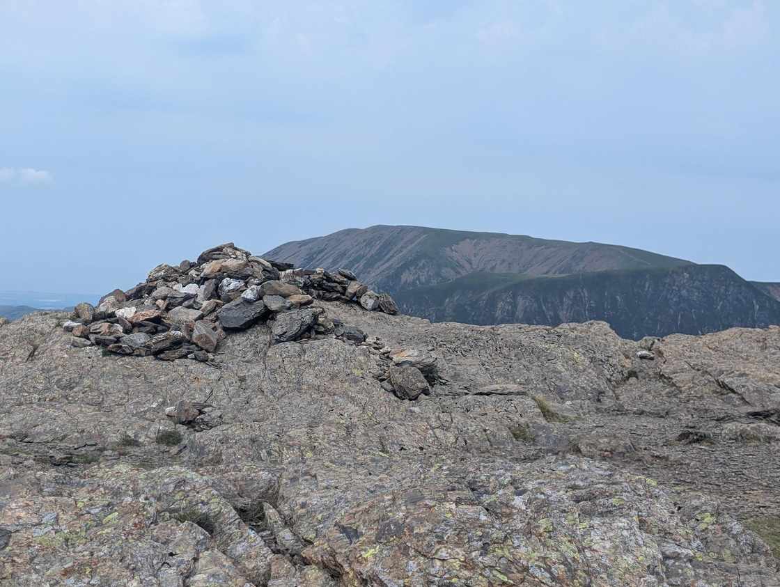
Robinson
Robinson at 737m (2,418ft) is the north-western bastion of the Newlands Horseshoe — the great classic ridge walk that circuits the Newlands valley.
Is it worth going? — Today’s conditions & 7-day summit forecast
Modelled guidance for the 738 m summit. Always check the Met Office mountain forecast and MWIS before you set off.
On the summit today (Tue 28 Jul): 14° to 13°C, gusts to 37 mph, 4.7 mm of rain forecast.
Forecast snapshot from 28 Jul 2026, 04:58 UTC — refreshed nightly and updated live in your browser. Temperatures and gusts adjusted to the 738 m summit altitude via Open-Meteo. Summit conditions are always harsher than the valley — check the professional mountain forecasts before you go.
About the walk
Robinson
Routes up Robinson
Hand-mapped, with GPX to download — full maps further down.
Map & nearby Birketts
Skip mapFree mapping: OpenTopoMap / OpenStreetMap (switch layers top-right). Parking positions are approximate.
Nearest parking: Gatesgarth Farm, Buttermere (paid), about 2.1 km from the summit (straight line). Full parking, toilets and bus details are below.
Birketts near Robinson (within 3 km)
These Birkett tops are not Wainwright summits — detour to them on this walk and they are pure profit. Distances are straight-line; allow extra for terrain.
Routes over Robinson
✎️ Because it finishes in a different valley from where it starts, this one suits a car–free day: the seasonal Honister Rambler (the 77 / 77A) sets you down at Honister Hause and you walk back into Keswick for the bus home. From Penrith it’s the X4 / X5 to Keswick, then the Rambler up to Honister. Check the last bus before you set off — the walk’s long tail down the Newlands valley eats time when legs are tired.
✎️ Planned route — drawn but not personally walked or checked yet.
A planned line is a suggestion, not a guarantee — conditions change. Navigate independently and carry a map & compass.
The View from Robinson
A computed 360° skyline — every visible named top labelled by distance and bearing, from the terrain model in perfect clarity, not photographed. Drag to pan; reveal the far four-nations horizon.
What you can see from Robinson, by direction
- North: Crag Hill (4 km), Grisedale Pike (6 km)
- North-east: Skiddaw Lesser Man (13 km), Skiddaw Little Man (13 km), Skiddaw South Top (13 km), Skiddaw Middle Top (13 km), Skiddaw (14 km), Knowe Crags (15 km), Gategill Fell Top (16 km), Blencathra (16 km), Atkinson Pike (17 km)
- East: Helvellyn Lower Man (14 km), White Side (14 km), Raise (14 km), Helvellyn (14 km), Stybarrow Dodd (14 km), Nethermost Pike (14 km), High Crag (14 km), Great Dodd (14 km), Catstye Cam (15 km), Dollywaggon Pike (15 km), Cofa Pike (16 km), Fairfield (16 km), Dove Crag (18 km)
- South: Kirk Fell (6 km), Great Gable (7 km), Great End (9 km), Broad Crag (10 km), Scafell Pike (10 km), Ill Crag (10 km), Esk Pike (10 km), Scafell (10 km), Pike de Bield (11 km), Bowfell (11 km)
- South-west: High Stile (4 km), High Stile (4 km), Pillar (6 km), Scoat Fell (7 km), Haycock (8 km)
- North-west: Grasmoor (4 km)
On the clearest days the far horizon adds: Snowdon (173 km, Wales), Slieve Donard (179 km, Ireland), Carnedd Llewelyn (161 km, Wales), Merrick (104 km, Scotland), Moel Siabod (170 km, Wales), Cairnsmore of Fleet (86 km, Scotland), Corserine (99 km, Scotland), Windlestraw Law (127 km, Scotland).
Computed from terrain in perfect clarity, not photographed · distances are straight-line.
Computed from Copernicus GLO-30 terrain; distant tops from the Database of British and Irish Hills (opens in new tab) (CC BY 4.0). See how we compute the view · and the summit intervisibility report below.
What you can see from Robinson
On a clear day — computed sightlines, curvature- and refraction-corrected.On the clearest days the view reaches across to Wales and Scotland.
- Snowdon (Yr Wyddfa) Wales
- Carnedd Llewelyn Wales
- Merrick Scotland
- Whernside Yorkshire Dales
- Great Dun Fell North Pennines
- Cross Fell North Pennines
- Irish Sea open water
All 83 Wainwrights in clear view (nearest first)
Hindscarth, Knott Rigg, Dale Head, Fleetwith Pike, Ard Crags, Whiteless Pike, Wandope, Sail, Crag Hill (Eel Crag), High Crag (Buttermere), Maiden Moor, Rannerdale Knotts, Scar Crags, Haystacks (Buttermere), High Stile, Causey Pike, Grasmoor, Red Pike (Buttermere), Grey Knotts, Brandreth, Mellbreak (Mellbreak South Top), Barrow, Pillar, Grisedale Pike, Starling Dodd, Green Gable, Kirk Fell, Great Gable, Steeple, Scoat Fell (Little Scoat Fell), Hen Comb, Glaramara, Great Borne, Haycock, High Seat, Low Fell, Lingmell, Gavel Fell, Walla Crag, Great End, Bleaberry Fell, Yewbarrow, Allen Crags, Blake Fell, Scafell Pike, Lord's Seat, Esk Pike, Ullscarf, Scafell, High Raise (High White Stones), Crag Fell, Latrigg, Bowfell, Dodd (Skiddaw), High Rigg (Naddle Fell), Pike of Stickle, Pavey Ark, Harrison Stickle, Long Side, Ullock Pike, Skiddaw Little Man, Lonscale Fell, Skiddaw, White Side, Watson's Dodd, Raise, Helvellyn, Stybarrow Dodd, Nethermost Pike, Clough Head, Pike of Blisco, Great Dodd, Catstye Cam, Dollywaggon Pike, Seat Sandal, Fairfield, Great Rigg, Wetherlam, Dove Crag, Binsey, Bowscale Fell, Red Screes, Thornthwaite Crag
How Robinson’s view compares with all 214 — the View Report: every Wainwright ranked by what you can see from the top.
Sightlines from a bare-earth terrain model (forests and buildings not included), corrected for the Earth’s curvature and average atmospheric refraction. “Distant” sightlines and any over 100 km depend on exceptionally clear air. Modelled from Copernicus GLO-30 open elevation data — a guide to the view, not a guarantee of any single one.
Best parking to hike Robinson
Where we have the data, each parking spot also shows the nearest public toilets and facilities (cafés, pubs, shops).
Positions are approximate — zoom the map to confirm. Lakeland car parks fill before 9am on fine weekends.
Tip: pan and zoom the interactive map at the top of this page to spot other potential parking near your route.
Water & shelter on the way up
On the Honister to Keswick: over the Newlands fells route:
On-route facilities © OpenStreetMap contributors, per route — an absent marker doesn’t mean none.
Buses to Robinson from Penrith / Ambleside / Windermere
Rural routes change seasonally — confirm on stagecoachbus.com (opens in new tab) or Traveline before relying on a last bus.
My hikes over Robinson (Strava)
1 logged hike pass over this summit:
- Dale Head Hindscarth and Robinson (opens in new tab) — 17.3 km · 743 m ascent · 4h 14m moving · 11 Jul 2026
Interactive route maps and photos load here for visitors with JavaScript. Data from Strava.
Hazard & Incident Information for Robinson
A big, broad-topped fell between Buttermere and the Newlands valley, easy underfoot on its grassy upper slopes but defended by bands of rock and a featureless summit that catches people out in cloud. The ridge carries a set of rock steps that need hands and care when wet, and the approaches run above lines of crag. Keswick Mountain Rescue Team covers the Newlands side of this fell.
- The rock steps on the ridge: The south-western ridge has a series of three short rock steps — an easy scramble in the dry, but awkward, polished and slippery when wet. Take them carefully, test holds, and don't rush the down-climb if descending this way.
- Crag bands on the approaches (Blea Crags / High Snab): The paths from the Newlands side run above lines of crag, including by Blea Crags. Keep to the path and don't drift toward the edges in mist; the easy grass can give way to steep ground without much warning.
- The broad summit in cloud: Robinson's top is wide and largely featureless, with steep flanks down to both Buttermere and Newlands. It is easy to leave on the wrong bearing in mist and end up above crags or in the wrong valley. Set a compass bearing before you descend.
Most common causes: Slips on the wet, polished rock steps · Walkers drifting over crag edges on the approaches in poor visibility · Navigation errors off the broad featureless summit in cloud · Misjudging the steep flanks down to Buttermere or Newlands
Local Mountain Rescue: Keswick Mountain Rescue Team (opens in new tab) · Reviewed 14 Jun 2026
Safety: Hazard guidance compiled from published Mountain Rescue reports and well-documented accident history - editorial background, not a live feed of callouts. Always check current conditions, carry proper navigation equipment, and seek qualified instruction before heading onto the fells. In an emergency, call 999, ask for Police, then Mountain Rescue.
Navigating Robinson in cloud
StraightforwardA broad, gently-sloping top with little to steer by — easy to lose your bearings and hard to relocate in mist. Navigation here is relatively straightforward even in cloud — but carry map and compass and know how to use them; a low score never means “safe”.
In winter — snow, whiteout, cornices, buried features — every top demands full winter navigation skills whatever its band, and a broad, gentle summit can be the worst place of all. See walking in bad weather and the navigation guide.
How Robinson compares with all 214 — the Clag Index: navigating in cloud. A relative, deliberately cautious guide; the site can’t navigate for you.
Frequently asked questions about Robinson
Is Robinson hard to climb?
It's a moderate fell — a broad, grassy whaleback that's a steady rather than fierce climb, though some routes have steep zig-zags and a few rocky steps for interest. Robinson (737 m / 2,418 ft) sits between the Newlands valley and Buttermere.
The main things to watch are the boggy crossing of Buttermere Moss and route-finding on the broad top, rather than any difficult or exposed ground.
Sources: Knowledge.me.uk — Fell Guide: Robinson (opens in new tab)
What is the best route up Robinson?
Two favourites: the High Snab Bank north-east ridge from the Newlands valley (Little Town), a lovely steady ridge rising in steps to the summit; and the steeper climb from Buttermere via High Snockrigg, using zig-zags through gullies and terraces with a couple of rocky steps.
Robinson also pairs naturally with Hindscarth and Dale Head on the Newlands Horseshoe.
Sources: Where2Walk — Robinson from Newlands Hause (opens in new tab)
How long does it take to climb Robinson?
On its own from Buttermere (about 9 km) allow roughly 3.5–4.5 hours. From the Newlands valley it's a similar half-day; combined with Hindscarth and Dale Head on the Newlands Horseshoe it becomes a longer 6–7 hour round.
Sources: Walkingworld — Buttermere, High Snockrigg, Robinson (opens in new tab)
How boggy is Robinson, and is Buttermere Moss bad?
Robinson is genuinely boggy in places, and Buttermere Moss — the broad, peaty plateau on the Buttermere side — is notoriously wet, with sucking, ankle-deep ground that's hard to cross dry-shod after rain.
Wear waterproof boots, expect to pick your way around the worst, and note it's easy to lose the line across the moss in mist, so carry a compass. In a wet spell, the Newlands ridge stays drier underfoot.
Sources: Knowledge.me.uk — Fell Guide: Robinson (opens in new tab)
Who is Robinson named after?
Unusually for a Lakeland fell, Robinson is named after a person — Richard Robinson, a 16th-century landowner who acquired the fell after the dissolution of the monasteries. It's one of the very few Wainwrights to carry a plain surname rather than a descriptive Norse or English name.
That quirk often surprises walkers, who expect a 'Robinson Fell' or similar.
Sources: Wikipedia — Robinson (Lake District) (opens in new tab)
Is Robinson suitable for beginners?
Yes, for a fit beginner on a clear day — there's no scrambling on the normal routes and the gradients are manageable. The catches are the wet ground (especially Buttermere Moss) and navigating the broad, featureless summit in cloud.
Choose the drier Newlands ridge in wet spells, wear waterproof boots, carry a map and compass, and pick settled weather for the best of the views.
Sources: Cockermouth Mountain Rescue Team (opens in new tab)
What should I wear and take up Robinson?
Wear waterproof walking boots — the boggy ground and Buttermere Moss are wet underfoot — and carry warm and waterproof layers, as the broad summit is exposed. A map and compass matter for navigating the featureless top in cloud, along with water, food and a charged phone.
Check the mountain forecast, and take care on the steep zig-zags and rocky steps on the Buttermere side, especially when wet or icy.
Questions drawn from real Google “People also ask” searches; answers written and fact-checked by us. · Reviewed 2026-06-15 · Suggest a question or correction (opens in new tab)
Other fells near Robinson
- Ard Crags
- Barf
- Barrow
- Broom Fell
- Castle Crag
- Cat Bells (Catbells)
- Causey Pike
- Crag Hill (Eel Crag)
- Dale Head
- Grasmoor
- Graystones (Graystones North Top)
- Grisedale Pike
- High Spy
- Hindscarth
- Hopegill Head
- Knott Rigg
- Ling Fell
- Lord's Seat
- Maiden Moor
- Outerside
- Rannerdale Knotts
- Sail
- Sale Fell
- Scar Crags
- Wandope
- Whinlatter (Brown How - Whinlatter)
- Whiteless Pike
- Whiteside (Whiteside West Top)
Maps & guidebooks for Robinson
- Buy on Amazon (opens in new tab)
- Buy on Amazon (opens in new tab)
- Buy on Amazon (opens in new tab)
- Buy on Amazon (opens in new tab)
- Buy on Amazon (opens in new tab)
As an Amazon Associate we earn from qualifying purchases — at no extra cost to you. How affiliate links work →