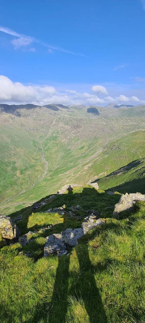
Pike of Stickle
Pike of Stickle at 709m (2,326ft) is the most distinctive of the Langdale Pikes — a soaring, pointed summit of volcanic rock that thrusts skyward above the head of Langdale.
Is it worth going? — Today’s conditions & 7-day summit forecast
Modelled guidance for the 708 m summit. Always check the Met Office mountain forecast and MWIS before you set off.
On the summit today (Sat 12 Sep): 13° to 7°C, gusts to 47 mph, 50.2 mm of rain forecast.
Forecast snapshot from 12 Sep 2026, 15:36 UTC — refreshed nightly and updated live in your browser. Temperatures and gusts adjusted to the 708 m summit altitude via Open-Meteo. Summit conditions are always harsher than the valley — check the professional mountain forecasts before you go.
Pike of Stickle at a glance
Pike of Stickle
Routes up Pike of Stickle
Hand-mapped, with GPX to download — full maps further down.
Classifications & hill data
The short answers
Is Pike of Stickle a Wainwright?
Pike of Stickle is a Wainwright. It is also on the Birkett list, the Synge list, the Nuttall list and the Fellranger list.
Where do you park for Pike of Stickle?
The nearest car park we hold is Old Dungeon Ghyll (NT, paid), about 1.7 km from the summit in a straight line. The next is Side Pike (verge, south), 2.2 km out. We only look within 2.5 km, measured straight-line: over longer distances a road may cross a pass and the drive bears no relation to the line.
How hard is Pike of Stickle?
The shortest way up we hold is Langdale Pikes Round — 12.3 km, 830 m of ascent, about 3.9 hours. On our scale its hardest axis is steepness — Severe.
All axes: steepness: Severe · navigation: Hard · exposure: Moderate · length: Moderate · terrain: Moderate.
My hikes over Pike of Stickle (Strava)
1 logged hike pass over this summit:
- 8 Wainwrights today - had some catching up to do! (opens in new tab) — 14.5 km · 1013 m ascent · 4h 23m moving · 1 Jun 2024
Interactive route maps and photos load here for visitors with JavaScript. Data from Strava.
Parking & buses for Pike of Stickle
Best parking to hike Pike of Stickle
Where we have the data, each parking spot also shows the nearest public toilets and facilities (cafés, pubs, shops).
Positions are approximate — zoom the map to confirm.
Tip: pan and zoom the interactive map at the top of this page to spot other potential parking near your route.
Vehicles are left entirely at their owner’s risk. We list places people park; we cannot vouch for any of them. Judge it on the day: take valuables with you, leave nothing on show, and if a spot feels wrong when you get there, park somewhere else.
Getting to Pike of Stickle by bus
The 516 stops at New Dungeon Ghyll Hotel (at), 140 m from the start of Langdale Pikes Round — a route we rate Moderate. Last bus: Monday to Friday 20:13 towards Kendal (516) and 18:13 towards Ambleside (516); Saturday 22:33 towards Kendal (516) and 21:13 towards Ambleside (516); Sunday 20:13 towards Kendal (516) and 18:13 towards Ambleside (516). Checked against the operator’s timetable, 7 September 2026. Times here are a guide, not a promise — leave yourself more than the minute.
Rural routes change seasonally — confirm on stagecoachbus.com (opens in new tab) or Traveline before relying on a last bus.
Hazards on Pike of Stickle
Hazard & Incident Information for Pike of Stickle
A striking, steep-sided rocky dome — one of the Langdale Pikes — whose summit is gained by a short but genuine scramble, and whose great south scree gully has a long accident record. Langdale Ambleside Mountain Rescue Team is repeatedly called here to walkers who slip or come to grief on the Pike o' Stickle screes, and the steep ground all around demands care in cloud.
- The Pike o' Stickle screes / south gully: The steep scree gully on the south side is a notorious accident spot — slips and 'scree running' here have caused repeated head, back and leg injuries. It is loose, steep and fast: do not scree-run, descend it with great care if at all, and treat it as a serious slope rather than a shortcut.
- The summit scramble: The final few metres to the top are a short rock scramble — straightforward for the confident in the dry, but exposed and awkward when wet or icy, and a fall from it would be serious. Use hands, test holds, and don't commit if unsure.
- Steep flanks & plateau navigation: The cone falls away steeply on all sides, and the broad Langdale Pikes plateau around it is easy to misread in mist (steep ground toward Langdale and Mickleden). Keep back from the edges and navigate by compass between the Pikes.
Most common causes: Slips and falls on the steep south scree gully, including from 'scree running' · Falls on the short summit scramble, especially when wet or iced · Walkers straying onto steep ground off the plateau in cloud · Underestimating the steepness of a small but rocky peak
Local Mountain Rescue: Langdale Ambleside Mountain Rescue Team (opens in new tab) · Reviewed 14 Jun 2026
Safety: Hazard guidance compiled from published Mountain Rescue reports and well-documented accident history - editorial background, not a live feed of callouts. Always check current conditions, carry proper navigation equipment, and seek qualified instruction before heading onto the fells. In an emergency, call 999, ask for Police, then Mountain Rescue.
Navigating Pike of Stickle in cloud
StraightforwardA broad, gently-sloping top with little to steer by — easy to lose your bearings and hard to relocate in mist. Navigation here is relatively straightforward even in cloud — but carry map and compass and know how to use them; a low score never means “safe”.
In winter — snow, whiteout, cornices, buried features — every top demands full winter navigation skills whatever its band, and a broad, gentle summit can be the worst place of all. See walking in bad weather and the navigation guide.
How Pike of Stickle compares with all 214 — the Clag Index: navigating in cloud. A relative, deliberately cautious guide; the site can’t navigate for you.
Map & nearby Birketts
Skip mapFree mapping: OpenTopoMap / OpenStreetMap (switch layers top-right). Parking positions are approximate.
Nearest parking: Old Dungeon Ghyll (NT, paid), about 1.7 km from the summit (straight line). Full parking, toilets and bus details are below.
Birketts near Pike of Stickle (within 3 km)
These Birkett tops are not Wainwright summits — detour to them on this walk and they are pure profit. Distances are straight-line; allow extra for terrain.
Routes over Pike of Stickle
✎️ Planned route — drawn but not personally walked or checked yet.
A planned line is a suggestion, not a guarantee — conditions change. Navigate independently and carry a map & compass. How to use this guide.
A planned line is a suggestion, not a guarantee — conditions change. Navigate independently and carry a map & compass. How to use this guide.
On the hill: terrain and water on Pike of Stickle
Water & shelter on the way up
On the Langdale Horseshoe route:
On the Langdale Pikes Round route:
💧 Treat water from the fell before you drink it. A mapped point is usually a tap or public supply, but never drink untreated from a beck, stream or tarn — even clear-looking hill water can carry giardia or cryptosporidium from livestock or a carcass upstream and leave you seriously ill. Run it through a filter or purifier (a LifeStraw, Sawyer Squeeze or HydraPak) or bring it to a rolling boil first.
On-route facilities © OpenStreetMap contributors, per route — an absent marker doesn’t mean none.
The view from Pike of Stickle
The 360° skyline from Pike of Stickle
A computed 360° skyline — every visible named top labelled by distance and bearing, from the terrain model in perfect clarity, not photographed. Drag to pan; reveal the far four-nations horizon.
What you can see from Pike of Stickle, by direction
- North: Knowe Crags (20 km), Skiddaw Lesser Man (20 km), Skiddaw Little Man (20 km), Gategill Fell Top (20 km), Skiddaw South Top (21 km), Skiddaw Middle Top (22 km), Skiddaw (22 km), Skiddaw North Top (22 km)
- North-east: Dollywaggon Pike (9 km), High Crag (9 km), Fairfield (10 km), Cofa Pike (10 km), Nethermost Pike (10 km), Helvellyn (10 km), Helvellyn Lower Man (10 km), White Side (11 km), St Sunday Crag (11 km), Gavel Pike (12 km), Raise (12 km)
- East: Hart Crag (10 km), Dove Crag (10 km), Thornthwaite Crag (16 km), High Street (17 km), High Raise (18 km)
- South: Swirl How (7 km)
- South-west: Crinkle Crags (3 km), Crinkle Crags (4 km)
- West: Allen Crags (4 km), Great End (5 km), Scafell Pike (6 km), Kirk Fell (8 km)
- North-west: Looking Steads (4 km), Glaramara (4 km), Green Gable (7 km), Great Gable (7 km), High Stile (13 km), High Stile (13 km), Crag Hill (15 km), Grasmoor (16 km), Grisedale Pike (17 km)
On the clearest days the far horizon adds: Snowdon (167 km, Wales), Carnedd Llewelyn (155 km, Wales), Moel Siabod (163 km, Wales), Arenig Fawr (176 km, Wales), Tinto (131 km, Scotland), Green Lowther (111 km, Scotland), Queensberry (97 km, Scotland), Culter Fell (124 km, Scotland).
Computed from terrain in perfect clarity, not photographed · distances are straight-line.
Computed from Copernicus GLO-30 terrain; distant tops from the Database of British and Irish Hills (opens in new tab) (CC BY 4.0). See how we compute the view · and the summit intervisibility report below.
Sunrise and sunset on Pike of Stickle
Pike of Stickle sits close to the flat-horizon case. Even on its longest wait of the modelled year (at midsummer) first light is only 11 minutes after almanac sunrise, so the published sunrise time is a fair guide here.
| First light | Almanac sunrise | Difference | |
|---|---|---|---|
| Midsummer | 04:48 BST ±5.0 min | 04:37 | +11 min |
| Equinox | 06:19 GMT ±5.0 min | 06:16 | +3 min |
| Midwinter | 08:27 GMT ±5.0 min | 08:33 | -6 min |
A low, open northern horizon — the ground falls away northwards (mean 0.33°).
Last light — when the sun leaves Pike of Stickle
Pike of Stickle loses the sun early. Its earliest evening of the modelled year falls on 1 March, when last light is 26 minutes before almanac sunset — 17:23 against 17:49. The sun goes down to the west-south-west from here (253.1°), and the skyline on that bearing stands at 3.35°.
| Last light | Almanac sunset | Difference | |
|---|---|---|---|
| Midsummer | 21:45 BST ±5.0 min | 21:52 | -7 min |
| Equinox | 18:08 GMT ±5.0 min | 18:26 | -18 min |
| Midwinter | 15:30 GMT ±5.0 min | 15:49 | -19 min |
Computed, not photographed. First light is the first minute the sun’s upper limb clears this summit’s own skyline and last light the last minute it is still clear of it, both solved against the 360° horizon profile behind The View from Pike of Stickle. Almanac sunrise and sunset are the flat-horizon convention. Every time carries a ± band from the 30 m elevation model — it smooths arêtes and cornices, so nothing here claims better than five minutes. These are daylight figures, not a descent plan: the light goes on fading for a good while after the sun leaves, and going down in it is a decision about your own ground and party, not about this table.
What you can see from Pike of Stickle
On a clear day — computed sightlines, curvature- and refraction-corrected.On the clearest days the view reaches across to Wales.
- Snowdon (Yr Wyddfa) Wales
- Carnedd Llewelyn Wales
- Ingleborough Yorkshire Dales
- Solway Firth bay/estuary
- Whernside Yorkshire Dales
- Morecambe Bay bay/estuary
All 71 Wainwrights in clear view (nearest first)
Loft Crag, Harrison Stickle, Thunacar Knott, Pavey Ark, High Raise (High White Stones), Rossett Pike, Bowfell, Pike of Blisco, Crinkle Crags - Long Top (Second Crinkle), Esk Pike, Allen Crags, Cold Pike, Sergeant's Crag, Lingmoor Fell (Brown How), Glaramara, Eagle Crag, Great End, Silver How, Rosthwaite Fell - Bessyboot, Scafell Pike, Great Carrs, Wetherlam, Swirl How, Green Gable, Great Gable, Grey Friar, Great Crag (Stonethwaite), Loughrigg Fell, Holme Fell, Seat Sandal, Kirk Fell, Great Rigg, Black Fell, Grange Fell (Brund Fell), Dollywaggon Pike, Fairfield, Dale Head, Dow Crag, High Spy, Nethermost Pike, Hart Crag, High Seat, St Sunday Crag, High Crag (Buttermere), Robinson, Bleaberry Fell, Cat Bells (Catbells), High Stile, Baystones (Wansfell), Ard Crags, Causey Pike, Scar Crags, Sail, Crag Hill (Eel Crag), Sour Howes, Grasmoor, Yoke, Sallows, Grisedale Pike, Hopegill Head, Lonscale Fell, Dodd (Skiddaw), Barf, Skiddaw Little Man, Lord's Seat, Carl Side, Long Side, Ullock Pike, Skiddaw, Knott, Binsey
How Pike of Stickle’s view compares with all 214 — the View Report: every Wainwright ranked by what you can see from the top.
Sightlines from a bare-earth terrain model (forests and buildings not included), corrected for the Earth’s curvature and average atmospheric refraction. “Distant” sightlines and any over 100 km depend on exceptionally clear air. Modelled from Copernicus GLO-30 open elevation data — a guide to the view, not a guarantee of any single one.
Places to stay near this fell
From Great Langdale: 3 places in Grasmere
Frequently asked questions about Pike of Stickle
Is Pike o’ Stickle a scramble?
Yes — a short one, but a genuine one. The last part of the steep rocky dome is hands-on, and while it is over quickly it is the real thing rather than an awkward step. If you are not comfortable with that, the view from the shoulder is most of the view.
The more important answer is about coming down. Do not descend the great south scree gully. It is loose, it steepens out of sight, and it is the classic mistake on this fell — go back the way you came. Our Langdale Pikes round takes it in over 12.3 km with 830 m of ascent, rated Moderate.
Questions drawn from real Google “People also ask” searches; answers written and fact-checked by us. · Reviewed 2026-08-30 · Suggest a question or correction (opens in new tab)
Other fells near Pike of Stickle
- Armboth Fell (Armboth Fell South Top)
- Blea Rigg
- Bleaberry Fell
- Calf Crag
- Eagle Crag
- Gibson Knott
- Grange Fell (Brund Fell)
- Great Crag (Stonethwaite)
- Harrison Stickle
- Helm Crag
- High Raise (High White Stones)
- High Rigg (Naddle Fell)
- High Seat
- High Tove
- Loft Crag
- Loughrigg Fell
- Pavey Ark
- Raven Crag
- Sergeant Man
- Sergeant's Crag
- Silver How
- Steel Fell (Dead Pike)
- Tarn Crag (Easedale)
- Thunacar Knott
- Ullscarf
- Walla Crag