hikes.guideLake District

A Lake District walking collection — generated from live fell & route data.

Sergeant Man
Collection · 27 fells

Walking the Central Fells

The Wainwright and Outlying fells we group as the Central area of the Lake District — each with its height, a typical round time, the bus where there’s one, and today’s predicted conditions. Grouped by our own area tag (a practical guide, not a fixed authored canon). Check the live conditions and the mountain forecast before the tops.

27
fells
from 1.5 hr
shortest day
0
dog-friendly

6 of these are rated good to climb on 11 Septembersee live conditions →
A prediction from our daily fell score (clear summits, wind, rain, visibility), not a guarantee — always check the mountain forecast before you go.

Map

fells within ~5 km

An interactive map of the route start points and the fells within about 5 km. Each marker links to its page; the same routes and fells are listed below.

  • High Raise (High White Stones)762 m~3.5 h🚌 BusMarginal · 40Summit likely clagged inHigh Raise at 762m (2,500ft) is the central summit of the Lake District — literally and figuratively.
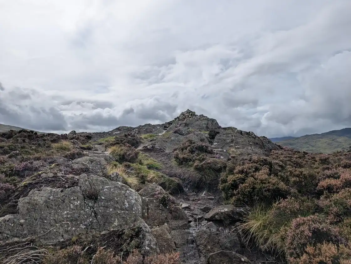
  • Sergeant ManSergeant Man736 m~3 h🚌 BusMarginal · 40Summit likely clagged inSergeant Man at 736m (2,415ft) is the subsidiary summit of High Raise above Langdale, a rocky outcrop on the rim of the plateau with outstanding views of the Langdale valley and the Pikes below.
  • Harrison StickleHarrison Stickle735 m~3 h🚌 BusMarginal · 40Summit likely clagged inHarrison Stickle at 736m (2,415ft) is the highest and most prominent of the Langdale Pikes, a magnificent crag-crowned summit that dominates the head of Great Langdale and is one of the most recognisable profiles in English fell walking.
  • Thunacar Knott723 m~3 h🚌 BusDecent · 63DryThunacar Knott at 723m (2,372ft) is the broad, grassy summit between Harrison Stickle and High Raise, often crossed without recognition on the way between the Langdale Pikes and the High Raise plateau.
  • Ullscarf723 m~3 h🚌 BusMarginal · 40Summit likely clagged inUllscarf at 726m (2,382ft) is the quietest and most remote of the Central Fells, a broad, heathery plateau above the headwaters of Wyth Burn that Wainwright described as giving an unfrequented and peaceful summit with outstanding views in all directions.
  • Pike of Stickle708 m~3 h🚌 BusMarginal · 40Summit likely clagged inPike of Stickle at 709m (2,326ft) is the most distinctive of the Langdale Pikes — a soaring, pointed summit of volcanic rock that thrusts skyward above the head of Langdale.
  • Pavey Ark702 m~3 h🚌 BusMarginal · 40Summit likely clagged inPavey Ark at 700m (2,297ft) is the great crag above Stickle Tarn in Great Langdale — its massive cliff face dropping nearly 100m from rim to tarn and offering some of the finest rock climbing in the Lake District.
  • Loft CragLoft Crag682 m~3 h🚌 BusMarginal · 40Summit likely clagged inLoft Crag at 682m (2,237ft) is the smallest and least visited of the Langdale Pikes, sitting between Pike of Stickle and Harrison Stickle on the western side of the Pikes circuit.
  • High Seat609 m~3 h🚌 BusMarginal · 40Summit likely clagged inHigh Seat at 608m (1,995ft) is the highest summit of the Bleaberry Fell–Armboth plateau above Thirlmere and Derwent Water — a broad, boggy moorland that Wainwright regarded as something of an endurance test, given the extensive wet ground.
  • Bleaberry FellBleaberry Fell590 m~2.5 h🚌 BusMarginal · 40Summit likely clagged inBleaberry Fell at 590m (1,936ft) is a broad, heathery summit above Cat Bells and Derwent Water, giving one of the finest aerial views of the lake in the whole district.
  • Sergeant's Crag571 m~2.5 h🚌 BusMarginal · 40Summit likely clagged inSergeant's Crag at 571m (1,873ft) is a craggy, rocky summit above Langstrath in Borrowdale, its small crags giving a surprisingly dramatic profile for a modest summit.
  • Steel Fell (Dead Pike)Steel Fell (Dead Pike)553 m~2.5 h🚌 BusMarginal · 40Summit likely clagged inSteel Fell at 553m (1,814ft) is the ridge south of Dunmail Raise above Thirlmere, its long summit crest giving outstanding views of Grasmere below and the full Southern Fells beyond.
  • Tarn Crag (Easedale)Tarn Crag (Easedale)549 m~2.5 h🚌 BusMarginal · 40Summit likely clagged inTarn Crag at 583m (1,913ft) above Easedale is a craggy little summit above the head of the Sour Milk Gill path from Grasmere.
  • Blea Rigg542 m~2.5 h🚌 BusMarginal · 40Summit likely clagged inBlea Rigg at 541m (1,775ft) is a craggy, complex ridge above Easedale and Langdale, giving excellent views down into Great Langdale from its rocky summit.
  • Calf CragCalf Crag537 m~2.5 h🚌 BusMarginal · 40Summit likely clagged inCalf Crag at 537m (1,762ft) is the northernmost summit of the Central Fells above Greenburn, a rocky top giving fine views down into Wythburn and north to the Helvellyn range.
  • Eagle CragEagle Crag523 m~2.5 h🚌 BusMarginal · 40Summit likely clagged inEagle Crag at 520m (1,706ft) is a magnificent rocky buttress above Langstrath, its eastern face dropping in great crags to the valley below.
  • High Tove515 m~2.5 h🚌 BusMarginal · 40Summit likely clagged inHigh Tove at 515m (1,690ft) is a modest, boggy summit on the Armboth plateau between Thirlmere and Borrowdale, its open top giving views across to the Helvellyn range and north to Skiddaw.
  • Armboth Fell (Armboth Fell South Top)475 m~2.5 h🚌 BusMarginal · 40Summit likely clagged inArmboth Fell at 479m (1,572ft) is a broad, peaty summit on the central plateau between Thirlmere and Watendlath, giving adequate views across to the Helvellyn range.
  • Raven CragRaven Crag461 m~2.5 h🚌 BusMarginal · 40Summit likely clagged inRaven Crag at 461m (1,512ft) is the dramatic cliff above Thirlmere, its great crag face one of the most impressive roadside crags in Lakeland.
  • Great Crag (Stonethwaite)Great Crag (Stonethwaite)449 m~2.5 h🚌 BusDecent · 70Dry, light windsGreat Crag at 449m (1,473ft) is a small, craggy summit above Watendlath, its rocky top giving fine views of the charming hamlet and tarn below and across to Glaramara and the Borrowdale fells.
  • Gibson KnottGibson Knott420 m~2 h🚌 BusMarginal · 40Summit likely clagged inGibson Knott at 420m (1,378ft) is a craggy, pleasant little summit on the ridge above Greenburn above Grasmere, giving good views of the valley and Helm Crag to the south.
  • Grange Fell (Brund Fell)Grange Fell (Brund Fell)417 m~2 h🚌 BusMarginal · 40Summit likely clagged inGrange Fell at 415m (1,362ft) is a rough, rocky summit above the village of Grange in Borrowdale, its craggy knolls and heathery terraces giving a charming, varied walk.
  • Helm CragHelm Crag405 m~2 h🚌 BusDecent · 70Dry, firm underfootHelm Crag at 405m (1,329ft) is one of the most famous and distinctive summits in Lakeland — the jagged, rocky outline known as 'The Lion and the Lamb' visible from Grasmere below.
  • Silver HowSilver How394 m~2 h🚌 BusDecent · 74DrySilver How at 395m (1,296ft) is a delightful, rocky little summit above Grasmere and Chapel Stile, its summit giving one of the finest views of Grasmere and the surrounding fells from any low-level viewpoint in the district.
  • Walla CragWalla Crag379 m~2 h🚌 BusMarginal · 40Summit likely clagged inWalla Crag at 379m (1,244ft) is the great rocky escarpment above Derwent Water, its summit giving one of the finest aerial views of the lake in the whole district.
  • High Rigg (Naddle Fell)356 m~1.5 h🚌 BusDecent · 64DryHigh Rigg at 357m (1,171ft) is a delightful, craggy ridge above St John's in the Vale — one of the most pleasant low-level walks in the Eastern Fells, its heathery knolls giving fine views of Blencathra, Helvellyn and the Vale of St John from multiple viewpoints.
  • Loughrigg FellLoughrigg Fell335 m~2 h🚌 BusDecent · 68DryLoughrigg Fell at 335m (1,099ft) is one of the most beloved and visited fells in the Lake District, a complex heathery mass rising between Ambleside, Grasmere and Elterwater.

More collections

All collections →