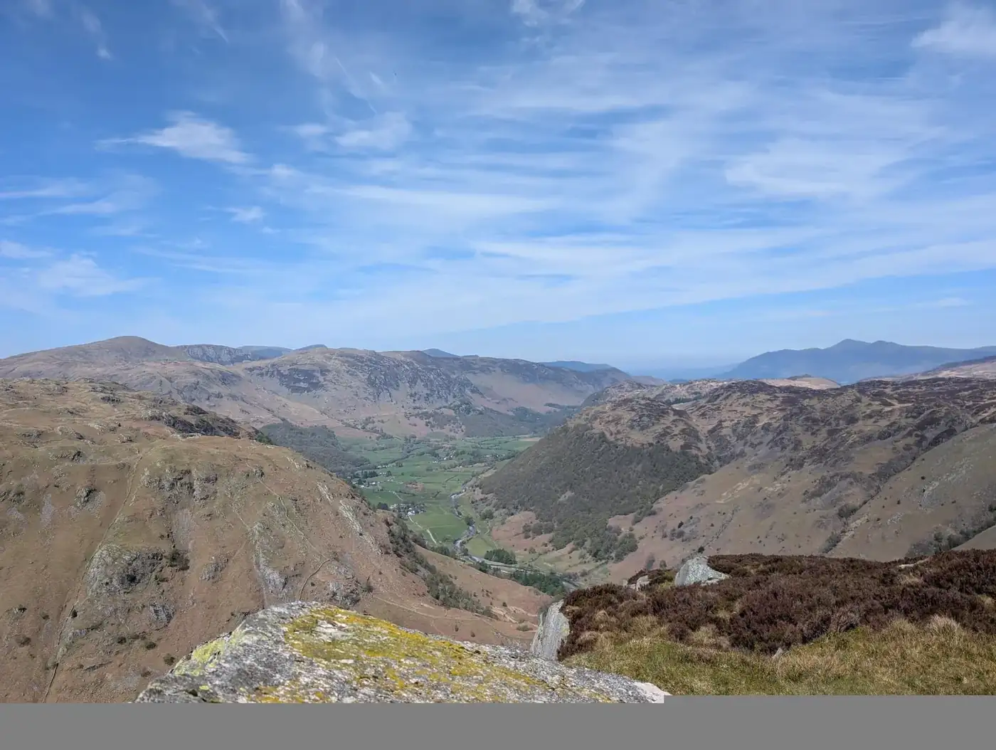
Ullscarf, Eagle Crag & Sergeant's Crag
Photo: © Lee McCoy
Key facts
✎️ Walked and described first-hand by Lee. A serious round: the navigation over Ullscarf and Greenup Edge is boggy and featureless (a compass is essential in cloud), and the direct Eagle Crag line is steep and intricate — good-weather, sure-footed terrain. Carry OS Explorer OL4.
Difficulty profile
Five independent axes, not one score. “Desk” ratings come from maps and guidebooks, not yet walked — treat them as a guide, not a survey.
Conditions on this route
We score every Lakeland Wainwright each morning on cloud, wind, rain and underfoot, and this route crosses 3 of them. The worst summit governs the verdict — a route is only as kind as its roughest top.
Modelled guidance — not a substitute for the mountain forecast or your own judgement. See how every fell ranks today →
☀️ Daylight & turnaround
Daylight is short from October to February — check today’s sunrise and sunset before you set off, and carry a head-torch and spare batteries. On short days, decide your turn-back time before you start.
Why this matters: 78% of Mountain Rescue call-outs come after midday — the day runs out on the way home, not on the way up. See also walking in bad weather and today’s conditions.
1 Lining Crag2 Ullscarf3 Sergeant's Crag4 Eagle Crag
Free mapping: OpenTopoMap / OpenStreetMap (switch layers top-right).
This walk covers about 14.83 km with around 720 m of ascent, taking in 4 summits. The map above shows the line; the elevation profile and stage notes are below.
Access & barriers
Can a dog, a buggy or dodgy knees manage this route? A quick read from the gates and stiles mapped along the way.
- Dog: 1 ladder/squeeze stile(s) a dog can’t get through.
- Buggy: Stiles or rough going on the route.
- Knees: A long, steep ~57% drop around the 12.0 km mark — hard on the knees.
On the line: 8 gates · 1 ladder stile · 4 stiles (type unmapped)
These are mapped barriers, from OpenStreetMap — coverage in the Lakes is good but not guaranteed complete. Spotted a stile or gate we’ve missed? Tell us (opens in new tab) and we’ll fix it. Barrier data as of 2026-07-09. Access data © OpenStreetMap contributors (via Overpass).
Pacing
| Summit | Cumulative | Ascent | Time (fast–steady) |
|---|---|---|---|
| Lining Crag | 4.2 km | 439 m | 1:34–2:05 |
| Ullscarf | 6.5 km | 630 m | 2:21–3:07 |
| Sergeant's Crag | 10.6 km | 689 m | 3:16–4:21 |
| Eagle Crag | 11.6 km | 695 m | 3:29–4:37 |
| Finish | 14.8 km | 720 m | 4:10–5:32 |
Naismith-based estimate — a fast/steady range. Your pace will vary.
The walk, stage by stage
Stonethwaite → Lining Crag (4.2 km, 439 m)
Climb of about 439 m over 4.2 km (around 10% average).
Lining Crag → Ullscarf (2.3 km, 191 m)
Climb of about 191 m over 2.3 km (around 8% average).
Decision point: From Lining Crag continue SE/S onto the broad, boggy plateau of Greenup Edge. The fence on the map is gone — follow the faint line of old metal posts and a vague trod between the bogs, picking the drier hummocks. Where a clearer path climbs onto drier grass, follow it toward the Ullscarf ridge. At a path split just past the worst bog, take the LEFT fork — the dry short-cut across a fence corner — which rejoins the post-line higher up (note this re-join point; you use it on the way back). Then climb roughly SSE to Ullscarf's small summit cairn on its anonymous plateau.
Easy to get wrong: Greenup Edge and the Ullscarf plateau are notoriously boggy and featureless — in poor visibility this is serious compass-and-pacing ground; leave the path and you drift into trackless bog. Take the LEFT (dry) fork at the split, not the right fork that stays in the bogs, and fix the re-join point in your memory for the return.
Ullscarf → Sergeant's Crag (4.1 km, 59 m)
About 4.1 km with 59 m of ascent.
Decision point: Retrace NW from the cairn beside the old posts; at the familiar fence-corner split take the dry short-cut again (bear right) back onto Greenup Edge. On the plateau pick up the cairns heading NW/W toward the Greenup Gill descent — aim for a large rocky knoll with a distinctive summit fence post, bear right in front of it skirting a bog, and pick up a cairn marking the route. Drop gently toward the boggy head of Greenup Gill below Long Crag, swinging left beneath Long Crag's bulk (little more than hints of trod — navigate by terrain, above the worst bog, below the crags) until you meet the wall and path at the saddle between Eagle Crag and Sergeant's Crag; the last short climb to Sergeant's Crag is straightforward.
Easy to get wrong: There's almost no path across the head of Greenup Gill — keep above the bog and below the outcrops, and use the wall as a handrail once you reach it. In mist the cairns and the knoll's fence post are the key markers; this is the easiest place on the round to lose the line.
Sergeant's Crag → Eagle Crag (1.0 km, 7 m)
Descent of about 49 m over 1.0 km.
Decision point: From Sergeant's small summit cairn (a short path off the wall), continue over the top and bear slightly left down to a ladder stile over the wall — the far side is steep, descend carefully. Follow the faint path skirting the peaty head of Greenup Gill toward Eagle Crag, keeping to the RIGHT (west) side of the wall when you meet it. Follow the wall and main trod ~300 m over mostly good turf; where the path bears away from the wall, follow it to Eagle Crag's modest summit cairn on its sloping rock.
Easy to get wrong: When you meet the wall, keep to its RIGHT (west) side — ignore any ladder stile that would put you on the wrong side for the Eagle Crag line. The far side of the Sergeant's Crag ladder stile is steep.
Eagle Crag → Finish (3.2 km, 25 m)
Descent of about 405 m over 3.2 km.
Decision point: From Eagle Crag's cairn take the clear path NE off the top, dropping toward the rock terraces above Heron Crag. Thread the terraces — generally favour the central / slightly-left line where a short rocky step links them — gravitating toward the gully below. Descend the short (often wet) gully using hands for balance; at its foot bear left onto a grass-and-heather knoll, then down to the saddle behind Bleak How and the step-stile over the fence. Below the stile turn right down steep grass / bracken close to the wall, above the enclosed woodland, through a hole in the wall into the field; bear left round the field edge skirting a marshy patch, through the gates back to the bridleway by the Greenup Gill footbridge, and reverse your outward route to Stonethwaite Bridge — left across it and back up the lane to the phone box.
Easy to get wrong: This direct Eagle Crag line is really an ascent route — guidebooks say not to descend it, and not in poor weather (see the warnings; consider walking the round the other way to climb it instead). On the terraces, sight each one before committing — ground that felt fine on the way up looks exposed coming down — and don't go too far right where the terrace narrows above big drops. At Bleak How the step-stile's lower step has rotted away, leaving a big drop — take care and lift/assist dogs. The steep grass/bracken below is slippery when wet; stay close to the wall.
Summits bagged (4)
- Lining Crag 542 m · Central · Birkett, Synge
- Ullscarf 723 m · Central · Wainwright, Birkett, Fellranger, Synge, Nuttall, HuMP
- Sergeant's Crag 571 m · Central · Wainwright, Birkett, Fellranger, Synge
- Eagle Crag 523 m · Central · Wainwright, Birkett, Fellranger, Synge
🅿️ Getting there & parking
Positions are approximate. Lakeland car parks fill before 9am on fine weekends.
💧 Water, shelter & getting away
On-route facilities © OpenStreetMap contributors — an absent marker does not mean the facility isn’t there.
🚌 Buses
Rural routes change seasonally — confirm on stagecoachbus.com (opens in new tab) or Traveline before travelling.
⚠️ Safety & conditions
- The direct Eagle Crag route (described here in descent) is a steep, intricate line of rock terraces and a wet gully that guidebooks recommend for ascent only, and only in good weather — consider walking the round the other way to climb it, and avoid it altogether in the wet.
- On Eagle Crag's terraces, don't go too far right where the terrace narrows above steep drops; sight each terrace before committing.
- The Bleak How step-stile has a rotted lower step — a big step down; take care and lift or assist dogs.
- Lining Crag's north face is near-vertical into Greenup Gill with little warning from the grassy top — keep back from the lip.
- Greenup Edge and the Ullscarf plateau are boggy and featureless — serious navigation in mist; rely on the old fence posts, cairns and bearings.
Check live conditions in the “From the fells” panel, on MWIS (opens in new tab) and the Met Office mountain forecast (opens in new tab) before you set off.
Make it easier or harder
Easier: In poor weather, skip the boggy Ullscarf / Greenup Edge plateau — many walkers take the Greenup Gill bridleway to Lining Crag and visit Eagle Crag and Sergeant's Crag by their easier lines, omitting Ullscarf altogether. The direct Eagle Crag terraces are best avoided in the wet.
Why this direction: The direct Eagle Crag line is described here in descent to keep the round clockwise from Stonethwaite, but it is really an ascent route. If you'd rather climb it than descend it, walk the round the other way — up Eagle Crag first, then Sergeant's Crag and Ullscarf, descending the easy Greenup Gill bridleway past Lining Crag.
Short version: turn back at about 10.1 km (drop to Stonethwaite) — roughly half the distance.
📚 Maps & guidebooks for Ullscarf, Eagle Crag & Sergeant's Crag
- Buy on Amazon (opens in new tab)
- Buy on Amazon (opens in new tab)
- Buy on Amazon (opens in new tab)
- Buy on Amazon (opens in new tab)
- Buy on Amazon (opens in new tab)
- Buy on Amazon (opens in new tab)
As an Amazon Associate we earn from qualifying purchases — at no extra cost to you. How affiliate links work →