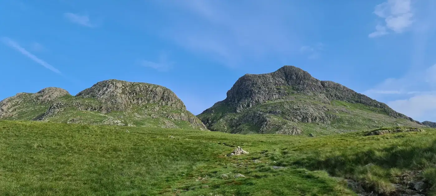
Thorn Crag
Thorn Crag at 644m (2,113ft) is a Birkett top on the rough fell above the Langstrath valley and Stonethwaite in the Central Fells, giving views into the wild Langstrath valley and across to the Glaramara ridge.
Is it worth going? — Today’s conditions & 7-day summit forecast
Modelled guidance for the 644 m summit. Always check the Met Office mountain forecast and MWIS before you set off.
On the summit today (Tue 28 Jul): 15° to 13°C, gusts to 38 mph, 11.8 mm of rain forecast.
Forecast snapshot from 28 Jul 2026, 04:58 UTC — refreshed nightly and updated live in your browser. Temperatures and gusts adjusted to the 644 m summit altitude via Open-Meteo. Summit conditions are always harsher than the valley — check the professional mountain forecasts before you go.
About the walk
Thorn Crag
Routes up Thorn Crag
Hand-mapped, with GPX to download — full maps further down.
Map & nearby Birketts
Skip mapFree mapping: OpenTopoMap / OpenStreetMap (switch layers top-right). Parking positions are approximate.
Nearest parking: Old Dungeon Ghyll (NT, paid), about 1.4 km from the summit (straight line). Full parking, toilets and bus details are below.
Birketts near Thorn Crag (within 3 km)
These Birkett tops are not Wainwright summits — detour to them on this walk and they are pure profit. Distances are straight-line; allow extra for terrain.
Routes over Thorn Crag
✎️ Planned route — drawn but not personally walked or checked yet.
A planned line is a suggestion, not a guarantee — conditions change. Navigate independently and carry a map & compass.
A planned line is a suggestion, not a guarantee — conditions change. Navigate independently and carry a map & compass.
Best parking to hike Thorn Crag
Where we have the data, each parking spot also shows the nearest public toilets and facilities (cafés, pubs, shops).
Positions are approximate — zoom the map to confirm. Lakeland car parks fill before 9am on fine weekends.
Tip: pan and zoom the interactive map at the top of this page to spot other potential parking near your route.
Water & shelter on the way up
On the Langdale Horseshoe route:
On the Langdale Pikes Round route:
💧 Treat water from the fell before you drink it. A mapped point is usually a tap or public supply, but never drink untreated from a beck, stream or tarn — even clear-looking hill water can carry giardia or cryptosporidium from livestock or a carcass upstream and leave you seriously ill. Run it through a filter or purifier (a LifeStraw, Sawyer Squeeze or HydraPak) or bring it to a rolling boil first.
On-route facilities © OpenStreetMap contributors, per route — an absent marker doesn’t mean none.
Buses to Thorn Crag from Penrith / Ambleside / Windermere
Rural routes change seasonally — confirm on stagecoachbus.com (opens in new tab) or Traveline before relying on a last bus.
My hikes over Thorn Crag (Strava)
1 logged hike pass over this summit:
- 8 Wainwrights today - had some catching up to do! (opens in new tab) — 14.5 km · 1013 m ascent · 4h 23m moving · 1 Jun 2024
Interactive route maps and photos load here for visitors with JavaScript. Data from Strava.
Other fells near Thorn Crag
- Armboth Fell (Armboth Fell South Top)
- Blea Rigg
- Bleaberry Fell
- Calf Crag
- Eagle Crag
- Gibson Knott
- Grange Fell (Brund Fell)
- Great Crag (Stonethwaite)
- Harrison Stickle
- Helm Crag
- High Raise (High White Stones)
- High Rigg (Naddle Fell)
- High Seat
- High Tove
- Loft Crag
- Loughrigg Fell
- Pavey Ark
- Pike of Stickle
- Raven Crag
- Sergeant Man
- Sergeant's Crag
- Silver How
- Steel Fell (Dead Pike - Steel Fell)
- Tarn Crag (Easedale)
- Thunacar Knott
- Ullscarf
- Walla Crag
Maps & guidebooks for Thorn Crag
- Buy on Amazon (opens in new tab)
- Buy on Amazon (opens in new tab)
- Buy on Amazon (opens in new tab)
- Buy on Amazon (opens in new tab)
As an Amazon Associate we earn from qualifying purchases — at no extra cost to you. How affiliate links work →