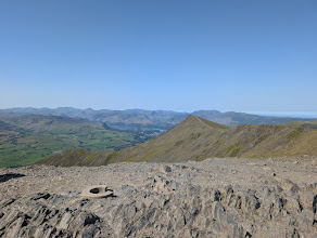
Blencathra - Hallsfell Top
Blencathra at 868m (2,848ft) was, by many accounts, Wainwright's personal favourite — he described it as 'a mountain that has everything a mountain should have.' Its dramatic southern face presents a series of sweeping ridges and dark corries that compose into one of the great mountain spectacles of Lakeland, visible from the A66 below.
Is it worth going? — Today’s conditions & 7-day summit forecast
Modelled guidance for the 868 m summit. Always check the Met Office mountain forecast and MWIS before you set off.
On the summit today (Tue 28 Jul): 13° to 12°C, gusts to 37 mph, 6.9 mm of rain forecast.
Forecast snapshot from 28 Jul 2026, 04:58 UTC — refreshed nightly and updated live in your browser. Temperatures and gusts adjusted to the 868 m summit altitude via Open-Meteo. Summit conditions are always harsher than the valley — check the professional mountain forecasts before you go.
About the walk
Blencathra - Hallsfell Top
- Height
- 868 m (2,848 ft)
- How long
- ~4–5 h
- How hard
- how hard Blencathra is depends entirely on the ridge you choose — from a straightforward mountain walk to one of Lakeland’s most serious scrambles.
- Weather today
- 🌧️ 13°/12°C, gusts 37 mph
- Is it dangerous?
- Yes — you can climb Blencathra without Sharp Edge.
- Parking
- Scales, A66 (layby)
Short version: how hard Blencathra is depends entirely on the ridge you choose — from a straightforward mountain walk to one of Lakeland’s most serious scrambles. The walking lines up Scales Fell and Blease Fell are well-graded ascents that suit any fit hillwalker in reasonable conditions. Hall’s Fell (Narrow Edge) is a steeper, more exposed walkers’ scramble that wants a steady head. Sharp Edge is in a different league: our own assessment rates its terrain and exposure both Severe — a polished Grade 1 arête with unprotected drops on both sides, hands required and lethal when wet. Match the route to your experience and the day’s conditions, not to the summit. (The scrambling verdicts are editorially assessed from the routes’ documented character; not yet personally walked.)
Routes up Blencathra - Hallsfell Top
Hand-mapped, with GPX to download — full maps further down.
Map & nearby Birketts
Skip mapFree mapping: OpenTopoMap / OpenStreetMap (switch layers top-right). Parking positions are approximate.
Nearest parking: Scales, A66 (layby), about 2.0 km from the summit (straight line). Full parking, toilets and bus details are below.
Birketts near Blencathra - Hallsfell Top (within 3 km)
These Birkett tops are not Wainwright summits — detour to them on this walk and they are pure profit. Distances are straight-line; allow extra for terrain.
Routes over Blencathra - Hallsfell Top
✎️ Planned route — drawn but not personally walked or checked yet.
A planned line is a suggestion, not a guarantee — conditions change. Navigate independently and carry a map & compass.
A planned line is a suggestion, not a guarantee — conditions change. Navigate independently and carry a map & compass.
✎️ Blencathra deserves its reputation and Sharp Edge deserves its own. This route is here because people are going to walk it and they should walk it with clear information: it is a scramble with genuine consequences, its danger is governed almost entirely by whether the rock is dry, and there is an excellent, safe alternative up the same fell. Mountain rescue attend this ridge every year.
✎️ Planned route — drawn but not personally walked or checked yet.
A planned line is a suggestion, not a guarantee — conditions change. Navigate independently and carry a map & compass.
The View from Blencathra - Hallsfell Top
A computed 360° skyline — every visible named top labelled by distance and bearing, from the terrain model in perfect clarity, not photographed. Drag to pan; reveal the far four-nations horizon.
What you can see from Blencathra - Hallsfell Top, by direction
- South-east: High Street (20 km)
- South: Great Dodd (7 km), Stybarrow Dodd (9 km), Raise (10 km), Catstye Cam (12 km), Helvellyn Lower Man (12 km), Helvellyn (13 km), St Sunday Crag (15 km), Fairfield (16 km), Hart Crag (17 km), Bowfell (23 km), Shelter Crags (24 km), Crinkle Crags (24 km), Crinkle Crags (24 km), Crinkle Crags (24 km), Crinkle Crags (24 km), Crinkle Crags South Top (24 km)
- South-west: Crag Hill (15 km), Eel Crag (15 km), Grasmoor (17 km), High Stile (20 km), Great Gable (21 km), Great End (22 km), Pillar (22 km), Esk Pike (22 km), Lingmell (23 km), Broad Crag (23 km), Ill Crag (23 km), Scoat Fell (23 km), Steeple (23 km), Scafell Pike (23 km), Red Pike (23 km), Scafell (24 km)
- West: Skiddaw Lesser Man (6 km), Skiddaw Little Man (6 km), Skiddaw (6 km), Skiddaw Middle Top (6 km), Skiddaw South Top (6 km), Skiddaw North Top (6 km), Broad End (7 km)
On the clearest days the far horizon adds: Goatfell [Goat Fell] (175 km, Scotland), Slieve Donard (193 km, Ireland), Merrick (107 km, Scotland), Snaefell (101 km, Isle of Man), Cairnsmore of Carsphairn (101 km, Scotland), The Cheviot (110 km, England), Cairnsmore of Fleet (91 km, Scotland), Corserine (102 km, Scotland).
Computed from terrain in perfect clarity, not photographed · distances are straight-line.
Computed from Copernicus GLO-30 terrain; distant tops from the Database of British and Irish Hills (opens in new tab) (CC BY 4.0). See how we compute the view · and the summit intervisibility report below.
What you can see from Blencathra - Hallsfell Top
On a clear day — computed sightlines, curvature- and refraction-corrected.On the clearest days the view reaches across to Scotland and the Isle of Man.
- Merrick Scotland
- Snaefell Isle of Man
- Whernside Yorkshire Dales
- Criffel Scotland
- Irish Sea open water
- Great Dun Fell North Pennines
- Solway Firth bay/estuary
- Cross Fell North Pennines
All 118 Wainwrights in clear view (nearest first)
Bannerdale Crags, Mungrisdale Common, Bowscale Fell, Souther Fell, Lonscale Fell, Great Calva, Clough Head, Skiddaw Little Man, Knott, High Rigg (Naddle Fell), Carrock Fell, Skiddaw, Bakestall, High Pike (Caldbeck), Great Dodd, Great Mell Fell, Walla Crag, Watson's Dodd, Hart Side, Bleaberry Fell, Raven Crag, High Seat, Gowbarrow Fell (Wainwright summit), Raise, Little Mell Fell, White Side, Cat Bells (Catbells), Barrow, High Tove, Lord's Seat, Catstye Cam, Armboth Fell (Armboth Fell South Top), Causey Pike, Binsey, Helvellyn, Maiden Moor, Outerside, Grange Fell (Brund Fell), Grisedale Pike, Scar Crags, Place Fell, Whinlatter (Brown How - Whinlatter), Hallin Fell, Castle Crag, Ard Crags, High Spy, Sail, Hopegill Head, Beda Fell (Beda Head), St Sunday Crag, Crag Hill (Eel Crag), Bonscale Pike, Steel Knotts (Pikeawassa - Steel Knotts), Knott Rigg, Arthur's Pike, Hindscarth, Wandope, Angletarn Pikes (Angletarn Pikes North Top), Dale Head, Fairfield, Eagle Crag, Steel Fell (Dead Pike - Steel Fell), Rosthwaite Fell - Bessyboot, The Nab, Brock Crags (Wainwright), Sergeant's Crag, Wether Hill, Rest Dodd, Hartsop Dodd, Grey Knotts, Tarn Crag (Easedale), High Raise (High White Stones), The Knott (High Street), High Raise (High Street), Glaramara, Base Brown, Rampsgill Head, Sergeant Man, Fellbarrow - Mosser Fell, Kidsty Pike, Middle Dodd, High Crag (Buttermere), Seathwaite Fell (Wainwright summit), Blea Rigg, High Stile, Green Gable, Red Screes, Red Pike (Buttermere), Great Gable, Harrison Stickle, Allen Crags, Silver How, Kirk Fell, Rossett Pike, Great End, Starling Dodd, Pillar, Esk Pike, Froswick, Lingmell, Bowfell, Harter Fell (Mardale), Ill Bell, Scoat Fell (Little Scoat Fell), Steeple, Scafell Pike, Lingmoor Fell (Brown How), Red Pike (Wasdale), Crinkle Crags - Long Top (Second Crinkle), Scafell, Haycock, Cold Pike, Wetherlam, Great Carrs, Swirl How, Lank Rigg, The Old Man of Coniston (Coniston Old Man), Dow Crag
How Blencathra - Hallsfell Top’s view compares with all 214 — the View Report: every Wainwright ranked by what you can see from the top.
Sightlines from a bare-earth terrain model (forests and buildings not included), corrected for the Earth’s curvature and average atmospheric refraction. “Distant” sightlines and any over 100 km depend on exceptionally clear air. Modelled from Copernicus GLO-30 open elevation data — a guide to the view, not a guarantee of any single one.
Getting to Blencathra - Hallsfell Top
Blencathra rises straight above Threlkeld, just off the A66 east of Keswick. The walkers’ lines (Scales Fell, Blease Fell) and the scrambles (Hall’s Fell, Sharp Edge) all start from this southern side.
Park at Scales or Threlkeld
Most walks start from the small pull-ins and lane-ends around Scales (on the old road) or from Threlkeld village, with a little more roadside space at Gategill. All of it is limited and fills on fine weekends, so arrive early — the parking options listed further down the page give the nearest spots and their distances.
Back in the village, two traditional inns sit a few minutes’ walk apart for the finish — the Horse & Farrier and the Salutation (“the Sally”). Check current opening before you count on either.
Best parking to hike Blencathra - Hallsfell Top
Where we have the data, each parking spot also shows the nearest public toilets and facilities (cafés, pubs, shops).
Positions are approximate — zoom the map to confirm. Lakeland car parks fill before 9am on fine weekends.
Tip: pan and zoom the interactive map at the top of this page to spot other potential parking near your route.
Water & shelter on the way up
On the Blencathra via Blease Fell route:
On the Blencathra by Sharp Edge route:
On-route facilities © OpenStreetMap contributors, per route — an absent marker doesn’t mean none.
Buses to Blencathra - Hallsfell Top from Penrith / Ambleside / Windermere
Rural routes change seasonally — confirm on stagecoachbus.com (opens in new tab) or Traveline before relying on a last bus.
My hikes over Blencathra - Hallsfell Top (Strava)
1 logged hike pass over this summit:
- On the 7th Day God Created Blencathra (opens in new tab) — 17.6 km · 960 m ascent · 4h 23m moving · 25 May 2026
Interactive route maps and photos load here for visitors with JavaScript. Data from Strava.
Is Blencathra - Hallsfell Top dangerous?
Yes — you can climb Blencathra without Sharp Edge. The straightforward walking lines up Scales Fell and Blease Fell reach the summit without ever touching the arête, and the fell’s other south-face ridges avoid it too. Sharp Edge is a specific north-eastern approach you have to choose — not the price of admission to the summit.
Sharp Edge itself earns its reputation. Our own assessment rates it Severe for both terrain and exposure: a Grade 1 scramble on rock polished smooth by a century of boots — hands required, lethally slippery when wet or icy — along a narrow arête with serious, unprotected drops on both sides, where a slip in the wrong place is not survivable. The awkward slab near the far end is where most falls happen, and once you are committed mid-edge there is no easy retreat. It is no place to be in wind, wet or winter.
If Sharp Edge is what makes you nervous, take the walking lines from Threlkeld or Scales instead — the same mountain and the same summit, without the arête. (These scrambling verdicts are editorially assessed from the documented character of the routes; we have not yet personally walked them.)
Go deeper: the Mountain Rescue Report (what actually goes wrong, in numbers) · Summer on the Fells — the season’s hazards, ranked by evidence.
Hazard & Incident Information for Blencathra - Hallsfell Top
A magnificent fell with a wide range of routes — and the choice of route is everything. The walking lines up Scales Fell and Blease Fell are straightforward, but Sharp Edge is one of the most serious scrambles in the Lake District: a narrow arête of rock polished by generations of boots, with unprotected drops on both sides, where a slip in the wrong place is not survivable. Most serious incidents happen there, on wet or icy rock.
- Sharp Edge: A serious, exposed grade 1 scramble on rock polished smooth by decades of use — lethally slippery when wet or icy, with unprotected drops on both sides where a slip is not survivable. The awkward slab section at the far end (the usual crux) is where most falls happen, and there is no easy retreat once you are committed mid-edge — turning back is harder than carrying on. If conditions are poor or you are not a confident scrambler, do not attempt it — use Scales Fell instead.
- Hall's Fell ridge (Narrow Edge): A fine direct line to the summit, but steep and exposed near the top. Good conditions and a steady head required.
- Summit plateau in cloud: Steep drops on the southern edge; navigate carefully off the top in poor visibility.
Most common causes: Slips and falls on Sharp Edge, especially when wet or icy · Scramblers caught out by deteriorating weather · Navigation errors descending the plateau
Local Mountain Rescue: Keswick Mountain Rescue Team (opens in new tab) · Reviewed 15 Jul 2026
Safety: Hazard guidance compiled from published Mountain Rescue reports and well-documented accident history - editorial background, not a live feed of callouts. Always check current conditions, carry proper navigation equipment, and seek qualified instruction before heading onto the fells. In an emergency, call 999, ask for Police, then Mountain Rescue.
Don’t drink from Gategill Beck
On the way up you cross Gategill Beck, which runs below the old Threlkeld and Gategill lead mines. The Environment Agency records it carrying dissolved lead and cadmium above the level that is safe to drink. This is not the usual hill-water risk: a squeeze or hollow-fibre filter (LifeStraw, Sawyer and the like) removes none of these dissolved metals, and boiling only concentrates them. Carry your own water for this walk and don’t refill from the beck.
What’s actually in this beck — we mapped every mine-fed one →
Metal-mine water data © Environment Agency (Open Government Licence v3.0).
Navigating Blencathra - Hallsfell Top in cloud
StraightforwardA broad, gently-sloping top with little to steer by — easy to lose your bearings and hard to relocate in mist. Navigation here is relatively straightforward even in cloud — but carry map and compass and know how to use them; a low score never means “safe”.
In winter — snow, whiteout, cornices, buried features — every top demands full winter navigation skills whatever its band, and a broad, gentle summit can be the worst place of all. See walking in bad weather and the navigation guide.
How Blencathra - Hallsfell Top compares with all 214 — the Clag Index: navigating in cloud. A relative, deliberately cautious guide; the site can’t navigate for you.
Frequently asked questions about Blencathra - Hallsfell Top
Is Blencathra difficult to climb?
It depends entirely on the route. Blencathra (868 m / 2,848 ft), also known as Saddleback, has something for everyone — from gentle grassy ascents to one of the most serious ridge scrambles in the Lake District.
- Easier walkers' routes: the broad ridges of Blease Fell or Scales Fell are steep, sustained climbs on grass and clear paths, with no scrambling.
- Hall's Fell ridge: a magnificent but exposed Grade 1 scramble straight to the summit — Wainwright's favourite way up, and not for the nervous.
- Sharp Edge: a narrow, polished, exposed arête that is one of the most accident-prone spots in the Lakes — a serious undertaking, lethal when wet or icy.
Choose your route to match your experience, and treat it as a full mountain day whichever line you take.
Is Blencathra suitable for beginners?
Yes — provided you pick the right route and the right day. A reasonably fit beginner can manage Blencathra by the gentler ridges, but should steer well clear of Sharp Edge.
- Best for beginners: up Blease Fell from the Blencathra Centre, or the Scales Fell / Doddick Fell paths from Scales — steep but straightforward grass with no scrambling.
- Avoid as a beginner: Sharp Edge and the upper Hall's Fell ridge, which are exposed scrambles.
Go in good, clear weather, carry a map and compass, and be ready to turn back — the summit is broad and can be disorienting in cloud, with steep ground on several sides.
Can you climb Blencathra without doing Sharp Edge?
Absolutely. Sharp Edge is just one of many ways up, and most walkers reach the summit without ever setting foot on it. The ridge is entirely optional.
To avoid it, use any of the southern or western routes — Blease Fell, Scales Fell, Doddick Fell or the gentler Scaley Beck approach. These give a grand mountain day with big views and no scrambling. If you want a hands-on ridge but find Sharp Edge too much, Hall's Fell is a fine alternative, though it is still an exposed Grade 1 scramble near the top.
Which is harder, Striding Edge or Sharp Edge?
Most experienced fellwalkers rate Sharp Edge (on Blencathra) as the harder and more intimidating of the two. Although both are Grade 1 scrambles on exposed arêtes, Sharp Edge is narrower, the rock is notoriously polished and slippery, and the crux involves committing moves above big drops.
Striding Edge (on Helvellyn) is longer but a little more forgiving, with a path that can be followed just below the crest in places. Both are among the most accident-prone spots in the Lakes, both have claimed lives, and both become full winter mountaineering in snow and ice — needing an axe, crampons and experience. In the wet, Sharp Edge in particular is best avoided altogether.
Sources: Keswick Mountain Rescue Team (opens in new tab) · Met Office — Lake District mountain forecast (opens in new tab)
How long does it take to climb Blencathra, and how far is it?
Most routes up Blencathra are 4 to 7 miles (6–11 km) round trip and take 3 to 5 hours, depending on your line and pace.
- Direct ridges (Hall's Fell, Doddick Fell) are short and sharp — under 4 miles, but steep and slow on the scrambly sections.
- A horseshoe linking Scales Fell, the summit and Sharp Edge or Hall's Fell makes a fuller day of 5 to 7 miles.
Allow extra time for navigation on the broad summit, for photos, and for descending carefully — most slips happen on the way down.
What is Blencathra known for?
Blencathra is one of the best-loved and most distinctive fells in the Lake District, famous for several things:
- Its profile: the long, scooped summit ridge gives it the nickname Saddleback, and it stands proudly on its own above the A66 north of Keswick.
- Sharp Edge: a classic, fearsome scramble that draws (and occasionally catches out) walkers from all over.
- Hall's Fell ridge: which Wainwright called the finest way to any summit in the District.
- Its views and ridges: a fan of grassy ridges and deep gills on the southern face, with huge views over the Northern Fells and across to the Helvellyn range.
One more thing the guidebooks skip: the old Threlkeld workings above Gategill leave a mark on the water. Environment Agency sampling puts the Woodend adit discharge at a median 453 µg/L lead — about 45 times the World Health Organization’s drinking-water guideline. It is nowhere near the ridge lines, but it is a reason not to fill a bottle from the becks low on this side.
Sources: Keswick Mountain Rescue Team (opens in new tab) · Environment Agency Water Quality Archive (OGL v3.0) (opens in new tab)
How do I check it is safe to climb Blencathra today?
Always check a mountain forecast rather than the valley forecast — conditions on the tops are often far worse, and Sharp Edge and the ridges become dangerous in wind, rain, snow or ice.
- Met Office Lake District mountain forecast.
- Mountain Weather Information Service (MWIS).
Carry a map and compass and know how to use them, tell someone your route and return time, and turn back if cloud, wind or wet rock make the scrambles unsafe. In an emergency call 999, ask for Police, then Mountain Rescue.
Sources: Met Office — Lake District mountain forecast (opens in new tab) · Mountain Weather Information Service (MWIS) (opens in new tab)
Questions drawn from real Google “People also ask” searches; answers written and fact-checked by us. · Reviewed 2026-07-27 · Suggest a question or correction (opens in new tab)
Other fells near Blencathra - Hallsfell Top
Maps & guidebooks for Blencathra - Hallsfell Top
- Buy on Amazon (opens in new tab)
- Buy on Amazon (opens in new tab)
- Buy on Amazon (opens in new tab)
- Buy on Amazon (opens in new tab)
- Buy on Amazon (opens in new tab)
As an Amazon Associate we earn from qualifying purchases — at no extra cost to you. How affiliate links work →