
Stock Ghyll Force
Photo: © Lee McCoy
Key facts
Difficulty profile
Five independent axes, not one score. “Desk” ratings come from maps and guidebooks, not yet walked — treat them as a guide, not a survey.
Daylight & turnaround
Daylight is short from October to February — check today’s sunrise and sunset before you set off, and carry a head-torch and spare batteries. On short days, decide your turn-back time before you start.
Why this matters: 78% of Mountain Rescue call-outs come after midday — the day runs out on the way home, not on the way up. See also walking in bad weather and today’s conditions.
Easy 100%ModerateHardSevere
Free mapping: OpenTopoMap / OpenStreetMap (switch layers top-right).
This walk covers about 1.98 km with around 90 m of ascent. The map above shows the line; the elevation profile and stage notes are below.
Access & barriers
Can a dog, a buggy or dodgy knees manage this route? A quick read from the gates and stiles mapped along the way.
- Dog: 1 ladder/squeeze stile(s) a dog can’t get through.
- Buggy: Not a pushchair route.
- Knees: No sustained steep descent — kind on the knees.
On the line: 2 gates · 1 ladder stile
These are mapped barriers, from OpenStreetMap — coverage in the Lakes is good but not guaranteed complete. Spotted a stile or gate we’ve missed? Tell us (opens in new tab) and we’ll fix it. Barrier data as of 2026-07-09. Access data © OpenStreetMap contributors (via Overpass).
Pacing
| Summit | Cumulative | Ascent | Time (fast–steady) |
|---|---|---|---|
| Finish | 2.0 km | 90 m | 0:33–0:44 |
Naismith-based estimate — a fast/steady range. Your pace will vary. These use Naismith’s textbook constants (5 km/h, 600 m of ascent an hour). Measured against a pace fitted to 41 recorded Lakeland walks they run about 8% slow, and we have left them that way deliberately: a slow estimate strands nobody.
The walk, stage by stage
Ambleside (Stock Ghyll Lane, behind the Salutation) → Finish (2.0 km, 90 m)
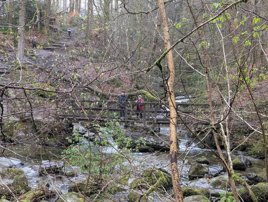
Start in Ambleside town centre on Stock Ghyll Lane, directly behind the Salutation Hotel. Follow the narrow tarmac lane gently uphill past cottage gardens until you reach a red Victorian post box and the wooden sign marking the entrance to Stock Ghyll Woods. Enter through the kissing gate and pick up the clear, well-trodden woodland path heading upstream along Stock Ghyll beck. Follow the red-arrowed circular trail markers as the trail climbs gently through ancient trees via a series of wooden and stone steps. Reaching the upper gorge, cross the high footbridge to access the railed viewing platforms overlooking the spectacular 70-foot cascade of Stock Ghyll Force. To complete the loop, continue along the marked path across the top of the woods, descending gently past the old revolving turnstile to exit back onto Stock Ghyll Lane for the easy stroll back into Ambleside
WaypointsStock Ghyll Lane (behind the Salutation Hotel) Stock Ghyll Woods entrance gate & Victorian post box Stock Ghyll Beck stream-side path Stock Ghyll Force viewing platforms & high footbridge Old turnstile / woodland exit Return to Ambleside town centre.
Decision pointThe woodland trail is exceptionally well-waymarked with color-coded wooden posts (follow the red trail markers for the waterfall loop). Stock Ghyll beck acts as a continuous handrail
Easy to get wrongVery minor physical effort required. However, the woodland paths and tree roots can be slick when wet, and there are several flights of uneven stone/wooden steps near the waterfall gorge. Exposed drops down into the ravine are protected by safety railings
If you need to get offBeing a short, self-contained 2.0 km loop adjacent to Ambleside, you are never more than a 10-minute walk from town. If needed, simply turn 180 degrees at any point and follow the main path back down to Stock Ghyll Lane
© Lee McCoy

Getting there & parking
Positions are approximate. Lakeland car parks fill before 9am on fine weekends.
Vehicles are left entirely at their owner’s risk. We list places people park; we cannot vouch for any of them. Judge it on the day: take valuables with you, leave nothing on show, and if a spot feels wrong when you get there, park somewhere else.
Every option near this start, on the parking map →
Water, shelter & getting away
On-route facilities © OpenStreetMap contributors — an absent marker does not mean the facility isn’t there.
Buses
The 505 stops at Ambleside, at Hayes Garden Centre, 810 m and 43 m of ascent from this start. Last bus: Monday to Friday 22:43 towards Grasmere (555) and 20:29 towards Keswick (555) and 09:47 towards Coniston (505) and 09:21 towards Dungeon Ghyll (516); Saturday 22:43 towards Grasmere (555) and 20:29 towards Keswick (555) and 09:47 towards Coniston (505) and 09:21 towards Dungeon Ghyll (516); Sunday 19:09 towards Grasmere (555) and 18:15 towards Keswick (555) and 09:47 towards Coniston (505) and 09:21 towards Dungeon Ghyll (516). Checked against the operator’s timetable, 7 September 2026. Times here are a guide, not a promise — leave yourself more than the minute.
The 505 passes this route at 0.0 km (Ambleside bus interchange (Stand 1), 140 m off the line).
Rural routes change seasonally — confirm on stagecoachbus.com (opens in new tab) or Traveline before travelling.
If the parking is full
There is no real plan B here. Every place we know beside this route serves the same walks and sits close together, so if one is full the others usually are too. Worth starting early, or having a different walk in mind before you set off.
- Ambleside, King Street (paid)
- Ambleside, Rydal Road (paid)
- Ambleside, Miller Bridge (paid)
Worked out from the parking we hold within walking reach of this route and the other walks each place serves — two places that serve the same walks fill for the same reasons. We are not saying whether anywhere has spaces today, and we never will: this is what exists, not what is free.
Safety & conditions
Check live conditions in the “From the fells” panel, on MWIS (opens in new tab) and the Met Office mountain forecast (opens in new tab) before you set off.
Places to stay near this start
From Ambleside or Grasmere: 11 places