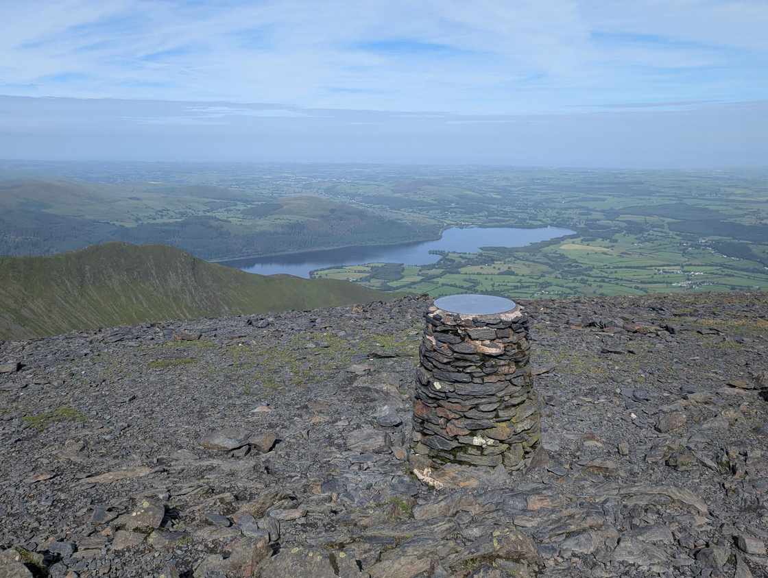
Skiddaw via Ullock Pike and Dodd
Photo: © Lee McCoy
Key facts
✎️ Start from the pay-and-display forestry car park at Dodd Wood (Mirehouse), on the A591 by the east shore of Bassenthwaite Lake — the path heads up through the trees, over a brook, and north past Sand Beds.
Difficulty profile
Five independent axes, not one score — all field-checked on the ground here, with nothing left as a desk estimate.
Conditions on this route
We score every Lakeland Wainwright each morning on cloud, wind, rain and underfoot, and this route crosses 5 of them. The worst summit governs the verdict — a route is only as kind as its roughest top.
Modelled guidance — not a substitute for the mountain forecast or your own judgement. See how every fell ranks today →
☀️ Daylight & turnaround
Daylight is short from October to February — check today’s sunrise and sunset before you set off, and carry a head-torch and spare batteries. On short days, decide your turn-back time before you start.
Why this matters: 78% of Mountain Rescue call-outs come after midday — the day runs out on the way home, not on the way up. See also walking in bad weather and today’s conditions.
1 Ullock Pike2 Long Side3 Skiddaw Middle Top4 Skiddaw5 Carl Side6 Dodd (Skiddaw)
⚑ escape route
Free mapping: OpenTopoMap / OpenStreetMap (switch layers top-right).
This walk covers about 12.41 km with around 1081 m of ascent, taking in 6 summits. The map above shows the line; the elevation profile and stage notes are below.
Access & barriers
Can a dog, a buggy or dodgy knees manage this route? A quick read from the gates and stiles mapped along the way.
- Dog: Gates and kissing gates only — a dog can do the whole route.
- Buggy: Stiles or rough going on the route.
- Knees: A long, steep ~37% drop around the 8.2 km mark — hard on the knees.
On the line: 1 gate · 1 step-over stile
These are mapped barriers, from OpenStreetMap — coverage in the Lakes is good but not guaranteed complete. Spotted a stile or gate we’ve missed? Tell us (opens in new tab) and we’ll fix it. Barrier data as of 2026-07-09. Access data © OpenStreetMap contributors (via Overpass).
Pacing
| Summit | Cumulative | Ascent | Time (fast–steady) |
|---|---|---|---|
| Ullock Pike | 3.7 km | 564 m | 1:41–2:14 |
| Long Side | 4.2 km | 601 m | 1:51–2:28 |
| Skiddaw Middle Top | 5.8 km | 821 m | 2:31–3:21 |
| Skiddaw | 6.0 km | 854 m | 2:38–3:30 |
| Carl Side | 7.3 km | 904 m | 2:58–3:56 |
| Dodd (Skiddaw) | 9.7 km | 1028 m | 3:39–4:51 |
| Finish | 12.4 km | 1081 m | 4:17–5:42 |
Naismith-based estimate — a fast/steady range. Your pace will vary.
The walk, stage by stage
Dodd Wood / Mirehouse forestry car park → Ullock Pike (3.7 km, 564 m)
Climb of about 564 m over 3.7 km (around 15% average).
Ullock Pike → Long Side (0.6 km, 37 m)
Undulating section of about 0.6 km.
Decision point: Continue along Longside Edge towards Long Side. Despite the name it's nothing like Striding Edge — a clean, airy ridge with a fine sense of height. Long Side's summit is barren and featureless, more a breather than a stop.
Easy to get wrong: The ridge is open to the wind — in a gale it can feel daunting even though it's broad enough underfoot.
Long Side → Skiddaw Middle Top (1.5 km, 221 m)
Climb of about 221 m over 1.5 km (around 15% average).
Decision point: Drop off Long Side towards Carl Side. This is the first bail point — branch right for the short Carl Side / Dodd loop if you want to skip Skiddaw (see Escape routes). To continue, carry on (essentially straight on) down into the col beside Carl Side, where a small tarn sits — the last bail before the climb — then up the loose scree, over Skiddaw's broad Middle Top on the summit ridge.
Easy to get wrong: The crux navigation trap: aim straight up the scree. Bear left too soon and you'll pass under Skiddaw and miss the summit, then have to turn back. Don't miss the scree.
Skiddaw Middle Top → Skiddaw (0.3 km, 32 m)
Undulating section of about 0.3 km.
Decision point: A short step along the summit ridge from the Middle Top to Skiddaw's main summit — the famous cairn and shelter, and the view stretching out to the Solway Firth and Scotland beyond.
Easy to get wrong: In cloud the broad summit plateau is disorientating — keep to the line of cairns along the ridge.
Skiddaw → Carl Side (1.2 km, 50 m)
About 1.2 km with 50 m of ascent.
Decision point: To return, backtrack down the scree to the small tarn and climb back up to Carl Side — not difficult in clear or claggy weather.
Easy to get wrong: Re-ascending Carl Side is short but comes after the Skiddaw pull — pace it.
Carl Side → Dodd (Skiddaw) (2.4 km, 124 m)
Climb of about 124 m over 2.4 km (around 5% average).
Decision point: From Carl Side keep a close eye on the GPS. There are two ways down; the 'direct' line is too challenging, so take the steadier back-and-forth on the right (some significant steps down). Turn right and head down towards the road — do NOT take the direct line straight up to the left, which is almost impassable — then immediately take the left, back-tracking on yourself, onto the clear path that climbs to Dodd's wooded summit.
Easy to get wrong: The route's real navigation test: right (not left) down to the road, then left to double back. The 'direct' left line off Carl Side is almost impassable — trust the GPS, not the apparent shortcut.
Dodd (Skiddaw) → Finish (2.7 km, 53 m)
About 2.7 km with 53 m of ascent.
Decision point: From Dodd, turn around and head back down to the road — the safest line — then follow the track home through the forest to the car park.
Easy to get wrong: A clearing to the left on the way down looks like a short-cut but isn't: it leads through branches and moss to a sharp drop. Stick to the road and the GPX.
Summits bagged (6)
- Ullock Pike 690 m · Northern · Wainwright, Birkett, Fellranger, Synge
- Long Side 734 m · Northern · Wainwright, Birkett, Fellranger, Synge, Nuttall
- Skiddaw Middle Top 929 m · Northern · Birkett
- Skiddaw 930 m · Northern · Wainwright, Birkett, Fellranger, Synge, Nuttall, Marilyn
- Carl Side 747 m · Northern · Wainwright, Birkett, Fellranger, Synge, Nuttall
- Dodd (Skiddaw) 502 m · Northern · Wainwright, Birkett, Fellranger, Synge, HuMP
🅿️ Getting there & parking
Positions are approximate. Lakeland car parks fill before 9am on fine weekends.
💧 Water, shelter & getting away
On-route facilities © OpenStreetMap contributors — an absent marker does not mean the facility isn’t there.
🚌 Buses
Rural routes change seasonally — confirm on stagecoachbus.com (opens in new tab) or Traveline before travelling.
⚠️ Safety & conditions
- Longside Edge is an airy ridge — fine in calm weather and nothing like Striding Edge, but it can feel daunting in a high wind.
- The pull onto Skiddaw is loose scree, with a navigation trap: don't bear left too soon or you'll pass under the summit and miss it — aim straight up the scree.
- The descent from Carl Side to Dodd needs care with the GPS: turn right down towards the road — the 'direct' line straight up to the left is almost impassable — then immediately left to pick up the clear path to Dodd.
- Off Dodd, a clearing to the left looks like a short-cut but isn't: it leads through branches and moss to a sharp drop. Head back to the road and follow the track home.
Hazard & incident notes: Skiddaw
Check live conditions in the “From the fells” panel, on MWIS (opens in new tab) and the Met Office mountain forecast (opens in new tab) before you set off.
⚡ Escape routes
- At about 4.3 km: descend to Carl Side, then down Dodd's north side to the car park (cuts ~2.5 km) — Shortly after Long Side, branch right to Carl Side, then right again at its summit and down the north side of Dodd to the car park on a visible track — the short loop that skips Skiddaw.
- At about 4.8 km: descend to Carl Side, then down to Dodd (cuts ~2.3 km) — The last chance before the scree: at the col by the small tarn, turn right and climb back up to Carl Side, then down to Dodd — saving the Skiddaw scree out-and-back.
Bail-out lines verified on the ground. In poor visibility a marked descent can be safer than retracing a ridge.
Make it easier or harder
Easier: Skip Skiddaw for a shorter Carl Side / Dodd loop: bail either just after Long Side (branch right to Carl Side) or at the col by the small tarn (right, back up to Carl Side), then down to Dodd and the car park. You still bag Ullock Pike, Long Side, Carl Side and Dodd without the scree.
Why this direction: Walked as a loop from Dodd Wood, up the Ullock Pike / Longside Edge ridge first: you take the clean, airy ridge as an ascent while fresh, hit Skiddaw and the Solway view at the high point, then return over Carl Side and finish on the gentle wooded top of Dodd — keeping the tricky GPS-checked descent for when you're warmed up to it.
Short version: turn back at about 5.8 km (drop to Dodd Wood / Mirehouse forestry car park) — roughly half the distance.
📚 Maps & guidebooks for Skiddaw via Ullock Pike and Dodd
- Buy on Amazon (opens in new tab)
- Buy on Amazon (opens in new tab)
- Buy on Amazon (opens in new tab)
- Buy on Amazon (opens in new tab)
- Buy on Amazon (opens in new tab)
- Buy on Amazon (opens in new tab)
As an Amazon Associate we earn from qualifying purchases — at no extra cost to you. How affiliate links work →