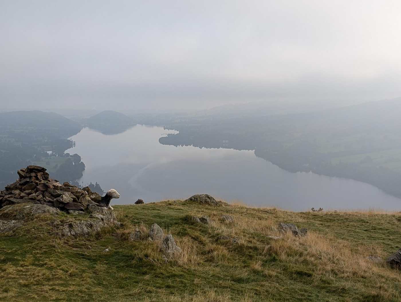
Fusedale Circuit
Photo: © Lee McCoy
Key facts
Difficulty profile
Five independent axes, not one score. “Desk” ratings come from maps and guidebooks, not yet walked — treat them as a guide, not a survey.
Conditions on this route
We score every Lakeland Wainwright each morning on cloud, wind, rain and underfoot, and this route crosses 6 of them. The worst summit governs the verdict — a route is only as kind as its roughest top.
Modelled guidance — not a substitute for the mountain forecast or your own judgement. See how every fell ranks today →
☀️ Daylight & turnaround
Daylight is short from October to February — check today’s sunrise and sunset before you set off, and carry a head-torch and spare batteries. On short days, decide your turn-back time before you start.
Why this matters: 78% of Mountain Rescue call-outs come after midday — the day runs out on the way home, not on the way up. See also walking in bad weather and today’s conditions.
1 Hallin Fell2 Bonscale Pike3 Arthur's Pike4 Loadpot Hill5 Wether Hill6 Brownthwaite Crag7 Steel Knotts (Pikeawassa - Steel Knotts)
⚑ escape route
Free mapping: OpenTopoMap / OpenStreetMap (switch layers top-right).
This walk covers about 14.68 km with around 856 m of ascent, taking in 7 summits. The map above shows the line; the elevation profile and stage notes are below.
Access & barriers
Can a dog, a buggy or dodgy knees manage this route? A quick read from the gates and stiles mapped along the way.
- Dog: Gates and kissing gates only — a dog can do the whole route.
- Buggy: Stiles or rough going on the route.
- Knees: A long, steep ~40% drop around the 11.0 km mark — hard on the knees.
On the line: 5 gates
These are mapped barriers, from OpenStreetMap — coverage in the Lakes is good but not guaranteed complete. Spotted a stile or gate we’ve missed? Tell us (opens in new tab) and we’ll fix it. Barrier data as of 2026-07-09. Access data © OpenStreetMap contributors (via Overpass).
Pacing
| Summit | Cumulative | Ascent | Time (fast–steady) |
|---|---|---|---|
| Hallin Fell | 0.8 km | 166 m | 0:26–0:34 |
| Bonscale Pike | 4.3 km | 553 m | 1:47–2:22 |
| Arthur's Pike | 5.5 km | 591 m | 2:05–2:46 |
| Loadpot Hill | 8.2 km | 748 m | 2:54–3:51 |
| Wether Hill | 9.7 km | 791 m | 3:15–4:20 |
| Brownthwaite Crag | 12.5 km | 816 m | 3:52–5:09 |
| Steel Knotts (Pikeawassa - Steel Knotts) | 13.4 km | 853 m | 4:06–5:27 |
| Finish | 14.7 km | 856 m | 4:22–5:48 |
Naismith-based estimate — a fast/steady range. Your pace will vary.
The walk, stage by stage
Howtown (Ullswater) → Hallin Fell (0.8 km, 166 m)
Climb of about 166 m over 0.8 km (around 21% average).
Hallin Fell → Bonscale Pike (3.5 km, 387 m)
Climb of about 387 m over 3.5 km (around 11% average).
Bonscale Pike → Arthur's Pike (1.2 km, 38 m)
Undulating section of about 1.2 km.
Arthur's Pike → Loadpot Hill (2.7 km, 157 m)
Climb of about 157 m over 2.7 km (around 6% average).
Loadpot Hill → Wether Hill (1.5 km, 43 m)
Undulating section of about 1.5 km.
Wether Hill → Brownthwaite Crag (2.9 km, 24 m)
Descent of about 240 m over 2.9 km.
Brownthwaite Crag → Steel Knotts (Pikeawassa - Steel Knotts) (0.9 km, 37 m)
Undulating section of about 0.9 km.
Steel Knotts (Pikeawassa - Steel Knotts) → Finish (1.3 km, 3 m)
Descent of about 190 m over 1.3 km.
Stage-by-stage field notes coming soon.
Summits bagged (7)
- Hallin Fell 388 m · Far Eastern · Wainwright, Birkett, Fellranger, Synge, Marilyn
- Bonscale Pike 524 m · Far Eastern · Wainwright, Birkett, Fellranger, Synge
- Arthur's Pike 533 m · Far Eastern · Wainwright, Birkett, Fellranger, Synge
- Loadpot Hill 672 m · Far Eastern · Wainwright, Birkett, Fellranger, Synge, Nuttall
- Wether Hill 672 m · Far Eastern · Wainwright, Birkett, Fellranger, Synge
- Brownthwaite Crag 444 m · Far Eastern · Birkett, Synge
- Steel Knotts (Pikeawassa - Steel Knotts) 432 m · Far Eastern · Wainwright, Birkett, Fellranger, Synge
🅿️ Getting there & parking
Positions are approximate. Lakeland car parks fill before 9am on fine weekends.
💧 Water, shelter & getting away
💧 Treat water from the fell before you drink it. A mapped point is usually a tap or public supply, but never drink untreated from a beck, stream or tarn — even clear-looking hill water can carry giardia or cryptosporidium from livestock or a carcass upstream and leave you seriously ill. Run it through a filter or purifier (a LifeStraw, Sawyer Squeeze or HydraPak) or bring it to a rolling boil first.
On-route facilities © OpenStreetMap contributors — an absent marker does not mean the facility isn’t there.
🚌 Buses
Rural routes change seasonally — confirm on stagecoachbus.com (opens in new tab) or Traveline before travelling.
⚠️ Safety & conditions
- Steep crag edges above Ullswater: Bonscale Tower and the western drops off Arthur's Pike and Bonscale Pike are serious — keep well back, especially in cloud or wind.
- Boggy, featureless plateau: the Loadpot Hill saddle is peat-hagged and wet, and the broad grassy tops give little to aim for in mist — a compass day if the cloud is down.
- Summer bracken + a washed-out descent: the Brock Crag short-cut and the steep drop off Bonscale to Mellguards can be thick, navigation-sapping bracken, with one eroded section underfoot — walking poles help.
- Easy-to-miss summits: Wether Hill and Loadpot Hill both have their true top just off the obvious path — step the few metres across to be sure you've actually bagged them.
Check live conditions in the “From the fells” panel, on MWIS (opens in new tab) and the Met Office mountain forecast (opens in new tab) before you set off.
⚡ Escape routes
- At about 1.6 km: descend to Martindale Hause (retrace) (cuts ~10.0 km) — Early exit: from Steel Knotts the cleanest escape is simply to turn around and retrace the ridge back to the start — no awkward descent.
- At about 9.2 km: descend to Howtown, below Brock Crag (cuts ~3.0 km) — Cut short near Arthur's Pike: keep left toward (not onto) Brock Crag and follow the path down to Howtown, letting it swing naturally left at the steep section. Expect thick, hard-to-navigate bracken here in summer; lands at Howtown rather than the car, so a short valley walk or the steamer back.
Bail-out lines verified on the ground. In poor visibility a marked descent can be safer than retracing a ridge.
Make it easier or harder
Easier: Shorten by retracing from Steel Knotts, or cut down to Howtown from near Arthur's Pike (below Brock Crag), skipping Bonscale Pike and its steep descent — both avoid the trickiest ground (mind the summer bracken on the Howtown line).
Why this direction: Walked anticlockwise from Martindale Hause — the steep little pull onto Steel Knotts first, then an easy high-level traverse of the High Street ridge (Wether Hill, Loadpot Hill, Arthur's Pike) before Bonscale Pike and the steep drop to Mellguards and Fusedale.
Short version: turn back at about 9.1 km (drop to Howtown (Ullswater)) — roughly half the distance.
📚 Maps & guidebooks for Fusedale Circuit
- Buy on Amazon (opens in new tab)
- Buy on Amazon (opens in new tab)
- Buy on Amazon (opens in new tab)
- Buy on Amazon (opens in new tab)
- Buy on Amazon (opens in new tab)
- Buy on Amazon (opens in new tab)
As an Amazon Associate we earn from qualifying purchases — at no extra cost to you. How affiliate links work →