Portinscale
Ready for your day: the walks from Portinscale, the tops above it, and the bus to the start.
Daylight on 27 October: sunrise 07:04, sunset 16:48
The tops Decent on Latrigg, the best of the 6 fells nearest Portinscale: dry verdicts for 27 October
Choose from all 22 walksExplore the map
Closed Keswick to Threlkeld trail: the River Greta bridge is closed for replacement, until 12 November 2026.
Closed Whinlatter: sections of bridleway 201006 and footpath 201044 are closed for forestry thinning, until 11 May 2027.
Verdicts: the site’s scorer reading the weather on each top, not whether a walk suits you. Daylight: worked out for the centre of Portinscale; a latest start assumes a steady pace and an hour in hand before dusk, a computed time, not a guarantee. Closures: the Authority’s notices as of 27 October. How we check →
First light
The sun reaches the Keswick town centre, by Booths start about 08:22 in October · sunrise 07:42
From the terrain around the start (Copernicus GLO-30), mid-month · how we work it outThe last bus
From Keswick Bus Station (K) (Stand 3):
Towards Cockermouth (77): Tuesday to Sunday 16:30.
Towards Cockermouth (77A): Tuesday to Saturday 18:30 only.
Towards Seatoller (78): Tuesday to Sunday 19:30.
As timetabled from 27 October to 1 November · checked against the operator’s timetable, 24 September · the bus mapA day from Portinscale
On the fells
Verdicts for 27 October, lowest fell first:
- Latrigg 369 m Decent
- Walla Crag 379 m Save it
- Cat Bells (Catbells) 451 m Save it
- Barrow 455 m Save it
- Dodd (Skiddaw) 502 m Save it
- Causey Pike 637 m Save it
On the water
Keswick Launch on Derwentwater: Runs all year, on a summer timetable and a winter timetable; the operator posts a same-day service status.
Landings: Keswick, Ashness Gate (Barrow Bay), Lodore, High Brandelhow, Low Brandelhow, Hawes End, Nichol End
Landing seasons as of 27 October; the operator’s page read 17 September · Keswick Launch’s own timetable and status (opens in new tab)Mountain forecast
Met Office mountain forecast for the Lake District (opens in new tab)
The forecasters’ own words for the tops.Explore Portinscale
The walks from Portinscale on one map, with the fells above them, the buses that reach their starts, and where to park. Choose a walk to see how you reach its start; everything on the map is in the lists below it.
An overview, not a navigation map: carry a map and compass on the fell. Lines are simplified from our GPX; distances to a stop or landing are on foot, the others in a straight line. Map data © OpenStreetMap contributors, SRTM; map style © OpenTopoMap (CC-BY-SA).
The walks on the map
22 walks that start within 5 km of Portinscale, as Walks from Portinscale lists them, the ones you reach by bus first, then by car; shortest first within each:
All 22 walks
Each filter reads the walk’s own card: how you reach the start is its lines below; effort is its band, the size of the day from the distance and the climb; length is its distance in the route pages’ length grades. One answer to each question; the map shows the same walks.
Latrigg
2.48 km · ~106 m up · ~½–1 h
Easy effort Easy: distance, steepness and navigation
Measured from the GPX track: the distance; the steepest sustained climb, about 14%. Navigation: graded by Lee on the ground, on the stretches he walked.
Starts at Gale Road car park (Underscar), Keswick
- By bus X5, 2.6 km walk from Keswick, opposite The Pheasant
- By car park at Latrigg car park (free)
Friar's Crag & the Derwentwater shore
4.22 km · ~43 m up · ~¾–1¼ h
Easy effort Moderate: navigation
Navigation: estimated from the map, not checked on the ground.
Starts at Keswick town centre, by Booths
- By bus X5 at the start
- By car park at Keswick Rugby Club car park (paid)
Catbells: the short way up
5.67 km · ~407 m up · ~1¾–2½ h
Easy effort Hard: steepness
Measured from the GPX track: the steepest sustained descent, about 31%.
Starts at Hawes End
- By bus 77 at the start
- By car park at Skelgill Bank, north car park
Whinlatter Forest: Tarbarrel Moss, Ullister Hill & Seat How
7.32 km · ~261 m up · ~1¾–2¾ h
Easy effort Moderate: navigation
Navigation: our judgement from the map and the route’s record; not walked yet.
Starts at Whinlatter - Forestry Commission Car Park
- By bus 77 at the start
- By car park at Whinlatter Visitor Centre (paid)
Stile End, Outerside, Causey Pike, Rowling End
10.08 km · ~692 m up · ~3–4¼ h
Moderate effort Severe: steepness
Measured from the GPX track: the steepest sustained descent, about 42%.
- By bus 77 at the start
- By car park at Braithwaite village (roadside/small areas)
Maiden Moor and High Spy
10.16 km · ~653 m up · ~3–4¼ h
Moderate effort Hard: steepness
Measured from the GPX track: the steepest sustained descent, about 32%.
Starts at Brackenburn layby, below Cat Bells
- By bus 77, 910 m walk from Brandelhow Park (outside)
- By car park at unnamed layby south-east of Cat Bells
Little Dale Horseshoe
10.77 km · ~793 m up · ~3¼–4¾ h
Moderate effort Hard: steepness and navigation
Measured from the GPX track: the steepest sustained descent, about 34%. Navigation: estimated from the map, not checked on the ground.
Starts at Chapel Bridge Car Park
- By bus 77, 2.7 km walk from Manesty, outside Cocklety How
- By car park at Little Town, Newlands (paid, small)
Birketts around Grisedale Pike
11.7 km · ~750 m up · ~3½–5 h
Moderate effort Hard: steepness
Measured from the GPX track: the steepest sustained climb, about 27%.
Starts at Whinlatter - Forestry Commission Car Park
- By bus 77 at the start
- By car park at Whinlatter Visitor Centre (paid)
Up to Skiddaw Round Trip
12.01 km · ~849 m up · ~3¾–5¼ h
Moderate effort Hard: steepness
Measured from the GPX track: the steepest sustained climb, about 30%.
- By bus X5, 2.6 km walk from Keswick, at Latrigg Close
- By car park at Latrigg car park (free)
Scope End, Hindscarth & Dale Head from Little Town
12.08 km · ~757 m up · ~3½–5 h
Moderate effort Severe: steepness
Measured from the GPX track: the steepest sustained descent, about 37%.
Starts at Chapel Bridge Car Park
- By bus 77, 2.7 km walk from Manesty, outside Cocklety How
- By car park at Little Town, Newlands (paid, small)
Scar Crags, Causey Pike
12.16 km · ~848 m up · ~3¾–5¼ h
Moderate effort Severe: steepness
Measured from the GPX track: the steepest sustained descent, about 42%.
- By bus 77 at the start
- By car park at Braithwaite village (roadside/small areas)
Walla Crag and Bleaberry Fell from Keswick
12.53 km · ~658 m up · ~3½–5 h
Moderate effort Hard: steepness
Measured from the GPX track: the steepest sustained climb, about 32%.
Starts at Keswick town centre
- By bus X5 at the start
- By car park at Keswick, Central Car Park (paid)
Catbells, Maiden Moor & High Spy
12.59 km · ~726 m up · ~3½–5 h
Moderate effort Hard: steepness
Measured from the GPX track: the steepest sustained descent, about 29%.
Starts at Hawes End
- By bus 77 at the start
- By car park at Skelgill Bank, north car park
Coledale Round
16.13 km · ~1277 m up · ~5¼–7¼ h
Severe effort Hard: distance, steepness, navigation and exposure
Measured from the GPX track: the distance; the steepest sustained climb, about 32%. Exposure and navigation: graded by Lee on the ground.
Starts at Whinlatter Pass road car park (above Braithwaite)
- By bus 77, 720 m walk from Braithwaite, at Croft Terrace
- By car park at Kinn car park
Latrigg, Little Man, Sale & Cumbria Way Section
18.15 km · ~971 m up · ~5¼–7 h
Hard effort Hard: distance and steepness
Measured from the GPX track: the distance; the steepest sustained climb, about 32%.
Starts at Keswick
- By bus X5, 450 m walk from Keswick, at Greta Bank
- By car park at Keswick Old Station, hotel car park (paid)
Lonscale Fell, Skiddaw Lesser Man, Skiddaw and Bakestall in the sun!
19.25 km · ~1118 m up · ~5½–7¾ h
Hard effort Hard: distance, steepness and terrain
Measured from the GPX track: the distance; the steepest sustained descent, about 29%. Terrain: graded by Lee on the ground.
- By bus X5, 2.5 km walk from Keswick, opposite The Pheasant
- By car park at Latrigg car park (free)
Ard Crags & Knott Rigg
19.31 km · ~708 m up · ~5–6¾ h
Hard effort Hard: distance and steepness
Measured from the GPX track: the distance; the steepest sustained descent, about 33%.
One-way: finishes at Keswick
- By bus 77 at the start
- By car start at Braithwaite village (roadside/small areas)
Dodd from Dodd Wood
6.26 km · ~398 m up · ~1¾–2¾ h
Easy effort Moderate: steepness and navigation
Measured from the GPX track: the steepest sustained descent, about 21%. Navigation: our judgement from the map and the route’s record; that stretch not walked.
Starts at Dodd Wood car park
- By bus, not from Portinscale X4 at the start
- By car park at Dodd Wood (paid)
Skiddaw via Ullock Pike and Dodd
12.41 km · ~1123 m up · ~4¼–6 h
Hard effort Hard: steepness and navigation
Measured from the GPX track: the steepest sustained descent, about 33%. Navigation: graded by Lee on the ground.
Starts at Dodd Wood / Mirehouse forestry car park
- By bus, not from Portinscale X4 at the start
- By car park at Dodd Wood (paid)
Ashness Bridge & Surprise View
13.43 km · ~322 m up · ~3–4½ h
Moderate effort Hard: steepness
Measured from the GPX track: the steepest sustained climb, about 26%.
Starts at Keswick (lakeside)
- By bus, not from Portinscale 78, 350 m walk from Keswick, outside Daleview Hotel
- By car park at Lakeside long stay car park, Keswick (paid)
The full circuit of Derwentwater from Keswick
14.38 km · ~103 m up · ~3–4¼ h
Moderate effort Hard: distance
Measured from the GPX track: the distance.
Starts at Keswick, the lakeside landing stages
- By bus, not from Portinscale 78, 530 m walk from Keswick, outside Daleview Hotel
- By car park at Lakeside long stay car park, Keswick (paid)
Walla Crag, Bleaberry Fell, High Seat, High Tove and Armboth Fell
17.02 km · ~812 m up · ~4¾–6½ h
Hard effort Hard: distance and steepness
Measured from the GPX track: the distance; the steepest sustained descent, about 26%.
Starts at Ashness Gate Car Park
- By bus, not from Portinscale 78 at the start
- By car park at Walla Crag car park (free)
The fells on the map
Verdicts for 27 October, lowest fell first:
- Latrigg 369 m Decent
- Walla Crag 379 m Save it
- Cat Bells (Catbells) 451 m Save it
- Barrow 455 m Save it
- Barf 469 m Decent
- Dodd (Skiddaw) 502 m Save it
- Outerside 568 m Save it
- Causey Pike 637 m Save it
- Lonscale Fell 715 m Save it
- Long Side 734 m Save it
- Carl Side 747 m Save it
- Skiddaw Little Man 865 m Save it
Buses, stops and the launch
The buses that call in Portinscale:
- The 77: seasonal, Saturdays and Sundays from 5 September 2026 to 1 November 2026; and on 15 listed dates, 7 September 2026 to 25 September 2026
Their stops on this map:
- Bowder Stone, Grange: the 77 · stop page
- Brandelhow Park: the 77 · stop page
- Bridge, Grange: the 77 · stop page
- Bus Station (K), Keswick: the 77 · stop page
- Cattle Grid, Hawes End: the 77 · stop page
- Cocklety How, Manesty: the 77 · stop page
- Court Hotel, Buttermere: the 77 · stop page
- Croft Terrace, Braithwaite: the 77 · stop page
- Dalegarth Guest House, Hassness: the 77 · stop page
- Derwent Bridge, Low Portinscale: the 77 · stop pages: one side of the road, the other side
- General Store, Rosthwaite: the 77 · stop page
- Green Road, Swinside: the 77 · stop page
- High Hill Garage: the 77 · stop pages: one side of the road, the other side
- Hillside, Low Portinscale: the 77 · stop page
- Howe Lane end, Rosthwaite: the 77 · stop page
- Longthwaite road end, Rosthwaite: the 77 · stop page
- Mountain Rescue Point, Gatesgarth: the 77 · stop page
- Nichol End: the 77 · stop page
- Portinscale House: the 77 · stop page
- Village Caf, Grange: the 77 · stop page
- Visitors Centre, Whinlatter: the 77 · stop page
- Youth Hostel, Buttermere: the 77 · stop page
Launch landings (Keswick Launch (opens in new tab) on Derwentwater), as of 27 October:
- Keswick, on Derwentwater
- Ashness Gate (Barrow Bay), on Derwentwater
- Lodore, on Derwentwater
- High Brandelhow, on Derwentwater
- Low Brandelhow, on Derwentwater
- Hawes End, on Derwentwater
- Nichol End, on Derwentwater
Where the buses stop and where the launch lands, not when: the stop and route pages have the timetables, and the operator’s own page says whether a boat is running today.
Car parks and toilets
- Kinn (verge, east) · in Parking near Portinscale
- Keswick Rugby Club car park (paid) (Keswick Rugby Club) · in Parking near Portinscale
- Keswick, Pencil Museum (paid) (Keswick Ministries) · in Parking near Portinscale
- Coleridge Court, Keswick (paid) · in Parking near Portinscale
- Rawnsley Centre car park, Keswick (paid) (Keswick Ministries) · in Parking near Portinscale
- Keswick, Crosthwaite Road (paid) (Fitz Park Trust) · in Parking near Portinscale
Paths closed on these walks
- Closed Keswick to Threlkeld trail: the River Greta bridge is closed for replacement, until 12 November 2026. On Castlerigg Stone Circle (from Keswick), Keswick to Threlkeld Railway Trail, with a Pub.
- Closed Whinlatter: sections of bridleway 201006 and footpath 201044 are closed for forestry thinning, until 11 May 2027. On Birketts around Grisedale Pike, Whinlatter Forest: Tarbarrel Moss, Ullister Hill & Seat How.
The Authority’s notices as of 27 October; a walk counts once an editor has checked its line against the notice.
Portinscale at a glance
Portinscale is a small, quiet village on the north-western shore of Derwentwater, just over a mile west of Keswick — close enough to walk into town in about twenty minutes over the footbridge across the River Derwent, far enough to feel a step removed from the bustle. The National Park's Howrahs Path is a level, Miles without Stiles route between Keswick bus station and the village (3.35 km). Its name is old (the village was a Quaker centre in the seventeenth century), but for today's visitors three things define it: the Lingholm estate, with the walled garden that inspired Beatrix Potter; the two marinas on the lake; and the Cat Bells path more or less on the doorstep.
For a base it's quiet and good value: Cat Bells and the Newlands fells rise just across the water, the Derwentwater shore path starts from the village, the launch and the marinas put you on the lake, and Keswick's shops, restaurants and bus links are a short stroll away. It's tiny, though — a handful of places to stay and eat, limited parking — so most people use it as a peaceful billet and Keswick for the rest.
Quick facts
| Where | NW shore of Derwentwater, Cumbria — just over a mile west of Keswick, civil parish of Above Derwent |
|---|---|
| Famous for | Lingholm (Beatrix Potter's walled garden) and as a quiet Catbells & Derwentwater base |
| Getting there | Off the A66; no railway (Keswick ~1 mi, Penrith ~22 mi); the 77/77A bus into the village, the X5 on the A66 |
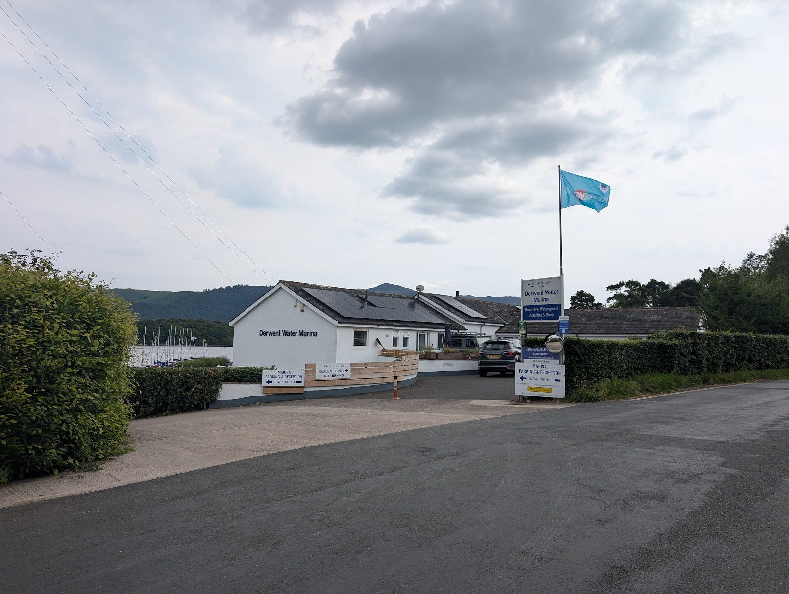
| On the water | Derwent Water Marina & Nichol End Marine (hire, sailing, café); the Hawes End launch pier ~1.5 mi round the shore |
| Walk to Keswick | ~20 minutes on a rural path over the Derwent footbridge |
| Dogs / weather | Good dog-walking on the shore and low fells; check the live fell conditions before the tops |
Why visit Portinscale? Is it a good base?
Portinscale's appeal is simple: it's quiet and pretty, yet minutes from Keswick and the Derwentwater launches. You get the lakeshore, the marinas and the Lingholm gardens on your doorstep, an easy car-free walk into town, and a lot of low-level and middle-height walking — Cat Bells, the Newlands round, the shore path — without staying in the middle of a busy town.
It suits walkers and families after a calm base, and anyone drawn to the Lingholm/Beatrix Potter story. Be realistic about the size: there are only a few places to stay and eat, village parking is limited, and you'll lean on Keswick (a mile away) for shops, the bus station and the full range of food. As a peaceful, good-value base for the north-western and Newlands fells, though, it works very well.
Lingholm — gardens & Beatrix Potter
The headline. The Lingholm Estate, just outside the village, is where Beatrix Potter spent ten childhood and family summers between 1885 and 1907 — sketching, exploring and gathering the ideas that became Squirrel Nutkin, Mrs Tiggy-Winkle and others. The estate's Victorian walled garden stands on the old kitchen gardens she knew, and is credited as the inspiration for Mr McGregor's garden in The Tale of Peter Rabbit.
Today the Lingholm Kitchen & Walled Garden is the main draw: a café with a long glass wall looking down over the octagonal walled garden and up to Skiddaw, an artisan bakery and shop, and an outdoor gallery dedicated to Beatrix Potter and her Lingholm connection. Entry to the garden and gallery is free, and there's a footpath through the estate linking up with the Cat Bells path — so you can fold it into a walk. (Opening hours change seasonally — the café has generally run daily from morning to late afternoon, dusk in winter; check the estate's site before a special trip.)
Derwentwater, the marina & boats
Portinscale is a good spot on Derwentwater to get afloat. Derwent Water Marina offers boat and paddleboard hire, sailing and watersports tuition, plus moorings and winter storage; nearby Nichol End Marine has boat hire, moorings and a lakeside café. The Keswick Launch circles the lake from Keswick, with the nearest landing for the village at Hawes End (about 1.5 miles round the shore — and the usual jumping-off point for Cat Bells). And the footbridge over the River Derwent links the village straight onto the Derwentwater shore walk and the path back into Keswick.
Walks & fells from Portinscale
This is where Portinscale punches above its size — it sits at the foot of some of the most loved walking in the Lakes:
- Cat Bells — the classic little fell on the doorstep (reached via Hawes End / Skelgill). For the fuller day, carry on along the ridge: our Catbells–Maiden Moor–High Spy route Walked May 2026 links Skelgill Bank, Maiden Moor and High Spy.
- The Newlands fells — Barrow and Causey Pike rise just to the west, with the superb Coledale Round Walked May 2026 from neighbouring Braithwaite nearby.
- The Derwentwater shore — a gentle, largely level easy walk from the village along the lake (see our easy & family walks); across the water rise Walla Crag and Latrigg.
Before you head up, check the live "Best Fells today" conditions. Explore Portinscale, above, lists the fells on its map.
The walks from Portinscale are in Explore Portinscale above, on one map and in a list you can filter by how you reach the start.
Places nearby: Keswick · Braithwaite · Derwentwater · Whinlatter Forest
Where to stay
For a small village it's well set up for a quiet stay, mostly in guest houses, B&Bs and self-catering cottages (with The Chalet among them). The big lakeside Derwentwater Hotel sits in eighteen acres of grounds on the edge of the village, but note it has been closed since 2020 and was bought by the Leisureplex Hotel Group in October 2025 — check for its reopening rather than assuming it's trading. Either way, Portinscale is a calm, good-value alternative to staying in the middle of Keswick, with the town an easy walk away.
Food & drink
The Lingholm Kitchen café is the standout for daytime food. In the village, the Farmers Arms is a traditional Lakeland pub (trading since around 1835) with real ale, food and a beer garden. Beyond that, Keswick is a mile away for the full range of pubs, cafés and restaurants — and the place to stock up on supplies.
Getting there & parking
Without a car: The nearest stations as the crow flies are Aspatria (20 km away) and Maryport (24 km away); the 77, 77A and 78 stop at Keswick Bus Station (K) (Stand 3), 1.4 km from here in a straight line. The 77 and 77A run until 1 November 2026, the last day of their season. The bus map has every stop we hold.
Portinscale is about a mile west of Keswick, just off the A66. There's no railway station (Keswick is ~1 mile, the nearest railhead Penrith ~22 miles). By bus, the 77/77A (the Keswick–Buttermere "Honister Rambler" loop) runs into the village, while the X5 (Penrith–Keswick–Cockermouth) passes on the A66 rather than entering the village — check Stagecoach for live times. Village parking is limited and residential, so be considerate; many visitors park in Keswick and walk in over the Derwent footbridge (about twenty minutes on a rural path).
Parking near Portinscale
All the car parks around Portinscale on the parking map →
Straight-line distances from the centre of Portinscale. We publish whether a car park charges, and who runs it, but never the price — tariffs change and a stale one is worse than none, so check the sign or the operator’s own site on the day.
Vehicles are left entirely at their owner’s risk. We list places people park; we cannot vouch for any of them. Judge it on the day: take valuables with you, leave nothing on show, and if a spot feels wrong when you get there, park somewhere else.
Getting there across the Lake District: Buses · Parking map · By train · By boat
Practical & nearby
There's good dog-walking along the shore and the low fells; public toilets and the main facilities are in Keswick, a mile away. Easy day trips from Portinscale take in Keswick and Derwentwater, Braithwaite and the Newlands valley, Bassenthwaite Lake and the osprey viewpoint, and Whinlatter Forest.
Frequently asked questions about Portinscale
Where is Portinscale?
How far is Portinscale from Keswick, and can you walk between them?
What is Lingholm, and the Lingholm Kitchen?
Sources: The Lingholm Estate — Kitchen & Walled Garden (opens in new tab)
Is Portinscale a good base for the Lake District?
What are the best walks from Portinscale?
Can you get to Portinscale by bus?
Sources: Stagecoach Cumbria & North Lancashire (opens in new tab)
Events across the Lake District
Planning a trip around a show or festival? See our Lake District events & festivals guide for what's on near Portinscale — traditional Lakeland sports, agricultural shows and seasonal events, month by month.