Easedale Tarn
Getting there, parking, where to stay and the fells you can walk straight from Easedale Tarn.
Summit forecast
High Raise (High White Stones) summit, verdict for 27 October: Save it for another day · Too windy for the tops
10°C at the summit, gusts 62 mph
Weather on the tops, not whether a route suits you. One summit, the highest within 5 km, not the valley · scored for 27 October by the site’s own scorer · all 214 ranked · Weather data by Open-Meteo.com (opens in new tab)First light
The sun reaches the Great Langdale (New Dungeon Ghyll) start about 07:58 in October · sunrise 07:41
From the terrain around the start (Copernicus GLO-30), mid-month · how we work it outEasedale Tarn at a glance
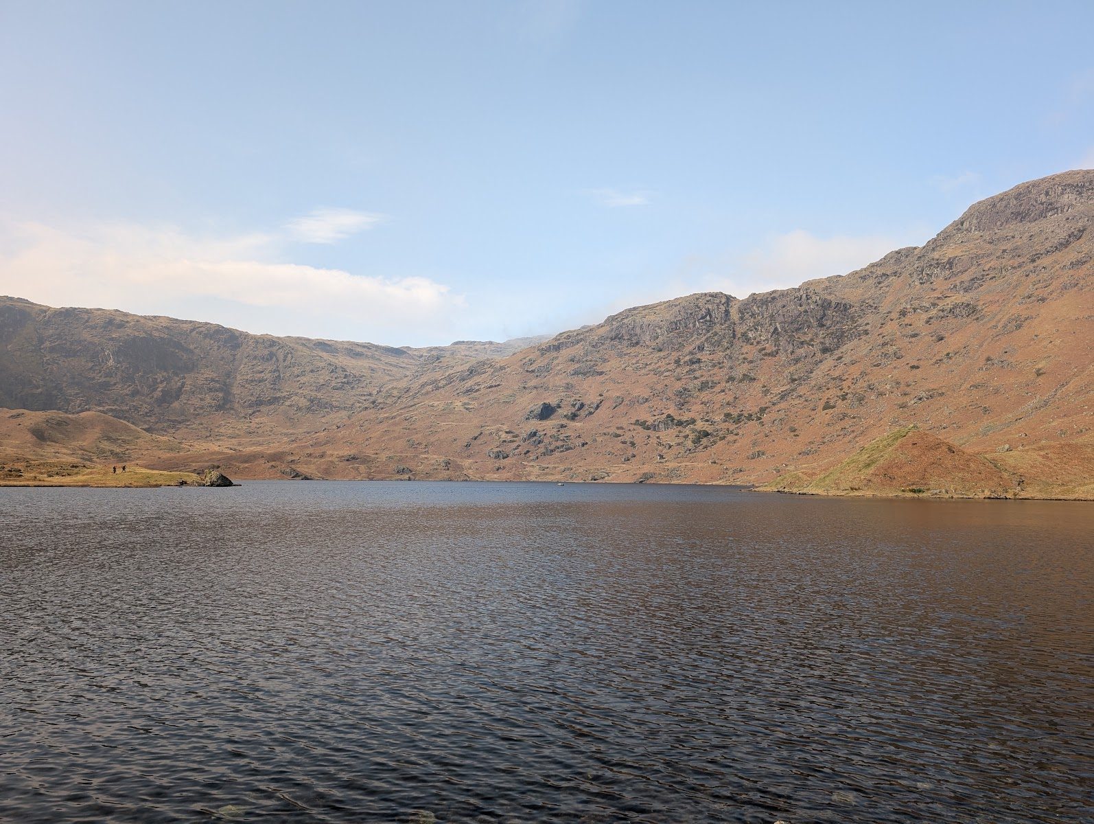
Easedale Tarn is the goal of one of Grasmere's best-loved walks — a fine mountain tarn set in a glacial bowl beneath Tarn Crag and Sergeant Man, reached by climbing alongside the white cascade of Sourmilk Gill. It was a Victorian honeypot — there was once a refreshment hut by the shore, now a low ruin — and it remains a classic half-day from the village.
Quick facts
| What it is | A corrie tarn in a glacial bowl above Grasmere |
|---|---|
| The walk | A steady ~7 km (4.5-mile) there-and-back from Grasmere, climbing beside Sourmilk Gill |
| Can you swim? | Yes — a popular wild swim; deep, clear and very cold |
| Dogs | Welcome on leads (open fell and grazing stock) |
| Pushchair / family | No pushchairs (rocky, steep upper path); good for fit, sure-footed children |
| Getting there | On foot only from Grasmere village (Easedale Road) |
| Best time | After rain/snowmelt for the falls in spate; summer for swimming; weekdays for quiet |
| The fell above | Tarn Crag (Easedale) & Sergeant Man |
The walk up
From Grasmere village, the lane and path lead up Easedale to the foot of Sourmilk Gill, which tumbles down the fellside in a series of white falls — the walk climbs beside it, steepening over rougher, rockier ground, before levelling out at the tarn in its hollow. It's a there-and-back of about 7 km (4.5 miles) with a steady climb; allow a good 2½–3 hours with stops. Good boots help — the upper path is rocky and often wet. From the tarn you can extend onto the fells, or continue up to little Codale Tarn just above.
Routes that start near Easedale Tarn
| Route | Distance | Ascent | Estimate |
|---|---|---|---|
| West of GrasmereStart 3.1 km away (straight line) | 15.44 km | 863 m | ~4½–6¼ h |
| Castle How & Lang How - BirkettsStart 3.5 km away (straight line) | 10.91 km | 490 m | ~3–4 h |
| Silver How from GrasmereStart 3.5 km away (straight line) | 5.06 km | 311 m | ~1½–2¼ h |
| Stone Arthur from GrasmereStart 3.5 km away (straight line) | 6.82 km | 528 m | ~2¼–3 h |
| Helm Crag, Gibson Knott, Calf Crag, Steel Fell and Tarn CragStart 3.5 km away (straight line) | 20.82 km | 950 m | ~5¾–7¾ h |
| Helm Crag & Far EasedaleStart 3.5 km away (straight line) | 15.93 km | 870 m | ~4½–6¼ h |
More routes that start near Easedale Tarn: Grasmere lake circuit (not yet walked) · Alcock Tarn from Grasmere (not yet walked)
Routes starting within about 2 km of Easedale Tarn, or on its doorstep at one of its car parks. Each time is the whole route’s, from a fast to a steady pace, and takes no account of stops, conditions or daylight — a guide, not a schedule.
Fells & walks near Easedale Tarn
Straight-line distances from the centre of Easedale Tarn — the nearest summits with a full guide on this site.
Places nearby: Sour Milk Gill (Easedale) · Stickle Tarn · Great Langdale · Dungeon Ghyll Force
All walks near Easedale Tarn → — the routes we have mapped and every Wainwright and Outlying fell within about 5 km, ranked, with today’s conditions.
Wild swimming
Easedale is one of the classic Grasmere wild swims — a proper mountain tarn, deep and clear, in a wild bowl with the crags reflected. The shore gives reasonable entries, and the depth means it's a real swim rather than a paddle. It's also very cold, all year: get in slowly, never jump in, and watch for the gasp of cold-water shock in the first minute. There's no help nearby and the walk out is long, so swim well within yourself, keep an early-season dip short, and have warm layers ready. Follow Leave No Trace on this much-loved, busy path.
When to go
Time it for the water: after heavy rain or spring snowmelt, Sourmilk Gill is in full spate and the climb beside the thundering falls is a highlight of the day. Summer brings the swimming and the long evenings; autumn turns the valley gold and thins the crowds. It's a popular walk, so a weekday or an early start gives you the tarn far more to yourself than a fine summer weekend will.
The setting & wildlife
The tarn fills a classic glacial corrie — a deep, ice-scooped bowl ringed by the crags of Tarn Crag and the long ridge of Blea Rigg, draining out over the lip as Sourmilk Gill. It's wild, open fell: cropped grass, rock and bog, with upland birds overhead and the constant sound of falling water below. The low ruin by the shore is all that remains of the Victorian refreshment hut, a reminder of how long people have made this exact walk.
The name & its story
"Tarn" is the Old Norse tjörn, a small mountain lake. The falls below carry the better-known name: Sourmilk Gill, for the way the white, frothing water churns down the rock "like sour milk" — a name repeated at other tumbling Lakeland becks. The walk has been trodden for centuries from Grasmere: it was a favourite of Dorothy and William Wordsworth, whose home at Dove Cottage sat just down the valley, and a Victorian tourist objective complete with that lakeside hut.
Family, dogs & accessibility
This is a real fell walk, not a stroll: 4.5 miles there and back with a steady climb and a rocky, wet upper path, and no facilities at the tarn. It's a fine objective for fit, sure-footed children used to hills, but it's not suitable for pushchairs or wheelchairs. Dogs enjoy it, but it crosses open grazing fell, so keep them on a lead around stock — and remember the only water is the gill and the tarn.
The fells above
The tarn sits beneath Tarn Crag (Easedale), with Sergeant Man and the long ridge of Blea Rigg rising beyond — a natural continuation for a bigger day, looping back over the tops to Grasmere.
Getting there & parking
Without a car: The nearest stations as the crow flies are Windermere (15 km away) and Staveley (19 km away). The bus map has every stop we hold.
Start from Grasmere village (Easedale Road) and walk out past the green to the open valley. There's no parking at the tarn — it's walk-in only. Grasmere is well served by bus (the 555 and the open-top 599 in season), so it's an easy day without a car.
Parking, toilets and buses: Parking near Easedale Tarn
Where is Easedale Tarn?
Easedale Tarn near Grasmere, in the Lake District. Zoom and pan to explore — or see all the Lake District lakes & waters on one map.
Parking near Easedale Tarn
Toilets, food and shops near these car parks
Toilets: Grasmere (opens in new tab) (about 396 m from Stock Lane Car & Coach Park (LDNPA, paid), straight line, accessible, RADAR key)
Cafes: The Little Inn Coffee Shop (opens in new tab), Grasmere Tea Gardens (opens in new tab), Thirteen Valleys Kitchen (opens in new tab)
Pubs: 1769 Bar & Restaurant (opens in new tab), Tweedies Bar (opens in new tab), The Distiller’s Arms (opens in new tab)
Shops: Grasmere Outdoors (opens in new tab), Mountain Hi (opens in new tab), Trespass (opens in new tab), Mountain Warehouse (opens in new tab)
All the car parks around Easedale Tarn on the parking map →
Straight-line distances from the centre of Easedale Tarn. We publish whether a car park charges, and who runs it, but never the price — tariffs change and a stale one is worse than none, so check the sign or the operator’s own site on the day.
Vehicles are left entirely at their owner’s risk. We list places people park; we cannot vouch for any of them. Judge it on the day: take valuables with you, leave nothing on show, and if a spot feels wrong when you get there, park somewhere else.
Can you stay overnight?
- Red Bank Road, Grasmere (W&F, paid) — run by Westmorland and Furness Council, whose public spaces order rules out an overnight stay on its land without its prior written consent. “No person shall position any vehicle, campervan, motorhome, caravan, tent or any other temporary structure designed or intended to provide shelter or accommodation for the purpose of an overnight stay or stays, within the areas listed in Schedule 2A and Schedule 2B, unless prior written consent has been obtained from the Council or National Trust.” (checked 2026-10-09)
- Thirteen Valleys, Grasmere (LDNPA, paid) — run by Lake District National Park Authority, which does not permit overnight parking. “The only legal places to park are on formal camp sites.” (checked 2026-08-05)
These are the land managers’ and the council’s own published rules, quoted. Where a car park is not listed here we have found no published rule for it, which is not the same as permission.
Getting there across the Lake District: Buses · Parking map · By train · By boat
Frequently asked questions about Easedale Tarn
Can you swim in Easedale Tarn?
Yes — Easedale is one of the classic Grasmere wild swims: a proper mountain tarn, deep and clear, in a wild glacial bowl with the crags reflected. The depth makes it a real swim rather than a paddle. It's also very cold all year, with no help nearby and a long walk out, so get in slowly, beware cold-water shock in the first minute, swim well within yourself, keep an early-season dip short, and warm up straight afterwards.
How long is the walk to Easedale Tarn from Grasmere?
It's about a 4.5-mile (7 km) there-and-back from Grasmere village, climbing steadily beside Sourmilk Gill. Allow roughly 2½–3 hours with stops. The upper path is rocky and often wet, so good boots help; you can extend onto the fells or up to little Codale Tarn above.
Where do you park for Easedale Tarn?
Start from Grasmere village (Easedale Road) and use the village car parks, which fill early at weekends. There's no parking at the tarn — it's walk-in only. Grasmere is well served by bus (the 555, and the open-top 599 in season), so it's an easy car-free day.
Is the walk to Easedale Tarn hard?
It's a steady but real fell walk — not a stroll. The lower valley is gentle, but the climb beside Sourmilk Gill steepens onto rough, rocky, often wet ground before the tarn. Anyone reasonably fit and sure-footed in proper boots will manage it; it's not for pushchairs or wheelchairs.
Is Easedale Tarn dog-friendly?
Yes — dogs enjoy it. The route crosses open grazing fell, though, so keep them on a lead around stock, and note the only water along the way is the gill and the tarn.
What is Sourmilk Gill?
It's the white cascade you climb beside on the way up — the tarn's outflow, tumbling down the fellside in a series of falls. The name describes the churning, frothing white water, said to look "like sour milk"; it's a name repeated at other tumbling Lakeland becks (there's another Sourmilk Gill at Buttermere).
Events across the Lake District
Planning a trip around a show or festival? See our Lake District events & festivals guide for what's on near Easedale Tarn — traditional Lakeland sports, agricultural shows and seasonal events, month by month.