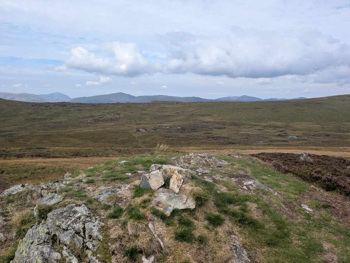
Armboth Fell (Birkett)
Armboth Fell at 479m (1,572ft) rises above Thirlmere reservoir in the Central Fells, its sprawling, marshy summit giving modest but pleasant views over the conifer plantations and across to the Helvellyn range.
Is it worth going? — Today’s conditions & 7-day summit forecast
Modelled guidance for the 479 m summit. Always check the Met Office mountain forecast and MWIS before you set off.
On the summit today (Tue 28 Jul): 16° to 14°C, gusts to 32 mph, 4.0 mm of rain forecast.
Forecast snapshot from 28 Jul 2026, 04:58 UTC — refreshed nightly and updated live in your browser. Temperatures and gusts adjusted to the 479 m summit altitude via Open-Meteo. Summit conditions are always harsher than the valley — check the professional mountain forecasts before you go.
About the walk
Armboth Fell (Birkett)
Routes up Armboth Fell (Birkett)
Hand-mapped, with GPX to download — full maps further down.
Map & nearby Birketts
Skip mapFree mapping: OpenTopoMap / OpenStreetMap (switch layers top-right). Parking positions are approximate.
Nearest parking: Swirls, Thirlmere (paid), about 2.1 km from the summit (straight line). Full parking, toilets and bus details are below.
Birketts near Armboth Fell (Birkett) (within 3 km)
These Birkett tops are not Wainwright summits — detour to them on this walk and they are pure profit. Distances are straight-line; allow extra for terrain.
Routes over Armboth Fell (Birkett)
A planned line is a suggestion, not a guarantee — conditions change. Navigate independently and carry a map & compass.
A planned line is a suggestion, not a guarantee — conditions change. Navigate independently and carry a map & compass.
The path beneath your boots
On the Pewits between High Tove and High Seat — Wainwright reckoned Armboth Fell the very centre of the Lake District — Fix the Fells laid the first upland flagged path in the Lakes in 2021, an £84,000 partnership project that set stone flags across the blanket bog and re-profiled dried-out peat hags to bring the sponge-like bog back to life.
Notice underfoot: the stone flags carrying you over the bog — keep to them; the peat either side stores carbon and holds back floodwater, and it only does that when it stays wet and undisturbed.
Fix the Fells built and maintains this path. How a fell path is made → · Give back (opens in new tab)
Path-repair data © Fix the Fells (National Trust / Lake District National Park). Source (opens in new tab).
Best parking to hike Armboth Fell (Birkett)
Where we have the data, each parking spot also shows the nearest public toilets and facilities (cafés, pubs, shops).
Positions are approximate — zoom the map to confirm. Lakeland car parks fill before 9am on fine weekends.
Tip: pan and zoom the interactive map at the top of this page to spot other potential parking near your route.
Water & shelter on the way up
On the Standing Crag, High Tove, Armboth route:
On-route facilities © OpenStreetMap contributors, per route — an absent marker doesn’t mean none.
Buses to Armboth Fell (Birkett) from Penrith / Ambleside / Windermere
Rural routes change seasonally — confirm on stagecoachbus.com (opens in new tab) or Traveline before relying on a last bus.
My hikes over Armboth Fell (Birkett) (Strava)
1 logged hike pass over this summit:
- Some Central Fells on my Todd (opens in new tab) — 17.2 km · 806 m ascent · 4h 04m moving · 24 Aug 2025
Interactive route maps and photos load here for visitors with JavaScript. Data from Strava.
Other fells near Armboth Fell (Birkett)
- Armboth Fell (Armboth Fell South Top)
- Blea Rigg
- Bleaberry Fell
- Calf Crag
- Eagle Crag
- Gibson Knott
- Grange Fell (Brund Fell)
- Great Crag (Stonethwaite)
- Harrison Stickle
- Helm Crag
- High Raise (High White Stones)
- High Rigg (Naddle Fell)
- High Seat
- High Tove
- Loft Crag
- Loughrigg Fell
- Pavey Ark
- Pike of Stickle
- Raven Crag
- Sergeant Man
- Sergeant's Crag
- Silver How
- Steel Fell (Dead Pike - Steel Fell)
- Tarn Crag (Easedale)
- Thunacar Knott
- Ullscarf
- Walla Crag
Maps & guidebooks for Armboth Fell (Birkett)
- Buy on Amazon (opens in new tab)
- Buy on Amazon (opens in new tab)
- Buy on Amazon (opens in new tab)
- Buy on Amazon (opens in new tab)
As an Amazon Associate we earn from qualifying purchases — at no extra cost to you. How affiliate links work →