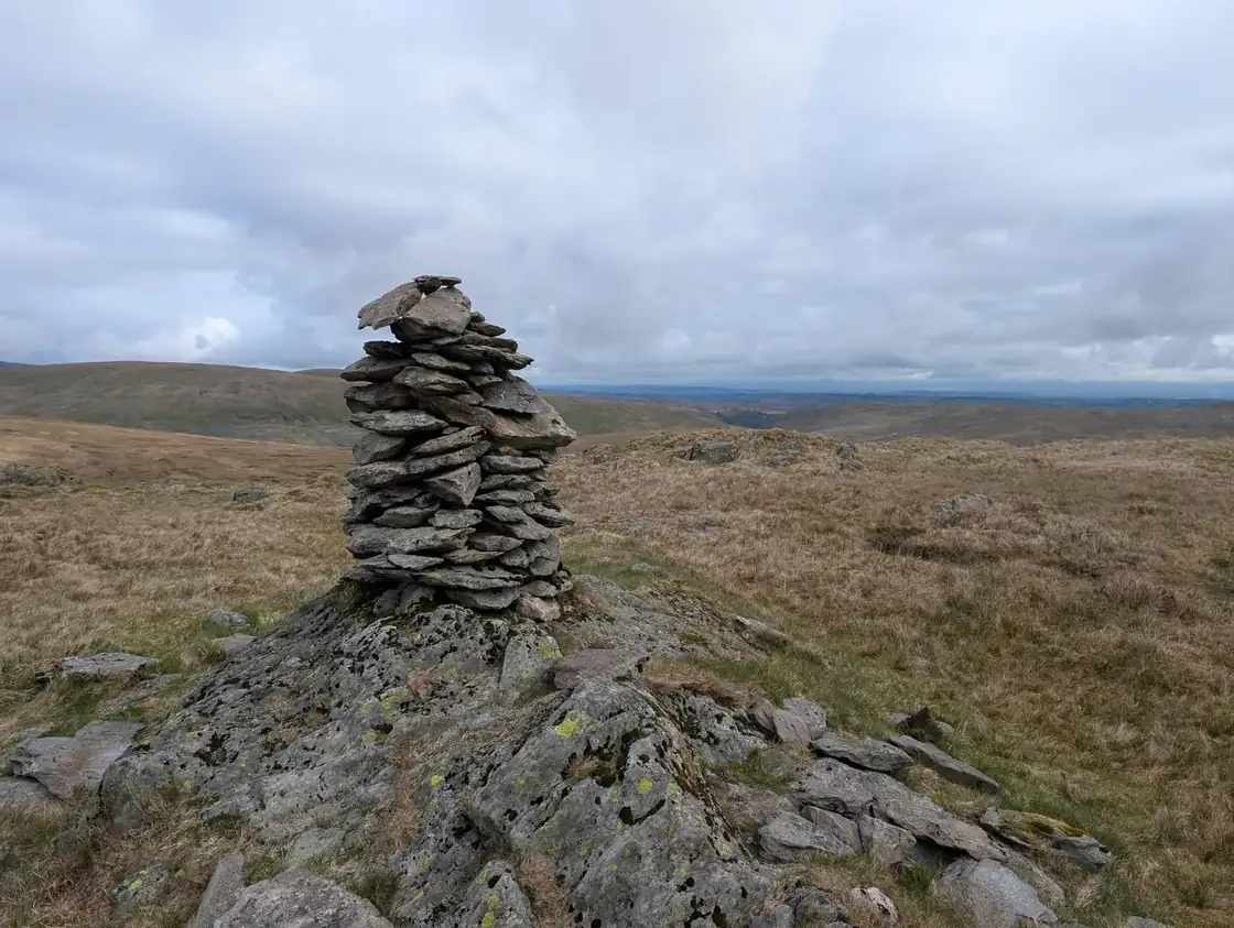
Harrop Pike
Harrop Pike at 637m (2,090ft) is a Birkett top on the high moorland east of Haweswater in the Far Eastern Fells, its grassy summit giving wide views across the limestone plateau and east to the Pennines.
Is it worth going? — Today’s conditions & 7-day summit forecast
Modelled guidance for the 637 m summit. Always check the Met Office mountain forecast and MWIS before you set off.
On the summit today (Tue 28 Jul): 15° to 13°C, gusts to 38 mph, 15.1 mm of rain forecast.
Forecast snapshot from 28 Jul 2026, 04:58 UTC — refreshed nightly and updated live in your browser. Temperatures and gusts adjusted to the 637 m summit altitude via Open-Meteo. Summit conditions are always harsher than the valley — check the professional mountain forecasts before you go.
About the walk
Harrop Pike
Map & nearby Birketts
Skip mapFree mapping: OpenTopoMap / OpenStreetMap (switch layers top-right). Parking positions are approximate.
Nearest parking: Sadgill, Longsleddale (free, limited), about 2.9 km from the summit (straight line). Full parking, toilets and bus details are below.
Birketts near Harrop Pike (within 3 km)
These Birkett tops are not Wainwright summits — detour to them on this walk and they are pure profit. Distances are straight-line; allow extra for terrain.
Best parking to hike Harrop Pike
Where we have the data, each parking spot also shows the nearest public toilets and facilities (cafés, pubs, shops).
Positions are approximate — zoom the map to confirm. Lakeland car parks fill before 9am on fine weekends.
Tip: pan and zoom the interactive map at the top of this page to spot other potential parking near your route.
Buses to Harrop Pike from Penrith / Ambleside / Windermere
No regular bus serves the start points for this fell — this is one for the car (or a long approach from the nearest served valley). The nearest hubs are Penrith (X4/X5 & 508), Ambleside and Windermere (555, 505, 516).
Rural routes change seasonally — confirm on stagecoachbus.com (opens in new tab) or Traveline before relying on a last bus.
My hikes over Harrop Pike (Strava)
1 logged hike pass over this summit:
- Grey Crag, Tarn Crag, Kentmere Pike & Shipman Knotts (Needed that!) (opens in new tab) — 17.7 km · 1031 m ascent · 4h 33m moving · 5 May 2026
Interactive route maps and photos load here for visitors with JavaScript. Data from Strava.
Other fells near Harrop Pike
- Angletarn Pikes (Angletarn Pikes North Top)
- Arthur's Pike
- Baystones (Wansfell)
- Beda Fell (Beda Head)
- Bonscale Pike
- Branstree
- Brock Crags (Wainwright)
- Froswick
- Gray Crag
- Grey Crag (Sleddale Fell)
- Hallin Fell
- Harter Fell (Mardale)
- Hartsop Dodd
- High Raise (High Street)
- High Street
- Ill Bell
- Kentmere Pike
- Kidsty Pike
- Loadpot Hill
- Mardale Ill Bell
- Place Fell
- Rampsgill Head
- Rest Dodd
- Sallows
- Selside Pike
- Shipman Knotts
- Sour Howes
- Steel Knotts (Pikeawassa - Steel Knotts)
- Stony Cove Pike (Caudale Moor)
- Tarn Crag (Sleddale)
- The Knott (High Street)
- The Nab
- Thornthwaite Crag
- Troutbeck Tongue
- Wether Hill
- Yoke
Maps & guidebooks for Harrop Pike
- Buy on Amazon (opens in new tab)
- Buy on Amazon (opens in new tab)
- Buy on Amazon (opens in new tab)
- Buy on Amazon (opens in new tab)
- Buy on Amazon (opens in new tab)
As an Amazon Associate we earn from qualifying purchases — at no extra cost to you. How affiliate links work →