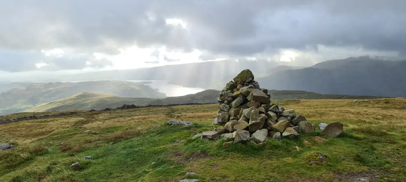
Birkett Fell
Birkett Fell at 725m (2,379ft) is a broad, heathery summit on the high moorland east of Ullswater, giving wide views across the Pennines and over the pastoral Eamont valley.
Is it worth going? — Today’s conditions & 7-day summit forecast
Modelled guidance for the 725 m summit. Always check the Met Office mountain forecast and MWIS before you set off.
On the summit today (Tue 28 Jul): 14° to 13°C, gusts to 39 mph, 5.7 mm of rain forecast.
Forecast snapshot from 28 Jul 2026, 04:58 UTC — refreshed nightly and updated live in your browser. Temperatures and gusts adjusted to the 725 m summit altitude via Open-Meteo. Summit conditions are always harsher than the valley — check the professional mountain forecasts before you go.
About the walk
Birkett Fell
Routes up Birkett Fell
Hand-mapped, with GPX to download — full maps further down.
Map & nearby Birketts
Skip mapFree mapping: OpenTopoMap / OpenStreetMap (switch layers top-right). Parking positions are approximate.
Nearest parking: Dockray (roadside), about 3.1 km from the summit (straight line). Full parking, toilets and bus details are below.
Birketts near Birkett Fell (within 3 km)
These Birkett tops are not Wainwright summits — detour to them on this walk and they are pure profit. Distances are straight-line; allow extra for terrain.
Routes over Birkett Fell
✎️ Planned route — drawn but not personally walked or checked yet.
A planned line is a suggestion, not a guarantee — conditions change. Navigate independently and carry a map & compass.
Best parking to hike Birkett Fell
Where we have the data, each parking spot also shows the nearest public toilets and facilities (cafés, pubs, shops).
Positions are approximate — zoom the map to confirm. Lakeland car parks fill before 9am on fine weekends.
Tip: pan and zoom the interactive map at the top of this page to spot other potential parking near your route.
Buses to Birkett Fell from Penrith / Ambleside / Windermere
Rural routes change seasonally — confirm on stagecoachbus.com (opens in new tab) or Traveline before relying on a last bus.
My hikes over Birkett Fell (Strava)
1 logged hike pass over this summit:
- Crappy Weather Up There But a Nice Leisurely Jaunt Up 6 Wainwrights (opens in new tab) — 22.1 km · 1105 m ascent · 5h 03m moving · 20 Aug 2023
Interactive route maps and photos load here for visitors with JavaScript. Data from Strava.
Other fells near Birkett Fell
- Arnison Crag
- Birkhouse Moor
- Birks
- Catstye Cam
- Clough Head
- Dollywaggon Pike
- Dove Crag
- Fairfield
- Glenridding Dodd
- Gowbarrow Fell (Wainwright summit)
- Great Dodd
- Great Mell Fell
- Great Rigg
- Hart Crag
- Hart Side
- Hartsop Above How (Gill Crag - Hartsop Above How)
- Helvellyn
- Heron Pike (Rydal)
- High Hartsop Dodd
- High Pike (Scandale)
- Little Hart Crag (Little Hart Crag - West Top)
- Little Mell Fell
- Low Pike
- Middle Dodd
- Nab Scar
- Nethermost Pike
- Raise
- Red Screes
- Seat Sandal
- Sheffield Pike
- St Sunday Crag
- Stone Arthur
- Stybarrow Dodd
- Watson's Dodd
- White Side
Maps & guidebooks for Birkett Fell
As an Amazon Associate we earn from qualifying purchases — at no extra cost to you. How affiliate links work →