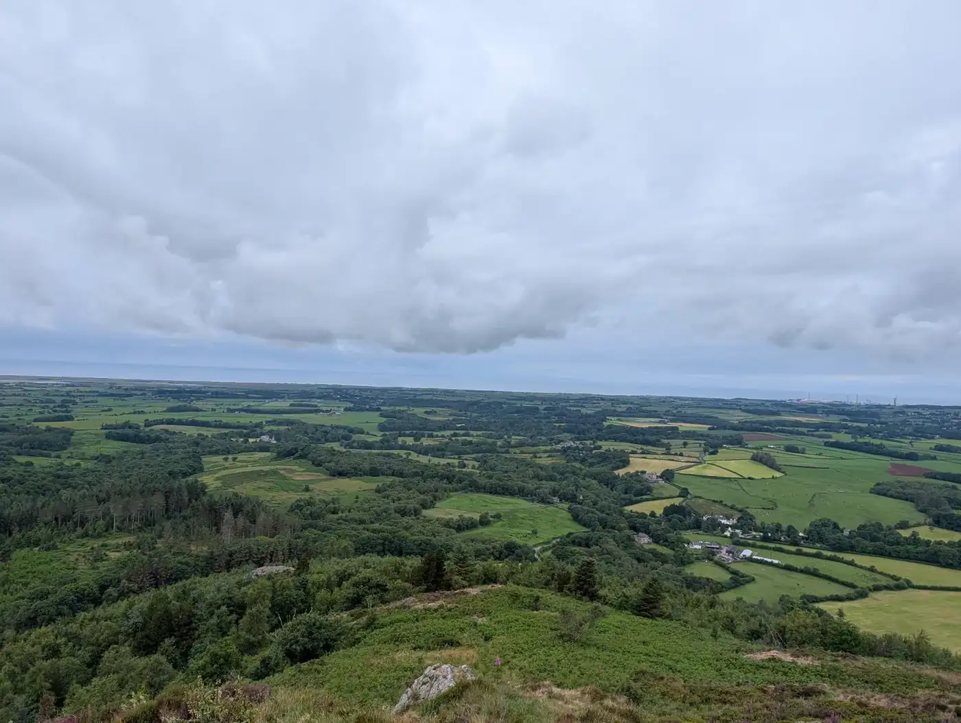
Irton Pike
Irton Pike at 229m (751ft) is a Birkett fell in the West Cumbria group above the Esk estuary and Miterdale, its modest summit giving views across the coastal plain and towards Ravenglass.
Is it worth going? — Today’s conditions & 7-day summit forecast
Modelled guidance for the 229 m summit. Always check the Met Office mountain forecast and MWIS before you set off.
On the summit today (Tue 28 Jul): 17° to 16°C, gusts to 23 mph, 0.4 mm of rain forecast.
Forecast snapshot from 28 Jul 2026, 04:58 UTC — refreshed nightly and updated live in your browser. Temperatures and gusts adjusted to the 229 m summit altitude via Open-Meteo. Summit conditions are always harsher than the valley — check the professional mountain forecasts before you go.
About the walk
Irton Pike
Map & nearby Birketts
Skip mapFree mapping: OpenTopoMap / OpenStreetMap (switch layers top-right). Parking positions are approximate.
Nearest parking: Greendale, Nether Wasdale (roadside, free), about 4.5 km from the summit (straight line). Full parking, toilets and bus details are below.
Birketts near Irton Pike (within 3 km)
These Birkett tops are not Wainwright summits — detour to them on this walk and they are pure profit. Distances are straight-line; allow extra for terrain.
Best parking to hike Irton Pike
Where we have the data, each parking spot also shows the nearest public toilets and facilities (cafés, pubs, shops).
Positions are approximate — zoom the map to confirm. Lakeland car parks fill before 9am on fine weekends.
Tip: pan and zoom the interactive map at the top of this page to spot other potential parking near your route.
Buses to Irton Pike from Penrith / Ambleside / Windermere
Rural routes change seasonally — confirm on stagecoachbus.com (opens in new tab) or Traveline before relying on a last bus.
My hikes over Irton Pike (Strava)
1 logged hike pass over this summit:
- Whin Rigg, Illgill Head and an Outlying fell. (opens in new tab) — 14.2 km · 684 m ascent · 3h 33m moving · 25 Jun 2025
Interactive route maps and photos load here for visitors with JavaScript. Data from Strava.
Other fells near Irton Pike
Maps & guidebooks for Irton Pike
As an Amazon Associate we earn from qualifying purchases — at no extra cost to you. How affiliate links work →